


Sections:
1.1.010 Purpose
1.1.020 Applicability
1.1.030 Background
1.1.040 Relationship to Other Goals and Policies
1.1.050 How the Guidelines Are Organized
1.1.060 The City
1.1.070 Neighborhoods, Districts and Corridors
1.1.080 Block and Street
1.1.090 Lot and Building
1.1.010 Purpose
A. It is the purpose of these design guidelines to promote public convenience and prosperity, conserve the value of the property and buildings, and encourage the most appropriate use of land within the City.
B. The guidelines are grounded in the interdependence of three important principles: good site planning, maintenance of aesthetics appropriate to Flagstaff, and preservation of land values. Flagstaff’s economic and environmental well-being is founded upon and maintained by the distinctive character and natural attractiveness of northern Arizona. This contributes substantially to Flagstaff’s potential as a regional trade center and recreational area. It is the purpose of the design guidelines to further encourage harmonious, safe, attractive and compatible development in furtherance of the public health, safety and general welfare of the citizens of the City.
C. These guidelines provide applicants, neighbors and Flagstaff residents with clear documentation of the City’s design objectives and expectations. The guidelines therefore present design approaches, which if followed, will offer applicants a high level of certainty through the design review process, assuming conformance with all other applicable City standards.
1.1.020 Applicability
A. The guidelines apply Citywide to the following land uses:
1. Residential and nonresidential subdivisions;
2. Multifamily uses;
3. Commercial uses;
4. Institutional uses; and
5. Business park uses.
B. Design guidelines in historic districts are applied in addition to these design guidelines. See Division 10-30.30, Heritage Preservation.
1.1.030 Background
Flagstaff wishes to protect its unique character, which is a combination of spectacular natural resources and a rich cultural heritage. The community is blessed with a tradition of building that reflects the natural features of the region, particularly its alpine setting, which the community wishes to maintain as it accommodates change that supports its quality of life.
1.1.040 Relationship to Other Goals and Policies
These design guidelines are the outgrowth of community policies that extend back many years. They demonstrate a consistent commitment to promoting livability and protecting the design traditions of the region. The following policies establish the basis for the design guidelines:
A. General Plan. In the General Plan, the community established formally defined goals to protect the character of the area through the use of design guidelines. These goals are further implemented through many specific policy and strategy statements. The primary goals of the General Plan regarding protection of the character of the Flagstaff area are as follows:
1. GOAL LU1. “Greater Flagstaff will have a compact land use pattern within a well-defined boundary that shapes growth in a manner that preserves the region’s natural environment, livability, and sense of community. Flagstaff will continue to offer the primary types of housing design developments that have defined its land use patterns: the conventional and traditional neighborhood scale which provides a choice of housing types and supporting non-residential uses within walking distances.”
2. GOAL CD1. “A sense of connection will be maintained in the built environment to the region’s natural setting and dramatic views.”
3. GOAL CD2. “The Flagstaff region will continue to protect its unique character that reflects its forested setting of ponderosa pine trees, piñon and juniper vegetation, and meadows through quality design and development. Emphasis will be placed on quality design in both the public realm – streets, civic buildings, and other public spaces – as well as the private realm – commercial buildings, work places, and housing. Preservation of vegetation and wildlife are part of the quality design and development process.”
B. The Zoning Code. The City regulates the scale and intensity of development through its Zoning Code by establishing, for example, minimum standards for the development of land, including the size of lots, landscaping, building placement, outdoor signs and lighting, and thoroughfare design. While many of these standards focus on assuring safe and efficient use of land, they also influence the design and character of development. The design guidelines provide additional guidance to satisfy the intent of the Zoning Code.
1.1.050 How the Guidelines Are Organized
The guidelines are organized into four levels of design:
A. The City. Guidelines on how development should be integrated into the larger context of the City. This section looks at how development should respond to its location within the context of the region and the City.
B. Neighborhoods, Districts and Corridors. Guidelines on how development should be integrated to neighborhoods, districts or corridors.
C. Block and Street. Guidelines that talk about the interconnected nature of development at the level of the block and street.
D. Lot and Building. Guidelines at the smallest scale, focusing in on the lot and building details that make Flagstaff unique.
Diagram Showing Developed Portions of the City of Flagstaff in Black and Land Constrained by Extreme Topography in Gray.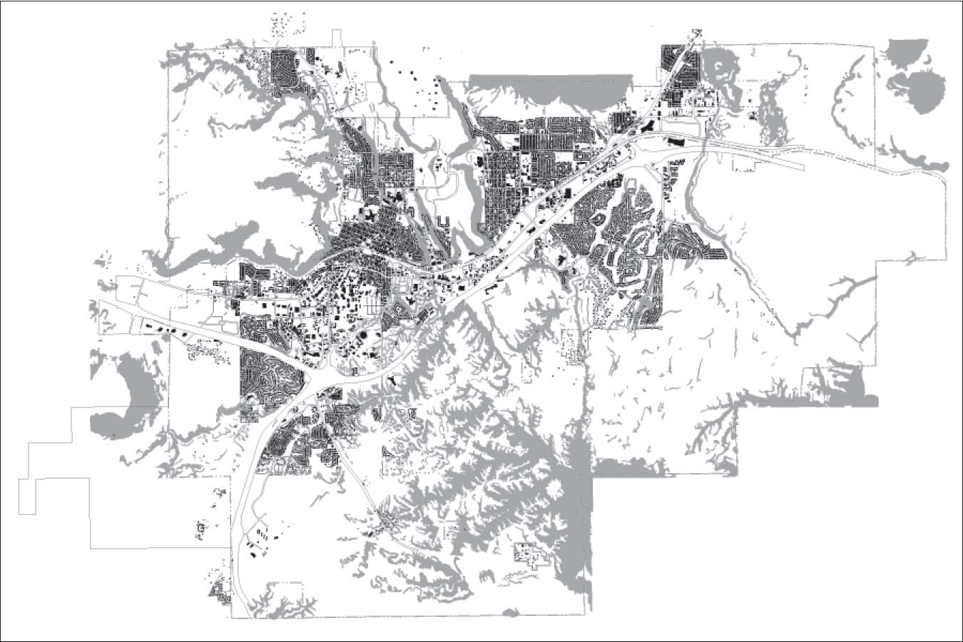
1.1.060 The City
The General Plan defines areas of anticipated growth within the City of Flagstaff and the Flagstaff Metropolitan Planning Organization’s (FMPO) planning area within Coconino County. The guidelines found in this section describe the elements that should be considered for new development projects at a regional and City level.
A. Limit development to areas where the General Plan calls for growth and prevent development in those areas indicated as land to be preserved or reserved.
1. Development should be in keeping with the intent of General Plan. Development should be focused on the areas listed as growth in the Regional Plan and areas that are preserved should not be allowed to develop.
2. Clearly define and maintain edges between areas that are to be preserved or reserved and those areas that are to be developed. Areas to preserve include agricultural land, open space and wildlife habitat.
3. Development should remain outside of sensitive habitats and watersheds.
B. Development should be focused on underutilized properties within the City.
1. Promoting infill on underutilized properties to maintain the rural-to-urban character of Flagstaff.
a. Preserve the edge of the City by discouraging auto dependent development that consumes large quantities of land at the edge of the City.
b. Develop infill in areas called out in the General Plan as focused infill growth before developing the periphery of the City.
2. In order to develop and preserve urban centers development should:
a. Maintain the existing neighborhoods and district edges while encouraging development within the urban pattern.
b. Create or reinforce a mix of residential, civic, retail and service uses integrated into the existing urban fabric, especially new development adjacent to existing development.
|
|
Example of the use of creeks to define the edges of neighborhoods. |
|
|
|
|
|
|
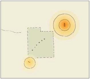
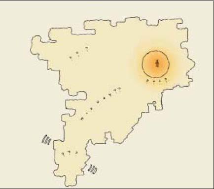
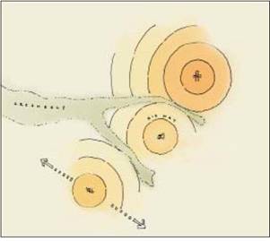
Existing nodes of development separated by undeveloped land. Hypothetical example of a community with a large mixed use walkable core and a distant smaller core. |
Example of what not to do. Growth pattern that ignores natural features and focuses on single use zones. |
Example of growth pattern to emulate. Growth that focuses on creating compact walkable mixed use communities and uses natural features to define boundaries. |
C. New non-contiguous development should:
1. Be designed with a mix of residential, civic, retail and service uses in a town or village setting with urban centers and defined edges.
2. Preserve natural features such as ravines and bluffs to provide opportunities to define natural edges to communities. Where possible these areas should be linked into the Flagstaff Urban Trails System.
3. At the regional level, support a framework of different transportation modes. New development should connect into the public transit system, the Flagstaff Urban Trails System and bicycle routes. Non-industrial developments should create a walkable environment regardless of the zone in which they are located.
4. Incorporate transit service and existing and proposed routes for the Flagstaff Urban Trails System where possible.
D. New development should take advantage of harvesting alternative energy.
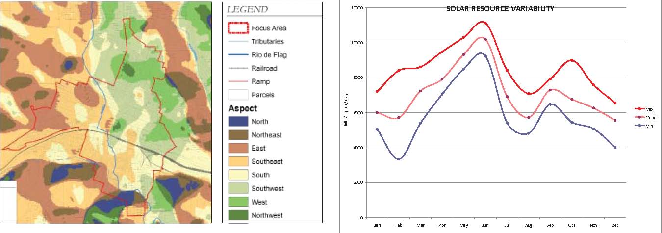
1. Flagstaff has an annual average of 288 days of sun in which there is good solar access. Development on lots and slopes that have good solar access should consider solar power and solar water heating as alternative energy solutions.
|
|
|
|
Diagram showing areas with high potential for using solar power and solar water heating based on orientation of slopes. |
Graph showing the potential of solar power in the Flagstaff region. |
|
|
|
|
Conceptual diagram of a mixed use center within a neighborhood, showing an interconnected network of thoroughfares and a mix of lot sizes. |
|
|
|
|
|
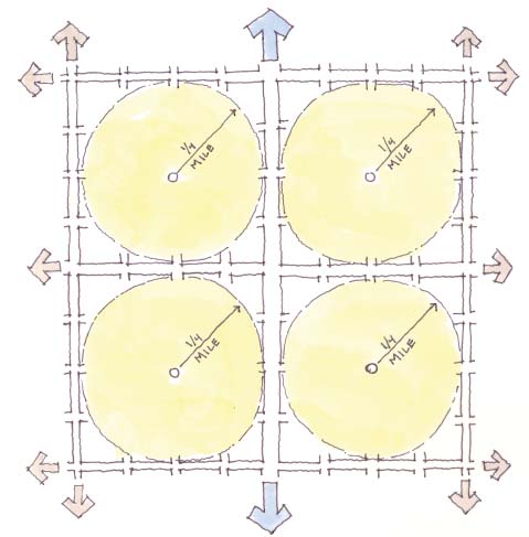
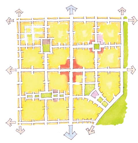
Conceptual diagram of the potential development of a square mile into four one-quarter mile radius neighborhoods.
|
|
|
|
|
|
|
|
|
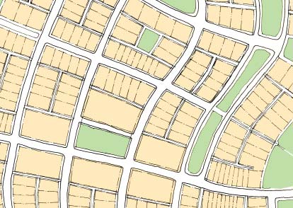
Illustrative diagram showing a mix of building types and densities within a neighborhood. |
|
|
|
|
|
Conceptual diagram of a mixed use center at the middle of a one square mile area and smaller mixed use, civic and open spaces centered neighborhoods. |
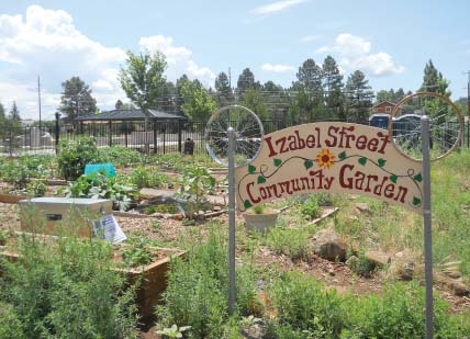
Community gardens provide the opportunity for residents of the City of Flagstaff to grow their own produce. |
1.1.070 Neighborhoods, Districts and Corridors
A. Neighborhoods.
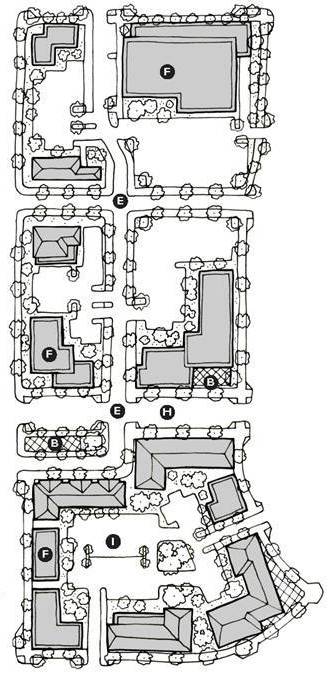
1. A neighborhood is the basic building block of a community which is typically limited in physical size with a well-defined edge and a center. Walkable communities are created and reinforced when neighborhoods:
a. Reduce the reliance upon automobiles as the main form of transportation for short trips and provide alternatives for longer trips.
b. Encourage walkability with a mix of uses and amenities in neighborhood main street environments.
c. Are defined by an area encompassed by a one-quarter to one-half mile radius.
2. Encourage a mix of residential building types to provide increased density and diversity for all ages, individuals, families, and income levels.
3. Distribute schools and other institutions throughout the City within walking distance of residential neighborhoods and not isolate them in locations from where residents would need to drive.
4. Provide a range of civic spaces such as parks and playgrounds convenient to as many dwellings as possible to encourage people to exercise and relax within their community.
5. Provide gardens where residents without yards are given the opportunity to grow their own produce. Community gardens often work well in conjunction with civic uses, such as school, where community members and school children are given the opportunity to grow local produce.
6. Streets within a neighborhood should be a connected network to disperse traffic by providing a variety of pedestrian and vehicular routes to any destination. Streets are also relatively narrow, provide on street parking, and shaded by rows of trees. This helps to slow traffic, creating an environment more suitable for pedestrians and bicycles.
7. Buildings in the neighborhood center are placed close to the street.
8. Parking is provided at the rear of buildings, usually reached by alleys, or is permitted on the street.
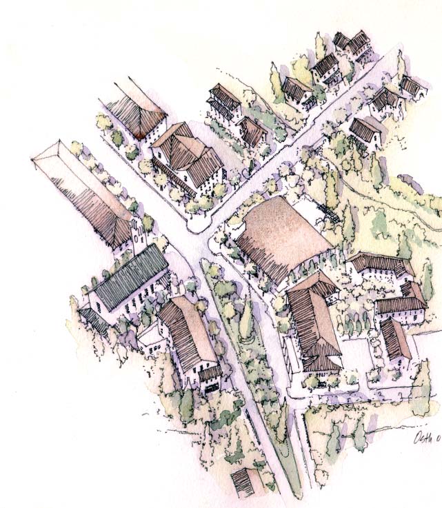
9. As needed within a neighborhood, prominent sites for civic buildings such as education, religion, culture, and government uses are reserved at the termination of street vistas or in neighborhood centers.
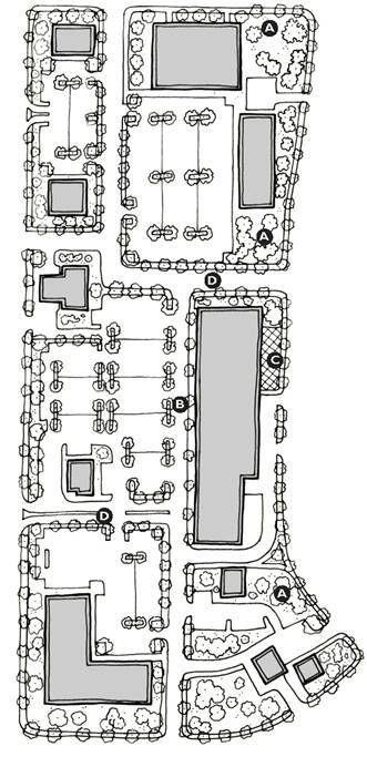
|
|
|
|
Inappropriate layout of an auto-dependent development. (A) Large expanses of poorly defined landscaping. (B) Lack of two sided pedestrian environment. (C) Plaza space not integrated into the pedestrian environment. (D) No hierarchy of places or street network. |
Appropriate layout of a “park once” auto-dependent development. (E) Defined grid of streets and blocks, not with driveways. (F) Larger retail buildings hold the edge of the block and provide entrances along the street edge and the parking within the block. (G) Open spaces integrated into the walkable environment. (H) Two-sided walkable environment. (I) Parking within the block with clusters of trees preserved. |
B. Districts and Corridors.
1. The City is comprised of many different environments, within which it is not always possible or intended to be walkable; these areas are often the transportation corridors and the single-use districts. In these predominately auto-dependent areas it is important to create small areas of walkability, where residents, tenants and users can be in a park-once environment. Doing so reduces the number of automobile trips and creates a more sustainable environment. The following features should be used to create a pedestrian-friendly park-once environment:
a. Create nodes of walkability within auto-dependent districts and corridors that reduce the need to drive and park from one destination to another;
b. Place parking in the middle of the block and behind buildings to increase the walkability of the block and create a more pedestrian-friendly environment;
c. Create environments where both sides of the street are pedestrian-friendly to encourage walking;
d. Place open or civic spaces within a walkable environment where buildings front onto the space; and
e. Encourage a mix of uses within a walkable node to allow a variety of daily activities to be completed within a park-once environment.
2. A fine-grained interconnected network of streets, trails and sidewalks provide the opportunity for users both within and from outside of a district or corridor to reduce the reliance on automobiles. A fine-grained network can also reduce the dependence and pressure on major corridors. Districts and corridors should provide connections throughout to transit, railways, bike lanes, boulevards, and walkable streets.
3. Providing good public transit and bicycle facilities along corridors reduces the reliance on automobiles in the community. In addition these facilities provide alternatives for all ages, individuals, families, and income levels who cannot or choose not to drive an automobile.
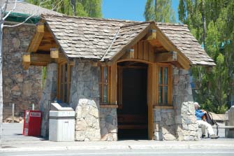
|
Example of a transit shelter integrated into the pedestrian realm and local architectural character. |
|
|
|
|
|
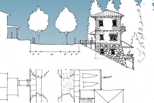
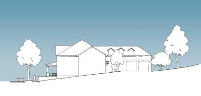
Small footprint house on a steeply sloped lot. |
|
|
|
|
|
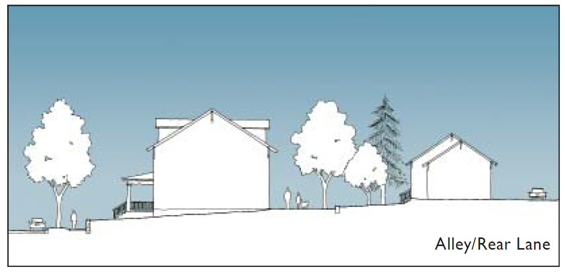
Uphill lot with alley access showing detached garages or carriage houses. |
Uphill lot without alley access showing parking placed in the rear of the lot around a parking court. |
|
|
|
|
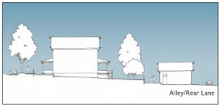
Downhill lot with alley access showing detached garages or carriage houses. |
Downhill lot without alley access showing parking placed in the rear of the lot around a parking court. |
|
|
|
|
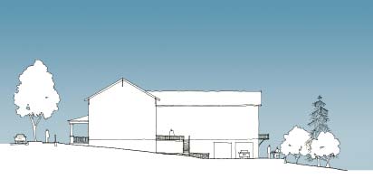
Individually graded lots allow for more variety in the character of the street and increase the possibility of preserving existing trees. |
|
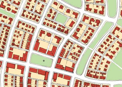
1.1.080 Block and Street
A. It is important to consider the size of the blocks, the spacing and size of streets, and what the streets connect both physically and visually. This section provides a series of elements to consider when creating a network of blocks and streets.
B. A fine-grained network of streets and blocks provides flexibility over time and disperses all modes of transportation throughout the City. Smaller blocks create a more pedestrian-friendly environment that also supports transit and bicycle usage.
C. Blocks and streets should be designed to minimize negative impacts to natural resources on abutting properties by:
1. Minimizing excavation that may be visible from adjacent properties; and
2. Minimizing the use of mass grading across blocks and streets. Instead, grade properties in smaller increments to preserve more natural resources such as existing trees and ground cover. This has the added benefit of allowing new development to maintain the character of the site.
D. Scenic views to natural features and landmarks from major viewpoints along a public way should be preserved or enhanced. Simple methods of preserving or enhancing scenic views of natural features include:
1. Frame distant views by locating streets and blocks to create terminated vistas on major viewpoints; and
2. Siting buildings in relation to adjoining properties to frame a view as it may be observed from the public rights-of-way. Siting of buildings should avoid completely blocking a view with a large building mass.
E. Streets with shared use of slower speed roadways for bicycles and cars create a better pedestrian and bicycle-friendly environment that reduces the reliance on automobiles and increases safety for bicycles and pedestrians.
F. Streets and development within the City should accommodate automobiles while protecting the safety and walkability of the area for pedestrians.
G. Development and streets within the City should be designed to feel comfortable and safe at the pedestrian scale in order to:
1. Encourage residents to walk and bicycle; and
2. Reduce the reliance on automobiles.
Local Building Character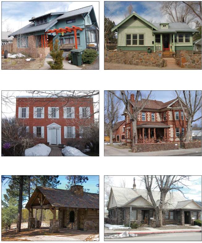
1.1.090 Lot and Building
A. The lot and building are at the most intimate of scales at which people can relate to and understand. The character of different memorable neighborhoods and cities is provided by the texture, variety and richness found in pedestrian environment. This section provides elements to consider to help provide a rich pedestrian and bicycle friendly environment and a sustainable future.
B. Buildings should be tailored to their urban/rural setting. See Division 10-50.20, Architectural Design Standards, for more specific standards.
C. Buildings should be positioned to enhance significant natural features that exist on a site. The features can be enhanced by:
1. Locating entry plaza or open spaces to frame a view, such as an existing rock outcropping or stand of mature trees; and
2. Siting buildings to minimize the destruction of natural features, allowing sites to take advantage of resources such as mature trees.
D. Buildings and lots should be designed and furnished to provide visual interest to pedestrians.
1. Active ground-floor spaces with windows and doors addressing the street help create an inviting pedestrian experience.
2. In walkable environments low walls, decorative fences, and hedges help define the edges of the public realm and the private realm while providing visual interest to pedestrians. These elements should be less than three feet in height.
3. Recessed windows and doors combined with projecting elements, such as balconies, eaves, and bay windows, provide visual relief to walls. Over the course of the day, the shadows cast by the small variations create a facade that appears to change throughout the day. This constantly changing back drop to the public realm provides a pedestrian experience that changes throughout the day and year.
4. In retail and service settings, furnishings along the street can provide areas to rest and additional visual interest for pedestrians.
E. Flagstaff’s multistory heritage homes have a pattern of having ground floors that are taller than the upper stories. The extra height in the ground floor allows for taller windows and more natural light to enter the buildings. In keeping with this pattern multi-story residential buildings should have ground floors that are taller than any individual upper floor. A minimum floor to ceiling height of nine feet in all T3 and T4 transect zones is preferred.
Local Building Character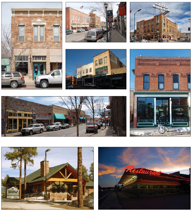
F. Urban agriculture and community gardens provide an urban environment with a local food source. They also empower residents to grow their own food and teach others on food growing techniques.
G. Understanding sustainable building practices provides the opportunity to consider the long-term effects of development on the City. The following elements provide guidance on what to consider.
1. Buildings should be designed to efficiently use space and energy.
2. Flagstaff has a unique environment that provides 288 days of solar access. Buildings should be designed to take advantage of this resource by utilizing passive systems to the maximum extent feasible. The following items should be considered when locating and designing a building.
a. Orientation of the site and building.
(1) Lots with good southern exposure provide the best opportunity to take advantage of Flagstaff’s remarkable solar access.
(2) Buildings should be laid out to take advantage of the solar access by orienting rooms to take advantage of the natural light and passive heating opportunities.
b. Passive cooling.
(1) Cross or stack ventilation systems, when carefully designed to take advantage of prevailing winds, can passively cool and ventilate the interior of a building without the need or use of energy.
(2) Thermal massing, appropriately arranged in conjunction with a passive ventilation system, can collect cool breezes from the open windows during the night and cool the air during the day when ambient temperatures are higher.
c. Passive heating.
(1) Thoughtful placement of windows can allow direct sunlight to enter a building, passively heating the interior while providing natural light.
(2) Thermal massing, appropriately arranged in conjunction with thoughtfully placed windows, can collect solar heat during the day and release the heat at night when ambient temperatures are lower.
(3) Solar water heaters passively heat water for showers and other uses by using solar heat to warm water as it is stored in an external container. Using solar water heaters can reduce the energy needed to provide hot water.
3. Photovoltaic panels can also take advantage of Flagstaff’s unique environment by providing energy and reducing reliance on the electrical grid.
4. Water collection and storage during Flagstaff’s times of rain can provide water for on-site irrigation.
5. The use of sustainable local materials and systems should be considered in order to reduce the short-term and long-term environmental impact of constructing and maintaining buildings.
6. Living roofs or vegetated roofs reduce the heat island effect and if planted with indigenous flora enhance the local urban ecology.
7. Landscaping should include native plant species.
a. Native plant species enhance the urban ecology and provide habitat to at-risk fauna while preserving the natural character of the region.
8. The following resources provide additional guidance on what to consider before, during and after development.
a. Leadership in Energy and Environmental Design (LEED) programs encourage sustainable development and building practices.
b. Energy Star appliances reduce the energy needs of a building.
c. Alternative energy is energy that is used in place of what is provided by the grid that serves the City and is derived from natural occurring sources (water, wind, solar) that would have otherwise gone unused. For more information see Appendix 1.3, Sustainability Guidelines.