Chapter 17.56
PLANNED DEVELOPMENT COMBINING DISTRICT
Sections:
17.56.050 Processing requirements.
17.56.060 Development standards.
17.56.080 Fences, walls and hedges.
17.56.110 Planning commission findings.
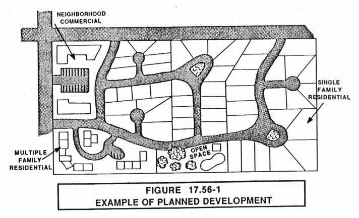
17.56.010 Purpose.
The purpose of this combining district is to promote cluster development, provide for design flexibility, encourage the creation of open space areas, meet the changes in development technology and be responsive to changes in market demand. The PD combining district is designed to produce a comprehensive development that is equal to or better than that resulting from traditional lot-by-lot development. (Ord. 90-02 §2(part), 1990).
17.56.020 Application.
A. This district may be combined with any of the residential, office, commercial or industrial districts identified in this title. For purposes of identification, all established PD districts shall be suffixed by the zoning notation of the district with which it is combined (e.g., PD-R-1 or PD-CN).
B. Existing uses in PD districts shall continue to be governed by this chapter, but no additional PD districts shall be established. Modifications, expansions or changes of use within existing PD districts shall require rezoning to be compatible with adjacent uses, and may be, but is not required to be, rezoned to the SD zone as specified in Chapter 17.58. (Ord. 06-02 §1, Exh. A §2, 2006: Ord. 90-02 §2(part), 1990).
17.56.030 Permitted uses.
Uses identified on the permitted use list of the R-1, R-2 and R-3 zone districts or as designated by the land use element of the Kerman general plan. (Ord. 90-02 §2(part), 1990).
17.56.040 Conditional uses.
Uses identified on the conditional use list of the R-1, R-2 and R-3 zone districts. (Ord. 90-02 §2(part), 1990).
17.56.050 Processing requirements.
Prior to filing an application for rezoning to a PD district, the applicant shall present to the planning commission for staff and commission review, a proposed development plan. This plan shall include the following information:
A. Legal description and boundary survey map of the exterior boundaries of land to be developed;
B. Plot plan of land and area to be developed. For residential uses, the number and type of dwelling units, and the total population anticipated from the development;
C. A topographic map indicating drainage location, groupings of existing trees, and other natural features;
D. Vehicular and pedestrian circulation within the site, and adjacent streets and alleys;
E. The extent, location, general arrangement, and proposed improvements of all off-street parking and loading facilities;
F. The location and general arrangement of all open space and landscaping;
G. Architectural drawings to demonstrate the concept and character of the proposed development;
H. A preliminary utilities report;
I. The anticipated timing for each phase, if any, of the development. (Ord. 90-02 §2(part), 1990).
17.56.060 Development standards.
The following development standards together with applicable standards specified in Chapter 17.78 shall apply to all land and structures within this district.
A. Minimum Site Area. The minimum site area for a planned development shall be two acres.
B. Density. The average number of dwelling units per net area shall not exceed the density allowed by the base zone, unless the applicant can demonstrate that additional usable common open space beyond the five percent requirement can be achieved. If so, the planning commission or city council may grant a density bonus. This density bonus shall be based on the following standards:
1. Net Usable Open Space.
a. Six to ten percent: Six percent density bonus;
b. Eleven to twenty-five percent: Ten percent density bonus;
c. Over twenty-five percent: Twenty percent density bonus.
2. Usable common open space is those portions of the project site which are suitable for common use by the residents of the development. This open space shall not include parking areas, private patios, building separations, or storage areas.
C. Height. The maximum height of a structure shall be consistent with the base zone requirements.
D. Average Lot Size. The average lot size of a single-family residential subdivision that is processed under the planned residential zone district shall be that of the minimum lot size of the base zone (e.g., the R-1 zone district has a minimum parcel size of seven thousand square feet therefore the average lot size shall be seven thousand square feet). Average lot size shall be calculated by adding the square footage of all lots designated for single-family use and dividing that number by the number of single-family lots.
E. Percentage of Lots Below Minimum Parcel Size of Base Zone. The percentage of lots designated for single-family homes that are below the minimum lot size of the base zone shall not be more than thirty-three percent of the total lots designated for single-family uses.
F. Lot Width. The minimum lot width of a single-family residential lot that has a R-1 base zone shall not be less than sixty-five feet, one hundred feet for the R-1-12 zone, and one hundred twenty feet for the RR zone. Not more than thirty-three percent of the single family residential lots shall have a lot width less than the base zone standard.
G. Lot Depth. The minimum lot depth of a single-family residential lot that has a R-1 base zone shall be one hundred feet; one hundred twenty feet for the R-1-12 and RR zone districts.
H. Side Yard Setback. Not more than twenty-five percent of the lots in a single-family subdivision shall deviate from the sideyard setback standard of the base zone nor shall any of these lots have a sideyard setback that is less than five feet on interior lots, ten feet of street side lots, or fifteen feet on reverse corner lots.
I. Duplex Locations. All duplexes shall be located on corner lots. The front door of each living unit in a duplex shall face a different street. The city may require one duplex for every twenty single-family residential lots contained in a subdivision. Duplex units shall have the same setback requirements as adjacent single family units, except in the case of the sideyard between a duplex and single-family unit. This side yard shall be twelve feet.
J. Street Width. Single-family residential subdivisions may have local streets that have a minimum right-of-way width of fifty-six feet, thirty-six paved width; cul-de-sac streets shall have a minimum right-of-way width of fifty-two feet, thirty-two feet paved width.
K. Neighborhood Subdivision Parks. In consideration of the greater need for public recreational space in higher density residential districts the city of Kerman requires that certain improvements will be made to the city’s park system. This may be accomplished in one of two methods as selected by the planning commission and subject to the city council’s approval, based upon the needs of the park system and the impact of the proposed development. The value of these improvements shall be based upon the cost and park development of one average size lot for every thirty lots within a subdivision. The commission and the council shall determine whether property dedication and development or the payment of an in-lieu fee for acquisition or development of nearby recreational facilities would best serve the recreational needs of residents. The amount of any in-lieu fee shall be based upon the value of the lot dedication and development costs referenced above as determined by the city engineer provisions for dedication and development or payment shall be made in a subdivision agreement. (Ord. 01-04 § 1, 2001; Ord. 97-02 §1, 1997: Ord. 90-02 §2(part), 1990).
17.56.070 Signs.
Signs shall be consistent with the requirements of Chapter 17.76. (Ord. 90-02 §2(part), 1990).
17.56.080 Fences, walls and hedges.
Fences, walls and hedges shall be consistent with the requirements specified in Chapter 17.40. (Ord. 90-02 §2(part), 1990).
17.56.090 Parking.
Off-street parking and loading standards shall be consistent with the requirements of Chapter 17.74 and the following provisions:
A. All parking for residential uses shall be screened from adjacent public rights-of-way. Such screening may include dense plantings, fences or hedges, or grade separation (Ord. 90-02 §2(part), 1990).
17.56.100 Site plan review.
A sited plan for construction of a planned development, shall be submitted to the city planner in accordance with Chapter 17.14. Construction that increases the square footage or the number of units shall also require site plan review. (Ord. 90-02 §2(part), 1990).
17.56.110 Planning commission findings.
The planning commission may combine the planned development district with a base district if it makes the following findings:
A. The proposed project is consistent with the Kerman general plan;
B. The standards of population density, site area and dimensions, site coverage, yard spaces, height of structures, off-street parking and landscaped areas are consistent with the objectives of this title;
C. A homeowners association or maintenance district has been formed to maintain the common area of the residential development;
D. The development will not generate more traffic than the streets in the vicinity can carry without congestion and the local infrastructural systems and utilities are not overloaded;
E. Any unique features of a site are considered in the overall design of the planned development;
F. Development in this district is demonstratively superior to the development that could occur under the base zone district regulations. (Ord. 90-02 §2(part), 1990).