FRONT MATTER
FINAL
FEBRUARY 18, 1997
CITY OF SOLANA BEACH
SPECIFIC PLAN
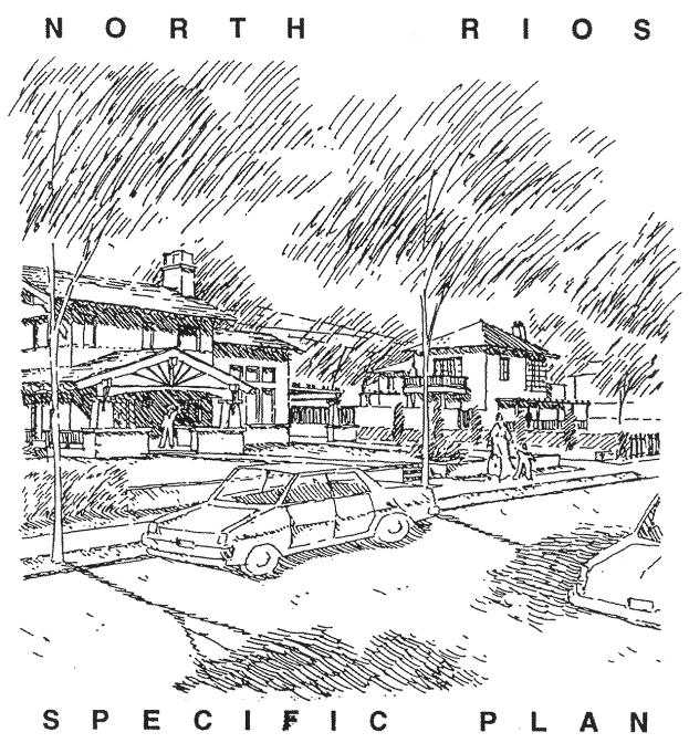
NORTH RIOS
Solana Beach, California
Submitted to:
The City of Solana Beach
Prepared for:
Isao & Midori Nakatani
Broadmoor Beach II, LLC.
Rios Drive Associates
Prepared by:
architects
HANNA
GABRIEL
WELLS
Reformatted and Published by
CODE PUBLISHING COMPANY
Seattle, Washington
2010
Project Team
|
Governing Body |
The City of Solana Beach 635 South Highway 101 Solana Beach, CA 92075 Telephone: 619.755.2998 |
|
Owner/Developer |
lsao & Midori Nakatani 236 Patty Hill Drive Solana Beach, CA 92075 |
|
Broadmoor Beach II, LLC. 5405 Oberlin Drive Suite 200 San Diego, CA 92121 Telephone: 619.455.1433 |
|
|
Rios Drive Associates 11585 Sorrento Valley Road Suite 103 San Diego, CA 92121 Telephone: 619.350.1826 |
|
|
Architect |
Architects Hanna. Gabriel. Wells 1237 Moana Drive San Diego, CA 92107 Telephone: 619.221.0265 |
|
Civil Engineer |
Stuart Engineering 7525 Metropolitan Drive Suite 306 San Diego, CA 92108 Telephone: 619.296.1010 |
|
Resolution No. 97-21 |
|
I. Introduction |
|
Executive Summary |
|
Purpose of the Specific Plan |
|
Location and Physical Description |
|
Project Goals and Objectives |
|
Vicinity Map |
|
Zoning Map |
|
Relevant Documents |
|
Conditions of Approval |
|
II. Development Regulations and Implementation |
|
Project Review Process |
|
Development Regulations |
|
III. Site Development Guidelines |
|
Neighborhood Plan |
|
Midori Court and Midori Lane |
|
Rios Avenue and Patty Hill Drive |
|
Lot Standards |
|
Subdivision Plan |
|
Retaining Walls |
|
Entries |
|
Drives and Garages |
|
View Preservation |
|
View Preservation Plan |
|
Yard Design Standards |
|
Public Services |
|
Signage |
|
IV. Appendix |
|
1.0 California Planning and Zoning Law – Article 8. Specific Plans |
|
2.0 Agreement between Broadmoor Beach II, LLC, et al and Save Old Solana, et al |
|
3.0 City of Solana Beach Resolution No. 96-94 |
|
4.0 San Elijo Lagoon Conservancy List of Not-to-Be Planted Species |
|
5.0 Architectural Character |
“Site planning is the art of arranging structures on the land
and shaping the spaces between;
an art inseparable from the architecture it serves.
More than a practical art, its aim is both moral and aesthetic:
to make places that enhance everyday life.”
Kevin Lynch, Cambridge 1971
RESOLUTION NO. 97-21
A RESOLUTION OF THE CITY COUNCIL OF THE CITY OF SOLANA BEACH, CALIFORNIA, APPROVING A TENTATIVE SUBDIVISION MAP FOR 24 RESIDENTIAL LOTS FOR PROPERTY LOCATED AT THE NORTHEAST CORNER OF NORTH RIOS AVENUE AND PATTY HILL EXTENDING FROM PATTY HILL TO SEABRIGHT LANE
APPLICANTS: JENSEN, NAKATANI AND RIOS DRIVE ASSOCIATES
CASE NO.: 17-96-23
WHEREAS, the above referenced applicant has submitted an application pursuant to Chapter 16, Subdivision, of the Solana Beach Municipal Code to create a 24-lot Subdivision of land on property owned by the applicant; and
WHEREAS, a General Plan Amendment, Rezone and Specific Plan has been previously or concurrently approved by Council action following public notice and discussion; and
WHEREAS, the application has been duly processed according to applicable law; and WHEREAS, the application is consistent with those prior approvals; and
WHEREAS, on February 18, 1997, the City Council held a duly noticed public hearing to consider the tentative subdivision; and
WHEREAS, at the hearing the City Council received and considered evidence concerning the proposed application; and
WHEREAS, the View Assessment Structure Development Permit procedure as contained in Chapter 17.62, View Assessment, of the SBMC are deemed satisfied as referenced in the Specific Plan and no further on-site View Assessment for those 24 lots within the Specific Plan area is required unless the Specific Plan is modified; and
WHEREAS, the City Council has considered and, on December 11, 1995 by separate resolution, certified the Final Environmental Impact Reports and supporting documents for the applications; and
WHEREAS, this decision is based upon the applications, evidence presented at the hearings, written correspondence and petitions submitted to the City Council, the Final EIR’s, visits to the sites and other legislative facts;
NOW THEREFORE, the City Council of the City of Solana Beach, California, does resolve as follows:
1. That the foregoing recitations are true and correct.
2. That the previously prepared and certified Environmental Impact Report dated December 11, 1995, satisfies the California Environmental Quality Act requirements for this project.
3. That the request for a Tentative Subdivision Map dated December 23, 1996, and on file with the Community Development Department is conditionally approved based upon the following Findings and subject to the following Conditions.
A. Findings: Pursuant to Section 16.24.140 of the Solana Beach Municipal Code the City Council makes the following Findings:
I. The Tentative Parcel Map is consistent with the General Plan and the Zoning Ordinance and Specific Plan. The proposed density of development is consistent with the three dwelling unit per acre density permitted by the underlying Low Residential land use designation. The subdivision is consistent with the LR zone in terms of type of use and density of development.
II. The design and improvement of this subdivision is consistent with the setbacks, floor area ratio, lot design, height, parking, view assessment, and density regulations of the Specific Plan which has been incorporated into the Zoning Ordinance.
III. The site is physically suitable for the detached single-family residential development because it has more than adequate area to provide for the building pads, parking, and yards for each residential dwelling unit.
IV. The project site is physically suitable for the density of development because the majority of the site has a relatively flat topography slope. The size and flat topography of the property will accommodate three dwelling units per acre with usable open space/yard area for each unit. The project density is also consistent with the density permitted by the General Plan and Zoning Ordinance and Specific Plan.
V. The design of the subdivision will not cause any serious public health problems because all public utilities are available to serve future residents of this development, including sewer and water, for the project. The project will not interfere with existing public utilities to adjacent properties.
VI. The design of the subdivision will not conflict with existing sewer, drainage, vehicular access and other utility easements on site and on adjacent properties.
VII. The subdivision does not convert residential real property to a common interest development.
VIII. The subdivision is not subject to a contract entered into pursuant to the Williamson Act.
B. Conditions: Unless otherwise stated, prior to obtaining the Final Subdivision Map or obtaining any permits as appropriate upon reliance on the approval, the Applicant shall:
I. In lieu of re-vegetation as specified in the FEIR, the Applicant shall pay an in-lieu fee to be placed into a fund administered by the San Elijo Lagoon Conservancy for appropriate lagoon conservation measures. This fund will be kept separate from all other funds of SELC and can be audited at any time. The fee shall equal one-half the approximate cost of the proposed re-vegetation plan, and the amount shall be specified in the Specific Plan. (At the February 18, 1997 City Council meeting, this Applicant’s fee was conceptually agreed to not exceed $42,500.) (BP)
II. At the Applicant’s request, the Applicant may satisfy its Affordable Housing obligation off-site under Chapter 17.70 of the Zoning Ordinance without increasing the number of single-family homes. (At the February 18, 1997 City Council meeting, the Applicant stated they shall satisfy their obligation off-site. Ordinance 214 presently requires the Applicant to provide either three affordable housing units or two units and an in-lieu fee of $54,000.) (BP)
III. Improvements to the storm drain catch basin at the north end of North Rios Avenue to mitigate effects on the Lagoon shall be developed to the satisfaction of the City Engineer. (DCE)
IV. The affordable housing requirements for two new units and $56,000, or three new units as established by Chapter 17.70 shall be met proportionally prior to the issuance of building permits. (BP)
V. CC&R’s for the project shall be submitted for approval by the City Attorney prior to the recordation of the Final Subdivision Map of the property and shall contain provisions relating to the following: (FM)
a. Developer shall include a list of plant species which shall not be planted within specific portions of the subject project.
b. Pools and Spas shall never be drained into streets, storm drains, backyards or over fences.
c. Street sweeping as required by the FEIR or more frequently as determined appropriate by the City Engineer shall be done at the expense of the H.O.A.
d. Developer shall distribute General Rules provided by the San Elijo Lagoon Conservancy to all new homeowners for their educational use.
e. No feeding of pet cats outdoors.
f. Dogs shall be kept on a leash when outside their fenced yard.
g. Meandering path shall be planted by developer and maintained by H.O.A.
h. Tree heights shall be limited to 25 feet or roof top height, whichever is less.
VI. The impacts on public schools serving residents of development of the subject property shall be fully mitigated by the owner and/or developer to the satisfaction of the Solana Beach School District and the San Dieguito Union High School District, as well as the City Council, as indicated in correspondence dated February 4, 1997, referencing signed Mitigation Agreements with both School Districts. (FM)
VII. The mitigation measures identified in the Final EIR, and its certifying resolution, are hereby incorporated as conditions of approval of this Tentative Subdivision Map, Final Subdivision Map and building permits as appropriate.
VIII. The Final Map shall reflect the elevations and details referenced in the Specific Plan.
C. EIR Mitigation Measures and Conditions shall be as follows:
I. An open barrier such as that illustrated in Final EIR Figure 19 shall be used for any necessary perimeter fencing on the west and south sides of the project. The design of the fencing shall be to the satisfaction of the Solana Beach Community Development Director. (This condition shall not apply as perimeter fencing is not proposed.) (BP)
II. Any solid surfaces, regardless of the style of the wall or barrier, shall either be coated with one of the new polymers specifically designed to allow easy removal of graffiti or shall be left as an irregular masonry surface easily amenable to cleaning by sand blasting. (This condition shall not apply to natural wood fencing.) (BP)
III. Landscaping throughout the proposed subdivision shall be allowed subject to specified height limitations. The planting of tree species normally known to grow to heights in excess of 25 feet shall be prohibited, as shall be the planting of vegetation on any portion of a lot that would, in combination with that species’ known height at maturity, likely exceed 25 feet above the elevation of the lot’s building pad. (BP)
IV. Landscape plantings along the eastern property boundary slope shall be limited to low- to moderate-growing materials that will not exceed the height of the adjacent home within the Subdivision. (BP)
V. Appurtenant structures such as potting sheds, fences, satellite dishes, gazebos, etc., shall be prohibited on site wherever their placement would interrupt existing neighboring viewsheds. (BP)
VI. Roofing materials shall be limited to earthen colors, and non-reflective materials. Roof line designs shall be architecturally varied, wherever possible, so as to provide diversity of appearance. The exteriors of the proposed residences, appurtenant structures and their future modifications, shall be limited to earthen colors. (BP)
VII. The development shall be responsible for half-width improvements of both North Rios Avenue and Patty Hill Drive as they front on the proposed subdivision, these improvements shall include curbs and gutters as required by the City of Solana Beach. Such improvements to be performed to the satisfaction of the City Engineer. (FM)
VIII. The development shall provide limited improvements to the intersection of Patty Hill Drive and Barbara Avenue. At a minimum the present alignment of Patty Hill Drive shall be re-configured within the present travel way to provide a reverse curve section at the junction with Barbara Avenue (See Final EIR Figure 28 for a conceptual design). This improvement shall be completed to the satisfaction of the City Engineer. (FM)
IX. The development shall provide appropriate stop controls at the project entrance (Street “A”, See Final EIR Figure 4) to the satisfaction of the City Engineer. (FM)
X. The development shall contribute proportionately to the future improvement of the intersection ramps at both the northbound and southbound movements to and from Interstate 5 at Lomas Santa Fe Avenue. (At the February 18, 1997 City Council meeting, the Council accepted that the determination of the developers’ contributions should be on a pro rata basis, using the anticipated ADTs of 240 trips per day as establishing a reasonable contribution fee.) (DCE)
XI. Owner shall be required to enter into a School Impact Mitigation Agreement (“SIMA”) with the Solana Beach School District (“District”) which provides for adequate funding to construct and/or lease Owner’s proportionate share of school and support facilities necessary to serve new students generated by new residential development with the District’s boundaries. The actual dollar amount required for mitigation in the SIMA, on a per unit basis, depending on product type, shall be mutually agreed upon by Owner and District after good faith negotiations. It is expressly agreed by Owner and the City of Solana Beach (“City”) that Owner cannot and will not obtain final subdivision tract maps and City will not approve any final subdivision map for this Subdivision until a SIMA executed by both Owner and District is presented to the City. Funding required under the SIMA shall be paid prior to the issuance of any building permit and may, at the option of Owner and District, be in the form of a special tax levied under a community facilities district (“CFD”) to be formed by the District and annexed into by Owner. If Owner elects to annex into a CFD, Owner must have irrevocably voted to annex into the CFD prior to the approval of any final subdivision map by City. Owner agrees that the funding required under the SIMA shall not be subject to the limitations set forth in Government Code Section 65995(b)(1) or any future amendment thereto, or any other school fee limitations enacted after the approval of the tentative map for the project. (FM)
XII. The development project will be required to fully mitigate the impact of its development on school capacity within the San Dieguito Union High School District. In this regard, the developer of the project shall, prior to obtaining a building permit for any lot, enter into a mitigation agreement with the affected school district to provide sufficient funds to construct facilities to fully meet the needs generated by the development. (FM)
XIII. The Home Owner’s Association of the proposed subdivision shall, through a contract with the City of Solana Beach or other appropriate entity, have the streets of the subdivision swept on a year-round monthly basis. Street sweeping shall include the streets internal to the subdivision as well as the proximate part of North Rios Avenue and Patty Hill Drive. Street sweeping shall be by means of a vacuumized sweeper and at least three passes per monthly cycle shall be made along each specified curb. This street sweeping will be continued in perpetuity, for the life of the residential project. (DCE)
XIV. See substituted In-Lieu Re-vegetation Fee, Condition 2.B.I.
XV. In order to fulfill the City’s requirement for the maximal utilization of xeric landscaping materials, the project shall make use of native plant species whenever feasible. The use of native materials would limit in some small way the potential for additional nonnative invasions of the lagoon and provide a very limited amount of habitat within the bounds of the Subdivision. (The Specific Plan provides for a list of plant species that are not allowed within the development.) (FM)
XVI. The developer shall prepare, to the satisfaction of the Director of Community Development, Covenants, Conventions and Restrictions (CC&R’s) for the proposed development including a condition notifying the home owner of the proximity of the lagoon, of the biological value of the lagoon, of the need to regulate subsidized predators and providing such additional information and educational material as may be appropriate. An effective homeowner notification mechanism with enforcement provisions shall be included. (FM)
XVII. CC&R’s for the proposed development shall include a condition restricting the ownership of cats to indoor animals and shall prohibit the feeding of cats outside of the residences. (At the February 18, 1997 City Council meeting, the Applicants stated their intent to only restrict no feeding of pets outdoors as agreed to by the San Elijo Lagoon Conservancy.) (FM)
XVIII. CC&R’s for the proposed development shall include a condition restricting pet dogs to fenced yards unless otherwise leashed and requiring the home owner to clean up pet waste. (FM)
XIX. Additional testing of the site for adverse concentrations of agricultural chemicals shall be accomplished prior to the issuance of a grading permit. This study shall be conducted by a qualified consultant approved by the Community Development Director. If pesticide or other adverse residues are encountered a remediation plan shall be designed and implemented. If significant levels of pesticides or other toxins are encountered, the developer shall complete a risk assessment to address the possible migration of toxic components through foundations and building pads. These studies and assessments shall be sufficient to scientifically validate findings and address the pesticide/toxin exposure risks for the entire project. (DCE)
XX. Watering of freshly graded surfaces (both cut and fill) shall be conducted to the maximum extent allowed by the on site engineering geologist in order to control fugitive dust. Additional use of water based suppressant and dust control mitigation strategies/chemicals shall be required to absolutely minimize fugitive dust transport outside of the project’s boundaries. (DCE)
XXI. The grading contractor shall be notified in writing, prior to the issuance of grading permits, of the presence and potential presence of chlorinated pesticides, including DDT. The grading and excavation plans shall include an on-site monitoring program to determine both personnel exposure limits (PEL’s) as well as potential for off-site disbursing of airborne or solid-borne pesticides. (DCE)
XXII. Prior to grading of the site a “mounding” study shall be conducted to determine the potential for groundwater rise beneath the finished subdivision. Such a study requires determination of the depth to the existing perched water table, determination of the hydrological conductivity of the water bearing soils (Bay Point Formation), and completion of appropriate computer modeling to ascertain the potential extent of groundwater rise under future conditions. (DCE)
XXIII. Prior to grading of the site a comprehensive engineering geology study of the site shall be conducted to the satisfaction of the Solana Beach City Engineer. This study shall, at a minimum, be based on additional subsurface investigations and shall provide specific recommendations for grading of the site and for the design of all structural components proposed. (DCE)
XXIV. Only grading equipment fitted with exhaust silencers will be utilized in the grading of the project site. Older equipment, lacking or not retrofitted with exhaust silencers, shall not be permitted. All tracked vehicles shall be maintained on a daily basis. Special attention shall be paid to the lubrication of the tracks so as to prevent excessive noise generation. Construction activities shall be limited to the hours of 7:00 a.m. to 5:00 p.m., Monday through Friday, including maintenance of grading equipment. (FM/BP)
XXV. Grading shall be limited to the non-rainy season, roughly from 1 April through 31 October. (FM/BP)
XXVI. All graded slopes will be sandbagged during the rainy season to prevent any drainage across the face of the slope. (FM/BP)
XXVII. All finished grades will be constructed so as to direct future drainage away from cut and fill slopes. (FM/BP)
XXVIII. Any graded pads left undeveloped during the rainy season shall be constructed in a manner (utilizing sandbags and other devices as necessary) that they will act as detention basins. The surface of the pad shall act to store runoff, releasing it to the street drains only at a rate less than or equal to the natural runoff rate. (DCE)
XXXIX. Landscaping with a fast growing ground cover (temporary if necessary) shall be installed on all cut and fill slopes prior to the onset of the rainy season. Similarly, graded pads that are to be left vacant for an appreciable period of time during the rainy season shall also be temporarily landscaped with ground cover. (DCE)
XXX. Equipment deliveries, the parking of construction equipment, the parking of the personal vehicles of construction workers, and of related vehicles shall be limited to within the bounds of the subdivision during construction, until such time as the half-width improvements to North Rios Avenue and Patty Hill Drive are completed. (FM/BP)
XXXI. Lay down storage and vehicle parking shall be limited to areas within the subject property (such as the finished interior streets) following initial grading. (FM/BP)
XXXII. A qualified paleontological consultant shall be retained prior to the initiation of grading activities. The consultant shall attend all pre-grade meetings. The paleontological consultant shall monitor all excavations below the weathered zone of the site. If significant fossil materials are encountered during grading, adequate time shall be afforded to the consultant to remove the materials. All fossil materials so recovered shall be curated at an appropriate scientific institution, approved by the Community Development Director, where they shall be made available for future study and reference by qualified professionals, and a brief report of the findings and their disposition shall be made to the City Council. (DCE)
D. Fire Department Conditions shall be as follows:
I. Fire mitigation fees based on gross square footage and type of construction. (BP)
II. Fire plan review fees based on current schedule. (BP)
III. Fire Access Requirement. Fire lane must be a minimum 20 feet in width, 13 feet 6 inches vertical clearance, including any proposed landscaping. Fire lane shall be designed and maintained to support load of fire apparatus and shall be provided with an approved paved surface so as to provide all weather driving capabilities. (FM/BP)
IV. The first lift of asphalt shall be laid prior to combustibles being brought to building site. (DFD)
V. Turnaround required for fire lane, minimum 38 foot radius. (FM)
VI. Fire lane marking and/or signage must be installed. (DFD)
VII. Approved address signage must be placed in such a position to be plainly visible from the street fronting property. (BP)
VIII. Knox installation required to all fire department access. (DFD)
IX. Additional fire hydrant(s) must be installed and/or upgraded. Number and location to be determined by fire department. (DFD)
X. Project must have a fire alarm installed according to NFPA Standard #72. (BP)
XI. All plans for any fire alarm, fire sprinkler system, fixed extinguishing system shall be submitted to the fire department for approval prior to installation. (BP)
XII. Roof covering must be Class A or B minimum, no wood shakes or shingles allowed. (BP)
XIII. During formal review of any building plans, additional fire department requirements may be imposed. (BP)
E. Engineering Conditions shall be as follows: (DCE)
Tentative Map Conditions.
1. Property line returns, knuckles, and all other street right-of-way alignments and widths shall be improved according to City standards as shown on the tentative map and as required by the City Engineer.
2. Prior to approval of any final map increment, all of the above requirements within such increment, or outside of it if required by the City Engineer, shall be covered by a subdivision agreement, secured with sufficient improvement securities or bonds guaranteeing performance, payment for labor and materials, setting of monuments, and warranty against defective materials and workmanship.
3. Where proposed off-site improvements, including but not limited to slopes, public utility facilities, and drainage facilities, are to be constructed the applicant shall, at his own expense, obtain all necessary easements or other interests in real property and shall dedicate the same to the City as required. The applicant shall provide documentary proof satisfactory to the City that such easements or other interest in real property have been obtained prior to the approval of the final map. Additionally, the City may at its sole discretion, require that the applicant obtain at his sole expense a title policy insuring the necessary title for the easement or other interest in real property to have vested with the City of Solana Beach or the applicant, as applicable.
4. All on-site streets shall be improved with concrete curbs and gutters, street lights, five-foot wide sidewalks.
5. Curb return radii shall be 30 feet at the intersections of Street “A” and Rios Avenue, and Rios Avenue and Patty Hill Drive. All other curb return radii in the tract shall be a minimum of 25 feet.
6. All street dedications, alignments, widths, and exact geometries shall be in substantial conformance with the tentative map and as approved by the City Engineer.
7. The dedicated portion of Patty Hill Drive and Rios Avenue shall be widened and improved to the requirements established by the Engineering Department.
8. Pavement sections for all streets, driveways, and parking areas shall be based upon soil tests and traffic index. The pavement design to be prepared by the subdivider’s soils engineer must be approved by the City Engineer.
9. All traffic signal reimbursement fees (Reimbursement Agreement No. 92), park fees, reimbursements, and other applicable charges, fees and deposits shall be paid prior to the issuing of any building permits in accordance with City policies. The subdivider or developer shall also be required to join into, contribute, or participate in any improvement, lighting, or other special district affecting or affected by this project. Approval of the tentative map or project shall constitute the developer’s approval of all such payments, and his agreement to pay for any other similar assessments or charges in effect at the time any increment is submitted for final map or building permit approval, and to join, contribute, or participate in such districts.
10. Design and construction of all improvements shall be in accordance with standard plans and specifications of the City and subject to approval by the City Engineer. Plans shall be in substantial conformance with the tentative map.
11. Parking shall be prohibited on both sides of all interior streets less than 32 feet curb-to-curb width, and on one side of all streets less than 40 feet in width.
12. All streets shall be improved with street name signs and traffic control devices as required by the City Engineer.
13. Sight distance requirements at all street intersections shall conform to City of Solana Beach sight distance criteria as provided by the City and to the satisfaction of the City Engineer.
14. Landscaping plans for trees, bushes and shrubs, or plans for the construction of walls, fences or other structures at or near intersections must conform to sight distance requirements and must be submitted to and approved by the City Engineer prior to the issuance of building permits and prior to the implementation of any landscape improvements.
15. Traffic control during the construction of streets which have been opened to public travel shall be in accordance with construction signing, marking and other protection as required by the State Department of Transportation (Caltrans) Traffic Manual.
16. A desilting basin to be constructed on site shall be included in drainage improvements.
17. Grading and drainage facilities shall be designed to adequately accommodate the local storm water run-off and shall be in accordance with the County of San Diego Hydrology Manual and County of San Diego Design and Procedures Manual.
18. The proposed 42" storm drain pipe on Rios Avenue and the catch basin at the terminus of Rios Avenue shall be designed and constructed by North Rios Properties. The City will help in establishing a reimbursement agreement to distribute the cost to other developers in the area.
19. Storm drain easements shall be dedicated when required. The subdivider or developer shall be responsible for obtaining any off-site easements for storm drainage facilities.
20. All drainage picked up in an underground system shall remain in underground system until outlet into proper drainage channel.
21. On-site grading design and construction shall be in accordance with the City’s current Grading Ordinance.
22. Prior to any grading of any part of the tract or project, a comprehensive soils and geologic investigation shall be conducted of the soils, slopes, and formations in the tracts or projects. All necessary measures shall be taken and implemented to assure slope stability, erosion control, and soil integrity. No grading shall occur until a detailed grading plan, to be prepared in accordance with the Grading Ordinance and Zoning Ordinance, is approved by the City Engineer.
23. The applicant shall obtain a permit for discharge of storm water associated with their development activity. The applicant shall file with the State of California a “Notice of Intent” to comply with the terms of the Statewide General Water Permit or obtain an individual permit from the state. Copies of the Notice of Intent and Storm Water Pollution Prevention Plan shall be provided to the City Engineer prior to any grading.
24. The applicant shall provide adequate erosion control devices for the borrow sites at the completion of each phase of grading. This shall include landscaping and temporary irrigation systems on exposed slopes unless otherwise approved by the Engineering Department.
25. The entire project shall be served with a water system adequate enough for fire protection and domestic supply with hydrants and other appurtenances as needed. The main lines shall be dedicated to the City and appropriate easements shall be provided. The sewer system to serve the tract shall be designed and constructed to City standards. All other utilities to serve the project, including electrical, telephone, and cable television, shall be constructed underground.
26. All existing continuous overhead utility lines and all new extension services for the development of the project, including electrical and telephone, shall be constructed underground within the boundaries of the project.
27. Street lights shall be installed along all streets in the subdivision or project. In addition to existing street lights on Patty Hill Drive an additional street light shall be installed to the satisfaction of the City Engineer. The subdivider or developer shall pay all applicable fees, energy charges, and/or assessments and shall agree to the formulation of or the annexation to the City’s street lighting district. Street light plans shall be submitted and approved prior to recordation of Final Map or issuance of building permits, whichever is applicable.
28. Prior to the City Council approval of the first final map, a phasing plan for the construction of public and private improvements shall be reviewed and approved by the City Engineer.
Traffic Conditions. (DCE)
30. Traffic study at Patty Hill Drive and Barbara Avenue intersection – study report shall be wet stamped.
31. If realignment of Patty Hill Drive is the desired alternative (Alternative 3) for Patty Hill Drive/Barbara Avenue intersection, show right-of-way widths of future Patty Hill Drive improvements.
32. Show cross-section of Patty Hill Drive east of Barbara Avenue in the realigned area of Patty Hill Drive.
33. Drainage pattern on reverse curve at Patty Hill Drive and Barbara Avenue shall be approved by the City Engineer.
34. Improvement plans are required for Patty Hill Drive realignment.
35. A lot line adjustment for the lot with the existing house shall be recorded prior to approval of the Tentative Map.
36. No parking shall be allowed on Street “A”.
37. From the subdivision, Lot 16 shall only have access to Patty Hill Drive.
38. Storm sewer east of Lot 6, adjacent to Lots 7 and 8, shall be owned privately.
39. Storm drainage easement between Lots 6 and 7 shall be 15' wide and storm drain easement north of Lots 1 and 6 shall be 15' wide.
40. Storm drainage system shall be designed for 100-year frequency storm and to the satisfaction of the City Engineer. The size of the storm drain as shown on the Tentative Map is only for clarification purposes.
41. Street light locations on Rios Avenue, Patty Hill Drive, and Street “A” shall be approved by the City Engineer. The type of street lights shall be approved by the City Engineer.
42. The landscaping on the 5-foot parkway (right-of-way) shall be approved by the City.
43. The landscaping on the 5-foot parkway and on the 4-foot landscape easement shall be maintained by the homeowners’ association.
44. The keystone retaining wall shall be designed by a registered civil engineer according to geotechnical report information and approved by the City Engineer.
45. Driveway locations shall be approved by the City Engineer.
46. Locations of fire hydrants shall be approved by the Solana Beach Fire Department. (See Condition D.X.)
47. Meandering Alternative B sidewalk design to be approved by the City Engineer.
48. The City Engineer shall exercise reasonable discretion in attempting to substantially conform minor adjustments to the alignment of Midori Lane with its intersection with North Rios Avenue.
NOTE: Anticipated schedule and department/staff responsible for enforcement of above listed conditions are abbreviated as follows:
(BP) Building Permit/Planning Department
(FM) Final Map
(DCE) Defer to City Engineer
(DFD) Defer to Fire Department
F. Applicant shall pay appropriate Park Fees at $600 per unit and Public Facilities Fees at one percent of building valuation. (BP)
G. Applicant shall apply for and receive appropriate Coastal Commission Permits. (FM/BP)
H. Pursuant to SBMC Section 16.12.100, the conditional approval of a Tentative Map shall expire in 24 months (March 4, 1999) unless it is extended in accordance with the provisions of State Law and/or City Codes. (FM)
PASSED AND ADOPTED at a regular meeting of the City Council of the City of Solana Beach, California, on the 4th day of March, 1997, by the following vote:
|
AYES: |
Councilmembers – Campbell, Dodson, Kellejian, Renteria, Tompkins |
|
NOES: |
Councilmembers – None |
|
ABSTAIN: |
Councilmembers – None |
|
ABSENT: |
Councilmembers – None |