


Division I. North Avenue Corridor Plan
Chapter 32.04
GENERAL PROVISIONS
Sections:
32.04.030 North Avenue Corridor background.
32.04.040 Kick-off meeting (February 7, 2007).
32.04.010 Executive summary.
(a) EDAW was retained by the City of Grand Junction to complete a conceptual Master Corridor Plan for the future development and redevelopment of the North Avenue Corridor. North Avenue is a major east-west commercial thoroughfare, and has experienced significant decline over the last years. The corridor study area includes the intersection at 12th Street, eastbound to the I-70B business loop intersection, and an approximate one-block radius on either side of North Avenue.
(b) This plan includes an overall strategy to revitalize the corridor in order to promote the future development of retail, commercial, office and residential opportunities to sustain and increase the vitality of this corridor. Specific key projects and strategies for the implementation of improvements have been identified including:
(1) Fulfill a market gap in the region;
(2) Create services at the neighborhood level;
(3) Restore the regional destination desire;
(4) Improve mobility for pedestrians, bicyclists and transit riders;
(5) Create a significant neighborhood of residential, retail, commercial and public activity areas.
(c) Success in filling the market gap is dependent in three areas: financial, physical and regulatory. The plan recognizes existing barriers and provides strategies to overcome these:
(1) Financial.
(i) Work with private and nonprofit interests to assemble and hold opportunity sites.
(ii) Share market opportunities with various audiences to encourage investment.
(iii) Use range of mechanisms – land swaps, low-interest loans, acquisition/write-down.
(iv) Consider establishing appropriate districts as holding entities.
(v) Problem is less severe near logical development node – probably can use traditional land assembly.
(2) Regulatory.
(i) Consider overlay district that is more supportive/encouraging of mixed use.
(ii) Revise regulations to eliminate barriers to investment in neighborhoods on the corridor; promote density and greater variety of residential products (i.e., density bonuses).
(iii) Encourage the introduction of residential development within nodes and at key locations; fill financial gaps, and support demonstration projects (look for institutional partners).
(iv) Where necessary, assist with assembling properties to accommodate a range of product types (workforce, student, senior, etc.).
(v) Eliminate regulatory barriers which preclude or delay redevelopment buildings for residential use (building codes, limits on adjacency among uses, etc.).
(vi) Work with private and nonprofit interests to provide opportunity sites for residential development.
(3) Physical.
(i) Maintain (City) flexible position on the use and width of alleys (if relevant) in select locations.
(ii) Create street standards for building setbacks, sidewalk width, signage, awnings, etc., sensitive to the feasibility of the remaining building envelope.
(iii) For stores that require surface parking in front, require heightened landscaping or pad site development with interior parking – remaining sensitive to sight-lines.
(iv) Establish street standards – define the street’s role by district based on the vision and desired character.
(v) Update any transportation plans relative to desired district functions, including encouraging public transportation through increased comfort and security of stops.
(vi) Link parking lots, minimize curb cuts and consolidate driveways – selectively – where feasible.
(vii) Redesign intersections and access points within the nodes to simplify and coordinate signal sequences.
(d) The key to achieving new development must be initiated on a theme of:
(1) Capitalize on proximity to college and downtown through marketing efforts, product mix and positioning.
(2) Educate the Council about this market reality and prepare them for filling the gap of catalyst projects resulting from inflated land prices and other factors.
(3) Consider an urban renewal district to assist with on-site and off-site costs for qualifying elements.
(4) Capitalize on proximity to hospital and park through marketing, product mix and positioning (including actual physical connectivity).
(5) Encourage hospital, or unrelated clinics, to explore partnership opportunities.
(6) Encourage mixed uses including affordable residential and multifamily.
(7) Capitalize on substantial infrastructure investment in north-south connection (along with presumably softer land assembly costs) to pursue regional retail opportunity.
(e) Creating services at the neighborhood level requires an assessment of existing resources for project area workers and residents. Accommodating these uses and supplemental regional, County-wide services, will round out the corridor. Key physical projects have been identified for the revitalization of North Avenue and are more clearly identified and discussed in GJMC 32.24.020. The three key projects identified are:
(1) Community/development nodes at the intersections of 12th Street, 28 and 29 Road.
(2) Corridor – right-of-way and streetscape improvements.
(3) Land assembly areas for potential large/high impact – public/private partnerships at intersection nodes. (An example massing and phasing concept is presented for such larger development opportunities in GJMC 32.24.030.)
(f) This philosophy will address the goal of restoring the corridor for regional destinations. The project area is disabled in providing for pedestrian and bicyclist mobility. Addition of sidewalks, curb cuts consolidation and streetscape improvements will achieve a number of goals including creating a unified street edge and overall character of the corridor. The following examples are taken from the in-depth study of the streetscape improvements that would further improve North Avenue:
(1) Create a generous vegetated swale to collect, filter and distribute stormwater to replace the drainage adjacent to street.
(2) Where buildings are adjacent to the street, sidewalk improvements include connecting the sidewalks to building entrances, defined curb cut entrances, and relocation of parking between buildings. This allows for an improved streetscape, greater visibility of storefronts, and clear and safe pedestrian connections.
(3) Parking lots adjacent to streets should have a defined curb cut entrance, added sidewalks and additional plantings to define parking lot circulation and enhance way finding. Additionally, planting islands within these expansive asphalt areas will allow for a reduction in the urban heat islands typically found in large parking lots. Logical ped/bike connections from North Avenue to destinations through parking lots should be explored.
(4) Curb cuts should be reduced and consolidated in order to enhance the overall character of the corridor and improve vehicular and pedestrian circulation.
(5) Signage along North Avenue can be improved by minimizing pole-mounted signs and replacing them with ground-mounted monument signs.
(6) A streetscape kit-of-parts will further unify the streetscape by implementing amenities that maintain the character throughout the corridor.
(7) Modifications and recommended adjustments to the Grand Junction sign code are provided in detail in GJMC 32.24.090.
(g) Additional streetscape improvements and guidelines recommendations are provided in order to help guide new and future development along North Avenue. These guidelines will assist in creating a cohesive and unified streetscape. These recommendations are located in GJMC 32.24.070.
(h) These projects, at a reasonable scale and value, will enlist future developer interest and act as catalyst projects to meet the greater need of private investment.
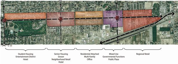
(i) The preferred alternative was developed from the demand and market study as well as the public comment obtained from the open houses. The predominant elements of this preferred alternative are:
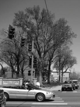
(1) A student and entertainment district in proximity to Mesa College would also provide student housing, after 5:00 p.m. activities and the opportunity for a quality hotel to serve the area.
(2) A neighborhood center where senior housing located in proximity to a quality grocer, neighborhood retail, and the potential for a hotel to serve the hospital and surrounding neighborhood.
(3) A multifamily and attached residential district connecting to the neighborhoods to the north, and potential for office space to the south.
(4) A mixed-use area with residential over retail incorporated with the governmental functions and public plazas to create a gateway for the 29 Road intersection.
(5) Regional retail to anchor the east end of the corridor.
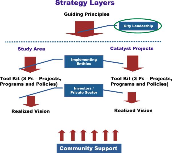
(j) Roles and Responsibilities.
|
City Leadership |
Support at least two demonstration projects (catalyst projects) – commit support for the use of a range of gap filling tools |
|
Once potential incentives are identified – publish a request for development |
|
|
Consider the range of district mechanisms which could potentially fund improvements in the corridor |
|
|
New Initiatives |
|
|
Implementing Entities (i.e., City Staff, Advocacy Entities, etc.) |
Continue to monitor the market and development climate – establish benchmark database |
|
|
Develop targeted marketing materials – solicit regional retail opportunity |
|
|
Establish street standards |
|
|
Link parking lots, minimize curb cuts and consolidate driveways – within nodes |
|
|
Complete regulatory review – eliminate gaps and barriers |
|
Investors/Private Sector |
Host developer/lender (“delivery system”) information meetings – progress updates |
|
|
Share development challenges – open book and open dialogue |
|
Community |
Continue to participate – get educated |
|
|
Support leadership decisions which advance the vision |
(Res. 174-07 (Exh. A), 12-3-07)
32.04.020 Overview.
The following report provides an overall view of the current situation of the North Avenue Corridor. Barriers and constraints have been identified and studied to understand their relevance and contribution to the decline of this commercial district and thoroughfare.
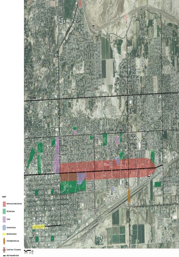
The three miles of the corridor expanse has been divided into three distinct proposed districts as a practical way of addressing the corridor. These three areas are logically divided by north/south major streets – 12th Street, 28 and 29 Roads – and relate to specific neighborhoods and land uses. The report further defines the key projects that will provide the greatest synergy from which development can further progress and build upon.
Implementation tools and specific strategies have been developed to address the barriers pertaining to the districts. An example is presented and used to illustrate how such strategies and tools would be employed for the phasing of such a key project.
Other strategies that encompass the entire corridor study area are also defined with recommendations. Both private and public leadership is necessary to achieve these goals and partnerships are encouraged for policy and physical planning efforts.
All of these recommendations will serve the City of Grand Junction to have a defined document by which to solicit and guide new development in an effort to revive and improve the current situations facing the North Avenue Corridor.
(Res. 174-07 (Exh. A), 12-3-07)
32.04.030 North Avenue Corridor background.
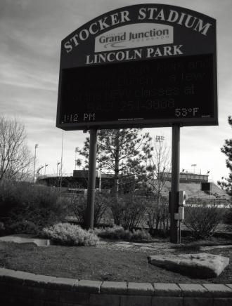
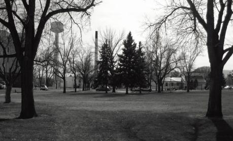
Historically, North Avenue was the northernmost boundary of Grand Junction. As development continued to grow to the north, the North Avenue Corridor now finds itself at the center of the City and in great location and proximity to many great assets and amenities such as the Stocker Stadium and Lincoln Park and Golf field, Mesa College and a wide range of community services, hospitals, downtown, access, etc.
Until the 1990s North Avenue was the primary retail tax generator for the City of Grand Junction. However, over the last few years it has experienced a dramatic loss in revenue in great part associated with the extensive development of new and large commercial and retail centers along the western edge of the City.
As business is pulled to these new commercial centers, North Avenue has the opportunity to reestablish itself with improvements and developments that support a community environment and will make it uniquely different. Rather than mimic the developments occurring on the western edge, the North Avenue Corridor can reclaim its identity by promoting developments that combine retail, office and residential with civic components to establish a distinctive sense of place and character. This will provide, as supplement to downtown, an historically rich active neighborhood with a focus on entertainment and mixed use.
(Res. 174-07 (Exh. A), 12-3-07)
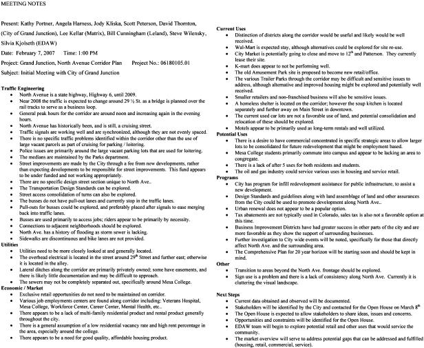
32.04.040 Kick-off meeting (February 7, 2007).
A kick-off meeting with the EDAW project team and City of Grand Junction internal staff served to obtain information from the Planning Department on the conditions of the corridor and local insights and issues to keep in mind during the planning process. The following meeting notes show the items discussed and important information relating to the history and conditions of the corridor study area. These items will help guide implementation plans and will be maintained in further evaluation and development of the plan.
Primary key issues that were discussed in the kick-off meeting and have directed the progress of the corridor study and plan are as follows:
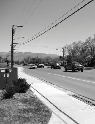
(a) The 29 Road intersection will become a key transportation corridor with the new bridge planned continuing south over the railroad tracks, connecting to the greater business loop. Daily trips are expected to increase and this development area could serve as an identifiable community node.
(b) North Avenue has historically been a cruising street and is currently still used as such. While the cruising of the corridor in itself is not a problem, associated problems such as the congregation and loitering in vacant parking lots is a safety and security problem.
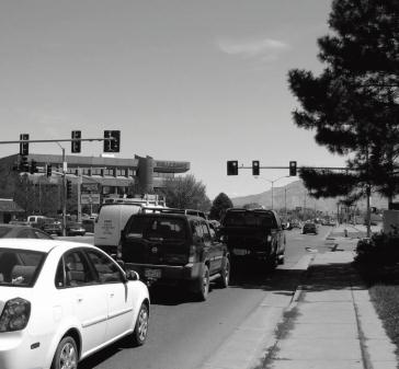
(c) No major traffic problems were identified in regards to traffic lights, accidents, or problem intersections.
(d) Bus transportation and usage is well used within the corridor and potential “farside” pull-outs after intersections might be explored in future design scenarios to allow for buses to not impede with the vehicular flow of traffic on North Avenue.
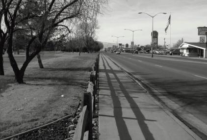
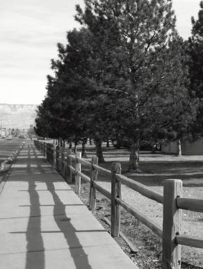
(e) There is a lack of consistency in sidewalks and street design that would create an identifying character to make the pedestrian environment more appealing and usable.
(f) The consolidation of curb cuts would greatly improve access, safety and the pedestrian streetscape environment.
(g) Utilities should be consistently located and buried whenever possible to further improve the visual view of North Avenue.
(h) There is a great need and opportunity to provide good quality and affordable housing, multifamily and attached residential units along the corridor.
(i) Alternative and possible methods to mitigate the issues surrounding the existing homeless shelter would further improve the perceived environment of North Avenue.
(j) Consolidation of commercial uses into core districts would provide areas where the community could access neighborhood services with associated active public spaces while providing opportunities for large lot configurations for future development.
(k) An overall re-evaluation and improvement of the signage standards along the entire corridor would further improve the visual character of the streetscape and promote a pleasant pedestrian and vehicular environment.
(Res. 174-07 (Exh. A), 12-3-07)
32.04.050 Regional context.
The North Avenue study area is nearly three miles in length and contains the key intersections of 12th Street, 28 and 29 Roads that create ideal five-minute walking districts. While the corridor is in general proximity to the downtown area, it is outside of a typical walking distance. The proposed bridge at 29 Road is also a key factor to North Avenue and will increase traffic circulation through this retail area. Crucially important assets to North Avenue are the adjacent Mesa College, Lincoln Park and Stocker Stadium, the multiple government office and job employment centers, community centers, and the direct and easy access to I-70 to the north and I-70B to the south.
(Res. 174-07 (Exh. A), 12-3-07)