


Chapter 34.24
PARKS, RECREATION AND OPEN SPACE ACTION PLAN
Sections:
34.24.020 Colorado River State Park – Connected Lakes section.
34.24.030 Public lands/trail heads.
34.24.050 Goals, policies, implementation.
34.24.010 Findings.
(a) 2001 City of Grand Junction Parks Master Plan. The City of Grand Junction adopted the 2001 Parks Master Plan on February 21, 2001. This Plan recommends several neighborhood parks located throughout the Redlands area.
The Parks Master Plan discusses that one of several measures of the adequacy of a park system is the location of facilities relative to users – whether the parks are convenient to the community. Distance to neighborhood parks has been identified as a “service area” which is represented by a desirable maximum distance that any home should be from the neighborhood park. The service area for a neighborhood park is a half-mile radius or a five- to 10-minute walk. Neighborhood parks are intended to be walk-to parks; therefore the service areas are truncated at major roads or natural barriers. It is assumed that parents or children who walk or ride bikes to a park should not have to cross arterial streets. Significant street barriers on the Redlands includes Broadway (Highway 340). Other conflicts include natural barriers such as the Colorado River. An assumption has been made that irrigation ditches can be crossed with pedestrian bridges at key points.
The Parks Master Plan identifies the Ridges School site and City land next to Wingate Elementary School as high priorities for development as the City already owns the land and neighborhoods have been waiting for these sites to develop for a number of years. (Figure 11)
A neighborhood park needs open turf, a children’s playground, picnic facilities, and court facilities. A neighborhood park also needs to be accessible to the residents without significant restrictions (i.e., access is not restricted during the school day). For this reason, school grounds are currently only considered as neighborhood parks where they serve an area that is otherwise difficult to serve. This is the case for the school site in the Redlands area along Broadway. The Parks Master Plan recommends that the City of Grand Junction pursue mutually beneficial agreements with the School District to allow public access and development of school grounds to meet neighborhood park standards. In 2000, Mesa County Planning Commission sunset 1984 and 1995 Parks Masterplans. In 2001, the Board of County Commissioners passed a resolution establishing a parks policy for Mesa County (MCM 2001-183).
(Res. 62-02, 6-26-02)
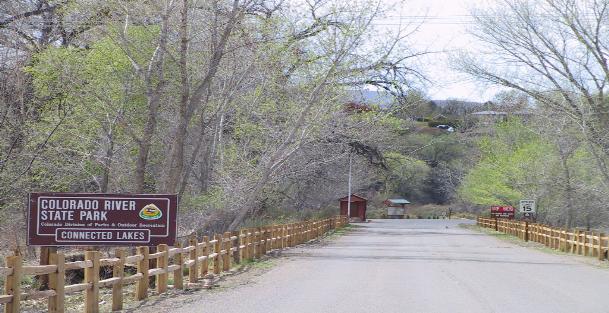
34.24.020 Colorado River State Park – Connected Lakes section.
Colorado River State Park is actually five sections of beautiful stops along the Colorado River as it flows through the Grand Junction area. From Island Acres on the east, the Colorado River State Park makes its way through Corn Lake, the Wildlife Area near 30 Road, then to Connected Lakes located in the north-central area of the Redlands and on down the river to Fruita. Connected Lakes Park has a trail system that winds through stands of tall trees and along the banks of the Colorado River. The park offers opportunities for visitors to enjoy great fishing and picnics in beautiful settings.
(Res. 62-02, 6-26-02)
34.24.030 Public lands/trail heads.
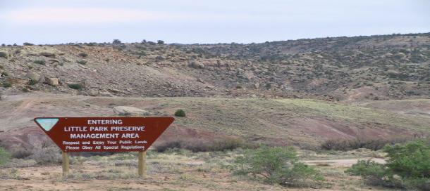
There is an abundance of publicly owned land in and around the Redlands area. Much of this land is owned and managed by the National Park Service and the Bureau of Land Management. The State of Colorado, Mesa County, City of Grand Junction, nonprofit organizations such as the Audubon Society and Museum of Western Colorado, School District 51 and the Bureau of Reclamation own other public lands. Hiking and/or biking trails have been constructed throughout the area. The Redlands area has many trailheads for these hiking and biking routes. See Redlands Area Public Lands and TrailHead Access Map (Figure 12).
(Res. 62-02, 6-26-02)
34.24.040 Open space.
In the Redlands area, there are many trails interwoven through passive open space. These include a trail network that is planned for the Redlands Mesa development, trails leading into the back country of the Colorado National Monument, as well as pedestrian/mountain bike trails like the Tabeguache Trail.
Tabeguache Trailhead
(Res. 62-02, 6-26-02)
34.24.050 Goals, policies, implementation.
(a) Goals.
(1) To develop and maintain an interconnected system of neighborhood and community parks, trails and other recreational facilities throughout the urban area.
(2) To include open space corridors and areas throughout the Redlands area for recreational, transportation and environmental purposes.
(b) Policies.
(1) Preserve areas of outstanding scenic and/or natural beauty.
(2) Obtain adequate parkland needed to meet neighborhood park needs.
(3) Pursue mutually beneficial agreements with the School District to allow public access and development of school grounds to meet neighborhood park standards.
(4) Encourage the retention of lands that are not environmentally suitable for construction (i.e., steep grades, unstable soils, floodplains, etc.) for open space areas and, where appropriate development of recreational uses. Dedications of land required to meet recreational needs should not include these properties unless they are usable for active recreational purposes.
(5) Encourage citizen groups to look at innovative ways to acquire open space areas.
(6) Mitigate the impact of recreational use of open space on its environmental value.
(7) Respect or replace historic trails and access to public lands with new development.
(c) Implementation.
(1) The City and County will help preserve areas of outstanding scenic and/or natural beauty and, where possible, include these areas in the permanent open space system.
(2) The City and County will obtain adequate parkland needed to meet neighborhood park needs, as urban development occurs, through the subdivision process and other appropriate mechanisms. Other public, quasi-public and private interests will be encouraged to secure, develop and/or maintain parks.
(3) The City and County will coordinate with the School District to achieve cost savings through joint development and recreational facilities. The City of Grand Junction will pursue mutually beneficial agreements with the School District to allow public access and development of school grounds to meet neighborhood park standards.
(4) The City and County will encourage the retention of lands that are not environmentally suitable for construction (i.e., steep grades, unstable soils, floodplains, etc.) for open space areas and, where appropriate, development of recreational uses. Dedications of land required to meet recreational needs will not include these properties unless they are usable for active recreational purposes.
(5) The City and County will coordinate with appropriate agencies to mitigate the impact of recreational use of open space on its environmental value.
(6) The City and County will seek public and private partnerships in efforts to secure open space.
(7) The City and County will require new development to respect or replace historic trails and access to public lands.
(8) Enter into a Public Purpose Act lease with the Bureau of Land Management for the BLM parcel north of South Camp Road for open space.
(9) Identify future trailhead locations.
(Res. 62-02, 6-26-02)