


Chapter 37.04
INTRODUCTION
Sections:
37.04.010 Introduction.
The Pear Park Planning effort began in the winter of 2004 as a joint effort between the City of Grand Junction and Mesa County, with the participation and involvement of School District 51. The planning area includes both City limits and unincorporated areas of Mesa County. The majority of the area lies within the boundary defined within the 1998 City/County Persigo Agreement which requires all new development to annex into the City of Grand Junction and submit any development requests to the City for review and approval.
(Res. 13-05, 1-5-05)
37.04.020 Location.
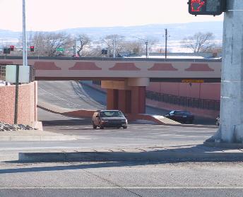
30 Road and I-70 B
The Pear Park Neighborhood includes all properties located between 28 Road and 32 Road and between the railroad (I-70 B) and the Colorado River. Major entrances into the neighborhood currently include 30 Road, E Road, D 1/2 Road and D Road. In the future, 29 Road will play a major role in providing access into and out of the neighborhood. The neighborhood is comprised of 6.33 square miles of land area, with most of the area currently located within unincorporated Mesa County; however, the majority of the area will be annexed to the City as development occurs.
(Res. 13-05, 1-5-05)
37.04.030 Purpose.
The Pear Park area is experiencing a great deal of growth with an ultimate projected population of approximately 22,000 people. With the opening of the 30 Road underpass and the future 29 Road connections to Orchard Mesa and Interstate 70, the Pear Park area is prime for development. Now is the time to plan for that growth and establish goals and guidelines that will help shape the Pear Park neighborhood.
The City of Grand Junction Growth Plan and the Mesa County Countywide Land Use Plan provide the general framework of the Pear Park Neighborhood Plan. The goals and policies of those plans remain in effect and apply to this neighborhood plan. The Pear Park Neighborhood Plan provides more specific guidance for both the public and private sectors in making decisions regarding development in the Pear Park area. The Plan will also be used by the City and County in developing annual work programs and budgets. Any recommended changes to regulations or ordinances will require additional review and public hearings for adoption.
(Res. 13-05, 1-5-05)
37.04.040 Demographics.
The Pear Park neighborhood experienced a 25 percent increase in population between the census years of 1990 and 2000. This compares to a 20 percent increase in population for all of Mesa County over the same decade. The area saw an increase of 2,141 people in the 1990s.
The current population of Pear Park is estimated to be 10,060. Since the 2000 U.S. Census, Pear Park has grown by an estimated 1,422 people living in 536 new homes (as of August 2004). Between 2000 and 2004, the City of Grand Junction and Mesa County approved 1,121 new residential home sites. The average housing density for new construction developed since the last census is 4.47 homes per acre.
|
1990 Census |
2000 Census |
Growth Rate |
2020 Projections |
2030 Projections |
||
|
Number of Homes |
2,276 |
3,246 |
30% |
6,570 |
8,305 |
|
|
Number of People |
6,497 |
8,638 |
25% |
17,449 |
21,926 |
|
|
Number of Persons Per Household |
2.85 |
2.66 |
-7% |
2.66 |
2.64 |
Population projections are based on the May 2003 Future Land Use Map densities using a midrange.
(Res. 13-05, 1-5-05)