


Chapter 37.16
SCHOOLS, PARKS AND TRAILS
Sections:
37.16.020 Existing parks and open space in Pear Park (public and private).
37.16.030 Existing parks and open space.
37.16.040 Neighborhood park and school service areas.
37.16.050 School site selection criteria.
37.16.070 Implementation strategies.
37.16.010 Background.
Chatfield Elementary is the only public school in the Pear Park Planning Area. Chatfield serves residents east of 30 Road and south of E Road. The remainder of the area is within the Columbine and Fruitvale Elementary attendance areas. Students also attend East Middle School, Grand Mesa Middle School, Grand Junction High School and Central High School. Generally, Pear Park students are bussed to the schools, with the exception of those students within one mile of Chatfield Elementary. Statistics indicate the number of students attending these public schools has increased by about 275 students (five percent) for K – 12 during the past four years.
|
School (LRP Target Capacity) |
Enrollment 2000 through 2004 |
% change |
|||
|---|---|---|---|---|---|
|
|
2000/01 |
2001/02 |
2002/03 |
2003/04 |
|
|
Chatfield Elementary (565) |
519 |
537 |
555 |
578 |
11.4 |
|
Columbine Elementary (268) |
224 |
221 |
263 |
244 |
8.9 |
|
Fruitvale Elementary (476) |
529 |
565 |
520 |
515 |
(2.7) |
|
Grand Mesa Middle (625) |
643 |
661 |
666 |
732 |
13.8 |
|
East Middle (398) |
436 |
453 |
450 |
446 |
2.3 |
|
Grand Junction High (1,676) |
1,624 |
1,576 |
1,600 |
1,632 |
0.5 |
|
Central High (1,470) |
1,544 |
1,596 |
1,652 |
1,650 |
1.7 |
|
TOTALS (5,478) |
5,519 |
5,609 |
5,706 |
5,797 |
5.0 |
Source: Mesa Valley School District 51.
The 2003/2004 attendance was nearly six percent above the target capacity of the schools. Recent School District 51 projections indicate about 600 additional students will be in these attendance areas by the year 2013 which would be about 17 percent above the target capacity of the schools. Within the Pear Park planning area, the School District’s Long-Range Planning Committee recommends that sites be identified for two additional elementary schools (10 acres each), one middle school (20 acres) and possibly one high school (40 acres). The acreage of potential sites can be reduced by 25 to 30 percent if combined with a park/open space. For example, an elementary school and a park together could potentially fit on 15 acres. The City of Grand Junction Growth Plan and the Mesa Countywide Land Use Plan adopted in 1996 identified the desire to combine school and park sites to achieve cost savings and provide more recreational opportunities for the community. According to the Grand Junction Growth Plan and the Mesa Countywide Land Use Plan, elementary schools should be located within residential neighborhoods to minimize the need for children to cross arterial streets and to minimize the need for school busing.
The tremendous growth of the Pear Park area has left few parcels of land available to be developed for parks and schools. Developing public parks in conjunction with schools allows greater opportunity for recreational/physical activities and learning opportunities for school children.
Parks are an important quality of life aspect of a community as they provide open space for active and passive recreation, community gathering areas, accommodate athletic events and protect natural or scenic areas. Trails link residential areas with amenities in and around their immediate area.
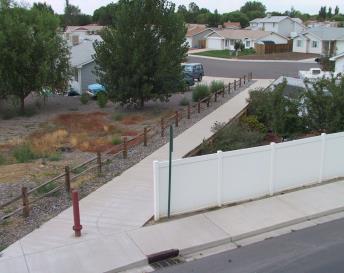
Trails are an important component to parks as well as the overall transportation system of a community. Trails are typically defined as off-street nonmotorized routes with few road crossings that are open for bicycle and pedestrian use and sometimes equestrian use. Trails are also identified as on-street bike lanes. The City of Grand Junction and Mesa County have adopted a Grand Junction Circulation Plan that defines the type and locations of nonmotorized transportation corridors in the Grand Junction urban area, as well as on-street bicycle and pedestrian facilities (see Chapter 37.12 GJMC, Transportation and Access Management). Trails not only provide recreational opportunities to residents, but provide a needed transportation option for the nonmotorized public, providing connections between residential areas. Trails, along with sidewalks and bicycle lanes, should link residential subdivisions with parks and schools helping to provide safe routes to schools, reducing the need for busing children to school and lessening the need for parents to drive children to school.
(Res. 13-05, 1-5-05)
37.16.020 Existing parks and open space in Pear Park (public and private).
|
Name |
Location |
Type |
Size |
Owner |
Amenities |
|---|---|---|---|---|---|
|
Colorado River State Park – Corn Lake Section |
32 Road and the Colorado River |
State Park |
41 acres |
State of Colorado |
Lake/picnic area/boat launch and landing/trails |
|
Colorado River Wildlife Refuge Area |
31 Road and D Road |
State Park |
141 acres |
Federal (Bureau of Reclamation) |
Limited public access. Wildlife view area/trails |
|
Colorado River State Park River Trail |
30 Road to 32 Road |
State Park |
20 acres |
State of Colorado |
Paved pedestrian/bike trail |
|
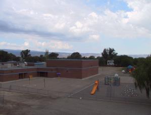
Chatfield Sports Complex (operated by Grand Mesa Youth Soccer Association) |
3188 D 1/2 Road |
Soccer Complex |
10 acres |
School District 51 |
Soccer Fields (adjacent playground with elementary school) |
|
Grove Creek HOA Park |
North side of subd at D 1/2 Road |
Homeowners’ Association |
1.5 acres |
Homeowners’ Association |
Grass (open space) |
|
Meadowvale Subdivision HOA Park |
D Road and Alamo Street |
Homeowners’ Association |
2.8 acres |
Homeowners’ Association |
Picnic area, playground, grass (open space) |
|
Midlands Village HOA Park |
Nottingham Drive and 32 Road |
Homeowners’ Association |
1 acre |
Homeowners’ Association |
Trails, grass (open space) |
|
Wedgewood Subdivision HOA Park |
D Road and Wedgewood Avenue |
Homeowners’ Association |
1.3 acres |
Homeowners’ Association |
Picnic area, playground, basketball court, grass (open space) |
|
Flint Ridge Neighborhood Park |
D 1/4 Road and Marianne Drive |
Neighborhood Park |
3 acres |
City of GJ |
Undeveloped |
|
Willowwood Mobile Home Park |
30 Road and D Road |
Homeowners’ Association |
3 acres |
Homeowners’ Association |
trails, basketball court, grass (open space) |
|
Cherokee Village |
Seminole Court |
Homeowners’ Association |
0.15 acre |
Homeowners’ Association |
Picnic area, grass (open space) |
|
Cimarron East |
Margi Court |
Homeowners’ Association |
0.5 acre |
Homeowners’ Association |
Picnic shelter, grass (open space) |
|
Orchard View |
Alegre Court |
Homeowners’ Association |
0.5 acre |
Homeowners’ Association |
Undeveloped |
|
Cherokee Village West |
Osage Circle |
Homeowners’ Association |
0.3 acres |
Homeowners’ Association |
Open space |
|
Parkwood Estates No. 3 |
Morning Dove |
Homeowners’ Association |
1 acre |
Homeowners’ Association |
Open space |
|
Ironwood |
30 1/4 Road and Colorado Ave. |
Homeowners’ Association |
1.1 acres |
Homeowners’ Association |
Open space |
(Res. 13-05, 1-5-05)
37.16.030 Existing parks and open space.
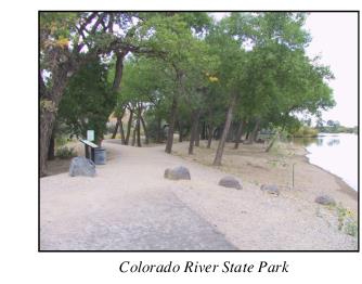
Existing park facilities and trails include the Corn Lake section of Colorado River State Park at 32 Road, access points along the river, eight-foot wide concrete trails and equestrian paths along the stretch between 30 and 32 Roads, all owned and maintained by the State of Colorado State Parks. The current focus of State Parks is on gaining nonmotorized access along the river between 27 1/2 to 30 Road for additional trails and interconnectivity. Some property owners have indicated they are hesitant to allow trail access through their property. The State’s response is that it will not condemn any land to gain access, but will work with property owners to find alternate routes in those areas along the river. Many of the existing State Park facilities have been designed to accommodate a multitude of users including pedestrians, bicycles and horses. Future trails and paths would be designed to provide the same or similar amenities.
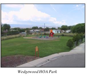
There are a few private parks owned by local homeowner associations. Some of these parks are simply open space grassy areas. Others, like Wedgewood Park, have playground equipment that was funded by Mesa County lottery funds.
Trails are very much needed throughout the planning area to link parks, schools and residential subdivisions. More connections to the riverfront trail, as well as links between other trails are needed. 28 3/4 Road was identified as a possible connection to the Colorado River trail. Parking areas for the river trail are also needed.
(Res. 13-05, 1-5-05)
37.16.040 Neighborhood park and school service areas.
This Plan provides for parks in the Pear Park neighborhood by identifying park service areas, establishing the type and size of parks needed, and identifying major urban trail corridors through and to these park service areas, other areas of Pear Park and other neighborhoods in Grand Junction and Mesa County. As land for parks and schools is identified and secured, trail linkages will need to be planned.
The Grand Junction Parks Master Plan and Mesa County’s East Valley Parks Plan identified the need for four neighborhood parks (three to 10 acres) and one community park (10 to 20 acres) for the Pear Park neighborhood. The following table from the previous plans defines those types of parks as well as two other types of parks that may be privately or publicly built in the Pear Park neighborhood.
|
Park Type |
Size Range |
Service Area |
Key Features: (May contain one or more of the following) |
|---|---|---|---|
|
Mini |
1/4 to 3 acres |
1/4 mile radius |
Open play area, playground, picnic tables, fronts on one or more streets |
|
Neighborhood |
3 to 10 acres |
1/2 mile radius |
Open turf area, picnic area/pavilion, playground, walking path, softball/baseball fields, tennis courts, basketball court |
|
Community |
10 to 20 acres |
2 mile radius |
Softball/baseball complex, restrooms, parking lot, open play fields, playground, tennis courts, basketball courts, picnic pavilion, walking paths, natural area, water feature, swimming pool, regional trail connections |
|
Regional |
40+ acres |
10 mile radius |
Lighted sport complexes, recreation/community center, and/or significant natural areas with natural recreation (hiking/biking trails), large complex |
In addition, the School District 51 Long-Range Planning Committee identified the future need for two additional elementary schools, one middle school and possibly a high school in the Pear Park neighborhood. With the above information, the following needs were identified through a review of existing plans, an inventory of existing parks and trails, meetings with officials from the School District, State Parks, City and County planners and input from residents gathered from the Pear Park Open House held on March 30, 2004, at the Pear Park Baptist Church.
The Pear Park Neighborhood Parks and Schools Map at the end of this chapter identifies the parks and schools needs for each service area as listed below.
(a) West Pear Park. The population density at build-out for this area is projected to be less than the other areas. West Pear is designated at a density of two to four units on the Growth Plan versus four to eight units in the other three areas, except the State property consisting of 151 acres which is designated as “public.” Generally school sites are most suitable east of 29 Road.
The need for an elementary school is not anticipated for this area; therefore a neighborhood park would be a stand-alone amenity in West Pear Park. In addition, there is the potential for passive recreation along the river, in conjunction with the Colorado State Park River Trail. A connection to the river trail is needed somewhere between 28 1/2 Road and 28 3/4 Road.
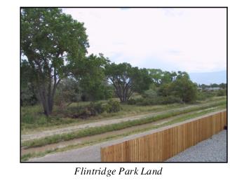
(b) Flintridge Pear Park. The school needs in this area include an elementary school and middle school, both of which could be combined with needed park sites. It could also be an area for a high school.
The City owns a three-acre parcel in the Flintridge subdivision that could be expanded for a neighborhood park. The needed neighborhood park could also be combined with a future elementary school site. The gravel pits south of D Road could be a future location for a middle school and community park. A high school site could also be located in this area and could be combined with a park.
(c) Central Pear Park. One neighborhood park and one elementary school are needed in this area and a middle school could also be located in this area if a large enough site is obtained. This area of Pear Park has very little vacant land remaining that could accommodate parks and schools. It is imperative that land be secured as soon as possible.
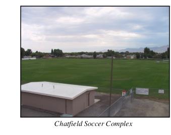
(d) Chatfield Pear Park. Chatfield Elementary School is already serving this area, but providing the additional two elementary schools in the other service areas of Pear Park will relieve the enrollment pressures on Chatfield. A neighborhood park is still needed. Chatfield Elementary School could be expanded and further developed to provide more park land. A regional park has also been identified as optional for this area, but may not be needed with the current development of Long Park, a new regional park located near 31 Road and E 1/2 Road, next to Central High School.
(Res. 13-05, 1-5-05)
37.16.050 School site selection criteria.
The following criteria should be used in the selection of sites for schools:
(a) Central location – walkable for majority of students within the service areas, minimizing bussing;
(b) Locate elementary schools on local streets with good connections to collector roads;
(c) Combine school/park sites;
(d) Maximize trails/sidewalk access;
(e) Availability of public utilities;
(f) Avoiding proximity to hazard areas, i.e., railroads, ditches, canals, etc.;
(g) Appropriate surrounding zoning;
(h) Analysis of existing site conditions for ease and efficient construction.
(Res. 13-05, 1-5-05)
37.16.060 Goals.
(a) Provide adequate public school and park sites to serve the Pear Park residents as identified on the Pear Park Neighborhood Parks and Schools Map.
(b) Schools and parks sites should be co-located and parks jointly developed by the City, County and School District for the benefit of all residents.
(c) Provide off-street trail connections between residential areas, parks and schools.
(d) Complete the Colorado River State Park Parks trail system through Pear Park.
(e) Increase recreational opportunities in the Colorado River corridor.
(Res. 13-05, 1-5-05)
37.16.070 Implementation strategies.
(a) The City and County will work with School District 51 to identify and purchase land for future school sites using the Pear Park Neighborhood Parks and Schools Map in this Plan and school site selection criteria. Options to purchase and/or rights of first refusal should be negotiated as soon as possible.
(b) The School District will establish the priority of which area (Flintridge Pear Park or Central Pear Park) should have the next elementary school constructed.
(c) Update the School Land Dedication fee collected by the City and County in lieu of land dedication and tie the fee to the Consumer Price Index.
(d) New trail linkages will be planned and built to provide access to future park and school sites to implement the Grand Junction Circulation Plan.
(e) The City of Grand Junction, Mesa County and/or State Parks should construct additional recreational facilities in the Colorado River Corridor.
(f) The Colorado River State Parks trail system will be extended from 30 Road to 27 1/2 Road.
(g) Construct trails as identified on the Grand Junction Circulation Plan to link the Colorado River Trail to residential areas within Pear Park.
(Res. 13-05, 1-5-05)