


Chapter 39.28
TRANSPORTATION
Sections:
39.28.040 Access control plan.
39.28.050 Potential transportation projects.
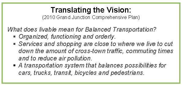
39.28.060 2010 Comprehensive Plan goals and policies.
39.28.070 Orchard Mesa transportation.
39.28.010 Background.
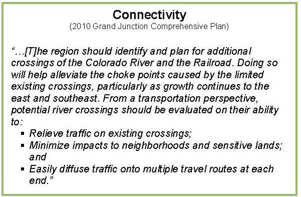
A well-designed and balanced transportation system will support access, circulation, and the safe movement of all modes of motorized and nonmotorized transportation. Multiple travel routes provide greater options for driving, walking, and biking, and help reduce congestion by diffusing traffic. Well-connected street networks have been shown to reduce congestion, increase safety for drivers and pedestrians, and promote walking, biking, and transit use. The Grand Valley Circulation Plan (2010) shows existing and future roads that would serve the plan area (Appendix Map 12).
“Complete Streets” are ones in which the design addresses the needs of users of all ages and abilities, including safety, mobility and accessibility. This means planning for everyone: pedestrians and bicyclists as well as the movement of vehicles and public transit. An important component of Complete Streets is providing for connectivity by creating small-scale, low-speed streets as part of a dense street grid with small block lengths. Such street networks maximize efficient traffic flow and roadway capacity while increasing safety by holding vehicles to slower speeds. Small block lengths encourage walking and increase pedestrian safety. Increasing connectivity is less costly, more cost-efficient, and less impactful than widening arterial roadways.
(Ord. 4629, 5-7-14)
39.28.020 Multi-modal system.
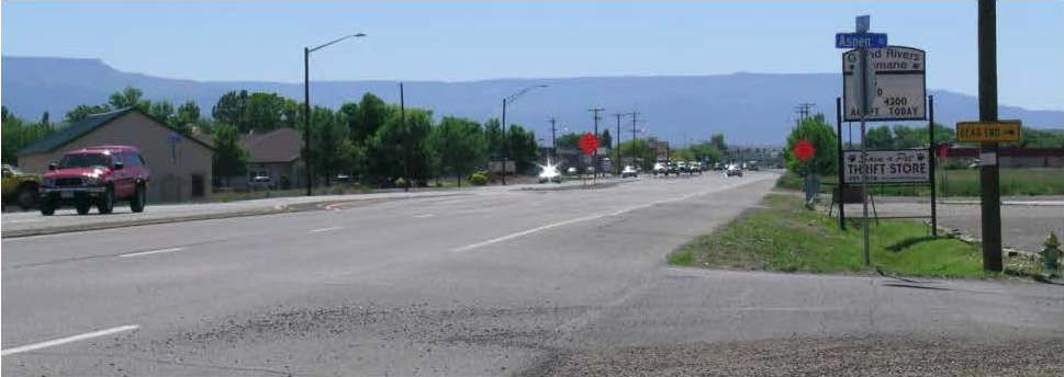
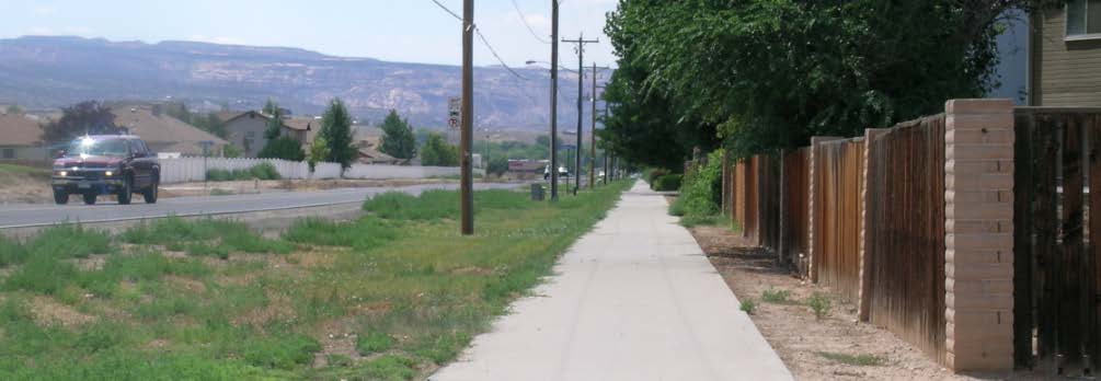
There is a significant need for pedestrian and bicycle improvements throughout Orchard Mesa. Highway 50 has no pedestrian infrastructure and few crossings, limiting the ability of local residents to walk or bike safely. Notably, Mesa Valley School District No. 51 buses students who would have to cross Highway 50 to school, even though students may live within the designated walking area. A bike and pedestrian path along Highway 50, as well as improved crossings, is a high priority. A few bike and pedestrian facilities are located along streets, but Orchard Mesa has little in the way of dedicated bike routes and pedestrian paths within the neighborhoods and connecting to other areas (Appendix Map 13). The Urban Trails Master Plan (UTMP) identifies existing and future routes for bike facilities and trails.
Grade-separated pedestrian crossings (bridges) are the safest method to provide Highway 50 crossings for students and residents. While building new pedestrian bridges is very expensive, reconfiguring the B 1/2 Road overpass to include pedestrian and bicycle facilities would provide both an economical and functional solution that significantly improves connections between schools, neighborhoods, commercial areas and the fairgrounds. Further improvements along the Highway 50 corridor would complement the reconfigured B 1/2 Road interchange and improve mobility. (Figure 8; Appendix Maps 14 and 15)
Figure 8: Neighborhood Center Circulation Concept Plan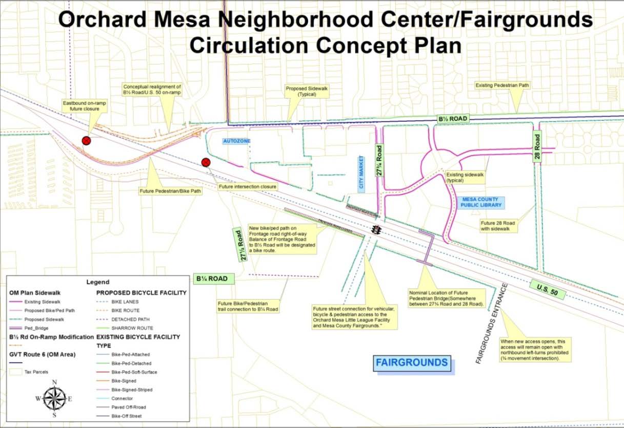
The nationally historic Old Spanish Trail travels through Orchard Mesa; the historical crossing of the Colorado River was near 28 3/4 Road. The Colorado Riverfront trail system runs along the north bank of the Colorado River and can be accessed from Orchard Mesa at four river crossings. Natural drainage ways traverse the planning area running north/northwest and can provide possible future trail connections to the trail facilities already in place. Linking neighborhoods with the Colorado River, downtown Grand Junction, village centers, neighborhood centers and other desired public attractions will provide a more complete transportation network for Orchard Mesa residents. Chapter 39.40 GJMC, Parks, Recreation, Open Space and Trails, provides more detail on trails, as well as additional goals and actions. (Appendix Maps 13 and 24)
(Ord. 4629, 5-7-14)
39.28.030 Public transit.
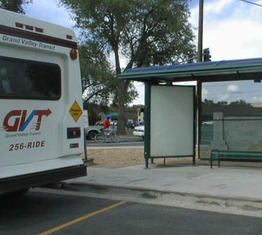 Public transit is an important component of a multi-modal system. It provides transportation for people without reliable transportation, as well as the elderly and others with limited mobility. It can also help to relieve road congestion. Bus service is provided by Grand Valley Transit (GVT). The GVT system includes a route that travels from the transit center at 5th Street and South Avenue through Orchard Mesa and north along 29 Road to the Mesa County Workforce Center at North Avenue. This provides direct connections to a number of other routes serving Grand Junction and the Grand Valley. Buses run every half hour, Monday through Saturday; there is no service on Sundays or holidays. GVT buses are wheelchair accessible. Paratransit riders may also qualify for curb-to-curb service.
(Ord. 4629, 5-7-14)
39.28.040 Access control plan.
In 2009 Mesa County, the City of Grand Junction, and the Colorado Department of Transportation (CDOT) entered into an agreement to implement an Access Control Plan (ACP) for U.S. Highway 50. The plan establishes future access conditions on a property-by-property basis along the corridor. The purpose of the ACP is to provide reasonable access to adjacent properties while maintaining safe and efficient traffic flow. Key objectives include reducing traffic conflicts and improving traffic safety. Certain proposed actions in this plan would implement the ACP, such as the addition of pedestrian and bicycle facilities on the B 1/2 Road overpass.
(Ord. 4629, 5-7-14)
39.28.050 Potential transportation projects.
For the past several years and during this planning process, the City and County have heard from businesses and residents about the many transportation needs on Orchard Mesa. The following is an unranked list of these projects:
(a) Highway 50 multi-modal improvements including nonmotorized crossings;
(b) B 1/2 Road multi-modal improvements;
(c) 29 Road and Unaweep Avenue intersection control;
(d) B Road multi-modal improvements;
(e) 32 Road corridor improvements;
(f) A connection between the Old Spanish Trail and the Colorado Riverfront trail system;
(g) New Black Bridge (bike/pedestrian) connecting Orchard Mesa with the Redlands;
(h) Bicycle improvements on the Fruit and Wine Byway;
(i) 27 Road multi-modal improvements;
(j) Complete Streets traffic improvements and other measures at key locations such as commercial centers, schools, parks and other activity centers.
(Ord. 4629, 5-7-14)
39.28.060 2010 Comprehensive Plan goals and policies.
(a) Goal 9. Develop a well-balanced transportation system that supports automobile, local transit, pedestrian, bicycle, air, and freight movement while protecting air, water and natural resources.
(b) Policies.
(1) The City and County will work with the Mesa County Regional Transportation Planning Office (RTPO) on maintaining and updating the Regional Transportation Plan, which includes planning for all modes of transportation.
(2) Include in the Regional Transportation Plan detailed identification of future transit corridors to be reserved during development review and consider functional classification in terms of regional travel, area circulation, and local access.
(3) The Regional Transportation Plan will be used as a basis for development review and to help prioritize capital improvement programming. The City and County will maintain capital improvement plans (CIPs) which prioritize road and alley improvements based on needs for traffic flow, safety enhancements, maintenance and linkages.
(4) A trails master plan will identify trail corridors linking neighborhoods with the Colorado River, downtown, village centers and neighborhood centers and other desired public attractions. The plan will be integrated into the Regional Transportation Plan.
(5) When improving existing streets or constructing new streets in residential neighborhoods, the City and County will balance access and circulation in neighborhoods with the community’s needs to maintain a street system which safely and efficiently moves traffic throughout the community.
(Ord. 4629, 5-7-14)
39.28.070 Orchard Mesa transportation.
(a) Goal 1. Orchard Mesa’s multi-modal transportation network serves all users – vehicles, transit, bicycles and pedestrians – through the planning and design of “Complete Streets.”
(1) Actions.
(i) Implement the Grand Valley Circulation Plan to improve the transportation network. Use a “Complete Streets” concept and policy for all transportation infrastructure, including planning, land use control, scoping, and design approvals.
(ii) Work with Grand Valley Regional Transportation Committee to include rebuilding the Highway 50 corridor as a Complete Street in the 2040 Regional Transportation Plan as a priority. Secure funding for CDOT to design and construct the corridor.
(iii) Future reconstruction or other major improvements to Highway 50 shall reflect the need to provide safe nonmotorized crossing of the highway and multi-modal facilities.
(iv) Convert the eastbound lane of the B 1/2 Road overpass to a pedestrian/bicycle connection across Highway 50 (Figure 8).
(v) Improve the westbound B 1/2 Road to westbound Highway 50 on-ramp to enhance safety (Figure 8).
(vi) As development/redevelopment occurs, ensure that the local road network supports the Highway 50 Access Control Plan.
(b) Goal 2. Safe walking routes lead to all Orchard Mesa schools.
(1) Actions.
(i) Ensure that nonmotorized access to schools is a key priority for new projects.
(A) Include safe walking routes in applicable Capital Improvement Projects.
(B) Seek grants and other funding, such as the federal Transportation Alternatives Program, for implementation.
(ii) Work with the school district, Colorado Department of Transportation and other partners to determine acceptable and effective Highway 50 school crossings and techniques at optimal locations.
(iii) Work with schools and community partners to ensure schools are connected to residential areas with walking paths and bicycle access, and secure bike parking is provided on school grounds.
(iv) Assist local partners such as Grand Valley Bikes and School District 51 with grant applications and other opportunities to map safe walking and biking routes to schools, conduct walking audits, create travel maps, and provide road safety information to parents and students.
(v) Work with schools and community partners to improve transportation infrastructure to reduce conflicts between transportation modes during school drop-off and pick-up.
(vi) Incorporate pedestrian/street lighting into nonmotorized facilities.
(c) Goal 3. Orchard Mesa has a comprehensive system of bicycle and pedestrian facilities as part of a Complete Street network.
(1) Actions.
(i) Implement the Urban Trails Master Plan through land development proposals, planning activities, Capital Improvement Projects and other roadway improvements.
(ii) Require that all new streets and roads include sidewalks and/or bicycle facilities, including capital improvement street projects.
(iii) Identify and seek funding to build sidewalks and/or bike lanes and trails with school connectivity a top priority. Other key priority measures are connections to activity centers such as parks, commercial/retail areas and the Mesa County Fairgrounds.
(iv) Provide connectivity to existing and planned trails on public lands. Identify locations for and improve trailheads, including parking areas and other facilities.
(v) Work with the Orchard Mesa Irrigation District, property owners and trails and bicycling organizations to identify corridors that will provide additional opportunities for nonmotorized recreational and commuting opportunities.
(A) Identify drainages and other corridors where trail linkages are possible based on location to existing or future trails, topographic constraints, and ownership agreements.
(B) Develop and maintain a database containing easement agreements and other access agreements that cross private property for access to public lands.
(d) Goal 4. Grand Valley Transit service and routes meet the needs of Orchard Mesa.
(1) Actions.
(i) Determine ridership demand through on-board surveys and collection and analysis of individual transit stop data and customer requests for service.
(ii) Add and/or adjust routes as justified by demand and budget allows.
(iii) Create new appropriate stops and “pull-outs” with proper signage.
(iv) Monitor land development activity to plan for future transit routes.
(v) Construct safe nonmotorized access to transit stops.
(Ord. 4629, 5-7-14)