


Chapter 39.48
NATURAL RESOURCES
Sections:
39.48.040 Visual resources/air quality.
39.48.060 2010 Comprehensive Plan goals and policies.
39.48.070 Orchard Mesa natural resources.
39.48.010 Background.
The Orchard Mesa planning area contains a wealth of natural resources and amenity values. Most of the neighborhoods benefit from great views of the Grand Mesa, Bookcliffs, and the Colorado National Monument. The area also includes mineral resources, historic and existing drainage channels, wetlands, wildlife habitat, and the Colorado and Gunnison River floodplains.
(Ord. 4629, 5-7-14)
39.48.020 Mineral resources.
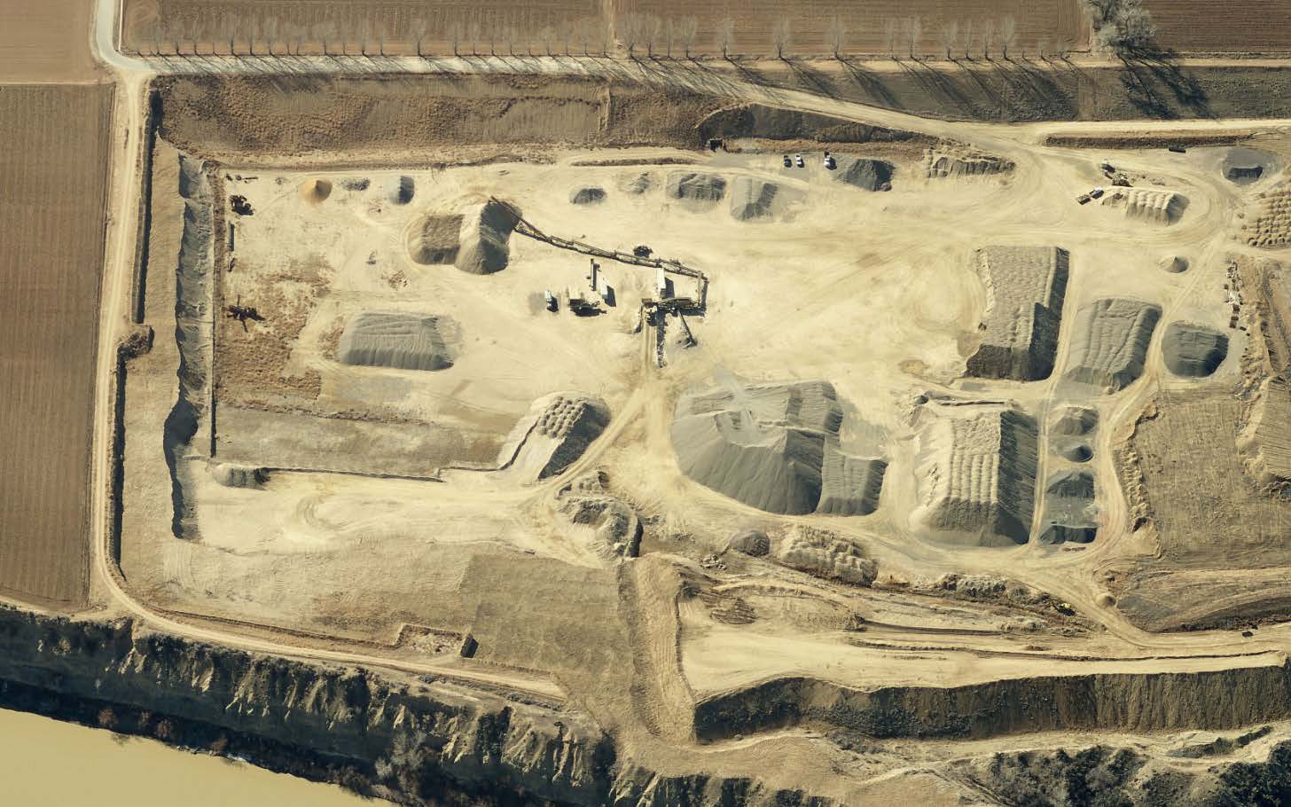
Mineral resources are predominantly upland gravel deposits on both the Colorado River and Gunnison River bluffs as well as floodplain deposits along both rivers. The current five gravel pits in the area are all outside of the City limits. Some coal deposits exist along the Gunnison River near the Department of Energy facility. These resources are all identified in the County’s Mineral and Energy Resources Master Plan and mapped in the Mineral Resources Survey of Mesa County (1978).
As Orchard Mesa grows, the potential for land use conflicts increases between gravel operations and other development. Mineral extraction is regulated by local development codes and the State of Colorado.
(Ord. 4629, 5-7-14)
39.48.030 Geologic hazards.
Evidence of unstable slopes, soil creep and slumping is easily seen along the bluffs of Colorado River. Numerous locations along the Colorado and Gunnison River bluff lines show signs of soil movement and unstable slopes, including some areas where residential development has occurred. In the 1980s several homes in the Lamplight Subdivision were damaged and ultimately removed due to earth movement sliding towards the Colorado River as shown below.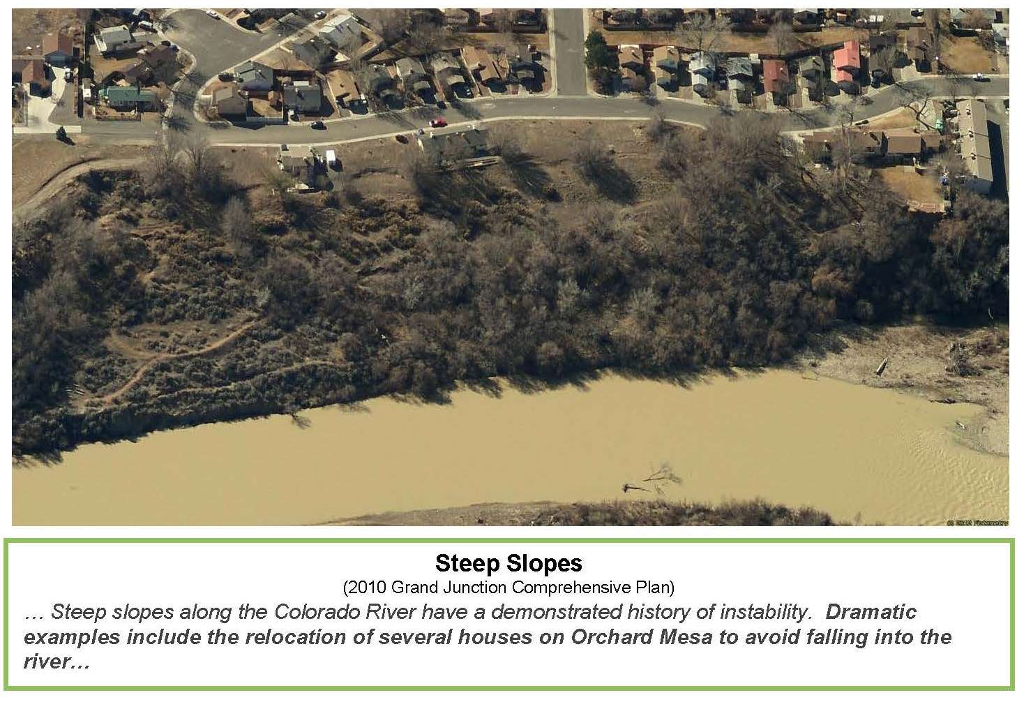
City and County development codes set forth specific criteria for land use and development activities to avoid hazard areas or mitigate potential impacts. The codes also have standards for development along mapped ridgelines visible from major transportation corridors.
(Ord. 4629, 5-7-14)
39.48.040 Visual resources/air quality.
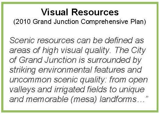
The Highway 50 corridor is a major entryway to the Grand Junction area and offers visitors and residents their first view of the urban area. The image many people have of Orchard Mesa and the Grand Junction area is based on their experience along this corridor. Orchard Mesa is located above the majority of the urban area and boasts some of the best scenic views of the Grand Valley, the Uncompahgre Plateau, Colorado National Monument, the Bookcliffs and Grand Mesa.
Like much of Mesa County, the enjoyment of the night sky is a high priority for residents of Orchard Mesa. Development codes include specific standards for outdoor lighting in and outside of the Grand Junction City limits.
The Mesa County Board of Health’s advisory body, the Grand Valley Air Quality Planning Committee, studies and addresses air quality issues such as: oil burning furnaces, illegal trash burning, legally permitted open burning, visibility, wood stove use during winter months, vehicle emissions, fugitive dust complaints, neighborhood odor complaints, etc.
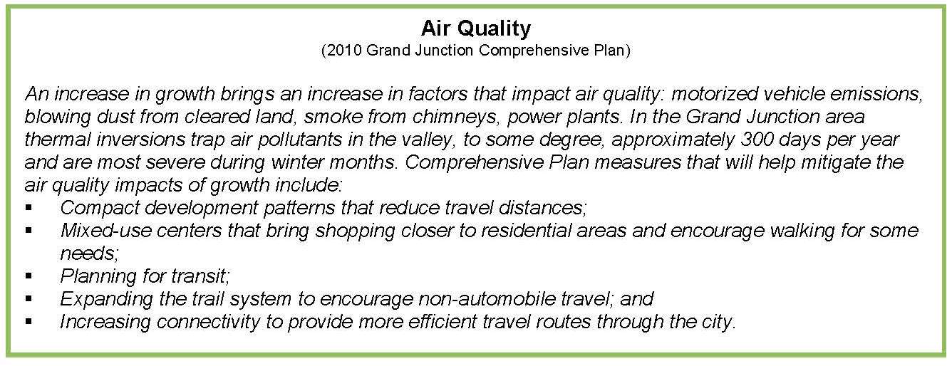
Mesa County Resolution MCM 2002-066, Mesa County Air Pollution Resolution on Open Burning, sets forth direction for air quality protection consistent with Section 25-7-128 of the Colorado Revised Statutes. The County’s resolution provides specific direction for open burning in the designated air shed, prohibited materials, general practices, exemptions, permit requirements, local fire protection agency requirements, and season and timing of burning. Agricultural burning is generally exempt from regulation and the resolution prohibits open burning of residential household trash.
(Ord. 4629, 5-7-14)
39.48.050 Wildlife.
The 100-year floodplains of the Gunnison and Colorado Rivers are designated as critical wildlife habitat by the U.S. Fish and Wildlife Service for several endangered fish species: the Colorado pikeminnow, razorback sucker, bonytail chub, and humpback chub. The western yellow-billed cuckoo is proposed for threatened status. The Colorado hookless cactus, a listed threatened plant, is also in the area. Local development codes require minimum setbacks from the Colorado and Gunnison Rivers and consultation with the Colorado Parks and Wildlife and the U.S. Fish and Wildlife Service for input on development near drainages and other wildlife habitat.
(Ord. 4629, 5-7-14)
39.48.060 2010 Comprehensive Plan goals and policies.
(a) Goal 10. Develop a system of regional, neighborhood and community parks protecting open space corridors for recreation, transportation and environmental purposes.
(b) Policies.
(1) Preserve areas of scenic and/or natural beauty and, where possible, include these areas in a permanent open space system.
(Ord. 4629, 5-7-14)
39.48.070 Orchard Mesa natural resources.
(a) Goal 1. Mineral resources are used efficiently while minimizing the impacts to related natural resources and adjacent neighborhoods.
(1) Actions.
(i) Use the Mesa County Mineral and Energy Resources Master Plan and local and State regulations to determine location of resources and manner of extraction and reclamation.
(ii) Continue to regulate gravel operations using the Conditional Use Permit process.
(iii) Collaborate with gravel mining interests to develop innovative approaches to reclamation that will provide wildlife habitat, restoration of native landscapes, recreational opportunities, limited development, and other public values.
(b) Goal 2. The natural environment is preserved including: wetlands, natural drainages, wildlife habitat, river floodplains, steep slopes, geological hazard areas and water quality.
(1) Actions.
(i) Preserve creeks, floodplains, washes, and drainages through incentives and standards in the applicable development codes.
(ii) Require sufficient setbacks of all structures from natural and constructed drainages to ensure the preservation of the integrity and purpose(s) [aquifer and water course recharge, wildlife habitat, water quality enhancement, flood control, etc.] of the drainages.
(iii) Direct landowners of significant wetlands and drainages to seek assistance from the Natural Resource Conservation Service or USDA Farmland Protection Program for the purpose of formulating management plans. Direct landowners to the U.S. Army Corps of Engineers for determining permit requirements prior to any construction activities.
(iv) Continue to use Colorado Parks and Wildlife and the U.S. Fish and Wildlife Service as review agencies for proposed development near potentially impacted riparian and other wildlife habitats.
(v) Continue to enforce ridgeline and geologic hazard development standards.
(c) Goal 3. Visual resources and air quality are preserved.
(1) Actions.
(i) Develop/distribute best management practices (BMPs) for mineral extraction, agricultural, and construction operations.
(ii) Encourage landowners to work with Natural Resource Conservation Service, the County Air Quality staff and Planning Committee, and the Tri-River Extension Service on best management practices for agricultural operations including: alternatives to open burning and dust minimization during high wind events, etc.
(iii) Enforce air emission permits (e.g., gravel operations, industrial uses).
(iv) Work with the County Air Quality Planning Committee on ways to maintain a healthy air quality.
(v) Continue to require full cutoff light fixtures on all new development to minimize light spillage outward and upward.
(vi) Create and distribute informational materials for homeowners and businesses to minimize outdoor lighting while still maintaining needed security.
(vii) Explore revising development codes to include protection of key view sheds and corridors.
(viii) Continue to enforce ridgeline development standards.
(Ord. 4629, 5-7-14)