


Chapter 17.360A
KEYPORT RURAL VILLAGE
Sections:
17.360A.020 Uses permitted and design standards.
17.360A.030 Special provisions.
17.360A.010 Purpose.
The purpose of this chapter is to set forth the regulations, procedures and special development objectives that apply to the Keyport rural village. The county has identified Keyport as a limited area of more intensive rural development (LAMIRD). A fundamental underpinning of this chapter is to comply with the requirements of the State Growth Management Act, while preserving and enhancing the unique historic character of the village. The intent of these regulations is to provide for visually compatible infill, development, and redevelopment of the existing commercial and residential areas in Keyport, while also containing such development within logical, permanent LAMIRD boundaries.
In the event of a conflict between the requirements of these regulations for the Keyport rural village and any other statute, rule, ordinance or regulation, the more restrictive requirement shall govern. The Keyport Community Plan shall be considered as a reference in any resolution.
Within the Keyport rural village, three land use zones exist. The purpose of each of the three Keyport rural village zones is set forth below.
A. Keyport Village Residential (KVR). This zone is intended to recognize and encourage redevelopment of the historic residential patterns within the village. Residential densities may approximate historic densities but shall not exceed five dwelling units per acre.
B. Keyport Village Commercial (KVC). This zone is intended to meet many of the village needs for basic retail shopping, tourism, and local services. The zone also recognizes and reflects the historically significant commercial use of the village, as well as the types of uses present in July 1990. The commercial zone may provide for tourist, visitor, and recreation uses. This zone may also support limited new commercial uses including isolated small-scale businesses and cottage industries not designed to serve the town population, but providing jobs to rural residents. Residential densities may approximate historic densities of five dwelling units per acre with the provision for a mixed use development density bonus based upon the historic underlying platted lots.
C. Keyport Village Low Residential (KVLR). This zone is intended to recognize and encourage redevelopment of the existing residential patterns in the Keyport village area west of Sunset Avenue. Residential densities may approximate historic density maximums of two dwelling units per acre with a provision for performance based developments to allow a maximum of three units per acre per the conditions of Section 17.360A.030(G).
(Ord. 534 (2016) § 7(5) (App. E) (part), 2016)
17.360A.020 Uses permitted and design standards.
A. Uses Permitted: Section 17.410.046, Limited areas of more intensive rural development (LAMIRD) zones use table.
B. Design Standards: Section 17.420.056, Limited areas of more intensive rural development (LAMIRD) density and dimensions table.
1. Density;
2. Lot dimensions;
3. Lot coverage standards;
4. Height regulations;
5. Setbacks.
C. Chapter 17.105, Interpretations and Exceptions.
D. Chapter 17.440, Master Planning.
E. Chapter 17.450, Performance Based Development.
F. Chapter 17.490, Off-Street Parking and Loading.
G. Chapter 17.500, Landscaping.
H. Chapter 17.510, Sign Code.
I. Chapter 17.580, Transfer of Development Rights.
(Ord. 534 (2016) § 7(5) (App. E) (part), 2016)
17.360A.030 Special provisions.
A. Applicability. This chapter applies to all development within the boundaries of the Keyport limited area of more intense development (LAMIRD). The Comprehensive Plan and the county zoning maps designate the permanent LAMIRD boundaries and zoning districts within the LAMIRD boundaries. In the event of a conflict between the requirements of these regulations and any other applicable statute, rule, ordinance, or regulation, the more restrictive regulation shall apply.
B. All references to Keyport design guidelines shall refer to the Keyport Community Plan, Appendix G. In order to ensure that all commercial development furthers the goal of maintaining and enhancing the rural character of the village, all commercial development shall comply with the Keyport development objectives of Section 17.360A.020. The director of community development shall refer any formal proposal requiring an administrative conditional use permit or conditional use permit or PBD approval for consistency with the Keyport design guidelines as provided by the Keyport Community Plan, Appendix G. Within the area identified as the Keyport rural village limited area of more intense rural development (LAMIRD), the following conditions apply to all commercial development within Keyport village commercial (KVC) or neighborhood commercial (NC) zones for:
1. All new construction, including any land use permit, grading or building permit, must undergo review by the department of community development to meet the Keyport design guideline requirements before any land use or building permit may be issued.
2. Any remodel of existing structures that impacts more than twenty percent of the perimeter walls of the structure must undergo review by the department of community development to meet the Keyport design guideline requirements before any land use or building permit may be issued.
3. Any remodel of existing structures that impacts more than fifty percent of the building facade along Washington Avenue must undergo review by the department of community development to meet the Keyport design guideline requirements before any land use or building permit may be issued.
C. Height. In addition to height regulations in Chapter 17.420:
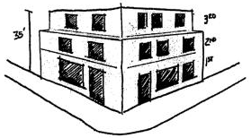
1. No structure in the Keyport village commercial (KVC) zone shall be constructed to have more than two stories facing Washington Avenue; provided however, additional stories may be allowed if those stories above the second story are set back a minimum of ten additional feet from the facade line and if the building otherwise meets height limitations.
2. Subgrade stories and basements are permitted up to thirty inches above sidewalk grade along Washington Avenue.
D. Parking. Parking requirements for all uses shall be determined by the director through analysis of the proposed use and with reference to the parking requirements of Chapter 17.490. The availability of street parking may be considered by the director. The determination of the director shall be an administrative decision made concurrently with the department’s decision or recommendation on a proposal.
1. Parking associated with an individual use shall, to the greatest extent feasible, be located behind structures or otherwise fully screened from street view.
2. All required commercial parking in the KVC zone may be provided off-site in shared or joint use parking areas, or considered with on-street parking except that provision must be made to develop or reserve on-site or on-street parking spaces for handicapped parking.
3. All required residential parking in the KVC zone for mixed use projects must be provided on site. No off-site parking is acceptable for residential parking requirements.
4. Shared or joint use parking lots shall be screened. The following standards may be modified upon recommendation of the director.
a. From adjacent residential zones by six-foot-high solid wood fencing or landscaped screen, or similar visual separation intended to soften the edges of the parking area;
b. From adjacent streets by a combination of solid wood fencing, plantings, public seating, shelters, or public information kiosks. Screening and plantings shall be of a height to shield light from vehicles but shall not interfere with general visibility into the parking area for public safety purposes. The goal is to achieve visual separation and soften the edges of the parking.
5. Shared or joint use parking lots shall provide internal landscaping as follows:
a. For parking areas providing up to fifty stalls, twelve square feet of landscaping, in addition to the perimeter or street screening, must be provided for each stall, including one tree for every five stalls.
b. For parking in excess of fifty stalls, an additional eighteen square feet of landscaping shall be provided for each stall over fifty, including one tree for every four stalls over fifty.
c. Landscaped areas shall have minimum dimensions of four feet in any direction, exclusive of vehicle overhangs, and a minimum area of thirty-six square feet.
d. Trees shall be a minimum of six feet high, with a minimum two-inch caliper if deciduous.
e. Landscaped areas shall be distributed equally throughout the parking area to create shade and break up large expanses of asphalt or other paving.
E. Signs and Lighting.
1. Signs and external lighting shall be designed to reflect historic styling and comply with the town development objectives and shall be reviewed by the director or designee for architectural and site design consistency with the Keyport design guidelines.
2. Internal illumination and neon lighting or signage is prohibited, except for window signs not exceeding four square feet; provided, that an applicant may request review of proposed signs by the director or his designated community committee, if one has been appointed. Following such review and on the recommendation of the committee, the director may allow internally illuminated signs or signs with neon lighting.
F. Within the area identified as the Keyport rural village, the following conditions apply to all existing, newly created and/or reconfigured lots.
1. All new construction, including any site development activity permit (SDAP), grading or building permit requiring access to a county right-of-way, must undergo appropriate review by the department of public works to meet current right-of-way use requirements before any site work may begin.
2. No grading of more than seventy-five cubic yards of earth may occur unless a site development activity permit (SDAP) is first obtained.
3. Drainage review is required prior to issuance of any SDAP or building permit. When the issuance of a grading or building permit will result in an increase in the total amount of impervious surface that currently exists on a lot:
a. The director will review each SDAP and building permit application to determine whether special drainage requirements are necessary to prevent newly installed impervious surfaces from creating a drainage problem or exacerbating an existing drainage problem. In making this determination, the director may consult the citizen complaint databases, perform an on-site inspection, review the condition of the receiving downstream drainage system, review the Kitsap County soil survey, and consult with the surface and storm water management program to determine if there have been identified drainage problems or corrections that are located in the vicinity of the application. The director will conduct his review in accordance with the “Downstream Analysis” section of Chapter 2 of the county’s Storm Water Design Manual;
b. If, in the opinion of the director, the proposal will not create a drainage problem or exacerbate an existing drainage problem, the applicant will be required to meet the minimum drainage and erosion control requirements of the storm water management ordinance (Chapters 12.04 through 12.32);
c. If, in the opinion of the director, the proposal will create or exacerbate an existing drainage problem then, before the director can recommend approval of the application, the applicant may be required to:
i. Provide an engineered drainage plan that addresses impacts of increased runoff on adjacent and downstream properties;
ii. Provide on-site storm water management BMPs to reduce or eliminate surface water discharge; and/or
iii. Improve or contribute to the improvement of the downstream drainage system.
G. Within the Keyport village low residential zone, the following conditions apply to all newly created and/or reconfigured lots that request or result in a density of three units per acre:
1. Three units per acre may only be requested though a performance based development (Chapter 17.450) and the use of lot clustering, common open space (Section 17.450.040(B)).
a. Within the Keyport LAMIRD, recreational open space (Section 17.450.040(C)) is modified as follows. All residential PBDs in Keyport village low residential shall provide a developed recreational area that meets the following requirements:
i. A contiguous area that is five percent of the lot area, (excluding critical areas). Said area shall be:
(a) Developed as an open grass field (manicured to a condition that allows mowing by mechanical means) or a natural area (not inside critical areas, or their buffers), that contains a pathway and benches;
(b) Owned in common and/or available for use by all residents of Keyport; and
(c) A provision implemented by the covenants for perpetual maintenance.
ii. A developed active recreation facility or facilities commensurate with the number of units/lots contained within the PBD. A “facility” shall be: a paved “sport court”; children’s play area; exercise fitness trail; community garden area with water service; or similar amenity (bocce ball, volleyball, horseshoes, putting green, rock climbing wall, etc.). Facilities shall be provided as follows:
(a) One facility per every three lots, partial calculations above 0.49 are rounded up to include an additional facility.
(b) All facilities shall be located adjacent to a public right-of-way or provided pedestrian easement access to the nearest public right-of-way and shall include directional signage and signage identifying the ability for public use.
(c) Land shown in the final development plan as common open space, and its landscaping and/or planting contained therein, shall be permanently maintained by and conveyed to one of the following:
(i) An association of owners formed and continued for the purpose of maintaining the common open space. The association shall be created as an association of owners under the laws of the state of Washington and shall adopt articles of incorporation of association and bylaws. The association shall adopt, in a form acceptable to the prosecuting attorney, covenants and restrictions on the open space providing for the continuing care of the area. No common open space may be altered or put to a change in use in a way inconsistent with the final development plan unless the final development plan is first amended. No change of use or alteration shall be considered as a waiver of any covenants limiting the use of the common open space, and all rights to enhance these covenants against any use permitted are expressly reserved;
(ii) A private nonprofit conservation trust or similar entity with a demonstrated capability to carry out the necessary duties and approved by the county. Said entity shall have the authority and responsibility for the maintenance and protection of the common open space and all improvements located in the open space.
(Ord. 534 (2016) § 7(5) (App. E) (part), 2016)