


Land Use and Urban Design Revised 11/21
A blending of old and new land uses.
What Olympia Values:
Olympians value neighborhoods with distinct identities; historic buildings and places; a walkable and comfortable downtown; increased urban green space; locally produced food; and public spaces for community members in neighborhoods, downtown, and along our shorelines.
Our Vision for the Future:
A walkable, accessible, vibrant city.
Read more in the Community Values and Vision chapter
Introduction
How we choose to live within, and how we alter, our landscape is critical to our quality of life, and to whether that quality of life can be sustained and improved.
The State’s 1990 Growth Management Act called for Olympia to establish land use designations and densities sufficient for at least 20 years. The County-Wide Planning Policies adopted by Thurston County and its seven cities in 1993 describe a common goal of concentrating growth in the urban areas "in ways that ensure livability, preservation of environmental quality and open space, varied and affordable housing, high quality urban services at least cost, and orderly transition of land from County to City.” We can choose to isolate land uses and neighborhoods, or blend them into a single vital community. We can create spaces separated by long travel distances, or provide for a variety of experiences in each part of the city. We can choose to use land efficiently for recreation, housing, and business while setting aside selected areas for open space and communing with nature, or we can create homogenous subdivisions and isolated commercial areas. We can employ architecture and landscaping reflecting Olympia’s unique and historic character, or we can build places with little regard to the local landscape and climate. These choices will determine Olympia’s form for many generations.
Our community seeks to:
• Encourage development in urban areas where public services and facilities are already present.
• Phase urban development and facility extension outward from the downtown area.
• Establish land use patterns that ensure residential densities sufficient to accommodate 20-years of population growth.
• Focus higher residential densities downtown, along urban corridors, and near neighborhood centers.
• Employ innovative development techniques that create a better community.
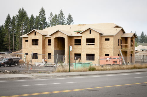
A new pair of townhomes reflects Olympia’s historic character.
Neighborhood character is made up of a variety of elements that give a neighborhood its distinct identity. Neighborhood characteristics are not stagnant and will change over time. Consideration of neighborhood character will vary by the unique features of a neighborhood and includes its physical attributes that contribute to its sense of place and identity. These elements may include, but are not limited to, a neighborhood's land use, urban design, visual resources, and/or historic resources. This includes design elements of buildings (mass, scale, materials, setting, and setbacks), parks and open space, provision of City utilities, street grids and connections, and street trees.
Our community considers it essential that all neighborhoods become accessible, sustainable, and culturally inclusive.
• Accessible: Includes ADA compliancy, multimodal mobility, and housing affordability.
• Sustainable: Promotes a healthy environment, a diverse and resilient local economy, and historic preservation, including, reuse, and adaptability of existing buildings.
• Culturally inclusive: Recognizes, supports and promotes diverse housing types, strong arts and historic preservation, and the various contributions of diverse Olympians, past and present.
Neighborhood character will be balanced with other plan goals and policies, such as increasing the variety of housing types and providing people-oriented places, and implemented through the City's development regulations.
Olympia’s “Urban Design Vision and Strategy,” appreciation of the area’s history, and sustainable community philosophy all provide additional direction for this chapter. In particular, the sustainability policies call for us to consider the long-range implications of our land use decisions and to provide for a pattern of development that can be sustained and enjoyed by future generations.
For example, mixed-use 'villages' and opportunities for residential development in commercial areas provide for increasing residential densities by blending land uses. By enabling less reliance on automobiles, by providing for compact development that requires less land, by efficiently providing streets, utilities, and services, and by establishing development densities and site designs that protect environmentally sensitive areas and reflect the capacity of natural systems, we can provide a quality community for coming generations.
We envision:
• Spaces that are safe and pedestrian-friendly
• Development that minimizes harm to the environment
• Densities and land use types consistent with many types of transportation
• Places for quiet residential uses, and places where economic activity is emphasized
• Walkable and accessible neighborhoods with unique centers and identities
• Development that complements the historic character of the community
• Recognition of the importance of lands near water
• A process for exploring the unique possibilities of each area with special attention given to Downtown, the Westside core area, the eleven planning 'subareas,' and other special geographic areas within the community
The focus here is on 'built' land uses such as housing and commercial structures and development patterns. Complementary parks, open spaces and natural areas are addressed in the Public Health, Parks, Arts and Recreation and Natural Environment chapters. These land uses cannot be isolated from economic topics, and employment in particular, addressed by the Economy chapter. Facilities and services to support this urban development pattern, including the critical transportation system, are described in the Transportation, Utilities, and Public Services chapters. In many cases the special area plans described in this chapter will touch on all of those topics and more.
The City of Olympia, in cooperation with Thurston County, plays a major role in determining the location, intensity, and form of land uses in the community. This chapter addresses the proposed uses of land in Olympia’s Urban Growth Area and the design and locations of buildings and other structures within that landscape. It includes:
• The location and quantity of those land uses and their relation to each other
• The functional design of those land uses including buildings and surrounding spaces
• Opportunities for historic preservation
• The aesthetic form of the built environment
The Future Land Use Map shows the approximate locations for a variety of land uses in Olympia’s Urban Growth Area. This map is not a zoning map. Rather it provides guidance for zoning and other regulations to ensure uses of land and development consistent with this Plan. Although these map lines are approximate, all future land uses should be consistent with the intent of this map and the land use category descriptions in Appendix A as well as the goals and policies of this Plan. In general, zoning and land uses should not deviate from the Future Land Use Map boundaries by more than about 200 feet. Compatible and supporting land uses, such as parks, schools, churches, public facilities and utilities, streets and similar features, are expected within these areas. See Appendix A regarding acreages, densities, and building heights of each use category.
Proposed rezones shall meet criteria to be adopted into the Olympia Municipal Code that address:
1. Consistency with the Comprehensive Plan.
2. Consistency with the City’s development regulations that implement the Comprehensive Plan.
3. Compatibility with adjoining zoning districts and transitioning where appropriate to ensure compatibility.
4. Adequacy of infrastructure in light of development potential of the proposed zoning.
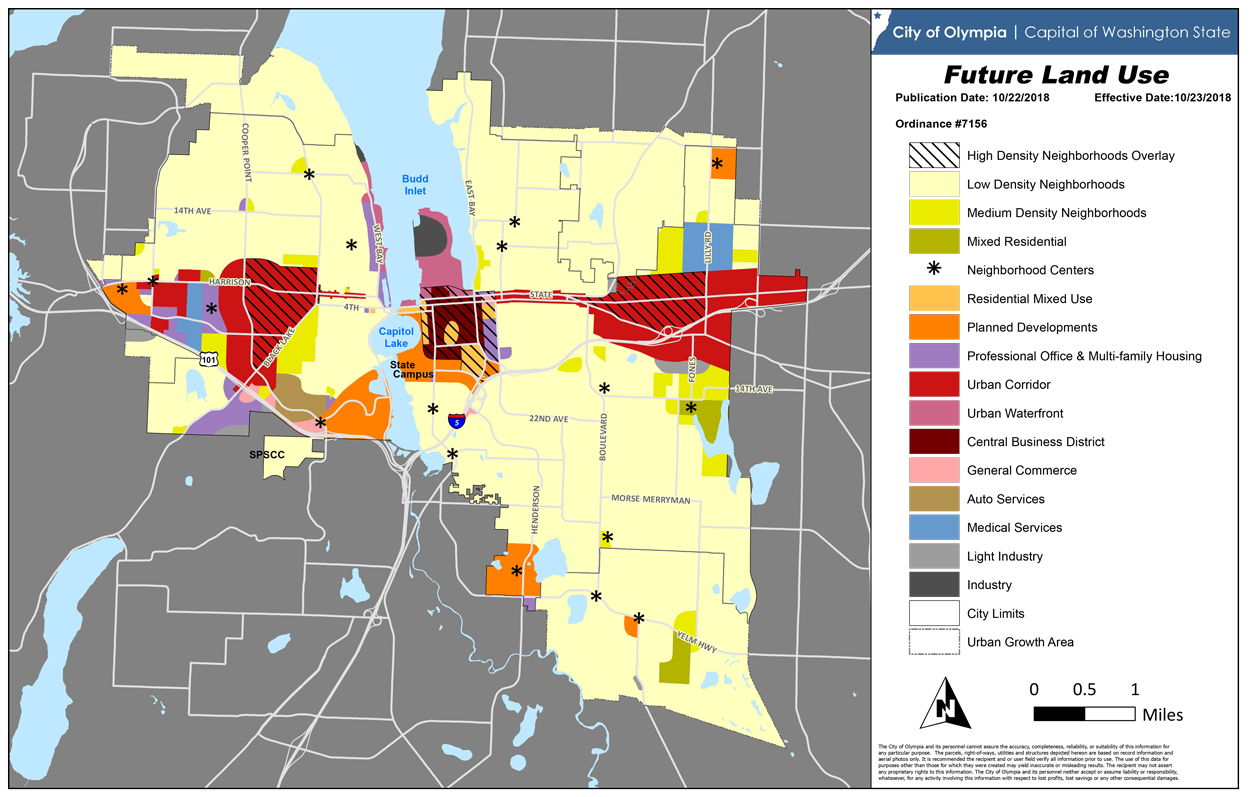
Future Land Use Map of Olympia and its Urban Growth Area
The community employs regulations, such as zoning, design review, stormwater, engineering, building, and subdivision standards, to ensure that new development conforms to the goals and policies described in this chapter. The regulations are administered by City staff and a Hearing Examiner selected by the City Council. Equally important to this land use and design vision is capital facility planning and construction by the City of Olympia and other public agencies of the area. Continuing cooperation between the State and the City, among the local governments, and with special purpose governments such as the Port of Olympia and the school districts is critical. And, as envisioned, substantial resources and the support of everyone in the community will be needed to focus more detailed efforts in neighborhoods and other special places.
General Land Use and Design
To achieve our vision of Olympia while accommodating our share of the region’s population, we need to plan for quantity at the same time as we pursue quality. Such a community is one in which pattern and mix of land uses supports healthy lifestyles, such as walking to nearby services instead of driving. We need to consider the implications of climate change, and how we can minimize our community’s contribution. We must be prepared to adapt our built environment as resources change, while preserving key elements of Olympia’s architectural and cultural heritage. At the same time, we need to consider the character of Olympians today, and those of the future. The needs and interests of a more diverse, more urban, and generally older population will differ from those of today.
Olympia was once a port-oriented community with a central business district and compact single-family neighborhoods. Now, its land-use pattern is more suburban, with commercial development taking place outside of downtown, and lower-density neighborhoods with fewer street connections. Over the next 20 years, as Olympia becomes a more urban place, the pattern of land use and design of urban areas will change as we accommodate an expanding population while retaining our community’s character and heritage.
This Plan envisions gradually increasing densities in Olympia accompanied by attractive streets and buildings arranged for the convenience of pedestrians. The location, mix and relationship of land uses to each other and to our streets will be crucial as will be the character of commercial and residential areas, parks, and open spaces. The Plan envisions new development that will reinforce the community’s identity, urban design preferences, and historic form. Selected major streets will gradually transform into attractive, higher density, mixed residential and commercial "urban corridors" with frequent transit service.
Housing will be available within and near shopping and employment areas. Development will be carefully designed to integrate with the adjacent transportation system, and with key features such as downtown and the hospitals. Neighborhoods and commercial areas will gradually be woven together into a cohesive urban fabric. These "ten-minute" neighborhoods will provide ready-access from homes to supporting businesses, and to parks, schools and other gathering places.
The relationship between the transportation system and other land uses plays a key role in urban life. The Transportation chapter addresses the specific design of streets, such as the number of travel lanes, the presence of bike lanes, transit pull-outs, pedestrian amenities, street trees, and sidewalks. The relationship of these street features to adjacent land uses, the location and supply of parking, and the proximity of buildings to the street is critical to the experience and choices of pedestrians, bicyclists, transit riders and motorists. Thus, to integrate the streets and trails with adjacent uses, development must be carefully designed in combination with the adjacent transportation system. Details must be suited to all users and to the form of the street. For example, major building entrances should face or be conveniently reached from streets, rather than parking lots.
In addition to private activities, such as homes, businesses and industry, some of the lands within the City will be used for public purposes and facilities. Although some of those lands are identified in this Plan, such as the locations of future streets, other specific needs are identified in more detailed planning documents of the City, such as the Water System Plan which identifies this utility’s need for new water tank sites. Olympia works with Thurston County and other local agencies to identify areas of shared need for public facilities.
The purpose of the goals and policies below is to direct land use patterns, densities, and design standards which:
• Reflect the community’s urban design vision
• Maintain or improve the character of neighborhoods
• Preserve the historic features of Olympia
• Provide for a variety of transportation alternatives
• Provide people with opportunities to live close to work
• Create desirable neighborhoods with a variety of housing opportunities, different lifestyles and income levels, and a sense of community
• Provide for a compact growth pattern
• Promote energy efficiency
• Reflect the land’s physical and environmental capability
• Provide space for parks, open spaces, and other community facilities
• Protect views and features of the community’s landscape valued by the public
Land use patterns, densities and site designs are sustainable and support decreasing automobile reliance.
PL1.1Ensure that new development is built at urban densities or can be readily modified to achieve those densities; and require that development lacking municipal utility service be designed to cost-effectively transform when services become available.
PL1.2Focus development in locations that will enhance the community and have capacity and efficient supporting services, and where adverse environmental impacts can be avoided or minimized.
PL1.3Direct high-density development to areas with existing development where the terrain is conducive to walking, bicycling and transit use and where sensitive drainage basins will not be impacted.
PL1.4Require functional and efficient development by adopting and periodically updating zoning consistent with the Future Land Use Map.
PL1.5Require new development to meet appropriate minimum standards, such as landscaping and design guidelines, stormwater and other engineering standards, and buildings codes, and address risks, such as geologically hazardous areas; and require existing development to be gradually improved to such standards.
PL1.6Provide for a compatible mix of housing and commercial uses in commercial districts and village sites that enables people to walk to work and shopping, supports transit, and includes convenience businesses for residents. Integrate adjacent uses with walkways and bike paths leading from residential areas to commercial districts and neighborhood-oriented businesses.
PL1.7Enable frequent transit service, support housing, utilize existing infrastructure, provide public improvements and concentrate new major shopping, entertainment and office uses downtown, in the medical services area of Lilly Road, near the Capital Mall, and in the urban corridors.
PL1.8Buffer incompatible industrial, commercial and residential uses by requiring landscaped buffers or transitional uses, such as plazas, offices, or heavily landscaped parking; use natural buffers where possible and require clustering where warranted.
PL1.9Require direct and convenient pedestrian access to commercial and public buildings from streets, bus stops and parking lots, and encourage sheltered seating and other uses of vacant sections of the street edge.
PL1.10In pedestrian-oriented commercial areas, require sidewalk awnings or other weather protection on new and substantially remodeled buildings.
PL1.11Require businesses along transit routes to accommodate transit use by including building entrances near bus stops or other features such as transit shelters or on-site bus access.
PL1.12Encourage major commercial projects to include display windows, small shops with separate entrances, and plazas with seating and other well-landscaped gathering spaces.
PL1.13Require new, and encourage existing, businesses to provide bicycle parking.
Land Use Patterns and Building Forms Determine Whether Energy is Used Efficiently
Land use patterns and development influence energy use. Blending of residential units with work places promotes energy efficiency. Higher densities contribute to the success of bus systems. Higher densities close to offices and commercial districts help reduce fuel consumption by reducing overall commuter and shopper mileage. In contrast, suburban densities and sprawl result in spending a lot of time and energy on transportation.
With a more compact development pattern and other transportation improvements, Thurston County’s percentage of drive-alone commuters can be reduced from 85 to 60 percent. Park-and-ride lots, vanpooling, ridesharing and flexible work schedules can help reduce vehicle miles and congestion. Both the public and private sectors can encourage transit use by offering bus passes and other incentives to employees. A well-laid-out transportation system will also aid in conserving energy. Smoother traffic flows can increase vehicle efficiency by up to five percent. Provisions for pedestrian and bicycle traffic can promote use of the energy saving means of commuting. By these means we could achieve a 10-15 percent transportation energy savings within a decade or two.
The primary residential use of energy is for space-heating. Thus, strengthening building code requirements for energy efficiency is an effective way to reduce energy consumption. When combined with appropriate insulation levels, solar energy can meet half the heating needs of a home in Olympia. Effective layout of subdivisions that allow for solar access and protection from winter winds can help, as can public education on energy conservation.
The competitive environment can stimulate energy efficiency by reducing production costs. Thus the combined industrial and commercial sectors do not use as much energy as either the transportation or residential sectors. Local governments can further influence industrial and commercial energy use through education and incentives.
The government sector is a very visible part of the energy picture and can set an example for efficient and conscientious energy use. Education in this sector includes both educating users, such as employees, and informing the public. Government buildings and equipment can be models of efficiency in the use of construction methods and materials, as well as utilizing efficient pumps, heating systems, and lighting. Government operations can also be models of use of alternative fuel sources and non-motorized travel.
PL2.1Pursue partnerships to promote energy efficient construction and lighting, low-energy designs, and weatherization in both new and existing buildings. Encourage material subsidies for low-income community members.
PL2.2Promote public education and provide energy conservation and solar and other renewable energy information in cooperation with local utilities and others.
PL2.3Encourage local 'cogeneration' of energy when environmentally sound and not in conflict with other land uses.
PL2.4Encourage and sometimes require buildings and site designs that result in energy efficiency and use of solar and other renewable energy.
PL2.5Support efforts to protect solar access in existing structures and to incorporate solar access provisions into new development projects.
Urban Design, Historic Structures and Built Form
Olympia’s Urban Design Vision and Strategy of 1991 identified the design and architectural preferences of community residents. This study continues to provide guidance for this Comprehensive Plan and future development. It identified the types of development that community members feel are appropriate and inappropriate for our community. Study participants particularly valued Olympia’s waterfront, downtown, the Capitol Campus, the older neighborhoods, and views of the Olympic Mountains and the Black Hills. They favored streets that provide an attractive, safe, and inviting place for pedestrians, as well as provide for efficient traffic flow. Specifically, they liked the portions of downtown where buildings form a continuous edge along the street, where it is interesting to walk, and where awnings protect people from the rain.
Much of our community is already built. Many of our neighborhoods are more than 50 years old and our downtown is older still. These neighborhoods provide a 'sense of place' and character of Olympia. To preserve this character, new buildings incorporated into the existing fabric must reflect both their own time-period and what’s come before. We will acknowledge the importance of historic preservation by protecting buildings and districts and celebrating the people and events that shaped our community. We will conserve natural resources by keeping historic buildings properly maintained and in continuous use, thereby avoiding decay and demolition which would waste resources used to create these structures.
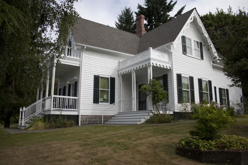
The Bigelow House, Olympia’s oldest residence.
However, our heritage extends beyond buildings and back in time before European settlement. Artifacts, photographs, structures, sites and stories of our collective past were entrusted to us and so should be preserved for future generations. Tribes, such as the Squaxin Island Tribe, play a major role in this task. Private property owners shoulder much of the responsibility of protecting historic buildings. And Olympia’s Heritage Commission advises the City Council on matters of historic preservation and assists owners of historic buildings in caring for their property. With the community support we can ensure that our heritage is preserved for everyone to appreciate today and always.
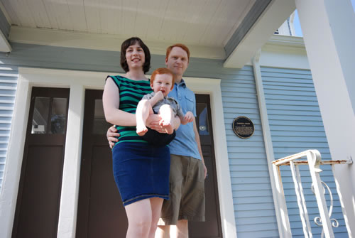
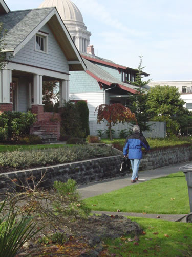
Many of our older homes are a source of pride for young families.
Studies of Olympia and other communities also reveal that including open space and appropriate landscaping within site designs improves developments by providing places for relaxing, restoration and outdoor activities in general. In particular, trees provide a valuable public resource, enhance the quality of the environment, provide visual buffers and natural beauty, preserve the natural character of an area, and soften the impact of buildings and streets. Trees and other landscaping help reduce air pollution, noise and glare, provide cooling in summer and wind protection in winter, and in some cases provide materials and food for wildlife and humans. The goals and policies below encompass all of these elements of good design.
Historic resources are a key element in the overall design and establishment of a sense of place in Olympia.
PL3.1Protect and evaluate historic and archaeological sites.
PL3.2Preserve those elements of the community which are unique to Olympia or which exemplify its heritage.
PL3.3Protect historic vistas from the Capitol Campus to Budd Inlet and the Olympic Mountains and from Budd Inlet to the Capitol Group.
PL3.4Safeguard and promote sites, buildings, districts, structures and objects which reflect significant elements of the area’s history.
PL3.5Encourage development that is compatible with historic buildings and neighborhood character, and that includes complementary design elements such as mass, scale, materials, setting, and setbacks.
PL3.6Plan for land uses that are compatible with and conducive to continued preservation of historic neighborhoods and properties; and promote and provide for the early identification and resolution of conflicts between the preservation of historic resources and competing land uses.
PL3.7Identify, protect and maintain historic trees and landscapes that have significance to the community or a neighborhood, including species or placement of trees and other plants.
PL3.8Encourage preservation and discourage demolitions or partial demolitions of intact historic structures.
PL4.1Assist older neighborhoods and districts to discover their social and economic origins and appreciate their historic features. (Also see downtown section below.)
PL4.2Facilitate the preservation of historic neighborhood identity and important historic resources.
Historic preservation is achieved in cooperation with all members of the community and is integrated into City decision-making processes.
PL5.1Work with the State archeologist to protect archeological resources.
PL5.2Coordinate with adjacent governments; particularly to provide public information about the area’s history and development.
PL5.3Recognize the contributions of minorities, workers, women and other cultures to Olympia’s history.
PL5.4Continue programs -- such as the Heritage Commission, the Heritage Register and the historic marker program -- that effectively identify, recognize, and encourage the preservation and continued use of historic structures, districts, and sites which provide physical evidence of the community’s heritage.
PL5.5Provide incentives and assistance for preserving, restoring, redeveloping and using historic buildings, districts, neighborhoods, streets, structures, objects and sites.
PL5.6Support public or non-profit acquisition of the most important historic resources to ensure their preservation.
PL5.7Recognize the value of historic preservation as part of the effort to maintain an affordable housing stock.
PL5.8Promote economic vitality through historic preservation.
PL5.9Promote mutual goals in historic areas, including districts, buildings and site, through collaboration among City departments, the Heritage Commission and other commissions.
PL6.1Establish and periodically update a design review process and design criteria consistent with the goals and policies in the Comprehensive Plan for:
• Commercial and mixed use development adjacent to freeways and public streets
• Other highly-visible, non-residential development, such as the Port of Olympia, campus developments, and master planned developments
• Multifamily residential development and manufactured housing parks
• Detached homes on smaller lots (less than 5,000 square feet) and in older neighborhoods (pre-1940)
• Properties listed on a Historic Register or located within a designated historic district
PL6.2The design review process should recognize differences in the city with the objective of maintaining or improving the character and livability of each area or neighborhood.
PL6.3Require commercial and residential buildings to face the street or a courtyard or other common area.
PL6.4Require multi-family housing to incorporate architectural forms and features common to nearby housing; to include porches, balconies, bay windows and similar details; to have entries oriented to streets or a courtyard, and include accessible open space; and to be reduced in size near lower density residential districts.
PL6.5Ensure that parking areas do not dominate street frontages or interrupt pedestrian routes, and that they are screened from housing.
PL6.6Prohibit fences and walls that inhibit walking or isolate neighborhoods from streets, except to reduce noise, provide buffers, or create private rear yards.
PL6.7Create attractive entry corridors to the community and neighborhoods, especially downtown and along urban corridors; to include adopting design standards and installing significant special landscaping along community-entry corridors.
PL6.8Enhance neighborhood identity by encouraging interested groups to beautify open spaces, streets and private property.
PL6.9Require that buildings complement and enhance their surroundings, appeal to and support pedestrian activities, and facilitate transit use.
PL6.10Preserve and enhance water vistas by retaining public rights-of-way that abut or are within one block of water bodies and by not siting public buildings within associated view corridors.
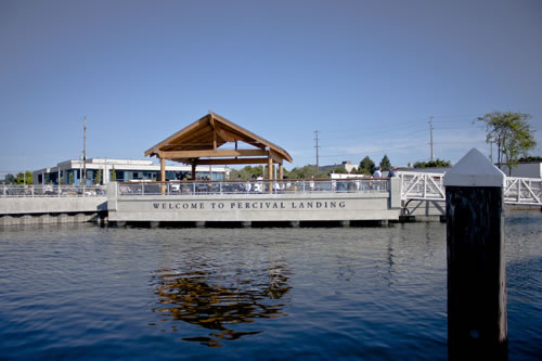
Percival Landing is enjoyable to view and to enjoy the view.
PL6.11Plant and protect trees that contribute to Olympia’s visual identity and sense of place.
PL6.12Separate incompatible land uses and activities with treed areas, including buffering residential areas from major streets and freeways.
Urban green space is available to the public and located throughout the community and incorporates natural environments into the urban setting, which are easily accessible and viewable so that people can experience nature daily and nearby.
PL7.1Provide urban green spaces in which to spend time. Include such elements as trees, garden spaces, variety of vegetation, water features, “green” walls and roofs, and seating.
PL7.2Provide urban green spaces that are in people’s immediate vicinity and can be enjoyed or viewed from a variety of perspectives.
PL7.3Establish a maximum distance to urban green space for everyone in the community.
PL7.4Increase the area of urban green space and tree canopy within each neighborhood proportionate to increased population in that neighborhood.
PL7.5Establish urban green space between transportation corridors and adjacent areas.
PL8.1Implement public processes, including the use of digital simulation software, to identify important landmark views and observation points.
PL8.2Use visualization tools to identify view planes and sightline heights between the landmark view and observation point.
PL8.3Prevent blockage of landmark views by limiting the heights of buildings or structures on the west and east Olympia ridge lines.
PL8.4Avoid height bonuses and incentives that interfere with landmark views.
PL8.5Set absolute maximum building heights to preserve publicly-identified observation points and landmark views.
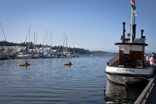
Percival Landing with the Olympics in the distance.
PL9.1Incorporate crime prevention principles in planning and development review and educate designers regarding those principles.
PL9.2Modify public facilities and properties to enhance crime prevention.
Industry
Industrial uses represent a relatively small but key component of Olympia’s jobs. Olympia’s waterfront has supported forest-related industries and maritime shipping for decades. The Olympia area also contains a few scattered, relatively small, light-industrial districts which support a variety of uses. Industrial districts in Tumwater, Lacey, and in the County will likely absorb most of the area’s new, non-waterfront-dependent industrial uses. However, the industrial land along Budd Inlet provides the only sites in the area for water-dependent industrial uses. This Plan aims to focus industrial development:
• Along Budd Inlet (in industrial districts)
• At Mottman Industrial Park, and
• Along Fones Road
while encouraging opportunities for small-scale industry integrated with other uses of land.
The Port of Olympia owns approximately two hundred acres and adjacent tidelands of what is known as the 'Port peninsula,' an area equivalent to about 80 city blocks. The Port peninsula includes a variety of industrial, commercial, retail, and recreational facilities. The centerpiece of the Port peninsula is its international marine shipping terminal. The East Bay waterfront is the location of the East Bay Marina, with moorage, a boat launch, and support facilities. On the northern end of the peninsula, the 17-acre Cascade Pole site is a contaminated area, used from 1940 to 1986 to treat wood poles with creosote and other chemicals. Although cleanup of that site is underway, future use will be restricted.
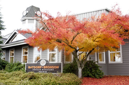
Batdorf and Bronson Coffee Roasters at the Port of Olympia.
The industrial portion of the Port peninsula will continue to be the community’s key industrial center. It has been, and should continue to be, a local source of family-wage jobs, handling inbound and outbound cargo by rail, truck and ship. Large buildings are anticipated for boat building and repair. A one-stop, full-service marine facility with a large vessel haul-out and repair center may be added.
Industry and related development with low environmental impact is well-located to help diversify the local economy.
PL10.1Encourage industry that is compatible with surrounding land uses and diversifies and strengthens the local economy.
PL10.2Designate and preserve sufficient land for industrial uses consistent with the regional strategy for 'build out' of the community and competitive land prices.
PL10.3Encourage full, intensive use of industrial areas while safeguarding the environment. Ensure land-use compatibility by buffering, height limits, landscaping, traffic routing, building design, and operation and maintenance standards.
PL10.4Limit non-industrial uses in industrial areas to those which do not conflict with industry; and eliminate or reduce the size of industrial areas only if not expected to be needed or not suitable for industry.
PL10.5Focus major industries in locations with good freeway access, adequate utilities, minimal environmental constraints, sufficient space and minimal land-use conflicts. Specific areas identified for industrial use include the Port Peninsula, the Mottman Industrial Park, and the vicinity of Fones Road.
PL10.6Coordinate with the Port of Olympia to allow for long-term viability of Port peninsula industry, compatibility with surrounding uses, and continuation of marina uses along East Bay. This coordination should address – at a minimum - transportation, pedestrian and recreation facilities, environmental stewardship, and overwater development.
PL10.7Design industrial areas for convenient freight access.
PL10.8Provide opportunities for light industrial uses in commercial areas consistent with the commercial and multi-family uses of those areas, such as low-impact production within buildings with retail storefronts.
Commercial Uses and Urban Corridors
More intensive development in commercial areas will increase their vitality and make better use of the City’s transit and street systems. For this reason, major new commercial areas are not to be created. Any new commercial areas will be limited to allowing neighborhood-oriented businesses and services in the neighborhood centers of residential areas that reduce the need for residents to travel far to shop.
Over time, we envision our existing commercial areas becoming more attractive to pedestrians and customers, to the point where they can attract a more balanced and attractive mix of commercial, residential, and recreational uses. Significant changes will need to occur for some of our commercial areas to increase their appeal as places to shop, live, work, and visit and to become more inviting higher-density, pedestrian-friendly, mixed-use areas for pedestrian and transit users.
PL11.1Encourage increasing the intensity and diversity of development in existing commercial areas by mixing commercial and multi-family development along with entertainment and cultural centers in a way that will reduce reliance on cars and enable people to work, shop, recreate and reside in the same area.
PL11.2Provide incentives for housing in commercial districts near transit stops.
PL11.3Work with developers to identify commercial areas for infill and redevelopment, to remove unnecessary barriers to this type of development, and to provide the infrastructure needed for intensive commercial and mixed use development.
PL11.4Locate and size commercial areas to decrease reliance on cars, improve community life, and maintain the tax base.
PL11.5Encourage the efficient use and design of commercial parking areas; reduce parking space requirements (but avoid significant overflow into residential areas); support parking structures, especially downtown and in urban corridors; and designate streets for on-street parking where safe.
PL11.6Encourage new commercial uses adjacent to the arterial street edge and in mixed-use projects.
PL11.7Provide convenient pedestrian access to and between businesses.
PL11.8Prohibit new and expanded commercial 'strips;' and allow conversion of such existing uses to a multi-use development with greater depth and integration of residential units.
PL11.9Outside urban corridors provide for low-intensity commerce that depends on automobile access and allow wholesale businesses near major customers or where resulting traffic will not impact retail areas.
PL12.1Work with businesses and residents to help make commercial areas functional and attractive.
PL12.2Establish maximum building heights that are proportional to streets, retain scenic views and result in compatibility with adjoining development.
PL12.3Seek opportunities to create or enhance town squares framed by commercial or civic buildings, pocket parks, plazas and other small public or private spaces in downtown or other high-density areas.
PL12.4Ensure that commercial uses are compatible with adjoining residential districts. This might include prohibiting reflective surfaces, screening solid waste and parking areas, regulating emissions, building size reductions and increased setbacks near residential districts, screening parking areas, and requiring facades with architectural features that reduce the appearance of a commercial building’s size, such as stepbacks and tiering above three stories.
PL12.5Require site designs for commercial and public buildings that will complement nearby development and either maintain or improve the appearance of the area. This may include building designs with a defined bottom, middle, and top; appealing architectural elements such as windows, wall detailing; fountains, vendor stations; and the use of balconies, stepped back stories and pitched roofs that reduce the perceived size of the building.
PL12.6Create visual continuity along arterial streets through coordinated site planning, landscaping, building designs, signage and streetscapes.
PL12.7Require screening of unattractive site features such as mechanical equipment and large solid waste receptacles, while maintaining good access for collection and maintenance.
PL12.8Use design standards to ensure pedestrians and bicyclists have direct, convenient access to commercial and public buildings.
PL12.9Require a form of parking that retains aesthetics and minimizes pedestrian barriers and inconvenience by including screening along streets and residential areas; limits parking lots to one contiguous acre; and locates them at the rear of buildings, or, if the rear is not possible, then on the side, but with minimal street frontage.
PL12.10Ensure that business signs identify the business but do not create visual clutter or dominate the character of the area; require the use of low or façade-mounted signs where possible.
Urban Corridors
Portions of our major arterial streets are lined with low-density residential and office uses and typical strip-commercial development. Driveways to each business interrupt and slow the flow of vehicular and pedestrian traffic; the pattern of buildings behind parking lots makes pedestrian access difficult and uninviting; and the disjointed signage, landscaping, and building designs are often unattractive. As a result, these areas have limited appeal as places to live, work, and shop.
Over time, thoughtful planning will change some of these sections of major streets into 'urban corridors' that will have a mix of high-density uses, and where people will enjoy walking, shopping, working, and living. See Transportation Corridors Map. Urban corridors like this are key to avoiding sprawl by providing an appealing housing alternative for people who want to live in an attractive, bustling urban environment close to transit, work and shopping. Redevelopment along these corridors will be focused in areas with the greatest potential for intensive, mixed-use development so that public and private investment will have maximum benefit. These corridors, first described in the 1993 Thurston Regional Transportation Plan, also should include land uses that support the community, such as community centers, day care centers, social service offices, educational functions, parks, and other public open space.
In cooperation with Lacey, Tumwater and Thurston County, this Plan calls for gradually redeveloping these urban corridors (listed below) with:
• Compatible housing, such as apartments and townhouses, within or near commercial uses
• Excellent, frequent transit service
• Housing and employment densities sufficient to support frequent transit service
• Wide sidewalks with trees, attractive landscaping, and benches
• Multi-story buildings oriented toward the street rather than parking lots
• Parking spaces located behind the buildings or in structures
The land use designations along these streets vary (see Future Land Use Map at the end of this chapter), to promote a gradual increase in density and scale of uses that supports and remains in context with the adjacent neighborhoods. Slightly less intensive land uses at the fringes of these corridors will create a gradual transition from the activity of the major street edge to less-dense areas in adjacent neighborhoods. Similarly, areas furthest from the downtown core are expected to infill and redevelop with excellent support both for cars and for those who walk, bike and use public transit.
These outer reaches of the urban corridors will feature buildings and walkways with safe and easy pedestrian access. Walkways will link those on foot to bus stops, stores, neighboring residences, free-standing businesses on corners, and perimeter sidewalks.
“Gateways” to Olympia are to be located at the entry/exit points of landscaped “civic boulevards,” at city boundaries, topographical changes, transition in land use, and shifts in transportation densities. Three of the eight gateways are located at the city limits and may include “Welcome to Olympia” signage. Gateways provide a grand entrance into the capital city of the State of Washington. Gateways are to be densely planted with trees and native understories; consideration will be given to the maximum landscaping and amenities feasible. Each civic boulevard will have a distinctive special environmental setting that is shaped by a public planning process that involves community members, neighborhoods, and city officials. Civic boulevards are to be densely planted with trees and native understory; consideration will be given to the maximum landscaping and amenities feasible.
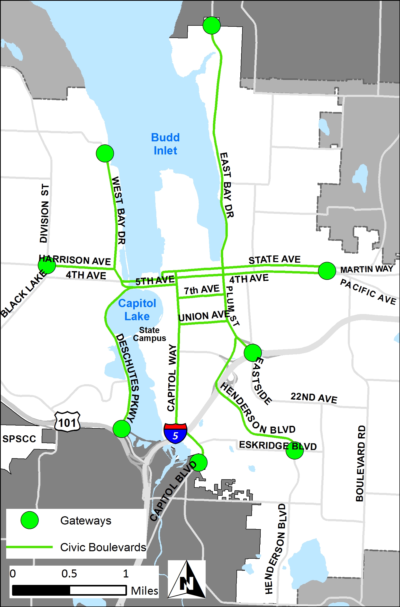
See Gateways and Civic Boulevards map.
PL13.1Establish urban corridors as shown on the Future Land Use Map with potential employment and residential density to support frequent transit service, encourage pedestrian traffic between businesses, and provide a large customer base and minimize auto use for local trips.
PL13.2Regionally coordinate urban corridor planning and improvements including public facilities and services in these areas to ensure redevelopment is continuous, consistent, and balanced.
PL13.3Transform urban corridors into areas with excellent transit service; multi-story buildings fronting major streets with trees, benches and landscaping; parking lots behind buildings; and a compatible mix of residential uses close to commercial uses.
PL13.4Establish minimum housing densities in urban corridors to support frequent transit service and sustain area businesses.
PL13.5Ensure appropriate transitional land uses from high intensity land uses along the arterial streets of the urban corridors to the uses adjacent to the corridors; corridor redevelopment should enhance both the corridor and quality of life in adjacent residential neighborhoods.
PL13.6Focus public intervention and incentives on encouraging housing and walking, biking and transit improvements in the portions of the urban corridors nearest downtown and other areas with substantial potential for redevelopment consistent with this Plan. These include, for example, the area from the Fourth Avenue/Pacific Avenue intersection east to Pattison Avenue, and the area near the intersection of Harrison Avenue and Division Street.
PL13.7Designate different categories of corridors generally as follows:
• Areas nearest downtown along Harrison Avenue east of Division Street and the upper portions of the State Street/Fourth Avenue corridor to the intersection of Fourth Avenue and Pacific Avenue should blend travel modes with priority for pedestrian, bicycle and transit systems. These areas should provide for a mix of low-intensity professional offices, commercial uses and multifamily buildings forming a continuous and pedestrian-oriented edge along the arterial streets. There will be a 35 feet height limit if any portion of the building is within 100’ from a low-density residential zone, provided that the City may establish an additional height bonus for residential development except in areas adjacent to a designated historic district.
• The area along Harrison Avenue west from the vicinity of Division Street to Cooper Point Road - and the portions of Martin Way and Pacific Avenues from Lilly Road to the intersection of Fourth Avenue and Pacific Avenue - will transition away from cars being the primary transportation mode to a more walkable environment, where bicycling and transit are also encouraged. Redevelopment of the area will create more density and new buildings that gradually create a continuous street edge and more pedestrian-friendly streetscape.
• The outer portions of the urban corridors west of the vicinity of the Capital Mall and east of Lilly Road will primarily be accessed by motor vehicles with provisions for pedestrian and bicycle travel; gradual transition from existing suburban character is to form continuous pedestrian-friendly streetscapes, but more regulatory flexibility will be provided to acknowledge the existing suburban nature of these areas. (See Capital Mall special area below.)
Olympia’s neighborhoods provide housing choices that fit the diversity of local income levels and lifestyles. They are shaped by thorough public planning processes that involve community members, neighborhoods, and city officials.
PL14.1Establish eight gateways with civic boulevards that are entry/exit pathways along major streets to downtown Olympia and the Capitol.
PL14.2Concentrate housing into three high-density Neighborhoods: Downtown Olympia, Pacific/Martin/Lilly Triangle; and the area surrounding Capital Mall. Commercial uses directly serve high-density neighborhoods and allow people to meet their daily needs without traveling outside their neighborhood. High-density neighborhoods are highly walkable. At least one-quarter of the forecasted growth is planned for downtown Olympia.
PL14.3Preserve and enhance the character of existing Low-density Neighborhoods. Disallow medium or high-density development in existing Low-density Neighborhood areas except for Neighborhood Centers.
PL14.4In low-density Neighborhoods, allow medium-density Neighborhood Centers that include civic and commercial uses that serve the neighborhood. Neighborhood centers emerge from a neighborhood public process.
Focus Areas
The City prepares plans and studies to help guide the future of targeted areas within our community. Leadership for plan preparation will vary by location and purpose, and priorities depend on funding availability and the potential for appropriate development or redevelopment. Generally, these plans feature the location, size and type of land uses; residential and employment density targets; pedestrian amenities; street system and parking location and quantity; and other public improvements. A few specific areas have been identified; more may be identified in the future.
Several of the city’s commercial and industrial areas have distinct roles, opportunities, and limitations. This section provides further guidance for the future of some of these areas. The City envisions some areas, such as the vicinity of Capital Mall, as areas that will gradually convert into urban neighborhoods with a mix of land uses. Others, such as the Auto Mall area, will be reserved for one or two primary uses. In cooperation with landowners and others, the City will be focusing its planning efforts on three of these urban corridor ‘focus areas’, possibly in the form of a 'master plan' that addresses issues such as land use, infrastructure and design.
See Transportation Corridors map.
In addition to the focus areas described below, the City works with the State of Washington in its preparation of the Capitol Campus Master Plan and with the Port of Olympia in its planning of its properties including the Port peninsula. Included in these efforts is the continuing goal of integrating these areas with downtown Olympia. The Future Land Use Map frames all of these planning efforts.
Capital Mall Area
The Capital Mall area is a regional shopping center, which also includes one of the area’s best balances of jobs within walking distance of medium-density housing. This area should continue to be economically viable and contribute to the community’s goals with infill, redevelopment, and connections to adjacent areas for all modes of travel. It is to evolve into a complete urban neighborhood with a mix of jobs, housing, and services. Redevelopment and incremental expansion consistent with community goals will allow the mall to flexibly adapt to retail trends. Design standards will encourage continued infill and redevelopment in the vicinity of 4th Avenue and Kenyon Street so that the potential of the mall and its surrounding properties can be fully realized. As illustrated below, redevelopment to the north, south, east and west will incorporate vehicle access and circulation with the addition of building focal points, significant entries and better access for walking from surrounding neighborhoods.
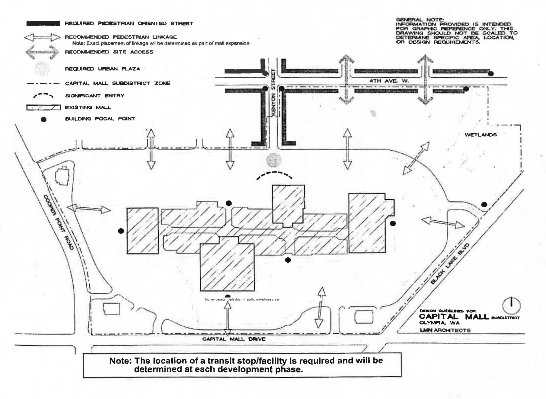
A plan for linking Capital Mall to its neighborhood.
Auto Mall Area
The Olympia Auto Mall is the region’s major center for auto sales and specialized services. Most of Thurston County’s new and used car dealers are located here, along with firms offering light trucks and motorcycles, auto rentals, body repair and detailing, and other auto-oriented businesses. Because it offers so many opportunities for comparison shopping in one location, it is a highly successful group of businesses, attracting customers from a regional trade area, and a significant employment center. Its proven formula should continue to serve the community successfully for many years to come.
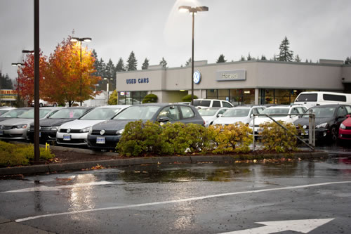
Landscaping enhances auto dealerships.
Lilly and Martin Area
The Medical Services district along Lilly Road near Martin Way is home to a regional hospital and numerous medical and dental clinics and offices. However, portions of Martin Way, once a rural highway, are little changed. These areas have the potential for additional health-care related uses, and housing, as well as supporting retail and service businesses. Thus this area is expected to continue to evolve into a medically-oriented neighborhood with jobs, housing, and supporting services.
Pacific Avenue and Lilly Road Area
The area surrounding the intersection of Pacific Avenue and Lilly Road, like the nearby Stoll Road area, has the potential to become a unique area within an urban corridor. It is located next to a regional trail, lies between two shopping centers, and includes a nearly complete street grid with many low-density homes. This location provides good access to retail services for daily and weekly shopping needs within easy walking distance for its residents, and is large enough for planned creative designs. Transit service on both Pacific Avenue and Lilly Road is excellent. But the area also has its challenges, such as substandard public improvements, no nearby parks, and surrounding traffic. City plans call for this area to be developed with a mix of retail, service, and high-density residential uses consistent with its location in an urban corridor.
West Bay Drive
The West Bay Drive area has a challenging mix of opportunities and constraints. Several sites along the shore are significant in Squaxin Island Tribal cultural history. Industrial use of this waterfront dates to the nineteenth century. The shallow waters along this shoreline continue to provide crucial habitat for young salmon leaving the Deschutes River basin. Birds, marine and upland mammals, and other wildlife species are relatively common for an urban area. The area known as the Port Lagoon, which is subject to a U.S. Fish and Wildlife Service conservation easement, serves as a fish and wildlife conservancy area.
Most industry has left this area, and only fragments of waterborne commerce remain. The community foresees continued transition of the West Bay Drive area toward a mix of urban uses and habitat improvements, while also allowing existing industries and shipping facilities to remain economically viable. The resulting mix of uses should form the foundation for a vibrant mix of light-industrial, office, restaurant, commercial, recreational, and residential uses, that also provides improved habitat for fish and wildlife. Future development and street improvements in this corridor will be consistent with the West Bay Drive Corridor.
Kaiser Harrison Opportunity Area
The Kaiser Harrison Opportunity Area Plan identifies a preferred alternative for a mixed use, pedestrian and bicycle friendly neighborhood. The area is intended to be walkable, accessible by transit, and to provide amenities such as gathering spaces and outdoor seating. The area has a distinct character with a lifestyle retail center that includes outdoor seating and gathering spaces. The lifestyle retail center will be a place that accommodates cars but is also designed for the safe and convenient enjoyment of bicyclists and pedestrians. A multi-use trail and neighborhood park are planned. Future development and street improvements in this opportunity area will be consistent with the Kaiser Harrison Opportunity Area Plan.
PL15.1Maximize the potential of the Capital Mall area as a regional shopping center by encouraging development that caters to a regional market, by providing pedestrian walkways between businesses and areas; by increasing shopper convenience and reducing traffic by supporting transit service linked to downtown; by encouraging redevelopment of parking areas with buildings and parking structures; and by encouraging multifamily housing.
PL15.2Maximize the potential of the Olympia Auto Mall as a regional auto sales and services center by encouraging its use for auto sales and services and limiting incompatible activities, and by imposing auto-oriented design guidelines along Cooper Point Road that ensure pleasing landscaping, minimal visual clutter, and easy pedestrian and vehicle access.
PL15.3Enhance the Lilly Road hospital area as a medical services center by encouraging health-care supporting uses such as restaurants, florists, child care, and convenience shops, and upper floor and rear multi-family and senior housing nursing homes; and by prohibiting non-medical uses that would generate high traffic volumes or noise disruptive of recuperation.
PL15.4Plan for redevelopment of the Stoll Road area and that area bounded by Lilly Road, Pacific Avenue and I-5 as 'focus areas' adjacent to the Pacific Avenue and Martin Way urban corridors to include retail, office, personal and professional services and high density housing. Planning for these areas should encompass consideration of redevelopment and improvement of nearby portions of the urban corridor.
PL15.5In the West Bay Drive area provide for a mix of recreation and urban uses that enhance wildlife habitat and cultural resources; limit industrial uses to existing sites; minimize blockage of upland views of Budd Inlet; and connect the area to the south with an urban trail.
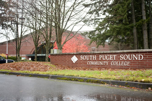
South Puget Sound Community College is a valued feature of Olympia.
PL15.6Work cooperatively with the State of Washington on planning for the Capitol Campus, and the Port of Olympia in planning for its properties. Provide opportunities for long-term 'master planning' of other single-purpose properties of at least 20 acres, such as hospitals, colleges, and high-school campuses.
Housing
Adequate and affordable housing is critical to a healthy community. The Growth Management Act directs each community to plan for it by:
• Encouraging affordable housing for all economic segments of the population
• Promoting a variety of residential densities and housing types
• Encouraging preservation of existing housing stock
• Identifying sufficient land for housing, including government-assisted housing, housing for low-income families, manufactured housing, multi-family housing, group homes, and foster-care facilities
The strategies of this chapter depend on well-formulated design standards to promote flexibility and stimulate innovation while preserving and enhancing the character of neighborhoods. We seek to establish and encourage diversity in housing opportunities and link diverse neighborhoods. With a strong foundation in preserving our heritage, our community can incorporate new housing and other developments in a manner that continues our legacy of well-planned neighborhoods. The housing goals and policies below provide a framework for residential land uses in Olympia’s area. See the City’s related programs for supporting affordable housing in the Public Services chapter.
An apartment building is added to the City’s housing stock.
Many factors contribute to the need for more and varied housing:
• Olympia’s growing residential population
• Varying household incomes
• The capitol’s legislative session creates a demand for short-term housing
• College students seek affordable housing near transportation corridors and services
• Households are getting smaller
• The proportion of seniors is increasing
The City will annually provide information to community members on affordable housing, family incomes, and market-rate housing.
Olympia is part of a larger housing market extending throughout Thurston County and beyond. Thus planning for housing is done based on anticipated shares of this larger area. The 2010 Census indicated that Olympia and its urban growth area included almost 26,000 housing units. As estimated in the Thurston Regional Planning Council “Profile,” 57% were single-family homes, 39% were multi-family (shared-wall) units, and 4% were manufactured housing. The 2014 Buildable Lands Report for Thurston County estimated that about 13,000 new housing units will be needed by 2035 to accommodate population growth in Olympia’s urban growth area. Of these, about 45% are expected to be single-family homes.
Based on existing zoning and development patterns, that Buildable Lands Report indicated the area could accommodate about 16,000 new housing units. In addition to large areas zoned for single-family development, almost 400 acres of vacant multi-family-and duplex zoned land were available. And, an additional 500 acres of vacant and partially-used commercial land could be redeveloped for new housing.
Because Olympia generally allows small group homes and manufactured housing wherever single-family homes are permitted, allows larger group homes by special approval, and does not discriminate with regard to government-assisted housing, foster-care, or low-income housing, the area is expected to be adequate to accommodate all types of housing.
Similarly, the 2008 Thurston County Consolidated Plan for housing indicates that there is no shortage of land for affordable housing. However, there is a "mismatch" between the availability of affordable housing and the need for such housing, both at the lowest end of the income scale and the upper end of the moderate-income bracket. That Plan and the Public Services Chapter of this Plan describe efforts to close these gaps and make adequate provisions for all economic segments of the community.
To meet all housing needs, we must keep growth compact, so it can preserve space for future residents and reduce the cost of public services. To ensure this happens, we will need to allocate enough land that will be suitable for a variety of housing types and costs including detached homes, duplexes, group homes, small cottages, apartments, special needs housing, manufactured housing, and accessory dwellings. This approach can provide both variety and affordable options. For example, factory-built manufactured housing governed by federal standards and modular housing built to state standards are often less expensive than site-built housing. This Plan provides for these types of units and more luxurious and higher-priced shared-wall housing, including condominiums and townhouses.
Housing costs in the Olympia area rose rapidly from 1990 until the economic recession of 2008. In general the cost of owner-occupied housing rose more rapidly than income, while rents roughly corresponded to income changes. Those changing costs and availability of land for development, combined with public preferences, resulted in gradual changes in the area’s ownership. While county-wide owner-occupancy rose from 65% to 68% between 1990 and 2010, owner-occupancy in the City declined from 52% to 50%. The type of housing structures being added to the housing stock has varied as a result of similar factors. As a result, multi-family housing county-wide increased gradually from about 16% in 1970 to about 22% by 2010. In the Olympia city limits multi-family structures provided 28% of the housing in 1970, and gradually increased to about 42% by 2010 as most new apartments were being built inside the urban areas.
The range of housing types and densities are consistent with the community’s changing population needs and preferences.
PL16.1Support increasing housing densities through the well-designed, efficient, and cost-effective use of buildable land, consistent with environmental constraints and affordability. Use both incentives and regulations, such as minimum and maximum density limits, to achieve such efficient use.
PL16.2Adopt zoning that allows a wide variety of compatible housing types and densities.
PL16.3Allow 'clustering' of housing compatible with the adjacent neighborhood to preserve and protect environmentally sensitive areas.
PL16.4Disperse low and moderate-income and special needs housing throughout the urban area.
PL16.5Support affordable housing throughout the community by minimizing regulatory review risks, time and costs and removing unnecessary barriers to housing, by permitting small dwelling units accessory to single-family housing, and by allowing a mix of housing types.
PL16.6Promote home ownership, including by allowing manufactured homes on individual lots, promoting preservation of manufactured home parks and allowing these parks in multi-family and commercial areas, all subject to design standards ensuring compatibility with surrounding housing and land uses.
PL16.7Allow single-family housing on small lots, but prohibit reduced setbacks abutting conventional lots.
PL16.8Encourage and provide incentives for residences above businesses.
PL16.9In all residential areas, allow small cottages and townhouses, and one accessory housing unit per home -- all subject to siting, design and parking requirements that contribute to neighborhood character.
PL16.10Require effective, but not unreasonably expensive, building designs and landscaping to blend multi-family housing into neighborhoods.
PL16.11Require that multi-family structures be located near a collector street with transit, or near an arterial street, or near a neighborhood center, and that they be designed for compatibility with adjacent lower density housing; and be 'stepped' to conform with topography.
PL16.12Require a mix of single-family and multi-family structures in villages, mixed residential density districts, and apartment projects when these exceed five acres; and use a variety of housing types and setbacks to transition to adjacent low-density areas.
PL16.13Encourage adapting non-residential buildings for housing.
PL16.14Provide annual information on affordable homeownership and rentals in the City, including the operative definitions of affordable housing, criteria to qualify for local, state, and federal housing assistance, data on current levels of market-rate and affordable housing, demand for market-rate and affordable housing, and progress toward meeting market-rate and affordable housing goals.
Downtown and other Neighborhoods
Our community is composed of many neighborhoods. Some, like the downtown area, are composed of commercial, cultural and residential activities and land uses. Other neighborhoods are primarily residential, with nearby parks and schools. This section of the Plan addresses these varied and unique places that together form Olympia.
Downtown Olympia
A community needs a "heart." For our community, the downtown area performs this role, not just for our city, but for the larger region. Downtown Olympia thus deserves and receives special attention. A city with a thriving downtown has more potential for bolstering community spirit and providing a healthy local economy.
Olympia’s downtown includes over 500 acres. It is bounded generally by the State Capitol Campus, Capitol Lake, Budd Inlet, and Plum Street. This area includes Olympia’s retail core, State and other office uses, and access to the waterfront, and is the center of most major transportation links. It is the social, cultural, and economic center of the area.
Downtown will continue to be an attractive place to live, work and play. Future office, retail and residential development will support downtown’s role as a regional center and home of state government, commerce, and industry. Given its history, physical location and identity, downtown Olympia will continue to be the heart of Olympia and the region.
PL17.1Adopt a Downtown Plan addressing - at minimum - housing, public spaces, parking management, rehabilitation and redevelopment, architecture and cultural resources, building skyline and views, and relationships to the Port peninsula and Capitol Campus.
PL17.2Include public art and public spaces in the downtown landscape.
PL17.3Through aggressive marketing and extra height, encourage intensive downtown residential and commercial development (at least 15 units and 25 employees per acre) sufficient to support frequent transit service.
PL17.4Encourage development that caters to a regional market.
PL17.5Coordinate with State of Washington and Port of Olympia to ensure that both the Capitol Campus plan and Port peninsula development are consistent with and support the community’s vision for downtown Olympia.
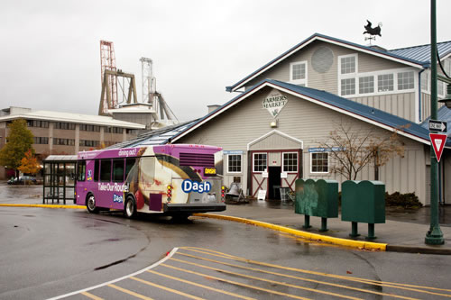
The Farmers Market, where downtown meets the Port.
PL17.6Landscape the downtown with trees, planters and baskets, banners, community gardens and other decorative improvements.
Downtown designs express Olympia’s heritage and future in a compact and pedestrian-oriented manner.
PL18.1Regulate the design of downtown development with specific but flexible guidelines that allow for creativity and innovation, enhance historic architecture and recognize distinct areas of downtown, and do not discourage development.
PL18.2Require that downtown development provide active spaces, adequate sunlight and air-flow and minimize 'blank' walls at street level.
PL18.3Require development designs that favor pedestrians over cars by including awnings and rain protection that blend with historic architecture, create interest, and minimize security and safety risks; development designs should also foster cultural events, entertainment, and tourism.
PL18.4Provide for private use of public lands and rights-of-way when in the best interest of the community.
PL18.5Design streets with landscaping, wide sidewalks, underground utilities and a coordinated pattern of unifying details.
PL18.6Designate 'pedestrian streets' where most of the frontage will have 'people-oriented' activities and street-level buildings will have a high proportion of glass. Prohibit parking lots along these streets, except when preserving scenic views and instead provide surface parking along other streets.
PL18.7Plant, maintain, and protect downtown trees for enjoyment and beauty; coordinate planting, with special attention to Legion Way and Sylvester Park and a buffer from the Port’s marine terminal.
PL18.8Limit drive-through facilities to the vicinity of the Plum Street freeway interchange.
PL18.9Limit building heights to accentuate, and retain selected public views of the Capitol dome.
Downtown’s historic character and significant historic buildings, structures, and sites are preserved and enhanced.
PL19.1Promote the Downtown Historic District to provide a focal point of historic interest, maintain the economic vitality of downtown, and enhance the richness and diversity of Olympia.
PL19.2Minimize damage to significant historic features or character during rehabilitation projects.
PL19.3Design new development and renovations so they are compatible and harmonious with the established pattern, alignment, size and shape of existing downtown area.
PL19.4Incorporate historic buildings into redevelopment projects and restore historic facades.
Neighborhoods
This section contains the goals and policies that will protect and improve the character and livability of our existing neighborhoods and shape our new neighborhoods. All of the city’s neighborhoods are envisioned as places where many features are available within a ten-minute walk. A variety of housing types located along pleasant, pedestrian-oriented streets will provide quality living opportunities. Lower-density housing will exist throughout much of Olympia, and higher-density housing will be available near major streets and commercial areas to take advantage of transit, other services, and employment opportunities. Housing types and densities will be dispersed throughout the city to minimize social problems sometimes associated with isolating people of similar means and lifestyles.
One of Olympia’s many attractive neighborhoods.
Each neighborhood should have:
• Narrow, tree-lined streets that are easy and interesting to use for walking, bicycling, and travel by transit
• A system of open space and trails with a neighborhood park
• A readily-accessible elementary school or other place of public assembly
• Diverse housing types that accommodate varying income levels, household sizes, and lifestyles
• Sufficient housing densities to support frequent transit service and sustain neighborhood businesses
• A ‘neighborhood center’ with businesses serving area residents
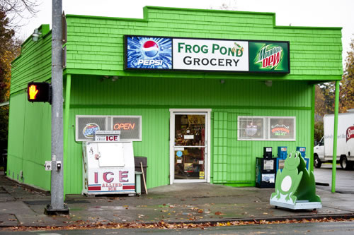
A neighborhood grocery near the Capitol.
large portion of Olympia’s residents are to live within a quarter-mile of a neighborhood center. These centers will be focal points of neighborhoods. Although they will vary by location, they generally should contain small-scale convenience and service businesses, a transit stop and a neighborhood park and be bounded by moderate or high-density housing. These neighborhood centers will serve as activity hubs or small-scale town squares that foster social interaction and a sense of community and accommodate nearby residents’ routine shopping needs.
Where possible, a network of walking and biking routes that provide both recreational and commuting opportunities will connect these neighborhood centers to parks, schools, and downtown. To minimize traffic impacts and provide for transit service, these centers will be near major streets. Approximate locations for these centers are shown on the Future Land Use Map.
Although neighborhoods will have some common features, each is unique. Recognizing this, the City envisions a public process where the needs of specific neighborhoods can be individually addressed. This process is described in the Public Participation Chapter and will focus on twelve planning areas. And, as described below, site-specific plans will be prepared for a few select other areas of the community. Managing these areas well will be critical to the success of this Comprehensive Plan and deserves extraordinary attention.
Shady sidewalks provide neighborhood character.
PL20.1Require development in neighborhoods to be of a type, scale, orientation, and design that maintains or improves the character, aesthetic quality, and livability of the neighborhood.
PL20.2Unless necessary for historic preservation, prohibit conversion of housing in residential areas to commercial use; instead, support redevelopment and rehabilitation of older neighborhoods to bolster stability and allow home occupations (except convalescent care) that do not degrade neighborhood appearance or livability, nor create traffic, noise or pollution problems.
PL20.3Allow elder care homes and seniors-only housing and encourage child care services everywhere except industrial areas; but limit hospice care to multi-family and commercial districts.
PL20.4Support development and public improvements consistent with healthy and active lifestyles.
PL20.5Prevent physical barriers from isolating and separating new developments from existing neighborhoods.
PL21.1Establish a neighborhood center at each village site, encourage development of the neighborhood centers shown on Future Land Use Map. and add additional centers when compatible with existing land uses and where they are more than one-half mile from other commercial areas.
PL21.2Locate neighborhood centers along collector or arterial streets and within about 600 feet of a transit stop.
PL21.3Support housing, a food store, a café or bakery, and a neighborhood park or civic green at all neighborhood centers. Allow churches, schools, and convenience businesses and services that cater primarily to neighborhood residents. Prohibit auto-oriented uses. Vary the specific size and composition of such centers for balance with surrounding uses. Where practical, focus commercial uses on civic greens or parks. Limit the size of commercial uses. (Note: A larger urban center is permitted in the Briggs Urban Village.)
PL21.4Allow neighborhood center designs that are innovative and provide variety, but that ensure compatibility with adjoining uses. Consider appropriate phasing, scale, design and exterior materials, as well as glare, noise and traffic impacts when evaluating compatibility. Require that buildings include primary access directly from street sidewalks and be oriented toward the neighborhood and any adjacent park or green. Require that signage be consistent with neighborhood character.
PL21.5Locate streets and trails for non-arterial access to the neighborhood center.
PL22.1Use trees to foster a sense of neighborhood identity.
PL22.2Identify, protect and maintain trees with historic significance or other value to the community or specific neighborhoods.
PL22.3Encourage the use of appropriate fruit and nut trees to increase local food self-sufficiency.
Sub-area Planning
Much of this Plan applies to the entire Olympia community. However, this is a large area of over twenty-four square miles with tens of thousands of residents. Thus this Plan cannot address all of the details of our community. Twelve planning areas, including downtown, are to be established to provide that opportunity. In general, planning areas will be comparable to the scale of an elementary school service area with five to ten thousand residents. As described in the Public Participation and Partners chapter, this scale will provide the opportunity for interested parties to focus on furthering the community’s plan for these areas. These sub-area efforts must be consistent with this Comprehensive Plan.
PL23.1In cooperation with residents, landowners, businesses, and other interested parties, establish priorities for the planning sub-areas. The specific area, content, and process for each sub-area is to be adapted to the needs and interests of each area. (See Goal 5 of Public Participation and Partners chapter.)
PL23.2Create sub-area strategies that address provisions and priorities for community health, neighborhood centers and places of assembly, streets and paths, cultural resources, forestry, utilities, open space and parks.
PL23.3Develop neighborhood and business community approaches to beautification that include activities in residential and commercial areas.
'Villages' and other Planned Developments
Sites for 'neighborhood villages,' one 'urban village,' and the older Evergreen Park planned unit development, each with a compatible mixture of single and multi-family housing and businesses, are designated within the urban area. These mixed-use projects are to provide for a coordinated, compatible mixture of single and multi-family housing arranged around a readily-accessible neighborhood center. The locations and mix of land uses and the design of the street and trail system in these areas are to create an environment that encourages walking, biking and use of transit, while providing direct, pleasant routes for motorists. These 'villages' will foster efficient land use through compact, higher-density development with residential uses near bus stops and basic retail and support services.
The smaller 'neighborhood villages' will typically consist of single-family detached homes, townhouses and multi-family units, surrounding a small neighborhood center. The 'urban village' will be more diverse and intensely developed. The businesses of the urban village will serve a larger area and may include a supermarket, offices, and a broad array of predominantly neighborhood-oriented businesses and services. Both the neighborhood villages and urban villages are to be designed as coordinated, integrated projects with a compatible mix of land uses. Development phasing requirements will ensure that each project component and amenity is developed at the appropriate time. While these villages and the Evergreen Park PUD will have many characteristics in common, the design and composition of each project will vary in response to site conditions, location, market demand, available street and utility capacity, and the character of the surrounding neighborhood, and will evolve over time.
Mixed use developments, also known as "villages," are planned with a pedestrian orientation and a coordinated and balanced mix of land uses.
PL24.1Require planned development sites shown on the Future Land Use Map to develop as coordinated, mixed-use projects.
PL24.2Provide for any redevelopment or redesign of planned developments including the Evergreen Park Planned Unit Development to be consistent with the 'village vision' of this Plan.
PL24.3Require 'master plans' for villages that encompass the entire site and specify the project phasing, street layout and design, lot arrangement, land uses, parks and open space, building orientation, environmental protection and neighborhood compatibility measures.
PL24.4Provide for a compatible mix of housing in each village with pleasant living, shopping and working environment, pedestrian-oriented character, well-located and sized open spaces, attractive well-connected streets and a balance of retail stores, offices, housing, and public uses.
PL24.5Require a neighborhood center, a variety of housing, connected trails, prominent open spaces, wildlife habitat, and recreation areas in each village.
PL24.6Require that villages retain the natural topography and major environmental features of the site and incorporate water bodies and stormwater ponds into the design to minimize environmental degradation.
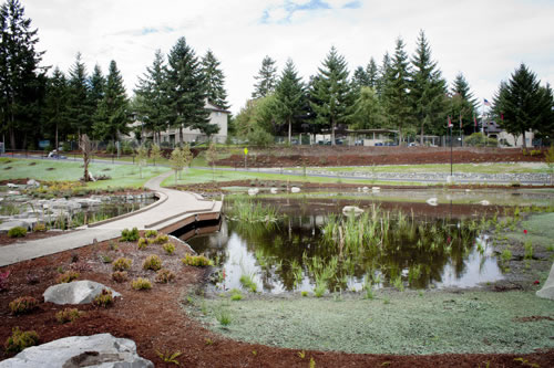
Landscaping enhances a stormwater pond.
PL24.7Locate parking lots at the rear or side of buildings, to avoid pedestrian interference and to minimize street frontage. Landscape any parking adjacent to streets and minimize parking within villages by reducing requirements and providing incentives for shared parking.
PL24.8Require village integrity but provide flexibility for developers to respond to market conditions.
PL24.9Limit each village to about 40 to 200 acres; require that at least 60% but allow no more than 75% of housing to be single-family units; and require at least 5% of the site be open space with at least one large usable open space for the public at the neighborhood center.
PL24.10Require that 90% of village housing be within a quarter mile of the neighborhood center and a transit stop.
PL24.11Provide for a single "urban village" at the intersection of Henderson Boulevard and Yelm Highway; allowing up to 175,000 square feet of commercial floor area plus an additional 50,000 square feet if a larger grocery is included; and requiring that only 50% of the housing be single-family.
Local Thurston County food production is encouraged and supported to increase self-sufficiency, reduce environmental impact, promote health, and the humane treatment of animals, and support the local economy.
PL25.1Actively partner with community organizations to provide education and information about the importance of local food systems.
PL25.2Encourage home gardens as an alternative to maintaining a lawn.
PL25.3Collaborate with community partners to ensure that everyone within Olympia is within biking or walking distance of a place to grow food.
PL25.4Encourage for-profit gardening and farming in the community.
PL25.5Purchase locally grown food when possible.
PL25.6Allow food-producing gardens on rooftops, and offer incentives to include greenhouses for year-round food production.
PL25.7Recognize the value of open space and other green spaces as areas of potential food production.
PL25.8Work with community organizations to develop strategies, measure, and set goals for increasing local food production.
PL25.9Work with local governments throughout the region to help protect existing agricultural lands and develop and promote a vibrant local food economy.
PL25.10Partner with community organizations to help educate community members who are interested in raising animals for food in the city. This might include information about protecting animals from predators, maintaining sanitary conditions, and treating animals humanely.
PL25.11Educate and encourage community members to purchase from local farms and small producers as an alternative to factory farms that may engage in inhumane treatment of animals.
Appendix A - Future Land Use Map Designations
The land use designations of the Future Land Use Map are described below and summarized in the Future Land Use Designations Table. Note that those indicated as symbols on the Future Land Use Map generally are not to exceed ten acres each.
Low-Density Neighborhoods. This designation provides for low-density residential development, primarily single-family detached housing and low-rise multi-family housing, in densities ranging from twelve units per acre to one unit per five acres depending on environmental sensitivity of the area. Where environmental constraints are significant, to achieve minimum densities extraordinary clustering may be allowed when combined with environmental protection. Barring environmental constraints, densities of at least four units per acre should be achieved. Supportive land uses and other types of housing, including accessory dwelling units, townhomes and small apartment buildings, may be permitted. Specific zoning and densities are to be based on the unique characteristics of each area with special attention to stormwater drainage and aquatic habitat. Medium Density Neighborhood Centers are allowed within Low Density Neighborhoods. Clustered development to provide future urbanization opportunities will be required where urban utilities are not readily available.
Medium-Density Neighborhoods. This designation provides for townhouses and multi-family residential densities ranging from thirteen to twenty-four units per acre. Specific zoning is to be based on proximity to bus routes and major streets, land use compatibility, and environmental constraints. Specific zoning will include minimum and maximum densities to ensure efficient use of developable land and to ensure provision of an adequate variety of types of housing to serve the community. Higher densities should be located close to major employment or commercial areas. Clustering may be permitted.
Mixed Residential. This designation requires a mixture of single and multifamily housing at densities ranging from seven to eighteen units per acre. Specific density ranges and mandatory mixes should be based on land use compatibility and proximity to bus routes and major streets, while also ensuring availability of a variety and blending of housing types and choices.
Neighborhood Centers. This designation provides for neighborhood-oriented convenience businesses and a small park or other public space. Although the locations shown on the Future Land Use Map are approximate, these centers should be along major streets and generally near areas of higher residential densities. The exact location and mix of uses of the centers in these areas will be established at the time of development approval. In general they should be focused on serving nearby residents, be well integrated with adjacent land uses, and have excellent pedestrian and bicyclist access with minimal car parking.
Residential Mixed Use. To provide opportunities for people to live close to work, shopping, and services, this designation provides for high-density multifamily housing in multistory structures combined with limited commercial uses in parts of downtown, near the State Capitol Campus, and near urban corridors and other activity centers. This designation helps to achieve density goals, to create or maintain a desirable urban living environment for residents of these areas, and to ensure that new urban residential buildings incorporate features which encourage walking and add interest to the urban environment. The commercial uses are intended to help support the residential use of the area by providing retail and personal services within walking distance of the housing. Housing in these high amenity areas will contribute to community vitality, include well-designed buildings on continuous street edges, link one area with another, encourage pedestrian activity, and include visible public spaces that increase safety and decrease vandalism.
Planned Developments. This designation includes areas of mixed uses where specific 'master plans' are required prior to development. These master plans are prepared and proposed by one or a few parties and subject to review and confirmation by the City. This designation is intended to achieve more innovative designs than in conventional developments but which are also compatible with existing uses in the area. Innovative designs may include offering a wider variety of compatible housing types and densities, neighborhood convenience businesses, recreational uses, open space, trails and other amenities. Generally residential densities should range from seven to thirteen units per acre, but the specific mix of land uses will vary with the zoning, environment, and master plan of each site. In addition to a variety of housing types, these areas may include neighborhood centers as described below. Each of the two planned developments along Yelm Highway may include a larger neighborhood-oriented shopping center with a supermarket. The planned development designation also includes retaining certain existing, and potentially new, manufactured housing parks in locations suitable for such developments. Two unique planned developments include substantial government office buildings and related uses - these are the Capitol Campus; and Evergreen Park, which includes the site of the Thurston County courthouse.
Professional Offices & Multifamily Housing. This designation accommodates a wide range of offices, services, limited retail uses specifically authorized by the applicable zoning district, and moderate-to-high density multifamily housing in structures as large as four stories.
Urban Corridors. This designation applies to certain areas in the vicinity of major arterial streets. Generally more intense commercial uses and larger structures should be located near the street edge with less intensive uses and smaller structures farther from the street to transition to adjacent designations. Particular 'nodes' or intersections may be more intensely developed. Opportunities to live, work, shop and recreate will be located within walking distance of these areas.
Urban Waterfront. Consistent with the State’s Shoreline Management Act, this designation provides for a compatible mix of commercial, light industrial, limited heavy industrial, and multifamily residential uses along the waterfront.
Central Business District. This designation provides for a wide range of activities that make downtown Olympia the cultural, civic, commercial and employment heart of the community. A dense mix of housing, pedestrian-oriented land uses and design and proximity to transit make a convenient link between downtown, the State Capitol, the waterfront, and other activity centers in the region. The scale, height and bulk of development reinforce downtown Olympia’s historic character, buildings, places and street layout.
General Commerce. This designation provides for commercial uses and activities which are heavily dependent on convenient vehicle access but which minimize adverse impact on the community, especially on adjacent properties having more restrictive development characteristics. The area should have safe and efficient access to major transportation routes. Additional "strip" development should be limited by filling in available space in a way that accommodates and encourages pedestrian activity.
Auto Services. This designation conserves areas for concentrating land uses associated with automobile and other motor vehicle sales and services. Alternative uses such as professional offices may be permitted if compatible with the primary purpose of the designation.
Medical Services. This designation conserves areas in the vicinity of hospitals for concentrating medical services and facilities, associated uses, and moderate to high-density housing.
Light Industry. This designation provides for light industrial uses, such as assembly of products and warehousing, and compatible, complementary commercial uses.
Industry. This designation provides for heavy industrial development, such as manufacturing, transportation terminals and bulk storage, and complementary commercial uses in locations with few land use conflicts, minimal environmental constraints, and adequate freight access.
High-Density Neighborhoods Overlay: Multi-family residential, commercial and mixed use neighborhoods with densities of at least 25 dwelling units per acre for residential uses that are not re-using or redeveloping existing structures. New mixed-use developments include a combination of commercial floor area ratio and residential densities that are compatible with a high-density residential neighborhood. The height in these neighborhoods will be determined by zoning and based on the "Height and View Protection Goals and Policies.”
|
FUTURE LAND USE DESIGNATION |
PRIMARY USE1 |
RESIDENTIAL DENSITY2 |
BUILDING HEIGHTS3 |
ESTIMATED ACREAGE4 |
PERCENTAGE OF UGA5 |
|---|---|---|---|---|---|
|
Low-Density Neighborhoods (LDN) |
Single-family Residential |
Up to 12 units per acre |
2 to 3 stories |
11,495 ac. |
68% |
|
Medium-Density Neighborhoods (MDN) |
Multi-family Residential |
13 to 24 units per acre |
Up to 3 stories |
615 ac. |
4% |
|
Mixed Residential |
Single & Multi-family |
7 to 18 units per acre |
Up to 4 stories |
200 ac. |
<1% |
|
Neighborhood Centers |
Commercial |
Variable |
2 to 3 stories |
Variable |
N/A |
|
Residential Mixed Use |
Multi-family Residential |
Not limited |
3 to 5 stories |
100 ac. |
≤1% |
|
Planned Developments |
Mixed Use |
Residential areas: 7 to 13 units per acre |
Varies by site and land use |
875 ac. |
5% |
|
Professional Offices & Multifamily Housing |
Mixed Use |
Minimum 7 units per acre |
3 to 4 stories |
405 ac. |
2% |
|
Urban Corridors |
Commercial |
Minimum 15 units per acre |
3 to 6 stories |
1,500 ac. |
10% |
|
Urban Waterfront |
Mixed Uses |
Minimum 15 units per acre |
3 to 7 stories |
670 ac. |
4% |
|
Central Business District |
Commercial |
Minimum 15 units per acre |
Up to 8 stories |
195 ac. |
1% |
|
General Commerce |
Commercial |
Minimum 7 units per acre |
3 to 6 stories |
75ac. |
<1% |
|
Auto Services |
Commercial |
Not applicable |
Up to 3 stories |
115 ac. |
≤1% |
|
Medical Services |
Commercial |
Minimum 7 units per acre |
Up to 6 stories; plus taller hospitals |
250 ac. |
1% |
|
Light Industry |
Industry & Wholesaling |
Not applicable |
5 stories |
110 ac. |
≤1% |
|
Industry |
Industrial |
Not applicable |
3 to 6 stories |
160ac. |
<1% |
1Primary Use is the anticipated use of the majority of building floor area in each category. Substantial other uses are likely.
2Residential Density is a general range for planning purposes and subject to variation based on site suitability. Specific allowed ranges should be established by development regulations.
3Building Heights is the approximate size of the taller buildings anticipated in each category. Specific height or stories limits should be established by development regulations.
4Estimated Acreage is a rough approximation based on the Future Land Use Map with recognition of the indistinct nature of the category boundaries.
5Percentage of UGA is a rounded number provided for convenience based on the 'estimated acreage' and an assumption of approximately 24 square miles of land in the Urban Growth Area.
Appendix B - Important Downtown Views
In accordance with Land Use Goal #8 and associated policies, as part of the Downtown Strategy (adopted April 2017), the City conducted a public process to identify important downtown views. Existing views within the following locations were identified.
|
|
Public Observation Area FROM |
Landmark View TO |
|---|---|---|
|
1 |
4th Ave Bridge to |
Capitol Lake |
|
2 |
4th Ave Bridge to |
Olympic Mountains |
|
3 |
4th Ave Bridge to |
Mt. Rainer |
|
4 |
4th Ave Bridge to |
Capitol Dome |
|
5 |
4th Ave Bridge to |
Budd Inlet |
|
6 |
Capitol Way & 11th |
Budd Inlet (looking north) |
|
7 |
Capitol Way & Talcott Ave |
Capitol Lake |
|
8 |
Capitol Way & Amanda Smith Way |
Capitol Lake |
|
9 |
Chestnut & 4th |
Budd Inlet (looking north) |
|
10 |
Deschutes Parkway |
Budd Inlet |
|
11 |
Deschutes Parkway |
Capitol Lake |
|
12 |
Deschutes Parkway |
Capitol Dome |
|
13 |
East Bay Dr. Lookout (ROW about 400’ from intersection of Olympia Ave and East Bay Dr.) |
Budd Inlet |
|
14 |
East Bay Dr. Lookout (ROW about 400’ from intersection of Olympia Ave and East Bay Dr.) |
Olympic Mountains |
|
15 |
East Bay Dr. Overlook (pocket park about 2,200’ from intersection of East Bay Dr. and State Ave.) |
Capitol Dome |
|
16 |
Henry & State Street |
Capitol Dome (looks through downtown) |
|
17 |
Madison Scenic Park |
Capitol Dome |
|
18 |
Madison Scenic Park |
Black Hills |
|
19 |
Northpoint |
Budd Inlet |
|
20 |
Northpoint |
Olympic Mountains |
|
21 |
Park of the Seven Oars |
Mt. Rainier |
|
22 |
Percival Landing |
Capitol Dome |
|
23 |
Percival Landing |
Olympic Mountains |
|
24 |
Percival Landing |
Budd Inlet |
|
25 |
Port Plaza |
Capitol Dome |
|
26 |
Priest Point Park |
Capitol Dome |
|
27 |
Puget Sound Navigation Channel |
Capitol Dome |
|
28 |
Puget Sound Navigation Channel |
Mt. Rainier |
|
29 |
Quince & Bigelow (Park) |
Capitol Dome |
|
30 |
Simmons St |
Capitol Dome |
|
31 |
Simmons St |
Capitol Lake |
|
32 |
State Capitol Campus Promontory |
Budd Inlet |
|
33 |
West Bay Park Rotary Circle |
Mt. Rainier |
|
34 |
West Bay Park Rotary Circle |
Budd Inlet |
|
35 |
West Bay Park Rotary Circle |
Capitol Dome |
For More Information
• The Buildable Lands Report prepared for Thurston County by the staff of the Thurston Regional Planning Council helps Olympia to determine the quantity of land to provide for population and employment growth
• The Capitol Master Plan prepared by the Department of Enterprise Services describes the State’s plans for certain lands within and adjacent to downtown
• The Port of Olympia’s Planning documents describe the Port’s vision for the future of its lands within Olympia, as well as its role within Thurston County in general
• The Downtown Strategy will define what steps the City will take to make the community’s vision for downtown a reality
• The Urban Corridors Task Force Recommendations, adopted by Thurston Regional Planning Council in 2012, describes challenges and opportunities for the urban corridors of Olympia, Lacey and Tumwater
• The Kaiser Harrison Opportunity Area Plan describes a mixed use pedestrian and bicycle friendly sub-area plan with a lifestyle retail center, multi-use trail, and a neighborhood park.