|
|
|
|
NEIGHBORHOODS
Future Vision for Redmond: Neighborhoods
In 2022, Redmond citizens describe their community as one that is complete, offering a wide range of services, opportunities, and amenities. It’s a community that has gracefully accommodated growth and change while ensuring that Redmond’s high quality of life, cherished natural features, distinct places, and character are not overwhelmed. It’s a place where people are friendly, diversity and innovation are embraced, and action is taken to achieve community objectives. It’s a place that is home to people from a variety of ethnic backgrounds, which contribute to the richness of the City’s culture.
Achieving a balance between accommodating growth and preserving Redmond’s unique features and livability has been challenging, but over the past 20 years through the clear, shared direction contained in the Comprehensive Plan, the vision has taken shape, and throughout Redmond the results are apparent.
Many citizens continue to actively participate in Redmond’s planning process and system improvements, and their preferences are incorporated so that Redmond continues to be the community desired by its citizens.
In 2022, as in 2003, Redmond is a community of good neighbors.
Organization of This Element
Introduction
A. Planning for Neighborhoods
B. Implementing Neighborhood Plans
C. – J. Neighborhood Policies for Redmond’s Neighborhoods
Introduction
The Neighborhoods Element contains neighborhood-specific policies. The overall goal of neighborhood plans is to enhance the quality of life for all who live or work in Redmond’s neighborhoods. Neighborhood planning uses the City’s overall policies, neighborhood issues, and neighborhood opportunities to develop solutions that take advantage of opportunities and address problems. The other Comprehensive Plan elements, for example, Transportation, Housing, and Utilities, address these topics Citywide; the Neighborhoods Element addresses these issues in a neighborhood-specific manner. The Neighborhoods Element is coordinated with other elements to ensure that policies are not duplicated. In addition to the neighborhood policies in this element, the Urban Centers Element includes policies applicable to the Downtown and Overlake Neighborhoods.
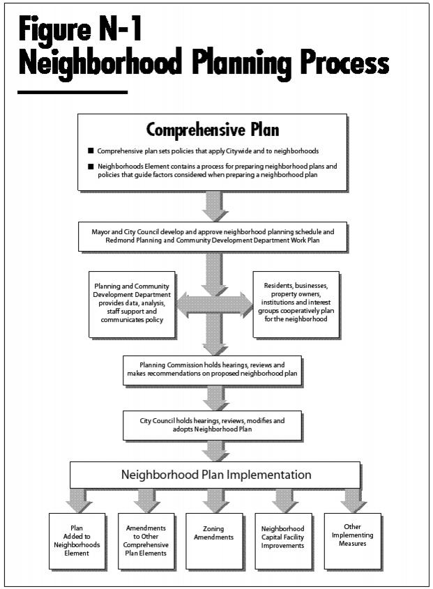
Figure N-1 illustrates the neighborhood planning and update process and the relationship of neighborhood plans to the Comprehensive Plan. The neighborhood planning and update process gives neighborhoods the opportunity to develop or refine neighborhood policies to fit community circumstances while meeting Citywide objectives.
Neighborhood planning has the following benefits:
◊ Working at the neighborhood level, City staff are able to develop and respond to a comprehensive inventory of neighborhood-specific issues and concerns.
◊ Addressing neighborhood problems and recognizing, enhancing, and maintaining neighborhood opportunities helps improve neighborhoods.
◊ Neighborhood-specific policies can help residents retain or strengthen a sense of place; that is, a combination of character, setting, land uses, and environment that makes a neighborhood unique.
◊ Neighborhood planning efforts bring together those who live, work, or own property in the neighborhood to address neighborhood concerns and goals jointly.
◊ Neighborhood planning brings together residents and City staff and officials, contributing to a stronger community.
◊ Two-way communication is enhanced among the neighborhood, the City staff, the Planning Commission, and City Council so that information and ideas may be shared between the groups.
◊ Opportunities and barriers to implementing Citywide policies are identified and addressed, enhancing the effectiveness of Citywide planning.
◊ Policies developed on a neighborhood level may inspire efforts for the entire City, improving planning and implementation Citywide.
By addressing neighborhood problems and drawing on the desirable attributes of neighborhoods, the Neighborhoods Element works to enhance Redmond’s quality of life. For example, neighborhood traffic management and land use policies help provide for efficient development while minimizing land use conflicts and adverse impacts on neighboring uses.
The Citywide vision and policies describe an overall preferred growth strategy for Redmond, while the Neighborhoods Element establishes a specific vision and policies for each neighborhood. The neighborhood policies are consistent with the Citywide framework, as required by the Growth Management Act. Fulfilling each neighborhood vision will collectively achieve the Citywide vision. For example, the Citywide policies call for creating opportunities within Redmond to provide a diversity of housing types at a range of prices, including affordable homes. The neighborhood policies identify the desired qualities of each residential neighborhood and the neighborhood’s strategies for promoting innovative and affordable housing within the neighborhood.
A. Planning for Neighborhoods
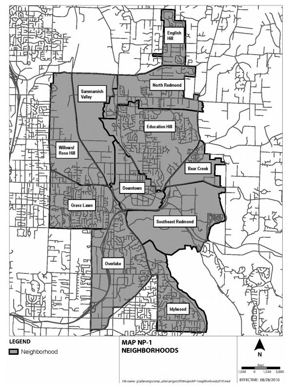
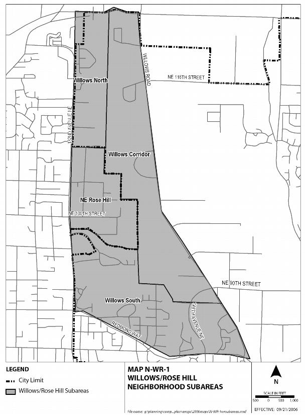
Redmond’s substantial residential and employment growth has increased the complexity of opportunities and issues the City faces. While many of these opportunities and issues can be effectively addressed at a Citywide level, others need more specific solutions. This section includes policies that will guide the preparation, review, and update of neighborhood plans, including plans for the Downtown and Overlake Neighborhoods in the Urban Centers Element. Redmond’s neighborhoods are shown on Map NP-1. These areas form the boundaries for the neighborhood plans, based on geography, the transportation network, and land use; they are utilized for planning purposes only.
Ord. 2537
Preparation and Coordination of Neighborhood Plans and Updates
Since the preparation and adoption of a neighborhood plan is typically an extended process, preparation of plans for different neighborhoods must be staggered to minimize costs and utilize staff effectively. The timing of the preparation of a plan for a given neighborhood will be based on the urgency of the issues, opportunities that need to be addressed, and the level of growth facing each neighborhood. For example, a neighborhood plan might be regarded as a high priority for update due to increased development activity or significant transportation concerns.
To be effective, plans must be current. Neighborhood plans will be periodically reviewed in anticipation of and during periods of growth. Based on that review, the City may decide that the plan does not require any changes, that limited updating is needed, or that the neighborhood plan should be redone.
NP-1
Prepare or update neighborhood plans every six years, and include a review of neighborhood plans to determine if they are adequate or require updating. Work with neighborhood representatives and the Planning Commission to prepare a recommendation on priority neighborhoods for consideration by the City Council.
After being developed, each neighborhood plan will be reviewed by the Planning Commission. The Planning Commission will conduct a public hearing on the plan and make a recommendation to the City Council. The City Council will then consider adoption of the plan, after modification if needed, and incorporate it into the Neighborhood Element.
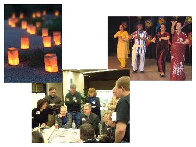
Maximum public input is essential for the preparation of, update to, and review of a neighborhood plan. At key milestones throughout the neighborhood planning and update process, staff emphasizes involvement from the community using a variety of methods, such as direct mailing, web announcements, flyers, and through other existing communication networks, such as homeowners’ associations and faith-based communities.
Public participation at neighborhood meeting
In addition to encouraging participation from the neighborhood as a whole, a Citizen Advisory Committee may be formed to help guide neighborhood planning. Potential Committee members are recruited broadly through techniques, such as direct mailings and web announcements, and may also be recommended by City staff and officials. The process includes recommendation of Committee members by the Mayor and confirmation by the City Council.
Public involvement may also be pursued by using existing neighborhood organizations as advisory groups, conducting neighborhood surveys, or holding workshops. The techniques selected should be appropriate to the planning effort and the community while providing a fair and equal opportunity for all who live, work, and own property within the neighborhood to participate.
NP-2
Maximize public input to neighborhood plans through the guidance of a Citizen Advisory Committee or other representative group composed of people who live, work, own property, or own a business in the neighborhood. Ensure that neighborhood residents, businesses, and property owners always have the opportunity to be involved in the review, preparation, and adoption of neighborhood plans. Use techniques appropriate to the neighborhood and to the issues under consideration, and involve affected City departments, boards, and advisory committees in the update and review of neighborhood plans.
Techniques and Structure of the Neighborhood Plan Update Process
Redmond’s neighborhoods are unique and each neighborhood plan will address different issues and opportunities. However, to ensure that plans are consistent with the Citywide Comprehensive Plan and that appropriate problems and opportunities are addressed, each plan should consider a common set of issues and opportunities.
One such consideration is neighborhood character. Neighborhood character refers to the overall sense of a neighborhood. It evolves over time and results from the interaction of a variety of factors. Those factors include the appearance of the neighborhood, such as the buildings, landscaping and streets; the types of land uses; natural features and open space; and other focal points, such as schools, churches, parks, and neighborhood businesses.
Staff will utilize a variety of techniques with the neighborhoods so that they equally understand the issues and opportunities, in order to establish a common knowledge base for all involved. From this base knowledge, recommendations will evolve.
NP-3
Address issues and opportunities in preparing neighborhood plans and updates, such as:
♦ Implementing the Citywide Comprehensive Plan;
♦ Establishing a long-range vision for the neighborhood;
♦ Coordinating neighborhood communication;
♦ Reviewing neighborhood boundaries;
♦ Preserving the natural environment;
♦ Promoting parks, recreation, open space, and cultural arts, especially those that address local neighborhood needs;
♦ Identifying community facilities and services;
♦ Encouraging provision of housing to serve people of a diversity of income levels, ages, family sizes, and special needs;
♦ Supporting commercial uses, when appropriately sited;
♦ Establishing and enhancing neighborhood character and design issues, such as identification and enhancement of formal and informal neighborhood gathering places, and identification and enhancement of neighborhood gateways;
♦ Conserving and improving historic, archaeological, or cultural sites;
♦ Supporting neighborhood transportation needs, including strategies to improve transportation connections, encourage use of alternative travel modes, and manage traffic; addressing modes of transportation, such as walking, bicycling, transit, and personal motor vehicle;
♦ Identifying and reporting other issues and opportunities raised by neighborhood residents, businesses, property owners, and other interested groups and individuals; and
♦ Developing a list of priority projects based on recommendation by neighborhood representatives.
The weight given to each of these areas will vary with its significance to the neighborhood.
While each neighborhood will require individual solutions and have individual opportunities, a “tool kit” of solutions forms the starting point that can be applied to neighborhoods, reducing planning costs and easing implementation. The tool kit includes planning techniques, zoning techniques, traffic-calming methods, design standards, and other implementation measures. While these tools should be customized to fit the neighborhood, they must also be consistent with the Citywide Comprehensive Plan and Community Development Guide, and be economical to administer. Over time, new tools will be added to the tool kit.
NP-4
Identify techniques and methods that can be used to address neighborhood issues and opportunities. Choose solutions that are compatible with the City’s Comprehensive Plan and development regulations.
NP-5
Update policy and development regulations necessary for a neighborhood plan concurrently to enable the Planning Commission and City Council to review and amend both the policies and development regulations at the same time.
Ord. 2384
B. Implementing Neighborhood Plans
Once a neighborhood plan is prepared and adopted, it must be implemented. Neighborhood plans, including those for the Downtown and Overlake neighborhoods in the Urban Centers Element, will be implemented through coordination among City staff, programs and policies carried out by City departments, and by applying neighborhood policies and regulations to specific developments through land use reviews. Examples of situations in which related neighborhood policies and implementing regulations would be applied include proposed Comprehensive Plan amendments, rezones, subdivisions, site plan entitlements, SEPA reviews, certain building permits, and similar permits and approvals.
NP-6
Implement the neighborhood plans’ vision, policies, and improvements by:
♦ Using discretionary land use reviews;
♦ Identifying capital facility improvements needed in a neighborhood and ways of funding them;
♦ Providing follow-up communication among interested parties and the members of the neighborhood;
♦ Offering the Neighborhood Spotlight Fund to complete appropriate projects; and
♦ Using other implementing measures.
Neighborhood Spotlight Fund project
Initial Neighborhood Improvements
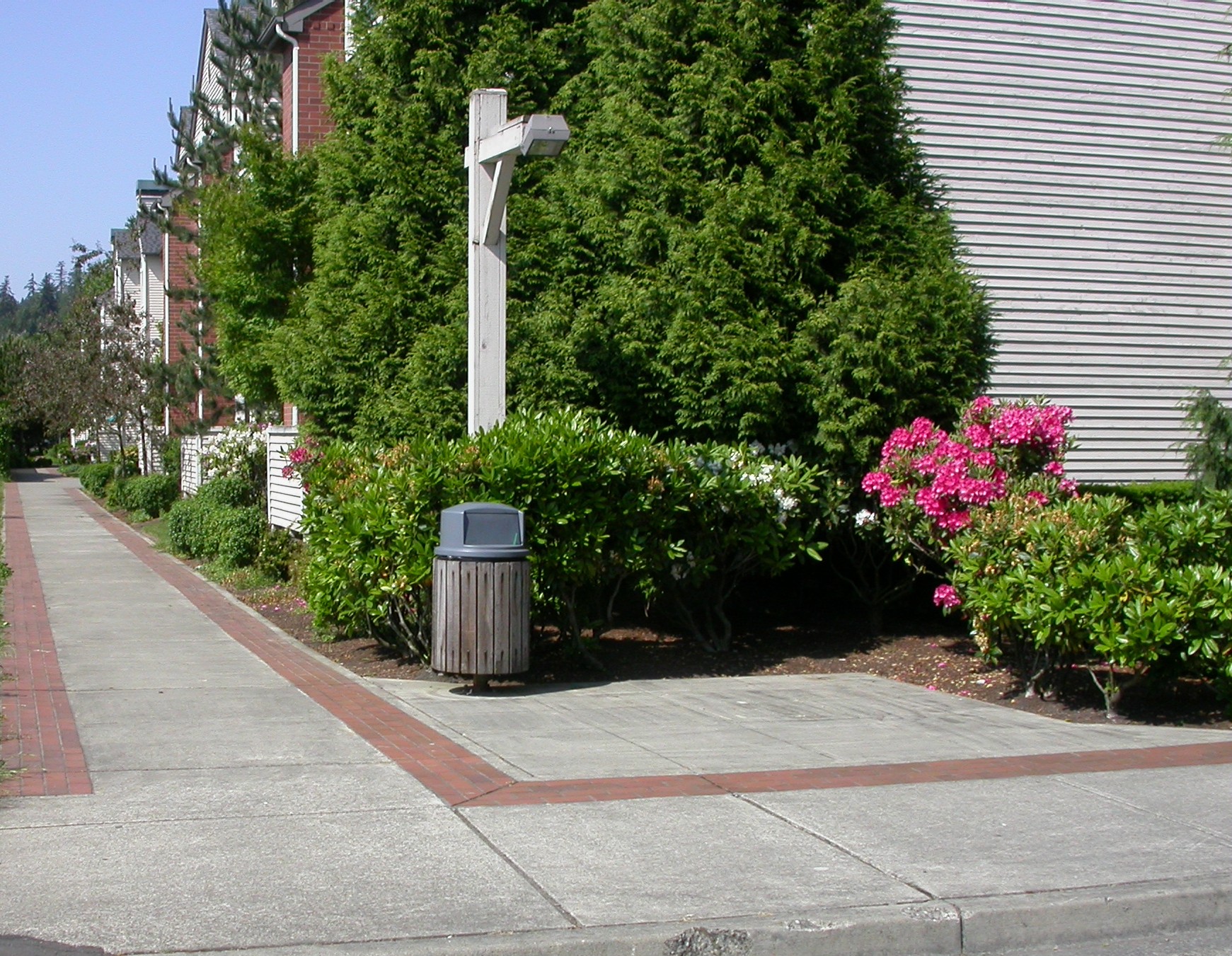
The neighborhood planning and update process provides an opportunity to identify small capital improvements of particular importance to the neighborhood that can be completed through the Neighborhood Spotlight Fund. Projects for consideration may include a trail connection, streetlights, signs, or a park improvement. Examples of smaller, noncapital projects that could be considered for assistance through the Neighborhood Matching Fund include a workshop event that promotes the goals and vision of the final plan or a neighborhood parade float for festivals, such as Derby Days.
NP-7
Work with neighborhood representatives to recommend projects for inclusion in the priority projects list. Give deference to neighborhood recommendations provided projects are consistent with the Comprehensive Plan and in compliance with safety standards set by the City. Periodically review the priority project list with neighborhood representatives, City staff, and officials, as well as key individuals identified by City staff and officials, in order to determine priority and feasibility.
NP-8
Identify and implement one or more small neighborhood projects to respond to specific issues identified during the planning process. Work together with representatives of the neighborhood in order to ensure the completion of the projects in a timely manner.
Process and Planning Review
Ongoing review of the plan, assessment of the planning process, and evaluation of the tools utilized allow staff and residents to examine and improve the neighborhood update procedure. The review serves as a check-in period with the neighborhood residents during which new ideas and issues are presented, in addition to an examination of the steps taken to promote plan implementation. Methods for assessment will be designed to meet the specific needs of the neighborhood. For example, communication may continue through public sessions and surveys with citizen advisory group members and other representatives of the neighborhood. Review also occurs at the staff level to ensure that Best Management Practices continue to be utilized and methods improve as identified.
Key milestones provide opportunities for feedback from the residents of a neighborhood. At those times, notification of a survey, workshop, open house, or other collaborative effort is provided in an effort to bridge the interests and issues reflected by City staff and officials, the neighborhood representatives, and neighborhood residents. Milestones include but are not limited to:
◊ Announcement of the neighborhood planning and update process, and recruitment of neighborhood representatives;
◊ Presentations of the initial identification of issues and opportunities regarding the neighborhood;
◊ The formal development of a neighborhood vision which includes the long-range ideas and concerns for the neighborhood in its entirety; and
◊ The development of recommendations by the neighborhood representatives, which are the basis for the creation of neighborhood policies within the neighborhood plan, as part of the Comprehensive Plan.
NP-9
Utilize all reasonable measures of communication with the neighborhood and neighborhood representatives throughout the neighborhood planning and update process. Periodically review and evaluate the neighborhood plan update process in order to improve the planning process and to strengthen communication between City staff and officials and neighborhoods through:
♦ Updating of current issues and feedback regarding the neighborhood planning and update process by representative groups within the neighborhood;
♦ Coordination among the Strategic Neighborhoods Team which is comprised of staff from City departments and divisions, for the purpose of ongoing contact with the neighborhood, providing continued support throughout the plan update, and developing future enhancements to the update process;
♦ Maintenance and enhancement of communication strategies to achieve an active network for reporting and feedback between City staff and officials and the neighborhood; and
♦ Identification and recruitment of neighborhood representatives and organizational contacts to provide ongoing maintenance of the neighborhood plan, to offer feedback to City staff and officials, and to remain informed of City projects and processes.
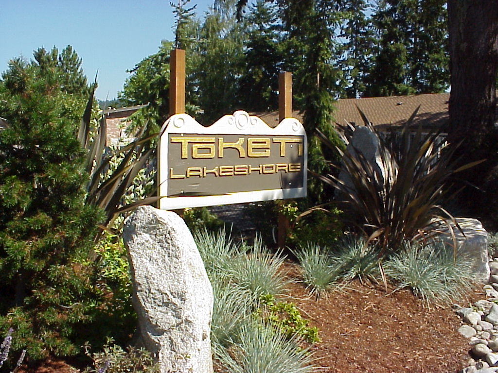
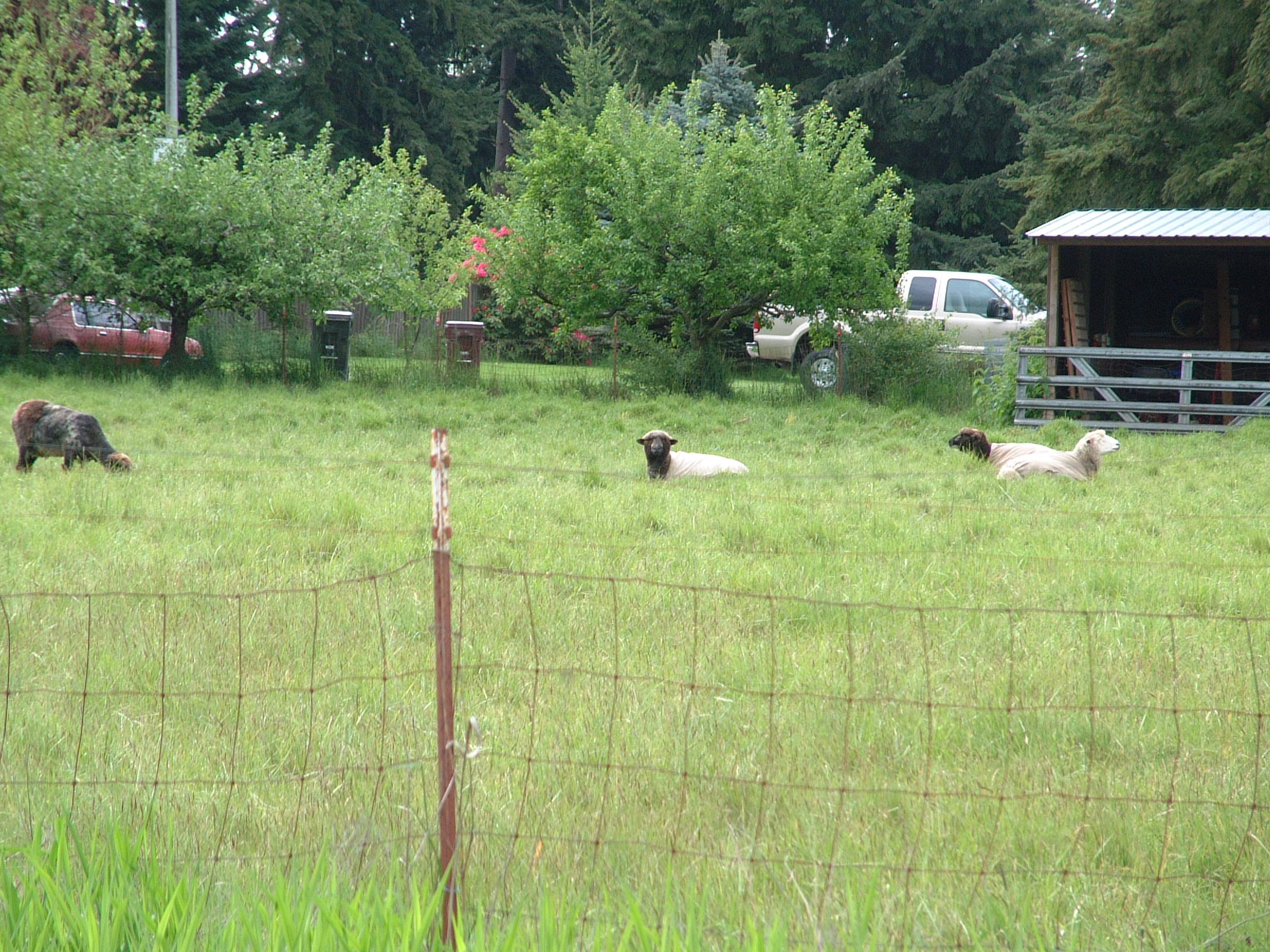
C. Bear Creek Neighborhood Policies
Neighborhood Vision
Bear Creek is unique in Redmond: it is a residential area adjacent to Downtown that contains large, ecologically important open spaces enjoyed not only by those who live there, but also by those whose only link with the neighborhood is a commute on Avondale Road.
The neighborhood vision describes the Bear Creek Neighborhood in 2030. It represents what the neighborhood will look and feel like when the neighborhood plan is implemented.
By 2030, the Bear Creek Neighborhood has grown while still sustaining natural and recreational resources for future generations. People live in a clean, healthy, and well-maintained environment in which everyone has a stake. The City and neighborhood work cooperatively to promote environmental quality.
Character. Bear Creek continues to be a safe neighborhood where people feel connected to one another. The neighborhood has a green character. It retains a significant tree canopy, and those in the neighborhood take advantage of the latest in energy-efficient and low-impact development techniques. The Bear/Evans Creek Valley – the neighborhood’s front yard – continues to have a rural-agricultural feel.
Housing. Residents take pride in living in the Bear Creek Neighborhood, while builders take pride in providing attractive housing in the neighborhood. Builders and designers seek out the neighborhood to pioneer new housing technologies and construction methods. People who live in the neighborhood appreciate that they can find homes that match their life needs, from apartments, cooperative housing, condominiums, and senior housing, to traditional single-family detached housing. Multi-unit housing is located near arterials and transit, with some limited attached homes designed to look like single-family dwellings in single-family zones. The neighborhood is safe, and housing is affordable at a variety of income levels.
Business. Neighborhood businesses prosper. This is in part because residents and the business community support each other by working cooperatively to address common issues. Residents take pride in the successful businesses in and adjacent to the neighborhood, while business owners and employees are partners in maintaining a high quality of life in the neighborhood and in Redmond as a whole.
Transportation. Redmond and the region have grown, and that has led to additional congestion on major roadways. Even so, everyone has safe access between the neighborhood, the rest of Redmond, and the region using a variety of travel modes. Pedestrians can safely cross busy streets to access transit, and can also safely walk within the neighborhood to access parks and other recreation opportunities. Some services are easily accessible by foot and bicycle, while other local destinations may be easily reached by transit. Those visiting find that there is sufficient guest parking.
Natural Environment. The Bear Creek Neighborhood values a culture of conservation and education. This has helped promote the health of the valley’s ecosystem. In the Bear/Evans Creek Valley, plants and wildlife thrive in the streams and the riparian corridors. For example, the creeks support healthy salmon runs and freshwater mussels, and have been reconnected to surrounding wetlands. Educational signage has made the neighborhood keenly aware that Redmond’s drinking water aquifer lies just beneath the creek valleys, teaching people to minimize groundwater pollution. Neighborhood awareness and enjoyment of these assets is enhanced because of easy access to natural areas. Residents breathe clean air and wildlife benefit from improved surface water quality.
Parks and Recreation. Residents, employees and visitors alike enjoy parks in the neighborhood that offer a balance of active and passive recreation opportunities. Natural park areas are walkable, educational, and designed to minimize environmental disturbance. Park visitors arrive by a number of travel modes, and most times there is sufficient parking to accommodate those arriving by car.
Neighborhood Character
The Bear Creek Neighborhood has at the same time an urban and rural feel. It is busy, and it is calm. Here the past and future come together in a kaleidoscope of uses and landscapes. The neighborhood values this unusual mix of nature and city.
Chief among the unique features in the Bear Creek Neighborhood is Bear Creek itself, along with Evans Creek and their respective riparian corridors. These creeks are home to critical salmon runs and other freshwater marine life. The aquifer below is a major source of Redmond’s drinking water. The neighborhood has retained its connection to a rural-farming past. It includes a diversity of housing types, and sports and recreation facilities at Perrigo Park.
Three neighborhood subareas have distinct land use mixes.
1. The west subarea, west of Avondale Road, is predominantly Multi-Family Urban with apartments and condominiums on the hillside overlooking the Bear/Evans Creek Valley. This subarea also contains a small cluster of commercial uses and a small amount of property zoned for Single-Family Urban uses.
2. The central subarea – generally the east side of Avondale Road and the west portion of the NE 95th Street corridor – has predominantly Single-Family Urban uses. This area also includes the Fairwinds Retirement Community. Together, the west and central subareas make up the populated parts of the neighborhood.
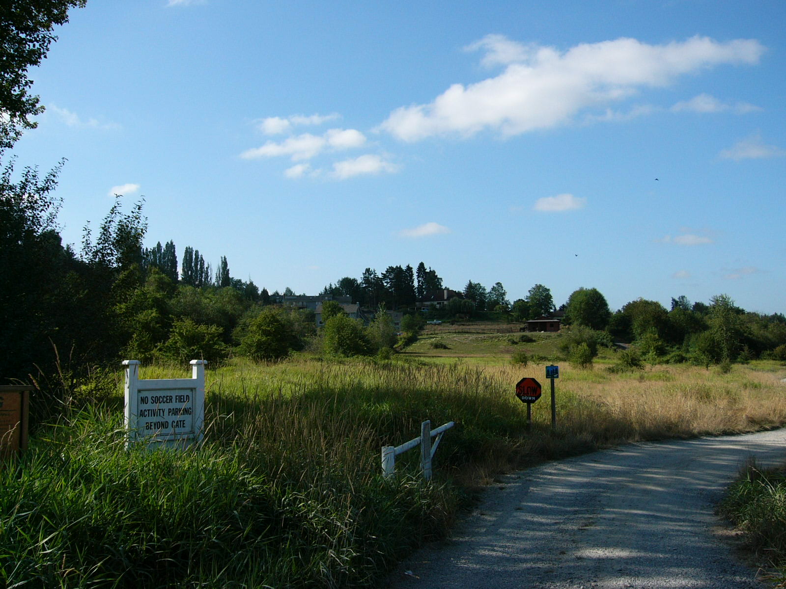
3. The south and east subarea is largely open space in the Bear/Evans Creek Valley. At the east end of this subarea is Perrigo Park as well as other City-owned open spaces. A large portion of this subarea is commonly known as the Keller Farm. This subarea is sparsely populated.
The following policies pertain to the character of the Bear Creek Neighborhood:
N-BC-1
Foster the Bear Creek Neighborhood’s diverse character through environmental stewardship, innovative land use techniques, and urban design and activities that bring people in the neighborhood together.
N-BC-2
Partner with educational organizations to ensure that all in the Bear Creek Neighborhood recognize the critical importance of the underground aquifer, Bear Creek, Evans Creek, and associated wildlife and wetlands. Consider interpretive signage as an educational tool.
N-BC-3
Preserve the public view corridor from Avondale Road through the Keller Farm toward Mt. Rainier.
N-BC-4
Maintain the rural feel along NE 95th Street, also known as Conrad Olson Road. Ensure that this corridor is safe for bicyclists and pedestrians.
N-BC-5
Work in collaboration with residents to create and maintain a welcoming feature at the south end of Avondale Road to signify the end of the freeway and the beginning of a neighborhood setting. Consider use of vegetation, traffic control measures, and other techniques.
N-BC-6
Promote nonmotorized connectivity throughout the neighborhood and to adjacent areas. In particular, improve nonmotorized connectivity from west of Avondale Road east to Perrigo Park.
N-BC-7
Ensure that future improvements to Avondale Road promote neighborhood quality of life, such as by providing safe crossings and by discouraging speeding, while facilitating local access and regional connection.
Communication
Neighborhood plans are not written in a vacuum, and they do not implement themselves. Therefore, it is important to express how the plan was created, and what will be done once the plan is adopted.
This neighborhood plan was created with the essential input of neighborhood residents, property owners, nearby business owners, natural resource stewards, and others with an interest in the Bear Creek Neighborhood. A four-member Citizen Advisory Committee (CAC) advised City staff, the Planning Commission, and the City Council throughout the development of the plan. The CAC met twice monthly for about one year to consider the future of the neighborhood. In addition, the CAC took its meetings to the neighborhood, attended multiple open houses to gather feedback, and brought issues of neighborhood importance to the attention of City staff and officials.
The policies below describe ongoing efforts to ensure that this plan is a living document that remains relevant to the neighborhood. The policies commit City representatives to two-way dialogue with neighborhood stakeholders, periodic evaluation of plan objectives, and participation in meetings about development proposals.
N-BC-8
Support Bear Creek residents and other stakeholders in ongoing and enhanced communication with the City and community building efforts.
N-BC-9
Meet with neighborhood stakeholders periodically after the adoption of the neighborhood plan to evaluate implementation of the plan, identify any needed changes, and discuss projects or issues of concern to the neighborhood.
N-BC-10
Attend required neighborhood meetings for development proposals in the Bear Creek Neighborhood.
Natural Environment
The Bear Creek Neighborhood is home to two key natural resources: the Bear/Evans Creek system, and Redmond’s drinking water aquifer. Policies in other Comprehensive Plan elements already speak to the protection of these resources. The policies below are geared toward neighborhood-level actions that will help ensure that these resources remain healthy for the long term.
N-BC-11
Take an active role in educating residents and others to make choices that support the long-term health of natural resources. Examples include natural yard care, landscape classes and educational opportunities related to groundwater protection.
N-BC-12
Locate interpretive signage along the Bear/Evans Creek Trail to highlight the benefits of a healthy creek and aquifer ecosystem.
N-BC-13
Encourage builders to plant native and drought-tolerant vegetation to reduce irrigation needs and encourage healthy landscaped areas.
N-BC-14
Encourage agricultural activities that use best management practices to protect stream and aquifer health.
N-BC-15
Partner with property owners and stewardship and other volunteer organizations to revegetate the Bear/Evans Creek corridor.
Land Use
Land is used for four broad purposes in the Bear Creek Neighborhood: for homes, businesses, parks and open space, and agriculture. By 2030, the balance of those uses is not expected to change significantly.
◊ The Avondale corridor will be the most densely populated area of the neighborhood, with homes, businesses, and small parks.
◊ The Bear/Evans Creek Valley will continue to be open. Land uses in the valley, whether based in agriculture or habitat enhancement, will be stream- and aquifer-friendly.
◊ Most of the west hillside and east edge of the neighborhood will be in open space and recreation. The west edge because much of it is too steep for development, and the east edge because it is home to the Bear/Evans Creek Greenway as well as Perrigo Park. The east edge helps transition from Redmond to rural unincorporated King County.
The policies below pertain to land use in the neighborhood:
N-BC-16
Focus urban development outside the Bear/Evans Creek Valley by clustering development outside the 100-year floodplain. Preserve undeveloped portions of the Bear/Evans Creek Valley for habitat enhancement or stream- and aquifer-friendly agriculture.
N-BC-17
Support the buildout of the PARCC Plan and East Redmond Corridor Master Plan to ensure a definite transition from urban to rural along the eastern edge of the neighborhood.
N-BC-18
Maintain predominantly Multi-Family Urban land uses west of Avondale Road, except on steep slopes and in other environmentally critical areas, where the land use designation should be Single-Family Constrained.
N-BC-19
Maintain Single-Family Urban land uses east of Avondale Road beginning at Avondale Green east to the east edge of Friendly Village and north to the City limit.
N-BC-20
Encourage commercial enterprise in the commercial area south of the “Y” of Avondale Way and Avondale Road.
Policies N-BC-21 and N-BC-22 describe criteria for potential future rezone requests to Neighborhood Commercial or Multi-Family Urban in the Avondale corridor. One important criterion is that one indoor gathering place be provided through a rezone. After one indoor gathering place is provided, the criterion would no longer apply. See policy N-BC-50 for more description of an indoor gathering place.
N-BC-21
Consider allowing Neighborhood Commercial zoning on a site when the following conditions are met:
♦ The site is at least 2.5 acres;
♦ The site has bidirectional direct access to a principal arterial;
♦ The site is located outside of the 100-year floodplain;
♦ The rezone proposal includes a provision for an indoor gathering place for the general public, whether publicly or privately owned; and
♦ The site meets additional criteria specified in LU-40 and LU-41.
N-BC-22
Consider approving rezones from Single-Family Urban or Bear Creek Design District Performance Area 1 to Multi-Family Urban on the east side of Avondale Road between NE 88th Place and the entrance to the Avondale Green development when the following conditions are met:
♦ At least 2.5 acres of land outside the 100-year floodplain are owned or controlled by one entity and are part of a single development proposal;
♦ The applicant submits a conceptual site plan for approval concurrently with the rezoning application;
♦ The site plan shows a single vehicular access point to Avondale Road or to another single ingress/egress;
♦ The development provides a way for future adjacent redevelopment to use the same single vehicular access point to Avondale Road or another single ingress/egress;
♦ The rezone proposal includes a provision for an indoor gathering place for the general public, whether publicly or privately owned; and
♦ The rezone application meets all other criteria for Comprehensive Plan and Development Guide amendments.
Transportation and Circulation
The Transportation Element of the Comprehensive Plan sets Citywide transportation policy in Redmond. This part of the Bear Creek Neighborhood Plan addresses long-term neighborhood transportation and circulation priorities.
Avondale Road is the principal route to and from the neighborhood for those who live and work there, and is also a major commuting corridor for thousands of others. For those reasons, policies that pertain to the purpose and character of Avondale Road are critical.
Another defining transportation characteristic of this neighborhood is the existing and planned trail network. These trails not only provide for excellent recreation opportunities, but also serve as transportation facilities for people who walk and bicycle to and through the neighborhood to access other destinations.
Finally, the developed portion of the Bear Creek Neighborhood has sufficient population density to support frequent transit service. Public transit in this neighborhood is a critical tool to easing congestion on arterials like Avondale Road, and to providing transportation choices for people who live and work in the neighborhood. Convenient connections to future light rail stations will be particularly important.
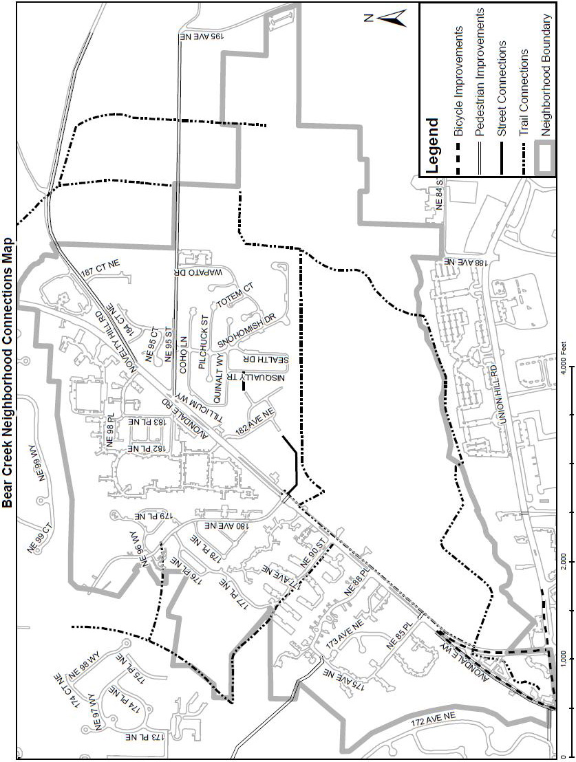
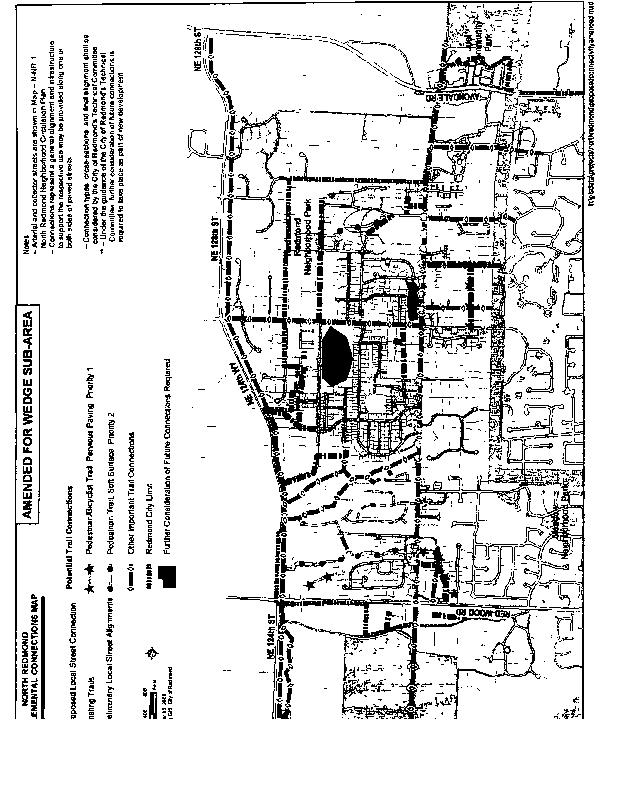
The Bear Creek Neighborhood Transportation Connections Map follows the policies.
N-BC-23
Coordinate location of crosswalks near transit stops and future trail connections to facilitate safe and convenient pedestrian crossings of Avondale Road.
N-BC-24
Ensure that transit stops and crosswalks are well lighted, and that lighting is not unduly obscured by trees or other objects.
N-BC-25
Support reliable and frequent regional transit service in the Avondale Road corridor to increase personal mobility within the existing right-of-way.
N-BC-26
Ensure that there is reliable and frequent transit service, and convenient access by other modes, to the Bear Creek Park and Ride and the future light rail stations in Southeast Redmond and Downtown Redmond.
N-BC-27
Provide safe and convenient bidirectional access to Avondale Road for local residents. Achieve this by building new local street connections to provide access to signalized intersections, creating safe U-turn opportunities, or using other traffic management techniques.
N-BC-28
Discourage speeding on Avondale Road. In addition to regular enforcement activities, achieve this by altering the street cross-section, such as by adding planting or using other design techniques or best practices.
N-BC-29
Remediate local access issues in the Avondale corridor when opportunities arise through private development or capital improvement projects, consistent with transportation planning documents. For example, replace individual residential driveways with consolidated access to a signalized intersection.
N-BC-30
Design site plans for new developments so that they accommodate planned street connections as shown in the Transportation Master Plan and Bear Creek Neighborhood Transportation Connections Map.
N-BC-31
Complete the bike facilities along Avondale Road and Avondale Way. Connect these facilities to the local and regional trail networks.
N-BC-32
Complete the regional trail system in the neighborhood in order to provide multi-modal transportation access to parks and throughout the neighborhood.
N-BC-33
Provide sufficient parking to accommodate visitors to community parks in the neighborhood, including Perrigo Park. Balance parking provision with space for recreation facilities, habitat and open space protection.
N-BC-34
Evaluate strategies in future Avondale corridor planning efforts that would:
♦ Improve safety for students walking and riding the bus to school;
♦ Work to improve traffic flow by partnering with the school district and other transit agencies to evaluate and encourage alternatives to in-lane stops; and
♦ Manage speeds to posted limits.
Housing
The amount of land available for residential development or redevelopment is limited in the Bear Creek Neighborhood by Bear Creek itself and its associated environmentally critical areas. As a result, development activity is limited mainly to the Avondale corridor and the portion of the NE 95th Street corridor that is within City limits. Because of development limitations in the neighborhood, these policies focus on making the most of existing housing opportunities and finding innovative ways to include new types of housing in the neighborhood.
N-BC-35
Continue to encourage a diverse mix of single- and multi-family housing types, in recognition that the Bear Creek Neighborhood is diverse in its makeup, and as a way to achieve Citywide goals of providing a variety of housing options.
N-BC-36
Allow cottage housing developments in all Single-Family Urban zones.
N-BC-37
Allow the subdivision of existing lots to encourage the development of smaller, affordable homes in Single-Family Urban zones. Permit “backyard homes” as described in the zoning code.
N-BC-38
Permit single-family attached housing in all Single-Family Urban zones using an administrative review process. Ensure that neighbors are notified when a triplex or fourplex is proposed so that the builder and the neighborhood can identify and work through design and compatibility concerns.
N-BC-39
Design single-family attached housing to portray the appearance of single-family detached homes. Use techniques, such as shared driveways, single front entries, and varied facades to achieve this.
N-BC-40
Require that a minimum of 10 percent of units in all new residential developments of 10 units or more be affordable to individuals or families earning up to 80 percent of the King County median income. Provide at least one bonus market rate unit for each affordable unit constructed, in accordance with Citywide policy and regulation.
N-BC-41
Design new single-family homes to maintain visual interest and compatibility with the neighborhood’s character. In new developments provide a variety of home designs and vary sizes, types, and site design features, such as setbacks or lot sizes, to maintain variety and visual interest, to avoid repetitive style, and to avoid a bulky and massive appearance.
N-BC-42
Design new single-family homes to feature living space as the dominant feature of the street elevation to encourage active, engaging, and visually appealing streetscapes. Minimize the garage feature of the street elevation unless the home is located on an arterial and options to minimize the appearance of the garage through design are limited.
N-BC-43
Require abutting property owners to make use of joint driveways whenever practical.
N-BC-44
Require builders to use technologies and practices that reduce resource consumption and minimize development’s footprint on the land. For example, this could involve selecting renewable materials, conserving energy and water, encouraging the use of native landscaping, and using low-impact development techniques.
N-BC-45
Require that clean stormwater runoff from new residential development be infiltrated on-site as conditions permit.
N-BC-46
Encourage accessibility, particularly for seniors, by allowing single-story homes that meet universal accessibility standards to exceed ordinary maximum lot coverage standards. Limit this allowance to no more than 10 percentage points over the ordinary standard.
Parks and Recreation
The Bear Creek Neighborhood is lined with community and resource parks on its eastern edge, including popular Perrigo Park. In the future, there will be better connections from the Avondale corridor to these parks as the Bear/Evans Creek Greenway is completed. Connections to parks on Education Hill and Downtown will also be maintained, providing opportunities for recreation and also alternative commute options. High priorities of the neighborhood include building awareness about the natural resources in the area and creating an indoor gathering place.
N-BC-47
Maintain a balance of active and passive recreation opportunities in the neighborhood. Look for opportunities to enhance both, especially if those opportunities can be reached by pedestrians in the neighborhood.
N-BC-48
Include educational components in park and recreation facilities, especially regarding the Bear/Evans Creek Valley ecosystem and Perrigo Springs and Creek. Consider interactive educational components like demonstration plantings. For example, consider using the future rerouting of Evans Creek away from industrial properties as an education and partnership opportunity.
N-BC-49
Maintain a sense of openness in the Bear/Evans Creek Valley.
N-BC-50
Look for opportunities to locate one publicly or privately owned indoor gathering place, such as a community hall or cafe. Such a place might also serve as a library book drop or include meeting rooms.
Ord. 2579
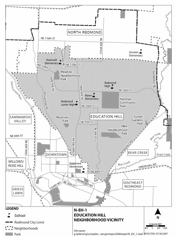
D. Education Hill Neighborhood Policies
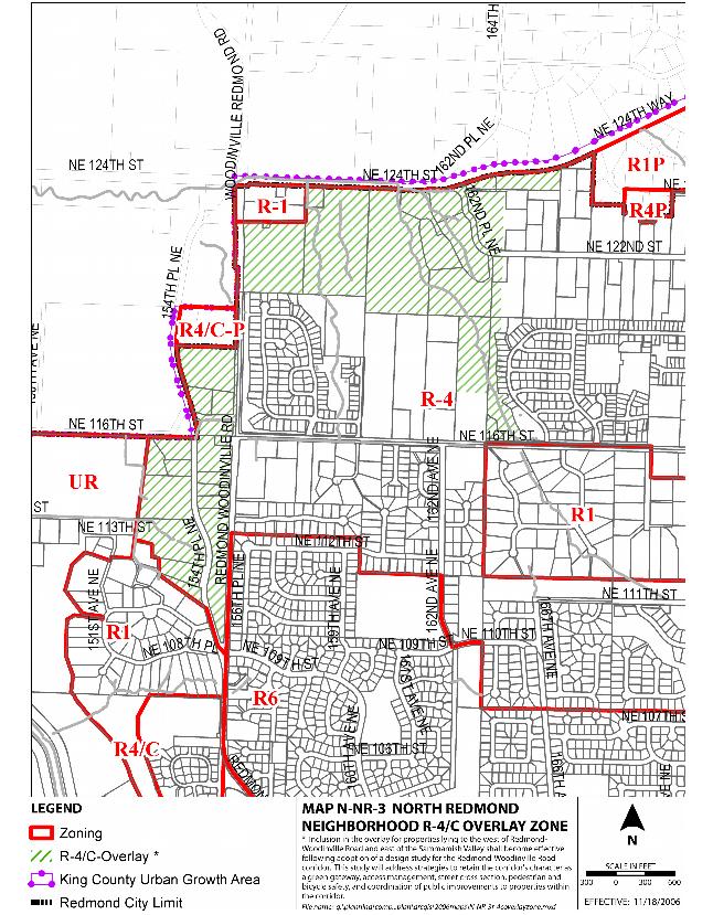
Situated on a hillside overlooking the Sammamish Valley to the west, the Bear Creek Valley and the Cascade Mountains to the east, the Education Hill Neighborhood is centrally located in the City of Redmond. Its name derives from the numerous schools located in the area, including Redmond High and Redmond Junior High, and two elementary schools: Horace Mann and Rockwell Elementary. The southern end of the planning area borders the Downtown Neighborhood, providing access to a variety of shopping and other services. Education Hill is one of the oldest areas in Redmond and consists of largely low-to-moderate density residential housing. The neighborhood’s boundaries are (generally): north, the Puget Sound Energy power line (west to east); south, Downtown Redmond; west, Redmond-Woodinville Road and also including the Mondavio (Redmond 74) development; east, Avondale Road NE/Avondale Way NE. The surrounding neighborhoods are: north, North Redmond; east, Bear Creek (mostly unincorporated King County); south, Downtown and Southeast Redmond; and west, Sammamish Valley.
Public Participation in the Neighborhood Plan Update
This Neighborhood Plan was based on participation by people who live, work or own property in the Education Hill Neighborhood. A 12-member Citizen Advisory Committee participated throughout the process, including reviewing background information, identifying issues to address, considering alternative responses, and recommending updated policies and regulations.
The Citizen Advisory Committee received input from residents in the area throughout the process. In June 2004, a neighborhoodwide workshop and City Services Fair was held. At the workshop, citizens identified what should be preserved in the neighborhood, what should be improved, and what should be kept in mind during the Plan update. After working together during the fall and winter, the Citizen Advisory Committee hosted a neighborhood open house in May 2005 to preview the group’s preliminary recommendations and to solicit additional ideas and comments. The Citizen Advisory Committee continued to refine the policies, with a subsequent open house in December 2005. Prior to this event, a newsletter was mailed to the neighborhood to seek input on the Committee’s preliminary plan recommendations. The Plan development process also included input on recommended updates from the Redmond Parks Board and Trails Commission.
In addition to the public events, the Education Hill Plan update had continuous coverage on the City’s web page. Through the provision of meeting details, call to action notices, contact information, and neighborhood history, residents remained informed on current actions and plans. As well, links on the City’s web page provided supplemental information related to Citywide events, opportunities, and project status.
Redmond’s FOCUS magazine, cable access channel RCTV, and the Redmond Reporter newspaper were also used to announce meetings, neighborhoodwide events, and to seek participation and input.
Neighborhood Vision
The vision statement below is a word picture of the Education Hill Neighborhood projected into the year 2020. It is intended to describe what the neighborhood will look and feel like when the Plan is implemented.
◊ The Education Hill Neighborhood remains a vital neighborhood that is residential in character. The neighborhood includes a mix of Single-Family Urban (four to eight dwelling units per acre) and Multi-Family Urban (12 to 30 units per acre) residential areas. The central portion of the neighborhood is predominantly low-to-moderate density, single-family in character, with the higher density areas along Redmond-Woodinville Road on the western edge and Avondale Road NE on the eastern boundary. Higher-density residential development has occurred near access to transit, and residents enjoy a wide variety of housing choices with an increase in new housing types, such as cottages, multiplex homes and accessory dwelling units, or ADUs. New housing forms blend in well with the neighborhood and are accessible to a diverse population.
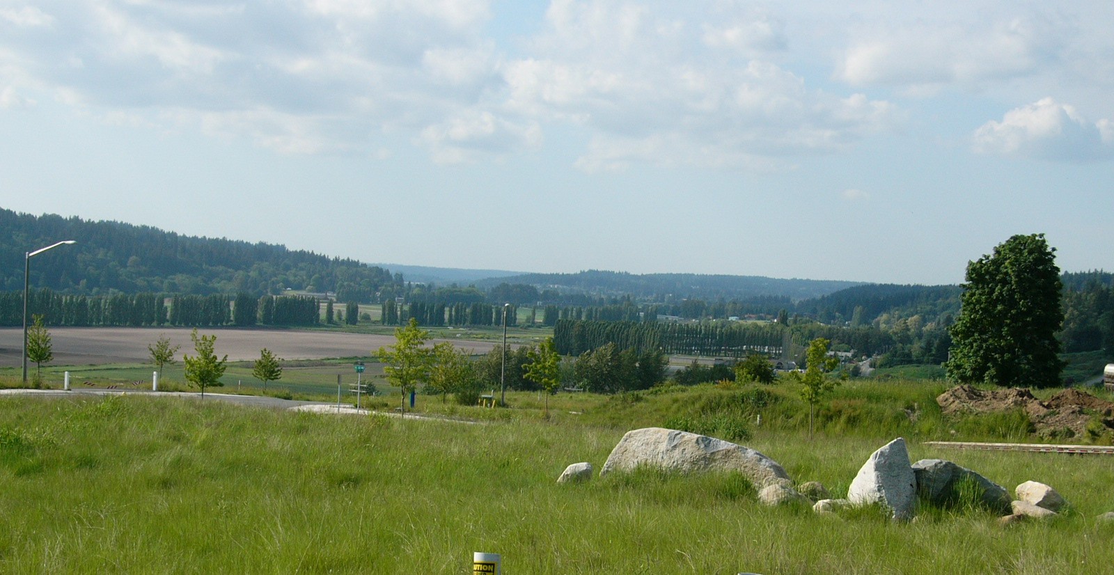
◊ Education Hill is an attractive, green area. Critical areas, such as streams and unstable slope areas, have been protected from development. Most of the slopes overlooking the Sammamish and Bear Creek Valleys are maintained in a native, undeveloped condition to protect the environment and preserve the woodland views valued by neighborhood residents.
Woodland views
◊ Community gathering places are enhanced with special amenities to encourage their use and to further identify the neighborhood. These “special places” are within parks, e.g., tables, benches and concessions at Hartman Park, major trails developed with greater pedestrian facilities, or pedestrian comfort areas developed as part of the streetscape at the “crossroads” of Education Hill, which is the intersection of 166th Avenue NE and NE 104th Street.
◊ Those who live or work in the neighborhood have a variety of travel choices, including driving, walking, bicycling, transit, and other forms of new technology transportation, such as moving sidewalks. Safe pedestrian crossings are provided on all busy streets. Streetscapes are attractive and functional for all travel modes, with street trees and landscaped areas that separate walkways from traffic where possible.
◊ A system of parks, trails and pathways has been enhanced in the neighborhood. Most residents are now located within walking or bicycling distance of a park. The trails and pathways provide connections within the neighborhood, and connect the neighborhood to other parts of Redmond and to other areas in the region.
PSE Trail
◊ The Redmond/Puget Sound Energy Trail forms an important recreation and transportation linkage for west/east travel and is developed to allow greater use and enjoyment by Education Hill residents as well as others from adjacent neighborhoods and the region.
◊ The Redmond-Woodinville Road (SR 202) and Avondale Road NE are main north/south arterials which also form the western and eastern boundaries to the neighborhood. 166th Avenue NE remains the major access from the south to the central portion of the neighborhood, and is developed to carry local traffic as well as to enhance the safety and enjoyment of pedestrians and bicyclists. More recent north/south corridors are 160th Avenue NE and 172nd Avenue NE, north of the Puget Sound Energy power line. NE 104th Street provides the main west/east arterial for the Education Hill Neighborhood.
◊ There are more transportation choices in addition to the auto. Mobility and access through the neighborhood has improved. The Education Hill Neighborhood is considered in regional plans to increase bus and other transit stops along neighborhood arterials identified as multi-modal corridors. The frequency of transit service to Downtown Redmond and major employment centers has increased with easy neighborhood access to a major transit hub and shopping in Redmond’s Downtown. Transportation improvements include: roadway enhancements; bus pull-outs on arterials; dedicated bus lanes on arterials; overall improved transit service; more pedestrian walkways; and bikeways. The trail and pedestrian linkage system also provides important pedestrian connections to Downtown and other areas, both within and adjacent to the Education Hill Neighborhood.
Neighborhood Character
Education Hill is one of Redmond’s largest residential neighborhoods, yet is cohesive, largely due to the topography of the hill, which defines the area and creates a neighborhood that is somewhat geographically distinct from other areas in the City. In addition, due to its size, the neighborhood can be thought of as consisting of several smaller areas (subareas) and neighborhoods that share similarities in character and needs as well as unique differences.
The entirety of the Education Hill Neighborhood is zoned for residential uses, and the neighborhood has expressed an interest in the continuation of this policy. The majority of the residences are built at a low-to-moderate density, with the exception of three areas of apartment and condominium developments: the western and eastern edges of the neighborhood, e.g., along Redmond-Woodinville Road and Avondale Road NE, as well as centrally located along the west side of 166th Avenue NE from NE 85th to NE 95th Street. It is anticipated that shopping for daily needs will be accommodated by retail services adjacent to the neighborhood; e.g., Downtown, NE 116th Street and Avondale Road NE, and elsewhere. In the future, these needs could be met by a small store within the Education Hill Neighborhood if determined to be appropriate through a land use application or neighborhood planning process.
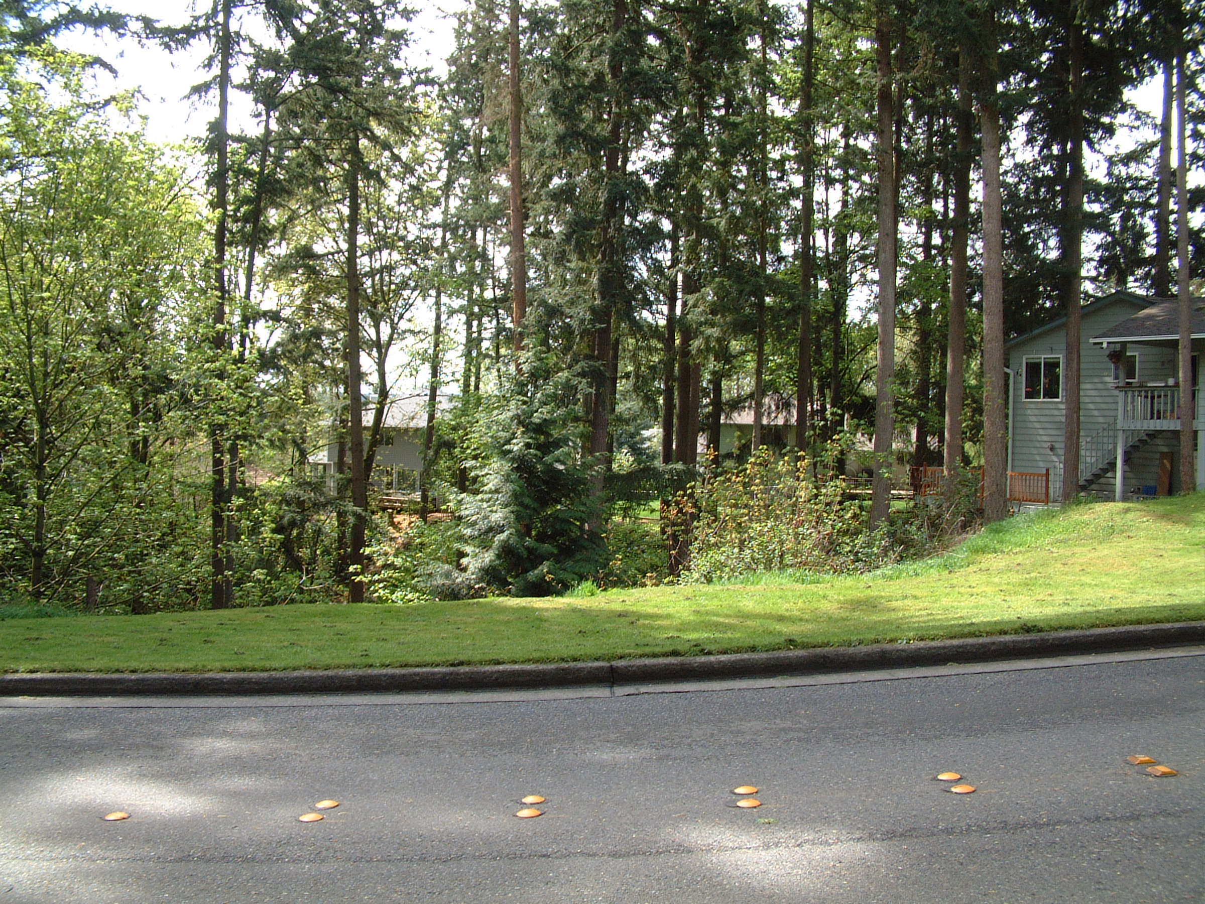
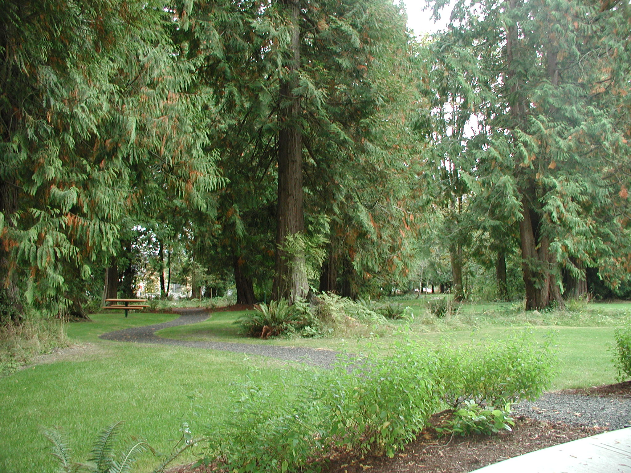
Education Hill is predominantly a mature neighborhood with established character and a significant number of large trees. Central to the neighborhood is Hartman Park, a facility highly valued by the neighborhood as a community gathering place and organized sports venue. Many neighborhood residents cherish the walkability of their neighborhood, the number of schools and churches in the area and the friendliness of neighbors who look out for each other. Panoramic views from various locations on Education Hill further add to the neighborhood’s character and identity and include vistas of Bear Creek Valley and the Cascade Mountains to the east, Mount Rainier, Downtown Redmond, Lake Sammamish and the Cascade foothills to the south, and the Sammamish River and Sammamish Valley to the west.
Hartman Park
Neighborhood Identity and Character
The Community Character and Historic Preservation Element of the Comprehensive Plan describes entrances and landmarks that may set apart one community from another as well as define a sense of place. Neighborhoods may also use this concept in the form of a neighborhood gateway. As defined in the Community Character and Historic Preservation Element, a gateway possesses distinctive design elements through the use of symbolic markers, landscaping, or monuments.
The Education Hill Neighborhood Plan promotes the use of gateways to serve not only as entry points to the neighborhood but also to assist with traffic calming at the intersection of NE 85th Street and 166th Avenue NE, for example. Additional gateway locations may also provide opportunities for defining the character of the Education Hill Neighborhood.
N-EH-1
Identify and develop gateway entries to the Education Hill Neighborhood. Promote the following intersections for location of gateway identification:
♦ 166th Avenue NE and NE 85th Street.
♦ Redmond-Woodinville Road and NE 109th Street.
♦ Avondale Road NE and NE 104th Street.
N-EH-2
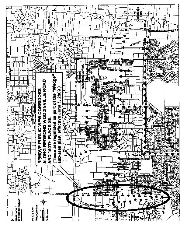
Identify public view corridors unique to the Education Hill Neighborhood, such as those of the Sammamish River and Sammamish Valley, Bear Creek Valley and the Cascade Mountains, Lake Sammamish, and Mt. Rainier. Design streets, trails and parks, as well as elements adjacent to the public right-of-way, to preserve and enhance those view corridors while considering safety and privacy concerns of private property owners.
Subareas
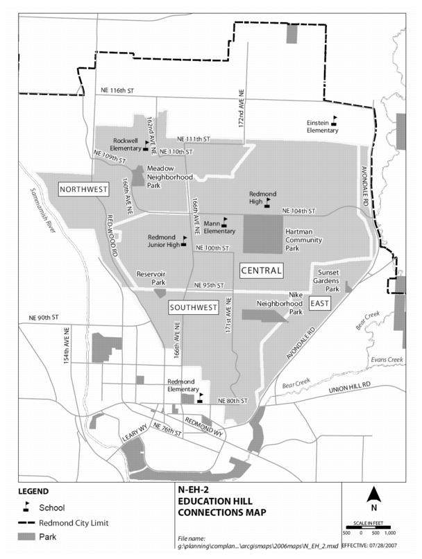
Subareas are defined herein for planning purposes only, and contain a diversity of housing types. The Education Hill subareas also serve to assist with the planning of innovative housing opportunities that may be created throughout the neighborhood, dispersed equally throughout the four subareas, preserving the unique variety and diversity of the existing housing. Refer to Map N-EH-2 for geographic descriptions.
Southwest Education Hill: This subarea is bounded by the Downtown Neighborhood on the southern and western edges. This area is on the lower part of the hill adjacent to Downtown and contains some of the oldest housing stock in the neighborhood. Included in this subarea are Nike Park and Reservoir Park.
Central Education Hill: This subarea extends north of an alignment with NE 95th Street. It continues north to the Redmond/Puget Sound Energy Trail. Included in this subarea area are Hartman Park, Redmond High School, Redmond Junior High School, Horace Mann Elementary School and the Emerald Heights Retirement Community.
Northwest Education Hill: This subarea is bounded on its western edge by the northern portion of the Downtown Neighborhood and the Sammamish Valley Neighborhood. This subarea includes the Mondavio (Redmond 74) development on the west side of Redmond-Woodinville Road, as well as Meadow Park and Rockwell Elementary School.
East Education Hill: This subarea follows Avondale Road NE and Avondale Way NE along the eastern and southern edges of Education Hill. This area is somewhat geographically separate from the other subareas as it borders the west side of Avondale Road. This area includes Sunset Gardens Park.
Neighborhood Communication Policies
The neighborhood planning process provided several opportunities to improve communication between the City of Redmond and people who live or own property in the Education Hill Neighborhood. Based on input received during the planning process, the City’s neighborhood team will continue to work to develop stronger connections with the neighborhood and to enhance delivery of City services through a coordinated effort. The Education Hill Neighborhood Plan policies strongly encourage the continued involvement and coordination with the community through the use of a City representative who would assist in this ongoing communication process.
Formation of a Neighborhood Citizens Committee whose purpose is to maintain communication with the City has been emphatically supported by the Neighborhood Plan. In addition to providing annual feedback to the City on implementation of the Neighborhood Plan, the Neighborhood Citizens Committee would be a resource for the City to discuss issues that may be of interest to the neighborhood. The Neighborhood Citizens Committee could also help create a stronger identity for the neighborhood by considering issues, such as neighborhood identification and gateway signs, providing information about development proposals and public process requirements, and increasing the involvement of other residents in neighborhood issues.
N-EH-3
Support Education Hill residents in the formation of a Neighborhood Citizens Committee to assist neighborhood residents in communication and community building efforts.
N-EH-4
Meet with the neighborhood one year after adoption of the Neighborhood Plan update and biannually thereafter to evaluate implementation of the Neighborhood Plan, identify any needed changes, and discuss projects or issues of concern with the neighborhood.
N-EH-5
Encourage continued communication and assistance with the City of Redmond by the use of a City representative to provide information and support to the neighborhood regarding land use issues.
N-EH-6
Encourage members of the neighborhood committee and require the City representative to participate in neighborhood meetings required by new forms of innovative housing and other developments. Require the City representative to prepare a document that summarizes the issues and concerns raised in the meeting, including a response by the developer and/or staff.
Parks, Recreation and Open Space Policies
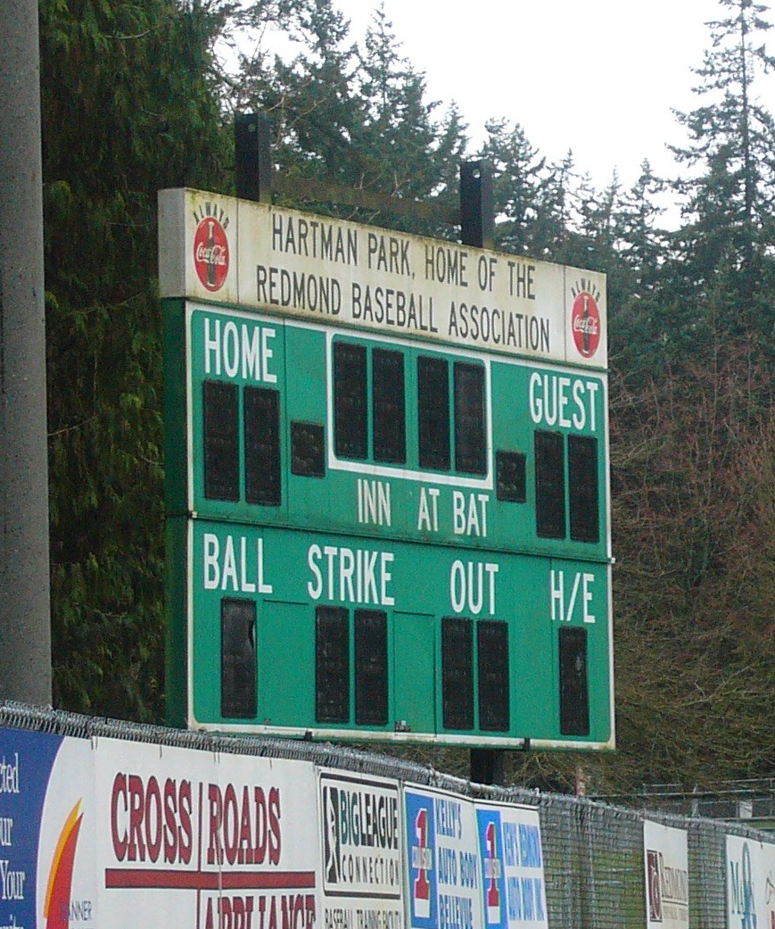
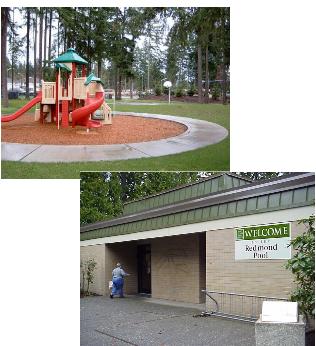
Redmond’s Parks, Recreation and Open Space (PRO) Plan identifies needs for parks and recreation facilities and how those needs will be met. The Education Hill Neighborhood enjoys many parks which serve a variety of needs, including active recreation, such as at Hartman Park, and Nike, Reservoir and Meadow Parks, which serve adjacent neighborhoods and provide both active and passive recreational opportunities. The Redmond/Puget Sound Energy Trail provides a linear open space recreation area at the northern edge of the Education Hill Neighborhood. Sunset Gardens is the newest and also the smallest park in the neighborhood, at one acre in size. It is situated on the west side of Avondale Road NE near its intersection with NE 95th Street.
Hartman Park, at 40 acres, is the largest park in Education Hill and is centrally located in the neighborhood. As such, it serves the area as both a community and neighborhood park, with its proximity to schools and nearby residences as well as incorporating the Redmond Pool. As a community park, Hartman Park is a venue for various athletic activities and organized sports, including swimming, baseball and softball. As a neighborhood park, the facility provides recreational and social opportunities for nearby residents, such as passive open space, a play area for children and nearby trails. The Neighborhood Plan supports further enhancement of Hartman Park as a community gathering place with more amenities for neighborhood residents. As Hartman Park undergoes a master planning process to update the Park’s facilities and services, opportunities for some of these suggested changes should occur.
Preservation of existing open space and wooded areas is a goal that is strongly emphasized by the neighborhood policies. Wooded areas enjoyed by many that are on privately held land are becoming no longer available as residential development continues to occur at a rapid pace. While public budgets cannot always meet the demand to purchase these open space areas, the policies encourage the concept of preservation to the greatest extent possible through negotiated agreements with developers, other government entities and the Lake Washington School District when surplus land becomes available.
The desire for the continuation and enhancement of the trail system in the Education Hill Neighborhood is also reflected in the Parks and Recreation Policies. New trails should be developed where indicated by this plan and as opportunities arise through private development projects.
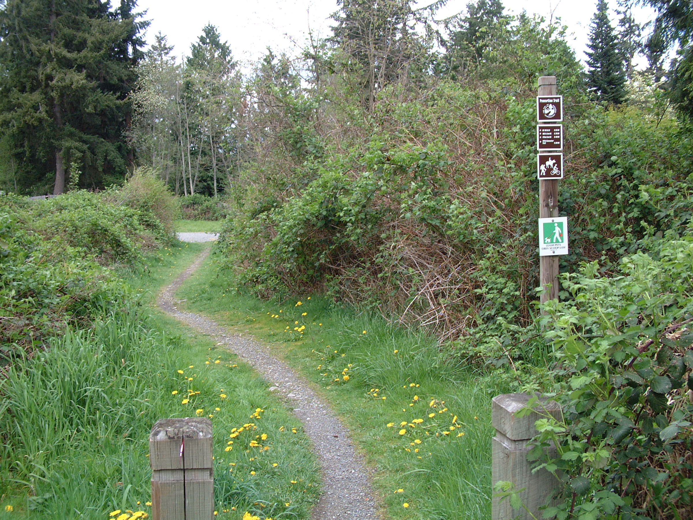
The Redmond/Puget Sound Energy Trail is a significant element in the City’s, as well as the region’s, trail system. It should be preserved and enhanced for continued use by Education Hill and other area residents, through a renewed lease with Puget Sound Energy. Future recreational use of the Redmond/Puget Sound Energy Trail is encouraged by the Education Hill Neighborhood Plan and should be further defined through community input, the Redmond Parks Board and the Trails Commission.
N-EH-7
Encourage the preservation of wooded areas and open space in larger, undeveloped areas to the greatest extent possible. Provide trail connections through these areas to allow access through future developments as well as further enhance the pedestrian circulation system in the area.
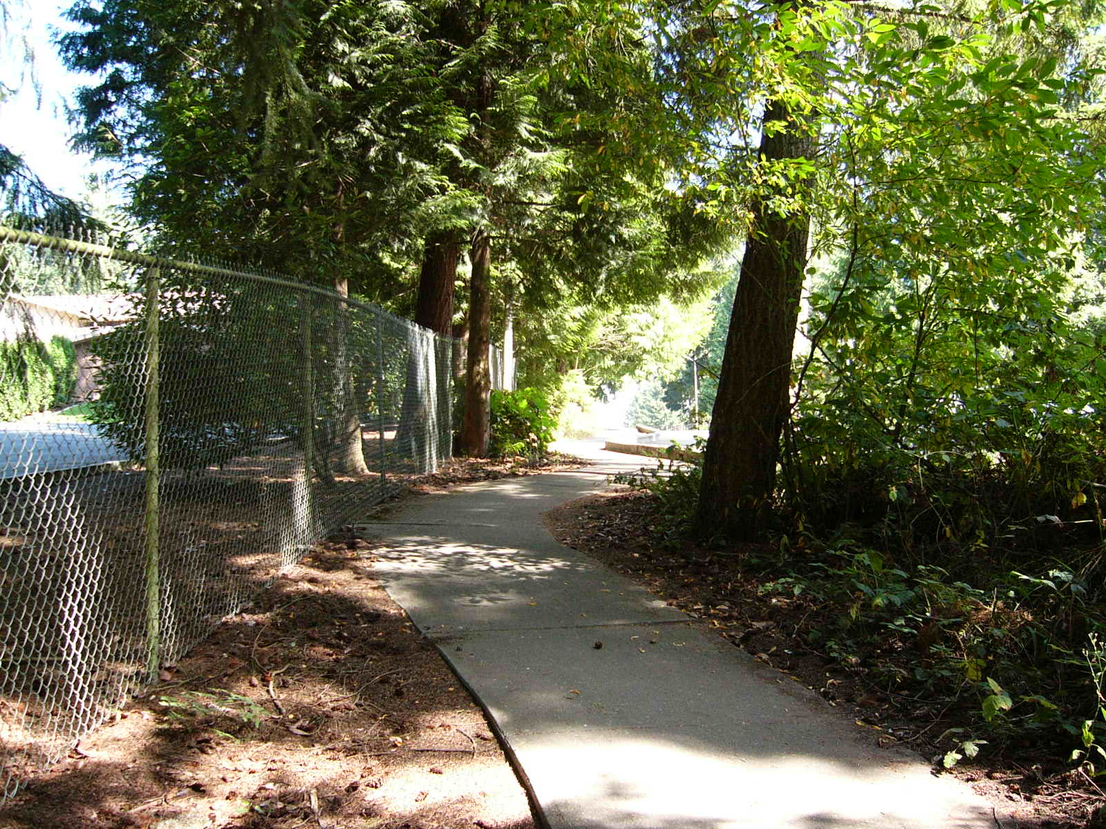
Wooded trail
N-EH-8
Encourage the acquisition or shared use of land that may become available for open space or recreational purposes; e.g., such as the City of Redmond water utility property adjacent to Hartman Park or school district surplus property.
N-EH-9
Promote Hartman Park as a neighborhood community-gathering place. Provide amenities in Hartman Park, such as food concessions, tables, benches and covered picnic areas to encourage gathering and other passive recreational activities.
N-EH-10
Work in collaboration with Puget Sound Energy to explore the designation and development of the Redmond/Puget Sound Energy Trail as a linear park that both serves and unifies the Education Hill and North Redmond Neighborhoods.
♦ Maintain pedestrian-friendly soft-surface trails;
♦ Promote trails and landscaping that are compatible with operation and maintenance of the power line, as well as other amenities as determined appropriate by the City’s Parks Board;
♦ Encourage the development of a variety of parks and open spaces along the Redmond/Puget Sound Energy Trail as development occurs on adjacent parcels;
♦ Support City efforts to negotiate with Puget Sound Energy for the renewal of easements allowing use of the Redmond/Puget Sound Energy Trail for the linear park, including trails and linkages; and
♦ Consider amenities, such as:
o Combined multi-purpose trails that support pedestrians and bicyclists, including nonmotorized road bicycles;
o Dog service stations, drinking fountains, and exercise stations; and
o Educational signage concerning nearby natural features, critical areas, and area history.
N-EH-11
Provide additional trail connections throughout the Education Hill Neighborhood, as identified in the Redmond PRO Plan, and through private developments where feasible. (Pedestrian connections are identified in Table 1.)
N-EH-12
Explore opportunities for additional neighborhood park or local park facilities in the northeast section of the Education Hill Neighborhood.
N-EH-13
Consider providing low-intensity, cost-effective lighting in parks after dusk when necessary for public safety.
Residential Policies
As Redmond seeks to increase its supply and diversity of housing available to various income levels and family types and sizes, a number of opportunities exist to provide for the housing needs of the community. The Education Hill Neighborhood Plan promotes the development of more affordable home options that encourage a diverse population and keep residents from having to move from the neighborhood or Redmond. Examples of such residents include individuals who work in Redmond but may not earn enough money to live here, and those who already live in Redmond but must move away due to a change in family size or other financial circumstances.
In order to address these needs, the Education Hill Neighborhood Plan supports cottages, accessory dwelling units (ADUs), backyard homes, and multiplex units, particularly duplex or single-family attached housing, as desirable options when sited appropriately. The residential policies recommend that innovative housing projects should also be encouraged through the Innovative Housing Ordinance or other demonstration projects. Cottage housing provides a housing type that responds to changing household sizes and ages, such as retirees, small families, and single-person households. Since cottages are smaller (limited to 1,000 square feet in size), they provide opportunities for ownership of small detached dwelling units than can blend well within a single-family neighborhood and encourage the creation of more usable open space for residents through flexibility in density and lot standards. Accessory dwelling units are currently permitted throughout the City and are a viable means to create an additional housing opportunity at relatively low cost and impact to the neighborhood. Backyard homes are a new means to create additional home ownership opportunities that would be similar in design and impact as detached accessory dwelling units. It is also important that multiplex homes are designed to look like single-family homes and blend in well with the existing neighborhood character.
While encouraging innovative forms of housing, there is the recognition that service capacity issues could arise from additional infill housing. As new, innovative housing projects come forward, they should be carefully evaluated for impacts to capacity with regard to all public services, particularly sanitary sewer service capacity in certain portions of the Education Hill Neighborhood. In estimating the impacts on services, however, it should be assumed that innovative housing types have a lower demand on public services than that of standard single-family residential uses. This is primarily due to the size restrictions placed on these housing alternatives and the likelihood of fewer persons living in the household. Further, new “green” development practices and increased conservation efforts may serve to extend capacity limits.
N-EH-14
Encourage a mix of housing types, styles and a range of choices while maintaining the overall single-family character of established neighborhoods in Education Hill.
N-EH-15
Promote a variety of housing choices that are accessible to persons of all income levels.
Cottage and Multiplex Housing Policies
N-EH-16
Encourage cottages in the Education Hill Neighborhood. Allow two cottage units for every standard single-family residence allowed in the R-4, R-5 or R-6 zone in which the property is located. Allow up to a maximum of eight cottages per cottage housing development except in the East Subarea, within which a maximum of 12 cottages are allowed per development; and otherwise pursuant to RCDG 20C.30.52-040.
N-EH-17
Encourage multiplex homes on individual lots in the Education Hill Neighborhood in locations designated Single-Family Urban and higher densities, subject to the provisions of RCDG 20C.70.20‑020, Multiplex Housing. Strongly encourage the development of duplexes through more flexible lot size standards and Type I review. Allow triplexes or fourplexes on individual lots, subject to a Type II permit process, including review by the Design Review Board.
N-EH-18
Design duplexes, triplexes, and fourplexes to portray the appearance of single-family houses and be compatible with the character of nearby single-family homes. Allow the same number of dwelling units for triplexes or fourplexes on a proposed site as the allowed number of detached single-family dwelling units for the zone in which the site is located, exclusive of any bonuses allowed on the site.
N-EH-19
Require a minimum of 80 percent of the total dwelling units within the single-family portion of each residential subarea of the Education Hill Neighborhood to be detached single-family dwellings to maintain the primarily single-family detached character of the neighborhood. Require multiplex homes (specifically triplex and fourplexes on separate lots), and cottage housing developments to locate a minimum of 500 feet from any of the above-named residential units. Require duplex structures on separate lots to locate a minimum of 250 feet from each other. Maintain these requirements unless otherwise determined by the Code Administrator. Evaluate compliance with this policy and the continued need for this policy annually with participation by the City of Redmond and a representative neighborhood group. If the finding of an evaluation is that the minimum percent of detached single-family dwellings has not been met in a subarea, no more development applications that propose multiplexes in that subarea may be accepted unless this policy is revised or deleted or the required minimum percentage of single-family dwellings has been met. Review other infill housing developments, such as cottage housing developments, or triplex or fourplex structures, in consideration of this policy. Accessory dwelling units and backyard homes are excluded from this calculation.
N-EH-20
Evaluate the need to hold neighborhood meetings associated with the construction of cottage and multiplex housing (specifically triplex or fourplex structures) or their dispersion requirements within two years after adoption of the Plan, or after the construction of three cottage and/or multiplex housing projects, whichever occurs first.
Affordable Housing Policies
Citizens in the Education Hill Neighborhood have expressed concern about rising home costs and the likelihood that many households, such as those with one wage earner, seniors, day care workers, and technicians, will not be able to afford to live in the neighborhood. Over time, the neighborhood has included a wide variety of household incomes and family sizes. Neighborhood residents desire providing options so a diversity of people can continue to live in the neighborhood and contribute positively to the community. More proactive steps are needed to address the needs for affordable housing while ensuring that affordable homes are designed to be similar in appearance to existing and new market rate homes in the neighborhood.
The Education Hill Neighborhood Plan encourages the development of affordable options in a variety of ways. The neighborhood is one of the oldest residential areas in Redmond; as such, it is mostly built out, with diminishing opportunities for large-scale new developments. Policies that require a percentage of new units to be affordable are one means to encourage affordability. However, with less available land for development, the number of potential affordable units to be developed in this way may be limited. Therefore, the Plan also strongly encourages the development of affordable housing through the use of accessory dwelling units, additional flexibility for multiplex units, particularly duplexes, and a new concept, “backyard homes.” The backyard home will enable property owners to build an additional dwelling unit on their property if they have a suitable amount of land that is available for development on their lot, possibly behind their existing house. The additional land required for the backyard home is slightly less than would be required to create an additional standard sized home. Also, the backyard home would be limited in size to 1,000 square feet and would be maintained as affordable to persons earning 120 percent of the King County median income by providing resale controls.
Redmond’s goals for affordable housing reflect the Washington State Growth Management Act mandate to encourage affordable housing for all economic segments of the population. As home prices continue to increase at a more rapid rate than the increase in household incomes, there are very few opportunities for households that earn the King County median income or less to buy a home in Redmond. Further, as land that is costly is developed with more expensive homes, less land is available to meet the needs of other income groups. By providing incentives, bonuses, resale controls and public funding for creating and preserving affordable housing, the Education Hill Neighborhood will help support the City’s goals for housing that is affordable to all of its residents.
N-EH-21
Require a minimum of 10 percent of the units in all new housing developments of 10 units or greater in the Education Hill Neighborhood to be affordable to individuals or families earning 80 percent of the King County median income. Minimize development costs associated with this requirement by providing incentives and bonuses. Maintain the long-term affordability of the dwelling unit through resale controls.
N-EH-22
Encourage strongly the development of accessory dwelling units through information and promotion of the concept to residents and a more user-friendly review and approval process by the City.
N-EH-23
Allow the subdivision of existing lots to encourage the development of smaller, affordable homes in Single-Family Urban areas. Permit “backyard homes” on lots that are 200 percent of the average lot size of the underlying zone per RCDG 20C.30.25-050, Average Lot Size, and limited to 1,000 square feet in size, excluding garage area. Ensure the affordable nature of the home by establishing the initial and subsequent sales price at 120 percent of the King County median income.
Residential Character and Design Policies
The Education Hill Neighborhood has its own unique character, including differences in each of the residential subareas as noted above. Key aspects of the neighborhood and character of each subarea can be maintained by considering the existing context defined by built and natural features, including architectural details and development patterns, when designing new residences for the neighborhood. Neighborhood residents would like to ensure that site and building design for new residential developments provide variety and visual interest that is compatible and blends with the neighborhood. The design concepts set forth in these policies will be implemented through regulations that use criteria and illustrations to demonstrate the concepts.
N-EH-24
Design single-family dwellings and significant expansions to existing single-family dwellings to maintain visual interest and compatibility with the neighborhood’s character. Provide, in new residential developments, a variety of home designs and vary sizes, types, and site design features, such as setbacks or lot sizes, to maintain variety and visual interest, to avoid repetitive style, and to avoid a bulky and massive appearance.
Home design variety
N-EH-25
Design single-family dwellings and significant expansions to single-family dwellings to have living space as the dominant feature of the street elevation to encourage active, engaging and visually appealing streetscapes with vegetation and design features that bring the living space toward the front street. Minimize the garage feature at the street elevation, unless the home is located on an arterial and options to minimize the appearance of the garage through design are limited.
Neighborhood Commercial Policies
Commercial areas that are adjacent to the neighborhood provide a wide selection of choices for stores and services to Education Hill residents. While these services are convenient mostly to those traveling by car, the distance from these areas to portions of Education Hill, particularly the top of the hill, are challenging to those who would like to walk. The long-range vision for the neighborhood includes the desirability of providing some of these services within reasonable walking distance for residents needing to pick up a quart of milk and not have to get in to their car to do so. Most people will walk a quarter- to a half-mile to purchase convenience items. The topography of Education Hill is such that existing commercial areas that are adjacent to the neighborhood involve a fairly steep climb either coming or going. If there are items to carry, the trip is even more challenging. Thus, future gathering places with small commercial nodes ideally could be located in the area that is central to the neighborhood, near the NE 104th Street corridor. Also, increased trail connections, additional transit service, or other alternative forms of travel in the future will allow greater accessibility to these goods and services.
If designed appropriately, a very small neighborhood commercial service can encourage people to gather and build community by providing a physical place to greet neighbors while shopping for daily needs. Future planning efforts within the neighborhood and/or proposed land use amendments will continue to allow the consideration of a well-situated and compatibly designed commercial space within the Education Hill Neighborhood.
Transportation Policies
Redmond’s Comprehensive Plan includes extensive policies on transportation that apply Citywide. In addition, the Transportation Master Plan is a functional plan that establishes the direction for the City’s future transportation improvements. This section includes transportation policies specific to the Education Hill Neighborhood.
The Education Hill Neighborhood Plan transportation policies recommend consideration of the long-term usability, accessibility and design of the transportation infrastructure that serves the neighborhood and surrounding areas. In support of the Transportation Master Plan as well, the goal of providing additional forms of alternative travel modes in order to reduce car trips within and surrounding the neighborhood is widely emphasized.
Priorities addressed by the policies included: additional transit service, possibly in the form of a shuttle that provides more frequent and direct service to Downtown; traffic-calming measures along 166th Avenue NE, 183rd Avenue NE, NE 111th and NE 104th Streets; safe and accessible trails; noise reduction along SR 520; and connection of bicycle routes and sidewalks primarily in the areas of schools, parks and providing access to Downtown. The Plan policies also support the provision of vehicular connections where compatible with the neighborhood, to allow more opportunity for through traffic rather than concentrating automobile traffic on existing arterials.
N-EH-26
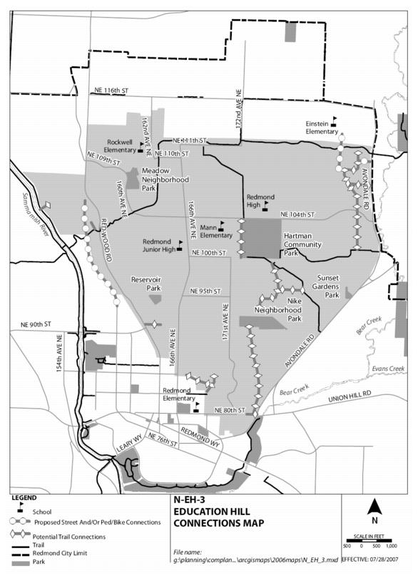
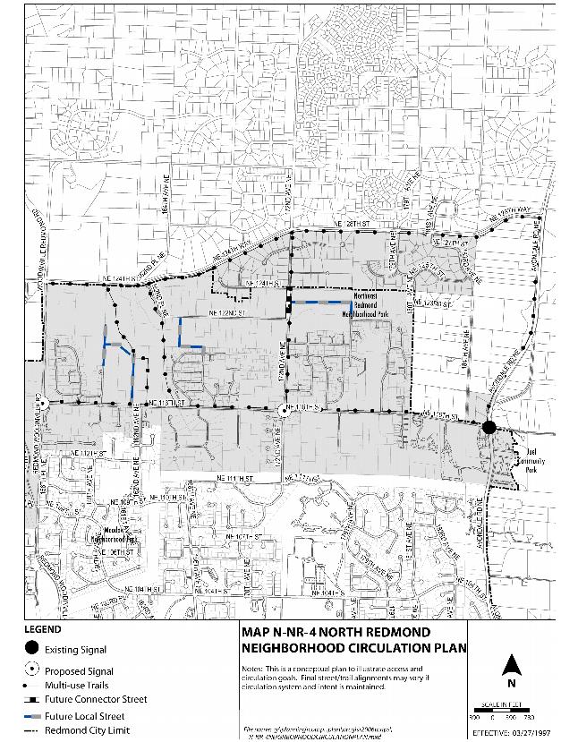
Encourage and facilitate transportation mobility of all forms, including pedestrian, bicycle and vehicular, in the Education Hill Neighborhood. Provide the necessary connections to support these modes of transportation within the neighborhood and between the neighborhood and other areas of the City, including schools, Downtown and connecting transit routes. See Table 1 and Map N-EH-3: Education Hill Connections Map.
N-EH-27
Require, within utility corridors and associated easements to off-site connections, the granting and/or improvement of pedestrian and other nonmotorized public access easements, when determined appropriate by the City’s Technical Committee for all new development.
N-EH-28
Encourage transit service providers to consider alternative choices of vehicles for service within and connecting to the Education Hill Neighborhood to facilitate more direct and frequent transit service to Downtown and other major employment centers.
N-EH-29
Minimize the use of cul-de-sac streets to further encourage a more grid-like pattern of streets and promote connectivity in the Education Hill Neighborhood.
N-EH-30
Support improvements as defined in the Transportation Master Plan to Redmond-Woodinville Road, Avondale Road NE, Willows Road, and SR 520; also support the extension of 160th Avenue NE to Redmond-Woodinville Road at approximately NE 106th Street, in order to enhance the variety of transportation corridors available for navigating around the perimeter of Redmond’s northern neighborhoods.
N-EH-31
Encourage the connection of neighborhoods north and south of the Puget Sound Energy power line easement along the approximate alignment of 183rd Avenue NE to provide additional access for local neighborhood residents, enhanced access to Albert Einstein Elementary School, and greater connectivity for the Education Hill and North Redmond Neighborhoods. Encourage pedestrian and bicycle access at a minimum.
Through a variety of meetings with Planning, Parks, and Public Works staff, the Education Hill Citizens Advisory Committee defined priority connections for consideration along streets and trails. The following list represents the location of the project.
Table 1: Street, Trail and Sidewalk Connections
Streets:
1. Extension of 160th Avenue NE to connect with Redmond-Woodinville Road at approximately NE 106th Street
Trail Connections (In addition to those already shown on PRO Plan):
1. Avondale Estates/Tyler’s Creek: trail connection north to Redmond/Puget Sound Energy Trail
2. East Valley Heights/Valley View Trail: maintain existing and construct “missing link” and provide safe pedestrian crossing of NE 104th Street at 183rd Avenue NE to enhance trail connection to south
3. Provide west/east access from Valley View Trail to Avondale Road NE (approximately NE 108th Street)
4. Perrigo Heights, north/south link, to encourage ultimate connection to north side of Nike Park
5. Trail from Rainsong Condominiums (PRD) down slope to Redmond-Woodinville Road, provide connection to Downtown and Bella Bottega at NE 90th Street
6. Shaughnessy Heights trail connections:
a. East/west from NE 85th Street, down through western ravine
b. North to 169th Place NE
7. Hartman Park Connection to NE 100th Street to west and south
8. Extension of NE 80th Street east down slope to Avondale Road NE
9. Redmond/Puget Sound Energy Trail Enhancements at SR 202, NE 104th Street, NE 110th Street and 172nd Avenue NE
10. Redmond 74/Mondavio: trail linkages from project to Redmond/Puget Sound Energy Trail
11. Trail from Nike Park south along ridge line (east of 172nd Avenue NE) to NE 80th Street
Sidewalk Connections:
1. South Education Hill:
a. NE 89th Street: 166th to 168th Avenue NE
b. NE 88th Street: 166th to 172nd Avenue NE
c. NE 87th Street: 166th to 169th Court NE
d. 172nd Avenue NE: NE 88th Street to Nike Park
e. 172nd Avenue NE: NE 100th to NE 104th Street
2. Redmond-Woodinville Road: completed connections from NE 90th Street, north to City limits
Safe Crossing Improvements:
1. Provide safe crossing improvements to NE 111th Street when warranted
The Education Hill Neighborhood Plan identifies the intersection of NE 166th Avenue NE and NE 85th Street as an important neighborhood gateway. Establishing a gateway at this location will further define a major entrance to the Education Hill Neighborhood, and possibly serve as a means to calm traffic that is entering the neighborhood from the south. A gateway may also promote pride in the neighborhood and its historic beginnings. Gateways may be defined with a variety of landscaping materials and distinctive signage as specified in the Community Character and Historic Preservation Element of the Comprehensive Plan.
Additionally, 166th Avenue NE has been identified in the City’s Transportation Master Plan as a multi-modal corridor, which indicates its significance not only as a central vehicular route into and through the Education Hill Neighborhood, but also as an important route for other modes of travel; e.g., transit, pedestrians and bicyclists. The Neighborhood Plan also encourages the consideration of other even more “alternative” solutions, such as moving sidewalks, as a future means of navigating the hill as a pedestrian.
One means to accommodate these various modes of travel along 166th Avenue NE, as well as to provide a safe and inviting entry to the neighborhood, is the conversion of 166th Avenue NE from a four- to three-lane configuration. This type of conversion has already occurred on the southern end of 166th Avenue NE from Redmond Way to NE 85th Street, with positive results on traffic management and calming. The continuation of the four- to three-lane configuration up the hill from NE 85th to NE 104th Street is consistent with Transportation Master Plan goals, such as improved vehicular and pedestrian safety. However, the community has voiced a significant amount of concern about the potential negative impacts the reconfiguration may have on vehicular mobility and turning movements. The Neighborhood Plan supports further study of the reconfiguration when other improvements to 166th Avenue NE are considered, such as the possible installation of a traffic signal at NE 104th and 166th. In addition, when the reconfiguration is under further review, there should be a major communication outreach to the community to provide education about the design and potential impacts. One area in particular that should be addressed is in developing solutions to the conflicts caused by drop-off traffic at Redmond Junior High School along with any change to the existing roadway. A traffic signal at the intersection of NE 104th Street and 166th Avenue NE near Redmond Junior High School is also recommended, to provide additional safety at the major vehicular and pedestrian intersection in the neighborhood.
Redmond Junior High School
The intersection of NE 104th Street and 166th Avenue NE has also been identified as a central core of the neighborhood, forming a “crossroads” through which much local traffic may flow. To retain the character of Education Hill, encourage community building, and to supplement efforts of traffic calming, the intersection and area adjacent should include physical improvements and amenities, such as benches, streetlights, planter boxes and hangers, art exhibits for local area students, and a neighborhood information kiosk. The infrastructure should also include elements, such as unique materials defining crosswalk paths and pavement design.
N-EH-32
Develop gateway features at entrances to the neighborhood to further identify and promote the uniqueness of Education Hill, with priority given to the intersection of 166th Avenue NE and NE 85th Street.
N-EH-33
Support the conversion of 166th Avenue NE from NE 85th to NE 104th Street from a four- to three-lane configuration contingent upon solutions provided for vehicular conflicts near the intersection of 166th Avenue NE and NE 104th Street, including the installation of a traffic signal at that intersection.
N-EH-34
Support place-making, with neighborhood-based character and infrastructure design improvements at the intersection of 166th Avenue NE and NE 104th Street. Encourage the addition of features such as:
♦ Unique materials to define crosswalk paths;
♦ Streetlights characteristic of the neighborhood;
♦ Planter boxes and hanging baskets;
♦ Benches and other pedestrian or bicycle amenities;
♦ Art exhibit space in cooperation with local students; and
♦ Neighborhood information kiosk.
Neighborhood residents have expressed concern about dark streets and are supportive of improving street lighting to minimize opportunities for vehicular and pedestrian conflicts and to increase pedestrian safety.
N-EH-35
Improve street lighting in the Education Hill Neighborhood to help avoid pedestrian and vehicular conflicts and to improve pedestrian safety while minimizing disturbances to nearby residences.
Additional improvements are needed to further improve pedestrian safety and to promote alternative forms of transportation. In order to improve safety and more efficiently move traffic within the neighborhood, the Education Hill Neighborhood Plan recommends various improvements and several actions as top priorities. See Tables 1 and 2.
N-EH-36
Develop street standards for new or redeveloped local streets within the Education Hill Neighborhood that allow for a narrow street width, yet meet required standards for safety, mobility and emergency access.
N-EH-37
Promote the retention and health of landmark trees and improve the pedestrian experience by designing sidewalks to meander around the tree(s) or include them within curb bulbs, unless said location would prove a danger to public safety. Incorporate these improvements in locations along principal, minor and collector arterials where there is sufficient existing right-of-way.
N-EH-38
Preserve the west side of 171st Avenue NE from NE 80th Street to NE 88th Street as a wooded corridor with limited driveway access whenever possible.
Wooded corridor on 171st
N-EH-39
Provide limited access on the west side of Avondale Road NE in the area north of NE 104th Street, and approximately south of NE 108th Street, if extended.
N-EH-40
Work with the Education Hill Neighborhood to implement priority improvements as identified in Table 2: Education Hill Neighborhood Highest-Priority Pedestrian Mobility and Safety Improvements.
Table 2: Education Hill Neighborhood Highest-Priority Pedestrian Mobility and Safety Improvements
Improve Pedestrian Safety and Mobility
The goals of the improvements below are to improve safety for pedestrians by providing sidewalks and walkways that are separated from motorized traffic when possible and to promote opportunities to walk to schools, parks, trails, transit stops, and other destinations within or near the neighborhood.
◊ Address visibility issues and crossing opportunities along 166th Avenue NE, including the intersections with NE 104th Street and NE 95th Street.
◊ Consider an enhanced connection between Redmond High School and Hartman Park with consideration of a pedestrian overpass or tunnel design.
◊ Complete sidewalks in the neighborhood based on Citywide criteria at locations described in the previous connections table (Table 1).
◊ Work in partnership with transit authorities, City staff, and the Neighborhood Citizens Committee to address transit ridership issues that include:
♦ Placement of shelters at bus stops;
♦ Increased choices, efficiency, and frequency of routes within and connecting to the neighborhood;
♦ Student access to and from school and school related activities; and
♦ Coordination with housing policies to optimize the alignment of transit services.
◊ Provide improvements to the intersection at 166th Avenue NE and NE 104th Street, including street lights for safety and a traffic signal that gives higher priority to pedestrian flow over vehicular flow. Design the improvements to promote interactivity within the neighborhood, to be pedestrian-oriented, and provide character and identity to the Education Hill Neighborhood.
◊ Consider a “scramble phase” option for the intersection of 166th Avenue NE and NE 104th Street through which traffic stops in all directions while providing pedestrians and bicyclists ample time for street crossings during high pedestrian volume periods.
◊ Analyze the effectiveness and design alternatives for a roundabout or signalization at the intersection of 166th Avenue NE and NE 95th Street.
◊ Work with the Neighborhood Citizens Advisory Committee to consider additional and alternative forms of pedestrian access along the southern slopes of the neighborhood as they meet the edges of the Downtown Neighborhood.
Public Facilities and Services
The Utilities Element of Redmond’s Comprehensive Plan addresses public facilities and services for the entire City, including Education Hill. Included within are policies that plan for a future vision, while ensuring a continued supply of clean water and energy, and protection of the natural environment and resources.
The Education Hill Neighborhood places emphasis on sustainable land use and building practices in order to promote a livable neighborhood, while preserving natural space for public use and environmental consideration. The use of low-impact development (LID) standards for new construction and stormwater management will help further these goals.
LID practices as a stormwater management strategy emphasize conservation and the use of existing natural features integrated with distributed, small-scale stormwater controls to more closely mimic natural hydrologic patterns. Hydrology and natural site features that influence water movement will guide the site planning for streets, structures and other infrastructure layout. LID standards establish the conservation of natural site assets, which include native vegetation and soils, existing drainage courses, and directing development away from environmentally critical areas. When strategically distributed throughout the project, the native vegetation and soil also function as a hydrologic control that helps to slow, store and infiltrate storm flows. One specific example of a low-impact development treatment is the Street Edge Alternative (SEA) street in the City of Seattle, which uses bioswales to slow and filter runoff.
While Citywide policies may be found in the Utilities, Natural Environment, and Community Character Elements, the Education Hill Neighborhood encourages additional efforts toward caring for the natural environment, while meeting demands for growth. This section includes those policies specific to the Education Hill Neighborhood.
The Education Hill Neighborhood Plan views expanded and enhanced educational opportunities as one method for encouraging greater application of projects that meet sustainable living and growth trends. The education components are expected to supplement the existing policies that support sustainable and environmental practices.
N-EH-41
Support public education programs, such as:
♦ Sustainable and green building practices;
♦ Low-impact development and related technologies;
♦ Conservation and natural resource management;
♦ Water conservation/efficient irrigation;
♦ No and low-maintenance landscaping;
♦ Narrow street, Street Edge Alternative (SEA), and Green Street standards, including landscaping; and
♦ Land use opportunities specific to Education Hill’s natural environment.
N-EH-42
Use a variety of methods to encourage development practices and infrastructure maintenance practices that promote sustainability, such as Street Edge Alternative (SEA) streets, green streets, and low-impact development and associated technologies.
N-EH-43
Provide additional and enhanced reference materials in a variety of formats and at various locations, including Redmond’s web page to support educational programs aimed toward conservation and environmentally sound practices.
The Education Hill Neighborhood, with its wealth of parks, schools, and other gathering places, is seen as an attractive location for the addition of a botanical garden space. Such a garden would be an opportunity to provide educational programming in support of sustainable living practices through demonstration, a place to connect residents with City staff through the development and maintenance of the site, and a gathering location for residents of the neighborhood and beyond.
N-EH-44
Consider placement of benches on publicly owned lands where appropriate, such as the intersections of 172nd Avenue NE and NE 104th Street, 171st Avenue NE and NE 80th Street, and 172nd Avenue NE and NE 100th Street.
In support of policies that describe the evaluation of regional stormwater facilities, the Neighborhood Plan encourages cooperative agreements through which costs and maintenance fees may be shared among users of the system. In promotion of limiting individual collection and treatment, in addition to individual maintenance cost requirements, the Plan supports a collective effort that also serves to beautify the neighborhood.
N-EH-45
Consider cooperative stormwater agreements to consolidate facilities whenever possible.
N-EH-46
Promote cooperative partnerships among residents and the City in order to create or upgrade storm retention and detention facilities through the use of natural and native landscaping as well as attractive fencing.
Residents promote an inventory of local businesses through which recycling and reclamation of goods is provided and coordinated. The identification of said businesses enables community choices and enhances the awareness of the need for lesser impacts on the environment and nonrenewable resources.
Ord. 2355
E. Grass Lawn Neighborhood Policies
Situated on a hillside overlooking Redmond’s Sammamish Valley and the Cascade Mountains to the north and east, Grass Lawn Neighborhood is located on the west side of Redmond. Neighborhood boundaries are: north Redmond Way; south NE 60th Street; east SR 520 and West Lake Sammamish Parkway. The western boundary is 132nd Avenue NE.
A. Public Participation in the Neighborhood Plan Update
This Neighborhood Plan was based on participation by people who live and own property in the Grass Lawn Neighborhood. A seven-member Citizen Advisory Committee participated throughout the process, including reviewing background information, identifying issues to address, considering alternative responses, and recommending updated policies and regulations.
The Citizen Advisory Committee received input from residents in the area throughout the process. A neighborhoodwide workshop and City services fair was held. At the workshop, citizens identified what should be preserved in the neighborhood, what should be improved, and what should be kept in mind during the Plan update. A newsletter was mailed later to the neighborhood to seek input on the Committee’s preliminary Plan recommendations.
B. Neighborhood Vision
The vision statement below is a word picture of the Grass Lawn Neighborhood in the year 2020. It is intended to describe what the neighborhood will look and feel like when the Plan is implemented.
◊ Like its namesake park, Grass Lawn remains an attractive, green area. The neighborhood includes a mix of Single-Family Urban (four to eight units per acre) and Multi-Family Urban (12 to 30 units per acre) Residential areas. Higher-density residential development has occurred near access to transit. There are a variety of types of housing that blend in well with the neighborhood.
◊ The forested slopes along several streams have been protected. Most of the unstable slopes overlooking the Sammamish Valley remain forested to protect the environment and maintain the woodland views valued by neighborhood residents.
◊ Two- to three-story buildings are located in the Neighborhood Commercial zone with ground floor small retail neighborhood commercial uses that have a neighborhood feel and are located on street corners. The buildings have offices, professional and technical services on the upper floors and are within walking or bicycling distance of many residences. The structures also serve as a community-gathering place, have high-quality architecture and are situated in a way that is sensitive to the environment.
Neighborhood Commercial in Grass Lawn
◊ Those who live or work in the neighborhood have a variety of travel choices, including driving, walking, bicycling, transit, and other forms of new technology transportation. Safe pedestrian crossings are provided on all busy streets. Streetscapes are attractive and functional for all travel modes, with street trees and landscaped areas that separate walkways from traffic.
◊ A system of parks, trails and pathways has been enhanced in the neighborhood. Most residents are located within walking or bicycling distance of a park. The trails and pathways provide connections within the neighborhood, and connect the neighborhood to Downtown Redmond and to other cities in the region.
◊ Grass Lawn Park is an athletic venue for the community as well as a gathering place for the neighborhood. Gathering place examples include, a small stage available for theater groups, high school bands, and display of student art projects, an at-grade labyrinth, or checker boards. Concession stands and small rentals are allowed uses in the park.
◊ West Lake Sammamish Parkway, 140th Avenue NE, 148th Avenue NE, 132nd Avenue NE, Redmond Way, and Old Redmond Road remain the main arterials in the neighborhood.
◊ There are more alternative modes of transportation in addition to the auto. Mobility and access through the neighborhood has improved. Grass Lawn Neighborhood is considered in regional plans to increase bus and other transit stops along neighborhood arterials. There is a neighborhood link to a major transit hub and shopping in Redmond City Center. Transportation improvements include: roadway enhancements; bus pull-outs on arterials; dedicated bus lanes on arterials; overall
improved transit service; transit shelters; more pedestrian walkways; and bikeways.
◊ Redmond and Kirkland have worked together to improve 132nd Avenue NE. Speeds along 132nd Avenue NE are safe and bicycle lanes, sidewalks and a turn lane have been added to improve safety and access. Landscaped medians and street trees have been added to manage traffic flow and improve the visual quality of the street.
Neighborhood Character
The Grass Lawn Neighborhood consists of several smaller neighborhoods with similarities in character and needs as well as unique differences. The majority of the neighborhood is zoned for residential uses, with two small commercially zoned areas. The majority of the houses are built at a low-to-moderate density, with the exception of a fair amount of apartment and condominium developments in the eastern part of the neighborhood. Grass Lawn is a mature neighborhood with established character and includes Grass Lawn Park, a facility highly valued by the neighborhood as a community-gathering place. Many neighborhood residents cherish the walkability of their neighborhood and friendliness of neighbors who look out for each other. Map N‑GL-1 shows the study area for the Grass Lawn Neighborhood Plan.
Subareas
Northeast Grass Lawn: There is a colorful variety of housing and architectural style in the NE Grass Lawn Subarea. Housing ranges from condominium complexes to single-family homes. Roughly half of the area’s land is dedicated to condominium developments zoned for Multi-Family Urban Residential and many of the developments reflect the architectural styles of the past two decades. The other half of NE Grass Lawn is zoned for Single-Family Urban Residential development. Single-family homes were built over a time span of about 100 years with the majority being built in the 1980s. The single-family homes reflect varying styles, such as one-bath ramblers built to take advantage of larger lots and open space, to two-story homes with protruding garages, and new luxury homes built on smaller lots.
Condominiums in Grass Lawn
Northwest Grass Lawn: Single-family homes are the dominant type of housing in the northwest portion of the neighborhood although the area does contain some townhomes. Most of the parcels are zoned for Single-Family Urban Residential development. Home styles are typical of suburban homes from the 1960s, including small ramblers on large lots, cottage-like homes with detached garages, and two-story homes fronted with a garage. The subarea offers a suburban feel. The majority of the streets are residential collectors with sidewalks and cul-de-sacs. The surrounding streets to the north, west, south, and east support through-traffic, as does 140th Avenue NE that cuts through the area. The Grass Lawn Community Park on Old Redmond Road and 148th Avenue NE contributes to the suburban feel of the area. The small area at 132nd Avenue NE and Old Redmond Road zoned for Neighborhood Commercial uses supports neighborhood-scale retailers, such as a video store and a hairdresser. The development also links to other commercial developments in Bellevue and Kirkland at the other corners of the crossroads. The building contains apartments on the second and third stories. Though this retail area gives an urban feel, it supports the suburban community and fits well into the suburban feel of the subarea.
Ord. 2441
Southeast Grass Lawn: Single-family homes are the only type of housing in the southeast portion of Grass Lawn. Housing styles and types vary, but most have a suburban look from the 1960s and 1970s. All of the parcels are zoned for Single-Family Urban Residential development. The subarea has a suburban feel. Most of the developments have wide streets, sidewalks, and many cul-de-sacs. The surrounding roads to the north, west, and south support some through-traffic, but the main source of traffic on the interior streets is from the residents themselves.
Southwest Grass Lawn: The southwest area of Grass Lawn is composed of both single-family homes and apartment complexes. The western half of the area is mostly unincorporated and has pre-annexation zoning of residential single-family. With very large lots, most are ranch style-from the 1960s and 1970s, and some properties contain horse stables. The eastern half of the southwest subarea of Grass Lawn is zoned for residential development at eight to 12 units per acre and consists mostly of gated apartment complexes accessed along Old Redmond Road and 140th Avenue NE. The complexes consist of multi-story buildings with styles dating back to the 1970s. The very-low-density area juxtaposed with the moderate density provides contrast. The low-density areas consist of ranch-style homes, some horse stables with split-rail fences, and large open spaces. The area provides an open, countryside feeling.
C. Neighborhood Communication Policies
The neighborhood planning process provided several opportunities to involve the public and improve communication between the City of Redmond and people who live or own property in the Grass Lawn Neighborhood. Based on input received during the planning process, the City’s neighborhood enhancement team will continue to work to develop stronger connections with the neighborhood and to enhance delivery of City services through a coordinated effort. This team includes staff from various departments, including planning, parks, public works, fire, and police.
Formation of a neighborhood association whose purpose is to maintain ongoing communication with the City has been strongly supported by the neighborhood. In addition to providing annual feedback to the City on implementation of the Neighborhood Plan, the neighborhood association could be a resource for the City to discuss issues that may be of interest to the neighborhood. The neighborhood association could also help create a stronger identity for the neighborhood by considering issues, such as neighborhood identification signs, and increasing the involvement of other residents in neighborhood issues.
N-GL-1
Support Grass Lawn residents in the formation of a neighborhood association.
N-GL-2
Meet with the neighborhood and the neighborhood association annually beginning one year after adoption of the 2004 Neighborhood Plan update to evaluate implementation of the Neighborhood Plan, identify any needed changes, and discuss projects or opportunities of concern with the neighborhood.
D. Parks, Recreation and Open Space Policies
Redmond’s Parks, Recreation and Open Space (PRO) Plan identifies needs for parks and recreation facilities and how those needs will be met. Grass Lawn Park is located in the center of the neighborhood and serves the area as both a community and neighborhood park. As a community park, the facility is a venue for various athletic events and organized sports. As a neighborhood park, the facility provides recreational and social opportunities for nearby residents, such as: passive open space; play areas for children; trails; picnic tables; and a covered shelter. Neighborhood residents agree that Grass Lawn Park should be improved as a community gathering place and include more amenities for neighborhood residents. Provision of additional open space in other locations in the neighborhood is also a high priority.
N-GL-3
Work with the Parks Board to improve Grass Lawn Park as a neighborhood community-gathering place. Promote more neighborhood amenities in Grass Lawn Park, such as food concessions, tables and benches for playing games, such as checkers, and an outdoor performing platform.
Grass Lawn Park
N-GL-4
Encourage better and more non-motorized connections to Grass Lawn Park, especially from the north. Work with volunteer groups to research potential connections throughout the neighborhood.
N-GL-5
Explore a pedestrian crossing on 148th Avenue NE between Redmond Way and Old Redmond Road.
N-GL-6
Improve the local resource site at NE 80th Street and Redmond Way with amenities appropriate for use as a greenbelt/open space.
N-GL-7
Work with the Park Board to create a local resource park on undeveloped right-of-way located on 141st Avenue NE and NE 77th Street.
N-GL-8
Explore opportunities to work with the residents of Stratford Village in seeking to establish a neighborhood connection from the undeveloped right-of-way located on 141st Avenue NE and NE 77th to the future local resource site on NE 80th Street and Redmond Way.
E. Residential Policies
As Redmond seeks to increase its supply and diversity of housing available to various income levels and family types and sizes, a number of opportunities exist to provide for the housing needs of the community. The Grass Lawn Citizens Advisory Committee feels it is in the best interest of the neighborhood and greater community to provide more affordable home options to keep residents from having to move outside the neighborhood or Redmond. Examples include individuals who work in Redmond but may not earn enough money to live here and those who live in Redmond but must move due to change in family size or other circumstances.
In order to address these needs, the Grass Lawn Citizens Advisory Committee supported both cottages and multiplex units with two to four units per building as desirable options. Cottage housing provides a housing type that responds to changing household sizes and ages, such as retirees, small families, and single-person households. Since cottages are smaller, they provide opportunities for ownership of small detached dwelling units that can blend well within a single-family neighborhood and encourage the creation of more usable open space for residents through flexibility in density and lot standards. The Committee also agreed duplex, triplexes, and fourplexes designed to look like single-family homes can help provide more affordable housing options and blend in well with the existing neighborhood character.
Cottage and Multiplex Housing Policies
N-GL-9
Encourage cottages in the Grass Lawn Neighborhood. Allow two cottage units for every standard single-family residence allowed in the zone in which the property is located, pursuant to RCDG 20C.30.52-040.
N-GL-10
Encourage duplexes, triplexes, and fourplexes on individual lots in the Grass Lawn Neighborhood in locations designated Single-Family Urban and higher densities.
Attached homes in Grass Lawn
N-GL-11
Design duplexes, triplexes, and fourplexes to portray the appearance of single-family houses and to be compatible with the character of nearby single-family homes. Allow the same number of dwelling units for duplexes, triplexes, or fourplexes on a proposed site as the allowed number of detached single-family dwellings units for the zone in which the site is located, exclusive of any bonuses allowed on the site.
N-GL-12
Evaluate the need to hold neighborhood meetings associated with the construction of cottage and multiplex housing two years after adoption of the plan, or after the construction of three cottage or multiplex housing projects, whichever occurs first.
Affordable Housing Policies
Citizens in the Grass Lawn Neighborhood have expressed concern about rising home costs and the likelihood that many households, such as those with one wage earner, seniors, day care workers, and technicians, will not be able to afford to live in the neighborhood. Over time, the neighborhood has included a wide variety of household incomes and family sizes. Neighborhood residents desire providing options so a diversity of people can continue to live in the neighborhood and contribute positively to the community. More proactive steps are needed to address the needs for affordable housing while ensuring that affordable homes are designed to be similar in appearance to existing and new market rate homes in the neighborhood.
Redmond’s goals for affordable housing reflect the Growth Management mandate to encourage affordable housing for all economic segments of the population. As home prices continue to increase at a more rapid rate than the increase in household incomes, there are very few opportunities for households that earn the King County median income or less to buy a home in Redmond. Further, as land develops for upper income households, less land is available to meet the needs of other income groups. City goals to provide incentives, bonuses, and public funding for the creation and preservation of affordable housing will help promote the neighborhood’s support of housing that is affordable to all of its residents.
N-GL-13
Require a minimum of 10 percent of the units in all new housing developments of 10 units or greater in the Grass Lawn Neighborhood to be affordable. Minimize development costs associated with this requirement by providing incentives and bonuses.
Residential Character and Design Policies
Grass Lawn Neighborhood has its own unique character, including differences in each of the residential subareas as noted above. Key aspects of the neighborhood and character of each subarea can be maintained by considering the existing context defined by built and natural features, including architectural details and development patterns, when designing new residences for the neighborhood. Neighborhood residents would like to ensure that site and building design for new residential developments provide variety and visual interest that is compatible and blends with the neighborhood. The design concepts set forth in these policies will be implemented through regulations that use criteria and illustrations to demonstrate the concepts.
N-GL-14
Design single-family dwellings and significant expansions to single-family dwellings to maintain visual interest and compatibility with the neighborhood’s character. Provide, in new residential developments, a variety of home designs and vary sizes, types, and site design features, such as setbacks or lot sizes, to maintain variety and visual interest, to avoid repetitive style, and to avoid a bulky and massive appearance.
N-GL-15
Except for homes located on arterials, design single-family dwellings and significant expansions to single-family dwellings to have living space as the dominant feature of the street elevation to encourage active, engaging, and visually
appealing streetscapes with vegetation and design features that bring the living space toward the front street. Minimize the garage feature at the street elevation, unless the home is located on an arterial and options to minimize the appearance of the garage through design are limited.
Neighborhood Commercial Policies
Nearby commercial areas in Downtown Redmond and Kirkland provide a wide array of stores and services. These uses serve the Grass Lawn Neighborhood and broader community. As convenient as these services are, many who live in the neighborhood are at least two miles from these stores and services. This is too far to walk comfortably, and encourages driving for daily service needs, such as meals or banking. Most people will walk a quarter to a half-mile to convenience retail and service areas. Encouraging small-scale stores and services, such as banking, coffee shops, restaurants, and video stores, to locate within appropriate areas in the neighborhood can help meet the daily or weekly service needs of neighborhood residents and reduce vehicle trips. To maintain the high visual quality of the neighborhood, stores and services must be designed to be compatible with nearby residential uses. The policies below address the location of the retail and service uses.
N-GL-16
Explore opportunities for additional neighborhood convenience retail and service businesses to locate within the neighborhood with the following criteria:
♦ Limit these businesses to small-scale convenience retail or service uses that primarily serve daily or weekly needs of Grass Lawn Neighborhood residents, encourage access by walking or bicycling, and are compatible with existing nearby uses.
♦ Prohibit supermarkets, retail vehicle fuel sales, hotels and motels, or convenience retail or service businesses that primarily serve the general public.
♦ Restrict hours of operation of convenience retail and service businesses to be closed a minimum of eight hours in any 24-hour period.
F. Transportation Policies
Redmond’s Comprehensive Plan includes extensive policies on transportation that apply Citywide. This section includes transportation policies specific to the Grass Lawn Neighborhood.
People who live in the neighborhood have expressed strong interest in improving pedestrian safety and increasing opportunities to walk to neighborhood parks, Downtown Redmond, and other nearby locations. Improving pedestrian safety by separating sidewalks or walkways from traffic is also valued.
N-GL-17
Improve pedestrian safety and encourage non-motorized connections between neighborhood housing developments by completing missing links in sidewalks and walkways. Follow when possible the Citizen Committee’s priority list of missing sidewalk segments for completion.
Neighborhood residents have expressed concern about dark streets and support improving street lighting to minimize opportunities for vehicular and pedestrian conflicts and increase pedestrian safety.
N-GL-18
Improve street lighting on local streets in the Grass Lawn Neighborhood to help avoid pedestrian and vehicular conflicts and improve pedestrian safety while minimizing disturbances to nearby residential homes.
People who live or own property in the neighborhood provided input on needed transportation improvements through workshops and Citizen Committee meetings. Some of the improvements recommended through these meetings have been completed, such as installation of a new bus shelter on Old Redmond Road and 140th Avenue NE. However, additional improvements are needed to further improve pedestrian safety and promote alternative forms of transportation. In order to improve safety and more efficiently move traffic within the neighborhood, the Citizens Advisory Committee reviewed a list of several improvements and recommended seven actions as top priorities.
N-GL-19
Work with the Grass Lawn Neighborhood to implement priority improvements as identified in Table 1: Grass Lawn Neighborhood Highest-Priority Pedestrian Mobility and Safety Improvements.
Table 1: Grass Lawn Neighborhood Highest-Priority Pedestrian Mobility and Safety Improvements
Improve Pedestrian Safety and Mobility
The goals of the improvements below are to improve safety for pedestrians by providing sidewalks and walkways that are separated from motorized traffic when possible and to promote opportunities to walk to schools, parks, trails, transit stops, and other destinations within or near the neighborhood.
◊ Establish safe pedestrian crossings of Redmond Way and 148th Avenue NE, particularly in sections where there are long distances between existing and planned signalized intersections.
◊ Complete street lighting on Redmond Way for pedestrians.
◊ Complete sidewalks in the neighborhood based on Citywide criteria and the following neighborhood priorities: (1) Redmond Way; (2) 139th PL NE between NE 75th and NE 78th PL; (3) NE 73rd PL between NE 70th PL; (4) NE 75th Street; (5) 151st Avenue NE; and (6) 135th Avenue NE between NE 75th Street and NE 80th Street and other missing sidewalk segments throughout the neighborhood.
◊ Install bus shelters at neighborhood bus stops.
◊ Consider providing sidewalks along one or both sides of Redmond Way that are separated from traffic, for example by a planting strip, to improve safety for pedestrians and support transit use.
◊ Support efforts between the City of Redmond and the City of Kirkland to provide sidewalks on both sides of 132nd Avenue NE south of Old Redmond Road. Sidewalks should be separated from traffic by a planting strip.
F. North Redmond Neighborhood Policies
The North Redmond Neighborhood is located on the hillsides east of the Sammamish Valley and constitutes the northeastern corner of Redmond. The neighborhood is bound on the north by NE 124th/128th Street, on the east by Avondale Road, and on the south by the Redmond/Puget Sound Energy Trail until the power line turns south. At this point, the neighborhood boundary moves to the north and then jogs around several developments whose access is primarily taken from NE 116th Street. At Redmond-Woodinville Road the boundary turns south to encompass the Valley Estates development and then turns north to create the western boundary of the neighborhood by including residential properties west of 154th Place NE.
Public Participation in the Neighborhood Plan Update
The North Redmond Neighborhood Plan is based on a significant amount of public participation by the people who live, work, and own property not only within the neighborhood but also in the immediate vicinity. A 10-member Citizen Advisory Committee considered the long-term changes that may occur in the neighborhood through 2022.
The Citizen Committee participated in a “Citizen’s Academy” through which City standards, Citywide policies and regulations, innovative opportunities, and trends were discussed by City staff and local experts. Three neighborhoodwide open house venues were provided in order to gain a sense of concern and support from the residents of North Redmond and the surrounds. Early venues allowed attendees to identify areas for improvements and to provide input to the major topics being considered as part of the plan update process. Later venues enabled further refinement of recommendations that were formed by the Citizen Advisory Committee, based on public input submitted at the events and through mailed summaries.
The Citizen Advisory Committee also considered projects and concepts that will benefit the neighborhood. A list of priority projects for consideration as capital improvements, along with a list of recommended future considerations, was generated. The lists will serve as a basis for communication and action between the City and the residents as the North Redmond Neighborhood Plan is implemented.
Neighborhood Vision
The vision statement below is a word picture of the North Redmond Neighborhood in the year 2022. It is intended to represent what the neighborhood will look and feel like when and as the Plan is implemented.
◊ North Redmond is a distinctive and desirable neighborhood. Despite being developed with urban levels of development, many mature trees and open spaces throughout the neighborhood have been preserved, leaving a sense of the semirural history of this part of Redmond.
Semirural feel
◊ The areas surrounding the neighborhood’s eastern and western boundaries have remained rural and agricultural/urban recreational, respectively. Trails and pathways throughout the neighborhood and along or within preserved open space corridors, mostly characterized by streams and forested ravines, create a seamless continuity between rural areas and centrally located residential neighborhoods, parks, and neighborhood gathering spaces. Safe connections for pedestrians and bicyclists have been enhanced through the expansion of a multipurpose, accessible trail network.
◊ The area’s environmentally constrained land has been preserved by allowing clustering of new homes in order to protect wetlands and steep slopes. Residential areas are set back from the major roads on the perimeter of the neighborhood, and many new homes have utilized low-impact development techniques to further protect the area’s natural resources. The protected slopes and wetlands have led to generous portions of land remaining forested.
Clustered housing
◊ Within North Redmond, there are a variety of home sizes and styles ranging from large luxury homes built on acre lots to smaller attached and detached homes built at four to six units per acre. Home styles include choices for people of all ages and family types, and a variety of income levels. The neighborhood is conveniently located for residents who work and shop in Redmond’s Downtown.
◊ Nearly all the developments in North Redmond are connected by a series of vehicular and/or pedestrian trails and linkages which are accessible by all types of pedestrian traffic, such as strolling and jogging, as well as by equestrians and bicyclists, in order to take advantage of the area’s open space corridors, improved streets, and other natural amenities. A high degree of connectivity is provided within the neighborhood. Most streets provide through-connections to other developments and arterials. Vehicular or pedestrian connections are provided at appropriate locations along lengthy or cul-de-sac streets.
◊ Redmond-Woodinville Road, Avondale Road NE, NE 116th Street, NE 124th/128th Street, and NE 172nd Avenue remain the main arterials and collectors in the neighborhood.
◊ North Redmond is a neighborhood known for its variety of parks and open spaces. The Northeast Redmond (Smith) Park has been expanded to include other nearby or adjacent properties, and the City has successfully acquired other parcels in the neighborhood, including park area west of 172nd Avenue NE. The Redmond/Puget Sound Energy Trail has been improved into a linear park that serves as a unifying feature with the Education Hill Neighborhood, and a number of small parks have been added to the Power Line Trail as adjacent properties have developed. Amenities, such as benches at vista points and along walkways, and restrooms in public facilities, have been incorporated into the neighborhood.
PSE Trail
◊ In addition to having easy access to Redmond’s Downtown Urban Center, the North Redmond Neighborhood is conveniently served by gathering places and shopping opportunities, such as Avondale Center and the Northeast Redmond Neighborhood Park.
Neighborhood Commercial
Neighborhood Communication Policies
The neighborhood planning process provided many opportunities to involve the public and improve communication between the City of Redmond and people who live, work, or own property in the North Redmond Neighborhood. Based on input provided by the Citizen Advisory Committee, the City’s strategic neighborhood team will continue to work to develop stronger communications with the neighborhood and vicinity, and to enhance delivery of City services through a coordinated effort. The team includes representatives from all City departments, including Planning, Public Works, Police, Fire, Finance, and Parks.
The formation of a Neighborhood Citizen Committee for the purpose of maintaining ongoing communication with the City has been strongly supported by the neighborhood. In addition to providing annual feedback to the City on the implementation of the Neighborhood Plan, the committee may serve as a resource for the City regarding issues that may be of interest to the neighborhood. The committee may also help to create a stronger identity for the neighborhood by considering issues, such as gateways, signage, and increased involvement of neighborhood residents.
N-NR-1
Support the North Redmond residents in the formation of a Neighborhood Citizen Committee, following the adoption of the Neighborhood Plan update.
N-NR-2
Meet with the residents of the neighborhood and the Neighborhood Citizen Committee beginning one year after the adoption of the 2006 Neighborhood Plan update to evaluate implementation of the Neighborhood Plan, identify needed changes, update the priority projects list, and discuss opportunities and areas of concern with the neighborhood.
General Land Use Policies
General land use policies ensure that the services and amenities located within the North Redmond Neighborhood meet the daily and weekly needs of the predominantly residential neighborhood. Policies seek to balance the strong demand for additional residential development, the need for pedestrian and bicycle amenities, and community gathering places. These amenities provide for the convenience of North Redmond residents and reflect upon the desire to preserve the area’s natural qualities. Additional amenities, such as benches strategically placed along trails, paths and sidewalks, serve to promote a sense of community and uniqueness of the neighborhood. By recognizing the value of environmentally critical areas, such as the various creeks that run through the neighborhood, wetlands and steep slopes, the City’s policies focus residential development in areas that have the least environmental constraints.
The land use policies for North Redmond also recognize the character of existing and well-established neighborhoods that are located on large but otherwise unconstrained lots in single-family subdivisions throughout the neighborhood.
N-NR-3
Preserve the North Redmond Neighborhood as a predominantly residential neighborhood, with a variety of amenities that serve the daily and weekly needs of the North Redmond residents.
N-NR-4
Conserve and strive to enhance existing significant natural features, including steep slopes, wetlands, streams, creeks, trees, and fish and wildlife habitat conservation areas.
Natural features
N-NR-5
Encourage innovative development techniques that provide for a variety of lot sizes, housing types, styles, and sizes, and a variety of affordability levels within the neighborhood.
N-NR-6
Encourage owners of underdeveloped contiguous parcels to coordinate development with neighboring property owners in order to create a cohesive and well-designed neighborhood.
N-NR-7
Ensure that the North Redmond Neighborhood boundary reflects any future modification of the King County designated Urban Growth Area.
Neighborhood Character and Design Policies
There are three main defining characteristics of the North Redmond Neighborhood: its open spaces and natural resources; its mix of housing types, sizes, and styles that promote high-quality design; and its neighborhood gathering spaces.
North Redmond’s open space and natural character is derived from its forested ravines, wetlands, open spaces, and pedestrian and bicycle linkages. In order to preserve the area’s natural features, the appropriate use of planning and design tools is needed to protect and enhance these assets. Several techniques can be used to retain these natural features while accommodating new residential development. The use of residential clustering, setbacks and landscape buffers will foster a neighborhood that coexists with the landscape rather than dominates it.
N-NR-8
Promote the preservation of the area’s important natural features through clustering and allowing innovative forms of housing that utilize less land area, particularly in the vicinity of critical areas as designated by the Critical Areas Ordinance.
N-NR-9
Promote the preservation of public view corridors through a variety of techniques, such as innovative site design.
Sammamish Valley view
N-NR-10
Preserve scenic, public view corridors toward the Cascades and the Sammamish Valley. Public view corridors are defined along NE 116th Street, 172nd Avenue NE, NE 122nd Street to 162nd Place NE, 154th Place NE, Redmond-Woodinville Road, and along the easement of the Redmond/Puget Sound Energy Trail.
N-NR-11
Require that new development be designed in a manner that demonstrates respect of the natural features of the neighborhood, such as terraces, ravines, woodlands, streams and wetlands.
N-NR-12
Provide incentives and support for the preservation of open space corridors to maintain natural transitions between semirural areas and critical areas, in addition to open spaces and protected easements that are adjacent to developed portions of the neighborhood.
N-NR-13
Require the retention and promote the health of landmark trees. Require sidewalk designs that meander around the tree(s) and respective driplines, or include them within curb bulbs in locations along arterials where there is sufficient existing right-of-way, unless said location would prove a danger to public safety.
N-NR-14
Maintain the Redmond-Woodinville Road corridor, from NE 124th Street to the intersection of Redmond-Woodinville Road with 154th Place NE/NE 109th Street, as a green, vegetated entryway to the City.
By staggering setbacks along arterials through residential design and development, visual variety will be enhanced and help to retain the area’s semirural qualities.
N-NR-15
Require setbacks along principal and designated collector arterials in order to preserve the natural transition areas, retain semirural qualities, and encourage visual variety. Allow for adjustments as needed for parcels two acres or less in size.
N-NR-16
Discourage direct vehicular access to new single-family residences from arterials.
Another quality of North Redmond’s character is its semirural history. The area began to see dramatic changes between 1995 and 2005, yet remnants of its early beginnings remain present. The keeping of horses on larger lots with regional connections to equestrian facilities, and the preservation of existing low-density residential developments within the neighborhood are examples of the semirural features that still remain, yet also provide a sense of the early development and character of the neighborhood.
N-NR-17
Allow the keeping of horses in low-density residential areas. Maintain existing equestrian linkages within the neighborhood and to regional trails within the neighborhood’s vicinity.
N-NR-18
Maintain the existing R-1 density in the Equestrian Tracts, 169th Court NE, and Valley View Estates subdivisions, in recognition of the critical areas within these areas.
Environmental Protection
Policies to preserve the natural environment focus upon protecting the most environmentally critical areas and retaining open space corridors. These corridors, comprising streams and forested ravines, provide a visual continuity between semirural and agricultural areas that lie to the east and west. In addition, open space corridors secure natural habitat for wildlife that otherwise would be displaced by development. Maintaining the integrity of forested slopes enhances the ecological functions of the region’s streams, allows for infiltration, ensures survival of native wildlife, and protects the property from excessive erosion and slope failure.
Implementation of Redmond’s Critical Areas Ordinance and stormwater regulations will help support the neighborhood vision for preservation of open spaces and environmental resources. The use of low-impact development (LID) standards for new construction will help further enhance these programs, along with the use of compost-amended soils in all landscaped areas.
The use of LID practices as a stormwater management strategy emphasizes conservation and the use of existing natural features integrated with distributed, small-scale stormwater controls to more closely mimic natural hydrologic patterns. Hydrology and natural site features that influence water movement will guide the site planning for streets, structures and other infrastructure layout. LID standards establish the conservation of natural site assets which include native vegetation and soils, existing drainage courses, and directing development away from environmentally critical areas. When strategically distributed throughout the project, the native vegetation and soil also function as a hydrologic control that helps to slow, store, and infiltrate storm flows.
The use of compost-amended soils in addition to glacial till-based soils further enhances LID practices for urban development. Proven benefits of using compost-amended soils include a reduced demand on summer irrigation, reduced stormwater runoff and erosion, and improved soil quality which improves the health of and success in establishing landscaped areas. Use of compost-amended soils may provide other long-term environmental benefits, including reduced pesticide use and runoff, as well as reduction in the need to use fertilizer in landscaped areas. Fertilizer and pesticide use are proven hazards for the health of local streams and creeks, including Cottage Creek, Bear Creek and the Sammamish River, as well as the City’s aquifers, watersheds, and other water bodies. By linking the use of compost-amended soils with appropriate plant selection, property owners in North Redmond will likely benefit from reduced costs for maintaining landscaped areas. The Washington State Department of Ecology has published guidelines for production, quality measurements for compost-amended soils and site implementation.
N-NR-19
Require the use of compost-amended soils, consistent with the guidelines of the Washington State Department of Ecology, in the required landscaping for all developments.
N-NR-20
Preserve native soils, to the extent possible, during development.
N-NR-21
Allow, under the discretion and guidance of the City’s Technical Committee, for the use of privately maintained, smaller and more strategically placed stormwater detention facilities, that:
♦ Include LID technologies or vault systems;
♦ Promote dual use of privately maintained storm facilities, such as off-season garden areas or sports courts designed with permeable surfaces;
♦ Incorporate native, natural, screening, and shade plantings that are supportive of wetland ecology and are designed by a Washington State certified professional wetland scientist; and
♦ Utilize compost-amended soil techniques in all landscaped areas.
N-NR-22
Consider cooperative stormwater agreements to consolidate facilities whenever possible.
N-NR-23
Promote cooperative partnerships among residents and the City in order to create or upgrade storm retention and detention facilities through the use of natural and native landscaping as well as attractive fencing.
N-NR-24
Encourage the use of native and habitat plants in required landscaping.
N-NR-25
Prohibit the invasion of noxious weeds as listed by the Washington State Noxious Weed Board by limiting and guiding the use of specific plants in landscaped areas in North Redmond.
N-NR-26
Promote the City’s natural yard care programs, specifically within the Wedge subarea.
The North Redmond Neighborhood includes areas east of 172nd Avenue NE that lie within the City’s Wellhead Protection Zone 2 and Zone 3. The western portion of the neighborhood lies within Zone 4. In addition to City wells, local private wells currently exist in this neighborhood. The presence of wells and the general need to maintain groundwater supplies for other beneficial purposes means that groundwater recharge should be maintained as development occurs.
N-NR-27
Require, under the discretion and guidance of the City’s Technical Committee, applicants for all new development to analyze and make provisions to closely match natural amounts of groundwater recharge. Provisions include measures, such as the preservation of natural and native vegetation and soils, minimizing total impervious surfaces, and designing small-scale, distributed hydrologic controls, that are required for groundwater infiltration.
The Wedge subarea, shown on Map N-NR-X, serves as a transition between the agricultural valley and the residential uses east of and south along Redmond-Woodinville Road. Redmond-Woodinville Road, adjacent to the subarea, serves as a green entryway to the City and to the North Redmond Neighborhood. The Redmond-Woodinville Road corridor links the City to the agricultural valley and its heritage that evolved from native forest to agricultural production. Limited by steep slopes and wetlands, this area is envisioned to provide a balance of dedicated preservation and restoration of multistory, native vegetation along with residential development and multimodal transportation amenities.
N-NR-28
Preserve and enhance, or reestablish, dense vegetation within the Wedge subarea. Select and maintain species for required tree preservation, common landscaping, visual screening, building setbacks, front yards, and other required landscape areas to provide vegetation that is multistory at maturity, native, noninvasive, and appropriate to the site.
N-NR-29
Require a vegetated buffer between the western edge of the Redmond-Woodinville Road right-of-way and residential dwellings that:
♦ Matures to a multistory canopy and contains plant species that are native, noninvasive, and appropriate to the site;
♦ Discourages public access within the vegetated buffer and associated easements;
♦ Provides, at a minimum, filtered visibility throughout the buffer from adjacent dwellings and the Redmond-Woodinville Road corridor; and
♦ Helps to mitigate traffic impacts such as light, noise, and pollution on adjacent residential dwellings.
N-NR-30
Allow minimal trespass of critical areas along 154th Place NE to allow vehicular and nonvehicular access and utility connections. Combine access ways, easements, and access alignments, when feasible, to further limit disturbance of critical areas, soils, and vegetation.
Neighborhood Gathering Spaces
In addition to the need for neighborhood parks and trails, North Redmond residents spoke to the importance of maintaining and enhancing opportunities for gathering places that provide locations for people to meet and recreate. Based on their locations, the various places should have distinct qualities that service different aspects of the neighborhood, ranging in scale and geared to serve pedestrians and bicyclists in the immediate neighborhood. Existing gathering places are provided throughout at parks, open spaces, schools, churches, and at Theno’s and Avondale Center located at the eastern and western edges of the neighborhood. The variety of places supports pedestrian and other nonmotorized access, but based on the neighborhood’s topography some people will be less likely to walk to peripheral locations.
N-NR-31
Support the use of community spaces located throughout the neighborhood, such as churches, schools, and other locations for the purpose of community based gathering.
Theno’s Dairy
In recognition of the unique character of the North Redmond Neighborhood and in order to promote a sense of identity and place for the neighborhood residents, the intersection of NE 116th Street and 172nd Avenue NE is identified for the creation of innovative forms of housing, along with enhanced neighborhood amenities. At the intersection of pedestrian and bicycle amenities, the point at which two multimodal corridors meet, and as the center of the North Redmond Neighborhood, this intersection is encouraged to host features that allow the residents to come together. Features, such as benches, a natural landscaping area, appropriate signage, or a small resting area, support the opportunity for neighborhood gathering and recognition.
Innovative housing types, sizes, and levels of affordability also integrate with the multimodal character of the intersection. The immediate proximity to alternative transportation services and amenities allows the residents of smaller, size-limited dwellings to further consider reducing or eliminating their need for automobiles. Smaller dwellings also support the need for a variety of affordability levels within the neighborhood. As the population of Redmond continues to grow, and in order to support the ability for existing residents to age in place, the North Redmond Neighborhood provides housing choices that are affordable to residents, such as seniors, teachers, and the general workforce.
N-NR-32
Utilize incentives to promote innovative forms of housing within the vicinity of the intersection of NE 116th Street and 172nd Avenue NE that:
♦ Offer choices of detached housing types, such as cottages, ADUs, and size-limited dwellings, that are affordable to a diverse population, such as seniors, teachers, and the general workforce;
♦ Help to enhance a neighborhood identity;
♦ Enhance the natural beauty and environs; and
♦ Provide a sense of place that may include gathering space for area residents.
Parks, Recreation and Open Space Policies
As vacant land is diminished in some areas to accommodate residential development, these policies seek to ensure that remaining open space is protected and its quality enhanced. While the development of many new homes will change the semirural character of North Redmond, the City’s critical areas regulations and developer incentives will help protect many of the neighborhood’s open spaces and natural resources. In addition, the Bear Creek area and the Sammamish Valley will continue to surround the North Redmond Neighborhood with open space uses. Neighborhood parks also protect open space and provide recreational opportunities. The City has acquired a five-acre parcel in the northeast corner of the neighborhood for future park uses, and other Neighborhood Plan policies seek to enhance trail corridors and pathways to provide recreational opportunities within the neighborhood. Other parks in close vicinity to North Redmond include 60 Acres Park to the west, Juell Community Park to the east, Farrel-McWhirter and Perrigo Parks to the southeast, and Hartman Park to the south. The Parks, Recreation and Open Space Plan (PRO Plan) identifies facility needs for the neighborhood.
Opportunities to expand passive and/or active recreation and open space facilities exist throughout the neighborhood. These include the addition of a centrally located park or expansion of other existing parks and open spaces that will better meet residents’ recreational needs. Also, the Redmond/Puget Sound Energy Trail, which currently divides the North Redmond and Education Hill Neighborhoods, could be developed into a unifying feature that services both neighborhoods. Any new park facilities would be integrated into the open space corridor and trail system.
N-NR-33
Support efforts to acquire additional public park properties in North Redmond. Additionally, support efforts to expand existing public park properties.
N-NR-34
Work with Lake Washington School District to explore all options for development of the school property located on the southwestern corner of the intersection of 172nd Avenue NE and NE 122nd Street to include park facilities, local artists’ display space, and public meeting space in configurations such as:
♦ Parks and recreation facilities;
♦ Mixture of housing and parks; or
♦ School, public library, and community recreation facilities.
N-NR-35
Explore creative funding opportunities to support acquisition of additional park sites in North Redmond, such as charitable remainder trusts, long-term purchase agreements, charitable donations, density land transfers, and grants.
Connectivity and options for residents to utilize nonmotorized forms of transportation is a priority for the North Redmond Neighborhood and surrounding areas. The North Redmond Neighborhood Circulation Plan and the North Redmond Supplemental Connections Map (please refer to the Transportation and Circulation Policies) indicate preferred connections. Trails which are of primary interest for development are shown as Priority 1, with all other connections respectively identified. Alignments are general as the connection types, cross sections, and final alignment are considered by the City’s Technical Committee as development occurs. Additional choices are also available through a variety of other connections, such as multiple-use easements, sidewalks, and paths.
N-NR-36
Encourage the use of permeable treatments in the development of hard surface trails, where applicable.
N-NR-37
Work in collaboration with Puget Sound Energy to explore the designation and development of the Redmond/Puget Sound Energy Trail as a linear park that both serves and unifies the North Redmond and Education Hill Neighborhoods.
♦ Maintain pedestrian-friendly soft-surface trails;
♦ Promote trails and landscaping that are compatible with operation and maintenance of the power line, as well as other amenities as determined appropriate by the City’s Parks Board;
♦ Encourage the development of a variety of parks and open spaces along the Redmond/Puget Sound Energy Trail as development occurs on adjacent parcels;
♦ Support City efforts to negotiate with Puget Sound Energy for the renewal of easements allowing use of the Redmond/Puget Sound Energy Trail for linear park, including trails and linkages; and
♦ Consider amenities such as:
o Combined multipurpose trails that support pedestrians and bicyclists, including nonmotorized road bicycles;
o Dog service stations, drinking fountains, and exercise stations; and
o Educational signage concerning nearby natural features, critical areas, and area history.
N-NR-38
Promote the complete construction of a North Redmond multipurpose trail network for pedestrian, bicycle and equestrian use parallel to NE 116th Street, NE 124th/128th Street, Avondale Road and 172nd Avenue NE. Design and implement a trail that follows the ravine in the western portion of the neighborhood and connects to the trail that follows the Redmond/Puget Sound Energy Trail or as otherwise delineated on the North Redmond Neighborhood Circulation Plan and the North Redmond Supplemental Connections Map. Delineate and align trails to provide continuous access, and that meander to avoid tree loss; including routes along safe passageways parallel to and set back from arterials and collectors, as shown on the North Redmond Neighborhood Circulation Plan and the North Redmond Supplemental Connections Map and to include amenities such as benches and resting places.
NE 116th sidewalk
N-NR-39
Create resting areas as part of the future NE 116th Street trail between Redmond-Woodinville Road and 154th Place NE to serve residents and trail users. Include amenities, such as benches, picnic tables, interpretive signage, and similar amenities, as feasible.
N-NR-40
Encourage multiple-use trail linkages, utilizing permeable materials where appropriate:
♦ From residential developments to trails and open spaces;
♦ Between existing developments;
♦ At appropriate locations within cul-de-sacs;
♦ To improve safe walking paths for access to schools, in accordance with Lake Washington School District standards, and to parks within the neighborhood; and
♦ To support use by pedestrians and bicyclists.
N-NR-41
Encourage the maintenance of pedestrian and bicycle connections on private streets and on public trails where vehicular access may otherwise be denied.
N-NR-42
Promote public access, viewing, or educational opportunities, where appropriate, to critical areas, such as wetlands, ravines, and open spaces.
N-NR-43
Require, within utility corridors and associated easements to off-site connections, the granting and/or improvement of pedestrian and other nonmotorized public access easements for all new development, when determined appropriate by the City’s Technical Committee.
Housing Policies
Beginning in the mid-to-late 1990s, North Redmond began shifting from a very semirural neighborhood to a rapidly changing urban area with predominately larger and consequently more expensive homes. If these development trends continue, homes in North Redmond will be out of reach for many people who work in Redmond but cannot afford to live here. Together with other neighborhoods in Redmond, residents of North Redmond support activities to increase the variety of home choices available for all ages and varying income levels, while not precluding the construction of high-end housing within the neighborhood. Some of the innovative home choices supported by North Redmond residents include cottages and multiplex housing and size-limited structures. These forms of housing styles, through the lessened impact of a smaller footprint, will also help to achieve other neighborhood goals for preserving stands of mature trees, creating new open space areas, establishing neighborhood connectivity and linkages, and protecting the area’s other natural resources. Design standards that promote a single-family appearance for these innovative home choices will ensure that North Redmond presents itself as a cohesive and interconnected neighborhood.
By providing a variety of home sizes and styles, new housing costs will be relatively more affordable for many households. However, it is unlikely that, without incentives, there will be any new homes built in North Redmond that are affordable for working families with moderate wages. Among these households are teachers, nurses, administrative support workers, police, firemen, and seniors. Consistent with other City of Redmond goals to provide housing for all economic segments of the community, North Redmond supports regulations that require a percentage of all new housing to be made affordable to moderate-income households.
N-NR-44
Allow cottages in the North Redmond Neighborhood and allow density on a proposed cottage housing site to exceed the permitted density for a standard detached single-family development on the site, pursuant to RCDG 20C.30.52 (Cottage Housing Developments).
Cottage housing
N-NR-45
Allow the construction of multiplex housing units in Single-Family Urban zones, with the exception of the Wedge subarea, particularly in order to preserve stands of mature trees, create new open space areas, establish neighborhood connectivity and linkages, and protect the area’s other natural resources. Ensure that multiplex units are interspersed with a variety of other housing types, avoiding the location of units adjacent to each other.
N-NR-46
Require the design of multiplex and other innovative housing styles to portray the appearance of single-family houses. Allow up to one entrance per side and do not architecturally differentiate attached dwellings.
N-NR-47
Encourage the design and building of size-limited and affordable dwellings, including accessory dwelling units and air space condominium design.
N-NR-48
Encourage clustered residential development in the North Redmond Neighborhood. Maintain a significant amount of contiguous open space and preserve a minimum of 25 percent of the site.
N-NR-49
Require a minimum of 10 percent of the units in all new housing developments of 10 units or more in the North Redmond Neighborhood to be affordable, as defined in the Redmond Community Development Guide. Minimize development costs associated with this requirement by providing bonuses and incentives.
N-NR-50
Promote the design of new single-family dwellings that maintain visual interest and provide a mix of home sizes and styles within new developments.
N-NR-51
Encourage the design and building of residential structures within the Wedge subarea that sustain the existing neighborhood character. Promote design and architectural techniques that blend with the existing and required landscaping, and fit into the context of local, residential architectural styles.
N-NR-52
Ensure that new single-family dwellings are designed to have living space as the dominant feature of the street elevation to encourage active, engaging, and visually appealing streetscapes with landscaping and design features that bring the living space toward the front street. Minimize the garage feature at the street elevation, unless the home is located on an arterial and design options to minimize the appearance of the garage are limited.
Home with living space in front
N-NR-53
Apply and maintain the Residential Development and Conservation Overlay Zone in North Redmond as shown on Redmond’s zoning map. Allow density to be transferred from critical areas and associated buffers to developable areas at a maximum density of one unit per acre. Limit the maximum underlying zoning to R-4 for all properties within the overlay zone.
The overlay zone applies to those properties along 154th Place NE from the intersection with Redmond-Woodinville Road on the south to the City limit line and Urban Growth Area boundary on the north, as well as for those properties along NE 124th Street and 162nd Place NE from Redmond-Woodinville Road on the west, to an alignment with 167th Avenue NE on the east, the City limit line on the north, and NE 116th Street on the south; with the exception of properties fronting the intersection of Redmond-Woodinville Road and NE 124th Street; as shown on the Comprehensive Land Use Plan Map.
Transportation and Circulation Policies
One of the key components of the North Redmond vision is the interconnectedness of the neighborhood. Residents of North Redmond place a high value on creating a neighborhood that promotes walkability and pedestrian friendliness, while also providing for other non-motorized and vehicular travel in a safe environment. A connections map has been prepared that outlines preferred trails, connections, streets, and linkages throughout the neighborhood. Reducing the number of cul-de-sacs and providing linkages at appropriate intervals to open spaces, neighborhood and regional trails, parks, and adjacent developments will help ensure that the neighborhood’s goals for connectivity and walkability are achieved.
Streetscape characteristics, such as meandering sidewalks, tree canopy, and preservation of significant trees, will also add quality to the pedestrian and residential experience. Traffic mitigation and pedestrian amenities will be included in street design and construction. Some of these measures include low-level fencing and landscaping, benches as an identifying feature of the neighborhood, narrow, tree-lined streets, and street designs, such as the Street-Edge Alternative program, that will help preserve some of the neighborhood’s semirural character while providing for urban levels of development.
The neighborhood’s trails and linkages provide connections between developments throughout North Redmond and to neighborhood destinations, such as parks and schools, and to community gathering areas. The City’s Parks, Recreation and Open Space (PRO) Plan indicates that the North Redmond Neighborhood is served by the Redmond/Puget Sound Energy Trail which is a backbone trail, along with existing and proposed collector trails along NE 116th Street, 172nd Avenue NE, Avondale Road NE, and 124th/128th Avenue NE. A proposed soft-surface, multiuse trail is shown in the ravine extending north of 162nd Avenue NE, between NE 116th Street and NE 124th Street. These trails connect the neighborhood to other collector and backbone trails in the City. Where practical, linkages from developments to open spaces will provide trail connections that are designed to accommodate all levels of pedestrian activity.
Redmond-Woodinville Road is a major corridor that serves people travelling within and through the neighborhood. As a multimodal corridor and entryway to the City, it offers many opportunities to improve mobility choices by placing greater emphasis on services and enhancements that encourage people to use alternatives to driving alone.
N-NR-54
Encourage reliable and frequent transit services along multimodal corridors, within the North Redmond Neighborhood and immediate vicinity, consistent with the Redmond Transportation Master Plan.
N-NR-55
Promote additional and enhanced nonmotorized amenities within the Wedge subarea at transit stops and activity nodes. Consider features such as benches, shelters, street lights, secure bike parking, waste receptacles, and traveler information.
N-NR-56
Ensure that as new development occurs on a property or configuration of adjacent properties, the developer plans, designs, and implements linkages as shown on the North Redmond Neighborhood Circulation Plan and the North Redmond Supplemental Connections Map, in order to promote connections to schools, recreation, and to other developments. Accommodate a variety of motorized and non-motorized traffic in the neighborhood. Allow for flexibility in the general location and alignment of the connections while utilizing mitigation techniques to accommodate increased traffic, reduce impacts to corridor residents, and provide enhanced safety measures.
N-NR-57
Encourage adjacent property owners along NE 116th Street, 172nd Avenue NE, NE 122nd Street, 162nd Place NE, NE 124th Street, Redmond-Woodinville Road, and 154th Place NE to coordinate the required improvements to infrastructure in order for improvements to occur at one time.
N-NR-58
Ensure the implementation of traffic-calming features along 172nd Avenue NE, north of NE 116th Street to NE 124th/128th Street, including but not limited to landscaped buffers and medians.
N-NR-59
Study, identify, and install traffic calming features along 154th Place NE from the intersection of Redmond-Woodinville Road to the City limits with particular consideration of:
♦ The future crossing of the NE 116th Street trail extension;
♦ Opportunities for safety improvements at the intersection of NE 116th Street;
♦ Existing and potential residential development of the Wedge subarea; and
♦ Feedback obtained from vicinity residents and property owners.
N-NR-60
Ensure the incorporation of traffic-mitigation techniques at the intersection of 172nd Avenue NE and NE 116th Street, which is the intersection of two multimodal corridors, and include in the analysis opportunities for:
♦ Efficient traffic flow;
♦ Pedestrian and bicycle travel; and
♦ Safety for pedestrians, bicyclists, and motorists.
N-NR-61
Study, identify, and install features to promote a minimum of three safe crossings at appropriate intervals along NE 116th Street, within the segments from Redmond-Woodinville Road to Avondale Road NE.
N-NR-62
Require that bike lanes are also delineated if centerlines are added to existing streets.
N-NR-63
Require that any new private streets are designed, built, and maintained for pedestrian safety and accessibility as defined in the Transportation Master Plan, in addition to utilizing low impact and environmentally sensitive techniques as appropriate.
N-NR-64
Encourage the design and construction of all new local streets at the minimum allowable width in order to preserve the area’s character, protect critical areas, and reduce stormwater runoff, while also providing for safe pedestrian and bicycle activity, provided that there is a minimum of two vehicle access points serving the development, with the exception of the Wedge subarea.
N-NR-65
Promote combining emergency access with required nonmotorized connections, within the Wedge subarea, to minimize removal of vegetation, when emergency access to development is determined to be necessary.
N-NR-66
Encourage the design and construction of new streets to follow the natural topographic contours of the land and avoid landmark trees.
N-NR-67
Allow narrow Street Edge Alternative (SEA), low-impact development, and Woonerf design and construction standards on local streets. Ensure that the designs:
♦ Do not result in a reduction of class or service as defined by the existing City street standards;
♦ Provide access to residential areas while reducing environmental and economic impacts; and
♦ Do not increase congestion, hazards or difficulty in serving the area.
N-NR-68
Minimize points of potential vehicular conflict along Redmond-Woodinville Road, 154th Place NE, and NE 116th Street, within the Wedge subarea, by providing shared access streets and driveways for privately owned properties, where feasible. Refer to the North Redmond Supplemental Connections Map for preferred points of access.
N-NR-69
Utilize traffic-calming techniques to slow traffic through residential neighborhoods, including on arterials and collectors.
N-NR-70
Support the installation and maintenance of soft-surface trails, as components of multimodal corridors, to allow for safe use by joggers and walkers.
N-NR-71
Study, design, and implement improvements to the intersection of 154th Place NE, NE 116th Street, and the extension of the NE 116th Street Trail when the trail is proposed for extension.
Map N-NR-X
Redmond-Woodinville Road serves as a “green” entryway to the City, transitioning from the agricultural uses of the Sammamish Valley to the urban environment of Redmond’s Downtown. The policies are intended to preserve and enhance the character of this corridor from the City limits to the intersection of Redmond-Woodinville Road at 154th Place NE/NE 109th Street through treatments that maintain a natural, vegetated presence and welcome not only the driver and passenger but also the pedestrian and bicyclist into Redmond.
N-NR-72
Preserve, enhance, and install vegetation along Redmond-Woodinville Road at preferred locations depicted on the Green Corridor Treatment Areas map.
N-NR-73
Mimic the vegetation and other components of the green corridor treatments in required medians, transition islands, along the street edge, along nonmotorized connections, at the ingress and egress of paths and trails, at the substation at the NE 116th Street intersection, and at transit stops.
N-NR-74
Provide character-supportive street lighting, such as that used in Redmond’s Old Town, which connects the corridor to the agricultural and historic past of North Redmond and the Sammamish Valley. Install character lighting along the corridor, at locations depicted on the Green Corridor Treatment Areas map, and at street intersections.
N-NR-75
Select and install street trees along Redmond-Woodinville Road, 154th Place NE, and NE 116th Street, within the Wedge subarea, in a manner that reflects natural growing conditions, such as irregularly spaced groupings, clusters of species, and multistory canopy. Select a diversity of species to further enhance the vegetated, green character.
N-NR-76
Meander sidewalks in order to save mature, site-appropriate, and healthy native vegetation along the Redmond-Woodinville Road corridor, within the Wedge subarea.
Historically, the Sammamish Valley has been linked to agricultural uses. Recently, recreational facilities and residences have been established in the area west of Redmond-Woodinville Road and east of the Sammamish River. To preserve the natural character with specific attention to the evening sky, residents prefer to maintain low light levels along 154th Place NE and NE 116th Street as it crosses the Sammamish Valley floor.
N-NR-77
Maintain low levels of illumination within the Wedge subarea, to the west of the Redmond-Woodinville Road right-of-way, by using the lowest level of required illumination based on the classification of the street.
Utilities Policies
The State Growth Management Act (GMA) and King County Countywide Planning Policies direct cities to be the provider of local urban services to urban areas. North Redmond property owners within the Urban Growth Area (UGA) who decide to subdivide their land are required to install urban water and sewer systems. Policies in the Utility Element of the Comprehensive Plan seek to achieve the following: to protect the environment by minimizing disruption of the natural and built environment when placing utilities, to encourage provision of utilities in an economical fashion, and to minimize disruption that results from the provision of utilities to the natural vistas and to open spaces within the neighborhood. As development in North Redmond continues, it is ever important to ensure that reliable and consistent utility services are available to its residents.
N-NR-78
Require the undergrounding of all new utilities in North Redmond and as older utility lines are updated, with the exception of the Puget Sound Energy high-voltage transmission lines. Coordinate the undergrounding of existing overhead utilities as street construction or maintenance occurs in these service areas.
N-NR-79
Minimize excavation, clearing, and grading within the Wedge subarea by, as feasible, combining all utility easements and by combining other corridors and easements such as:
♦ Street right-of-way,
♦ Nonmotorized paths, and
♦ Other existing unvegetated corridors.
Ord. 2462; Ord. 2417; Ord. 2307
G. Sammamish Valley Neighborhood Policies
The Sammamish Valley is bound on the north by the Redmond City limits, on the south by Downtown Redmond, on the east by the Redmond-Woodinville Road and on the west by Willows Road.
Neighborhood Vision
◊ From NE 102nd Street in Redmond north into Woodinville, the Sammamish Valley is a productive agricultural area. Farmers grow vegetables and flowers for local farmers’ markets. City residents visit farms to buy seasonal vegetables. Other crops are also grown in the valley.
◊ Maintaining the valley for agriculture has protected development from many natural hazards, including flooding, excessive earthquake damage, soil subsidence and wetlands that are difficult to develop. It has protected Aquifer Recharge Areas.
◊ Recreational uses occur in the valley. King County has a linear park on both sides of the Sammamish River running from Bothell to Marymoor Park and another park along 116th Street NE. Measures have been taken to reduce potential adverse impacts from the parks on agriculture.
◊ South of NE 102nd Street is a manufacturing and research and development area. A mixed-use office park has developed immediately west of Downtown, with some residences on floors above offices.
◊ On the east side of the valley, the slopes have also remained forested, with residential uses on the relatively flat land on top of the slopes. North of Downtown is a moderate density residential neighborhood that takes advantage of the natural environment along the river and has protected the high-quality wetlands on the site.
Neighborhood Policies
The forested slopes along the Sammamish Valley are an important element of Redmond’s character. These areas have Comprehensive Plan designations intended to protect these slopes. The following policy further defines the parts of these properties that should be developed and those that should be protected.
N-SV-1
Development on the west side of Redmond-Woodinville Road shall be clustered on the relatively flat areas above the slopes. The wooded character of the slopes shall be retained.
N-SV-2
A master plan shall be prepared as a condition of development for the property north of the Puget Power right-of-way, west of Redmond-Woodinville Road, east of the Sammamish River Trail right-of-way and south of Valley View Estates. The master plan shall reflect the following policy direction and address the issues identified below:
♦ Development shall take place outside the Sammamish Valley and outside the steep wooded slopes on the property.
♦ The maximum total density on the property west of the 160th Avenue NE alignment and outside the valley and steep wooded slopes shall be four units per acre. If any housing units are transferred from the Sammamish Valley and the steep wooded slopes on the property, the transferred units may increase the density in the area above four housing units per acre.
♦ The residential density allowed on the various parts of the development shall vary from low density (two to three units per acre) in the north to moderate densities (four to five units per acre) in the middle and higher low-moderate densities (six units per acre) on the southern portion of the property.
♦ The maximum densities on the property between 160th Avenue NE and the Redmond-Woodinville Road shall be six to eight units per acre. A 50 percent density bonus may be awarded for this property to provide for senior housing that has the appearance of single-family residences through the use of design elements typical of single-family residences. These elements should include a pitched roof covered with nonmetallic material, an entry that is noticeable from the street, a chimney form, and frames around each window. These structures shall be no higher than three stories.
A potential adverse impact of development on nearby agricultural uses is trespass. Persons trespassing onto farmland may purposefully or inadvertently damage fences and crops. They also may take some crops. Trespass can be reduced by separating uses, such as siting residential uses on the top of slopes away from agricultural areas, as required by the prior policy, or including measures, such as tall fences, to reduce trespass.
N-SV-3
Measures shall be taken to minimize the potential for trespass on the lands in the Sammamish Valley from nearby nonagricultural developments.
N-SV-4
Development of the area adjacent to the Sammamish Valley, west of Redmond-Woodinville Road, and north of NE 116th Street shall be required to protect significant tree stands, views from the valley and maintain the rural quality of the site. Development of the area shall be required to protect agricultural lands and to minimize the potential of trespass and overspray. Measures to protect agricultural lands include setbacks on new development, density limitations and stormwater measures to prevent runoff from flooding agricultural lands.
Sammamish Valley view
N-SV-5
Businesses located along the Sammamish River south of the Puget Power and Light right-of-way should be allowed and encouraged to include amenities and businesses that front on the river.
H. Southeast Redmond Neighborhood Policies
The Southeast Redmond Neighborhood is bounded generally on the west by Avondale Road NE, Bear Creek and the Sammamish River; on the north by the portion of Bear Creek north of Union Hill Road; on the east by 196th Avenue NE (Red Brick Road), and on the south by the Redmond-Fall City Road (SR 202) and 187th Avenue NE.
The Southeast Redmond Neighborhood policies consist of two types. Framework policies are identified by “N-SEF” followed by a number. Framework policies describe the goals for that topic area for the Southeast Redmond Neighborhood. Other policies are identified by “N-SE” and a number. These policies identify more concrete steps that must be taken to implement the vision for the neighborhood and the framework policies.
Neighborhood Vision
◊ The Land Use Plan for Southeast Redmond promotes the area’s role as an employment center that can protect the aquifer and an environmentally sensitive rural area to the east. The Plan provides for a transition in land use intensity from the west where intensive retail uses and industry are expected, to the east and south where moderate-density housing is developed but does not threaten the rural character at the subarea’s eastern border.
Retail in SE Redmond
◊ Land-extensive commercial and office park uses have developed around the SR 520/202 intersection. Land-extensive commercial uses also are located south of this area along the Redmond-Fall City Road.
◊ Manufacturing parks and research and development uses take place west of the Redmond-Fall City Road and are developing east of the commercial areas.
◊ On the east edge of the City, residential neighborhoods have developed that include moderate-density housing, including single-family residences on small lots and townhouses. Moderate-density housing is located along the Redmond-Fall City Road and the existing high-density residential areas remain along the south edge of the City. Development of moderate-density, family-oriented housing with supporting uses is a strong priority and provides housing near Redmond’s three major employment centers.
Neighborhood Policies
Overall Land Use Policies
N-SEF-1
Provide for a major employment center with family-oriented housing and supportive uses while protecting the aquifer and environmentally sensitive rural areas along the subarea’s eastern border.
N-SE-1
Allow regional retail uses in the west portion of the subarea. Promote light industrial uses in the central portion and manufacturing uses in the north portion. Provide for affordable home ownership housing. Provide sites for Neighborhood Commercial uses and parks to serve the needs of future employees and residents.
Genie Industries, light industrial
N-SE-2
Provide a pedestrian and bikeway trail with trees to establish a clear transition between urban and rural land use at the 100-foot elevation contour and buffer established rural uses along 196th Avenue NE (Red Brick Road) and farther east.
N-SE-3
Allow existing industrial uses of land east of 188th Avenue NE, north of NE 76th Street to continue, including the mineral resource manufacturing operations. Existing, new, relocating or expanded manufacturing uses should utilize significant earth berms, landscaping or other noise restricting efforts on their sites to buffer new residential developments.
N-SE-4
Reserve land for manufacturing firms to locate in the central portion of the planning subarea.
N-SE-5
Establish a strong and effective transition between residential and nonresidential uses along the NE 65th Street, NE 76th Street, 192nd Avenue NE and 188th Avenue NE road corridors to encourage residential development to the east and south of this transition area and to protect nonresidential uses from nuisance complaints. Techniques that could be used include:
♦ Earth berms;
♦ Location of quieter business park uses where allowed adjacent to residential uses;
♦ Location of boulevards with landscaped center medians to increase the distance between the nonresidential uses and residential uses;
♦ Site buildings so that noisiest activities (i.e., loading, outdoor manufacturing, etc.) are located furthest from residential uses; and
♦ Locate open space areas between nonresidential uses and residential uses.
N-SE-6
Work in cooperation with Sound Transit and other stakeholders to prepare a detailed high-capacity transit/light rail station area plan, which emphasizes pedestrian activity to access the surrounding employment and recreation uses, to identify the site and design treatments for facilities in Southeast Redmond and to attract commuters using a variety of modes from the surrounding area. Provide for a high-capacity transit/light rail station and park and ride near the intersection of NE 70th Street and 176th Avenue NE (see Map N-SE-1).
N-SE-6.1
Accommodate a high-capacity transit/light rail maintenance facility south of Redmond Way between NE 70th Street and NE 65th Street as a terminus for a regional high-capacity transit/light rail system that would make Redmond an important location for transit operations on the Eastside.
N-SE-7
Transit stations and terminals are desired in the subarea, subject to special development permit approval. Development of retail and services uses in combination with the transit station shall be permitted, provided that commercial uses are designed and sited to be supportive of transit ridership. Examples of such uses include: day care facilities, newsstands and laundromats, coffee shops and pharmacies.
Natural Environment Policies
N-SEF-2
Significant natural features, including, but not limited to, tree stands, wetlands, streams, steep slopes, and the aquifer, shall be protected within the subarea.
N-SE-8
Preserve and/or enhance the tree stands located between 180th Avenue NE and Redmond Way, and along the eastern slopes. Throughout the subarea, preserve areas of significant vegetation, slopes, streams, and wetlands.
N-SE-9
Throughout the subarea, preserve other areas of significant vegetation, slopes, streams, and wetlands.
N-SE-10
Buildings shall be clustered and impervious surfaces minimized to reduce lot coverage and to avoid deleterious effects on the aquifer recharge system.
N-SE-11
Future wellhead protection and Redmond-Bear Creek Groundwater Management Plan requirements shall be applied throughout the subarea.
N-SE-12
Land within the rural agricultural valley shall be retained in low-density rural residential uses not to exceed one unit per five acres.
N-SE-13
To help conform to air quality standards, strongly discourage wood burning fireplaces in residential construction.
Character and Design Policies
N-SEF-3
New development in Southeast Redmond shall protect historic and cultural features, especially those of the Snoqualmie Tribe and the Red Brick Road.
N-SE-14
A monument or other historical/cultural interpretive center to recognize the role of the Snoqualmie Tribe in the area shall be provided in a highly visible and pedestrian-oriented section of the Design District in the west portion of the subarea. Design and features of this recognition shall be developed jointly with the Tribe and the City.
N-SE-15
Additional trees and vegetation should be planted along the bluffs above the Red Brick Road to buffer views of urban development from the road and adjoining rural uses.
N-SE-16
Site plans shall be designed to incorporate planned public transit with safe and convenient access by transit patrons.
N-SE-17
Where industrial uses would be located near existing or future residential uses, site designs should reduce potential visual and noise impacts through measures such as: locating vehicle and service access areas to the rear of buildings fronting 188th Avenue NE and otherwise away from residential dwellings; adding significant
vegetative and earth berms along arterials and between residential and commercial land uses, and limiting building heights to two or three stories to retain architectural compatibility and reduce oversight of residential areas by non-residential buildings.
N-SE-18
New development shall use energy-efficient lighting and fixtures that direct light and glare away from adjacent rural areas and traffic corridors, emphasize ground-direct lighting, and provide the flexibility to adjust angles, intensity and hours of operation when adjacent to sensitive land uses.
Housing Policies
N-SEF-4
Provide a range of housing types and densities affordable to a broad range of individuals within the subarea and protect or replace the existing stock of affordable housing (mobile homes).
N-SE-19
The Land Use Plan reflects an area between 188th Avenue NE and the 100-foot contour for moderate-density residential uses. Within this area at least 70 percent of the housing should be developed in accordance with the R-12 zone. Housing in the remaining 30 percent of the area, preferably east of 192nd Avenue NE, should be developed in accordance with the R-8 zone to ensure that a transition to lower densities occurs as you approach the 100-foot elevation contour. Transfer of residential density to allow a range of housing products no higher than 18 units per net acre is permitted to encourage clustering of housing units and
incorporation of neighborhood amenities. To ensure that a variety of housing products result from the transfers, targets for overall housing numbers and types of housing units should be set through the master plan.
Woodbridge development
Prior to the development of any housing, master planning of this new residential area should address the following provisions:
◊ Ensure that housing numbers for the subarea as set by the City’s adopted population projections are met.
◊ Encourage at least 10 percent of the units to be affordable (available to families at or under 80 percent of King County median income). As an incentive for providing the affordable units, the developer may choose either a density bonus of up to one market rate unit for each affordable unit (maximum of 10 percent of total units) or a reduction in infrastructure, connection or impact fees for each affordable unit, if the City adopts fee reductions for affordable housing.
◊ Provide a circulation network of roads, sidewalks, trails and bikeways that is coordinated among area property owners, including review of the placement and mitigation of impacts for 192nd Avenue NE, through the master plan process.
◊ Provide a utilities and storm drainage network that allows for the efficient provision of these public improvements and is coordinated among area property owners. Encourage innovative techniques that allow stormwater to be recharged into the aquifer, when consistent with City guidelines.
◊ Housing developments should focus on creating affordable home ownership opportunities in an environment which creates an attractive, safe place to live.
◊ Condominium, townhouse or small-lot, single-family style homes are encouraged with building intensities, orientation and massing designed to cluster development and provide active open space areas, support transit, and create a sense of neighborhood.
◊ Subdivision design should consider whether use of a grid-type street and lot layout is appropriate. A walkway system should consider the design of entries, balconies, porches, architectural features and activities to help create safe, pleasant walking environments.
◊ Variation and human-scale details in architecture is encouraged.
◊ Parking and garage space should be encouraged to be placed to the rear of or side of buildings or otherwise in a manner that emphasizes the unit living area rather than the garage. Garages and parking are encouraged to use site design which requires access through alleys behind units. Examples of these ideas are contained with these policies.
◊ Identify a usable site for an eight-acre neighborhood park consistent with the SE Redmond Subarea land use goals for parks, recreation and open space.
◊ Housing units developed adjacent to the 100-foot contour elevation shall be set back a minimum of 50 feet from the 100-foot contour in order to provide adequate rear yard space and allow room for the proposed pedestrian/bike trail. Provided, a setback of up to 300 feet may be required, where determined appropriate, to provide a greater buffer and better transition to those rural residences that are located in close proximity to the 100-foot elevation contour. The width of the buffer shall be established during housing master plan review.
N-SE-20
Include extra sound proofing in residential uses near commercial activity and heavily traveled streets.
N-SE-21
Encourage a variety of housing, including small-lot, single-family subdivisions to help meet City housing targets.
N-SE-22
Development standards, such as setbacks, building site circle, street standards and minimum yard area, that traditionally allow large-lot subdivisions should also provide for appropriate small-lot, single-family developments.
Business Uses Policies
N-SEF-5
Southeast Redmond should serve urban and suburban east King County as a major employment center.
N-SE-23
Retain land in large parcels to encourage master planning in the center of the subarea for light manufacturing uses; restrict land use which conflicts with manufacturing uses.
N-SE-24
Restrict land uses, such as major office and walk-up retail, which should locate in Downtown Redmond.
N-SE-25
Four alternative locations should be designated for a Neighborhood Commercial Center, three to four acres in size, within the subarea. Before the center is developed, one of the sites must be rezoned to Neighborhood Commercial. This rezone may take place at any time;
however, when only two of the sites remain undeveloped, a rezone shall be approved for one of the designated sites before development may occur on either of the two remaining sites. A rezone for this purpose shall be exempt from Zoning Map amendment criteria that require a showing of changes in conditions which would warrant the amendment and that there is a demonstrated need for additional zoning as proposed.
In addition to any criteria the City Council could develop, the center would consider the following:
◊ Strongly encourage the center to include a major user which provides groceries as an anchor tenant, designed to meet the everyday convenience shopping needs of the future employees and residents expected in the subarea. Size of the major tenant should be limited to allow room for other limited retail and service businesses, such as drug stores, day care centers, dry cleaning, personal care, and medical and dental services. Second floor and third floor residential uses at 20 units per net acre are permitted and strongly encouraged as opposed to separate business and residential buildings within the center.
◊ The design and scale of the center and hours of operation should be strictly regulated to ensure compatibility with the surrounding neighborhood. Where appropriate, additional landscaping should be used along side and rear property lines to screen unattractive areas and provide a better transition to adjoining residential uses.
◊ Building design and materials should reflect a residential theme and utilize materials that complement those materials used on nearby housing. An example of incompatibility would be a flat roof building with smooth face concrete building blocks. An example of compatibility would be pitched roof (or false pitched facades all around the building) with “decorative panel” windows with wood siding, “dryvit” or architectural concrete building block construction.
◊ The proposed development shall tie in with existing or planned pedestrian connections to the neighborhood it serves.
◊ Design features must tie the architecture of the center to surrounding development with strong pedestrian and transit accessibility.
N-SE-26
Four alternative locations for the center are shown on the Land Use Plan Map. If an equally appropriate or superior site is identified in the future, zoning for the site may be granted through a rezone provided the following locational criteria are met:
♦ Within the study area at an intersection of two or more streets.
♦ The proposed location is east of 185th Avenue NE, west of 192nd Avenue NE and south of NE 76th Street and north of the Redmond-Fall City Road. The site will not be located at any intersection with Redmond-Fall City Road, however.
♦ The proposed location is within convenient walking distance of an adjoining residential district and has existing or planned pedestrian connections to the neighborhood it serves.
N-SE-27
If a rezone is proposed to delete an adopted Neighborhood Commercial zoned site from the study area completely, the proposed rezone may only change the designation to allow compatible housing.
Parcels designated Business Park/Design District between East Lake Sammamish Parkway and Redmond-Fall City Road have small lots and the depth of the lots are constrained by East Lake Sammamish Parkway and Redmond-Fall City Road. These unique site characteristics can make development under Business Park zone site standards difficult. Historically, permitted business park uses have had difficulty locating on these properties due to these constraints.
N-SE-28
The Commercial designation between East Lake Sammamish Parkway and the Redmond-Fall City Road and south of the existing Kindercare binding site plan should be developed based on a master plan which meets the objectives of this policy. The master plan shall meet the following requirements:
♦ One limited access shall be allowed on Redmond-Fall City Road. Adequate study has not been done to conclude that any access to this State highway will be permitted.
♦ Development access along East Lake Sammamish Parkway shall be shared and limited.
♦ The development proposal would maintain the existing elevation differences between Redmond-Fall City Road and East Lake Sammamish Parkway.
♦ Trees and other landscaping shall soften parking lots and buildings.
♦ Buildings shall be oriented to and front on the East Lake Sammamish Parkway.
♦ Building design shall include elements to lessen the effect of large walls. Mechanical equipment shall be screened. All buildings and site designs shall be approved by the Design Review Board.
♦ Pedestrian connections shall also be provided within the development.
♦ Traffic generated by commercial development shall not exceed that generated by business park uses.
Parks, Recreation and Open Space Policies
N-SEF-6
Provide adequate parks, recreation, and open space to meet the everyday needs of residents and employees within the subarea.
N-SE-29
Before any housing is developed, identify a site for an eight-acre neighborhood park as shown on the Parks, Recreation and Open Space Plan Map south of NE 76th Street and east of 188th Avenue NE. The park shall have a strong trail connection to a 12-foot-wide pedestrian trail within the Urban Growth Boundary, approximate to the 100-foot contour. Acquire the park site through a combination of dedication, City funding, development fees and incentives, such as density transfers.
N-SE-30
Business and industrial uses should include provisions for open space and recreational activities for employees.
N-SE-31
New housing developments should provide usable open space for residents. Pedestrian connections through housing developments that lead to public park space should be encouraged.
Circulation/Public Transportation Policies
N-SEF-7
Provide transportation facilities within the subarea that promote safe and efficient circulation and accommodate public transportation.
N-SE-32
Provide transportation facilities as shown in the SE Redmond Subarea street plan for use by area residents and employees.
N-SE-33
Joint use of parking facilities among major adjacent land uses shall occur, particularly where there is a complementary demand for parking space. Internal trips between various land uses shall be facilitated by joint driveways, sidewalks, access roads, pathways, and other beneficial linkages.
N-SE-34
Individual buildings shall be designed to be transit supportive.
N-SE-35
Repealed by Ord. 2392.
N-SE-36
Transit shelters and stops shall be located to facilitate safe and convenient access to employment and retail areas. Attractive, distinctive shelter design, compatible with surrounding development, should also be encouraged.
N-SEF-8
Discourage access on the Red Brick Road due to its historical significance and rural setting.
N-SE-37
Restrict through-traffic on 196th Avenue NE (the Red Brick Road) and discourage unnecessary traffic from using the public street system by encouraging site plans that allow internal trips between major land uses. New arterials and roads within the subarea shall be designed to direct access and impacts away from 196th Avenue NE.
N-SE-38
No activities other than rural residential uses shall have access to 196th Avenue NE.
N-SE-38A
A 60-foot-wide right-of-way for future construction of an east-west Commercial/Industrial Local Access Street between 185th and 188th Avenues NE shall be dedicated to the City of Redmond. Prior to dedication of the right-of-way, the Director of Public Works may reduce the width of the right-of-way upon demonstration by the applicant/landowner that such a reduced right-of-way is warranted by site conditions. The alignment of the right-of-way shall be located between 600 feet to 1,050 feet south of the center line of the NE 76th Street right-of-way, and may meander to accommodate site topography. The future construction of this road shall be considered as part of any development applications on Parcel No. 0725069129, with the intent that a through connection to 185th Avenue NE will be provided across Parcel No. 0725069117 and/or Parcel No. 7198950010. If at the time of development of Parcel No. 0725069129 an agreement has been made to provide the through connection to 185th Avenue NE across Parcel Nos. 0725069117
and/or 7198950010, then the owners of Parcel No. 0725069129 shall be required to construct that portion of the roadway across their parcel as part of site development, and shall be eligible for a pro-rata reimbursement for costs of such construction, subject to the provisions of a local improvement district (LID), street reimbursement agreement, or similar mechanism. If an agreement for the through connection has not been made prior to site development, then the owners shall only be required to dedicate the right-of-way and enter into a “No Protest” LID agreement prior to issuance of any building permits. Until the street is constructed, the right-of-way may be used by the owner or occupant of the property or properties on which it is dedicated, provided such use is consistent with the future plans for use of the right-of-way as a Commercial/Industrial Local Access Street, and the owners or occupants shall not seek reimbursement for loss of any such use resulting from the construction of the roadway.
Pedestrian Circulation Policies
N-SEF-9
Promote significant travel via bike, bus and walking to reduce reliance on single-occupancy vehicles.
N-SE-39
Bicycle, pedestrian and transit safety and access shall be incorporated within site plans. Sidewalks shall be installed on both sides of area streets. Bicycle and pedestrian links shall be installed in accordance with the bikeway plan for the subarea.
N-SE-40
Incorporate a pedestrian circulation path while reviewing the housing master plan which is at least 12 feet wide approximate to the 100-foot contour and within the Urban Growth Boundary as housing develops east of 192nd Avenue NE. Connections to the path from adjoining housing and 192nd Avenue NE should be incorporated into site plans. In some limited cases, the pathway may be located within a development west of the contour, if placement along the contour would otherwise unduly impact rural residents in close proximity to the contour.
N-SE-41
Facilitate safe and secure movement between the planning subarea and Downtown Redmond through a variety of means, including bicycle and pedestrian sidewalks.
N-SE-42
Buildings should be designed to encourage pedestrian travel through special treatments of the street and sidewalk, including access, architectural features and activities which help create safe, pleasant walking environments.
Community Services, Facilities and Institutions Policies
N-SEF-10
Provide and plan for adequate sewer, water and life safety services to permit intensive land use within the planning area.
N-SE-43
Infrastructure plans and facility design shall be prepared to accommodate area land use plans.
N-SE-44
Approximately five acres of land near NE 65th Street in the central portion of the planning subarea shall be retained to provide new fire and water service facilities.
N-SE-45
Minimize public cost of infrastructure to support new development. New development shall be required to upgrade systems to their planned capacity, within the portion of the system the development receives service from, as a condition of receiving development approval.
N-SE-46
Facilities to be constructed will be determined in conjunction with site-specific development proposals and in compliance with adopted public service facility plans.
N-SE-47
The sewer shall maintain necessary depth within NE Union Hill Road to serve the properties in the southern portion of the subarea.
N-SE-48
Provide sewer service for those developments east of 192nd Avenue NE by extending the sewer within the pedestrian/bicycle pathway that is planned along the 100-foot contour unless alternate gravity sewer service routing is identified in the housing master plan process.
N-SE-49
Gravity sewer service to development is preferred. However, in the event that gravity service is not feasible, public pump facilities built with private funds, will be required.
N-SE-50
Encourage water conservation measures to reduce water consumption: Plants with low water requirements should be used in site landscaping, minimize the use of turf in landscaping and parks, use drip irrigation systems, and install low-flush toilets and water-saving faucet and shower heads.
N-SE-51
Construct all water system improvements in accordance with the adopted Water System Plan. Fees collected from developers for connection to the existing water system, late-comer fees, user fees, and/or the formation of an LID may be acceptable methods to help cover the costs associated with new growth and development.
N-SE-52
Encourage building and site designs that reduce opportunities for crimes to occur and demand upon police services.
Gateway Design District Policies
The Gateway Design District represents a unique land resource. Its location at a major entry to the City makes it important that development be designed to provide a high-quality, aesthetically pleasing gateway into the City’s corporate limits. Design features should include preservation of significant trees to the maximum extent practical, an aesthetically pleasing transition between trees and open areas, and screening of parking and service areas through use of berms, landscaping and other means. Because of its size, the nature of surrounding development, and proximity to transportation corridors, the Design District provides an appropriate location for a mix of business and commercial uses which may include regional retail/wholesale uses; general, professional and mixed offices; business park uses; hotels/motels; corporate headquarters offices; and support services.
N-SE-53
Provide for the location of high technology research and development facilities; associated light assembly and warehousing; other manufacturing uses with similar character, intensity and impact; support services; regional retail/wholesale uses with or without compatible uses; office uses, including corporate headquarters and regional offices; and hotels/motels.
N-SE-54
Encourage development which is sensitive to natural features and which will enhance the entryway to the City.
N-SE-55
Encourage a mix of research and development, office, hotel/motel and regional retail/wholesale uses to diversify and increase the employment and revenue base of the community.
N-SE-56
Provide recreation space within the district for both residents and employees.
N-SE-57
Provide an integrated, well-coordinated circulation system which minimizes adverse traffic impacts and enhances circulation within the district and with surrounding areas.
N-SE-58
Provide a network of accessible and safe paths, sidewalks and other pedestrian routes throughout the district.
N-SE-59
Provide a land resource for the City that can accommodate a mixed-use development with regional retail/wholesale uses which is compatible with the existing mix of uses in the surrounding areas, including the Downtown.
N-SE-60
Minimize interference with growth and vitality of the Downtown by restricting uses which tend to locate in smaller commercial spaces and do not require large parking areas and large warehouse space. Typical small footprint retail businesses should be encouraged to locate downtown or in other appropriate areas of the City.
N-SE-61
Provide for an aesthetically pleasing entryway into the City’s corporate limits.
N-SE-62
Maintain significant trees to the maximum extent practical in order to preserve the character of the existing tree stand, enhance the entryway to the City, and control erosion and stormwater runoff.
N-SE-63
Development should employ high-quality design to integrate development with the natural setting and surrounding development.
N-SE-64
Service areas should be located away from major public viewpoints.
N-SE-65
Building materials should provide a pleasing transition from trees and other natural features through use of color and texture which blend with, or provide appropriate contrast to, the natural features.
N-SE-66
Views of large areas of asphalt should be reduced through use of landscaping, berms, building placement, or other effective techniques.
N-SE-67
Site plans should incorporate one or more significant architectural entry features which will serve as landmarks, consistent with the gateway function of the area. This shall include an area(s) for public art and a feature recognizing the Snoqualmie Tribe for their historic use of this property.
N-SE-68
Encourage joint promotional projects between uses in the district and Downtown merchants designed to enhance the retail climate in both areas.
N-SE-69
Provide a coordinated system of passive and active recreation opportunities within the district, using the native tree stand area for jogging trails, bicycle trails, and natural park and picnic areas.
N-SE-70
Provide access to SR 202, Avondale Road NE, NE Union Hill Road, and 178th Place NE/180th Avenue NE at those points which are consistent with traffic safety and other planned improvements, such as the 520/202 interchange project, and which minimize disruptions to circulation.
N-SE-71
Provide a street plan that will enhance circulation within the district and with surrounding areas.
N-SE-72
Site design should incorporate facilities for public transit, such as bus pull-outs and transit shelters.
N-SE-73
To help reduce traffic impacts, require all district uses to provide transportation management plans (TMP) and have them approved by the City. The City should allow on-site child care facilities among other measures as part of the TMP(s).
N-SE-74
Provide pedestrian routes from major parking areas to buildings and other destinations which are clearly delineated.
N-SE-75
Provide pedestrian connections between major areas of development within the district to facilitate internal pedestrian circulation.
N-SE-76
Provide for connections between internal pedestrian circulation routes and major pedestrian facilities outside of the district.
Ord. 2560; Ord. 2392
I. Idylwood Neighborhood Policies
With striking views of Lake Sammamish and Marymoor Park, the Idylwood Neighborhood is a predominantly residential area located on a slope overlooking Lake Sammamish. This neighborhood is bounded to the north by Marymoor Park, to the south by NE 20th Street, to the east by Lake Sammamish, and to the west by the Bellevue-Redmond Road and 172nd Avenue NE. Signature places in the Idylwood Neighborhood include Idylwood Beach Park that attracts families and others who enjoy swimming and the lakefront beach amenities, and Audubon Elementary School. The neighborhood also includes a wide variety of homes within close proximity to the Overlake Urban Center. The Overlake Neighborhood and the City of Bellevue are located to the west and south, respectively, of the Idylwood Neighborhood.
Map N-ID-1
Public Participation in the Neighborhood Plan Update
Those who live, work, or own property in the Idylwood Neighborhood worked together, helping to develop the updated Neighborhood Plan.
A focus group and City services fair helped initiate the Neighborhood Plan update. Thereafter, interested residents and Citizen Advisory Committee members attended the Redmond Citizen Academy to gain a foundation for establishing plan recommendations. A 10-member Citizen Advisory Committee participated throughout the process, including reviewing background information, identifying neighborhood priorities, considering innovations, and recommending updated policies and regulations.
Throughout the update process, neighborhood residents remained informed about the update and provided feedback through tools, such as web-based surveys, newsletters, newspaper articles, public forums, open houses, and by attending the committee’s work sessions.
Neighborhood Vision and Character
A strong sense of community helps create a neighborhood where residents invest in the place they live. Idylwood’s sense of community stems from the value residents place on having a neighborhood that is well-maintained and friendly, with many trees and places to walk.
Neighborhood awareness fosters a sense of community and inclusiveness among Idylwood’s residents. Amenities, such as landscaping and art, serve as focal points throughout the neighborhood and help to build a sense of pride.
The vision statement below paints a picture of the Idylwood Neighborhood projected into the year 2030. It is intended to describe how the neighborhood will look and function when the plan is implemented.
◊ The Idylwood Neighborhood remains a desirable neighborhood with rich vegetation, diverse housing choices, recreational amenities, access to Lake Sammamish, and easy connections to the central Puget Sound region via the adjacent Overlake Neighborhood. Signature entryways welcome people to the neighborhood.
◊ Residents of Idylwood work together and collaborate with the City to protect the quality of Lake Sammamish and manage stormwater runoff. Natural and sustainable property management helps maintain clean and healthy water for wildlife and recreation.
◊ Idylwood Beach Park continues to function as a gathering place for residents not only of Redmond but also of adjacent municipalities. Neighborhood residents express a strong sense of community as they celebrate and meet at neighborhood parks and engage in planning the long-term future of these parks.
◊ The Idylwood Neighborhood offers many types of transportation connections. Residents take advantage of bike lanes that link directly to the regional Sammamish River Trail system. Streets provide a safe and comfortable environment for walking, running, and cycling as well as commuting. Residents also enjoy using the regional transit system as an alternative to vehicle travel since it is located nearby and connected via public transit, sidewalks, and bicycle lanes.
◊ A formal system of trails and paths supplement sidewalks to connect residents to Audubon Elementary and several neighborhood parks. Residents take pride in helping to maintain the trails as well as the parks and other natural places by acting as stewards and by establishing work parties throughout the year. Throughout the neighborhood, benches support walking for many ages and abilities and offer momentary, informal gathering places.
◊ Corridors with transit amenities, sidewalks, and bicycle lanes include: West Lake Sammamish Parkway, NE 24th Street, and NE 40th Street. To help support appropriate traffic volumes and speeds based on street type, these neighborhood streets feature a complete-street design where vegetation, beautification treatments, such as street lighting, and art complement the multimodal infrastructure.
◊ As many neighborhood residents use public transit, distinctive transit stops that include seating and lighting provide a safe and comfortable place to wait for service.
Neighborhood Goals
Idylwood’s residents plan to participate in implementing the Neighborhood Plan along with near-term and long-term goals. The neighborhood’s priority projects demonstrate a variety of goals and are reflected in the neighborhood’s “3rd Document,” a resource for the neighborhood to prioritize future programs and projects and to promote the priorities to the City for further consideration. Residents help maintain this working document through neighborhood interaction and regular updates. The following is a summary of goals discussed in this document.
Updating public infrastructure:
◊ Most of Idylwood was annexed to Redmond in 1964, and the neighborhood includes dwellings that date to the 1910s. As an established neighborhood, some aspects of Idylwood call for update or provision of infrastructure, such as sidewalks and street lights.
Calming traffic today and in the future:
◊ Residents have also expressed an interest in public safety. They support site-specific traffic calming and other techniques to mitigate abnormally high traffic speed and volume while enhancing the nonmotorized features of the primary transportation corridors.
Preparing neighbors with an emergency plan:
◊ Residents recognize that the neighborhood’s geography and infrastructure may increase the potential for power outages during inclement weather. They look forward to establishing an Idylwood Emergency Preparedness Plan as a guide for residents to remain safe and prepared throughout the year.
Acting as stewards throughout the neighborhood:
◊ Idylwood’s residents also take great pride in the neighborhood’s natural areas, including public parks and open spaces. Idylwood Beach Park’s destination effect leads residents to call for active monitoring and maintenance of the park’s conditions, including parking and solid waste. Many residents are interested in participating in stewardship activities in partnership with local and regional organizations as they maintain and enhance natural areas in the neighborhood’s parks and open spaces.
Focusing on pedestrian and bicycle mobility and safety:
◊ With active residents and an array of informal gathering places, the neighborhood has also emphasized the need for pedestrian and bicycle safety. As opportunities allow, residents look to Redmond’s public safety staff, Lake Washington School District, and other regional organizations for educational programs that can help enhance walking and bicycling safety.
Throughout the long term, Idylwood’s residents anticipate proactive opportunities for education, coordination, and collaboration by and with the City to help realize neighborhood goals.
Neighborhood Communication Policies
The neighborhood planning process provided several opportunities to improve communication between the City of Redmond and the people who live or own property in the Idylwood Neighborhood. The City’s Neighborhood Team continues to work to develop stronger connections with the neighborhood and to enhance delivery of City services through a coordinated effort.
The Idylwood Citizen Advisory Committee strongly supports ongoing communication between the City of Redmond and neighborhood residents, including opportunities to consider priority projects and other near-term items to support implementation of the Neighborhood Plan.
N-ID-1
Support Idylwood residents in ongoing and enhanced communication with the City as well as community building efforts.
Natural Environment Policies
The Idylwood Neighborhood includes several wooded or partially wooded parks with many tall conifer trees. Much of the landscaping is older and well-developed. Preserving the trees and established character of the neighborhood landscaping is important to residents.
Residents of Idylwood support and encourage stewardship of natural areas in the neighborhood’s public parks and open spaces. In addition to regularly scheduled work parties, they seek additional opportunities to enhance and expand the richly vegetated character of the neighborhood. Through programs, incentives, and education, the Idylwood Neighborhood wants to dedicate itself and partner with the City to sustain a healthy natural environment for wildlife and residents.
N-ID-2
Promote the creation of a botanical, native garden on public land within the neighborhood for demonstration and educational purposes. Encourage programs, such as salmon-safe and rain garden workshops and private garden sharing, to foster sustainable land management practices.
N-ID-3
Promote incentives, such as neighborhood matching grants, that assist Idylwood residents with planting native plants and other site-appropriate vegetation adjacent to the right-of-way in appropriate locations, coordinated with future street and infrastructure improvements.
The Idylwood Neighborhood is within the Lake Sammamish watershed and borders the lake shore. The lake is the significant natural feature of the neighborhood, and the neighborhood has a direct effect on the lake’s water quality. Improving the quality of stormwater runoff from the neighborhood to the lake is a significant and timely priority. Residents look for opportunities as part of new development, redevelopment and remodeling projects, for existing single-family properties and for other existing land uses throughout the Idylwood Neighborhood.
Residents support several measures that can cultivate a healthy neighborhood environment, specifically related to stormwater runoff and Lake Sammamish’s water quality. One of these measures is the addition of SEA Streets to the Idylwood Neighborhood. SEA Streets, Street Edge Alternatives, are a natural draining system applied to street edges to help slow and filter stormwater through a combination of both infrastructure and landscaping.
N-ID-4
Encourage greater reductions in impervious surfaces by offering guidelines and allowing use of innovative stormwater infrastructure techniques where feasible in the Idylwood Neighborhood. Use methods, such as the low-impact development techniques found in Redmond’s Stormwater Technical Notebook. Seek opportunities as part of new development, redevelopment, and for existing land uses throughout the neighborhood.
N-ID-5
Promote neighborhood stewardship and educational activities related to improving the water quality of Lake Sammamish.
N-ID-6
Encourage additional educational outreach to Idylwood residents and developers in support of local and regional best air, land, and water management practices. Consider techniques, such as:
♦ Enhanced communication tools, such as the Internet, newsletters, and other media;
♦ Pedestrian-oriented kiosks located in public places, such as parks and along pathways;
♦ Signage at Idylwood Beach Park, provided at existing structures or pedestrian-oriented kiosks, specifically concerning safe water and wildlife practices; and
♦ Communication techniques near residential areas, such as existing, private bulletin boards and homeowners’ association networks.
N-ID-7
Promote sustainable stormwater management activities, such as rainwater catchment, rain gardens, and removal of existing impervious surfaces.
N-ID-8
Consider bioretention within the right-of-way throughout the Idylwood Neighborhood, in appropriate locations. Promote 180th Avenue NE for demonstration of this stormwater management technique and other low-impact development techniques, such as permeable sidewalks and site-appropriate, native vegetation. Consider designs similar to Seattle’s SEA-Street.
Parks, Recreation, Open Space, and Neighborhood Gathering Policies
Residents greatly value the parks and open spaces in the Idylwood Neighborhood. These spaces include treed areas, playgrounds, waterfront and lake access, and open lawns for spending time outdoors in a community setting. Walking is an especially popular form of recreation for neighborhood residents. Residents also value their proximity to Lake Sammamish and take pride in sustaining it as a healthy aquatic ecosystem with great value to the region.
The three parks in the neighborhood – Idylwood Beach Park, Viewpoint Park, and the Viewpoint Open Space – serve a variety of needs.
◊ Idylwood Beach Park is an active park with a sandy beach area, picnic tables and a rentable, three-season shelter, children’s play area, and a sand volleyball pit. During the summer months, Redmond’s Parks and Recreation Department designates a swimming area serviced by lifeguards. Idylwood’s frontage and access to Lake Sammamish serve both the neighborhood and residents of nearby communities. Parking during the summer months is at a premium and often spills over onto nearby neighborhood streets. An overflow parking lot supplements the primary parking facility.
◊ Viewpoint Park is a smaller, neighborhood park located on NE 24th Street. It offers a playground for young children, pickle ball, and basketball courts.
◊ The Viewpoint Open Space includes a trail system that connects to the City of Bellevue’s Tam O’Shanter Park. This park and open space is also located on NE 24th Street and provides a green, natural forest setting within a suburban surrounding.
Neighborhood trails provide connections for residents to move about the neighborhood on foot and bicycle, away from vehicles. Some residents and homeowner groups support dedicating informal trails to the Redmond’s Parks Department. These trails could be updated to meet current City standards and maintained for access and safety.
N-ID-9
Encourage creation of formal nonmotorized connections between parks, using sidewalks, trails, and paths. Consider a voluntary program that helps transition informal paths to City trails on behalf of interested property owners.
Idylwood Beach Park serves as a primary and central neighborhood amenity. Idylwood residents recognize the park’s inherent value and strive to sustain the park throughout the long term. They seek balance, monitoring, and neighborhood engagement regarding long-term facility planning, the amount of park visitors, parking facilities, recreational programs and amenities, park maintenance, and the health of the local flora and fauna.
N-ID-10
Encourage addressing litter and parking management at Idylwood Beach Park, particularly during peak, seasonal use, to help minimize impacts on nearby residential properties.
Neighborhood residents recognize the value of other parks within and near the Idylwood Neighborhood. As a neighborhood that includes a significant portion of protected land and sensitive natural resources, residents place a high priority on careful management of this “green infrastructure,” including vegetation, stormwater utilities, parks and open spaces, and water bodies.
N-ID-11
Consider the following improvements and expansions to parks and open spaces located in the Idylwood Neighborhood:
♦ Expansion, as feasible, to Viewpoint Park; and
♦ Enhancement to native vegetation along with removal of invasive species in the Viewpoint Open Space.
The Idylwood Citizen Advisory Committee recognized opportunities for neighborhood gathering as a key consideration for ongoing action. They identified events, places, and amenities that support building community-based relationships. For example, as a way to establish connections among residents and also to demonstrate the neighborhood’s dedication to Lake Sammamish, the committee supported collaboration regarding the “Green Redmond” program. The program can help establish stewards of Redmond’s parks and open spaces for long-term maintenance of rich, forested suburban environments.
N-ID-12
Promote collaboration with Redmond Parks Department for parks located in the Idylwood Neighborhood. Include the following:
♦ Park enhancements including amenities, such as canoe or kayak rental;
♦ Opportunities for partnership between the City and neighborhood to establish and sustain natural areas, including removing invasive plant species and planting and maintaining native vegetation; and
♦ Stewardship of the natural environment, neighborhood parks, and open spaces.
A variety of locations throughout the Idylwood Neighborhood provide places for neighborhood gatherings. The three parks provide informal places for residents to meet while the Brae Burn golf community, Sammamish Forest Manor, and Audubon Elementary School fulfill special needs.
Idylwood citizens support establishing one multi-seasonal facility within the neighborhood. By supplementing existing facilities or working with long-range park plans, a park-oriented neighborhood center can provide a flexible space that not only supports informal gatherings and small meetings but can also offer shelter during emergencies, such as extended power outages.
In addition, the Idylwood Neighborhood shares an interest in events that foster community building, neighborhood pride, and that provide opportunities for residents to demonstrate stewardship for their surroundings.
N-ID-13
Promote, on public land where opportunities exist, the creation of additional small parks in the neighborhood. Consider improvements to publicly owned properties, installation of benches along public right-of-way, and other treatments that allow residents to gather or pause.
N-ID-14
Encourage acquisition and creation of additional public parks and open space as private land becomes available for purchase throughout the Idylwood Neighborhood.
N-ID-15
Promote opportunities for neighborhood gathering through enhancements, such as:
♦ Neighborhood events;
♦ Amenities and facilities, such as neighborhood picnics, benches, and picnic tables located in parks and along frequented pedestrian routes; and
♦ A multi-seasonal community building.
Parks, open space, and other public land provide opportunities to further establish the unique character of the Idylwood Neighborhood. Neighborhood focal points can introduce a neighborhood theme that consists of mature and varied vegetation, natural features, such as streams and other water bodies, and artistic elements. The theme can be repeated throughout the neighborhood where land is available, such as the City limits at West Lake Sammamish Parkway, intersections where right-of-way is sufficient, and along signature pedestrian routes. Residents of the neighborhood can assist in identifying potential opportunities, defining the neighborhood theme, and establishing and maintaining these features on behalf of the neighborhood.
N-ID-16
Support partnerships between the City and the Idylwood Neighborhood to establish and maintain neighborhood focal points that:
♦ Foster neighborhood character at strategic locations, such as major intersections throughout the neighborhood; and
♦ Incorporate vegetation, natural features, and art.
Residential Policies
Idylwood is proud to be a diverse residential neighborhood within the City of Redmond. The neighborhood contains an eclectic mix of old and new single-family homes ranging from custom lakefront homes to tract homes to vintage dwellings dating back over 70 years. Along West Lake Sammamish Parkway apartments, condominiums, townhouses, senior assisted living, and additional housing choices can be found.
Neighborhood residents place significant value on this character throughout the majority of the neighborhood. Residents advocate maintaining the existing zoning, house sizes, proportionate dwelling size to lot size, and monitoring in-fill development and allowed density while preserving the current proportions of multi- and single-family dwellings. Residents recognize the unique character among the geographic subareas and neighborhood subdivisions, such as the lakefront, the area south of NE 24th Street, and established communities, such as Little Tree, Wild Tree, and Brae Burn.
N-ID-17
Support the creation of backyard homes where lot size and configuration are supportive.
N-ID-18
Support senior living, aging in place, and designs for accessibility, consistent with underlying zoning and Citywide regulations.
N-ID-19
Support housing types and designs that allow for multiple generations of a family to reside in one dwelling.
Idylwood residents are mindful of private property rights and maintaining the value of their homes and properties. They recognize the limitations in place through the City’s critical areas and shoreline ordinances for those properties along Lake Sammamish and adjacent to the many streams and forested ravines throughout Idylwood. As part of the residential character, residents support design standards that encourage a friendly streetscape that further encourages active lifestyles and community engagement.
N-ID-20
Design single-family dwellings and significant expansions to single-family dwellings to have living space as the dominant feature of the street elevation. Encourage active, engaging, and visually appealing streetscapes with vegetation and design features that bring the living space toward the front street. Minimize the garage feature at the street elevation, unless options to minimize the appearance of the garage through design are limited.
Additionally, the Idylwood Neighborhood welcomes established “green” and innovative building practices, such as environmentally friendly building and alternative roof materials. Semi- and pervious drive- and walkways, planting strips and bio-swales, native landscaping, and natural yards help to minimize and filter stormwater runoff. Respectively, Idylwood residents appreciate opportunities for assistance with “green” infrastructure though grants and incentives to both private homeowners and potential developers.
The Idylwood Plan calls for new residential developments to designate easements and tracts as areas to preserve vegetation. In addition, developers may enhance and supplement existing vegetation by installing native and site-specific species as part of their landscaping effort. The intent is that residents of Idylwood will work together to establish and maintain community “green spaces,” such as pea patches, rain gardens, and public open space.
N-ID-21
Require new residential developments of 30 or more dwelling units to find opportunities for the following enhancements and encourage these enhancements for other new subdivisions:
♦ Greater preservation of open space in permanent easements and tracts;
♦ Enhancements and restoration to open space; or
♦ Neighborhood projects to establish and sustain “green” space, such as community-partnership pea patches and rain gardens.
N-ID-22
Consider using the following techniques for increased preservation and establishment of natural, open spaces as part of significant capital improvement projects throughout the Idylwood Neighborhood:
♦ Permanent preservation of land within, adjacent to, or near the project location as a wildlife corridor, area of significant trees, neighborhood entryway, or other natural feature; and
♦ Enhancements and restoration to existing open space.
Transportation Policies
Idylwood offers a safe, quiet, and peaceful place for residents to live and spend time in their neighborhood. Pleasing and distinct entryways help define the neighborhood’s identity along transportation corridors. West Lake Sammamish Parkway provides access for residents within the neighborhood. The Neighborhood Plan calls for West Lake Sammamish Parkway to evolve as a complete street that connects neighborhood citizens and provides a place along which they commute, recreate, meet, and foster their sense of neighborhood pride and identity.
As a “parkway,” the complete-street design of West Lake Sammamish Parkway encourages motorists to slow down to enjoy the many qualities that make Idylwood a desirable neighborhood. Other streets, such as 180th Avenue NE, NE 24th Street, and NE 40th Street, are also envisioned in the future as signature “public places” where people walk and ride their bicycles between neighborhoods, to Audubon School, and to neighborhood parks. These streets offer great potential to further enhance Idylwood as a place for residents to spend time outside, within the neighborhood.
The Idylwood Neighborhood seeks accessible and safe connections to the urban centers in Downtown Redmond and Overlake. Rather than driving alone, residents want to be able to use a variety of transportation modes to access stores, entertainment, and businesses and to have greater connections to the central Puget Sound region. Residents place high priority in connecting the neighborhood to Downtown Redmond, to the places where neighborhood students attend and participate in Lake Washington School District facilities and programs, and to the regional transportation network via public transit service.
N-ID-23
Promote ongoing collaboration and conversation with the Idylwood Neighborhood regarding multimodal design elements, such as sidewalks; bike lanes; transit shelters; traffic-calming treatments, such as medians, striping, signage, and pedestrian crossings; and multimodal services including a focus on public transit programs and connections between the neighborhood and Redmond’s Downtown, the Overlake Transit Center, and regional transit nodes. Engage neighborhood residents regarding the effect of future mobility on the Idylwood Neighborhood’s street network particularly regarding planned regional light rail service through Overlake and Downtown Redmond. Recognize possible aspects, such as:
♦ Increased destination trips along neighborhood streets;
♦ Increased access to high-capacity transit services from the neighborhood to local and regional destinations;
♦ Opportunities for local park and ride locations; and
♦ Greater establishment and use of nonmotorized facilities, including sidewalks, trails, and bike lanes.
As a predominantly residential neighborhood, residents also place value in the solitude of this lakeside community. Even though West Lake Sammamish Parkway is classified as a minor arterial and multimodal corridor, motorists use the parkway as a principal arterial during morning and evening peak hours. The parkway provides links to NE 24th Street, Bel-Red Road, and to NE 40th Street, and connects Redmond businesses in both Downtown and Overlake to communities to the south, such as Bellevue and Issaquah. Neighborhood residents desire accessible and enhanced pedestrian and bicycle amenities while promoting this corridor also as a critical link within the neighborhood for school children, transit customers, recreation, and a common element shared by the lakefront property owners and the upland portion of the neighborhood.
N-ID-24
Recognize that West Lake Sammamish Parkway serves two roles: one as direct access to residences and second as a minor arterial that supplements connections to Redmond’s employment and urban centers. Consider the need for updates to the Transportation Master Plan for West Lake Sammamish Parkway, the neighborhood’s highest priority for near-term improvements, and pursue opportunities to:
♦ Support the completion and build-out of West Lake Sammamish Parkway from its intersection with Bel-Red Road to Redmond’s City limits at NE 20th Street as intended: a minor arterial and multimodal corridor with a pedestrian-supportive environment, including design elements, such as sidewalks, bike lanes, crosswalks, and planted medians and buffers.
♦ Encourage volumes and travel speeds consistent with the West Lake Sammamish Parkway’s designation as a minor arterial and multimodal corridor.
♦ Incorporate designs as part of future infrastructure improvements in a manner that is sensitive to these two roles.
N-ID-25
Support improvements to West Lake Sammamish Parkway from NE 51st Street to Bel-Red Road including establishing a dedicated multi-use path for pedestrians and bicyclists that is separated from vehicular travel lanes by landscaping, grade, or both.
Neighborhood residents have prioritized several intersections for pedestrian and bicycle mobility and safety enhancements. These include:
◊ West Lake Sammamish Parkway, NE 36th Street, and 177th Avenue NE as a popular pedestrian and uniquely configured intersection nearest to Idylwood Beach Park and the park’s overflow parking lot;
◊ West Lake Sammamish Parkway and 180th Avenue NE as a significant location along walking paths to Audubon Elementary School;
◊ West Lake Sammamish Parkway and NE 24th Street as a primary regional connection to the Overlake Urban Center and Technical Center; and
◊ NE 40th Street and 172nd Avenue NE as one of the primary gateways to the Overlake Technical Center and the NE 40th Street Transit Center.
N-ID-26
Work with the Idylwood Neighborhood to implement priority improvements identified in Table 1: Idylwood Neighborhood Highest-Priority Pedestrian and Bicycle Mobility and Safety Improvements where justified by site-specific conditions. Consider these priority projects in conjunction with the following update to the Transportation Master Plan.
Table 1: Idylwood Neighborhood Highest-Priority Pedestrian and Bicycle Mobility and Safety Improvements
Priority Pedestrian Projects
Install a mid-block crosswalk with appropriate safety features on West Lake Sammamish at an appropriate location between 180th Avenue NE and NE 27th Street to increase opportunities for crossing where distances are greater than the City’s standard distance between legal crossings.
Use interim measures along West Lake Sammamish Parkway to increase pedestrian and bicycle access and promote safety until complete street improvements are implemented.
Install sidewalks and other pedestrian improvements that help establish and maintain a pedestrian-supportive environment along West Lake Sammamish Parkway where right-of-way is available.
Recognize Idylwood Beach Park as a regional facility with higher pedestrian volumes on a seasonal basis, particularly related to the off-site parking facility. Consider additional features at the related Idylwood Beach Park crosswalk that improve pedestrian visibility and motorist’s attention.
Identify and plan intersection improvements to promote pedestrian mobility and safety at:
– NE 40th Street and 172nd Avenue NE
– West Lake Sammamish Parkway, NE 36th Street, and 177th Avenue NE
– West Lake Sammamish Parkway and 180th Avenue NE
– West Lake Sammamish Parkway and NE 24th Street with particular attention to improving sight distances
Priority Bicycle Projects
Promote bicycle etiquette. Offer bicycle education and safety awareness programs to school-aged children. Consider partnership with Audubon Elementary School.
Utilities
Utilities throughout the Idylwood Neighborhood offer possible opportunities for upgrade over the next 20 years. The electrical and communication infrastructure is the most visible and significant component for residents. The elevated conduit experiences many issues during wet and windy weather, in part due to the proximity of dense, mature vegetation. The neighborhood supports priority undergrounding along corridors that provide the backbone of the electrical infrastructure for the Idylwood Neighborhood.
N-ID-27
Promote undergrounding utility lines along West Lake Sammamish Parkway, NE 24th Street, and NE 36th Street. Coordinate undergrounding of utility lines with significant street improvement projects as feasible.
To help establish a uniform appearance and character throughout the neighborhood, the Citizen Advisory Committee supports installation of a single street light style along Idylwood’s public streets. As upgrades warrant, as existing lights are maintained, and as part of both private and public project frontage and corridor improvements, a consistent and updated style of streetlight evolves. This helps promote an identifiable neighborhood character and supports beautification of the neighborhood.
N-ID-28
Consider a streetlight style that helps to establish an identifiable neighborhood character.
Ord. 2537
J. Willows/Rose Hill Neighborhood Policies
The Willows/Rose Hill Neighborhood is located on the hillsides west of the Sammamish Valley in the northwest corner of Redmond. The neighborhood is bound on the north by 124th Street, on the south by Redmond Way, on the east by Willows Road, and on the west by 132nd Avenue NE.
Public Participation in the Neighborhood Plan Update
This Neighborhood Plan is based on significant participation by people who live, work and own property in the Willows/Rose Hill Neighborhood. An 11-member Citizen Advisory Committee participated throughout the process, including reviewing background information, identifying issues to address, considering alternative responses, and recommending updated policies and regulations.
The Citizen Committee received input from citizens and those who work in the Willows Road employment area throughout the process. Three neighborhoodwide workshops and two workshops for the NE Rose Hill Subarea were held. At the first workshop, citizens identified what should be
preserved in the neighborhood, what should be improved, and what should be kept in mind during the Plan update. Subsequent workshops were held to seek input on residential development alternatives, preliminary recommendations, and the Committee’s final draft recommendations. The Committee also sought comments from two surveys. The first survey was distributed at kick-off meetings and was also on the City’s neighborhood web page. The second survey was mailed to the neighborhood to seek comments on the Committee’s preliminary recommendations.
The Plan development process also included input on recommended updates from City of Redmond boards and commissions, the City of Kirkland, residential developers, and housing organizations. Firms with expertise in architecture and urban design, financial analysis, and wildlife habitat were also consulted.
Framework Policies
The framework policies below set out the key goals on which the Neighborhood Plan is based.
N-WR-A-1
Preserve the natural character of the Willows/Rose Hill Neighborhood while providing for compatible residential and business growth in appropriate areas. Among the features that define the neighborhood’s natural character are the ravines and steep slopes, trees and forested areas, concentrations of open space, streams, wetlands, and wildlife diversity.
N-WR-A-2
Maintain the character of the Willows Corridor, including well-designed building clusters surrounded by trees and open space, parkway setbacks, and high proportions of open space relative to the area developed.
Building cluster on Willows Road
N-WR-A-3
Ensure that new residential development blends with and helps maintain the existing character in each neighborhood subarea, including sense of community, variety in lot sizes and house styles, small to moderately sized homes, abundance of trees and other greenery, nearness to open space and wildlife, and feeling of spaciousness throughout the neighborhood.
N-WR-A-4
Guide investments in services to meet priority needs for existing and future residents and employees, including pedestrian safety improvements, traffic management, improved street lighting, and additional park space.
N-WR-A-5
Promote communication between the Willows/Rose Hill Neighborhood and the City of Redmond.
Neighborhood Vision
The vision statement below is a word picture of the Willows/Rose Hill Neighborhood in the year 2020. It is intended to describe what the neighborhood will look and feel like when the Plan is implemented.
Overall Vision
◊ On rolling slopes immediately west of Willows Road are research and development as well as high technology manufacturing uses. The Willows Corridor is a high-quality employment area that has maintained a sense of openness and proximity to nature through protection of natural features, deep setbacks from Willows Road, and attractive landscaping.
Willows Corridor employment
◊ The steep, unstable slopes above the employment area remain forested. Wildlife habitat in the neighborhood has been protected and continues to sustain a variety of birds and animals. People who live and work in the neighborhood help to protect and enhance wildlife habitat.
◊ Residential areas contain an abundance of trees and other greenery and feel peaceful, spacious, and close to open space and wildlife. While consisting primarily of single-family homes, the neighborhood also contains townhomes, apartments, and condominiums clustered near Willows Road, Redmond Way and 132nd Avenue NE in the southern and northern portions of the neighborhood. Residents look out for each other and the neighborhood feels safe, friendly and well cared for.
◊ Those who live and work in the neighborhood have a variety of travel choices, including driving, walking, bicycling, and transit. Safe pedestrian crossings are provided on all streets, including arterial streets. Streetscapes are attractive and functional for all travel modes, with street trees and landscaped areas that separate walkways from traffic.
◊ A system of parks and trails has been developed in the neighborhood. Most residents are now located within walking or bicycling distance of a park. The trails provide connections within the neighborhood, and connect the neighborhood to Redmond and to other cities in the region. Neighborhood concerns about the environment, wildlife habitat, privacy, and security have been addressed through trail location and design.
◊ The pipeline operator helps to make the fuel pipelines safe. The risks associated with the pipelines have been minimized through public education, land use standards, public safety measures, and construction/operation/ maintenance requirements.
◊ Kirkland and Redmond maintain good communication regarding neighborhood needs and opportunities, community improvements, and development proposals. The cities work together and with people who live or work in the neighborhood to help address concerns and maintain the area’s livability.
Transportation
◊ Traffic through the neighborhood is directed to four main streets: Willows Road, Redmond Way, NE 124th Street, and 132nd Avenue NE. Transportation improvements on these streets are designed to accommodate a variety of mobility needs while maintaining reasonable access for nearby properties. Through traffic in residential areas is minimized and speeds on local streets are low.
◊ Transportation improvements, including high-occupancy vehicle facilities, transit service, pedestrian walkways, and bikeways have helped improve mobility and access along Willows Road, Redmond Way and connecting streets. Bikeways provide safe connections between neighborhood subareas, including residential and business areas. Pedestrians and bicyclists can safely cross Willows Road at multiple locations and there are connections to the Sammamish River Trail. Redmond Way provides a streetscape with sidewalks on both sides of the street. Pedestrians have a sense of safety because the sidewalks are separated from traffic lanes by a planting strip or other buffer.
◊ Redmond and Kirkland have worked together to improve 132nd Avenue NE. Speeds along 132nd Avenue NE are safe and bicycle lanes, sidewalks and a turn lane have been added to improve safety and access. Landscaped medians and street trees have been added to manage traffic flow and improve the visual quality of the street.
Employment Subarea
The Willows Corridor is a major employment area that provides thousands of jobs for several economic segments in the community, including high-wage manufacturing jobs. Employees along Willows Road have housing opportunities that may be within walking distance to their place of work.
Small-scale services that help meet day-to-day needs for employees, such as banking or coffee shops, are integrated with existing businesses along Willows Road. These small-scale services have little visual presence from the street to maintain the high visual quality along the corridor. Street trees and other plantings along Willows Road add a green corridor character.
Employees enjoy walking, jogging and bicycling along pathways and bikeways in the area, including a new multi-purpose trail along the former Burlington-Northern right-of-way.
Residential Subareas
The neighborhood includes three residential subareas: Willows North, NE Rose Hill and Willows South. New residential developments feel and look like mature neighborhoods and blend in with the neighborhood character, including the feeling of openness, predominance of small to moderately sized homes, and variety in lot sizes and house style. While the neighborhood continues to contain primarily traditional single-family homes, cottages and other smaller detached homes, attached homes, and accessory dwelling units are also included. There are opportunities for older couples to move from larger homes to new smaller homes in the neighborhood. Young families can also find housing without stretching budgets too far. People working at nearby employment centers in Redmond are attracted to housing choices in the neighborhood. New residential areas are also attractive and well landscaped and have been designed and developed to preserve trees and open space, and to maintain a healthy environment.
◊ Willows North (between NE 108th Street and NE 124th Street)
The Willows North Residential Subarea extends along the northwest edge of the neighborhood. Forests along the steep slopes, and trees retained in developed areas, have helped to maintain the neighborhood’s sense of serenity, privacy and open space. Residents enjoy nearby parks, including Mark Twain Park. Additional urban services, including sanitary sewers and streetlights, have been added in a manner that meets needs and minimizes adverse impacts on the environment and neighbors.
◊ NE Rose Hill (between NE 97th Street, NE 108th Street, 132nd Avenue NE, and Willows Road)
The NE Rose Hill Residential Subarea is located in the center of the neighborhood. The neighborhood is well cared for and has a sense of openness and privacy, in part due to the openness between homes and proximity to forested ravines. A new neighborhood park provides a community gathering place for residents of all ages. New residential development blends with existing homes and helps to maintain the neighborhood’s eclectic character and sense of openness. The streets are narrow and friendly to pedestrians and bicyclists. Residents and their children can safely walk to school, the neighborhood park, and other destinations. Homes are served by public facilities, such as sewer, street-lights, underground wiring, and stormwater management.
◊ Willows South (along Redmond Way)
The Willows South Subarea includes residential areas along Redmond Way and the south end of 132nd Avenue NE. Local streets are narrow and lined with street trees. There is a landscape strip separating the streets and sidewalks and both are adequate in width to provide a feeling of safety and attractiveness to pedestrians. A trail and continuous system of sidewalks and walkways provide safe pedestrian connections to Willows Road, providing good linkages between residential and employment areas. The neighborhood has green space, including small parks located within walking or bicycling distance of residents. The neighborhood is attractive and well cared for and includes detached and attached single-family homes, as well as multi-family residences. Neighborhood serving retail and service uses continue to be clustered at limited nodes on Redmond Way and Willows Road. Additional streetlights improve safety while minimizing glare. Overhead utilities have been moved underground as part of streetscape improvements.
Neighborhood Communication Policies
The neighborhood planning process provided several opportunities to improve communication between the City of Redmond and people who live, work or own property in the Willows/Rose Hill Neighborhood. Formation of a neighborhood association or other representative neighborhood group could continue the work begun by citizens through the Neighborhood Plan update. Citizens in the neighborhood indicated strong support for continuing to improve communication between the neighborhood and City, working together on community issues, and periodically evaluating the success of plan implementation and needed changes.
The City’s neighborhood enhancement team will also continue to work to develop stronger connections with the neighborhood and to enhance delivery of City services through a coordinated effort. This team includes staff from various departments, including planning, parks, public works, fire, and police.
N-WR-B-1
Redmond and a representative neighborhood group should hold a neighborhood meeting one year after adoption of the 2002 Neighborhood Plan update jointly with, and for neighborhood residents, business owners, and those who work in the neighborhood to evaluate implementation of the Neighborhood Plan, to discuss projects or opportunities of concern with the neighborhood, and to identify any needed changes to the Plan. A representative neighborhood group should hold subsequent annual or bi-annual meetings with assistance from the City. The City of Kirkland, other public agencies, and others with an interest in the neighborhood should be invited to participate. A City neighborhood website should be used to strengthen communication between Redmond and the neighborhood. Neighborhood plan amendments may also be requested through the public participation program for annual amendments of the City’s Comprehensive Plan.
N-WR-B-2
Redmond and a representative neighborhood group should explore formation of a neighborhood association.
Residents and businesses have expressed support for forming additional neighborhood block watch and business watch programs. Block watch groups contribute not only to crime prevention, but also enable neighbors to be better prepared in the event of emergencies. Block watch groups also contribute to improved communications with the City and facilitate problem solving. Information on how to form block and business watch programs could be provided by the City through a mailing and neighborhood-wide meeting or open house on City services.
N-WR-B-3
Block watches and business watches should continue to be formed and serve as a means to help keep the neighborhood safe and promote communication among neighbors and with City safety personnel.
Environmental Quality Policies
The Willows/Rose Hill Neighborhood includes a number of environmentally sensitive areas, including several streams, wetlands, Landslide Hazard Areas, and Aquifer Recharge Areas, as well as critical wildlife habitat. The Environmental Quality section supplements Citywide policies and focuses on neighborhood-specific policies to maintain environmental quality and natural features.
N-WR-C-1
Prevent the westward expansion of existing Business Park and Manufacturing land use designations in the Willows/Rose Hill Neighborhood to maintain natural features and to minimize possibilities for conflicts between residential and business uses.
N-WR-C-2
Properties with a significant amount of Class IV Landslide Hazard Areas should be designated Large Lot Residential to lessen hazards and to protect the forested slopes.
N-WR-C-3
Development proposed for sites with significant natural features shall preserve those features. Reduction in the scale and intensity of proposed development may be required to accomplish effective preservation of natural features.
N-WR-C-4
Residential areas should be protected from noise generation caused by non-residential uses and development. Mechanical and roof top equipment, parking areas and driveways on non-residential properties shall be designed to minimize noise impacts.
The plateau above the Sammamish Valley floor in the Willows/Rose Hill Neighborhood has high aquifer recharge capacity and is a likely source of groundwater for springs that keep streams in the neighborhood flowing year-round. These streams feed the Sammamish River all year, including during critical summer months. Maintaining groundwater recharge is also needed to avoid creating additional runoff during storms. For these and other environmental purposes, it is important that development in the Willows/Rose Hill Neighborhood minimize and mitigate disruption of groundwater flows.
N-WR-C-5
Maintain existing aquifer recharge in upland areas of the Willows/Rose Hill Neighborhood. Such recharge helps to maintain minimum stream flows for fisheries habitat, protect hillside vegetation, minimize flood hazard, and protect other natural features.
N-WR-C-6
Require grading and site development plans for sites in hillside and valley floor areas of the Willows/Rose Hill Neighborhood to minimize disruption of groundwater flows, and to provide measures for continuance of groundwater flows where disrupted.
Wildlife Habitat
The Willows/Rose Hill Neighborhood includes several streams, wetlands, and forested steep slopes extending from the northern portion of the neighborhood through to the south, providing open space and valuable habitat for wildlife. People who live and work in the neighborhood value the neighborhood’s existing wildlife habitat and open spaces, including the greenbelt that separates residential and business park areas. Residents and employees have expressed concern about loss of wildlife and their habitat in the neighborhood. They emphasized the importance of protecting wildlife habitat located on proposed development sites as well as habitat located on developed or partially developed lands.
Redmond protects and maintains wildlife habitat in two ways. First, the City has a variety of regulations to protect wildlife habitat. Examples include appropriate zoning, such as low-density zoning on part of the steep forested slopes above Willows Road, and requirements to protect stands of trees and other significant trees. Second, Redmond has policies and regulations to protect Priority Species and their habitats, including species protected by the State and federal government, as well as locally valuable species and habitat, such as raptor nest sites and heron rookeries.
N-WR-C-7
Critical wildlife habitat throughout the Willows/Rose Hill Neighborhood shall be protected.
Puget Sound Energy trail habitat corridor
N-WR-C-8
Wildlife diversity in the Willows/Rose Hill Neighborhood shall be protected and enhanced. Adverse impacts from new development on critical wildlife habitat shall be avoided subject to reasonable use provisions in the Redmond Community Development Guide.
The neighborhood includes four major wildlife habitat areas. The character of these areas is summarized below.
◊ The forested steep slopes extending from NE 124th Street to Redmond Way contain approximately 560 acres of wildlife habitat, the largest contiguous area in the Willows/Rose Hill Neighborhood. A number of plant communities are present, including upland forest and shrub, pasture, and wetland/riparian. This area also includes wetland mitigation sites near Willows Road and steep slope hazard areas.
◊ The riparian corridor immediately west of 149th Place NE contains about 10 acres of wildlife habitat. Dominant plant communities in this area include deciduous upland and wetland/riparian forest.
◊ An area of open space and parkland located north of Redmond Way between 141st Avenue NE and 140th Avenue NE (approximately four acres) provides habitat for wildlife and a dominant plant community of mixed forest.
◊ Land located east of 148th Avenue NE contains about four acres. Deciduous forest is the dominant plant community. In addition to providing wildlife habitat, this area helps separate urban residences from the traffic on 148th Avenue NE.
N-WR-C-9
Wildlife corridors in the Willows/Rose Hill Neighborhood that link critical wildlife habitats and provide for movement of wildlife, particularly in the forested slopes and between the neighborhood and nearby areas, such as the Sammamish River and Valley, shall be protected and enhanced.
N-WR-C-10
Developments upon the Willows/Rose Hill hillside shall be required to preserve open space in locations that are contiguous to existing or possible future open space areas of adjoining properties, for the purpose of providing a continuous band of open space and wildlife habitat across the hillside.
N-WR-C-11
The City should encourage owners of developed sites west of Willows Road to create Native Growth Protection Easements and to improve habitat, to preserve and restore the connection of natural open spaces across the hillside for the purpose of protecting critical wildlife habitat linkages.
Quality wildlife habitat provides food, water, shelter, and space for wildlife. Healthy habitat is vital to maintaining wildlife populations. One way to maintain and increase the number and variety of wildlife species is to enhance their habitat by providing structural diversity in the habitat. Adding a mixture of different types of plants and other special habitat components that provide food, water, shelter and space can provide structural diversity.
N-WR-C-12
New development that impacts already degraded critical wildlife habitat shall be required to improve the quality of the habitat. Enhancement techniques may include increasing structural diversity, adding layers of cover, protecting and planting native plants, and removing invasive species.
Edges are transition areas where one type of vegetation meets and blends with another. Edges can create valuable habitat for many types of wildlife. Edges can also provide a means for invasive species to degrade habitat. Providing a transition of native vegetation can maximize the value of edge habitats and minimize opportunities for invasion by intrusive species.
N-WR-C-13
New development adjacent to critical wildlife habitats shall use a majority of native vegetation that is supportive of wildlife instead of non-native landscape species.
People who work and live in the neighborhood have many opportunities to attract wildlife and improve wildlife habitat on their private property. The City’s Natural Resources Division, State of Washington Department of Fish and Wildlife, and other organizations and agencies experienced in wildlife habitat restoration can provide assistance and help organize volunteer projects. Residents can also apply for neighborhood-matching funds from the City to enhance wildlife habitat in common areas or on publicly owned property.
N-WR-C-14
The City should encourage residents and businesses to create backyard sanctuaries for wildlife habitat.
One of the greatest threats to existing habitats comes from people dumping yard waste and other materials in wildlife habitats. This smothers plants that make up habitat and introduces non-native species, such as blackberries and ivy, that do not benefit wildlife. Informing residents and property owners about the dangers of dumping will go a long way to protect and enhance existing wildlife habitats.
N-WR-C-15
The City should create and maintain an awareness program to inform residents and property owners of the value of wildlife habitat, how they can protect and enhance it, and related City programs that may provide resources.
Parks, Recreation and Open Space Policies
Redmond’s Parks, Recreation and Open Space (PRO) Plan identifies needs for parks and recreation facilities and how those needs will be met. Redmond’s PRO Plan proposes a new neighborhood park for the Willows/Rose Hill Neighborhood. Neighborhood parks can provide the recreational and social focus of a neighborhood. They typically include open space, open multi-purpose play areas, multi-purpose courts and recreational trails. Neighborhood residents agree that provision of additional neighborhood park space is a high priority.
N-WR-D-1
The City shall pursue acquisition and development of one or more neighborhood parks in the Willows/Rose Hill Neighborhood to meet the need for seven to 10 additional acres of neighborhood parkland. Included among the alternatives are a single larger park or two smaller parks. Preferred locations include the NE Rose Hill Subarea and north of NE 110th Street in the Willows North Subarea.
The purpose of a Neighborhood Commons is to provide recreational opportunities in areas not well served by a neighborhood park, or to take advantage of unique opportunities, such as a small area well suited to recreational use. Within a residential neighborhood, a Neighborhood Commons is privately owned and maintained and will typically include play areas and open space. It is designed to serve those who live or work close enough to walk or bike and usually does not include automobile parking.
A few existing developments in the Willows/Rose Hill area, including Willows Crest and Walden Ridge, include a Neighborhood Commons that helps address the need for recreational space in the neighborhood. The policy below intends to continue this approach by providing a general framework for the City and existing neighborhoods to work together to develop Neighborhood Commons in developed areas not well served by a neighborhood park.
N-WR-D-2
The City of Redmond and neighborhoods in the Willows/Rose Hill area should work together to develop Neighborhood Commons when the following criteria can be met:
♦ The Neighborhood Commons will be located a minimum of one-half mile from a neighborhood or community park.
♦ There is a feasible site available between 2,500 and 43,560 square feet in size.
♦ The neighborhood can provide funding or secure funding through a Redmond neighborhood enhancement grant and has a formal neighborhood association to maintain the Neighborhood Commons.
♦ There is substantial support for development of a Neighborhood Commons by the residents it would serve.
The Redmond Community Development Guide includes regulations for new residential developments that establish a minimum amount of open space that must be set aside on a lot-by-lot basis or through common open space created on a development-wide basis. The purpose of the open space is to provide visual relief from the massing and scale of the built environment, to afford adequate outdoor space for residents of the development, and to provide adequate off-street recreation space for children. The policy below concerns the location of open space for a residential development and supplements these regulations for the Willows/Rose Hill Neighborhood.
N-WR-D-3
A minimum of 25 percent of the required open space for residential developments of 30 dwelling units or more should be centrally located as common open space and should be designed to provide visual relief from the massing of development, to serve the recreational needs of residents of the development, to enable children’s play areas to be visible from residences in the development, and to provide habitat for wildlife. The common open space shall be usable area for passive or active recreation, such as picnic tables, benches, scenic viewing areas, children’s play equipment or sport courts. When common open space is provided in residential developments of 10 dwelling units or more, it should be located to achieve the intent of this policy.
Surface stormwater detention ponds and facilities that have a natural design and significant landscaping are highly valued by neighborhood residents. Naturally styled ponds undulate in shape and have soft edges with plenty of landscaping. Neighborhood residents prefer ponds that are designed with a natural appearance because they help maintain some of the natural character of the residential subareas of the neighborhood and can contribute to a feeling of open space.
N-WR-D-4
When surface stormwater facilities are built, they shall be well landscaped and maintained, shall appear aesthetically pleasing, and should be designed to appear naturally occurring.
Redmond’s Park, Recreation and Open Space (PRO) Plan identifies proposed multi-use trails to serve the Willows/Rose Hill Neighborhood and to link the neighborhood to the rest of Redmond, nearby cities, such as Kirkland and Bellevue, and the region. These trails will also provide significant regional connections to Bridle Trails State Park, Redmond’s Farrel-McWhirter Park and Watershed Preserve, and to the Sammamish River Trail and Burke-Gilman Trail.
The Willows/Rose Hill Neighborhood supports extension of the east-west Puget Sound Energy (PSE) trail due to opportunities to improve connections between residential developments and shopping, employment and recreation areas, while minimizing impacts to steep slopes. Extension of this trail also provides opportunities to improve linkages with the cities of Kirkland and Bellevue.
Specific alignments for future trails in the neighborhood will be determined at the time of design. People who live, work and own property in the neighborhood have expressed concern about potential impacts to security, privacy and the environment if trails are constructed. They have emphasized the need to minimize the potential for adverse impacts on nearby residents, businesses, and the environment, including wildlife habitat, as part of any trail design and construction.
N-WR-D-5
Trails in the Willows/Rose Hill Neighborhood shall be designed and constructed to minimize adverse impacts to adjoining residents and businesses and to the environment, including critical wildlife habitat.
There are a number of informal paths located on private property in the Willows/Rose Hill Neighborhood, including paths on the hillside separating residential and business park areas. If available for public use, these paths could help provide pedestrian connections between various parts of the neighborhood and provide opportunities to enjoy the forests and other natural features, while protecting environmentally sensitive areas. A reduction in tax rates through King County’s Public Benefit Rating System is among the potential incentives that could be available.
N-WR-D-6
The City should encourage property owners in the Willows/Rose Hill Neighborhood to grant easements allowing public use of informal paths through participation in available incentive programs. Use of such informal paths would promote recreation, educational opportunities, and improved access between residential and business areas in the neighborhood.
Residential Policies
The Willows/Rose Hill area includes a collection of residential neighborhoods, from Sunrise Vue in the north portion of the neighborhood to NE Rose Hill in the center, to Maplebrook Lane in the south. Each of these neighborhoods has characteristics that distinguish it and make it special to the residents. Through surveys and at workshops, residents have also described characteristics they value that are common to several areas in Willows/Rose Hill. These characteristics include a feeling of spaciousness, abundance of trees and other greenery, and nearness to open space and wildlife. Residents also value the variety in home types, styles and lot sizes; predominance of small to moderately sized homes; blend of income levels; cultural diversity; and sense of neighborliness and safety. In thinking about the future, Willows/Rose Hill citizens have stated that it is important to ensure that infill development fits with existing residential areas and that the character of existing neighborhoods be maintained as the area continues to grow.
The residential policies below are one part of the strategy in the Neighborhood Plan for achieving this objective. Most of these policies apply to the entire Willows/Rose Hill Neighborhood (cottages, multiplex dwellings, and affordable housing), while a portion applies specifically to the NE Rose Hill Subarea (Residential Innovative zoning).
The policies promote variety in the size, type and price of new homes, and variety in lot sizes, to enable families of different ages, sizes, and incomes to live in the neighborhood, helping to maintain the neighborhood’s existing diversity. Designing new residential developments to incorporate variety in the size of homes and lots, and variation in the location of homes on lots, also helps to promote more appealing and walkable streetscapes. The policies also encourage cottages and other smaller detached homes, which are less bulky and may offer more opportunities to create areas of common open space than typical single-family developments. Other parts of the strategy for maintaining neighborhood character are found in the sections of the Neighborhood Plan addressing residential design; parks, recreation and open space; wildlife habitat; and transportation.
Cottage and Multiplex Housing Policies
N-WR-E-1
Cottages shall be allowed in the Willows/Rose Hill Neighborhood. The allowed density on a proposed cottage housing site may exceed the allowed density for a standard detached single-family development on the site.
N-WR-E-2
Duplexes shall be allowed on individual lots in the Willows/Rose Hill Neighborhood in locations designated for low-moderate density residential and higher densities.
N-WR-E-3
Duplexes shall maintain the appearance of single-family houses and should maintain a character similar to nearby single-family homes. The allowed number of dwelling units for duplexes on a proposed site shall not exceed the allowed number of detached single-family dwellings on the site.
N-WR-E-4
Redmond, the Willows/Rose Hill Neighborhood, and private and non-profit developers and organizations should work in partnership through one demonstration project to create a small neighborhood that maintains the traditional character and quality of detached single-family dwellings (such as visible single-entries, pitched roofs, window frames, and porches), while offering a range of ownership housing choices, including triplexes and fourplexes. The City shall establish a process to select the demonstration project. For this demonstration project, the following provisions apply:
♦ Site design shall be approved through a Type III permit process with the participation of the neighborhood, particularly neighboring property owners and residents.
♦ The project should include a neighborhood park.
♦ Allowed density shall be calculated using the gross site area, including a neighborhood park if located on the project site.
♦ Dwelling unit type does not affect the allowed density on the gross site area. For example, a duplex structure is equivalent to two dwelling units.
♦ Within one year following occupancy of the project, the City together with the neighborhood shall evaluate whether and under what conditions triplexes and fourplexes shall be permitted in other locations in the neighborhood.
N-WR-E-5
A minimum of 70 percent of the total dwelling units within the single-family portion of each residential subarea of the Willows/Rose Hill Neighborhood shall be detached single-family dwellings to maintain the primarily single-family detached character of the neighborhood. Redmond and a representative neighborhood group shall evaluate compliance with this policy and the continued need for this policy semi-annually, coordinating these evaluations with reviews provided for in Policy N‑WR-B-1 or N-WR-G-4 as possible. If the finding of an evaluation is that the minimum percent of detached single-family dwellings has not been met in a
subarea, no more development applications that propose duplexes in that subarea may be accepted unless this policy is revised or deleted. Accessory dwelling units are excluded from this calculation.
Affordable Housing Policies
Citizens in the Willows/Rose Hill Neighborhood have expressed concern about rising home costs and the likelihood that many households, such as those with one wage earner, seniors, and public service employees, such as teachers, will not be able to afford to live in the neighborhood. Over time, the neighborhood has included a wide variety of household incomes and family sizes. More proactive steps are needed to address the needs for affordable housing while ensuring that affordable homes are designed to be similar in appearance to existing and new market rate homes in the neighborhood.
Redmond’s goals for affordable housing reflect the Growth Management mandate to encourage affordable housing for all economic segments of the population. As home prices continue to increase at a more rapid rate than the increase in household incomes, there are very few opportunities for households that earn the King County median income or less to buy a home in Redmond. Further, as land develops for upper income households, less land is available to meet the needs of other income groups.
Communities in a number of states, including California, Maryland, Colorado, Virginia, New Mexico, and New Jersey, require new single-family residential developments to include a certain percentage of affordable homes. Often these programs are established in communities like Redmond with high job growth, significant increases in housing costs, and a lack of housing choices affordable to young families and others with modest incomes. They are designed to provide housing that may not otherwise be built, including housing needs for existing and future local employees.
The term “affordable housing” is defined in Redmond’s Community Development Guide. In general, housing is considered affordable if the cost does not exceed 30 percent of the monthly income for a household earning 80 percent or less of the King County median income, adjusted for household size. The policy below addresses expansion of Redmond’s affordable housing program to new single-family residential developments in the Willows/Rose Hill Neighborhood. The goals are to:
◊ Help meet responsibilities under the Growth Management Act and the Countywide Policies for King County to meet the goal that 40 percent of the new housing in Redmond be affordable.
◊ Help to meet the housing needs of existing and future employees in Redmond.
◊ Ensure that lower cost homes blend well with the desirable characteristics of existing neighborhoods and new market rate homes.
◊ Enable the developer/builder to recoup costs through incentives or bonuses.
N-WR-E-6
New single-family developments of 10 units or more in the Willows/Rose Hill Neighborhood shall contain a portion of affordable housing as provided in RCDG 20D.30.10. The City shall provide incentives and bonuses intended to minimize development costs associated with this requirement.
The Willows/Rose Hill Neighborhood citizens have expressed interest in having at least one model development in the neighborhood that includes a significant portion of affordable homes. Achieving this goal will involve participation by the neighborhood, City of Redmond, private sector, and non-profit organizations.
N-WR-E-7
Redmond, the Willows/Rose Hill Neighborhood, and private and non-profit developers and organizations should work in partnership to pursue development of one demonstration project in which a minimum of 20 percent of the total dwelling units are affordable. The City shall establish a process to select the demonstration project. For this demonstration project, the following provisions apply:
♦ City regulations shall provide a bonus for this development that would allow a density of seven units per gross acre.
♦ The development should be at least three acres in size and a portion should be used for cottages to provide diversity in housing type as well as to avoid a crowded appearance.
♦ The site design process shall provide for public participation, particularly by neighboring property owners and residents.
♦ Within one year following occupancy of the project, the City together with the neighborhood shall evaluate whether to recommend amendments to policies or regulations to promote additional developments with a minimum of 20 percent affordable dwelling units.
Redmond’s Comprehensive Plan includes a number of strategies to promote housing affordable to households earning 80 percent or less of the King County median income. Strategies include: providing adequate land and zoning to meet a variety of housing needs, offering priority in development review for projects that include affordable homes, providing some funding and other financial incentives, evaluating opportunities to use surplus public land for housing, and encouraging preservation of existing affordable housing.
These strategies should be expanded to improve progress in encouraging affordable housing. Among the approaches discussed by the Willows/Rose Hill Neighborhood are to:
◊ Increase the City’s housing trust fund for affordable housing.
◊ Encourage smaller projects that could integrate well within the neighborhood.
◊ Take active steps to preserve lower cost housing in the neighborhood, such as working with housing organizations or interests on potential purchase.
◊ Create a program to grant housing certificates to developers who construct or retain affordable housing. Developers could sell these certificates to property owners wishing to increase density in designated receiving areas, such as City Center or Overlake.
N-WR-E-8
Redmond should expand the assortment of incentives, bonuses and public funding measures to create affordable housing and preserve some of the existing stock of affordable housing in the Willows/Rose Hill Neighborhood.
NE Rose Hill Subarea Zoning Policies
The residents of the NE Rose Hill Subarea value the diversity in existing development and the feeling of open space, and would like to see the character maintained as their neighborhood grows. The residents also believe it is necessary to create new approaches to ensure people of different ages, incomes and family sizes can live in the neighborhood. The Residential Innovative zoning designation is intended to address these values and to accommodate new development consistent with the neighborhood vision, while providing for more single-family housing in Redmond.
N-WR-E-9
The Low-Moderate Density Residential designation in the NE Rose Hill Subarea shall be implemented through the Residential Innovative zone.
N-WR-E-10
In the Willows/Rose Hill Neighborhood, the Residential Innovative zone provides for an allowed density of four to five dwelling units per gross acre, depending on site size. The allowed density may be exceeded through bonus provisions as provided for in the Redmond Community Development Guide. Developments at allowed densities of five dwelling units per gross acre shall include a minimum of 20 percent smaller dwelling units as specified in RCDG 20C.30.82.
Convenience Retail and Service Business Policies
Nearby commercial areas in Downtown Redmond, Totem Lake and Rose Hill provide a wide array of stores and services. These uses serve the Willows/Rose Hill Neighborhood and broader community. As convenient as these services are, many who work in the Willows Road employment area are at least two miles from these stores and services. This is too far to walk comfortably, and encourages driving for daily service needs, such as meals or banking. Redmond can experience mini traffic problems at noontime when many employees drive from work for lunch and small services.
Encouraging small-scale retail stores and services, such as banking, coffee shops, restaurants, and video stores, to locate within the employment area can help meet the daily or weekly service needs of area employees and reduce vehicle trips. The objective is to locate small-scale, convenience retail stores and services that primarily serve employees along Willows Road to encourage access by walking or bicycling. Most people will walk a quarter to a half-mile to convenience retail and service areas. To maintain the high visual and environmental quality of the Willows Corridor, stores and services must be located in multi-tenant buildings that contain business park uses and must be designed to be compatible with nearby light industrial and office development and with the forested hills and open spaces along the corridor.
The policies below address the location of these uses and other issues. Additional policy guidance is included in Redmond Comprehensive Plan Policies NP-13 through NP-15.
N-WR-F-1
Convenience retail and service businesses should be permitted in areas designated Business Park along the Willows Corridor. These businesses shall be limited to small-scale convenience retail or service uses that primarily serve daily or weekly needs of employees along Willows Road, encourage access by walking or bicycling, and are compatible with existing uses.
N-WR-F-2
Convenience retail and service businesses shall complement business park uses along the Willows Corridor and should be designed to serve as gathering and meeting places for employees. Convenience retail and service businesses shall be secondary uses located in multi-tenant buildings that contain business park uses, and shall not be located in separate buildings containing only retail and service uses.
N-WR-F-3
All elements of convenience retail and service businesses shall maintain the high visual and environmental quality defined by existing development and the forested hills and open spaces along the Willows Corridor. Elements of convenience retail and service businesses covered by this policy include but are not limited to site and building design, permitted uses, signage, lighting, and landscaping.
N-WR-F-4
Sidewalks or pathways shall be provided to link convenience retail and service businesses with employment uses in other business park developments.
N-WR-F-5
Businesses along the Willows Corridor are encouraged to provide bicycles for shared employee use to take advantage of services provided at convenience retail and service businesses.
Design Policies
Commercial Character and Design Policies
The Willows Corridor includes the benches and hills immediately west of Willows Road. Most uses in the Willows Corridor consist of high technology industries in a pastoral, park-like setting. The character of the Willows Corridor and the Sammamish River Valley are important to the community’s sense of place. The high-quality development and ample open space in the corridor contributes to this sense of place and have set a high standard for the community. The corridor also has sensitive areas that limit development of specific areas, including critical erosion hazards, landslide hazards, streams, wetlands and Aquifer Recharge Areas along the road. Finally, since the area is across Willows Road from the Sammamish River Valley, development in the Willows Corridor must be managed to protect the valley from negative impacts, such as increases in stormwater. Development must also be set back from the valley to preserve view corridors and so it does not interfere with agricultural practices north of NE 116th Street. The community seeks to maintain the following features of the Willows Corridor:
◊ Coordinated open space along Willows Road.
◊ Developments that consist of building clusters surrounded by trees and open space. The buildings are well-designed, have views of the Sammamish Valley and do not dominate views from the valley. Parking is placed behind the buildings or screened by trees and landscaping from Willows Road.
◊ Forested areas on the steep and erodible slopes behind the developments.
◊ Riparian corridors, forested gullies, streams and wetlands associated with the streams.
◊ A high portion of open space relative to the area developed.
The following policy applies to the Willows Corridor north of the Puget Power transmission line right-of-way. This policy is intended to maintain the desired features of the Willows Corridor, allow for the continued use of the area by high technology businesses, protect development from natural hazards, and minimize the impacts of development on sensitive areas and the Sammamish Valley. The design concepts set forth in the policy below shall be implemented through regulations that use criteria to achieve the concepts.
N-WR-G-1
Developments within the Willows Corridor north of the Puget Power transmission line right-of-way shall be designed to ensure the following:
♦ Important natural features of the hillside corridor are preserved.
♦ The area maintains a pastoral and parkway appearance.
♦ Buildings are visually compatible with the forested hills and open pastures of the Willows Corridor. Buildings and parking do not dominate views of the Willows Corridor.
♦ Developments are visually separated from each other and Willows Road with areas of open space.
♦ High-quality site and building designs are maintained.
♦ Pedestrian and bicycle links to Willows Road are provided.
♦ Nearby residential uses to the west are visually buffered from the development through screening by topography, trees or other measures.
Residential Character and Design Policies
Each residential subarea of the Willows/Rose Hill Neighborhood has it own unique character. Forests along the steep slopes and trees retained in developed areas have helped to maintain Willows North Subarea’s sense of quietness, privacy and open space. The Willows South Subarea is more urban, with sidewalks, streetlights, and a variety of types of residences and densities. NE Rose Hill is a subarea of the neighborhood unique in characteristics of open green spaces, small to moderately sized homes, and variety in house style.
Key aspects of the character of each subarea can be maintained by considering the existing context defined by built and natural features, including architectural details and development patterns, when designing new residences for the neighborhood. Neighborhood residents would like to ensure that site and building design for new residential developments provide variety and visual interest that is compatible and blends with the neighborhood. The design concepts set forth in these policies will be implemented through regulations that use criteria and illustrations to demonstrate the concepts.
N-WR-G-2
Single-family dwellings shall be designed to maintain visual interest and compatibility with the neighborhood’s character. New residential developments shall provide a variety of home designs, sizes, types, and site design features, such as setbacks or lot sizes, to maintain variety and visual interest, to avoid repetitive style, and to avoid a bulky and massive appearance.
Varied single-family home design
N-WR-G-3
Single-family dwellings shall be designed to have living space as the dominant feature of the street elevation to encourage visually appealing streetscapes that include vegetation and to bring living space toward the front street. Garages shall not be the dominant feature of the street elevation.
N-WR-G-4
Residential design policies and regulations for the neighborhood shall be reviewed by Redmond, affected parties, such as developers, and a representative neighborhood group within one year after implementation and new development, and annually thereafter as necessary to evaluate effectiveness and identify any needed changes.
Transportation Policies
Redmond’s Comprehensive Plan includes extensive policies on transportation that apply Citywide. This section includes transportation policies specific to the Willows/Rose Hill Neighborhood.
N-WR-H-1
Land designated for Business Park use within Willows Neighborhood should use Willows Road for access. Land designated for residential uses along Willows Road as shown in Map N-WR-2 should primarily use Willows Road for access and use connections to 132nd Avenue NE as secondary access or where topography prevents reasonable access to Willows Road.
N-WR-H-2
In establishing the construction standards and right-of-way widths for access to residentially designated land from Willows Road, the Technical Committee will consider variations from standards to reduce environmental and economic impacts; provided, that undue traffic congestion, environmental hazards or difficulty in serving the area do not result.
N-WR-H-3
New developments along Willows Road, Redmond Way and 132nd Avenue NE should share existing accesses. Shared access may include use of existing driveways and access corridors or the construction of new private streets to link properties. Internal vehicular access to adjacent properties should also be provided.
People who live and work in the neighborhood have expressed strong interest in improving pedestrian safety and increasing opportunities to walk to neighborhood parks, Downtown Redmond, and other nearby locations. Improving pedestrian safety by separating sidewalks or walkways from traffic is also valued.
N-WR-H-4
Missing links in sidewalks and walkways should be completed in the Willows/Rose Hill Neighborhood to improve pedestrian safety and to encourage walking. The City and neighborhood shall work together to identify a priority list of missing sidewalk segments for completion.
N-WR-H-5
Sidewalks and walkways in the Willows/Rose Hill Neighborhood shall be designed to include a planting strip or other appropriate buffering between motorized and non-motorized uses to improve safety for pedestrians.
Neighborhood residents have expressed concern about dark intersections and support improving street lighting to minimize opportunities for vehicular or pedestrian conflicts, particularly at intersections and crossings. In other locations, residents prefer pedestrian-scale lighting to help improve the appearance of street lighting and to provide lighting at a scale appropriate for people walking along the street.
N-WR-H-6
The City shall pursue improved street lighting in the Willows/Rose Hill Neighborhood to help avoid pedestrian and vehicular conflicts while minimizing light trespass into the night sky.
N-WR-H-7
Pedestrian scale lighting should be provided on public streets in new short plats and subdivisions in the Willows/Rose Hill Neighborhood.
Kirkland’s city limits extend to the east right-of-way line of 132nd Avenue NE. However, the safety, function and character of 132nd Avenue NE and Redmond Way/NE 85th Street are of concern to existing and future residents in both cities. Redmond and Kirkland have a history of working together on land use, transportation and other issues. This relationship should be expanded and formalized to address transportation issues of common concern through periodic joint meetings, an interlocal agreement, or other systematic means.
N-WR-H-8
Redmond and Kirkland should systematically work together, with the involvement of area residents and property owners, to plan for and implement improvements for transportation facilities that affect both cities. This work should include establishing milestones and reviewing progress towards meeting them.
People who live, work, or own property in the neighborhood provided input on needed transportation improvements through meetings and surveys. The Citizens Advisory Committee reviewed a list of approximately 50 improvements and recommended eight as top priorities.
N-WR-H-9
Table H-1 identifies the Willows/Rose Hill Neighborhood’s highest priorities for pedestrian safety and traffic management improvements. The City, together with the Willows/Rose Hill Neighborhood, should work cooperatively to implement priority improvements through City grant programs and coordination with transportation staff. The City and a representative neighborhood group shall periodically review progress and update this list of neighborhood proposed needs and solutions with the involvement of the Willows/Rose Hill Neighborhood.
Table H-1: Willows/Rose Hill
Neighborhood Highest-Priority Pedestrian Safety and Traffic Management
ImprovementsImprove Pedestrian Safety
The goals of the improvements below are to improve safety for pedestrians by providing sidewalks and walkways that are separated from motorized traffic and to promote opportunities to walk to schools, parks, trails, transit stops, workplaces, and other destinations within or near the neighborhood.
◊ Improve 132nd Avenue NE to enable pedestrians and bicyclists to safely cross the street to access destinations, such as Mark Twain School and Park, and the Lake Washington Technical College. Support the City of Kirkland’s plan to add a traffic signal at NE 100th Street. Additional locations recommended for improved crossings are the vicinity of NE 95th Street, NE 104th Street, and NE 114th Street. Among suggested improvements are lighted crosswalks, crossing flags, and improved signage.
◊ Improve Willows Road to enable pedestrians and bicyclists to safely cross the street at several locations to gain safer access to businesses, transit stops, and existing and planned trails. Among the potential improvements are crosswalks with pedestrian actuated signal or grade separated crossings.
◊ As part of new and improved streets in NE Rose Hill, include walkways that are separated from traffic to improve safety for pedestrians.
◊ Along Redmond Way, provide sidewalks along both sides of the street that are separated from traffic, for example by a planting strip, to improve safety for pedestrians and support transit use.
◊ Support the City of Kirkland’s plan for 132nd Avenue NE to provide sidewalks along the east side of the street that are separated from traffic by a planting strip.
Traffic Calming and Management
The goals of the improvements below are to promote driving at safe speeds in the neighborhood, to reduce the opportunities for traffic accidents, and to maintain reasonable access for residents turning onto and off of arterials by managing the traffic flow.
◊ Improve the intersection of 142nd Avenue and Redmond Way to address issues of limited visibility and access for vehicles turning left onto Redmond Way.
◊ Manage the speed and flow of traffic along 132nd Avenue NE to maintain reasonable access for residents turning onto and off of this street and to improve safety. Among the recommended improvements are:
1. Install a traffic signal at NE 100th Street and other locations as warranted to provide more breaks in north-south traffic and to enable access onto or off of this street from nearby residences.
2. Periodically use a speed monitoring display board to remind drivers of speed limits. Particular areas of concern include the portions of 132nd Avenue NE between Redmond Way and Mark Twain Park, and near Lake Washington Technical College.
3. Make other improvements to manage traffic flow and improve the visual quality of the street, such as turn lanes, landscaped medians, and additional street trees.
◊ Improve the safety of traffic speeds along Willows Road, particularly during non-peak hours. Recommendations include:
1. Make the speed limits in the north and south portions of the street consistent at 35 mph.
2. Use speed monitoring display boards and enforcement to deter drivers from exceeding speed limits.
NE Rose Hill Subarea Transportation Policies
Most streets in the NE Rose Hill Subarea are developed in a grid-pattern and help to provide multiple access ways through the area. This pattern of connections should be continued and enhanced as part of new development to promote vehicle circulation and pedestrian linkages. Having multiple access ways is particularly important in the event of an emergency, whether it is an areawide emergency, such as a pipeline failure, or an emergency involving personal property or illness. As development occurs, additional connections, such as between NE 104th Street and NE 108th Street, may be needed to provide multiple access ways.
N-WR-H-10
New residential developments in the NE Rose Hill Subarea should facilitate pedestrian and vehicle connections by providing convenient walkways and by designing new and improved streets to enhance the existing street grid. NE 100th Street shall not be extended through to Willows Road due to the presence of high Landslide Hazard Areas within this corridor.
Residents of NE Rose Hill have indicated through public meetings and surveys that they prefer a more rural street standard that includes narrow streets, landscaped drainage swales, and walkways. Included among the reasons for this preference are desires to better integrate new development with the existing development character, to reduce the amount of impervious surface and stormwater runoff, and to achieve a more rustic and less finished look. Residents are also seeking improved pedestrian safety through slower traffic speeds and adequate separation between walkways and motorized traffic. The design and improvement of such streets are described in the following policies.
N-WR-H-11
New and improved streets in the NE Rose Hill Subarea shall be built per the standards contained in Redmond’s Community Development Guide Appendix 20D-3, Design Standards for Rustic Green Streets. These streets shall be characterized by the following features:
♦ Narrow street widths designed to serve local access needs and to reduce the amount of impervious surface.
♦ Pedestrian walkways.
♦ Landscaped drainage swales designed at a minimum to convey stormwater and to provide a natural looking and informal landscaped edge that separates walkways from vehicle lanes. Subdivisions should include, and short subdivisions are encouraged to include, drainage swales landscaped to enhance stormwater quality and control.
N-WR-H-12
Drainage swales associated with new and improved streets shall be landscaped for the purposes of improved stormwater quality and optimal appearance. Plantings shall be appropriate for the function of the stormwater facility. The City shall provide guidelines to inform residents how to maintain swales.
Low-impact development
Ord. 2492; Ord. 2128; Ord. 2125; Ord. 2080; Ord. 2026; Ord. 1984; Ord. 1929; Ord. 1847