|
|

SHORELINE MASTER PROGRAM
Preamble
The purpose of the Shoreline Master Program is to implement the Shoreline Management Act of 1971, which is based on the philosophy that the shorelines of the state are among the most valuable and fragile of its natural resources, and there is great concern throughout the state relating to their utilization, protection, restoration, and preservation. Coordinated planning is necessary in order to protect the public interest associated with the shorelines of the state while, at the same time, recognizing and protecting private property rights.
The shorelines of the state are defined by state law and in Redmond include: all lands extending landward 200 feet of the ordinary high water mark on the Sammamish River; Lake Sammamish, its underlying land, associated wetlands and all areas within the one percent numerical probability floodplain (100-year floodplain) as defined by the most recent Federal Emergency Management Agency map or study, together with those lands extending landward 200 feet from the ordinary high water mark; Bear Creek and Evans Creek where the mean annual flow is 20.0 cubic feet per second or greater and the land underlying the creek in those areas, associated wetlands, and all lands extending landward 200 feet from the ordinary high water mark on both sides of Bear Creek west of Avondale Road; all lands extending landward 200 feet from the ordinary high water mark on the south sides of Bear Creek east of Avondale Road and Evans Creek; and all lands extending landward 200 feet from the ordinary high water mark on the north side of Bear and Evans Creeks plus all areas within the one percent numerical probability floodplain (100-year floodplain) as defined by the most recent Federal Emergency Management Agency map or study.
It is acknowledged that Marymoor Park, although surrounded by the City of Redmond, lies in unincorporated King County. Although the City has no jurisdictional authority over the park, the City continues to remain interested and will coordinate with King County on future shoreline environment designations and uses.
A. Shoreline Environment Designations
Introduction
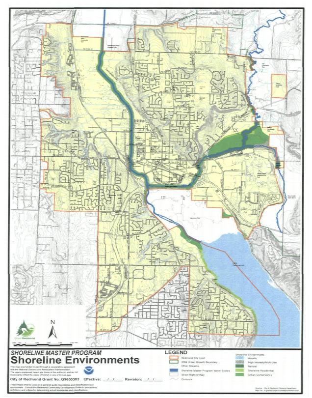
There are five shoreline environments. These designations are applied to homogenous areas and include policies to guide development of shoreline areas. These shoreline environments, as shown on the Shoreline Environments Map, incorporated as part of this paragraph, will be applied to the following areas:
◊ Sammamish River North of the Puget Sound Energy Right-of-Way: Designate the 200 feet of shoreline jurisdiction immediately along the river and associated wetlands Urban Conservancy on both sides of the river.
◊ Sammamish River South of the Puget Sound Energy Right-of-Way to Lake Sammamish: Designate the King County Sammamish River Park as Urban Conservancy and designate the balance of the adjacent property within the 200-foot shoreline jurisdiction as High-Intensity/Multi-Use. This designation shall be coincidental with the King County park property, which is approximately 100 feet in width, as of January 1, 2008. The area south of Marymoor Park (west side of river) is designated as Urban Conservancy.
◊ Lake Sammamish: Designate the shoreline as Shoreline Residential and the water surface as Aquatic. Associated wetlands at the north end of the lake should be designated Urban Conservancy.
◊ Bear and Evans Creeks:
♦ West of Avondale Road: Designate a 150-foot-wide Urban Conservancy strip with the balance (outer 50 feet) of the shoreline designated as High-Intensity/Multi-Use. This should be modified to reflect the SR 520 right-of-way south of Bear Creek.
♦ East of Avondale Road: Designate a 150-foot strip Natural along both sides of the creeks, with the balance of the wetland and 100-year floodplain outside of this 150-foot corridor on the north side of the creeks as Urban Conservancy environment.
❏ The area designated for residential density transfers near Avondale Green (near Avondale Road) should be designated Shoreline Residential.
❏ South of Bear Creek the remainder (outer 50 feet) of the shoreline jurisdiction outside of the 150-foot Natural designation should be High-Intensity/Multi-Use.
❏ Evans Creek south of Union Hill Road should be entirely Natural. Provided, however, that for the heavily developed Reach 2 of Evans Creek, extending east from 188th Avenue NE, then south to NE Union Hill Road, designate a 25-foot-wide strip as Natural along both sides of the creek, and designate the remainder 175-foot-wide strip as High-Intensity/Multi-Use. Where the Shoreline jurisdiction extends beyond 200 feet, on the north (or east) side of the creek, the shoreline jurisdiction shall be designated as High-Intensity/Multi-Use where, as of January 1, 2008, the land is disturbed by clearing or grading (not associated with agriculture but associated with the business operations at the site), industrial uses, commercial uses, structures, or pavement and Natural for all distance beyond the line of development.
Policies
SF-1
Provide a comprehensive shoreline environment designation system to categorize Redmond’s shorelines into similar shoreline areas to guide the use and management of these areas.
Shoreline environments are designations applied to similar shoreline areas to guide the use and management of these areas. The following policies describe the purpose of each environment, the criteria used to designate the environment, and some management policies specific to the environment. Redmond has five different environments: Aquatic, Natural, Urban Conservancy, Shoreline Residential, and High-Intensity/Multi-Use.
SL-1
Aquatic Environment.
Purpose. The purpose of this designation is to protect, restore, and manage the unique characteristics of the aquatic environment by managing use activities and by assuring compatibility between upland and aquatic uses and ensuring that shoreline ecological functions are protected and restored over time. It is designed to promote the wise use of the natural features and resources of water areas that are substantially different in character from those of adjoining uplands. Allowed uses are those that require an open water location.
Designation Criteria. Aquatic areas apply to all lakes subject to this program waterward of the ordinary high water mark. This designation does not apply to rivers and creeks subject to this program.
Management Policies.
1. Provisions for aquatic environment shall be directed towards maintaining and restoring shoreline ecological functions.
2. Uses that cause significant ecological impacts to critical freshwater habitats shall not be allowed.
3. Uses and modifications shall be designated and managed to prevent degradation of water quality and alteration of natural hydrographic conditions.
4. Structures that are not water-dependent and uses that will substantially degrade the existing character of the area are prohibited.
5. New over-water structures for water-dependent uses or public access are allowed provided they will not preclude attainment of ecological restoration.
6. Limit the size of new over-water structures to the minimum necessary to support the structure’s intended use.
7. Multiple-use over-water facilities are encouraged in order to reduce the impacts of shoreline development and increase effective use of water resources.
8. Developments within the aquatic environment shall be compatible with the adjoining upland environment.
9. Diverse public access opportunities to water bodies should be encouraged and developed and shall be compatible with the existing shorelines and water body uses and environment.
10. In appropriate areas, fishing and recreational uses of the water should be protected against competing uses that would interfere with these activities.
11. All developments and activities using navigable waters or their beds should be located and designed to minimize interference with surface navigation, to minimize adverse visual impacts, and to allow for the safe, unobstructed passage of fish and animals, particularly those whose life cycles are dependent on such migration.
12. Fills shall be prohibited except for shoreline restoration.
13. Underwater pipelines and cables shall not be allowed unless they are the best location due to the nature of the facility and the adverse environmental impacts are not significant or can be shown to be less than the impact of upland alternatives. When allowed, such facilities shall include adequate provisions to ensure against substantial or irrevocable damage to the environment.
SL-2
Natural Environment.
Purpose. The natural environment shall preserve and restore those natural resource systems existing relatively free of human influence and those shoreline areas possessing natural characteristics intolerant of human use or unique historical, cultural, or educational features. These systems require severe restrictions on the intensities and types of uses permitted so as to maintain the integrity of the ecological functions and ecosystem-wide processes of the shoreline environment.
Designation Criteria. Areas to be designated Natural shall reflect one or more of the following criteria:
1. Wildlife habitats.
a. A shoreline area that provides food, water, or cover and protection for any rare, endangered, or diminishing species, or for significant populations of flora or fauna during critical stages of their life cycle.
b. The shoreline is especially sensitive to human disturbance and important for the conservation and recovery of threatened and endangered species.
c. A seasonal haven for concentrations of native animals, fish or fowl, such as a migration route, breeding site, larval rearing grounds, or spawning site. This shall include:
i. Salmon and steelhead spawning areas.
ii. Salmon and steelhead migration routes and rearing areas that have not been significantly modified by human activities.
d. The shoreline is ecologically intact and therefore currently performing an important, irreplaceable function or ecosystem-wide process that would be damaged by human activity.
2. Areas of scientific and educational value.
a. Areas considered to best represent basic ecosystems and geologic types that are of particular scientific and educational interest.
b. Shoreline areas that best represent undisturbed natural areas.
c. Shoreline areas with established histories of scientific research.
3. Areas of scenic or recreational value.
a. Those shoreline areas having an outstanding or unique scenic feature in their natural state.
b. Areas having a high value in their natural states for low-intensity recreational use.
4. Other criteria.
a. Areas where human influence and development are minimal.
b. Areas that have been degraded but which are capable of easily being restored to a natural or near-natural condition or are capable of natural regeneration if left undisturbed.
c. Other unique natural features relatively intolerant of human use or development, such as: marshes, bogs and swamps, white water rapids, and waterfalls.
d. The shoreline is unable to support new development or uses without significant ecological impacts to ecological functions or risk to human safety.
Management Policies.
1. Any use or development that would potentially degrade the ecological functions and natural value or significantly alter the natural character of the shoreline area shall be severely limited or prohibited.
2. The following new uses are not allowed in the natural environment:
a. Residences, except limited single-family residential development may be allowed as a conditional use provided an equal or greater level of ecological functions results.
b. Commercial uses.
c. Industrial uses.
d. Agriculture.
e. Nonwater-oriented recreation. Foot trails may be permitted so long as they create no significant adverse impacts on the environment.
f. Roads and utility corridors that can be located outside of natural designated shorelines. Roads and their associated bridge crossings that must perpendicularly cross a Natural designated shoreline shall be processed through a shoreline conditional use.
3. New development or significant vegetation removal that would reduce the capability of vegetation to perform normal ecological functions is prohibited.
4. Limited access may be permitted for scientific, historical, cultural, educational, and low-intensity water-oriented recreational purposes, provided that no significant adverse ecological impact on the area will result on site.
5. Uses that are consumptive of physical, visual, biological, historic and cultural resources shall be prohibited.
6. Physical alterations should only be considered when they serve to protect or restore a significant, unique, or highly valued feature that might otherwise be degraded or destroyed.
7. Uses and activities permitted in locations adjacent to shorelines designated Natural shall be compatible and shall ensure that the integrity of the natural environment will not be compromised.
8. Developments within the natural environment should be compatible with uses and activities in adjacent (including aquatic) environments.
SL-3
Urban Conservancy Environment.
Purpose. The purpose of the Urban Conservancy environment is to protect and restore their historic ecological functions. The Urban Conservancy environment shall protect, conserve, and manage existing natural resources and valuable historic and cultural areas in order to achieve sustained resource use and provide recreational opportunities. The Urban Conservancy environment shall also protect environmentally sensitive areas that are not suitable for intensive use, such as salmon and steelhead habitats, riparian corridors, and wetlands. Examples of uses that are appropriate in a conservancy environment include dispersed outdoor recreation activities, environmental restoration and enhancement, and similar low-intensity uses and activities.
Designation Criteria. Areas designated Urban Conservancy should generally reflect one or more of the following criteria:
1. Areas subject to severe biophysical limitations or that play an important part in maintaining the regional ecological balance, such as:
a. Salmon and steelhead migration routes and rearing areas that have been significantly modified by human activities.
b. Riparian corridors.
c. Areas within shoreline jurisdiction subject to severe erosion.
d. Unstable banks or bluffs within shoreline jurisdiction.
e. Floodplains.
2. Areas where intensive development or uses would interfere with natural processes and result in significant damage to other resources.
3. Areas that retain important ecological functions, even though partially developed.
4. Areas that have potential for ecological restoration.
5. Areas that have potential for development that incorporates ecological restoration.
6. Areas suitable for a mix of water-related or water-enjoyment uses with other uses that allow a substantial number of people to enjoy the shoreline.
7. Areas of significant passive recreational value.
8. Areas with extensive or very important historic or cultural resources.
Management Policies.
1. Preferred uses in the Urban Conservancy environment are those that are nonconsumptive of the physical and biological resources of the area and activities and uses of a nonpermanent nature that do not substantially degrade or alter the existing character of the area. Nonconsumptive uses are those uses that use resources on a sustained-yield basis while minimally reducing opportunities for other existing and future uses of the resources of the area. Shoreline habitat restoration and environmental enhancement is a preferred use.
2. Activities and uses that would substantially degrade or permanently deplete the physical or biological resources of the area shall be prohibited.
3. New development and redevelopment shall be limited to that which is compatible with the natural and biological limitations of the land and water and will not require extensive alteration of the shore.
4. Development in the Conservancy environment shall be designed to protect the shoreline corridor and its biological systems.
5. Activities or uses that would strip the shoreline of vegetative cover, cause substantial erosion or sedimentation, or adversely affect wildlife or aquatic life are prohibited.
6. Agricultural and recreational activities that will not be detrimental to the shoreline character, scenic quality, and natural systems, such as sediment transport and geohydraulic processes, should be encouraged.
7. Commercial, manufacturing, and industrial uses other than low-intensity agricultural and commercial practices shall be prohibited.
8. Limited single-family residential development may be allowed as a conditional use provided an equal or greater level of ecological functions results. Mitigation should be on site.
9. Public access and public recreation objectives should be implemented whenever feasible provided significant ecological impacts can be mitigated.
10. Preservation of natural resources, the natural environment, and natural processes shall have priority over public access, recreation, and development objectives whenever a conflict exists.
SL-4
Shoreline Residential Environment.
Purpose. The purpose of the Shoreline Residential environment is to accommodate residential development and appurtenant structures that are consistent with this element and the protection and restoration of ecological functions and properly functioning condition for threatened and endangered species. An additional purpose is to provide appropriate public physical access and recreational uses.
Designation Criteria. Areas that are predominantly single-family or multi-family residential development or are planned and platted for residential development.
Management Policies.
1. Development should be permitted only in those shoreline areas where adequate setbacks or buffers are possible to protect ecological functions, where there are adequate access, water, sewage disposal, and utilities systems and public services available, and the environment can support the proposed use in a manner which protects or restores the ecological functions.
2. Densities or buffers/setbacks in the “shoreline residential” environment shall be set to protect the shoreline ecological functions, taking into account the environmental limitations and sensitivity of the shoreline area, the level of infrastructure and services available, and other comprehensive planning considerations.
3. Development standards for setbacks or buffers, shoreline stabilization, vegetation conservation, critical area protection, and water quality shall be established to protect and, where significant ecological degradation has occurred, contribute to the restoration of properly functioning condition and other ecological functions over time.
4. Multi-family and multi-lot residential greater than nine lots and recreational developments should provide joint use for public physical access and community recreational facilities where possible on adjacent lots.
5. Access, utilities, and public services should be available and adequate to serve existing needs and/or planned future development.
6. Industrial, non-water-enjoyment commercial, wholesale, retail development, churches, and other institutional uses shall be prohibited. Small scale retail, such as pedestrian-oriented carts/kiosks, produce or handcrafts stands up to 120 square feet, and cartop boat rentals (as noted in Table 1 of RCDG 20D.150.50-030), are permitted in City-owned parks.
SL-5
High-Intensity/Multi-Use Environment.
Purpose. The High-Intensity/Multi-Use environment is an area of moderate- to high-intensity land uses, including residential, commercial, and manufacturing development. The purpose of this environment is to ensure optimum use of shorelines that are either presently urbanized or planned for intense urbanization while providing no net loss of existing ecological functions and restoring ecological functions in areas that have been previously degraded. Development in high-intensity/multi-use areas should be managed so that it enhances and maintains the shorelines for a variety of urban uses, with priority given to water-dependent, water-related, and water-enjoyment uses. Measures should be taken to minimize adverse environmental impacts.
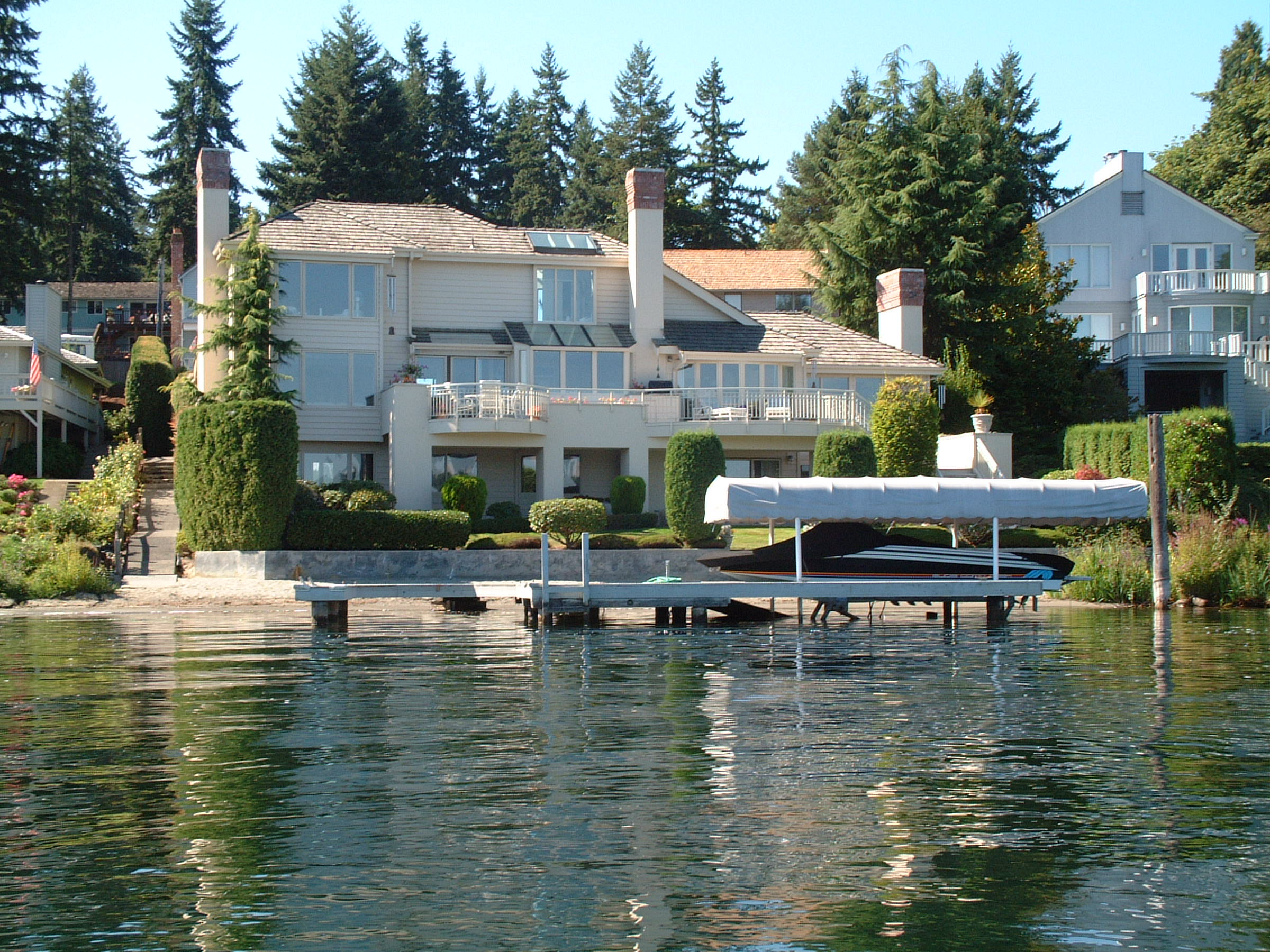
Residences on Lake Sammamish
Designation Criteria. Areas to be designated High-Intensity/Multi-Use should generally reflect all of the criteria:
1. Shorelines used or designated in the Comprehensive Land Use Plan Map for high-intensity commercial, manufacturing or recreational use, mixed-use, or for residential development at four or more housing units per acre.
2. Shorelines of lower intensity use within the urban growth area where surrounding land uses are urban and urban services are available or planned.
3. If the area is undeveloped, the area shall not have severe biophysical limitations to development, such as steep slopes, salmon and steelhead spawning or rearing habitats, on the landslide side of Bear Creek east of Avondale Road.
4. The shorelines along the following waterbodies shall not be designated High-Intensity/Multi-Use environment:
a. The Sammamish River north of the Puget Sound Energy right-of-way.
b. The north side of Bear Creek east of Avondale Road.
c. Bear Creek north of its confluence with Evans Creek.
d. The north and east sides immediately adjacent to Evans Creek and both sides of Evans Creek south of Union Hill Road.
Management Policies.
1. Because shorelines are a finite resource and because urban use tends to preclude other shoreline uses, emphasis should be given to directing new development into already developed areas consistent with this master program and the Redmond Comprehensive Plan.
2. New development shall cause no net loss of shoreline ecological functions.
3. Where feasible, visual and physical access to the shoreline should be required.
4. Aesthetic objectives shall be actively implemented by means such as sign control regulations, appropriate development siting, screening and architectural standards, and maintenance of natural vegetative buffers.
5. Full use of existing High-Intensity areas shall be achieved before further expansion of the environment is allowed. Environmental cleanup of previously developed shorelines and redevelopment of underutilized areas shall be encouraged.
6. Reasonable long-range projections of regional economic need shall guide the amount of shoreline designated High-Intensity/Multi-Use.
7. First priority shall be given to water-dependent uses. Second priority shall be given to water-related and water-enjoyment uses. Non-water-oriented uses should not be allowed except:
a. As part of a mixed-use development; or
b. In limited situations where they do not conflict with or limit opportunities for water-oriented uses and nonmixed uses or on sites where there is no direct access to the shoreline or the waterbody is not navigable; or
c. Where the site is physically separated from the shoreline by another property or public right-of-way.
Multi-family development on Lake Sammamish
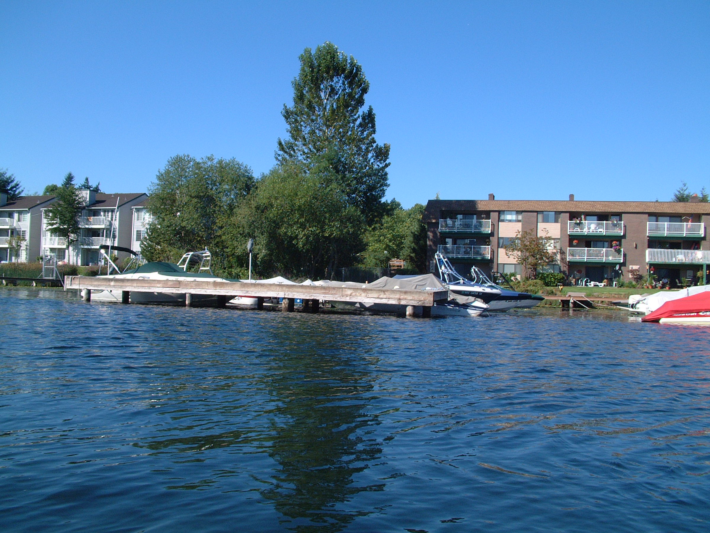
In High-Intensity/Multi-Use environment areas that are physically separated from the shoreline by other property or public right-of-way and there is thus no direct access from such areas to the shoreline, (a) water-dependent, water-related, and water-enjoyment uses, while encouraged, are unlikely to be conducted in the High-Intensity/Multi-Use environment areas and (b) non-water-oriented development shall be allowed without such water-oriented uses. Existing industrial, commercial and light manufacturing uses may continue to operate and expand even if located within the required stream buffer, provided the expansion will create no net loss of shoreline ecological functions and will not extend any structure containing the use closer to the shoreline. Where the land is actively being used as part of a legitimate business operation in the shoreline buffer, such land including either structures or active operational areas, established prior to January 1, 2003, may continue to operate. New structures, pavement, and other improvements are permitted within this area so long as incremental environmental benefit is provided and no net loss of shoreline ecological functions is demonstrated.
B. The Shoreline Environment
Redmond’s shoreline areas provide some of the most valuable natural amenities and resources found in the community. They provide corridors of vegetation and open space in otherwise highly urbanized areas, and habitat for fish and wildlife. In addition, shoreline areas and their associated floodplains, aquifers and wetlands fulfill a vital function in the management of storm water and water quality. Although not within the City of Redmond corporate limits, Marymoor Park provides an environmental asset to the City and the Lake Sammamish shoreline ecosystem. The value of this area of the lake as wildlife habitat is readily apparent in light of conditions elsewhere around the lake. Comprised of a variety of natural systems contained within relatively narrow corridors of land, shoreline areas are particularly vulnerable to development pressures. As a result, shoreline uses must be carefully designed and located to respect the development limitations presented by each natural system, which may be minimal or severe, depending on the type of system or hazard present and on the community’s goals for environmental protection.
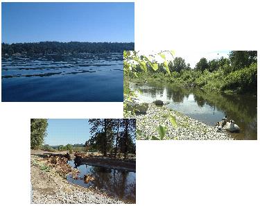
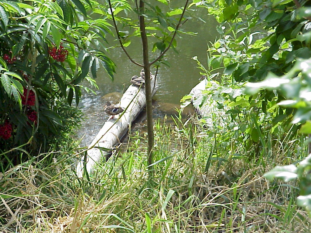
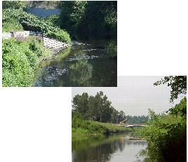
The Sammamish River, Lake Sammamish, Bear Creek and Evans Creek are important fish habitats. All four water bodies have fish that reside year-round, and that are classified by the Washington State Department of Fish and Wildlife as priority species. Bear Creek and Evans Creek provide critical spawning habitat for resident fish, salmon and steelhead. The Sammamish River, Lake Sammamish, Bear Creek, and Evans Creek all are important migration routes for salmon and steelhead.
Lake Sammamish supports salmon, rainbow and cutthroat trout, along with kokanee, yellow perch, small mouth bass, carp and catfish. The entire lake is an important link in the salmon and steelhead migration route, while the south end of the lake is an important salmon rearing area.
As a result of the channel and bank alterations, fish habitat in the Sammamish River and its tributaries north of Downtown has been almost totally eliminated. While the main channel of the Sammamish River is not considered quality habitat, it has value as a “fish freeway” for tens of thousands of salmonids that use the Sammamish watershed and larger Lake Washington basin. The Sammamish River, however, does provide for feeding and rearing, and some limited, but significant, spawning areas. Among the fish that use the river are several state priority species, including the federally listed Puget Sound Chinook, and anadromous and resident fish.
Bear Creek is one of the most important spawning and rearing habitats, particularly for Coho salmon, in the Lake Washington basin, and one of the most important salmon streams in King County. For its size, Bear Creek is considered by the State to be the most important salmon-spawning stream in Washington. Bear Creek supports Coho, Chinook and sockeye salmon, and steelhead trout. Resident fish in the creek consist of cutthroat trout, rainbow trout, and kokanee. The State considers all of Bear Creek a “critical spawning area” for these resident fish. All of the creek’s salmon and steelhead stocks are considered wild (nonhatchery).
Despite certain areas of degraded habitat, salmon have been observed in both Evans Creek and its tributaries. A section of Evans Creek near 196th Avenue NE is a major spawning area for Coho, and is considered a Priority Habitat by the Washington State Department of Fish and Wildlife.
SF-2
Protect and restore the natural resources and ecological functions of the shoreline, including wildlife habitat, fisheries and other aquatic life, natural hydrologic processes, and shoreline vegetation consistent with the planned uses of the shorelines. Ensure no net loss of shoreline ecological functions.
SL-6
Use the City’s established permit tracking program to periodically evaluate the effectiveness of the Shoreline Master Program update for achieving no net loss of shoreline ecological functions with respect to shoreline permitting and exemptions. Prepare an evaluation report every seven years when the SMP is required to be updated under RCW 90.58.080(4).
SL-7
Protect habitats critical to the lifecycle of salmon and steelhead, such as migration, rearing, feeding and spawning areas.
SL-8
Prohibit realignment or channelization of streams, clearing of adjacent native vegetation or large woody debris, and water withdrawals and diversions in salmon and steelhead habitats, except for the purpose of habitat restoration and enhancement. Allow and encourage restoration that reconstructs a meandered channel or channel diversity.
SL-9
Locate over-water structures when allowed outside of salmon and steelhead spawning areas and design these structures to achieve no net loss of shoreline ecological functions. Use open piling structures that minimize disruption of spawning beds and underwater shading rather than floating structures, landfills or solid structures.
SL-10
Design and construct bulkheads or other shoreline protective structures on Lake Sammamish in the vicinity of sockeye salmon spawning beds to minimize erosion of the beach in front of the bulkhead and to achieve no net loss of shoreline ecological functions. Encourage strongly the use of alternatives to bulkheads.
SL-11
Encourage joint use and shared use docks over single-use docks to reduce adverse impacts on salmon and steelhead. Encourage alternatives to docks, such as floats or lifts.
SL-12
Design and construct new and replacement docks and piers on Lake Sammamish to minimize adverse impacts on salmon and steelhead and to achieve no net loss of shoreline ecological functions.
Habitat Restoration and Enhancement
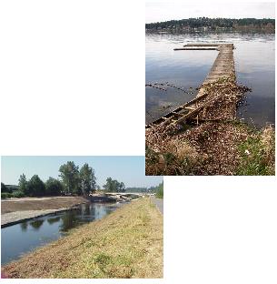
The extent of natural fish and wildlife habitat in shoreline areas has been greatly reduced by inadequately planned development, as has the quality of remaining habitat areas. When the Sammamish River and lower Bear Creek were channelized, much of the habitat in the river and creek was lost. Aspects of fish and wildlife habitat that have been impacted by development include fragmented vegetation buffers, exotic and invasive species dominating buffers, lack of large trees and other habitat features, and water quality degradation due to high temperatures and sedimentation.
Public and private efforts are needed to restore habitat areas. Opportunities include public-private partnerships, partnerships with other agencies and tribes, capital improvement projects, and incentives for private development to restore and enhance fish and wildlife habitat.
SL-13
Identify the key role of the City’s Shoreline Restoration Plan as improving shoreline ecological functions over time.
SL-14
Continue to acquire shoreline areas, particularly those areas with vulnerable or fragile natural features, for the purpose of protection, restoration and study.
SL-15
Include provisions for shoreline vegetation restoration, fish and wildlife habitat enhancement and, where feasible, retrofitting of existing capital improvements (e.g., outfalls) with habitat improvements in City capital improvement projects. Design these projects to achieve no net loss of shoreline ecological functions.
SL-16
Reintroduce, as opportunities become available, the natural channel characteristics of the Sammamish River by moving levee embankments away from the channel, removing barriers to connect streams and wetlands to the river, changing in-stream channel cross-sections, revegetating the riverbank, and placing complex large woody debris.
Tree Protection and Landscaping
The original conifer forests covering the Redmond planning area consisted mainly of Douglas fir, western hemlock, Sitka spruce, and western red cedar. Big leaf maple was common in well-drained stream bottomlands; in wetland and riparian areas western red cedar followed the fast-growing species, such as red alder and black cottonwood. Due to extensive logging and urbanization, much of the conifer forests in the area are gone. Stream valleys, providing the most fertile and productive land, were among the first to be cleared. Reconstruction of stream channels, particularly the Sammamish River, followed. As a result, many sections of Redmond’s shoreline are sparsely vegetated and lack large stands of trees that provide critical shade.
Riparian, or stream bank, vegetation is a critical component of quality fish and wildlife habitat. Vegetation provides food and cover for wildlife; it contributes the organic matter and large woody debris (e.g., fallen logs) that fish need. Larger trees provide perching and nesting places for herons and raptors. Riparian vegetation also plays a vital role in water quality. It not only moderates water temperatures, it reduces the potential for bank erosion and the subsequent sedimentation that can clog streams. Side benefits are self-evident in the enhanced aesthetic and recreational value of clear, tree-lined streams.
Vegetation along Sammamish River
SL-17
Encourage incorporation of substantial internal and perimeter landscaping in shoreline development. Encourage consolidation of open space and building setbacks to provide landscaped corridors, clustering development, use of native plants, and perimeter tree plantings.
SL-18
Protect and preserve significant trees within the shoreline jurisdiction to the maximum extent possible. Replace the ecological functions of significant trees removed, such as habitat and shading functions, when removal becomes necessary. Give preference, where safe, to creation of upland snags over removal of the entire tree.
SL-19
Minimize the area used for lawns and nonnative vegetation in the Sammamish Watershed. Minimize the use of herbicides, fertilizers and pesticides. Apply herbicides, fertilizers and pesticides, if used, in a manner that minimizes their transmission into the lake.
SL-20
Retain or replant native vegetation along shorelines to reduce the flow of herbicides, fertilizers and pesticides into the water bodies and to provide for improved fish and wildlife habitat.
Shoreline Buffers
Continuous buffers of riparian and lakeshore vegetation are essential to protecting wildlife, water quality, and critical fish habitat. Buffers reduce water quality impacts by providing for filtering of sediments and pollutants from runoff, and by reducing dust deposition from parking areas and other actively used areas. In addition to providing essential food and shelter, the trees and shrubs in buffers also screen fish and wildlife from noise, glare, and other adverse impacts of development and nearby human activity. Of the remaining wildlife corridors in the community, most are along shoreline buffers. For humans, the green corridors of shoreline vegetation provide areas for physical, mental and emotional rejuvenation. Redmond’s shorelines would not be the valuable natural and cultural amenities that they are without vegetated shoreline buffers.
Not all of Redmond’s shorelines are equally developed, nor equally vulnerable to the pressures of development. For example, semirural areas along upper Bear Creek contrast sharply with the intense commercial development that characterizes the creek’s path through Downtown. The Sammamish River and Lake Sammamish, with their greater area and volume, are less sensitive to development impacts than are the diminutive Bear and Evans Creeks. Because Lake Sammamish’s shoreline is largely developed, there are no buffer requirements along the lake. There is, however, a lakefront building setback. Redmond’s shoreline buffer policies reflect these variations between shoreline areas. Given the local and regional significance of Redmond’s shorelines for fish and wildlife habitat, shoreline buffer policies are based on the recommendations of fish and wildlife habitat managers and scientists throughout western Washington. At the same time, Redmond’s buffer policies balance the evolving knowledge of habitat managers with local development conditions. Where shorelines have already been intensely developed, Redmond’s buffer policies generally reflect existing setbacks and anticipated levels of growth, while maintaining most natural functions of the shoreline corridor.
SL-21
Provide native vegetated buffers on the Sammamish River, Bear Creek, and Evans Creek sufficient to protect the water body and its fish and wildlife resources from the adverse effects of development adjacent to the water body, with the goal of achieving a mixed mature riparian forest.
SL-22
Allow development flexibility where private development incorporates the restoration of shoreline buffers and habitat features, through such incentives as reduced building setbacks, or other modifications of site development standards that do not reduce buffer widths.
SL-23
Remove invasive species from the shoreline buffer area from multi-family residential, commercial, office, research and development, manufacturing, industry or similar uses where the uses are located adjacent to the Sammamish River, Bear Creek or Evans Creek. Replant the buffer area with native trees and understory vegetation upon development or redevelopment.
SL-24
Use the shoreline variance process for review of development of shoreline property that is largely encumbered by shoreline regulations in order to achieve reasonable use.
SL-25
Sammamish River:
North of the Puget Sound Energy powerline crossing the shoreline buffer shall consist of a 150-foot inner buffer plus a 50-foot outer buffer, measured from the ordinary high water mark.
South of the Puget Sound Energy powerline crossing to Lake Sammamish the shoreline buffer shall be a minimum of 150 feet, measured from the ordinary high water mark.
Trails and other public access features may be located in the Sammamish River buffers, but should generally be no closer than 75 feet to the ordinary high water mark. View points, spur trails, boat launches and similar public access features that provide visual access and direct water contact may be allowed closer than 75 feet.
SL-26
Bear and Evans Creeks:
West of Avondale Road the shoreline buffer shall be a minimum of 150 feet, measured from the ordinary high water mark.
East of Avondale Road the shoreline buffer consists of a 150-foot inner buffer plus a 50-foot outer buffer, measured from the ordinary high water mark.
Trails and other public access features may be located in the Bear and Evans Creeks buffers but shall be no closer than 100 feet to the ordinary high water mark. View points, spur trails, multi-use nonmotorized trails and trail crossings as identified on an adopted City plan, and similar low-impact public access features that provide visual or controlled access to the creeks may be allowed closer than 100 feet.
One of the most damaging, long-term impacts to Redmond’s salmon and steelhead habitat has been the loss of vegetated shoreline buffers. In addition to the ongoing efforts by the City and other agencies to restore buffers, private development that impacts buffers must also play a role in their restoration. Shoreline provisions require the restoration of a minimum buffer. This will help eliminate ongoing gaps in the protection of the shoreline natural environment within a specified, near-term time period.
SL-27
Encourage the establishment of 50-foot-wide vegetated buffers along the Sammamish River, Bear Creek and Evans Creek where no buffer or a buffer of less than 50 feet now exists. Encourage this on a cooperative, incentive-based approach, fostering partnerships with the City, property owners, and other organizations if appropriate. Periodically evaluate for success in achieving this goal in a 10-year planning horizon.
SL-28
Establish the setback on Lake Sammamish as 35 feet wide measured from the ordinary high water mark. Allow reduction of building setbacks if the setback area is revegetated with primarily native vegetation. Establish uses within the setback in the Shoreline Regulations.
C. Natural Environment
The adopted Conservation and Natural Environment Element of the City of Redmond Comprehensive Plan contains a comprehensive set of critical areas and tree preservation and landscape enhancement policies. These policies, NE-12 through NE-113, shall also be a part of the City of Redmond Shoreline Master Program.
D. Public Access
SF-3
Provide a comprehensive and focused system of physical, visual and cultural access to Redmond’s shorelines.
Sammamish River Trail
SF-4
Enhance physical, visual and cultural access where existing access is inadequate.
SF-5
Maintain shoreline views.
SF-6
Acquire shoreline lands for the purpose of providing public access.
SF-7
Minimize impacts on adjacent uses and the natural environment through the appropriate design of public access.
Providing Physical Access
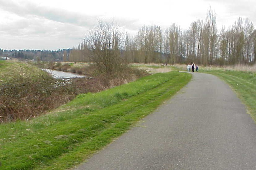
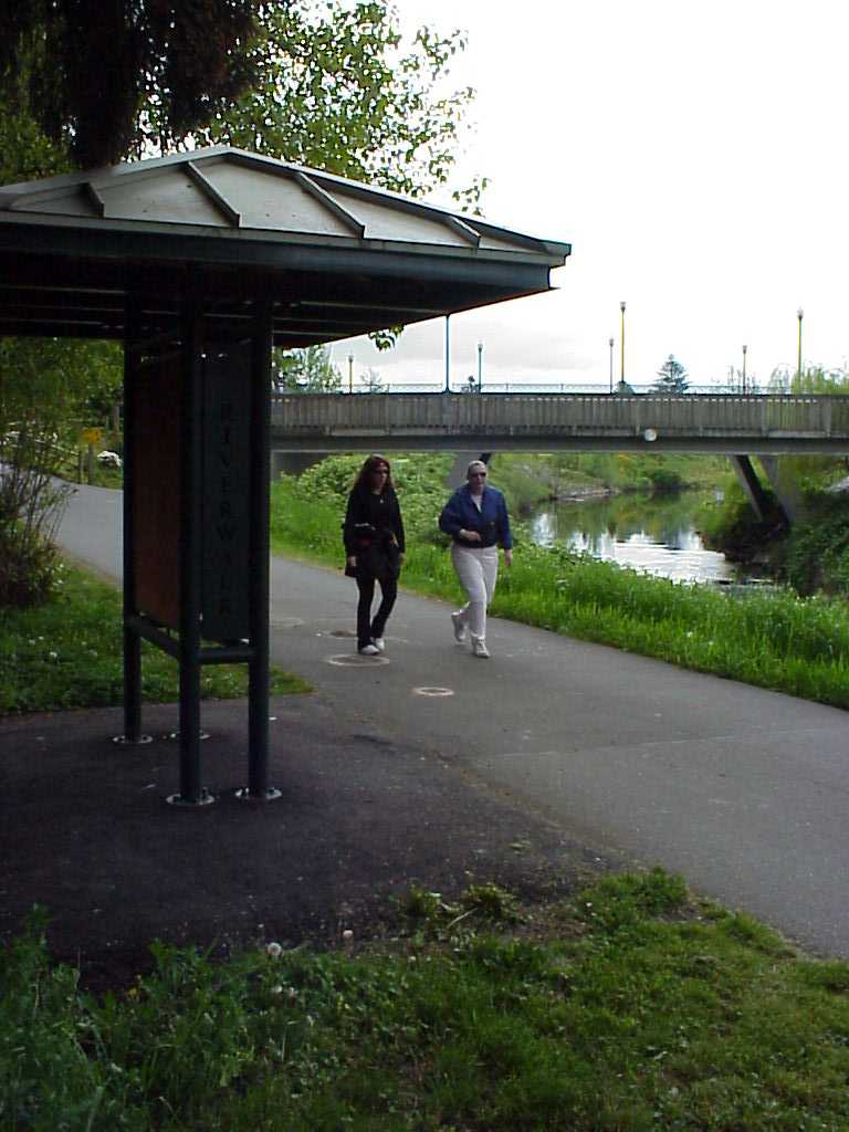
In general, Redmond is rich in opportunities for physical public access to the shoreline, through existing shoreline trails and parks. However, there are gaps and deficiencies in this system. For example, along the Sammamish River Trail access through existing developments to the trail corridor is often unavailable.
Developments near or just outside shoreline areas are often cut off from existing parks and the trail by a phalanx of buildings, parking lots and busy arterials. Redmond’s shorelines are part of a larger system of community amenities and open space. The trail systems also need to be completed. Where access is provided, amenities that may be needed to make it convenient and functional, such as a bench or parking area, may be absent.
Outside of single-family residential areas, the need to address public physical access increases as shoreline areas develop. Bringing residents, employees, and customers into the shoreline area increases demand for public physical access. If adequate physical access is not provided, this demand may result in informal trails that are unsafe, destructive of private property (e.g., by trampling landscaping), and hazardous to important plants and animals. Shoreline developments can also interfere with visual access by blocking views, and can interfere with informal existing public physical access. In these cases, when public physical access is allowed, it shall be designed and located to minimize or prevent these potential adverse impacts.
At the same time, shoreline development directly benefits from public physical access, because it attracts customers, tenants, employees and other users. A continuous, community and region-wide system of public physical access is even more beneficial. For example, residents and businesses located along the Sammamish River Trail and the Bear Creek and Evans Creek trails will benefit from a major amenity that provides for recreation, visual access and connections to other areas of the City.
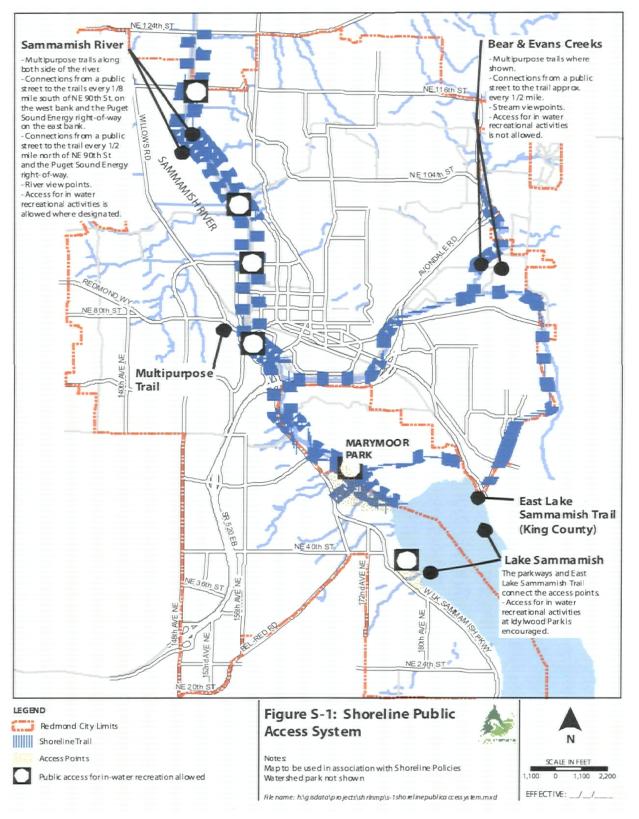
Shoreline Public Access System Map
Figure S-1, Public Access System, identifies Redmond’s regional shoreline public access system. The improvements shown on the map have been located to provide for a variety of recreational and educational opportunities while protecting the native plants, fish, and animals that depend on Redmond’s shorelines. Each type of access provided for on the map is described in the following sections.
Linear Trails
Linear trails parallel a river, creek, or lakeshore. The trail provides access along shorelines, although it may be set back from the shore to protect the natural environment. In addition to the trail, supporting facilities will be provided at appropriate locations. The supporting facilities include benches, interpretive signs and parking lots. Linear trails will be provided on the Sammamish River, parts of Bear Creek, and parts of Evans Creek.
Sammamish River Trail
Shoreline Access Trails
Shoreline access trails provide connections to linear trails or other shoreline features from a public street. Shoreline access trails will be provided every one-eighth mile to half mile depending on the location, intensity of nearby uses, and the environmental sensitivity of the area. Shoreline access trails shall be designed to protect the shoreline environment. Public access would occur only on publicly owned lands and shall be designed to discourage potential trespass onto adjacent private properties. Parking for shoreline users may be located near the street where shoreline access trails are located.
Accesses for In-Water Recreation
On the Sammamish River, direct access to the river will be allowed at designated locations for in-water activities, such as hand-launching boats, fishing and other recreational activities. In-water activities must be located and managed to protect the native plants, fish and wildlife that use the river. Figure S-1 identifies general areas where in-water recreational access facilities may be located. Several types of access may occur at each designated location. Where the designation is shown in the middle of the river, in-water access may occur on either or both sides of the river. Where an approved King County or City of Redmond Park Master Plan provides for in-water access to the Sammamish River, in-water access facilities may also be located in that park. Where consistent with the policies in this element, in-water accesses are allowed in any access point or park on Lake Sammamish.
To protect the important native plants, fish and wildlife on Bear and Evans Creeks, direct contact with the water for in-water recreation is discouraged.
View Points
On the Sammamish River, Lake Sammamish, Bear Creek and Evans Creek, water viewpoints that are designed and located to protect the natural environment should be provided.
Access Points
On the west and east shores of Lake Sammamish access points will be provided. Access points consist of streets, trails, and parks that connect a public street with the lakeshore. Parking for shoreline users may be located near the street where shoreline access trails are located. As it is now, the vast majority of the lakeshore will be privately owned. The access points will be designed to protect the privacy and quiet of neighboring residences. The access points will be connected by sidewalks and bikeways along West Lake Sammamish Parkway and along East Lake Sammamish Parkway and the proposed East Lake Sammamish Trail. On Lake Sammamish, direct water access, including swimming docks, boat launches, and fishing areas, is encouraged.
SL-29
Require public and private developments to provide the type of physical public access to the shoreline as shown on Figure S-1, the Shoreline Public Access System map. This requirement shall apply to all public projects. It shall also apply to any private development of:
♦ Ten or more housing units;
♦ Divisions of land creating 10 or more lots or any number of lots to be occupied by 10 or more housing units or nonresidential uses of any size;
♦ Nonresidential developments or nonresidential redevelopments of any size.
These public access requirements shall be subject to the nexus and proportionality tests laid out by the U.S. Supreme Court.
SL-30
Provide access for project occupants to the shoreline in residential developments of nine or fewer housing units or lots. Public access is not required.
SL-31
Design shoreline developments to include safe pedestrian linkages through the site to existing or planned shoreline public access facilities adjacent to the site, when required. Where required by the Shoreline Public Access System map, Figure S-1, links shall be dedicated for public use. These public access requirements shall be subject to the nexus and proportionality tests laid out by the U.S. Supreme Court.
While existing trail corridors along Redmond’s shorelines provide many outstanding opportunities for public access, there are few places within Redmond that allow one to get safely to the water’s edge. Along the Sammamish River, for example, steep, blackberry-covered banks make it difficult to get to or even see the water. Recreational activities that involve direct contact with the water, such as swimming and boating, are a highly valued part of the shoreline recreational experience. These areas should be located, designed, and managed to protect the native plants, fish, and wildlife that depend on Redmond’s shorelines. Access points should not be located in particularly vulnerable areas. Providing properly located access to the water’s edge can discourage the creation of unsafe paths by shoreline users. Controlled, limited access to the water can also help minimize potential disturbance of fragile areas by shoreline visitors.
SL-32
Allow access to the water’s edge where designated on the Shoreline Public Access System map, Figure S-1. Locate these access points and other access points where no significant impact on native plants, fish, and wildlife will occur. Locate these access points in areas where safe access can be provided.
In some shoreline locations, land use patterns limit opportunities to provide large-scale public access. Infrastructure corridors, such as utility easements, fire lanes, or stormwater detention areas, in appropriate locations, can serve a secondary purpose as pathways, or vegetated open space, as well as amenity areas for pedestrians or cyclists. Containing access in designated corridors may help also reduce the potential for trespass on private property in popular areas. However, this does not include creating a lakefront trail along the existing sewer or utility easement along Lake Sammamish’s waterfront. Similarly, other set-aside areas in a development, with no or limited improvements, might provide small-scale links to the larger shoreline access system. Open space buffers or native growth protection areas along ravines might provide private or public trail connections between upland residences and the shoreline.
SL-33
Require public access only on publicly owned land. This includes new publicly owned utility corridors and street rights-of-way. Design these elements within shoreline areas to incorporate public access appropriate to the size and function of the corridor or area. This requirement does not apply to utilities in easements on private property nor does it imply creating a lakefront trail along the existing sewer line easements along Lake Sammamish’s waterfront.
The City’s undeveloped street ends that abut Lake Sammamish, the Sammamish River, or Bear or Evans Creek have the potential to provide physical, visual and cultural access to the shoreline. They should be retained and used for public access.
SL-34
Do not vacate public street rights-of-way that abut shorelines or that connect to shoreline trail corridors where they are or can be used for shoreline public access unless an alternative corridor that affords better and safer public access is provided and permanently dedicated for public access.
Construction or improvements to transportation facilities within and adjacent to shorelines can diminish opportunities for public access. For example, street widenings may result in high-traffic corridors that are significant barriers between residences and the shoreline. However, transportation improvement projects can also improve public access. For example, a bridge may provide view opportunities, steps to the water’s edge, “gateway” design elements or interpretive signs. Both the Redmond Way Bridge and NE 90th Street Bridge across the Sammamish River have a river viewpoint built into them.
SL-35
Design street improvement projects to minimize potential adverse impacts to shoreline public access and, to the extent feasible, incorporate public access features, such as safe pedestrian and equestrian crossings, viewpoints, rest stops for bicycles, “gateway” design elements or interpretive features. Encourage access to the water’s edge where designated on the Shoreline Public Access System map, and where adverse impacts on native plants, fish, or wildlife will not result.
Many sections of Redmond’s shorelines contain older development that does not take advantage of a shoreline location. Redevelopment of existing development presents an opportunity to provide an on-site amenity for new employees, tenants or customers, and a community benefit, by providing public access where none exists or enhancing existing public access features. Policy SL-29 requires public access when new development or redevelopment occurs. Policy SL-36 provides for improvements to existing public access as properties redevelop or when new or improved public facilities are provided.
SL-36
Encourage public and private shoreline development and redevelopment to enhance physical, visual and cultural access, where designated public access already exists, by incorporating measures that serve users and minimize impacts on the natural environment and nearby uses. Such measures may include enhanced trail linkages, pedestrian furniture, shared parking, landscape screening, separating accesses and buildings by elevation differences and interpretive signs.
Capital improvements refer to public investments, such as streets, bridges, stormwater facilities, and utility corridors. These facilities provide an opportunity to add public access and supporting amenities, such as benches, interpretive displays, and viewpoints.
SL-37
Provide physical, visual, and cultural access to the shoreline on existing public capital improvements where practicable and compatible with natural shoreline features.
Protection of Visual Access
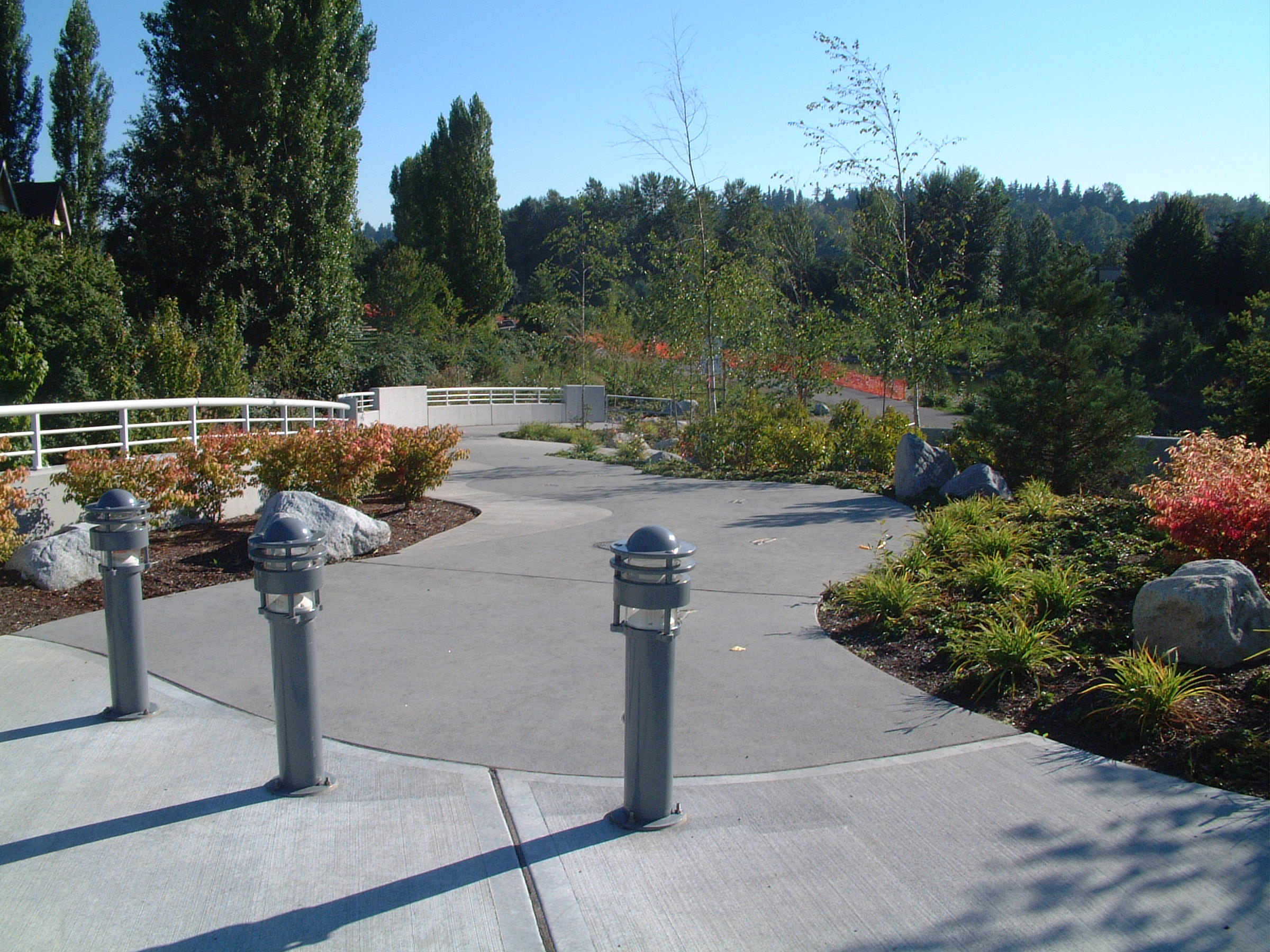
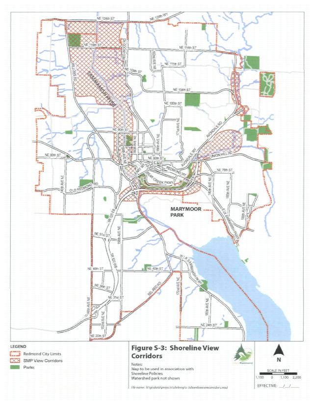
Lake Sammamish views, the open and pastoral vistas in the northern Sammamish River valley, and the distant views of Mount Rainier along Bear and Evans Creeks are valuable community amenities. This is readily apparent in community goal statements, recreational use patterns, and property values. Where physical access to the shoreline is unavailable, employees, residents, and visitors may still enjoy the visual and open space characteristics of the shoreline. Visual access is a high priority in the Shoreline Management Act.
Visual access to Redmond’s shoreline areas is mainly provided by existing parks and trails adjacent to the shorelines, and, in a few places, view corridors from major arterials or bridges. Developments can be designed to provide shoreline views and maintain existing view corridors. This may be accomplished by orienting windows and lobbies to the shorelines, using staggered building setbacks or breezeways, reducing building heights or widths, or other design strategies. Trees should not be removed to provide views after the fact. Restoration of the natural slope of the shoreline bank, such as the RiverWalk habitat restoration projects located at City Hall, can provide views of the water from the Sammamish River Trail and adjacent buildings. Acquisition of land for open space uses can increase the frequency of view corridors.
Redmond’s development regulations and the Shoreline Management Act restrict building heights in the shoreline jurisdiction in order to minimize intrusion into view corridors. However, tall buildings just outside the shoreline can block views from a number of residences and other development. A tiered system of building height limits can extend the visual benefits of the shoreline to a wider range of users.
SL-38
Maintain public view corridors as identified in RCDG 20D.42.50, Identification of Citywide Public View Corridors, where required, within the shoreline and from upland areas to the shoreline in shoreline developments, through appropriately designed building setbacks, height and bulk, clustering of structures, density bonuses where allowed, or similar design strategies.
SL-39
Encourage shoreline development that provides views of the water from the development, using appropriate building location and design, thoughtful selection and location of landscaping, and other design strategies.
Policies LU-61 and LU-62 in the Redmond Comprehensive Plan list requirements for future development of the semirural land north of Bear and Evans Creeks and east of Avondale Road. One requirement, for the protection of scenic view corridors, shall be part of the Shoreline Master Program, as follows:
SL-40
Maintain view corridors from Avondale Road and Union Hill Road in the Bear Creek Design District land north of Bear and Evans Creeks and east of Avondale Road, subject to the nexus and proportionality tests laid out by the U.S. Supreme Court.
Provision of Cultural Access
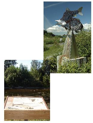
“Cultural access” to shorelines means opportunities for educational or cultural activities that promote interaction with, understanding of, and stewardship of shorelines. Cultural access can take place within or outside of shoreline areas. Examples include signs along shoreline trails explaining the habitat values of the river or stream, signs at historic sites, or a walking trail in a preserved wetland with signs or displays on plants and wildlife. Cultural access to shorelines enriches the shoreline recreational experience and allows an off-site connection to the shoreline, extending the educational, recreational and social benefits of shoreline areas. It also has the potential to promote understanding of shoreline issues, shoreline stewardship and protection amongst a large, diverse audience.
The City of Redmond, residents, business owners and other agencies participate in numerous programs that provide cultural access to shorelines, such as river stewardship programs, interpretive signs at stream outfalls and stormwater facilities, habitat restoration activities, river ecology classes, Citywide celebrations of the salmon, water quality public service announcements, and public artwork. Providing cultural access can be a no- to low-cost amenity for a shoreline development. However, it is intended that cultural access be provided as an adjunct to physical access. Where the natural environment is vulnerable, providing cultural access only may be appropriate.
SL-41
Encourage shoreline developments to provide cultural access to the shoreline, where appropriate to the type and scope of development.
SL-42
Include provisions for shoreline cultural access commensurate with the scale of the project for City capital improvement projects within the shoreline.
Design of Public Access
When properly located and well designed, public access minimizes trespass and damage to waterfront properties. Controlled public access corridors direct shoreline users into designated areas where otherwise they might trespass and damage landscaping or fences, generate litter, or otherwise damage private waterfront property. Through design strategies, such as screening, fencing, grade separations, signs, adequate maintenance, and appropriate siting, public access can be designed to address site security needs, privacy concerns and crime prevention objectives. Through appropriate designs and locations, public access can be directed away from, or excluded from, unsafe areas or shorelines with fragile natural resources.
SL-43
Design public access to be consistent with the privacy, site security and public safety requirements of nearby uses and the community.
SL-44
Design public access to be compatible with fragile shoreline resources, such as vulnerable streambeds, sensitive wildlife areas, and perching trees.
SL-45
Design public access to be safe and convenient, and encourage inclusion of pedestrian/equestrian/bicycle-oriented amenities, such as benches, drinking fountains, public parking, handicapped access, or lighting as appropriate to the type, location and scale of the development.
SL-46
Incorporate crime prevention principles in the design of public access to make facilities safe and easy to patrol and supervise.
E. Economic Development in the Shoreline
The Redmond Comprehensive Plan includes a Citywide economic development element that calls for protecting Redmond’s high quality of life, Redmond’s role in economic development, and how to encourage the type of economic development preferred by the City and the region. These policies apply within the shorelines and address encouraging development in shoreline areas. The policies below focus on economic development issues raised by the Shoreline Management Act.
Certain shoreline uses are more dependent on, or have a more direct relationship with, the shoreline than others. The Shoreline Management Act requires that shoreline master programs give preference to water-dependent uses, water-related uses, water-enjoyment uses (i.e., uses that provide an opportunity for substantial numbers of people to enjoy the shoreline), single-family residential uses, and shoreline recreation. Policies in the Shoreline Master Program give preference to such uses.
A “water-dependent” use is dependent on the water by reason of the intrinsic nature of its operations, and cannot exist in any other location. Examples include swimming beaches, boat launches, boat docks, marinas, and industries that need waterfront locations, such as ship building facilities. A water-related use is not intrinsically dependent on a waterfront location, but relies to a significant degree on water or water-dependent activities in its operations. Examples include boat outfitters and manufacturers that transport goods by water. Due to the location and physical limitations of Redmond’s shorelines, it is not practical to locate most types of water-dependent or water-related uses in Redmond. For example, the narrowness and shallowness of the Sammamish River would preclude a port facility or large boat commercial marina. However, small-scale water-dependent uses, such as boat launches, docks for small craft, or stormwater outfalls, can be accommodated. Shoreline Master Program policies give preference to such uses on the Sammamish River and Lake Sammamish, where compatible with the constraints of the natural environment and surrounding land uses.
A “water-enjoyment” use is a use that draws substantial numbers of people to the shoreline and that provides opportunities, through its design, location or operation, for the public to enjoy the physical and aesthetic benefits of the shoreline. Consistent with the goal of enhancing public access, Redmond’s Shoreline Master Program policies encourage water-enjoyment uses in appropriate locations. Examples of recreational water-enjoyment uses include parks and trails; examples of commercial water-enjoyment uses include museums, restaurants, aquariums, and some mixed-use commercial development. These uses often incorporate direct access to the shoreline, such as trails and viewing platforms. Along the Sammamish River in high-intensity areas already zoned for commercial or office uses, shoreline policies encourage water-enjoyment uses. Such uses complement Redmond’s long-range plans for high-density commercial and residential uses in the Downtown area. “Nodes” of water-enjoyment use along the river will also complement the City’s master plan for RiverWalk, a 1.5-mile shoreline corridor in the Downtown that envisions some pedestrian-oriented redevelopment of the river with small-scale retail, entertainment and cultural attractions, and public access features.
RiverWalk South gateway
Bear Creek, along with Evans Creek, is one of the most productive salmon streams in the region. It is considered a critical spawning area for resident fish species and one of the last urban refuges for freshwater mussels. On Bear and Evans Creeks, direct contact with the water can damage fragile salmon spawning areas and freshwater mussel beds. These areas should be limited to nonwater contact and cultural access only. On lower Bear Creek, water-enjoyment uses are encouraged, but limited to nonwater-contact uses. Due to the proximity of critical spawning areas, the need for adequate buffers, and site area limitations, water-enjoyment uses on upper Bear and Evans Creeks are discouraged.
Another preferred shoreline use, single-family residential, is the predominate land use around Lake Sammamish. Under Redmond’s Shoreline Master Program, this single-family land use pattern is expected and encouraged to continue.
SF-8
Give preference to shoreline uses that are unique to or dependent on shoreline areas, that protect the resources and ecology of the shoreline, and maintain no net loss of shoreline ecological functions.
SL-47
Lake Sammamish: Single-family residential uses and parks should be the preferred uses along Lake Sammamish.
SL-48
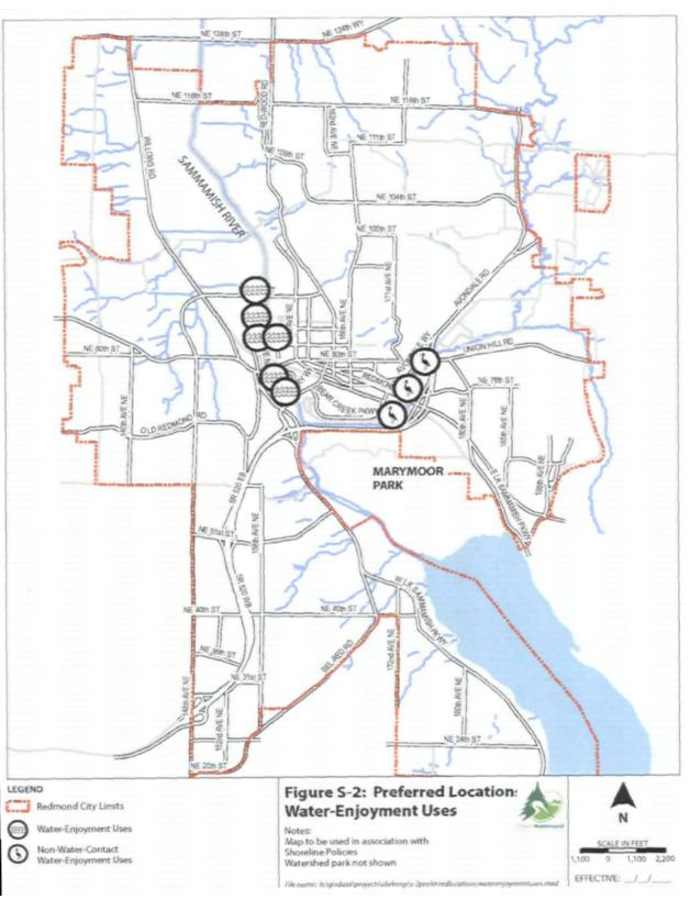
Sammamish River: Water-enjoyment uses and parks should be encouraged near major streets in the Downtown and designated business park areas as shown on Figure S-2, Preferred Location: Water-Enjoyment Uses.
SL-49
Bear and Evans Creeks: Downstream of Avondale Road, non-water-contact water-enjoyment uses are encouraged near major streets in areas shown on Figure S-2, Preferred Location: Water-Enjoyment Uses. Upstream of Avondale Road, in-water uses are not allowed.
SL-50
Avoid location of nonwater-dependent and nonwater-related uses, activities, and development, except for essential transportation and utilities facilities, waterward of the ordinary high water mark. Transportation and utilities facilities may be allowed where no feasible alternative exists and negative impacts to salmon and steelhead habitat are mitigated.
F. Managing Shoreline Uses and Activities
Redmond’s shorelines are home to a wide variety of land uses and activities, from long-established single-family neighborhoods ringing Lake Sammamish, manufacturing and industrial zones on the Sammamish River and Evans Creek, agricultural and recreational uses in the northern Sammamish Valley, to intense commercial and office development in the Downtown portions of the Sammamish River and Bear Creek. In addition, shoreline areas are essential links in the community’s network of natural and open space features, providing a place for fishing, swimming, boating, wildlife viewing and other recreational and educational activities. Redmond’s shorelines also contain a bounty of valuable natural amenities, critical habitat for fish and wildlife, significant trees, and wetlands. Most of Redmond’s shoreline areas are seismic hazard areas, floodplains, and wellhead protection Zones 1 and 2. Squeezed into the relatively narrow shoreline corridor, often with limited connections to other corridors, these important functions of shorelines are particularly vulnerable to the pressures of development.
To protect valuable shoreline resources, the Shoreline Master Program limits the extent and character of a number of land uses and activities. Policies are designed to protect water quality, shoreline vegetation and buffers, fish habitat, open space, wildlife habitat, and shoreline hydrology. Physical and visual access to shoreline open space are also important objectives of the Shoreline Master Program. Land use policies are also designed to minimize impacts to visual access, aesthetic qualities, scenic view corridors, and physical public access. Shoreline policies provide for a range of reasonable uses within the shoreline, while establishing limits to protect these shoreline resources and adjacent uses.
Shoreline policies focus on those land uses and activities that are unique to or dependent on shorelines, or that may significantly conflict with Redmond’s goals for protecting the natural environment or providing public access. These policies relate to shoreline land use, include policies for providing public access, protecting the natural environment from adverse impacts of shoreline uses, and shoreline environment designations. In addition, Shoreline Master Program policies and regulations address the character, density and quality of shoreline development.
SF-9
Manage shoreline development to avoid or minimize significant adverse impacts to the natural, aesthetic, and recreational resources of the shoreline, and to maintain no net loss of shoreline ecological functions.
SF-10
Promote respect of private property rights while implementing Shoreline Management Act requirements.
In deciding whether to allow uses and activities in shorelines areas, the shorelines environment should be protected from avoidable impacts. This can be done by carefully selecting allowed uses, providing policies and standards to prevent or minimize adverse impacts, and carefully reviewing development proposals to prevent or minimize adverse impacts.
SL-51
Design, locate, and manage shoreline uses to prevent and mitigate significant adverse impacts on water quality, fish and wildlife habitats, the environment and other uses. Prohibit uses where such impacts cannot be adequately managed. Ensure uses maintain no net loss of shoreline ecological functions.
SL-52
Design, locate, and manage shoreline uses to minimize impacts to existing and future planned public access and visual access and water-oriented uses.
SL-53
Encourage redevelopment of abandoned or obsolete buildings and sites and encourage redevelopment to be consistent with the policies for those areas, to ameliorate impacts to the shoreline, to restore degradation of shoreline habitat, and to provide for economic uses at those sites. Consider special allowances for restoration and adaptive reuse of historic buildings and sites.
Landfills, Excavation and Dredging
Landfills, excavation and dredging in the shoreline can destroy the natural character of the shoreline, remove native shoreline vegetation, introduce invasive plants, create unnaturally heavy erosion and siltation problems, and reduce the existing water surface area. The result is often significant damage to water quality and fish and wildlife habitat. However, in some instances these activities may be necessary on a limited basis for implementing desired or necessary shoreline objectives. For example, dredging may be the only immediate means to restore the natural functions of a degraded stream area, or to accommodate a water-dependent use. For these reasons, Shoreline Master Program policies allow only limited landfill, excavation and dredging activities.
SL-54
Design and locate new shoreline development to avoid the need for dredging.
SL-55
Allow dredging only when necessary for habitat or water quality restoration, or for maintaining the flood capacity of the floodplain in the flood fringe, and where impacts to habitat are minimized and mitigated.
SL-56
Permit landfills and excavations only in predominately upland areas outside of important habitat areas. Allow landfills and excavations in aquatic areas for the purpose of habitat enhancement. Limit all landfill and excavation activities, where allowed, to the minimum extent necessary to accommodate the proposed use, and prohibit long-term degradation of shoreline hydrology or water quality.
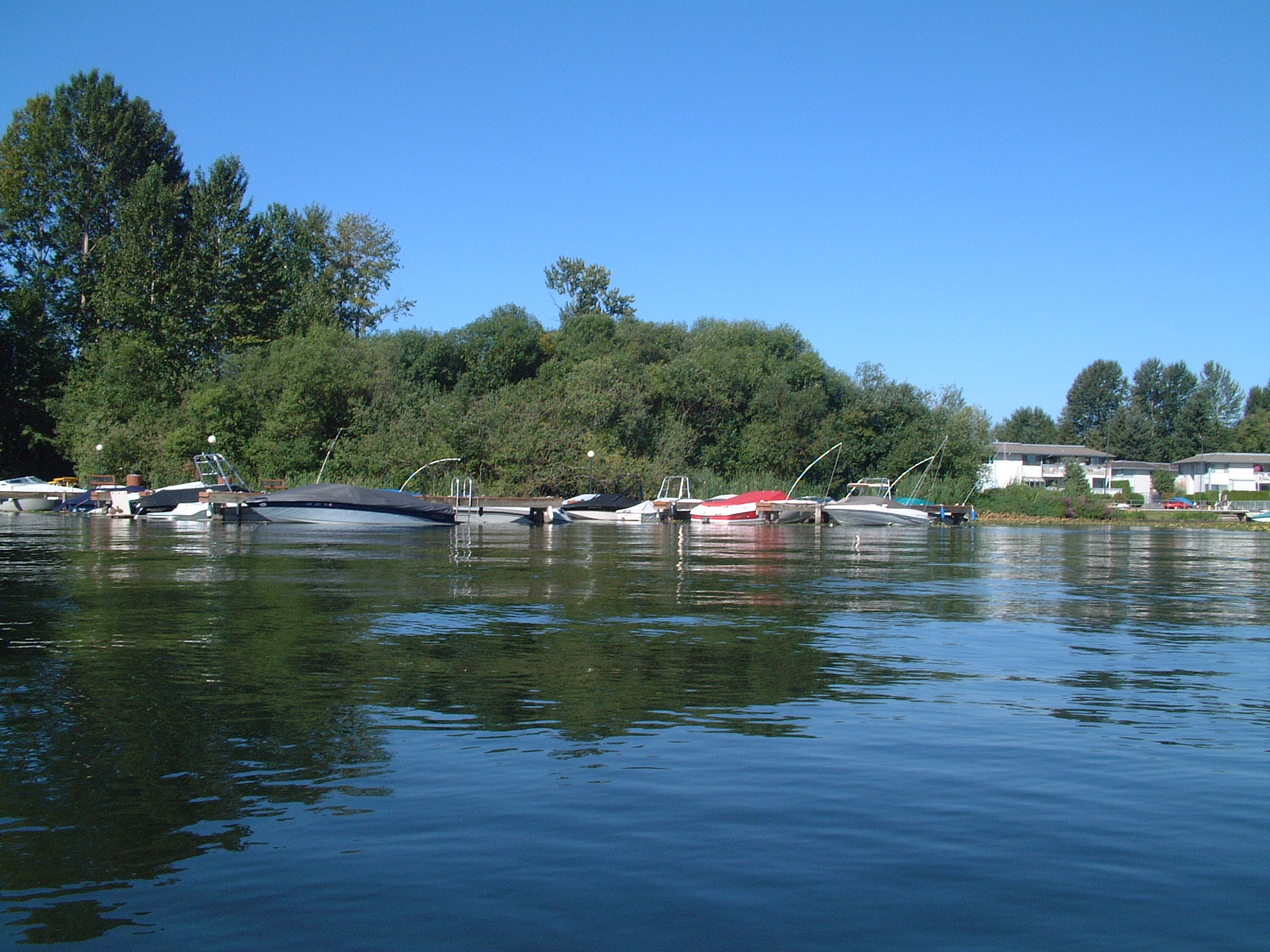
Marinas
Due to the nature of Redmond’s shorelines, marinas in Redmond are located only on Lake Sammamish. The other shorelines are too small to accommodate them. Boat ramps and launching sites for small boats may be located on the Sammamish River or Lake Sammamish. Care is needed to locate these facilities in areas that will not affect the natural environment and nearby uses.
Boats on Lake Sammamish
SL-57
Design and locate marinas, boat ramps and launching sites so as to not interfere with existing in-water recreational activities, significantly damage fish and wildlife habitats, and be aesthetically and functionally compatible with the shoreline area and nearby uses. Prohibit such facilities on Bear and Evans Creeks.
SL-58
Use, store, and dispose of fuels and waste materials associated with recreational boating in a manner which minimizes the potential for pollutants to enter the water.
Piers and Docks
Piers and docks can have significant impacts on the natural features and scenic values of the shoreline, navigation, water-dependent recreation and public access, native plant, fish, and wildlife habitat and water quality. However, residential piers and docks are long-established uses on Lake Sammamish, and a preferred shoreline use under the Shoreline Management Act, and as such may continue to be utilized and located on the lake.
SL-59
Locate residential piers and docks so they do not interfere with public swimming beaches, public fishing areas, and boating corridors. Design and construct piers and docks to minimize impacts on native fish and wildlife and their habitat. Prohibit such facilities on Bear and Evans Creeks.
SL-60
Encourage sharing of new piers and docks within new developments. Encourage the consolidation and multiple use of residential docks.
SL-61
Locate floatplane facilities so they do not interfere with public swimming beaches, public fishing areas, and boating corridors. Limit these to facilities accessory to a residential use. Design and construct floatplane facilities to minimize impacts on native fish and wildlife and their habitat. Encourage minimization of their impact on shoreline views. Limit these facilities to parcels large enough to safely accommodate them. Protect adjacent development and uses as well as human safety from these facilities, including limiting noise and other impacts on residential uses.
Outdoor Signage
Outdoor signage refers to signs used to identify a business, and excludes directional, traffic, and interpretive signs, and other similar informational signs. Outdoor signs in the shoreline, if not carefully designed, located and illuminated, can degrade the aesthetic values of the shoreline, view corridors, and impact fish and wildlife.
SL-62
Design and locate outdoor signs in the shoreline jurisdiction to avoid intrusion into and minimize glare into fish and wildlife habitats, buffers, shoreline views and public access areas.
Outdoor Storage
Outdoor storage (i.e., storage not contained within a building) in the shoreline can introduce potentially harmful materials into the water, such as through spills or flooding. This can have serious effects on fish habitat, wildlife, and aquifers. The operation of outdoor storage areas can generate noise and dust impacts on the shoreline environment. Outdoor storage can also conflict with goals for protecting shoreline aesthetics, particularly if public trails or views are nearby.
SL-63
Design and locate outdoor storage incidental to other uses to avoid potential flood and water quality hazards, and screen them from public access areas and shoreline view corridors. Direct lighting of outdoor storage areas, where allowed, away from or screened from the shoreline. Prohibit outdoor storage as a primary use in the shoreline area.
Shoreline Recreation
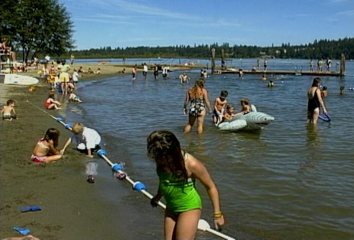
Shoreline recreation is a preferred shoreline use under the Shoreline Management Act and Redmond’s Shoreline Master Program. Shoreline recreation may be water-dependent, such as canoeing or swimming; water-related, such as bird watching; or a water-enjoyment use, such as an interpretive center. These and other recreational uses can be well suited to shoreline areas if they are properly designed and maintained.
Idylwood Beach Park
SL-64
Give preference to shoreline recreational development related to access to, enjoyment and use of the water and shorelines of the state.
SL-65
Design parks and other recreational developments to be compatible with adjacent preferred shoreline uses, and to protect fish and wildlife habitats. Encourage maintenance activities to protect water quality and minimize fish and wildlife and vegetation disturbance.
SL-66
Include both active and passive recreation areas, and facilities that are designed to encourage use of the shoreline by all members of the community, regardless of physical ability, in Redmond’s system of shoreline recreation.
Shoreline Protective Structures
Shoreline protective structures (e.g., bulkheads, riprap, revetments) have major adverse impacts. Their impacts are especially significant along salmon spawning areas, such as streams, rivers, and lakes used by Sockeye salmon, such as Lake Sammamish. On these areas, bulkheads and riprap can cover spawning beds. They increase water velocities, eroding spawning beds. They also remove vegetation that shades water and provides food for fish and wildlife. These facilities can shift erosion downstream and increase downstream flooding impacts. Structural reinforcement of a shoreline or stream bank encourages reliance on last resort solutions, instead of promoting more effective methods, such as setting back away from potentially eroding streams. Consequently, Shoreline Master Program policies discourage shoreline protective structures and encourage designs that avoid erosion hazards. However, limited bank reinforcement is allowed for habitat enhancement projects, public access, public roads, and protecting existing structures from floods. The Shoreline Management Act requires that shoreline master programs give preference to erosion protection measures for single-family residences occupied before January 1, 1992. Redmond’s shoreline policies address the issue of protection for single-family homes while minimizing impacts to the natural environment.
SL-67
Encourage design and location of new shoreline development to avoid the need for shoreline modification or protective structures. Allow shoreline protective structures only as necessary for:
♦ Supporting or protecting an allowed primary structure or a legally existing shoreline use that is in danger of loss or substantial damage;
♦ Reconfiguring the shoreline for mitigation or enhancement purposes; or
♦ Shoreline modifications that are appropriate to the specific type of shoreline and environment conditions for which they are proposed.
SL-68
Design shoreline modification, where allowed, to minimize impacts on shoreline hydrology, navigation, habitat and public access. Design shoreline protective structures for the minimum height, bulk and extent necessary to address an identified hazard to an existing structure. Encourage use of vegetative and biotechnical solutions rather than structural bank reinforcement.
Transportation and Circulation
Transportation and circulation patterns to a great degree shape the location and character of shoreline land uses. Transportation facilities have the potential to diminish shoreline views, reduce public access and remove vegetation. For example, major roadway expansions can become significant barriers between upland residences and the shoreline. Large projects can bring undesirable impacts to residential neighborhoods. On Lake Sammamish, in particular, major roadways or bridges in the shoreline would severely degrade views and could introduce noise and air pollution at levels incompatible with residential uses. Parking facilities for shoreline development can cause spillover of excessive noise, glare and pollutants into fish and wildlife habitat areas. The design of shoreline transportation and circulation projects should address such impacts by avoiding locating in the shoreline. Alternatively, impacts should be mitigated. For example, pedestrian crossings should be provided where shoreline access is needed. Streets, bridges, bikeways and sidewalks should be designed to provide shoreline views and incorporate attractive gateway design elements and pedestrian amenities. Landscaping and reestablishment of large trees and shoreline vegetation should be included in mitigation plans. Well-designed circulation facilities promote public access and views of the shoreline. Good design can also reduce the presence of auto-oriented development in shoreline (along with associated impacts). Including pedestrian and bike facilities in transportation projects complements region-wide goals for enhancing nonmotorized transportation.
SL-69
Encourage location of transportation facilities and parking facilities away from the water body, unless no feasible alternative exists. Discourage parking as a primary use along the shoreline.
SL-70
Design and landscape transportation and parking facilities within the shoreline jurisdiction to avoid or minimize impacts to existing land uses, shoreline views, public access, and the natural environment.
SL-71
Require transportation and parking plans to be consistent with the Shoreline Master Program public access policies and public access plan, including circulation, planning for pedestrians, bicycles, and public transportation where appropriate.
SL-72
Prohibit construction of bridges across Lake Sammamish.
Utilities
Telecommunications facilities and utilities can infringe on the scenic value of shorelines and interrupt shoreline view corridors. They often bring undesirable side effects such as noise, glare, use of herbicides, etc. If not designed and located appropriately, such facilities can become unwanted neighbors for residential and water-enjoyment uses. At the same time, undergrounding and tunneling of essential utilities under the river and creeks is sometimes necessary. Regional transmission lines, limited to one corridor, should continue to locate within the same corridor.
SL-73
Locate regional utilities outside of the shoreline. Locate such facilities away from public access areas and view corridors and away from the shoreline to the farthest location possible where a nonshoreline location is not feasible.
SL-74
Locate utilities, where feasible, within existing utility corridors. Locate above-ground utilities away from fish and wildlife habitat, public access areas, and view corridors.
Vegetation Management
Vegetation management in the shoreline can involve removal of vegetation to maintain structures, rights-of-way or trails, removal of invasive or exotic weeds, aquatic weed control or restoration of native vegetation for habitat enhancement. Excessive or improper control of vegetation can degrade shoreline habitat, aesthetics and water quality.
Scot’s broom – invasive plant
SL-75
Practice vegetation management through preventive measures, such as proper siting of structures and appropriate landscaping. Minimize removal of native vegetation to achieve the permitted use, maintain existing structures and public safety, or to achieve habitat restoration objectives. Discourage the use of herbicides, pesticides and fertilizer in the shoreline.
SL-76
Encourage restoration of native shoreline vegetation and other habitat restoration activities.
G. Shoreline Design Quality
High quality architectural design and site planning are particularly important in shoreline areas. The unique natural characteristics and “public resource” status of shorelines under the Shoreline Management Act demand that development in the shoreline responds to a wider range of issues than development elsewhere. In addition, shoreline development has a greater burden to respond to and respect the aesthetic qualities of the shoreline, which requires well-designed buildings, signs and graphics, landscaping and open space, and views of the water or wildlife. This is required of all types of shoreline development, whether a large commercial development, City street project, or subdivision. Past nonresidential development patterns have “turned their back” on the shoreline, orienting dumpsters and service areas toward the water, or blocking enjoyment of shoreline features by blank walls or parking lots.
City Hall on Sammamish River
In high quality shoreline developments, architectural design, site design and landscaping include such features as buildings or architectural elements oriented to the shoreline, shoreline views, outdoor gathering places, trees and buffers, incorporation of natural features as amenities, trail connections to the shoreline, pedestrian amenities, interpretation of historic sites and graphics and public art. Well-designed shoreline development brings value to surrounding uses and enhances the recreational experience.
SF-11
Promote high quality architectural design, site design and landscaping that reflect the aesthetic, recreational, and natural resource values of a shoreline location.
Development located in the shoreline has the advantage of a unique location and close proximity to a network of natural, aesthetic and recreational amenities. Accordingly, shoreline developments should be designed to respond to their shoreline location, through architectural or site design elements that connect visually or physically to the water body. While virtually all development in Redmond is now required to exhibit high quality design principles, shoreline development should strive to achieve an even greater level of design harmony with shoreline resources.
SL-77
Encourage design of shoreline development to reflect the natural, aesthetic, and recreational values of the shoreline, paying special attention to:
♦ Designing architectural and site design elements to connect visually or physically to the shoreline where consistent with the natural environment of the shoreline.
♦ Orienting views and windows to the shoreline.
♦ Orienting some entries, sight lines, buildings, pathways and other design elements toward the shoreline.
♦ Incorporating interpretation of on-site archaeological and historic sites or themes in the development.
♦ Keeping bulk and scale of buildings in proportion to shoreline features.
♦ Locating service areas away from the shoreline and screening incompatible activities.
♦ Incorporating native landscaping and open space.
♦ Respecting and reflecting significant natural features, such as large or valuable trees or landforms.
♦ Providing outdoor seating or gathering places along the shoreline, where appropriate.
♦ Providing well-designed public access from the site to the shoreline where consistent with the natural environment of the shore.
♦ Connecting to pedestrian paths to other nearby amenities.
♦ Designing signs to be compatible with surrounding public uses and aesthetic quality of the shoreline.
♦ Maintaining aesthetic quality of areas visible from public trails to the extent feasible.
Water-enjoyment uses bring substantial numbers of people to the shoreline, and provide opportunities for the public to enjoy shoreline amenities. These uses are encouraged in high-density areas, such as Redmond’s Downtown area. To achieve their “enjoyment” aspect, water-enjoyment uses, in addition to meeting good urban design principles, should incorporate a higher proportion of window areas, pedestrian amenities, and shoreline connections to ensure that development takes advantage of the recreational and aesthetic opportunities presented by a shoreline location.
SL-78
Encourage design of water-enjoyment uses to provide significant opportunities for public enjoyment of the aesthetic, natural and recreational amenities of the shoreline, through large areas of windows, outdoor seating areas, street furniture, views from public areas and pedestrian connections to the shoreline.
Service areas, such as loading docks and dumpsters, tend to generate more glare, noise and other pollutants than other activity areas. Typically these areas are located away from the public street, which means they are often located adjacent to wildlife habitat and public access areas along the shoreline.
SL-79
Encourage location of service areas and outdoor storage areas in non-single-family residential developments upland of or beside buildings, and adequately screen these from the shoreline.
SL-80
Encourage design of surface stormwater facilities located within the Urban Conservancy or Natural environments to enhance wildlife habitat, shade the water, and integrate into the overall landscaping theme.
The Redmond Comprehensive Plan designates the Sammamish River, Bear Creek and Evans Creek as open space and wildlife corridors. Shoreline areas are much more vulnerable than other urban areas to impacts of noise, glare, dust, vibrations, etc. To protect the scenic value, views, and fish and wildlife habitat value of shoreline areas, excessive lighting is discouraged. “Dark skies” policies are in place for the river and both creeks.
SL-81
Prohibit outdoor lighting levels for security, building and parking lot lighting, and intensive recreational uses in the shoreline that exceed the minimum necessary for safe and effective use. Screen all lighting, except for minimum pedestrian lighting, from the shoreline through landscaping, shields or other design measures.
Transportation and circulation facilities can have significant impacts on shoreline uses and resources. For example, bridges and freeway ramps can obscure shoreline views, access, and historic sites. At the same time, these facilities present opportunities for improved urban design and enhanced shoreline aesthetics. In Redmond, shoreline aesthetics are enhanced by trails along the Sammamish River and Bear Creek, banners on Downtown streets, and decorative lighting on the Leary Way Bridge, and other amenities. Many of the residential subdivisions along Lake Sammamish have identified themselves by unique community signs. The design of streets and other transportation improvements in the shoreline should incorporate measures to protect and enhance shoreline aesthetics, and to incorporate design amenities, such as gateway design elements, neighborhood signs or mailbox graphics to help define neighborhoods or landmarks, street tree plantings, public art, and decorative lighting.
SL-82
Encourage the design, where feasible, of transportation and circulation facilities in the shoreline to protect and complement shoreline aesthetics, provide view corridors, and to incorporate attractive design features, such as gateway design elements, decorative lighting, attractive landscaping, public art and street graphics.
H. Historic and Cultural Uses
Redmond’s shorelines have played a significant role in the development of the area. The Sammamish River and Lake Sammamish, for example, were essential transportation routes for Native Americans and early settlers and their products. Logs from surrounding hillsides were floated to processing plants and markets on Lake Sammamish, the Sammamish River, and the creeks. Several sites associated with this early history have been identified along Redmond’s shorelines. Of these sites, the Conrad Olson Farm on Bear Creek and the Red Brick Road (Yellowstone Trail) along Evans Creek are the only remaining structures identified to date. The Red Brick Road is on the National Register of Historic Places. These historic resources are important to the region and the Redmond community, and may provide amenities and attractions for shoreline developments. An understanding of the rich history associated with Redmond’s shorelines can help promote river stewardship.
These valuable aspects of Redmond’s past should be preserved. Since few structures exist, this effort will typically involve documentation of historic sites or events and, in some cases, the incorporation of historic features in site design. For example, historic sites along Lake Sammamish, such as those of early lumber mills, might be reflected in street graphics or interpretive signs. Historic structures should be restored where feasible. Other historic sites should be evaluated for possible incorporation as amenities, themes or interpretation in new development proposals.
The Land Use Element of the Redmond Comprehensive Plan contains policies protecting historic and cultural resources throughout the City. To ensure the level of protection envisioned by the Shoreline Management Act, supplemental policies for shoreline areas are included in the Shoreline Master Program.
SF-12
Require shoreline development to identify potential development impacts to, and to protect and respect, valuable archaeological and historic sites and cultural resources.
SL-83
Identify and protect valuable archaeological and historic sites and resources in shoreline development.
SL-84
Encourage acquisition of shoreline sites with major archaeological, historic or cultural value to the community by the City where feasible.
SL-85
Try to incorporate the interpretation of on-site archaeological and historic resources into the design of shoreline development, transportation improvements, and recreational developments.
SL-86
Require developers and property owners to immediately stop work and notify the City, the state Office of Archaeology and Historic Preservation, and affected Indian tribes if archaeological resources are uncovered during excavation.
SL-87
Require a site inspection or evaluation by a professional archaeologist in coordination with affected Indian tribes for permits issued in areas documented to contain archaeological resources.
Ord. 2486