


Chapter 17.32
SHORELINE MANAGEMENT OVERLAY
Sections:
17.32.030 Application of regulations.
17.32.040 Shoreline environments.
17.32.050 Shoreline environment guidelines.
17.32.055 Shoreline use activities.
17.32.060 Shoreline development guidelines.
17.32.065 Wetlands and critical areas.
17.32.100 Amendments and boundary changes.
17.32.120 Notes on the Westport comprehensive land use, shoreline, and zoning map.
17.32.010 Purpose.
This chapter is intended to carry out one of the responsibilities imposed on the city by the Shoreline Management Act of 1971 through an overlay shoreline regulation incorporated in the city’s zoning code. (Ord. 1146 § 2, 1998)
17.32.015 Administration.
(1) Administrator. The city public works director or, in the public works director’s absence, the city administrator shall be the administrator of this chapter, and shall perform all the duties ascribed to the administrator in this chapter, and shall administer the permit and notification systems.
(2) Interpretation. The terms of this regulation shall be interpreted to be consistent with the State Shoreline Management Act, Chapter 90.58 RCW and the implementing regulations of Chapters 173-16, 173-22, 173-26, and 173-27 WAC. (Ord. 1146 § 2, 1998)
17.32.020 Definitions.
As used in this chapter, unless context requires otherwise, the following definitions will apply for purposes of this chapter:
“Act” means Chapter 90.58 RCW, the Shoreline Management Act of 1971, as amended.
“Adoption by rule” means an official action by the department to make a local government shoreline master program effective through rule consistent with the requirements of the Administrative Procedure Act, Chapter 34.05 RCW, thereby incorporating the adopted shoreline master program or amendment into the State Master Program.
“Average grade level” means the average of the natural or existing topography of the portion of the lot, parcel, or tract of real property which will be directly under the proposed building or structure. Calculation of the average grade level shall be made by averaging the ground elevations at the midpoint of all exterior walls of the proposed structure.
“Boathouse” means a structure designed for storage of vessels located over water or in upland areas.
“Development” means a use consisting of the construction or exterior alteration of structures; dredging; drilling; dumping; filling; removal of any sand, gravel, or minerals; bulkheading; driving of piling; placing of obstructions; or any project of a permanent or temporary nature which interferes with the normal public use of the surface of the waters overlying lands subject to the Act at any state of water level.
“Development regulations” means the controls placed on development or land use activities by a county or city, such as zoning ordinances, critical areas ordinances, all portions of a Shoreline Master Program other than goals and policies approved or adopted under Chapter 90.58 RCW, official controls, planned unit development ordinances, subdivision ordinances, and binding site plan ordinances, together with any amendments thereto.
“Exempt” developments are those set forth in WAC 173-27-070 and RCW 90.58.030(3)(e), 90.58.140(9), 90.58.147, 90.58.355 and 90.58.515 which are not required to obtain a substantial development permit but which must otherwise comply with applicable provisions of the Shoreline Management Act and the Westport shoreline master program.
“Extreme low tide” means the lowest line on the land reached by a receding tide.
“Fair market value” of a development means the open market bid price for conducting the work, using the equipment and facilities, and purchase of the goods, services and materials necessary to accomplish the development.
“Floating home” is a structure designed and operated substantially as a permanently based over-water residence. Floating homes are not vessels and lack adequate self-propulsion and steering equipment to operate as a vessel. They are typically served by permanent utilities and semi-permanent anchorage/moorage facilities.
“Floodplain” is synonymous with 100-year floodplain and means that land area susceptible to being inundated by stream derived water with a one percent chance of being equaled or exceeded in any given year. The limit of this area shall be based upon flood ordinance regulation maps or a reasonable method which meets the objectives of the Shoreline Management Act.
“Floodway” means those portions of a river valley lying streamward from the outer limits of a watercourse upon which flood waters are carried during periods of flooding that occur with reasonable regularity, although not necessarily annually, said floodway being identified, under normal condition, by changes in surface soil conditions or changes in types or quality of vegetative ground cover condition. The floodway shall not include those lands that can reasonably be expected to be protected from flood waters by flood control devices maintained by or maintained under license from the federal government, the state, or a political subdivision of the state.
“Guidelines” means those standards adopted by the department to implement the policy of the Shorelines Management Act.
“Height” is measured from average grade level to the highest point of a structure, excluding antennas, chimneys and similar appurtenances.
“Houseboat” is a vessel, principally used as an over-water residence. Houseboats are licensed and designed for use as a mobile structure with detachable utilities or facilities, anchoring and the presence of adequate self-propulsion and steering equipment to operate as a vessel. Principal use as an over-water residence means occupancy in a single location, for a period exceeding two months in any one calendar year. This definition includes live-aboard vessels.
“Local government” means city of Westport.
“Ordinary high water mark” is a mark that will be found by examining the bend and banks and ascertaining whether the presence and action of waters are so common and usual, and so long continued in all ordinary years, as to mark upon the soil a character distinct from that of the abutting upland.
(1) In high-energy tidal water environments where the action of the waves or currents is sufficient to prevent vegetation establishment below mean higher high tide, the ordinary high water mark is coincident with the line of vegetation. Where there is no vegetative cover for less than 100 feet parallel to the shoreline, the ordinary high water mark is the average tidal elevation of the adjacent lines of vegetation. Where the ordinary high water mark cannot be found, it is the elevation of mean higher high tide.
(2) In low-energy tidal water environments where the action of waves and currents is not sufficient to prevent vegetation establishment below mean higher high tide, the ordinary high water mark is coincident with the landward limit of salt tolerant vegetation, which means the vegetation is tolerant of interstitial soil salinites greater than or equal to 0.5 parts per thousand.
“Permit” means any substantial development, variance, conditional use permit or revision authorized under Chapter 90.58 RCW.
“Person” means an individual, partnership, corporation, association, organization, cooperative, public or municipal corporation or agency of the state or local governmental unit however designated.
“Primary dune” means the first system of dunes shoreward of the water, having little or no vegetation, which are intolerant of unnatural disturbances. The primary dune is the equivalent of the foreshore dune as identified by the Soil Conservation Service and in Westport is covered by the dune protection zone which extends up to 100 feet shoreward of the primary or foreshore dune.
“Priority” for shoreland developments where authorized, is defined at RCW 90.58.020 and shall include uses which permit a significant number of people to use or enjoy the city’s shorelines, including water-dependent uses, public use and access, and residential uses consistent with environmental protection.
“Shorelands” or “Shoreland areas” means those lands extending landward for 200 feet in all directions as measured on a horizontal plane from the ordinary high water mark; floodways and contiguous floodplain areas landward 200 feet from such floodways; and all wetlands and river deltas associated with the streams, lakes, and tidal waters which are subject to the provisions of the SMA.
The following shall be interpreted as the upland extent of shoreline jurisdiction within the city:
(1) The Westhaven Area. The upland extent of shoreline jurisdiction shall be the ordinary high watermark plus 200 feet and associated wetlands line of ordinary high water plus 200 feet for the city core, Westhaven area (see areas “A” to “A” as identified on the Westport comprehensive land use, shoreline and zoning map);
(2) The ocean beach area bounded on the north by Ocean Avenue extended and on the south by the city limits. The upland extent of shoreline jurisdiction shall be a line drawn at the upland toe of the primary dune together with associated interdunal wetlands, easterly edge of the beach deflation plain to the OBR I area (see areas “B” to “B” as identified on the Westport comprehensive land use, shoreline and zoning map);
(3) The ocean beach area bounded on the north by the south boundary of Westhaven State Park and on the south by Ocean Avenue extended. The upland extent of shoreline jurisdiction shall be the 100-year floodplain or a line drawn at the upland toe of the primary dune together with associated interdunal wetlands, whichever location that is further upland, for the property designated TC (see areas “C” to “C” as identified on the Westport comprehensive land use, shoreline, and zoning map);
(4) The East Shore of Westport. The upland extent of shoreline jurisdiction shall be the ordinary high water mark plus 200 feet and associated wetlands. USCOE designated wetland edge from Firecracker Point east and south to the city limits (see areas “D” to “D” as identified on the Westport comprehensive land use, shoreline and zoning map).
The shoreland boundary has been mapped by the city and the map shall be the primary guide for purposes of this chapter. The map may be amended by request from an owner, with a field delineation more accurately locating the identified boundary.
“Shoreline master program” for the city means the Comprehensive Plan Chapter 9 together with maps, diagrams, charts, or other descriptive material and text, a statement of desired goals, and development standards identified in WMC Title 17, particularly this chapter.
“Shorelines” means all the water areas of the state, including reservoirs, and their associated shorelands, together with the lands underlying them, except (1) shorelines of state-wide significance, (2) shorelines on streams where the mean annual flow is 20 cubic feet per second or less, and (3) shorelines on lakes less than 20 acres in size.
“Shorelines of the state” are the total of all “shorelines” and “shorelines of state-wide significance” within the state.
“Shorelines of state-wide significance” relevant to the Westport area include the area between the ordinary high water mark and the western boundary of the state from Cape Disappointment on the south to Cape Flattery on the north, including harbors, bays, estuaries and inlets and the shorelands associated therewith.
“Structure” means a permanent or temporary edifice or building, or any piece of work artificially built or composed of parts joined together in some definite manner, whether installed on, above or below the surface of the ground or water, except for vessels.
“Substantial development” shall mean any development of which the total cost or fair market value exceeds $2,500, or any development which materially interferes with the normal public use of the water or shorelines of the state; except that the following shall not be considered substantial developments for the purpose of this chapter (as further explained under WAC 173-27-040):
(1) Normal maintenance or repair of existing structures or developments, including damage by accident, fire or elements;
(2) Construction of the normal protective bulkhead common to single-family residences;
(3) Emergency construction necessary to protect property from damage by the elements;
(4) Construction of a barn or similar agricultural structure and practices normal or necessary for farming on shorelands;
(5) Construction or modification of navigational aids such as channel markers and anchor buoys;
(6) Construction on shorelands by an owner, lessee, or contract purchaser of a single-family residence and appurtenance for his own use or for the use of his family, which residence does not exceed a height permitted in the underlying zone and which meets all requirements of the state agency or local government having jurisdiction thereof, other than requirements imposed pursuant to this chapter;
(7) Construction of a dock, including a community dock, designed for pleasure craft only, for the private noncommercial use of the owner, lessee, or contract purchaser of a single-family residence, the cost of which does not exceed $2,500, if in salt water, or not to exceed $10,000 if in fresh water. A dock is a landing an moorage facility for watercraft and does not include storage facilities, decks, or other appurtenances. Any subsequent construction exceeding $2,500 and occurring within five years of completion of the prior construction shall be considered a substantial development;
(8) Operation, maintenance, or construction of canals, waterways, drains, reservoirs developed as part of an irrigation system for the primary purpose of using system waters, including the return flow and artificially stored ground water from the irrigation of lands;
(9) The marking of property lines or corners on state-owned lands, when such marking does not significantly interfere with normal public use of the surface of the water;
(10) Operation and maintenance of dikes, ditches, drains, or other facilities existing on June 4, 1975, which are part of an agricultural drainage or diking system;
(11) Any project with a certification from the Governor pursuant to Chapter 80.50 RCW;
(12) Site exploration activities, as defined in RCW 90.58.030(3)(e)(xi), needed to prepare for a development application as long as said exploration activities do not interfere with normal public use of surface waters of the state, have no significant adverse impacts to the environment, the site is restored to pre-existing conditions, private entities post a performance bond, and the exploration activity is not subject to the permit requirements of RCW 90.58.550;
(13) Removing or controlling aquatic noxious weeds, as defined in RCW 17.26.020, through the use of an herbicide or other treatment method, as recommended by Department of Agriculture or Department of Ecology, per Chapter 43.21C RCW;
(14) Watershed restoration projects as reviewed and approved by the administrator; and
(15) Any other exemption as described or further explained in WAC 173-27-040.
Use, Conditional. “Conditional use” means a use, development, or substantial development which is classified as a conditional use or is not classified within the applicable master program. Conditional uses generally conform to the policies and management objectives of an environment, but because of potential problems inherent with the specific use or activity may not be appropriate in every situation. Conditional uses are allowable only if sufficient care is taken to avoid predictable negative impacts through the application of project/site-specific conditions. These conditions may include limitations on the scope and scale of the proposed use. A conditional use may be found to be not permissible after a specific case review.
Use, Permitted. “Permitted use” means a use that conforms to the Westport shoreline management program, and may be undertaken subject to the policies and requirements of this chapter and applicable permits.
“Variance” means a means to grant relief from the specific bulk, dimensional or performance standards set forth in Westport’s shoreline management program.
“Water-dependent use” means a use or portion of a use which cannot exist in any other location and is dependent on the water by reason of the intrinsic nature of its operations. Examples of water-dependent uses may include ship cargo terminal loading areas, ferry and passenger terminals, barge loading facilities, ship building and dry docking, marinas, aquaculture, float plane facilities and sewer outfalls.
“Water-enjoyment use” is a recreational use, or other use facilitating public access to the shoreline as a primary characteristic of the use; or a use that provides for recreational use or aesthetic enjoyment of the shoreline for a substantial number of people as a general characteristic of the use and which through the location, design, and operation assures the public’s ability to enjoy the physical and aesthetic qualities of the shoreline. In order to qualify as a water-enjoyment use, the use must be open to the general public and the shoreline-oriented space within the project must be devoted to the specific aspects of the use that fosters shoreline enjoyment. Primary water-enjoyment uses may include parks, piers and other improvements facilitating public access to shorelines of the state; and general water-enjoyment uses may include single-family residential, restaurants, museums, aquariums, scientific/ecological reserves, resorts, and mixed-use commercial; provided, that such uses conform to the above water-enjoyment specifications and the provisions of the shoreline master program.
“Water-oriented use” is any combination of water-dependent, water-related, and/or water-enjoyment uses. Water-oriented uses, together with single-family residential uses, and serves as an all-encompassing definition for priority uses under the Shoreline Management Act. Residential uses and particularly single-family residential uses are priority uses under the Shoreline Management Act and are considered water-oriented uses in the city. Nonwater-oriented, except single-family residential uses, serves to describe those uses which have little or no relationship to the shoreline and are not considered priority uses under the Act. Examples include professional offices, automobile sales or repair shops, mini-storage facilities, multifamily residential development, department stores, and gas stations.
“Water-related use” is a use or portion of a use which is not intrinsically dependent on a waterfront location but whose economic viability is dependent upon a waterfront location because: (A) of a functional requirement for a waterfront location such as the arrival or shipment of materials by water, or the need for large quantities of water; or (B) the use provides a necessary service supportive of the water-dependent commercial activities and the proximity of the use to its customers makes its services less expensive and/or more convenient. Examples include manufacturers of ship parts large enough that transportation becomes a significant factor in the product’s cost, water-transported foods. Examples of water-related uses may include warehousing of goods transported by water, seafood processing plants, hydroelectric generating plants, gravel storage when transported by barge, oil refineries where transport is by tanker, and log storage. Westport considers multifamily and mixed use residential developments to be water-related in that much of Westport’s attraction is as a seashore and water sports-oriented destination resort community. As such, residential structures for sale, long-term lease, and other term occupancy all facilitate the water-related nature of the Westport economy.
“Wetlands” means areas that are inundated or saturated by surface water or ground water at a frequency and duration sufficient to support, and that under normal circumstances do support, a prevalence of vegetation typically adapted for life in saturated soil conditions. Wetlands generally include swamps, marshes, bogs, and similar areas. Wetlands do not include those artificial wetlands intentionally created from nonwetland sites, including irrigation and drainage ditches, grass-lined swales, canals, detention facilities, wastewater treatment facilities, farm ponds, and landscape amenities, or those wetlands created after July 1, 1990, that were unintentionally created as a result of the construction of road, street, or highway. Wetlands may include those artificial wetlands intentionally created from nonwetland areas to mitigate the conversion of wetlands.
Wetlands are further explained in the “Washington State Wetlands Identification and Delineation Manual” as prepared by the Department of Ecology, Publication No. 96-94, dated March 1997.
Wetlands, Associated. “Associated wetlands” means those wetlands which are in proximity to and either influence or are influenced by tidal waters or a lake or stream subject to the Shoreline Management Act. (Ord. 1189 Att. A § 2, 1999; Ord. 1146 § 2, 1998)
17.32.030 Application of regulations.
These regulations shall apply to all the lands in the city identified as shorelines, and shall apply to every person, firm, corporation, local and state governmental agency, and other entities which would develop, use, and/or own lands, shorelands, or waters under the control of these regulations. Further, these regulations apply to all existing and future conditions within the area of jurisdiction except as provided in WMC 17.32.070.
(1) All structures or other development within the shorelines of Westport are required to comply with this chapter, whether or not the development is “substantial” or “exempt” as defined in WMC 17.32.020.
(2) All “substantial development” not otherwise exempt pursuant to WMC 17.32.020 shall obtain a shoreline substantial development permit as required by WMC 17.32.080.
(3) Any request for a variance or conditional use under WMC 17.32.080 shall obtain a shoreline substantial development permit as set forth in WMC 17.32.080. (Ord. 1146 § 2, 1998)
17.32.040 Shoreline environments.
Westport has identified three shoreline environments with the city:
(1) Urban shoreline is a designation in areas served by sewer, water, and other city services to enable intensive use and to manage development in order to maintain shorelines for a wide variety of intense uses. Within the urban shoreline environment designation, there are six shoreline use zones:
(A) Ocean Beach Residential Zone (OBR). The purpose of the OBR zones is to identify and provide for low-density residential uses on sewer. (The OBR I zone includes land within shoreline areas, but the OBR II zone does not.) (See also Chapters 17.18A and 17.18B WMC.)
(B) Recreation and Parks (RP). The RP zone includes public shorelands identified for parks or recreation. (See also Chapter 17.30 WMC.)
(C) Tourist Commercial (TC). The TC zone is designed to accommodate major tourist and recreational facilities, including a potential destination resort. (Not all TC zoned properties are within shoreline areas.) (See also Chapter 17.21 WMC.)
(D) Mixed Use/Tourist Commercial (MUTC). The MUTC-1 and MUTC-2 zones are designed to foster a mix of commercial and residential uses to promote a compact, urban center. (The MUTC zones contain lands both shoreline and nonshoreline areas.) (See Chapter 17.20A WMC.)
(E) Marine Industrial (MI). The MI zone provides for water-oriented and water-dependent uses. (See Chapter 17.26 WMC.)
(F) Residential (R-1 and R-2). The residential zones, where located in shoreline areas, provide water-oriented opportunities.
(2) Conservancy shoreline is a designation to conserve and protect significant natural resources, including ocean beaches, 200 feet shoreward of the marram grass line including the dune protection zone and estuary wetlands (as discussed in 17.32.120(C)).
(A) Dune Protection Zone (DP). The DP zone extends from the marram grass line shoreward 200 feet, the purpose of which is to identify and protect the foredune area along the Pacific Ocean Beach.
(3) Natural shoreline is a designation reserved for natural resource areas which areas intended to remain free of human influence. Natural shorelines are further explained in WAC 173-16-040(4)(b)(i). (Ord. 1146 § 2, 1998)
17.32.050 Shoreline environment guidelines.
(1) Urban Shoreline Environment.
(A) Purpose and Intent. The purpose of an urban shoreline is to designate areas in which there is or should be a mix of compatible uses. In general, residential densities will be higher, industrial and commercial uses will be service, natural resource, or community oriented, and public access to the water will be encouraged for recreational purposes.
(B) Designation. The shorelines identified in subsection (1)(B) of this section, described at WMC 17.32.120, shall be designated “urban” which shall be a zoning overlay, supplemental to the underlying zone.
(C) Map. The urban shoreline boundary is identified on the map entitled “City of Westport Comprehensive Land Use, Shoreline and Zoning Map” dated October, 1997, is adopted as the official zoning map for the city and is part of the city zoning code and development regulations.
(D) Management Objectives. The urban shoreline environment contains considerable salt marsh areas as well as the existing Westport airport, marina, the Westhaven district, and other developed areas of Westport. This environment is intended to demark the expanding urban areas of Westport, to protect the salt marsh, the Westport airport, and the marina, and in the Westhaven area, to accommodate the major commercial and sport fishing requirements of the Westport area. All of these resources and uses are important to the local economy and will be protected.
(E) Permitted Uses. Since the urban shoreline environment is an overlay zone, development shall be consistent with Westport’s underlying zoning designations, to the extent located in shoreline areas:
(i) OBR I (ocean beach residential I zone), see Chapter 17.18A WMC.
(ii) RP (recreation and parks zone), see Chapter 17.30 WMC.
(iii) TC (tourist commercial zone), see Chapter 17.21 WMC.
(iv) MUTC-1, MUTC-2 (mixed use/tourist commercial zones), see Chapter 17.20A WMC.
(v) MI (marine industrial zone), see Chapter 17.26 WMC.
(vi) R-1 and R-2 (residential zones), see Chapter 17.16 WMC.
(F) Conditional Uses. The following uses may be permitted when they comply with this chapter and the criteria for shoreline conditional uses in WMC 17.32.080: Shipping, mineral extraction and storage; forest products processing; heavy industries; ship construction and repair; barge berthing; ship berthing; port terminal facilities; nonappurtenant signs; agricultural uses and structures; outfall; diking; bank line erosion control; new shoreline works and structures; causeways; and landfills consistent with the other requirements of this chapter.
(G) Standards.
(i) All structural developments intended for human occupancy in the urban shoreline shall be located in areas of the shoreline outside of the high energy zones (also known as high velocity or “V” zones) which are subject to potentially dangerous flooding or erosion, as identified on the FEMA map for the city dated May 5, 1981, Panel No. 530067 0005 C.
(ii) Roads, utilities, and other infrastructure intended for dedication to the public shall be located outside of the high energy zones identified on the map which are subject to potentially dangerous flooding or erosion or flooding to the extent possible. Where a high energy area must be crossed, construction must be done consistent with the nature of the hazards likely to be encountered, and in a manner which does not increase or change the likely area of disturbance.
(iii) Grading and filling operations consistent with the permitted uses shall be permitted shoreward of the primary dune, where such dune is ascertainable. Modifications in the primary dune are permitted only where other alternatives are not available and then only when necessary to serve a public purpose (e.g., road, public access, utility, or safety measure) and not merely private or recreational purposes. Grading and filling will not be permitted for the purpose of creating new land out of the waters of the state.
(iv) Shoreline protective structures, docks, and piers. Shoreline protective structures, docks, and piers are permitted within the harbor area (any urban shoreline lying easterly of the main jetty) and any extension of the main jetty necessary to protect the main jetty or improve its functioning. The normal maintenance and repair of existing shoreline works and structures shall be exempt from the requirement to obtain a shoreline substantial development or conditional use permit pursuant to RCW 90.58.030(3)(e)(i).
(v) All projects within the MUTC and the tourist commercial zones abutting the shoreline shall make provision for access or use of the shoreline area for the enjoyment of the owners, tenants, and guests of the project, or where appropriate, the public as a whole.
(H) Setbacks. In OBR and TC zones, the building setback shall be 200 feet from the edge of the marram grass line. The line shall be determined as the average of the marram grass line measured 200 feet on either side of the structure to be constructed. In all other zones, the setback shall be shoreward of the line of ordinary high water except for those uses approved for over water – marinas, ferry terminals, water-dependent industry.
(2) Conservancy Shoreline Environment.
(A) Purpose and Intent. The conservancy environment is intended to protect areas for purposes that directly use or depend on natural systems. While it is not intended that such areas will be preserved in their natural state, the activities which occur in these areas shall be compatible the natural systems. It is the intent of this classification to allow uses which depend on the natural ecological system for production of food for recreation, for recognized scientific research, or for public access for recreational uses. Recreation uses will be water-dependent and designed to maintain the quality of the natural elements of the areas.
(B) Designation. The shorelines described at WMC 17.32.120 and identified on the map described below shall be designated “conservancy.”
(C) Map. The shoreline boundary is identified on the map entitled “City of Westport Comprehensive Land Use, Shoreline and Zoning Map” dated October, 1997, is adopted as the official zoning map for the city and is part of the city zoning code and development regulations.
(D) Management Objectives. The conservancy environment is intended to establish an eastern line of limitation for the expanding urban areas of Westport and to protect the salt marsh in the eastern portion of the city.
(E) Permitted Uses. The permitted uses in the conservancy environment are those fostered by the lands, wetlands, shorelands, and water of that environment. The following uses are permitted subject to compliance with the city of Westport shoreline master program policies and regulations: Oyster culture; aquaculture; commercial fishing and shellfish harvesting; navigational aids; public boat ramps; boating; public fishing areas; passive and subsistence agriculture; local market farming; tree farms; wildlife refuges; living resource production and habitat.
(F) Conditional Uses. Except on the Pacific Ocean Beach, the following uses may be permitted when they comply with the master program policies and regulations and the criteria for conditional uses in the city of Westport shoreline master program: Single-family dwelling; parks, pathways, and other public accesses; piling and mooring dolphins; outfalls, bankline erosion control; shoreline protective structures; new shoreline works and structures; landfills associated with approved shoreline permits and consistent with the other regulations of this master program.
(G) Standards.
(i) Density Limitations. Maximum residential density: one dwelling unit per five acres; provided, that cluster developments and planned unit developments may be permitted; provided, that an average density of one dwelling unit per five acres is maintained within the development and permanently guaranteed by legally binding and enforceable provisions. Areas covered by buildings, improved parking areas, storage areas shall not exceed three percent of the land area or 4,000 square feet of land area, whichever is the greater.
(ii) The normal maintenance and repair of existing shoreline works and structures shall be exempt from the requirement to obtain a shoreline substantial development or conditional use permit pursuant to RCW 90.58.030(3)(e)(i).
(H) Setbacks. Except as provided elsewhere in this chapter, all uses and structures shall be setback from the ordinary high water 75 feet.
(I) Dune Protection Zone. Within the conservancy shoreline environment, there is a dune protection zone identified by the marram grass line.
(i) Purpose and Intent. The purpose of the dune protection zone is to regulate development on the ocean dunes between the line or ordinary high water and the marram grass line plus 200 feet shoreward. This line shall move with the marram grass line.
(ii) Designation. All shorelines within the city located west between a line 200 feet shoreward of the marram grass line and the line of ordinary high water shall be within the dune protection zone.
(iii) Map. The dune protection zone is shown on the map entitled “City of Westport Comprehensive Land Use, Shoreline and Zoning Map.”
(iv) Permitted Uses. The permitted uses in the dune protection zone are public access roads, navigation aids, public recreational buildings, and public or private foot pathways, and shoreline works and structures. New shoreline works and structures to control erosion are permitted, subject to a conditional use permit. All uses not specifically authorized as a permitted or conditional use shall be prohibited and shall not be authorized.
(v) Setbacks. No structures shall be located within 50 feet of the seasonal high water line of any year-round body of water.
(vi) Height Limitation. Structures shall not exceed a height of 15 feet; provided, however, navigation aids or public facilities may exceed such limit with a conditional use permit which addresses access, maintenance, and visual impact. (Ord. 1189 Att. A § 3, 1999; Ord. 1146 § 2, 1998)
17.32.055 Shoreline use activities.
In addition to all other development regulations, the following projects or activities on shorelines shall also comply with specific criteria:
(1) Commercial Development. Pursuant to WAC 173-16-060(4), commercial developments are those uses which are involved in wholesale and retail trade or business activities. Commercial developments are intensive users of space because of extensive floor areas and because of facilities, such as parking, necessary to service them. Guidelines:
(A) New commercial developments on shorelines should be encouraged to locate in those areas where current commercial uses exist. The MUTC and TC zones in the shoreline areas are designed to accommodate these needs.
(B) Commercial projects should be designed to preserve and take advantage of significant views across public areas.
(C) Parking facilities should be placed inland away from the immediate water’s edge and recreational beaches.
(2) Residential Development. Pursuant to WAC 173-16-060(8), the following guidelines should be recognized in the development of any subdivision on the shorelands of the state.
(A) Subdivisions should be designed so as to adequately protect the water and shoreline aesthetic characteristics. Subdivisions in the OBR I zone limit total impervious surface and require wetland and dune protection.
(B) Residential developers should be encouraged to provide public pedestrian access to the shorelines within the subdivision.
(C) Except as provided in subsection (4) of this section, residential development over water shall not be permitted.
(D) Floating homes are to be located only at moorage slips approved in accordance with the guidelines dealing with marinas. In planning for floating homes, local governments should ensure that waste disposal practices meet local and state health regulations, that the homes are not located over highly productive fish food areas, and that the homes are located to be compatible with the intent of the designated environments.
(E) Residential developers shall be required to indicate how they plan to preserve shore vegetation and control erosion during construction.
(F) Residential development shall be required to connect to city sewer and water in order to protect ground water.
(G) Wetland areas may be disturbed for necessary transportation or utility access, when such disturbance is necessary for access to the property. Adequate mitigation shall be required consistent with the city’s critical areas guidelines, adopted by Resolution 497, when impacts cannot be avoided.
(3) Clearing and Grading. This section applies to all acts which alter the existing or natural contour of the land, shorelands, or bottom land. Such acts as mining, dredging, land clearing, grading, road building, landfilling, and the like. Land, wetland, and bottom land shall all be termed “land” within this section.
(A) Land shall be restored to a natural contour after mining.
(B) Protection from siltation and erosion shall be provided during and after clearing and grading activities.
(C) The removal of sand and gravel from marine beaches shall only be permitted to create an access on existing right-of-way or to keep existing road accesses open. The removal of sand and gravel from marine beaches for any other purpose is prohibited.
(D) While there are no known deposits of commercially significant aggregate and minerals within the estuarine areas near Westport, development of discovered resources shall only be permitted in conjunction with navigation channel maintenance.
(E) In-water landfills and landfills waterward of the line of ordinary high water or the edge of the associated wetland may only be permitted to accommodate the raising of the existing airport, the development of a new marina or transportation terminal and reconstruction of the existing dock, breakwater, or other existing facilities to permit optimum use of the existing marina facilities. Only the minimum amount of marsh area needed to accomplish these projects will be permitted to be filled.
(F) Other in-water landfills and landfills waterward of the line of ordinary high water or the edge of the associated wetland shall not be permitted unless the landfill is both necessary for a water-dependent use and the proposed fill sites are not within the marsh south of the existing airport.
(G) Where landfill does occur, only clean materials may be used. Materials which could created water quality problems or which will rapidly deteriorate are not permitted.
(H) Earth changes shall not interfere with the free passage of stream and flood waters except where such is specifically intended and authorized.
(I) There will be no sidecasting of excess road building material within the area of shorelines jurisdiction.
(J) All changes in contour, for roads or any other purpose, shall account for drainage by proper channeling and culverts. All drainage shall accept the 25-year storm. No culvert shall be less than 12 inches in diameter and all culverts will spill out onto rock or other nonerodible material.
(K) Land clearing shall be done in a fashion that does not place machinery or debris within 15 feet of the high water edge, all material shall be burned or removed except earth, rocks, and the like which can be graded back to the original contour or the contour approved by the permit.
(4) Erosion Control. Bank line erosion control is authorized as a permitted use, subject to the provisions of this section. Activities permitted within the category of bank line erosion control include riprapping and minor straightening and sloping of the bank line as required to stabilize upland areas and prevent accelerated erosion processes. All permitted bank line erosion control activities shall conform to the following requirements:
(A) Materials to be used shall be of nonerodable quality that will allow long-term stability and minimize maintenance.
(B) Riprap/bank stabilization procedures shall be confined to those areas where active erosion is occurring or new development or redevelopment requires protection for maintaining the integrity of upland structures or facilities.
(C) Only clean materials may be used. Materials which could create water quality problems or which will rapidly deteriorate are not permitted.
(D) Minor modifications of the bank line may be permitted on a case-by-case basis. These alterations shall be for the purpose of stabilizing the bank line, not for the purpose of developing new upland areas.
(E) Under no circumstances shall bank line erosion control be initiated for the purpose of gaining developable uplands from existing water areas.
(F) All projects shall be constructed in a manner to minimize turbidity.
(G) The use of concrete slabs will not be permitted for bank line erosion control unless the concrete is broken into pieces no larger than 10 square feet in surface area and placed in a manner so as to preclude slumping and displacement. It is not the intent of this section to preclude the use of old concrete, but rather to ensure that when used it will accomplish the same purpose and have the same qualities as natural material.
(H) The outer slope of the bank line after completion of the erosion control shall not exceed a slope of 2:1.
(I) Use of vegetation for bank line stability is required where technically applicable and is encouraged in conjunction with structural forms of erosion control.
(5) Renewable Resource Activities. This section covers human culturing, management, and harvesting of renewable or renewing natural resources. Such practices as animal husbandry, agriculture, aquaculture, and forestry are the subjects of this section, per WAC 173-16-060(1), (2), and (3).
(A) Vegetative buffers will be maintained between streams and cultivated ground. Twenty-five-foot buffers will be used.
(B) Plowing patterns that would cause direct runoff into streams or other water bodies shall not be used.
(C) Application of herbicides, insecticides, and fertilizers shall be done in a manner which prevents the entry of residual chemicals into watercourses. Factors to be considered include: Atmospheric conditions, provision of buffer strips, disposal of containers and chemical residues, soil absorption capacity, rate and timing of application in relation to other factors. Conditions contained in necessary permits from state and federal agencies shall be adhered to.
(D) The application of clean sand as a soil improvement measure to pasture and cropland may be permitted where the sand will not negatively impact aquatic vegetation or enter any water bodies. A shorelines substantial development permit shall be required for all sand application.
(E) Aquacultural practices that would endanger other aquatic life shall not be used without a substantial development permit.
(F) The perimeters of aquacultural areas shall be marked to warn away watercraft.
(G) Trees shall not be felled into streams. Within 30 feet from ordinary water, directional felling shall be used so that trees fall nearly perpendicular to and away from the stream. If this is not possible, trees will be felled so that disturbance to residual vegetation is minimal during felling and yarding.
(6) Docks, Piers and Other Water/Land Connectors. Pursuant to WAC 173-16-060(9), docks, piers, and other water/land connectors shall comply with the following:
(A) Where harbor lines have been designated, docks, piers, and other water/land connectors shall be located shoreward of the outer harbor line.
(B) Where harbor lines do not apply, docks, piers, and other waterward connectors shall project the minimum distance necessary to service the appurtenant vessels and shall not create a hazard to navigation.
(C) Individually owned, single-residence type piers, boat docks, floats, platforms and similar moorage facilities are permitted where it can be shown that a joint-use moorage facility is not feasible.
(D) Joint-use moorage facilities shall be required for residential developments, recreational developments, and commercial developments which provide moorage.
(E) In providing for additional boat docking facilities, proponents must establish the capacity of the utilities and public facilities to absorb the impact of waste discharges from boats including gas and oil spillage.
(F) Private docks and piers shall be no longer than necessary to reach navigable water for vessels not in excess of 60 feet and shall conform to guidelines for width and structures.
(7) Ports and Water-Related Industries. Pursuant to WAC 173-16-060(10), ports are centers for water-borne traffic and as such have become gravitational points for industrial/manufacturing firms. Heavy industry may not specifically require a waterfront location, but is attracted to port areas because of the variety of transportation available. Guidelines:
(A) Water-dependent industries which require frontage on navigable water shall be given priority over other industrial uses.
(B) Port facilities should be designed to permit viewing of harbor areas from view points, waterfront restaurants, and similar public facilities which would not interfere with port operations or endanger public health and safety.
(C) Industrial uses shall discharge wastewater to the city sewage treatment plant after appropriate pretreatment.
(D) The cooperative use of docking, parking, cargo handling and storage facilities should be strongly encouraged in waterfront industrial areas.
(E) Land transportation and utility corridors serving ports and water-related industry should be located upland to the extent feasible to reduce pressures for the use of waterfront sites.
(F) Master program planning is based on a recognition of the regional nature of port services. In identifying additional shorelines for port uses, proponents should consider state-wide needs and coordinate planning with other jurisdictions, including regional plans for ferry and existing port property.
(G) Since industrial docks and piers are often longer and greater in bulk than recreational or residential piers, careful planning must be undertaken to reduce the adverse impact of such facilities on other water-dependent uses and shoreline resources. Because heavy industrial activities are associated with industrial piers and docks, the location of these facilities must be considered a major factor determining the environmental compatibility of such facilities.
(8) Shoreline Works and Structures. Bulkheads, breakwaters, jetties and groins, landfills, dredging, shoreline protection, and artificial reefs shall be planned and designed in conformance with the criteria of the Washington State Department of Fish and Wildlife and other applicable state regulations. Bulkheads may be permitted in existing developed areas and in direct support of the recreation industry and other water-dependent industries.
(A) Bulkheads. Pursuant to WAC 173-16-060(11), bulkheads or seawalls are structures erected parallel to the high water mark for the purpose of protecting adjacent uplands from the action of waves or currents, and at or above the line of ordinary high water for undeveloped structures and reasonably facing existing structures. Where a gap or breach is being filled, the location shall be consistent with the adjoining structures. Bulkheads are constructed of steel, timber, or concrete piling, and may be either of solid or open-piling construction. For ocean-exposed locations, bulkheads do not provide a long-lived permanent solution, because eventually a more substantial wall is required as the beach continues to recede and layer waves reach the structure. While bulkheads and seawalls may protect the uplands, they do not protect the adjacent beaches, and in many cases are actually detrimental to the beaches by speeding up the erosion of the sand in front of the structures. The following guidelines apply to the construction of bulkheads and seawalls designed to protect the immediate upland area. Proposals for landfill must comply with the guidelines for that specific activity. Guidelines:
(i) Bulkheads and seawalls should be located and constructed in such a manner which will not result in adverse effects on nearby beaches and will minimize alterations of the natural shoreline.
(ii) Bulkheads and seawalls should be constructed in such a way as to minimize damage to fish and shellfish habitats. Open-piling construction is preferable in lieu of the solid type.
(iii) Consider the effect of a proposed bulkhead on public access to publicly owned shorelines.
(iv) Bulkheads and seawalls should be designed to blend in with the surroundings and not to detract from the aesthetic qualities of the shoreline.
(v) The construction of bulkheads should be permitted only where they provide protection to upland areas or facilities, not for the indirect purpose of creating land by filling behind the bulkhead. Landfill operations should satisfy the guidelines under WAC 173-16-060(14).
(B) Breakwaters and Artificial Reefs. Pursuant to WAC 173-16-060(12), breakwaters and artificial reefs are another protective structure usually built offshore to protect beaches, bluffs, dunes, or harbor areas from wave action. However, because offshore breakwaters are costly to build, they are seldom constructed to protect the natural features alone, but are generally constructed for navigational purposes also. Breakwaters can be either rigid in construction or floating, The rigid breakwaters, which are usually constructed of riprap or rock, have both beneficial and detrimental effects on the shore. All breakwaters eliminate wave action and thus protect the shore immediately behind them. They also obstruct the free flow of sand along the coast and starve the downstream beaches. Floating breakwaters do not have the negative effect on sand movement, but cannot withstand extensive wave action and thus are impractical with present construction methods in many areas. Guidelines:
(i) Floating breakwaters are preferred to solid landfill types in order to maintain sand movement and fish habitat.
(ii) Solid breakwaters and artificial reefs should be constructed only where design modifications can eliminate potentially detrimental effects on the movement of sand and circulation of water.
(iii) The restriction of the public use of the water surface as a result of breakwater construction must be recognized in this chapter and must be considered in granting shoreline permits for their construction.
(C) Jetties and Groins. Pursuant to WAC 173-16-060(13), jetties and groins are structures designed to modify or control sand movement. A jetty is generally employed at inlets for the purpose of navigation improvements. When sand being transported along the coast by waves and currents arrives at an inlet, it flows inward on the flood tide to form an inner bar, and outward on ebb tide to form an outer bar. Both formations are harmful to navigation through the inlet. A jetty is usually constructed of steel, concrete or rock. The type depends on foundation conditions and wave, climate and economic considerations. To be of maximum aid in maintaining the navigation channel, the jetty must be high enough to completely obstruct the sand stream. The adverse effect of a jetty is that sand is impounded at the updrift jetty and the supply of sand to the shore downdrift from the inlet is reduced, thus causing erosion. Groins are barrier-type structures extending from the backshore seaward across the beach. The basic purpose of a groin is to interrupt the sand movement along a shore. Groins can be constructed in many ways using timber, steel, concrete, or rock, but can be classified into basic physical categories as high or low, long or short, and permeable or impermeable. Trapping of sand by a groin is done at the expense of the adjacent downdrift shore, unless the groin system is filled with sand to its entrapment capacity. Guidelines:
(i) Project proponents must consider sand movement and the effect of proposed jetties or groins on that sand movement. Provisions can be made to compensate for the adverse effects of the structures either by artificially transporting sand to the downdrift side of an inlet with jetties, or by artificially feeding the beaches in case of groins.
(ii) Special attention should be given to the effect these structures will have on wildlife propagation and movement, and to the design of these structures which will not detract from the aesthetic quality of the shoreline.
(D) Landfill. Pursuant to WAC 173-16-060(14), landfill is the creation of dry upland area by the filling or depositing of sand, soil or gravel into a wetland area. Landfills also occur to replace shoreland areas removed by wave action or the normal erosive processes of nature. However, most landfills destroy the natural character of land, create unnatural heavy erosion and silting problems, and diminish the existing water surface. Guidelines:
(i) Shoreline fills or cuts should be designed and located so that significant damage to existing ecological values or natural resources, or alteration of local currents will not occur, creating a hazard to adjacent life, property, and natural resources systems.
(ii) All perimeters of fills should be provided with vegetation, retaining walls or other mechanisms for erosion prevention.
(iii) Fill materials should be of such quality that it will not cause problems of water quality. Shoreline areas are not to be considered for sanitary landfills or the disposal of solid waste.
(iv) Priority would be given to landfills for water-dependent uses and for public uses. In evaluating fill projects and in designating areas appropriate for fill, such factors as total water surface reduction, navigation restriction, impediment to water flow and circulation, reduction of water quality, and destruction of habitat should be considered.
(E) Dredging. Pursuant to WAC 173-16-060(16), dredging is the removal of earth from the bottom of a stream, river, lake, bay, or other water body for the purposes of deepening a navigational channel or to obtain use of the bottom materials for landfill. A significant portion of all dredged materials are deposited either in the water or immediately adjacent to it, often resulting in problems of water quality. Guidelines:
(i) Dredging is limited to urban areas to minimize damage to existing ecological values and natural resources of both the area to be dredged and the area for deposit of dredged materials.
(ii) Use of dredge spoils for protective areas and to restore areas of high erosion is appropriate. Depositing of dredge material in water areas should be allowed only for habitat improvement, to correct problems of material distribution affecting adversely fish and shellfish resources, or where the alternatives of depositing material on land is more detrimental to shoreline resources than depositing it in water areas.
(iii) Dredging of bottom materials for the sole purpose of obtaining fill material should be discouraged.
(F) Shoreline Protection. Pursuant to WAC 173-16-060(17), flood protection and streamway modifications are those activities occurring within the streamway and wetland areas which are designed to reduce overbank flow of high waters and stabilize eroding streambanks. Reduction of flood damage, bank stabilization to reduce sedimentation, and protection of property from erosion are normally achieved through watershed and floodplain management and by structural works. Such measures are often complementary to one another and several measures together may be necessary to achieve the desired end. Guidelines:
(i) Riprapping and other bank stabilization measures should be located, designed, and constructed so as to avoid the need for channelization and to protect the natural character of the streamway.
(ii) Where flood protection measures such as dikes are planned, they should be placed landward of the streamway, including associated swamps and marshes and other wetlands and shorelands directly interrelated and interdependent with the stream proper.
(iii) Flood protection measures which result in channelization should be avoided.
(9) Marinas. Pursuant to WAC 173-16-060(5), marinas are facilities which provide boat launching, storage, supplies, and services for small pleasure craft. There are two basic types of marinas: The open-type construction (floating breakwater and/or open-pile work) and solid-type construction (bulkhead and/or landfill). Depending upon the type of construction, marinas affect fish and shellfish habitats. Guidelines:
(A) In locating marinas, special plans should be made to protect the fish and shellfish resources that may be harmed by construction and operation of the facility. The city boat basin is designed to meet this need.
(B) Marinas should be designed in a manner that will reduce damage to fish and shellfish resources and be aesthetically compatible with adjacent areas. The city boat basin is designed to meet this need.
(C) Master programs should identify locations that are near high-use or potentially high-use areas for proposed marina sites. Local as well as regional “need” data should be considered as input in location selection. Growth should be proximate to existing marine facilities.
(D) Special attention should be given to the design and development of operational procedures for fuel handling and storage in order to minimize accidental spillage and provide satisfactory means for handling those spills that do occur.
(E) Shallow water embayments with poor flushing action should not be considered for overnight and long-term moorage facilities. No marine facilities should be located in conservancy areas.
(F) The Washington State Department of Fisheries should be consulted in planning for new marinas or ferry facilities. See Washington State Department of Fisheries, Criteria Governing the Design of Bulkheads, Landfills and Marinas.
(G) State and local health agencies standards and guidelines for the development of marinas should be consulted by local agencies. See Chapter 248-148 WAC.
(10) Road and Railroad Design and Construction. Pursuant to WAC 173-16-060(18), a road is a linear passageway, usually for motor vehicles, and a railroad is a surface linear passageway with tracks for train traffic. Their construction can limit access to shorelines, impair the visual qualities of water-oriented vistas, expose soils to erosion, and retard the runoff of flood waters. (See also the siting regulations at WMC 17.32.060(2)(F) and (G).) Guidelines:
(A) Whenever feasible, major highways, freeways, and railways should be located away from shorelands, except in port and heavy industrial areas, so that shoreland roads may be reserved for recreational traffic and terminal activity, passenger and freight.
(B) Roads located in wetland areas should be designed and maintained to prevent erosion and to permit a natural movement of ground water.
(C) All debris, overburden, and other waste materials from construction should be disposed of in such a way as to prevent their entry by erosion from drainage, high water, or other means into any water body.
(D) Road locations should be planned to fit the topography so that minimum alterations of natural conditions will be necessary.
(E) Scenic corridors with public roadways should have provision for safe pedestrian and other nonmotorized travel. Also, provision should be made for sufficient view points, rest areas, and picnic areas in public shorelines.
(11) Bridges and Water Control Devices. Bridges, water control devices and structures, vista points, and similar uses which require location under, on, or above water shall be located and designed to minimize interference with navigation and visual amenity where permitted by the applicable shorelines environment and the policies and regulations of this chapter. In water structures may be permitted in already developed areas and in direct support of the recreation industry or other water-dependent industries. (See also the siting regulations at WMC 17.32.060(2)(E)).
(12) Utilities. Pursuant to WAC 173-16-060(9), utilities are services which produce and carry electric power, gas, water, sewage, communications and oil. At this time the most feasible methods of transmission are the lineal ones of pipes and wires. The installation of this apparatus necessarily disturbs the landscape but can usually be planned to have minimal visual and physical effect on the environment. Guidelines:
(A) Upon completion of installation/maintenance projects on shorelines, banks should be restored to preproject configuration, replanted with native species, and provided maintenance care until the newly planted vegetation is established.
(B) Whenever these facilities must be placed in shoreline area, the location should be chosen so as not to obstruct or destroy scenic views. Whenever feasible, these facilities shall be placed underground, or designed to do minimal damage to the aesthetic qualities of the shoreline area.
(C) To the extent feasible, local government shall attempt to incorporate major transmission line rights-of-way on shorelines into their program for public access to and along water bodies.
(D) Utilities should be located to meet the needs of future populations in areas planned to accommodate this growth.
(13) Recreation. Recreation is the refreshment of body and mind through forms of play, amusement or relaxation. Water-enjoyment recreation accounts for a very high proportion of all recreational activity on the Pacific beaches and shorelines. The recreational experience may be either an active one involving boating, swimming, surfing, windsurfing, fishing, or hunting or the experience may be passive such as enjoying the natural beauty of a vista of a lake, river or saltwater area. Guidelines:
(A) Priority will be given to developments which provide recreational uses and other improvements facilitating access to shorelines. Tourist-related housing in MUTC and TC shorelines, together with OBR I residential developments, all facilitate recreational uses and access to the Westport shoreline and boating facilities.
(B) Access to recreation locations such as fishing piers and beach areas should be a combination of areas (parking areas and easements, for example) to reduce concentrations of use pressure at a few points.
(C) The city encourages the linkage of shoreline parks and public access points through the use of linear access. Many types of connections can be used such as hiking paths, bicycle trails and/or scenic drives. Private property will not be taken without consent or compensation to accomplish such a result.
(D) Environmental review of any project must consider the effect the development of a recreational site will have on the environmental quality and natural resources of an area.
(E) The land use map should depict areas required for the preservation and enhancement of scenic views and vistas.
(F) Recreational developments should be of such variety as to satisfy the diversity of demands from groups in nearby population centers. Such developments may be available to the public as a whole or limited to a “members only” or “residents only” basis to meet this goal.
(G) Facilities for intensive recreational activities are limited to urban areas where sewage disposal and vector control can be accomplished to meet public health standards without adversely altering the natural features attractive for recreational uses.
(H) In locating proposed recreational facilities such as playing fields and golf courses and other open recreation areas, proponents must address use of large quantities of fertilizers and pesticides in their turf maintenance programs to prevent these chemicals from entering water. If this type of facility is approved on a shoreline location, provision shall be made for protection of water areas from drainage and surface runoff.
(I) State and local health agencies have broad regulations which apply to recreation facilities, recreation watercraft, and ocean beaches which should be consulted by local governments in preparing use regulations and issuing permits. (See RCW 79.16.160, Declared a Public Highway; RCW 79.16.172, Declared a Public Recreation Area, Environmental Impacts; Chapter 248-72 WAC, Camps and Parks; Chapter 248-92 WAC, Public Sewage Disposal; and Chapter 248-98 WAC, Swimming Pools, Bathing Beaches, and Wading Pools.)
(14) Restoration. Restoration of shoreline areas shall mean either returning the area to its natural state, or cleaning up the area to remove litter, debris, abandoned structures, and pilings to present a neat and tidy appearance. Restoration of the first type is expected only after a use or structure is to be discontinued or removed, such as gravel mines or temporary structures, and then only where the area is not redeveloped for other uses or structures. Restoration of the second type shall occur with or at the completion of all developments. No specific standards are imposed in these regulations as to the degree of tidiness or what specific actions such restoration might require since the characteristics of each development or project will differ. However, every substantial development permit will contain a written finding concerning restoration. Such findings will include a statement as to whether restorative actions will be required for the project at all, and if such actions are needed, the details of each action shall be spelled out on the permit.
(15) Solid Waste Disposal. Solid waste disposal is prohibited in shoreline areas. (Ord. 1146 § 2, 1998)
17.32.060 Shoreline development guidelines.
(1) Effect on Other Regulations, Permits and Agreements. Except as specifically herein provided, whenever this chapter imposes greater restriction upon the erection, construction, establishment, moving, alteration, or enlargement of structures, or the use of any structure, or of any land or water under the jurisdiction of the Shoreline Management Act than are imposed or required by other regulations, then the provision of this chapter shall control. Nothing in this chapter shall obviate any requirement to obtain any permit, certificated, license or approval from any state agency or local government.
(2) Siting Regulations. This section applies to the site layout of shoreline developments. The design of buildings themselves is not regulated herein except by virtue of the siting constraints.
(A) Those aspects of a shoreline use which do not need to be located near the shoreline (incidental off-street parking, accessory buildings, storage areas, etc.) shall be located as far upland from the shorelines as site utilization requirements permit.
(B) No structure, fill or other appurtenance that would significantly interfere with the passage of stream waters or the natural flood flow or flood water storage capacity of the 100-year floodplain will be permitted except when the blocking of such passage is specifically intended and authorized by permit. (See WMC 17.32.060(5).)
(C) When no bulkheads or other protective structures are required or intended, the water’s edge shall be kept or restored to its natural contour, shape and appearance.
(D) In developments abutting publicly owned shorelines in residential zones which require shoreline permits, access rights-of-way shall be required where appropriate. Access may be limited in scope or nature to meet environmental limitations of the shoreline area.
(E) All bridges and other water crossing structures shall be designed to endure 100-year floods. Bridge approaches and side slopes shall be stabilized. (See WMC 17.32.050.)
(F) Roads will run on top of ridges or in bottom areas wherever practical. Side slope roads are permitted only when there is no reasonable alternative.
(G) Road culverts shall be installed at all stream crossings, gullies, intermittent streams, and often enough to prevent ditch erosion, and shall be installed in a manner to permit drainage onto rock or undisturbed forest floor. All culverts shall be large enough to carry at least the 25-year frequency storm, but no smaller than 12 inches in diameter.
(3) Valuable Site and Structure Protection Regulations. Pursuant to WAC 173-16-060(2), these regulations are designed to protect sites and structures seen to have historic, educations, cultural, scientific, or archaeological value, as listed on a state register or local register maintained to define and identify such uses.
(A) Where alternative sites can be used, a site or structure recognized as valuable will not be disturbed.
(B) After finding of fact, the legislative body will determine if a site or structure is to be recognized as valuable, per the National Historic Preservation Act of 1966, Chapter 43.51 RCW.
(C) The state may also declare a site or structure to be valuable.
(D) If there should be an attempt to destroy a valuable site or structure, or potentially valuable site or structure which is yet unrecognized, persons wishing to prevent such destruction may attempt to do so by filing objection with the permit authority. Denial of a permit which would result in destruction shall be based only upon:
(i) Other alternatives are economically available to the applicant; or
(ii) Objecting parties have made a bona fide offer which results in no economic loss to the applicant, by means of an offer to acquire the site or structure, or similar means.
(4) Flood Hazard Area Regulations. Development within designated flood hazard areas shall comply with the Westport floodplain management regulations, at Chapter 15.12 WMC.
(5) Ocean Management Regulations.
(A) Purpose and Intent. This section implements the Ocean Resources Management Act, (RCW 43.143.005 through 43.143.030) enacted in 1989 by the Washington State Legislature and further implemented by WAC 173-16-064. The law requires the Department of Ecology to develop guidelines and policies for the management of ocean uses and to serve as the basis for evaluation and modification of local shoreline management master programs of coastal local governments in Jefferson, Clallam, Grays Harbor, and Pacific Counties. The guidelines are intended to clarify state shoreline management policy regarding use of coastal resources, address evolving interest in ocean development, and prepare state and local agencies for new ocean developments and activities. These guidelines apply to ocean and marine-based industries and activities, from mean high tide seaward 200 miles.
(B) Permit Criteria. Ocean or coastal uses and activities may be permitted as a substantial development, variance, or conditional use only if the criteria of RCW 43.143.030(2) listed below are met or exceeded:
(i) There is a demonstrated significant local, state, or national need for the proposed use or activity;
(ii) There is no reasonable alternative to meet the public need for the proposed use or activity;
(iii) There will be no likely long-term significant adverse impacts to coastal or marine resources or uses;
(iv) All reasonable steps are taken to avoid and minimize adverse environmental impacts, with special protection provided for the marine life and resources of the Grays Harbor estuary;
(v) All reasonable steps are taken to avoid and minimize adverse social and economic impacts, including impacts on aquaculture, recreation, tourism, navigation, air quality, and recreational, commercial, and tribal fishing;
(vi) Compensation is provided to mitigate adverse impacts to coastal resources or uses;
(vii) Plans and sufficient performance bonding are provided to ensure that the site will be rehabilitated after the use or activity is completed;
(viii) The use or activity complies with all applicable local, state, and federal laws and regulations.
(C) General Ocean Uses Guidelines. The following guidelines apply to all ocean uses, their service, distribution, and supply activities and their associated facilities that require shoreline permits.
(i) Ocean uses and activities that will not adversely impact renewable resources shall be given priority over those that will. Correspondingly, ocean uses that will have less adverse impacts on renewable resources shall be given priority over uses that will have greater adverse impacts.
(ii) Ocean uses that will have less adverse social and economic impacts on coastal uses and communities should be given priority over uses and activities that will have more such impacts.
(iii) When the adverse impacts are generally equal, the ocean use that has less probable occurrence of a disaster should be given priority.
(iv) The alternatives considered to meet a public need for a proposed use should be commensurate with the need for the proposed use. For example, if there is a demonstrated national need for a proposed use, then national alternatives should be considered.
(v) Chapter 197-11 WAC (SEPA rules) provides guidance in the application of the permit criteria and guidelines of this section. The range of impacts to be considered should be consistent with WAC 197-11-060(4)(e) and 197-11-792(2)(c). The determination of significant adverse impacts should be consistent with WAC 197-11-330(3) and 197-11-794. The sequence of actions described in WAC 197-11-768 should be used as an order of preference in evaluating steps to avoid and minimize adverse impacts.
(vi) Impacts on commercial resources, such as the crab fishery, on noncommercial resources, such as environmentally critical and sensitive habitats and on coastal uses, such as loss of equipment or loss of a fishing season, should be considered in determining compensation to mitigate adverse environmental, social, and economic impacts to coastal resources and uses.
(vii) Allocation of compensation to mitigate adverse impacts to coastal resources or uses should be based on the magnitude and/or degree of impact on the resource, jurisdiction and use.
(viii) Rehabilitation plans and bonds prepared for ocean uses should address the effects of planned and unanticipated closures, completion of the activity, reasonable anticipated disasters, inflation, new technology and new information about the environmental impacts to ensure that state of the art technology and methods are used.
(ix) Ocean uses and their associated coastal or upland facilities should be located, designed, and operated to prevent, avoid, and minimize adverse impacts on migration routes and habitat areas of species listed as endangered or threatened, environmentally critical and sensitive habitats such as breeding, spawning, nursery, foraging areas, and shorelands, and areas of high productivity for marine biota such as upwelling and estuaries.
(x) Ocean uses should be located to avoid adverse impacts on proposed or existing environmental and scientific preserves and sanctuaries, parks, designated recreation areas and the city primary dune system.
(xi) Ocean uses and their associated facilities should be located and designed to avoid and minimize adverse impacts on historic or culturally significant sites in compliance with Chapter 27.34 RCW. Permits in general should contain special provisions that require permittees to comply with Chapter 27.53 RCW if any archaeological sites or archaeological objects such as artifacts and shipwrecks are discovered.
(xii) Ocean uses and their distribution, service, and supply vessels and aircraft should be located, designed, and operated in a manner that minimizes adverse impacts on fishing grounds, aquatic lands, or other renewable resource ocean use areas during the established, traditional, and recognized times they are used or when the resource could be adversely impacted.
(xiii) Ocean use service, supply, and distribution vessels and aircraft should be routed to avoid environmentally critical and sensitive habitats such as sea stacks and shorelands, preserves sanctuaries, bird colonies, and migration routes, during critical times those areas or species could be affected.
(xiv) In location and designing associated onshore facilities, special attention should be given to the environment, the characteristics of the use, and the impact of a probable disaster, in order to assure adjacent uses, habitats, and communities adequate protection from explosions, spills, and other disasters.
(xv) Ocean use activities in accessory facilities shall be located so they do not obstruct views of navigational aids.
(xvi) Ocean uses and their associated facilities should be located and designed to minimize impacts on existing water-dependent businesses and existing land transportation routes to the maximum extent feasible.
(xvii) Onshore facilities associated with ocean uses should be located in communities where there is adequate sewer, water, power, and streets. Within those communities, if space is available at existing marine terminals, the onshore facilities should be located there.
(xviii) Attention should be given to the scheduling and method of constructing ocean use facilities and the location of temporary construction facilities to minimize impacts on tourism, recreation, commercial fishing, local communities, and the environment.
(xix) Special attention should be given to the effect that ocean use facilities will have on recreational activities and experiences such as public access, aesthetics and views.
(xx) Detrimental effects on air and water quality, tourism, recreation, fishing, aquaculture, navigation, transportation, public infrastructure, public services, and community culture should be considered in avoiding and minimizing adverse social and economic impacts.
(xxi) Special attention should be given to designs and methods that prevent, avoid, and minimize adverse impacts such as noise, light, temperature changes, turbidity, water pollution, and contaminated sediments on the marine, estuarine, or upland environment. Such attention should be given particularly during critical migration periods and life stages of marine species and critical oceanographic processes.
(xxii) Preproject environmental baseline inventories and assessments and monitoring of ocean uses should be required when little is known about the effects on marine and estuarine ecosystems, renewable resource uses, and coastal communities or the technology involved is likely to change.
(D) Ocean Transportation. Ocean transportation includes such uses as: Shipping, transferring between vessels, and offshore storage of oil and gas; transport of other goods and commodities; and offshore ports and airports. The following guidelines address transportation activities that originate or conclude in Washington’s coastal waters or are transporting a nonrenewable resource extracted from the outer continental shelf off Washington.
(i) An assessment should be made of the impact transportation uses will have on renewable resource activities such as fishing and on environmentally critical and sensitive habitat areas, environmental and scientific preserves and sanctuaries.
(ii) When feasible, hazardous materials such as oil, gas, explosives, and chemicals should not be transported through highly productive commercial, tribal, or recreational fishing areas. If no such reasonable route exists, the routes used should pose the least environmental risk.
(iii) Transportation uses should be located or routed to avoid habitat areas of endangered or threatened species, environmentally critical and sensitive habitats, migration routes of marine species and birds, marine sanctuaries and environmental or scientific preserve to the maximum extent feasible.
(E) Ocean Research. Ocean research activities involve scientific investigation for the purpose of furthering knowledge and understanding. Investigation activities involving necessary and functionally related precursor activities to an ocean use or development may be considered exploration or part of the use or development. Since ocean research often involves activities and equipment, such as drilling and vessels, that also occur in exploration and ocean uses or developments, a case-by-case determination of the applicable regulations may be necessary.
(i) Ocean research should be encouraged to coordinate with other ocean uses occurring in the same area to minimize potential conflicts.
(ii) Ocean research meeting the definition of “exploration activity” of WAC 173-15-020 should comply with the requirements of Chapter 173-15 WAC: Permits for oil or natural gas exploration activities conducted from state marine waters.
(iii) Ocean research should be located and operated in a manner that minimizes intrusion into or disturbance of the coastal waters environment consistent with the purposes of the research and the intent of the general ocean use guidelines.
(iv) Ocean research should be completed or discontinued in a manner that restores the environment to its original condition to the maximum extent feasible, consistent with the purposes of the research.
(v) Public dissemination of ocean research findings should be encouraged.
(F) Ocean Salvage. Ocean salvage uses share characteristics of other ocean uses and involve relatively small sites occurring intermittently. Historic shipwreck salvage which combines aspects of recreation, exploration, research, and mining is an example of such a use.
(i) Nonemergency marine salvage and historic shipwreck salvage activities should be conducted in a manner that minimizes adverse impacts to the coastal waters environment and renewable resource uses such as fishing.
(ii) Nonemergency marine salvage and historic shipwreck salvage activities should not be conducted in areas of cultural or historic significance unless part of a scientific effort sanctioned by appropriate governmental agencies.
(6) Estuary Management Regulations.
(A) The estuary management land use map is adopted as an appendix to the city land use map; provided, that the city map shall prevail as to designation of urban areas.
(B) The permitted land uses and criteria for development in all urban shorelines within the city shall be determined by this chapter and the city zoning ordinance which shall take precedence over any conflict in the estuary plan.
(C) The permitted land uses and criteria for development in the estuary Management Units 36, 37, 38 and 39 for conservancy areas shall be as set forth in WMC 17.32.120(3)(c) and the attachments thereto. Where a conflict exists between the allowable uses and limitations set forth in the estuary plan and the other provisions of this title, the provisions of the more restrictive shall be given precedence.
(7) Public Access.
(A) Except as provided below in subsections (7)(B) and (7)(C) of this section, shoreline substantial developments or conditional uses shall provide public access where any of the following conditions are present:
(i) Where a development or use will create increased demand for public access to the shoreline, the development or use shall provide public access to mitigate this impact.
(ii) Where a development or use will interfere with an existing public accessway, the development or use shall provide public access to mitigate this impact. Developments may interfere with accesses on their development site by blocking access or by discouraging use of existing on-site or nearby accesses.
(iii) Where a use, which is not a priority shoreline use under the Shoreline Management Act, will locate on a shoreline of the state, the use or development shall provide public access to mitigate this impact.
(iv) Where a use or development will interfere with a public use of lands or waters subject to the public trust doctrine, the development shall provide public access to mitigate this impact.
The shoreline permit file shall describe the impact, the required public access conditions, and how the conditions address the impact.
(B) An applicant need not provide public access where one or more of the following conditions apply:
(i) Unavoidable health or safety hazards to the public exist which cannot be prevented by any practical means;
(ii) Inherent security requirements of the use cannot be satisfied through the application of alternative design features or other solutions;
(iii) The cost of providing the access, easement or an alternative amenity is unreasonably disproportionate to the total long-term cost of the proposed development;
(iv) Unacceptable environmental harm will result from the public access which cannot be mitigated; or
(v) Significant undue and unavoidable conflict between any access provisions and the proposed use and/or adjacent uses would occur and cannot be mitigated.
(C) In order to meet any of the conditions in subsections (7)(B)(i) through (7)(B)(v) of this section, the applicant must first demonstrate and the city determine in its findings that all reasonable alternatives have been exhausted, including but not limited to:
(i) Regulating access by such means as maintaining a gate and/or limiting hours of use;
(ii) Designing separation of uses and activities (e.g., fences, terracing, use of one-way glazings, hedges, landscaping, etc.); and
(iii) Developing provisions for access at a site geographically separated from the proposal such as a street end, vista or trail system.
(D) View Protection.
(i) No permit shall be issued for any new or expanded building or structure of more than 35 feet above average grade level on shorelines of the state that will obstruct the view of a substantial number of residences on areas adjoining such shorelines except where this master program does not prohibit the same and then only when overriding considerations of the public interest will be served.
(ii) Shoreline uses and activities shall be designed and operated to avoid blocking, reducing, or adversely interfering with the public’s visual access to the water and shorelines.
(iii) Public lands such as street ends, rights-of-way and utilities shall provide visual access to the water and shoreline in accordance with RCW 35.79.035 and 36.87.130.
(8) Signage.
(A) In all environments, public safety signs and signs not exceeding two square feet posted to warn against hunting, fishing, trespassing, and hazards are permitted. Signs erected by a public agency to warn of hazards; traffic requirements; or to notify the public of fish, shellfish and game regulations; or interpretive and educational signs are permitted within all environments.
(B) All signs shall be located and designed to minimize interference with vistas, viewpoints and visual access to the shoreline. No sign shall be placed in a required view corridor. No sign shall be placed on trees or other natural features.
(C) Signs related to specific on-site uses or activities shall not exceed 32 square feet in surface area. On-site freestanding signs shall not exceed six feet in height. When feasible, signs shall be flush-mounted against existing buildings.
(D) Sign plans and designs shall be submitted for review and approval at the time of shoreline permit approval.
(9) Stormwater Management. All shoreline development, both during and after construction, shall minimize any increase in surface runoff through control, treatment and release of surface water runoff so that the receiving water quality and shore properties and features are not adversely affected. Control measures include but are not limited to dikes, catch basins or settling ponds, oil interceptor drains, grassy swales, planted buffers and fugitive dust controls. (Ord. 1189 Att. A § 4, 1999; Ord. 1146 § 2, 1998)
17.32.065 Wetlands and critical areas.
(1) Adoption of Documents.
(A) State. For purposes of the shoreline master program, the city adopts the Washington State Manual, as prepared by the Department of Ecology, Publication No. 96-94, dated March, 1997.
(B) Local. Under Resolution 497, the city adopts criteria for wetlands and other critical areas. In addition, the following standards shall apply to wetlands located within shoreland areas.
(2) Wetland Buffers. Except as provided below, a buffer of undisturbed vegetation shall be maintained between the wetland and the nearest structure, including stormwater treatment and detention facilities, which shall also be placed outside of the wetland buffer.
(A) Urban Shorelines. Within urban shoreline environments, the required buffer for Category A wetlands shall be 100 feet wide surrounding the wetland; the required buffer for Category B wetlands shall be 50 feet wide surrounding the wetland; the required buffer for Category C wetlands will be as follows:
|
Lot Size |
Buffer Zone |
|---|---|
|
≥ 7,500 sq. ft. and < 10,000 sq. ft. |
15 feet |
|
≥ 10,000 sq. ft. and < 20,000 sq. ft. |
25 feet |
|
≥ 20,000 sq. ft. |
50 feet |
(B) Conservancy Shorelines. Within conservancy and natural shoreline environments, the required buffer shall be 100 feet wide surrounding the wetland.
(3) Wetland Fill. Except as provided below, the filling of wetlands is prohibited.
(4) Exceptions to Wetland Buffer and Fill Restrictions.
(A) Urban Shoreline Environment. Exceptions to wetland buffer requirements and wetland fill prohibitions may be made when necessitated by water-dependent structures, public use needs, or when joining an existing city road or utility network, pursuant to the additional requirements identified in WMC 17.32.055:
(i) Erosion control;
(ii) Docks, piers, and other water/land connectors;
(iii) Ports and water-related industries;
(iv) Shoreline works and structures;
(v) Marinas;
(vi) Roads and railroads;
(vii) Bridges and water control devices;
(viii) Utilities;
(ix) Recreation;
(x) Restoration.
In the event the wetland buffers preclude a reasonable use of the land, a variance to permit such reasonable use may be granted, upon application.
(B) Conservancy and Natural Shoreline Environments. The only exceptions to wetland buffer and fill requirements shall be to maintain an existing structure or if the imposition of wetland buffers and prohibition against the wetland fill render the lot unbuildable, and in that circumstance the buffer reduction or fill shall be the minimum necessary to obtain a reasonable use of the land.
(5) Wetland Mitigation.
(A) Buffer Averaging/Enhancement. Wetland buffers may be reduced in certain instances. The wetland buffer shall be “averaged” with other areas surrounding the wetland, so that the total wetland buffer averages out to become the required width, and all areas of the wetland buffer shall be enhanced to enable optimal wetland functions, if all of the following requirements are met:
(i) Averaging will not impair or reduce the habitat, water quality purification and enhancement, stormwater detention, ground water recharge, shoreline protection, erosion protection, and other functions of the wetland and buffer;
(ii) The total area of the buffer on the subject property is not less than the buffer, which would be required if averaging were not allowed;
(iii) No part of the width of the buffer is less than 50 percent of the required width or 25 feet, whichever is greater.
(B) Wetland Replacement. If a wetland area is filled, as may be authorized in certain instances, wetland mitigation shall be required. This may include a substitution or increase of wetland area, or it may be an enhancement, a restoration of wetland functions and values at an existing wetland in accordance with best science available at the time. A mitigation plan shall be prepared that describes how the proposed mitigation will replace the functions and values of the altered wetland. The replacement ratios below assume that the replacement wetland will be similar in type and structure to the wetland being altered.
(i) Urban Shoreline Environment. The ratio replacement for Category B wetlands shall be 2:1 – twice the amount of wetland created as what was filled, or a gain of twice the amount of wetland functions and values at an agreed upon wetland restoration site. The ratio replacement for Category C wetlands shall be as follows:
|
Lot Size |
Mitigation Ratio |
|---|---|
|
> 7,500 sq. ft. and < 10,000 sq. ft. |
1:1 |
|
> 10,000 sq. ft. and < 20,000 sq. ft. |
1:1.25 |
|
> 20,000 sq. ft. |
1:1.50 |
Any impacts to any wetland greater than 500 square feet shall require mitigation. However, fill of individual wetland(s) up to 500 square feet per project shall be exempt.
(ii) Conservancy and Natural Shoreline Environments. The ratio replacement shall be 4:1 – four times the amount of wetland created as what was filled, or a gain of four times the amount of wetland functions and values at an agreed upon wetland restoration site.
(6) Wetlands Classification.
(A) Categories of Wetlands.
(i) Category A Wetlands. All wetlands scoring a “Category I” or “Category II” rating under the Washington State Department of Ecology (DOE) Washington State Wetlands Rating System for Western Washington, Second Edition, August 1993.
(ii) Category B Wetlands. All wetlands scoring a “Category III” or “Category IV” rating on the DOE rating scale.
(B) Presumptions. All contiguous wetlands over two acres shall be presumed to be Category A wetlands and all other wetlands shall be presumed to be Category B wetlands until a formal rating is made. (Ord. 1189 Att. A § 5, 1999; Ord. 1146 § 2, 1998)
17.32.070 Nonconformities.
(1) Structures. All structures, lawfully erected and maintained in lawful condition prior to the effective date of the ordinance codified in this chapter and all structures in the process of being lawfully erected prior to the effective date of said chapter but which do not conform to the regulations contained herein may continue to exist or be completed according to the following provisions:
(A) No nonconforming structures may be expanded except in conformity to these regulations. Single-family residences located waterward of the ordinary high water mark may be enlarged upon approval of a conditional use permit, per WAC 173-27-080(3).
(B) Nonconforming structures which are damaged in any extent may be reconstructed to the configuration existing immediately prior to the time it was damaged; provided, that application is made within one year of the date the damage was incurred.
(C) Nonconforming structures may be maintained and improved; however, such maintenance and improvement shall not have the effect of expanding the size or bulk of the structure, except as provided in subsection (1) of this section.
(D) A nonconforming structure which is moved any distance must be brought into conformance with the shoreline master program.
(E) Uses within nonconforming structures may be changed to other permitted uses.
(2) Uses. Uses or activities that do not conform to these regulations, but which are ongoing prior to the effective date of the ordinance codified in this chapter, may continue under the following provisions:
(A) Nonconforming uses or activities that can be stopped without cost to the user shall cease upon notification from the administrator.
(B) Nonconforming uses or activities that may be altered to conformance and still continue to succeed in their function shall do so upon notification from the administrator.
(C) Nonconforming uses or activities which will result in increasing or long-term damage to the environment shall cease upon finding by the city that such increasing or long-term damage is indeed the case.
(D) Nonconforming uses discontinued for one year shall not be re-established.
(E) A nonconforming use within a structure may be substituted for a different nonconforming use upon approval of a conditional use permit subject to the showing that (i) no reasonable alternative conforming use is practical, and (ii) the proposed use will be at least as consistent with shoreline master program and as compatible with the area as the pre-existing use.
(3) Sites. Sites lawfully created as a separate parcel of land prior to the adoption of the ordinance codified in this chapter shall be considered a legal development site subject to the maximum coverage limitation and all other requirements of this chapter. (Ord. 1146 § 2, 1998)
17.32.080 Shoreline permits.
(1) Required Permits. Certain forms of development or activity occurring within the area of jurisdiction require a permit, termed substantial development permit, prior to commencement of construction or beginning the activity. The permit procedure shall be as explained in Chapter 90.58 RCW and amendments to that procedure shall automatically cause a similar amendment to this chapter. Those forms of development for which permits may be obtained are termed “substantial developments” and are defined by the Act at RCW 90.58.030(3)(e) and identified in this chapter in WMC 17.32.020. Only by following the permit procedure and applying for a variance as provided herein can there be any deviation from the strict interpretation of these regulations. A use otherwise exempt from permitting requirements which require a variance from these regulations for uses which would not require a permit must apply for a substantial development permit and a variance as provided in this section.
(2) Permit Application. Once an applicant has determined a permit is required for a contemplated project, he shall apply on forms provided by the administrator providing the information required by WAC 173-27-180. On the day the applicant submits the completed form along with the application fee and other information, the official permit procedure begins. The administrator shall not accept incomplete permit applications. Each application for a permit submitted by an applicant shall include as a minimum the following information:
(A) Permit application form with the following items completed:
(i) Name, mailing address, telephone number of applicant;
(ii) Name, address and phone of applicant’s representatives, including engineers, if applicable;
(iii) Name and address of property owners;
(iv) Legal description of property;
(v) Common description of property;
(vi) Identification of the water body with which the project sited is associated;
(vii) The current use of the property with existing improvements, and including a description of adjacent uses;
(viii) The proposed use of the property;
(ix) The intended starting and completion dates;
(x) The reason, if any, why this project requires a shoreline location as opposed to a nonshoreline location.
(B) Site development plan drawn to scale with the scale clearly indicated on the lower right corner attached to the application. Included on the plan shall be the following:
(i) Site boundary;
(ii) Property dimensions in vicinity of project;
(iii) Ordinary high water mark;
(iv) Typical cross section or sections showing:
(a) Existing ground elevations,
(b) Proposed ground elevations,
(c) Height of existing structures,
(d) Height of proposed structures;
(v) Where appropriate, proposed land contours using five-foot intervals in water areas and 10-foot intervals on areas landward of ordinary high water mark, if the development involves grading, cutting, filling, or other alteration of land contours;
(vi) Dimensions and locations of existing structures which will be maintained;
(vii) Dimensions and locations of proposed structures;
(viii) Identify source, composition and volume of fill material;
(ix) Identify composition and volume of any extracted materials, and identify proposed disposal area;
(x) Location of proposed utilities, such as sewer, septic tanks and drainfields, water, gas, electricity;
(xi) If the development proposes septic tanks, does proposed development comply with local health and state regulations;
(xii) Shoreline designation according to this chapter;
(xiii) Show which areas are shorelines and which are shorelines of state-wide significance;
(xiv) A delineation of all wetland areas that will be altered or used as part of the development;
(xv) A general indication of the character of vegetation found on the site;
(xvi) Where applicable, a landscaping plan for the project;
(xvii) Where applicable, plans for development of areas on-site or off-site as mitigation for impacts associated with the proposed project;
(xviii) If the application is for a variance, the site development plan shall clearly indicate where development could occur without approval of a variance, the physical features and circumstances which provide a basis for the request, and the location of adjacent structures and uses;
(xix) If a conditional use is being requested, the application shall explain why the conditional use should be granted, including notation of any special features of the proposed project that supports the request.
(C) Vicinity map drawn to scale with the scale indicated on the lower right-hand corner and attached to the application. The vicinity map shall include the following information:
(i) Indicate site location using natural points of reference (roads, state highways, prominent landmarks, etc.);
(ii) If the development involves the removal of any soils by dredging or otherwise, please identify the proposed disposal site on the map. If the disposal site is beyond the confines of the vicinity map, provide another vicinity map showing the precise location of the disposal site and its distance to the nearest city or town;
(iii) Give a brief narrative description of the general nature of the improvements and land use within 1,000 feet in all directions from development site (i.e., residential to the north, commercial to the south, etc.).
The administrator and/or the city may require such other information as is found to be reasonably necessary to review the application.
(3) Review Criteria for Shoreline Permits.
(A) Review Criteria for Shoreline Substantial Developments. As required by WAC 173-27-150, the city shall only grant a substantial development permit when the proposed development is consistent with:
(i) The policies and procedures of the Shorelines Management Act;
(ii) The provisions of the state implementing regulations; and
(iii) Westport’s shoreline master program.
(B) Review Criteria for Shoreline Conditional Uses. The purpose of a conditional use is to allow greater flexibility in varying the application of the use regulations of this chapter in a manner consistent with the policies of RCW 90.58.020; provided, that approval of conditional uses should also be granted in circumstance where denial of the use would result in a thwarting of the policy enumerated in RCW 90.58.020. In authorizing a conditional use, special conditions may be attached to the permit by the city to prevent any undesirable effects of the proposed use. In accordance with WAC 173-27-160:
(i) Uses which are classified or set forth in this title as conditional uses may be authorized provided the applicant can demonstrate all of the following:
(a) The proposed use will be consistent with the policies of the Shorelines Management Act and the Westport shoreline master program;
(b) The proposed use will not interfere with the normal public use of public shorelines;
(c) The proposed use is compatible with other authorized uses in the area or uses planned for the area under the city’s comprehensive plan and shoreline master program.
(d) The proposed use of the site and design of the proposed project will cause no unreasonably adverse effects to aquatic and shorelines areas;
(e) The proposed use will not have substantial adverse cumulative effects;
(f) There will not be substantial detrimental effects to the public’s interest in the area, including normal public use of the shorelines.
(ii) Other uses which are not classified or set forth in this title may be authorized as conditional uses provided the applicant can demonstrate, in addition to the criteria set forth in WMC subsection (3) of this section, that extraordinary circumstances preclude reasonable use of the property in a manner consistent with the use regulations of this chapter.
(iii) Uses which are specifically prohibited by this chapter may not be authorized. Washington State Department of Ecology criteria shall be considered.
(C) Review Criteria for Shoreline Variances. Pursuant to WAC 173-27-170, the purpose of a variance is strictly limited to granting relief to specific bulk, dimensional, or performance standards set forth in this chapter where there are extraordinary or unique circumstances relating to the property such that the strict implementation of this chapter would impose unnecessary hardships on the applicant or thwart the policies set forth in the Shorelines Management Act (RCW 90.58.020).
(i) A variance should be granted in a circumstance where denial of the variance would result in a thwarting of the policy enumerated in the Shorelines Management Act at RCW 90.58.020. In all instances, extraordinary circumstances should be shown and the public interest shall suffer no substantial detrimental effect.
(ii) Variances for development that will be located landward of the ordinary high water mark (as defined in RCW 90.58.030(2)(b)) and/or landward of any wetland (as defined in RCW 90.58.030(2)(h)) may be authorized provided the applicant can demonstrate all of the following:
(a) The strict application of the bulk, dimensional, or performance standards set forth in this chapter precludes or significantly interferes with a reasonable use of the property not otherwise prohibited by this chapter;
(b) The hardship described in subsection (3)(C) of this section is specifically related to the property, and is the result of unique conditions such as irregular lot shape, size, or natural features and the application of this chapter, and not, for example, from deed restrictions or the applicant’s own actions;
(c) The design of the project will be compatible with other permitted activities in the area and will not cause adverse effects to adjacent properties or the shoreline environment designation;
(d) The variance will not constitute a grant of special privilege not enjoyed by the other properties in the area;
(e) The variance requested is the minimum necessary to afford relief;
(f) The public interest will suffer no substantial detrimental effect.
(iii) Variances for development that will be located either waterward of the ordinary high water mark (as defined in RCW 90.48.030(2)(b)), or within any wetland (as defined in RCW 90.58.030(2)(h)), may be authorized provided the applicant can demonstrate all of the following:
(a) The strict application of the bulk, dimensional, or performance standards set forth in this chapter precludes all reasonable use of the property;
(b) The proposal is consistent with the criteria listed in subsection (3)(C) of this section (or WAC 173-27-170);
(c) The public rights of navigation and use of the shorelines will be adversely affected.
(iv) In the granting of all variances, consideration shall be given to the cumulative impact of additional requests for like actions in the area. For example, if variances were granted to other developments in the area where similar circumstances exist, the total of the variances shall also remain consistent with the policies of the Shorelines Management Act and shall not produce substantial adverse effects to the shoreline ecosystem or environment.
(v) Requests for varying the use to which a shoreline area is to be put are not requests for variances, but rather requests for conditional uses. Such requests shall be evaluated using the criteria set forth in subsection (3)(B) of this section.
(4) Permit Process. Permit processing shall be in accordance with Chapter 36.70B RCW, as follows:
(A) Determination of Completeness. The administrator has 28 days in which to determine if the application submitted, pursuant to the requirements listed at subsection (2) of this section is complete. If after 28 days the city has not issued a written determination to the applicant stating what information is necessary to make the application complete, then the application will be deemed complete. Once the applicant supplies the requested information, the city then has 14 days from the date the information is received to issue a determination of whether the application is now complete, or identify additional information needed.
(B) Notice of Application. Once the application has been determined to be complete, the city has 14 days to provide public notice of the application. Notice of environmental review under SEPA rules at Chapter 43.21C RCW may be combined with the application notice. The city shall provide timely notification to all agencies with jurisdiction per Chapter 43.21C RCW and to individuals and organizations requesting notice.
(i) Form of Notice. Pursuant to WAC 173-27-110, the notice shall inform the public of:
(a) The date the application was made and the date the application was determined to be complete;
(b) A description of the proposed project action and a list of the project permits included in the subject application;
(c) The identification of other permits not included in the subject application, if known;
(d) The identification of existing environmental documents that evaluate the proposed project and where such documents may be reviewed;
(e) A statement of the public comment period, which shall be at least 30 days (except for applications for limited utility extension and bulkheads which have a 20-day comment period, per WAC 173-24-120);
(f) The date, time, and place of the public hearing, if any;
(g) A statement of preliminary determination, if one has been made;
(h) The procedure and time limitation for commencing a challenge to the action.
(ii) Method of Notice. The city shall provide notice in accordance with WAC 173-27-110(4) and include at least one of the following noticing methods:
(a) Mailing of the notice to the latest recorded real property owners as shown by the records of the county assessor within 300 feet of the property boundary of the subject proposal;
(b) Posting the notice in a conspicuous manner on the property upon which the project is to be undertaken; or
(c) Publishing the notice in the local newspaper.
(C) Permit Review. The land use hearing examiner shall hold an open record public hearing to hear public comment on the application. Thereafter the land use hearing examiner shall approve, modify, or deny the application. The decision shall be based on whether the application conforms with the Shorelines Management Act, the state implementing regulations, and the goals, policies and regulations of this chapter. The decision shall be final and any appeals of the decision shall be filed in accordance with WMC 17.32.090. Records will be kept for all hearings.
(D) Notice of Final Decision. Pursuant to RCW 36.70B.090, the final decision shall be issued within 1201 days from the date the application has been deemed complete, except the following shall be excluded from that 120-day period:
(i) The time during which the applicant is providing any additional required information;
(ii) The time during which an environmental impact statement is being prepared, pursuant to Chapter 43.21C RCW;
(iii) The time period for administrative appeals, pursuant to RCW 36.70B.090(2)(c). The final decision, together with the findings, shall be mailed to the applicant, to anyone who commented on the application, and anyone who requested a copy of the decision.
(E) Filing with the Department of Ecology. Pursuant to WAC 173-27-130, the administrator shall, within five days after the period of any local administrative appeals has lapsed, transmit to the Department of Ecology:
(i) Content of Submittal to Ecology.
(a) The application;
(b) The determination of completeness;
(c) The final decision, together with the findings which are to include an identification of:
1. Applicable shoreline master program policies and other regulations;
2. The projects’s shoreline environment designations; and
3. The consistency of the project with the review criteria listed in WAC 173-27-140 through 173-27-170;
(d) A completed permit data sheet in the form as specified in Appendix A to WAC 173-27-990;
(e) Where applicable, the administrator shall also file with the Department of Ecology any environmental documents required by Chapter 43.21C RCW;
(f) In cases where the project has been modified from the original submittal, the administrator shall clearly indicate on the submitted materials what the final approved plan entails.
(ii) Department of Ecology’s Review of Submittal. Pursuant to RCW 90.58.140(6) and WAC 173-27-200, Ecology has 21 days for a shoreline substantial development permit or 30 days for a shoreline conditional use or variance permit from the receipt of the submittal of the above information to render a decision approving, conditioning, or disapproving the permit. Per WAC 173-27-130(5) if the Department determines the submittal to be deficient, it shall notify the applicant and the city in writing of what additional information is needed, and the permit becomes void until the required information is submitted. In accordance with WAC 173-27-190, no activity on shoreline substantial development, conditional use, and variance permits is authorized until 30 days after filing with the Department of Ecology.
(5) Time Limits Within Which Permits Must Be Begun and Completed. The following time requirements, in accordance with RCW 90.58.143 and WAC 173-27-090, shall apply to all substantial development, conditional use, and variance permits:
(A) Construction or substantial progress toward construction of a project for which a permit has been granted pursuant to the act must be undertaken within two years after the approval of the permit. Substantial progress towards construction shall include, but not be limited to, the letting of bids, making of contracts, purchase of materials involved in development, but shall not include development or uses which are inconsistent with the criteria set forth in this chapter. In determining the running of the two-year period hereof, there shall not be included the time during which a development was not actually pursued by construction and the pendency of litigation reasonably related thereto made it reasonable not to so pursue; provided, that the city may at its discretion extend the two-year time period for a reasonable time based on factors, including the inability to expeditiously obtain other governmental permits which are required prior to the commencement of construction.
(B) Pursuant to RCW 90.58.143, if a project for which a permit has been granted pursuant to the Act has not been completed within five years after the approval of the permit by the city, the city shall, at the expiration of the five-year period, review the permit, and upon a showing of good cause, do either of the following:
(i) Extend the permit for one year; or
(ii) Terminate the permit.
Provided, that the running of the five-year period shall not include the time during which a development was not actually pursued by construction and the pendency of litigation reasonably related thereto made it reasonable not to so pursue; and provided further, that nothing herein shall preclude the city from issuing permits with a fixed termination date of less than five years, plus a one-year extension as may be applied for and approved by the administrator. The effective date of a substantial development permit shall be the date of the last action required on the permit and all other government permits and approvals needed to authorize the development to proceed, including administrative and legal actions.
(6) Revisions to Approved Permits. In accordance with WAC 173-27-100, a permit revision is required whenever the applicant proposes substantial changes to the design, terms, or conditions of a project from that which is approved in the permit. Changes are substantive if they materially alter the project in a manner that relates to its conformance to the terms and conditions of the permit, the shoreline master program and/or Chapter 90.58 RCW. Changes which are not substantive do not require approval of a revision. When an applicant seeks to revise a permit, the administrator shall request from the applicant detailed plans and text describing the proposed changes in the permit.
(A) If the administrator determines that the proposed changes are within the scope and intent of the original permit, the administrator may approve a revision.
(B) “Within the scope and intent of the original permit” means the following:
(i) No additional over water construction will be involved;
(ii) Lot coverage and height may be increased a maximum of 10 percent; provided, that revisions involving new structures not shown on the original site plan shall require a new permit; and provided further, that any revisions authorized under this subsection shall not exceed height, lot coverage, setback, or any other requirements of this chapter for the area in which the project is located;
(iii) Landscaping may be added to a project without necessitating an application for a new permit; provided, that the landscaping is consistent with conditions (if any) attached to the original permit and is consistent with this chapter for the area in which the project is located;
(iv) The use authorized pursuant to the original permit is not changed;
(v) No additional significant adverse environmental impact will be caused by the project revision.
(C) Revisions to permits may be authorized after original permit authorization has expired under WAC 173-27-080(2), but shall be limited to changes not requiring a development permit under Chapter 90.58 RCW. If the proposed change constitutes a substantial development, then a new permit is required. Provided, the requested revision shall not be used to extend the time limits of the original permit.
(D) If the revision or the sum of the revision and any previously approved development exceed the criteria identified in subsection (6)(B) of this section, the administrator shall require the applicant to apply for a new permit.
(E) The revision approval, including the revised site plans and text consistent with WAC 173-27-180 shall be filed with the Department of Ecology, and the city shall notify parties of record.
(F) Additionally, if the permit revision involves a conditional use or variance, the administrator shall submit the revision to the Department of Ecology for its approval, pursuant to the requirements of WAC 173-27-100(6). Ecology makes its decision within 15 days of receipt of the submittal, and the administrator shall notify parties of record of the department’s final decision.
(G) The revised permit shall become effective immediately upon the final decision of the city, or upon final action as described above in subsection (4)(D) of this section.
(H) Appeals shall be in accordance with RCW 90.58.180 and shall be filed within 21 days from the date of receipt of the submittal described in subsections (6)(F) and (G) of this section by the Department of Ecology. Appeals shall be based only upon contentions of noncompliance with one or more of the provisions of subsection (6) of this section or WAC 173-27-100. Construction under taken pursuant to that portion of a revised permit not authorized under the original permit shall be at the applicant’s own risk until the expiration of the appeals deadline. If an appellant is successful in proving that a revision was not within the scope and intent of the original permit, the decision shall have no bearing on the original permit.
(7) Notification of Commencement of Exempt Development. There are certain forms of development and activity that may occur within the area of jurisdiction, but which do not need substantial development permits. In order to accomplish the purpose of these regulations, and to provide local government with the information for letters of exemption (required under WAC 173-27-050) for projects needing federal permits, notification of intent to perform some of these nonpermit requiring forms of development and activity must be given to the administrator. Such notification may be by letter, transmittal from other agency permit requirements, or any other recordable means. Such notification must include: The name of the person or persons intending to perform the subject development or activity, the name of the property owner, the nature of the proposed development or activity, the location of the property, and the anticipated starting and ending dates of the project. This notice must arrive in the office of the administrator at least one week prior to the anticipated starting date. Those forms of exempt development or activity subject to this notification provision are those identified in WMC 17.32.020 and at WAC 173-27-040. (Ord. 1530 § 2, 2012; Ord. 1249 § 1, 2003; Ord. 1146 § 2, 1998)
17.32.090 Appeal.
All of the various actions which may be taken during the administration and enforcement of these regulations may be appealed. The appeal procedure contained in the Shoreline Management Act itself provides the avenue of appeal for all actions. See RCW 90.58.180 (21-day deadline from the date of filing with WDOE), which provides for a procedure to appeal the city’s final decision to the State Shorelines Hearing Board, or in the case of appeals involving single-family residences, to a panel composed of three board members, per RCW 90.58.185.
(1) Any aggrieved person may appeal any administrative or enforcement decision made pursuant to the shoreline master program by filing a written appeal with the city clerk-treasurer within 10 days from the date of the decision. The appeal shall be filed on forms prescribed by the department and the appellant shall pay to the department the appeal fee prescribed by the approved fee schedule.
(2) Appeals of administrative and enforcement decisions shall be decided by the hearing examiner, after the public hearing, pursuant to Chapter 2.26 WMC. Notice of the hearing shall be mailed to the appellant and may be mailed to any other person who the administrator believes may be affected by or interested in the appeal. Notice shall be mailed not later than 10 days before the hearing.
(3) Any decision of the Westport hearing examiner on decisions made pursuant to the shoreline master program, including appeals or permit decisions, shall be the final decision of the city of Westport and shall be appealable to the Shorelines Hearings Board as provided by the Shoreline Management Act, Chapter 90.58 RCW. (Ord. 1530 § 3, 2012)
17.32.100 Amendments and boundary changes.
In accordance with the regulations of Chapter 173-26 WAC, any of the provisions of this chapter, or the shoreline management jurisdiction boundary lines, or environment boundary lines may be amended. Such amendment shall first occur in the form of a regular ordinance amendment according to the regular legislative rules of the city council, except that before the city council may entertain any amendments, there must first be a public hearing held by the planning commission at which the matter of amendment is presented to the public and their comment entertained.
When the city council has acted, the proposed amendment will be sent to the Department of Ecology for its review and approval. This chapter may be amended by ordinance following the procedure set out in this section. (Ord. 1146 § 2, 1998)
17.32.110 Permit violations.
(1) Revocation of Permits. As authorized by WAC 173-27-270 through WAC 173-27-290, the administrator may revoke the permit and halt the project if conditions written on the permit are not fulfilled or are violated or if other of these regulations are violated. Any such revocation shall be in the form of a cease or desist order from the city attorney, obtained at the request of the city and served by the administrator.
(2) Penalties. In addition to incurring civil liability under RCW 90.58.210 and WAC 173-27-280, any person found to have wilfully engaged in violation of the provisions of these regulations shall be guilty of a misdemeanor. Each day of violation may be considered a separate, and separately punishable, offense. In addition, the civil penalty may include recovery of reasonable attorneys’ fees or expert fees incurred by the city. The civil penalty may be appealed as outlined in WAC 173-27-290. Criminal penalties are governed by RCW 90.58.220.
(3) Enforcement. As authorized by WAC 173-27-260, the Westport city attorney shall bring such injunctive, declaratory, or other actions as are necessary to ensure that no uses are made of the shorelines of the state in conflict with the provisions and programs of this chapter, and to otherwise enforce the provisions of this chapter. (Ord. 1146 § 2, 1998)
17.32.120 Notes on the Westport comprehensive land use, shoreline, and zoning map.
(1) The Westhaven Area. The Westhaven area is bounded by and includes Westhaven State Park on the west, the Grays Harbor estuary on the north and east, and a drainage ditch north of the airport on the south. The Westhaven area is split between the urban and conservancy environments. The area landward of the ordinary high water line mark together with the water areas of the existing Westport marina are within the urban environment. The areas waterward of the ordinary high water line mark are within the conservancy environment.
(2) The East Shore of Westport. The east shore (bay side) of Westport from the ditch north of the airport to the south city limits is split between two environments. The areas upland of the line of ordinary high water mark, or edge of except associated wetlands, are within the urban environment. The areas waterward of the line of aquatic vegetation ordinary high water mark and all associated wetlands are within the conservancy environment. The upland boundary of shorelines jurisdiction is a line 200 feet upland of the line of ordinary high water or edge of wetland.
(3) Estuary Management Unit. The estuary management unit covers the shorelands associated with the eastern shoreline of the city. The attached Grays Harbor estuary management program maps and text for Management Units 36, 37, 38, and 39, and 40 are incorporated into the estuary management unit (see also WMC 17.32.060(F)).
(A) Where conflict exists between the environmental designations in the estuary plan and the city map, the city map shall prevail.
(B) In urban areas within the city limits, the city shoreline regulations and zoning designations take precedence over conflicting regulations in the estuary plan.
(C) In conservancy areas within the city limits where a conflict exists between city shoreline regulations and zoning designations and the estuary plan, the more restrictive shall take precedence.
(4) Ocean Beaches. The ocean shoreline south of Westhaven State Park to the south city limits is a parallel environment designation. All the surface waters and shorelands from the OHWM upland to a point 200 feet east of the marram grass line are designated conservancy. All shorelands upland of the line 200 feet east of the marram grass line are designated urban. (Ord. 1189 Att. A § 6, 1999; Ord. 1146 § 2, 1998)
FIGURE 17.32.120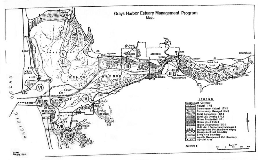
|
Standard Uses LEGEND: • Appropriate uses Uses that may be appropriate depending on circumstances within specific management units Uses that would be generally inappropriate within designated management units |
Natural |
Conservancy |
Rural |
Urban* |
Management Unit No. 44
|
|||||
|---|---|---|---|---|---|---|---|---|---|---|
|
|
N |
CN |
CM |
RL |
RA |
UR |
UD |
UM |
CM |
|
|
Port Facilities |
Dock and warehouse facilities |
|
|
|
|
|
|
• |
• |
|
|
Port terminal facilities |
|
|
|
|
|
|
• |
|
|
|
|
Ship berthing |
|
|
|
|
|
|
• |
|
|
|
|
Barge berthing |
|
|
|
|
|
|
• |
|
|
|
|
Ship construction and repair |
|
|
|
|
|
|
• |
|
|
|
|
Navigational aids |
|
|
• |
• |
• |
• |
• |
• |
|
|
|
Manufacturing and Other |
Heavy industry |
|
|
|
|
|
|
• |
|
|
|
Light industry |
|
|
|
|
|
|
• |
• |
|
|
|
Water-dependent industry |
|
|
|
|
|
|
• |
• |
|
|
|
Forest products processing |
|
|
|
|
|
|
• |
|
|
|
|
Mineral extraction and storage |
|
|
|
• |
• |
|
• |
|
|
|
|
Transportation |
Ferry terminal |
|
|
|
• |
• |
• |
• |
• |
|
|
Shipping |
|
|
|
|
|
|
• |
|
|
|
|
Roads and railroads |
|
|
|
• |
• |
• |
• |
• |
|
|
|
Airports |
|
|
|
|
|
|
• |
• |
|
|
|
Overhead utility corridor |
|
|
|
• |
• |
• |
• |
• |
|
|
|
Submerged utility corridor |
|
|
|
|
|
• |
• |
• |
|
|
|
Food Industry |
Commercial fishing (including shellfish) |
|
• |
• |
|
|
|
|
|
|
|
Oyster culture |
|
• |
• |
|
|
|
|
|
|
|
|
Aquaculture |
|
• |
• |
|
|
|
• |
• |
|
|
|
Fish and food processing |
|
|
|
|
|
|
• |
• |
|
|
|
Commercial |
Motel |
|
|
|
|
|
• |
|
• |
|
|
Boat sales, construction and repair |
|
|
|
|
|
• |
• |
• |
|
|
|
Restaurant |
|
|
|
• |
|
• |
|
• |
|
|
|
Marina |
|
|
|
|
|
• |
• |
• |
|
|
|
Other commercial |
|
|
|
|
|
|
|
• |
|
|
|
Recreation |
Public fishing areas |
• |
• |
• |
• |
• |
• |
• |
• |
|
|
Water-dependent hunting |
• |
• |
• |
• |
• |
|
|
|
|
|
|
Pleasure boating |
• |
• |
• |
• |
• |
• |
• |
• |
|
|
|
Camping |
|
|
• |
• |
|
|
|
|
|
|
|
Public boat ramp |
|
|
• |
• |
|
• |
• |
• |
|
|
|
Park/parkway, other public access |
|
|
|
• |
|
• |
• |
• |
|
|
|
Residential |
Floating homes |
|
|
|
|
|
|
|
|
|
|
Urban/suburban |
|
|
|
|
|
• |
|
• |
|
|
|
Rural low intensity (scattered) |
|
|
|
• |
|
• |
|
|
|
|
|
Rural agricultural (farm house) |
|
|
• |
|
• |
|
|
|
|
|
|
Agriculture |
Major cultivated crops |
|
|
|
|
• |
|
|
|
|
|
Passive agriculture |
|
|
• |
• |
• |
|
|
|
|
|
|
Subsistence/local market farming |
|
|
• |
• |
• |
|
|
|
|
|
|
Tree farm |
|
|
• |
• |
• |
|
|
|
|
|
|
Natural Areas |
Estuarine and marine sanctuaries |
• |
• |
|
|
|
|
|
|
|
|
Wildlife refuges |
• |
• |
• |
• |
|
|
|
|
|
|
|
Living resource production and habitat |
• |
• |
• |
• |
• |
• |
• |
• |
|
|
|
*All urban uses and standards governed by city map and zoning ordinance. See Chapter 17.32 WMC. |
||||||||||
|
MANAGEMENT UNIT 36 PLANNING AREA VII Management Category RL/CM – Rural Low Intensity/Conservancy Managed Boundary Description Southern boundary – Management Units 34* and 35. Northern boundary – Westport city limits, generally defined by the half section line in Section 18 (T16N, R11W). Split Unit Boundary – line of nonaquatic vegetation (Section 404). Plan boundary – a line 200 feet landward from the line of nonaquatic vegetation (Section 404). Management Objectives This is a transition management unit between the natural areas to the south and the urban areas of Westport to the north. The management philosophy of this unit preserves the shoreline area in a relatively undisturbed condition. The landward portion of the unit is intended to remain a low intensity use area. * The Westport Highway traveling west from the Elk River Bridge is within Management Unit 34. The highway may also be within Management Unit 36, depending on the exact location of the line of nonaquatic vegetation. In all cases, the highway is subject to the following special condition: Special Conditions 1. Maintenance, reconstruction and/or replacement of the highway bridge and bridge approaches are allowed. However, in the preparation of the Estuary Plan, it was not anticipated that such improvements would involve substantial loss of aquatic habitat. In the event substantial losses occur with highway or bridge improvements inside the plan boundary, Level V mitigation will be required.
|
|
Allowable Activities |
||
|
|
Management Category |
RL |
CM |
|
|
|
Structures |
|
|
|
|
|
Piers, docks, wharves |
|
|
|
|
|
Piling and mooring dolphins |
|
C |
|
|
|
Bridges |
1 |
1 |
|
|
|
Causeways |
|
|
|
|
|
Outfalls |
C |
C |
|
|
|
Cable/pipeline crossing |
|
|
|
|
|
Boathouse |
|
|
|
|
|
Breakwater |
|
|
|
|
|
Bank |
|
|
|
|
|
Diking |
C |
|
|
|
|
Bulkheading |
|
|
|
|
|
Groins |
|
|
|
|
|
Jetty |
|
|
|
|
|
Special project fills |
|
|
|
|
|
Bankline straightening |
|
|
|
|
|
Bankline erosion control |
C |
|
|
|
|
Special activities |
|
|
|
|
|
New access channel |
|
|
|
|
|
Channel/berth maintenance |
|
|
|
|
|
|
|
|
|
|
|
Legend: Allowed activity |
A |
|
|
|
|
Conditional activity |
C |
|
|
|
|
Special conditions |
1, 3 |
|
|
|
|
Not allowed |
|
|
|
|
|
|
|
|
|
|
|
STANDARD USES See Standard Use Table |
|||
|
MANAGEMENT UNIT 37 PLANNING AREA VIII Management Category UM/CM – Urban Mixed/Conservancy Managed Boundary Description Southern Boundary – Management Unit 36. Northern Boundary – Pacific Avenue. Split Unit Boundary – the line of nonaquatic vegetation (Section 404). Plan Boundary – a line approximately 200 feet landward of the line of nonaquatic vegetation. Management Objectives This management unit is intended to establish an eastern line of limitation for the expanding urban areas of Westport. There is considerable salt marsh in the eastern portion of the management unit and will be preserved in its natural conditions. |
|
Allowable Activities |
||
|
Management Category |
UM* |
CM |
||
|
Structures |
|
|
||
|
Piers, docks, wharves |
|
|
||
|
Piling and mooring dolphins |
|
|
||
|
Bridges |
|
|
||
|
Causeways |
C |
|
||
|
Outfalls |
C |
C |
||
|
Cable/pipeline crossing |
|
|
||
|
Boathouses |
|
|
||
|
Breakwater |
|
|
||
|
Bank |
|
|
||
|
Diking |
C |
|
||
|
Bulkheading |
|
|
||
|
Groins |
|
|
||
|
Jetty |
|
|
||
|
Special project fills |
|
|
||
|
Bankline straightening |
|
|
||
|
Bankline erosion control |
C |
|
||
|
Special activities |
|
|
||
|
New access channel |
|
|
||
|
Channel/berth maintenance |
|
|
||
|
|
|
|
||
|
Legend: Allowed activity |
A |
|
||
|
Conditional activity |
C |
|
||
|
Special conditions |
1, 3 |
|
||
|
Not allowed |
|
|
||
|
|
|
|
||
|
STANDARD USES See Standard Use Table |
||||
|
|
*All urban uses and standards governed by city map and zoning ordinance. See Chapter 17.32 WMC. |
|||
.
|
MANAGEMENT UNIT 38 PLANNING AREA VIII Management Category UM/CM – Urban Mixed/Conservancy Natural Boundary Description Southern Boundary – Management Unit 37. Northern Boundary – the line between the city of Westport Airport property and the lands owned by the Port of Grays Harbor. This line is further defined by a drainage ditch between the two properties. Split Unit Boundary – the line of nonaquatic vegetation (Section 404). Plan Boundary – a line of 200 feet landward of the line of nonaquatic vegetation. Management Objectives This management unit contains considerable salt marsh areas as well as the existing Westport Airport. Both uses are important to the local area and the regional economy and both shall be preserved. Special Conditions In addition to standard uses and allowable activities, the following conditions also apply: 1. Filling to raise the Westport airfield to provide for its year-round use is allowed in this management unit. The existing facility encompasses an area approximately 200 feet by 2,100 feet which is further identified by “X” shaped white markers at the northern and southern ends of the runway. These markers are visible on U.S. Army Corps of Engineers Surveillance Photo No. S83020 96-1, May 26, 1983. Based on current information, raising of the airfield would not have an unacceptable adverse impact on the ecosystem, including wetlands. |
|
Allowable Activities |
||
|
Management Category |
UM* |
CM |
||
|
Structures |
|
|
||
|
Piers, docks, wharves |
|
2 |
||
|
Piling and mooring dolphins |
|
C |
||
|
Bridges |
|
|
||
|
Causeways |
|
|
||
|
Outfalls |
C |
C |
||
|
Cable/pipeline crossing |
|
|
||
|
Boathouses |
|
|
||
|
Breakwater |
|
|
||
|
Bank |
|
|
||
|
Diking |
C |
1, 2, 3 |
||
|
Bulkheading |
|
|
||
|
Groins |
|
|
||
|
Jetty |
|
|
||
|
Special project fills |
|
|
||
|
Bankline straightening |
|
|
||
|
Bankline erosion control |
C |
3 |
||
|
Special activities |
C |
1, 2 |
||
|
New access channel |
2 |
2 |
||
|
Channel/berth maintenance |
2 |
2 |
||
|
|
|
|
||
|
Legend: Allowed activity |
A |
|
||
|
Conditional activity |
C |
|
||
|
Special conditions |
1, 3 |
|
||
|
Not allowed |
|
|
||
|
|
|
|
||
|
STANDARD USES See Standard Use Table |
||||
|
*All urban uses and standards governed by city map and zoning ordinance. See Chapter 17.32 WMC. |
||||
|
2. Regarding the marina expansion project in Management Unit 39, one of the important considerations in evaluating final design options will be the ability to obtain adequate flushing within the marina to maintain water quality conditions necessary to protect aquatic resources. It is possible that considering design options which would achieve better flushing characteristics, very limited encroachment into Management Unit 38 might be considered. However, encroachment into Management Unit 38 will not be allowed if another alternative to protecting water quality for fisheries resources, such as artificial aeration or basin redesign, is feasible. Any suspected water quality problems must be clearly demonstrated through physical or mathematical modeling, or other appropriate methods. This determination will be made by EPA, Corps of Engineers and state and federal resources agency personnel at the time marina design options and alternative methods for maintaining water quality are evaluated. Level V mitigation would be required for any loss of wetlands in Management Unit 38 associated with this special condition. 3. Bankline erosion control and diking will be allowed only in conjunction with other allowed activities.
|
|
|
|
|
|
MANAGEMENT UNIT 39 PLANNING AREA VIII Management Category UM – Urban Mixed Boundary Description Southern Boundary – Management Unit 38. Western Boundary – a point where the old railroad grade intersects with the shoreline of the western side of Point Chehalis. Plan Boundary – State Highway and Jetty Haul Road. Eastern Boundary – the waterward boundary includes all of the water area of the existing marina and protective breakwater. Management Objectives This is the most intensely developed management unit in this portion of the estuary. Because of its unique location in the harbor, it is anticipated that this area will be the focus for the harbor’s commercial and sport fishing industry. Its unique location at the mouth of the harbor along with equally unique stable soils, also make this area well suited for water-dependent industrial development. Intensive use of the shoreline and adjacent areas is envisioned for both activities. While it is not intended that water-dependent industrial development in the area would preclude expansion of the present marina, if such development should preclude future marina expansion, a plan amendment and Level V mitigation would be required to accommodate a new marina site. Special Conditions In addition to standard uses and allowable activities, the following conditions will also apply: 1. The new marina is allowed in the southeastern portion of the management unit.
|
|
Allowable Activities |
||
|
|
Management Category |
UM* |
|
|
|
|
Structures |
|
|
|
|
|
Piers, docks, wharves |
A |
|
|
|
|
Piling and mooring dolphins |
A |
|
|
|
|
Bridges |
|
|
|
|
|
Causeways |
|
|
|
|
|
Outfalls |
5 |
|
|
|
|
Cable/pipeline crossing |
|
|
|
|
|
Boathouses |
A |
|
|
|
|
Breakwater |
A |
|
|
|
|
Bank |
|
|
|
|
|
Diking |
C |
|
|
|
|
Bulkheading |
3, 6 |
|
|
|
|
Groins |
A |
|
|
|
|
Jetty |
A |
|
|
|
|
Special project fills |
1 – 4, 6 |
|
|
|
|
Bankline straightening |
|
|
|
|
|
Bankline erosion control |
A |
|
|
|
|
Special activities |
|
|
|
|
|
New access channel |
|
|
|
|
|
Channel/berth maintenance |
|
|
|
|
|
|
|
|
|
|
|
Legend: Allowed activity |
A |
|
|
|
|
Conditional activity |
C |
|
|
|
|
Special conditions |
1, 3 |
|
|
|
|
Not allowed |
|
|
|
|
|
|
|
|
|
|
|
STANDARD USES See Standard Use Table |
|||
|
|
||||
|
|
*All urban uses and standards governed by city map and zoning ordinance. See Chapter 17.32 WMC. |
|||
|
|
|
|||
|
2. The project is envisioned to involve a plan generally consistent with the size identified in Alternative 2, the Public Brochure released by the Corps of Engineers entitled, “Alternatives and Their Pros and Cons, Small-Boat Basin, Grays Harbor, Washington, Area A – Westport, Draft #3, September, 1973.” While such a project must meet applicable local, state and federal regulations, it is not considered an unacceptable adverse impact in the context of the total estuary management plan. 3. Filling and bulkheading as may be required by allowable uses is allowed including necessary reconstruction of existing docks, breakwater, or other existing facilities to permit optimum use of the existing marina. 4. Design options that are developed and evaluated as a part of the marina expansion permit may be constrained by factors in Management Unit 38. Prior to any final evaluations, the conditions and management objective of that management unit should be reviewed for compliance. 5. Continued operations and maintenance of the existing outfall in this management unit is allowed. New outfalls will not be allowed unless it can be demonstrated that they would not adversely affect water quality in Management Unit 38. 6. No more than five acres of wetland fill may be allowed for water-dependent industrial development in this management unit. In any case, the total impacts associated with any water-dependent industrial development which exceeds the impacts anticipated by the planned marina expansion will require Level V mitigation for the excess impacts. |
|
|
|
|
Except that pursuant to WAC 173-27-120, decisions on limited utility extensions and bulkheads shall be issued within 21 days of a 20-day comment period in the notice of application, and local appeals have a 30-day decision period.