


Chapter 1.05
GENERAL PROVISIONS
Sections:
1.05.010 Confirmation of district creation.
1.05.010 Confirmation of district creation.
The creation and establishment of the Cross Valley Water District by the majority of the voters voting at a special election held September 19, 1989, is hereby confirmed in its entirety. [Res. 1989-10-1 § 1.]
1.05.020 Official seal.
The seal as set forth below is hereby adopted as the official seal of the district for the purposes of transacting district business.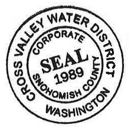
[Res. 1990-4-8; Res. 1989-10-1 § 2.]
1.05.030 District logo.*
The district hereby adopts as the district’s logo the design prepared by Janie Upton Design shown on Exhibit A attached to the resolution codified in this section, without the extra black wavy line between the upper and lower portion of the logo. [Res. 1991-11-8.]
* Code reviser’s note: The current district logo, as adopted and modified by this section, appears as follows:![]()
1.05.040 District boundaries.**
The Cross Valley Water District boundaries shall be as set forth below.
LEGAL DESCRIPTION FOR
CROSS VALLEY WATER DISTRICT
The sections or portions of Sections 1, 2, 11, 12, 13, 14, 16, 21, 22, 24, 25, 26, 27 and 36, Township 28 North, Range 5 East, W.M., Sections 30 and 31, Township 28 North, Range 6 East, W.M., Sections 1, 2, 3, 10, 11, 12, 13, 14, 15, 22, 23, 24, 25, 26, 27, 34 and 35, Township 27 North, Range 5 East, W.M., Sections 6, 7, 8, 16, 17, 18, 19, 20, 21, 26, 27, 28, 29, 30, 31, 32, 33, 34 and 35, Township 27 North, Range 6 East, W.M., in Snohomish County, Washington, described as follows:
Beginning at the northwest corner of Section 1, Township 27 North, Range 5 East, W.M.;
Thence easterly along the north line of the NW 1/4 of said Section 1 to the west line of the SW 1/4 of the SE 1/4 of Section 36, Township 28 North, Range 5 East, W.M.;
Thence northerly along said west line to the south line of the NE 1/4 of the SW 1/4 of said Section 36;
Thence westerly along said south line to the west line of the east half of the west half of said Section 36;
Thence northerly along said west line to the south line of Section 25, Township 28 North, Range 5 East, W.M.;
Thence westerly along said south line and the south line of the SE 1/4 of Section 26, Township 28 North, Range 5 East, W.M., to its intersection with the east line of the west 20 feet of the E 1/2 of the W 1/2 of the SE 1/4 of said Section 26;
Thence northerly along said east line to its intersection with the southwesterly margin of Lowell-Larimer Road;
Thence northwesterly along said southwesterly margin to its intersection with the east line of the W 1/2 of the W 1/2 of the SE 1/4 of said Section 26;
Thence southerly along said east line to the south line thereof;
Thence westerly along said south line to the west line thereof;
Thence northerly along said west line to its intersection with the south line of the E 3/4 of the S 1/2 of the NE 1/4 of the SW 1/4 of said Section 26;
Thence westerly along said south line to the west line thereof;
Thence northerly along said west line to its intersection with the south line of the N 1/2 of the NE 1/4 of the SW 1/4 of said Section 26;
Thence westerly along said south line to the west line thereof;
Thence northerly along said west line to the south line of the SW 1/4 of the NW 1/4 of said Section 26;
Thence westerly along said south line and the south line of the N 1/2 of Section 27, Township 28 North, Range 5 East, W.M. to its intersection with the west line of the SE 1/4 of the NW 1/4 of said Section 27;
Thence northerly along said west line to its intersection with the south line of the NW 1/4 of the NW 1/4 of said Section 27;
Thence westerly along said south line to its intersection with the east line of the west 800 feet of the NW 1/4 of the NW 1/4 of said Section 27;
Thence northerly along said east line to the north line thereof;
Thence westerly along said north line to its intersection with the east line of the south 430 feet of the west 410 feet of the SW 1/4 of Section 22, Township 28 North, Range 5 East, W.M.;
Thence northerly along said east line to the north line thereof;
Thence westerly along said north line to its intersection with the west line of the SW 1/4 of said Section 22;
Thence northerly along said west line to the south line of the SE 1/4 of the NE 1/4 of Section 21, Township 28 North, Range 5 East, W.M.;
Thence westerly along said south line to the west line thereof;
Thence northerly along said west line to its intersection with the southwesterly margin of Lowell-Larimer Road;
Thence northwesterly along said southwesterly margin to its intersection with the south line of the NW 1/4 of the NE 1/4 of said Section 21;
Thence westerly along said south line to the west line thereof;
Thence northerly along said west line to the south line of the E 1/2 of the SE 1/4 of the SE 1/4 of the SW 1/4 of Section 16, Township 28 North, Range 5 East, W.M.;
Thence westerly along said south line to the west line thereof;
Thence northerly along said west line to its intersection with the south line of the NE 1/4 of the SE 1/4 of the SW 1/4 of said Section 16;
Thence westerly along said south line to the west line thereof;
Thence northerly along said west line to its intersection with the south line of the NE 1/4 of the SW 1/4 of said Section 16;
Thence westerly along said south line to the west line thereof;
Thence northerly along said west line and the west line of the SE 1/4 of the NW 1/4 of said Section 16 to its intersection with the south line of the north 660 feet of the east 550 feet of the SW 1/4 of the NW 1/4 of said Section 16;
Thence westerly along said south line to the west line thereof;
Thence northerly along said west line to its intersection with the south line of the E 1/2 of the NW 1/4 of the NW 1/4 of said Section 16;
Thence westerly along said south line to the west line;
Thence northerly along said west line to the north line thereof;
Thence easterly along said north line and the north line of the E 1/2 of the NW 1/4 of said Section 16 to the east line thereof;
Thence southerly along said east line to the north line of the W 1/2 of the SE 1/4 of said Section 16;
Thence easterly along said north line to the east line thereof;
Thence southerly along said east line to the north line of the NE 1/4 of the NE 1/4 of Section 21, Township 28 North, Range 5 East, W.M.;
Thence easterly along said north line to the east line thereof;
Thence southerly along said east line to the north line of the SW 1/4 of the NW 1/4 of Section 22, Township 28 North, Range 5 East, W.M.;
Thence easterly along said north line to the east line thereof;
Thence southerly along said east line to the north line of the NE 1/4 of the SW 1/4 of said Section 22;
Thence easterly along said north line and the north line of the SE 1/4 of said Section 22 to the east line thereof;
Thence southerly along said east line to the north line of the NW 1/4 of Section 26, Township 28 North, Range 5 East, W.M.;
Thence easterly along said north line to the east line thereof;
Thence southerly along said east line to its intersection with the north line of the W 1/2 of the SW 1/4 of the NE 1/4 of said Section 26;
Thence easterly along said north line to the east line thereof;
Thence southerly along said east line to its intersection with the north line of the SE 1/4 of said Section 26;
Thence easterly along said north line to the west line of the NW 1/4 of Section 25, Township 28 North, Range 5 East, W.M.;
Thence northerly along said west line, the west line of Section 24, Township 28 North, Range 5 East, W.M., and the west line of Section 13, Township 28 North, Range 5 East, W.M., to its intersection with the southerly bank of the Snohomish River;
Thence generally northwesterly along said southerly bank to its intersection with the west line of the E 1/2 of the SW 1/4 of Section 11, Township 28 North, Range 5 East, W.M.;
Thence northerly along said west line to its intersection with the south line of the NE 1/4 of the NW 1/4 of the SW 1/4 of said Section 11;
Thence westerly along said south line to its intersection with the easterly margin of 69th Avenue East;
Thence northerly along said easterly margin to its intersection with the south line of the N 1/2 of the SW 1/4 of the NW 1/4 of said Section 11;
Thence westerly along said south line to its intersection with the west line of the NW 1/4 of said Section 11;
Thence northerly along said west line and the west line of Section 2, Township 28 North, Range 5 East, W.M., to its intersection with the north line of the S 1/2 of the N 1/2 of the S 1/2 of said Section 2;
Thence easterly along said north line to its intersection with the west line of the E 1/2 of the E 1/2 of said Section 2;
Thence northerly along said west line to the north line thereof;
Thence easterly along said north line and the north line of the W 1/2 of the W 1/2 of the NW 1/4 of the NW 1/4 of Section 1, Township 28 North, Range 5 East, W.M., to the east line thereof;
Thence southerly along said east line to its intersection with the north line of the W 1/2 of the SW 1/4 of the NW 1/4 of said Section 1;
Thence easterly along said north line to the east line thereof;
Thence southerly along said east line to its intersection with the north line of the W 1/2 of the SW 1/4 of said Section 1;
Thence easterly along said north line to the east line thereof;
Thence southerly along said east line to the north line of the E 1/2 of the NW 1/4 of Section 12, Township 28 North, Range 5 East, W.M.;
Thence easterly along said north line to the east line thereof;
Thence southerly along said east line and the east line of the north 250 feet of the NE 1/4 of the NE 1/4 of the SW 1/4 of said Section 12 to the south line thereof;
Thence westerly along said south line to its intersection with the east line of the north 300 feet of the NW 1/4 of the NE 1/4 of the SW 1/4 of said Section 12;
Thence southerly along said east line to the south line thereof;
Thence westerly along said south line to its intersection with the east line of the W 1/2 of the SW 1/4 of said Section 12;
Thence southerly along said east line and the east line of W 1/2 of the NW 1/4 of Section 13, Township 28 North, Range 5 East, W.M., to its intersection with the south line of Government Lot 4 of said Section 13;
Thence westerly along said south line to the northerly bank of the Snohomish River;
Thence generally southeasterly along said northerly bank to its intersection with the centerline of State Highway SR-9 (Snohomish-Woodinville Highway);
Thence southerly along said centerline to its intersection with the north line of the NW 1/4 of the SE 1/4 of Section 24, Township 28 North, Range 5 East, W.M.;
Thence easterly along said north line to the east line thereof;
Thence southerly along said east line to its intersection with a line parallel to and lying 285 feet northerly of the centerline of Harrison Street;
Thence easterly along said parallel line to its intersection with the centerline of Burlington Northern Railroad right-of-way;
Thence southerly along said centerline to its intersection with a line parallel to and lying 160 feet northerly of the centerline of Harrison Street;
Thence easterly along said parallel line to its intersection with the easterly margin of Cleveland Street;
Thence southerly along said easterly margin to its intersection with the easterly extension of the northerly margin of Harrison Street;
Thence easterly along said easterly extension to its intersection with the centerline of Batt’s Slough;
Thence southwesterly along said centerline to its intersection with the east line of the SE 1/4 of said Section 24;
Thence southerly along said east line to the north line of the W 1/2 of the NW 1/4 of Section 30, Township 28 North, Range 6 East, W.M.;
Thence easterly along said north line to the east line thereof;
Thence southerly along said east line to the south line thereof;
Thence westerly along said south line to the centerline of Burlington Northern Railroad Right-of-Way;
Thence southeasterly and southwesterly along said centerline to its intersection with the centerline of Connelly Road (Snoqualmie Drive);
Thence southeasterly, southerly and southeasterly along said centerline to its intersection with the centerline of Elliott Road (Cathcart-Snoqualmie Road);
Thence southeasterly, easterly and southeasterly along said centerline to its intersection with the north line of Section 17, Township 27 North, Range 6 East, W.M.;
Thence easterly along said north line and the north line of Section 16, Township 27 North, Range 6 East, W.M., to its intersection with the southwesterly bank of Snohomish River;
Thence southeasterly along said southwesterly bank to its intersection with the east line of said Section 16;
Thence southerly along said east line and the east line of Section 21, Township 27 North, Range 6 East, W.M., to the north line of Section 27, Township 27 North, Range 6 East, W.M.;
Thence easterly along said north line to the east line thereof;
Thence southerly along said east line to its intersection with the north line of the SW 1/4 of the SW 1/4 of Section 26, Township 27 North, Range 6 East, W.M.;
Thence easterly along said north line to the east line thereof;
Thence southerly along said east line and the east line of the W 1/2 of the NW 1/4 of Section 35, Township 27 North, Range 6 East, W.M., to the north line of the NE 1/4 of the SW 1/4 of said Section 35;
Thence easterly along said north line to its intersection with the west line of the south 165 feet of the east 400 feet of the SE 1/4 of the NW 1/4 of said Section 35;
Thence northerly along said west line to the north line thereof;
Thence easterly along said north line to the west line of the NW 1/4 of the SW 1/4 of the SW 1/4 of the NE 1/4 of said Section 35;
Thence northerly along said west line to the north line thereof;
Thence easterly along said north line to the west line of the E 1/2 of the NW 1/4 of the SW 1/4 of the NE 1/4 of said Section 35;
Thence northerly along said west line to the north line thereof;
Thence easterly along said north line and its easterly extension to the centerline of High Bridge Road (West Snoqualmie Valley Road);
Thence southeasterly and southwesterly along said centerline to its intersection with the south line of Section 35, Township 27 North, Range 6 East, W.M.;
Thence westerly along said south line and the south lines of Sections 34, 33 and 32, Township 27 North, Range 6 East, W.M., to the west line of said Section 32;
Thence northerly along said west line to its intersection with the south line of the N 1/2 of the N 1/2 of Section 31, Township 27 North, Range 6 East, W.M.;
Thence westerly along said south line to the west line thereof;
Thence northerly along said west line and the west line of Government Lot 4, Section 30, Township 27 North, Range 6 East, W.M., to the south line of the N 1/2 of the SE 1/4 of Section 25, Township 27 North, Range 5 East, W.M.;
Thence westerly along said south line and the south line of the SE 1/4 of the NE 1/4 of the SW 1/4 of said Section 25 to the west line thereof;
Thence northerly along said west line to the south line of the NW 1/4 of the NE 1/4 of the SW 1/4 of said Section 25;
Thence westerly along said south line to its intersection with the centerline of State Highway SR-522 (Woodinville to Monroe);
Thence generally westerly and southwesterly along said centerline to its intersection with the north line of the NW 1/4 of the SW 1/4 of Section 35, Township 27 North, Range 5 East, W.M.;
Thence easterly along said north line to the east line thereof;
Thence southerly along said east line to the south line thereof;
Thence westerly along said south line to its intersection with the east line of the W 1/2 of the SW 1/4 of the SW 1/4 of said Section 35;
Thence southerly along said east line to the south line thereof;
Thence westerly along said south line and the south line of Section 34, Township 27 North, Range 5 East, W.M., to its intersection with the westerly margin of State Highway SR-522;
Thence northeasterly along said westerly margin to its intersection with the easterly margin of State Highway SR-9 (Woodinville Cut-Off);
Thence northerly along said easterly margin to its intersection with the easterly extension of a line parallel to and lying 200 feet northerly of the south line of the SE 1/4 of the SE 1/4 of Section 27, Township 27 North, Range 5 East, W.M.;
Thence westerly along said easterly extension and said parallel line to its intersection with the west line of the E 1/2 of the SE 1/4 of said Section 27;
Thence northerly along said west line to the south line of the NE 1/4 of the NW 1/4 of the SE 1/4 of said Section 27;
Thence westerly along said south line to the west line thereof;
Thence northerly along said west line to the south line of the SW 1/4 of the SW 1/4 of the NE 1/4 of said Section 27;
Thence westerly along said south line and the south line of the NW 1/4 of said Section 27 to the west line thereof;
Thence northerly along said west line to the south line of the west 20 feet of the south 690 feet of the SW 1/4 of Section 22, Township 27 North, Range 5 East, W.M.;
Thence easterly along said south line to the east line thereof;
Thence northerly along said east line to the north line thereof;
Thence westerly along said north line to its intersection with the west line of the SW 1/4 of the SW 1/4 of said Section 22;
Thence northerly along said west line to the north line thereof;
Thence easterly along said north line and its easterly extension to the east line of the west 30 feet of the NE 1/4 of the SW 1/4 of said Section 22;
Thence northerly along said east line to its intersection with the centerline of Little Bear Creek Road;
Thence northwesterly along said centerline to its intersection with the west line of the NE 1/4 of the SW 1/4 of said Section 22;
Thence northerly along said west line, the west line of the E 1/2 of the NW 1/4 of said Section 22 and the west line of the SE 1/4 of the SW 1/4 of Section 15, Township 27 North, Range 5 East, W.M., to its intersection with the north line of the S 1/2 of the N 1/2 of the SE 1/4 of the SW 1/4 of said Section 15;
Thence easterly along said north line to the west line of the NW 1/4 of the NW 1/4 of the SW 1/4 of the SE 1/4 of said Section 15;
Thence northerly along said west line and the west line of the SW 1/4 of the SW 1/4 of the NW 1/4 of the SE 1/4 of said Section 15 to the south line of the N 1/2 of the S 1/2 of the N 1/2 of the SW 1/4 of said Section 15;
Thence westerly along said south line to its intersection with the west line of the said Section 15;
Thence northerly along said west line and west lines of Sections 10 and 3, Township 27 North, Range 5 East, W.M., to its intersection with the north line of the S 1/2 of the S 1/2 of said Section 3;
Thence easterly along said north line and the north line of the S 1/2 of the SW 1/4 of Section 2, Township 27 North, Range 5 East, W.M., to its intersection with the west line of the NW 1/4 of the SE 1/4 of said Section 2;
Thence northerly along said west line and the west line of the S 1/2 of the NE 1/4 of said Section 2 to the north line thereof;
Thence easterly along said north line to the west line of the NW 1/4 of the NW 1/4 of Section 1, Township 27 North, Range 5 East, W.M.;
Thence northerly along said west line to the point of beginning.
[Res. 1989-10-1 § 3.]
** Code reviser’s note: This section sets out the original boundaries of the district as adopted in 1989. For annexations and mergers that have modified these boundaries, see the Annexation and Merger Table.