


D. Guide to the Comprehensive Plan
The Comprehensive Plan is comprised of two major parts. The first part contains a vision statement, guiding principles, and a series of plan elements that apply Citywide. The second part contains plans for each of the City’s neighborhoods (see Figure I-2).
Citywide Elements
All of the Comprehensive Plan Elements contain goals, policies, and narrative. Goals describe the desired outcome that the City is striving to attain, policies are principles to achieve the goals, while the narrative provides further explanation of the goals and policies. In addition, several appendices are included to provide additional background information.
Two key parts of the Citywide portion of the Plan are the Vision Statement and the Guiding Principles. The Vision Statement is a reflection of the values of the community and establishes the character of community that the Plan is oriented toward. The Guiding Principles represent the fundamental goals guiding growth and development and establish a foundation for the Plan. The remaining elements are:
• Community Character
• Environment
• Land Use
• Housing
• Economic Development
• Transportation
• Parks and Recreation
• Public Utilities
• Public Services
• Human Services
• Capital Facilities
• Implementation Strategies
Neighborhood Plans
The Neighborhood Plans allow a more detailed examination of issues affecting smaller geographic areas within the City and clarify how broader City goals and policies in the Citywide Elements apply to each neighborhood. See Figure I-11 for the name, location and boundary of each neighborhood.
It is intended that each neighborhood plan be consistent with the Citywide Elements. The 2015 GMA Plan Update included revisions to the neighborhood plans to ensure consistency with the Citywide elements and the development regulations.
The Neighborhood Plans, found in Chapter XV, contain policy statements and narrative discussion, as well as a series of maps. The maps describe land use, natural elements, pedestrian and bicycle systems, vehicular circulation, urban design, and other graphic representations. These maps serve as a visual interpretation of the Neighborhood Plan policy statements and discussion. In the event of a discrepancy between the land use map and the narrative, the land use map will provide more explicit policy direction.
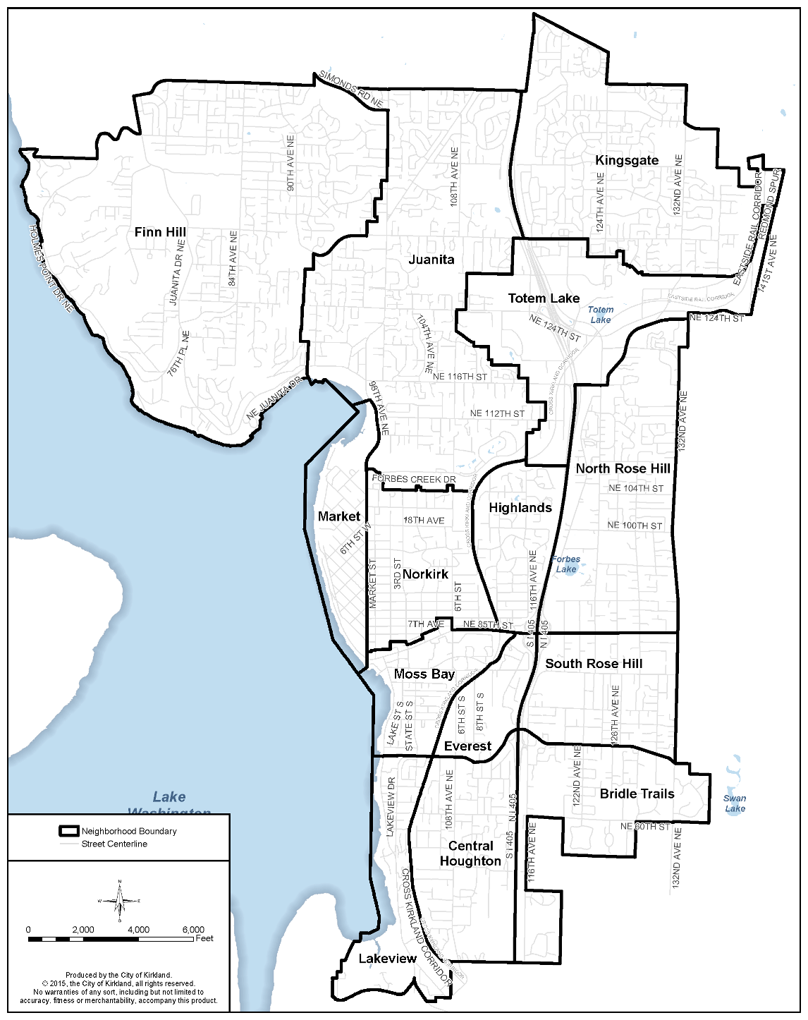
Figure I-11: City of Kirkland Neighborhoods