


B. Existing Conditions
The existing condition of Kirklands transportation system is shown in the following maps:
|
Figure T-1 |
Sidewalks Completion: Where Sidewalks Are Completed on Streets |
|
Figure T-2 |
Uncontrolled Crosswalks: Crosswalks and Improvements |
|
Figure T-3 |
Walkability: Walkability by Street Segment |
|
Figure T-4 |
Trails and Pedestrian Easements |
|
Figure T-5 |
Existing On-Street Bike Lanes |
|
Figure T-6 |
Completion of Sidewalks on School Walk Routes |
|
Figure T-7 |
Transit Routes in the Kirkland Vicinity: King County Metro and Sound Transit Routes |
|
Figure T-8 |
Volume of Riders and Location of Shelters at Transit Stops |
|
Figure T-9 |
Location of Transportation Management Program and Commute Trip Reduction Sites |
|
Figure T-10 |
Pavement Condition Index |
|
Figure T-11 |
Signals and Other Devices Maintained by the City of Kirkland |
|
Figure T-12 |
Freight Volume on Selected Routes |
|
Figure T-13 |
Parking Locations in Downtown Kirkland |
|
Figure T-14 |
Existing Traffic Congestion |
|
Figure T-15 |
Functional Classification of Streets |
|
Figure T-16 |
Volume of Auto Traffic on Selected Streets |
I-405 and associated ramp facilities at NE 70 Street, NE 85th Street, 116th Street, NE 124th Street and NE 128th Street are owned by the State of Washington. Express toll lanes operate on I-405.
There are no air, water or rail transportation facilities in Kirkland. Privately operated tour boats operate from a facility in downtown Kirkland.
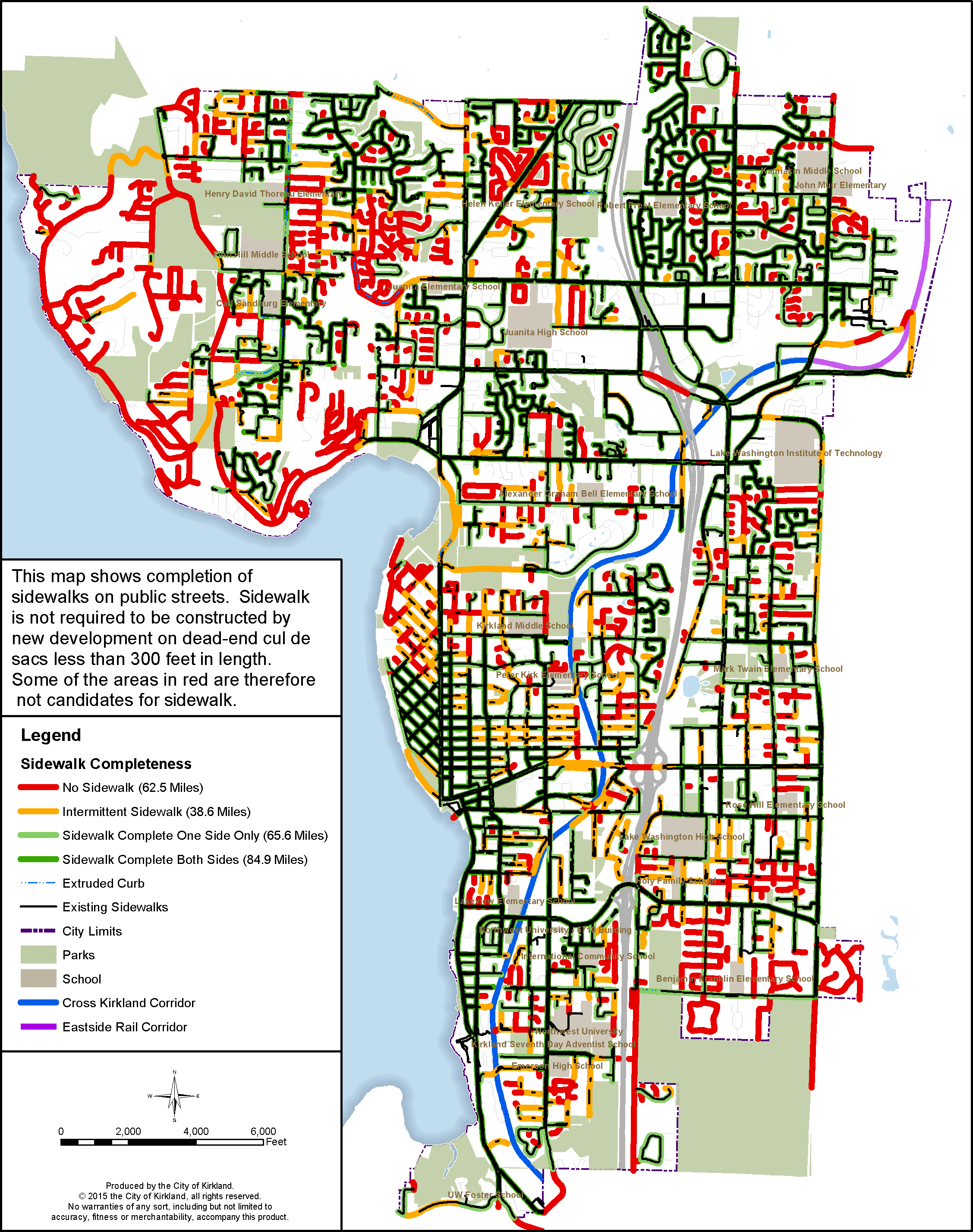
Figure T-1: Sidewalks Completion: Where Sidewalks Are Completed on Streets
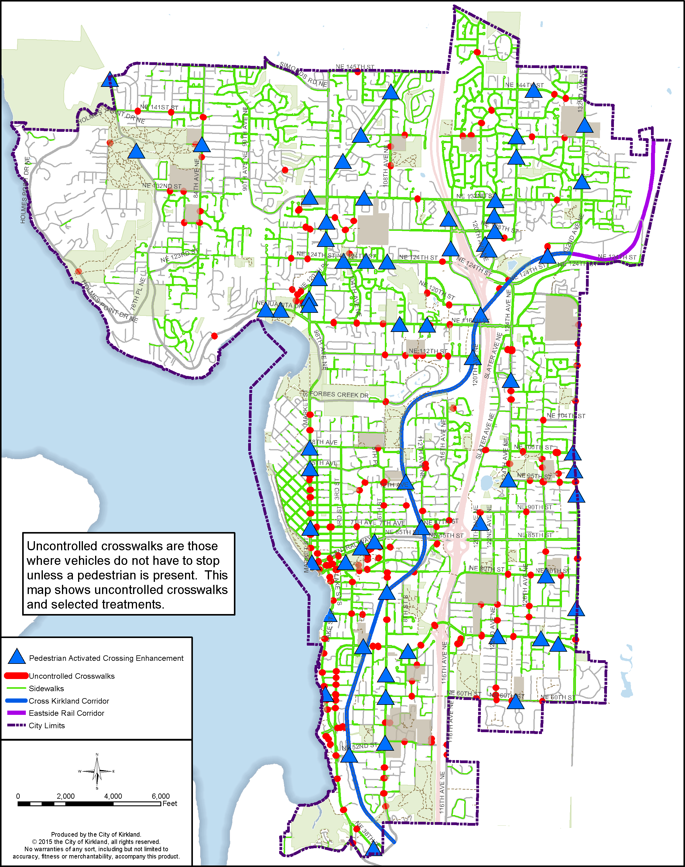
Figure T-2: Uncontrolled Crosswalks: Crosswalks and Improvements
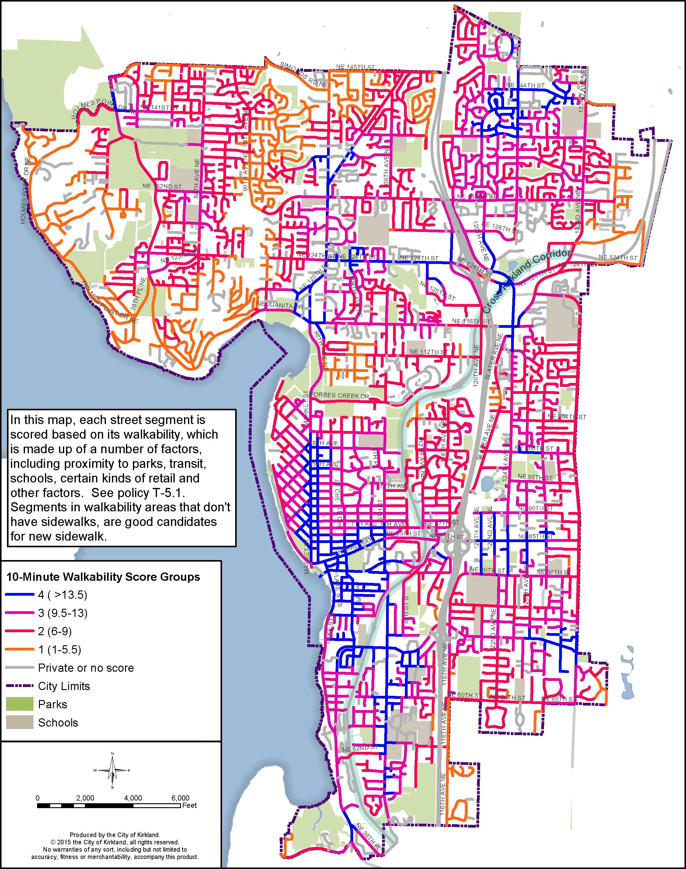
Figure T-3: Walkability: Walkability by Street Segment

Figure T-4: Trails and Pedestrian Easements
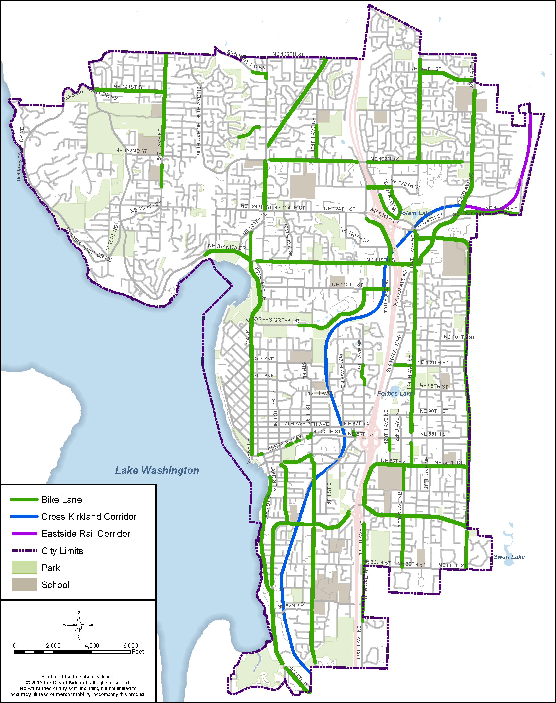
Figure T-5: Existing On-Street Bike Lanes
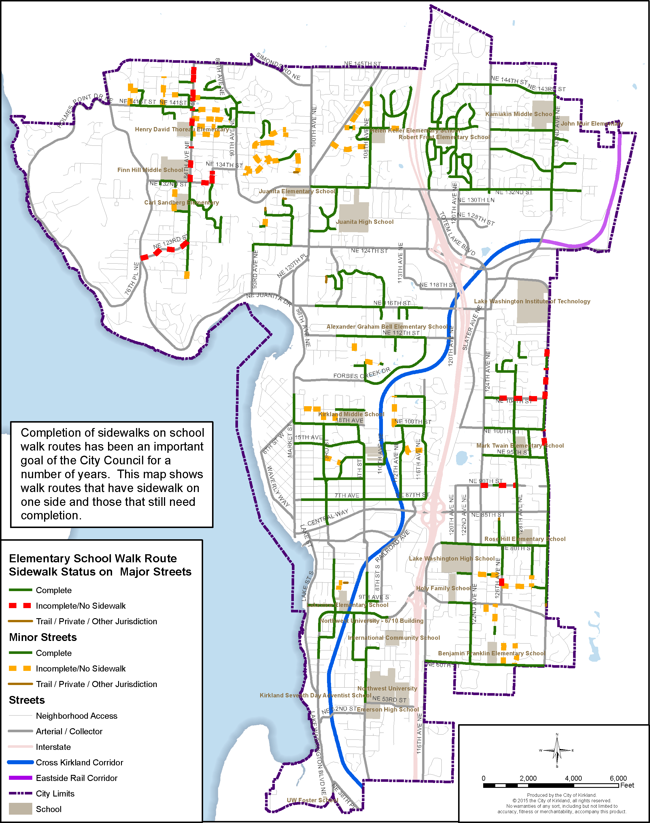
Figure T-6: Completion of Sidewalks on School Walk Routes
![]()
Figure T-7: Transit Routes in the Kirkland Vicinity: King County Metro and Sound Transit Routes
![]()
Figure T-8: Volume of Riders and Location of Shelters at Transit Stops
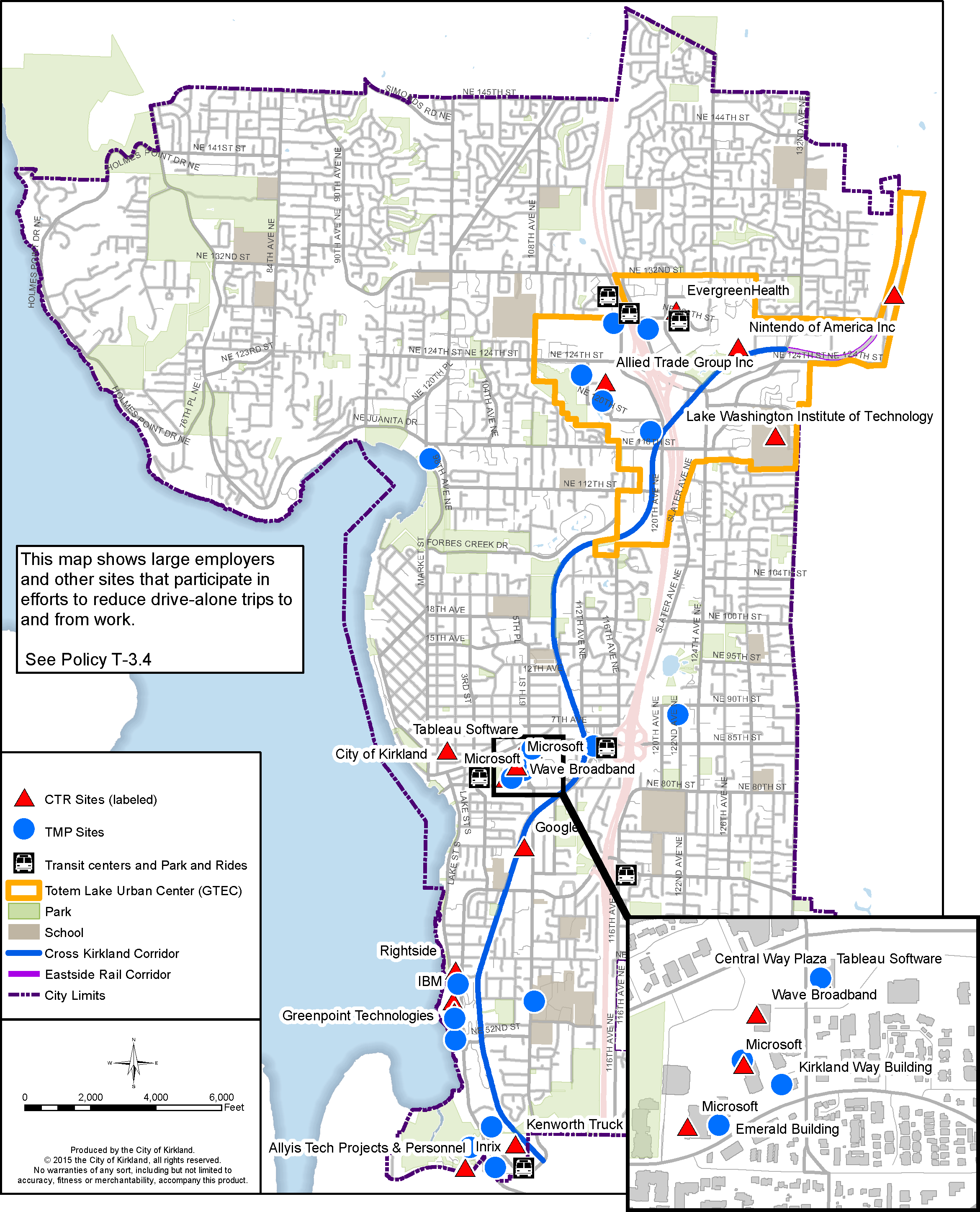
Figure T-9: Location of Transportation Management Program and Commute Trip Reduction Sites
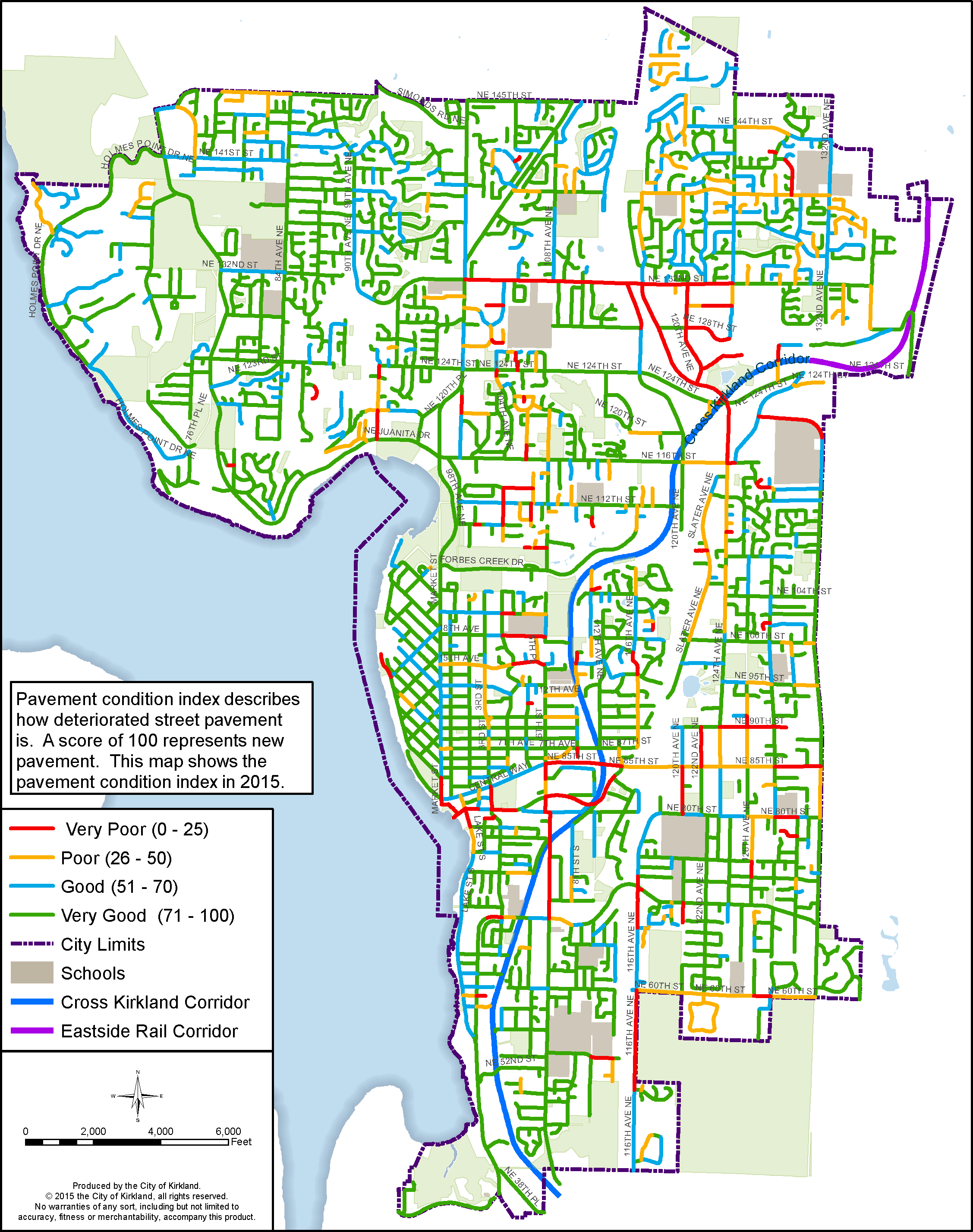
Figure T-10: Pavement Condition Index
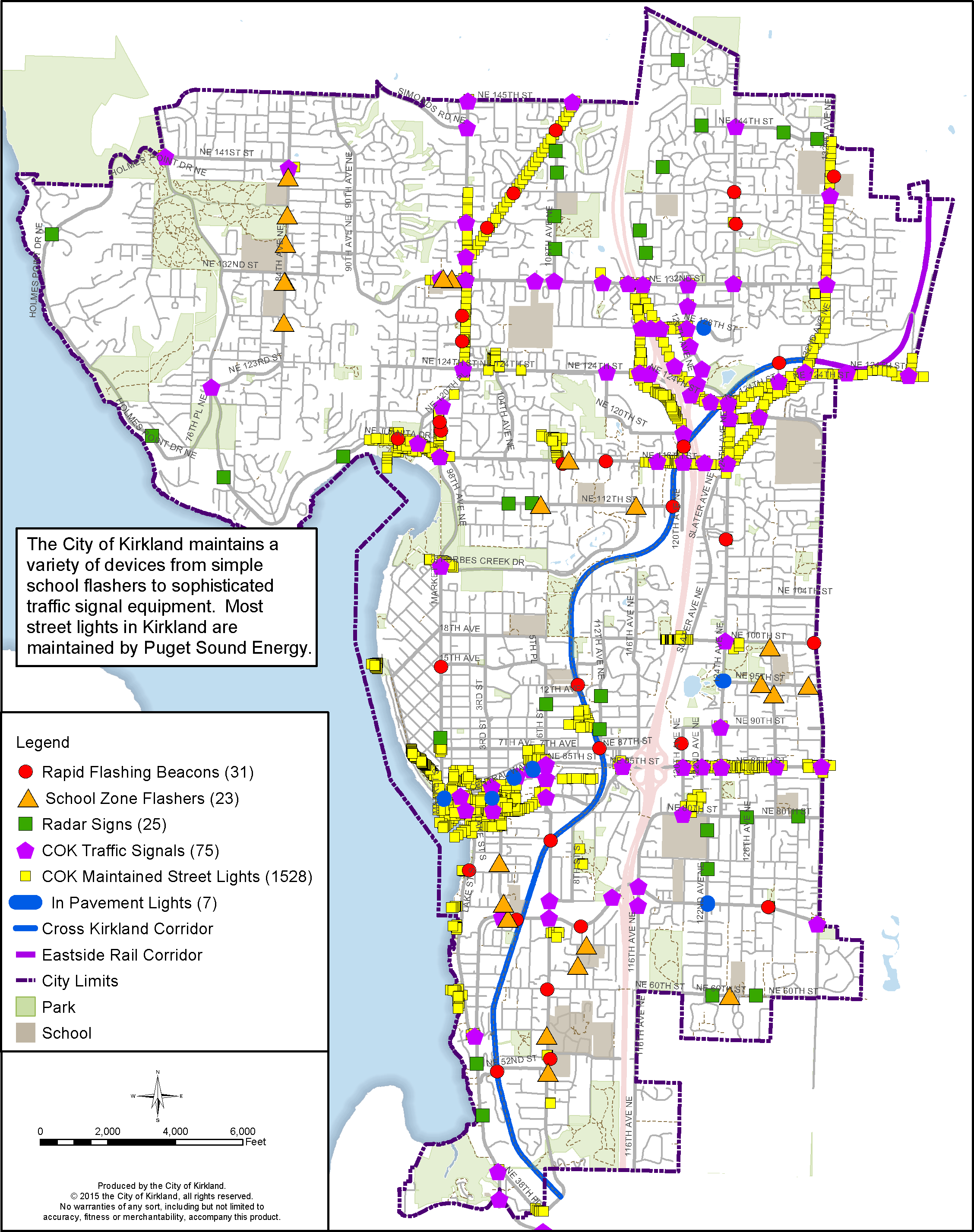
Figure T-11: Signals and Other Devices Maintained by the City of Kirkland
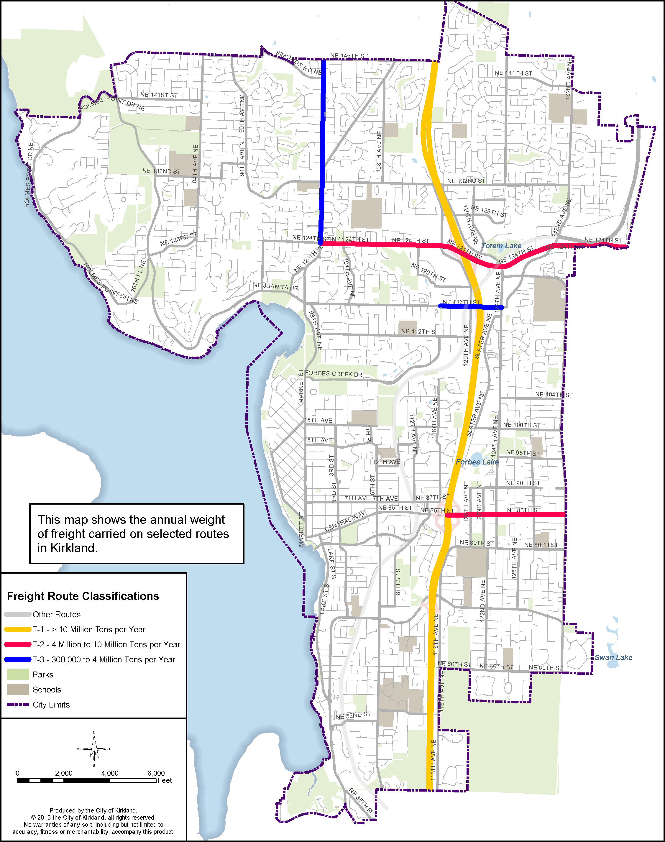
Figure T-12: Freight Volume on Selected Routes
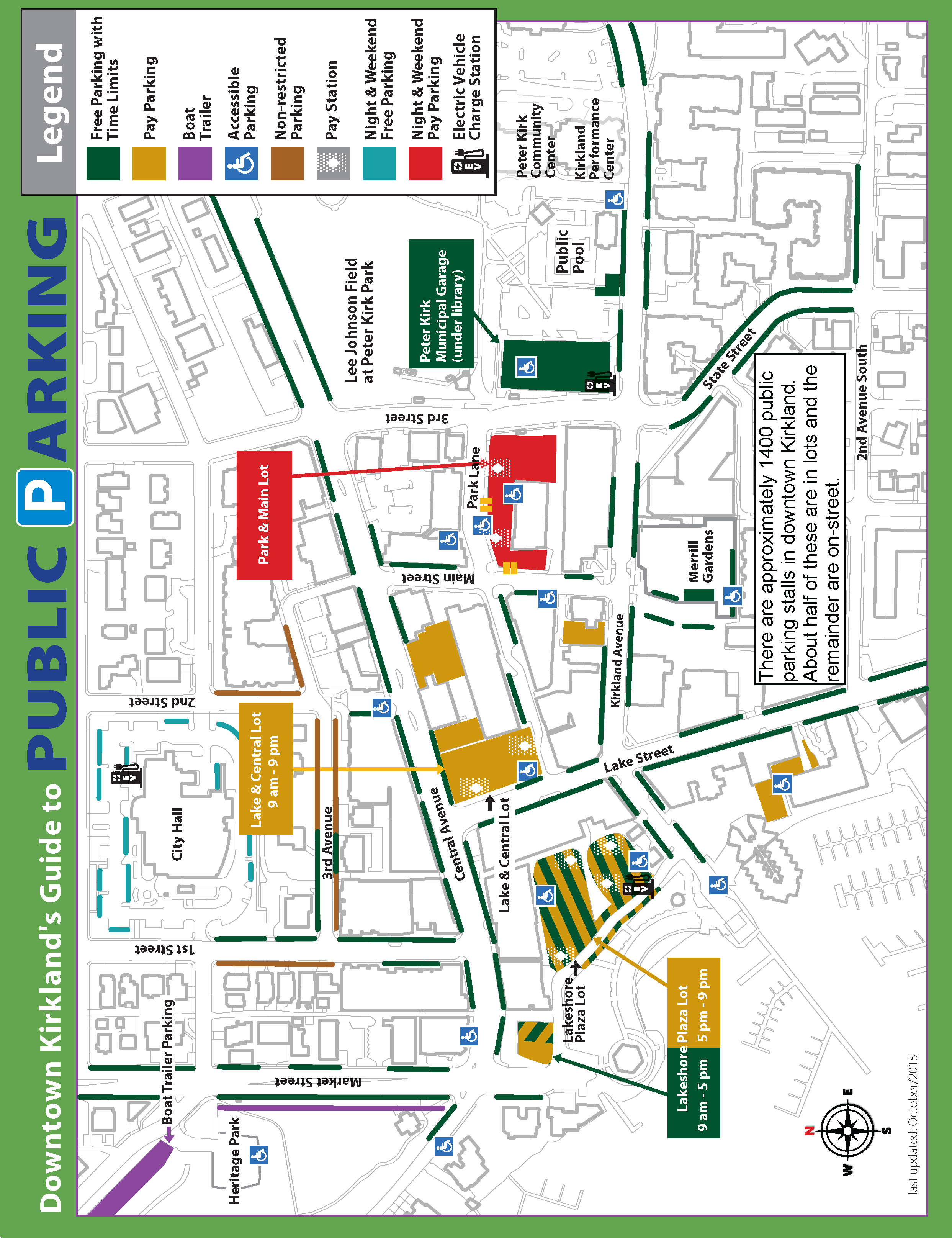
Figure T-13: Parking Locations in Downtown Kirkland
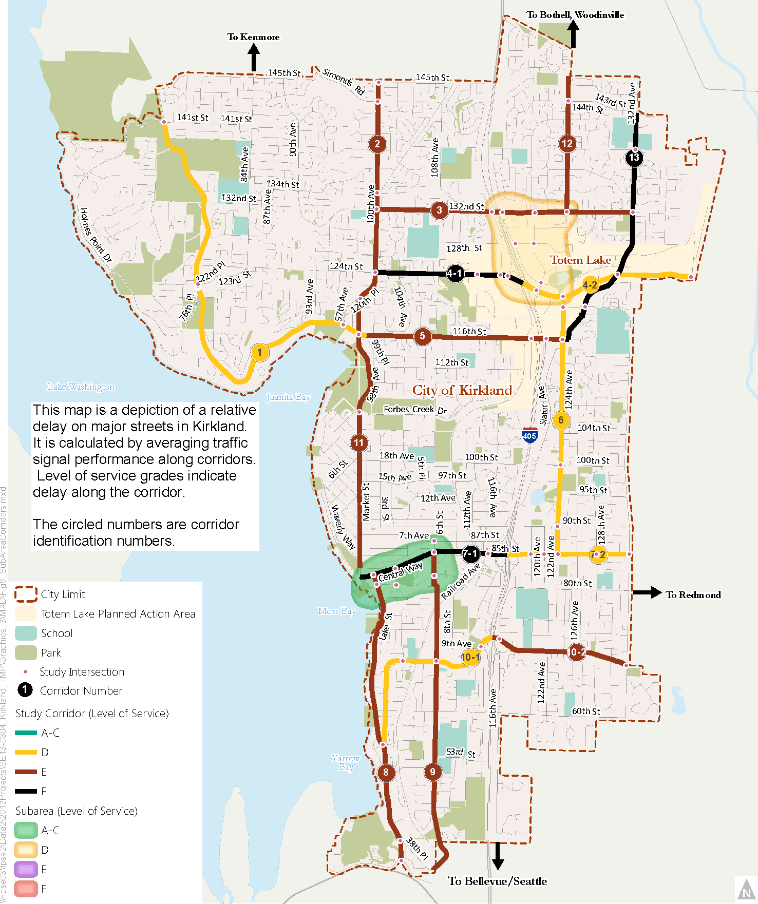
Figure T-14: Existing Traffic Congestion
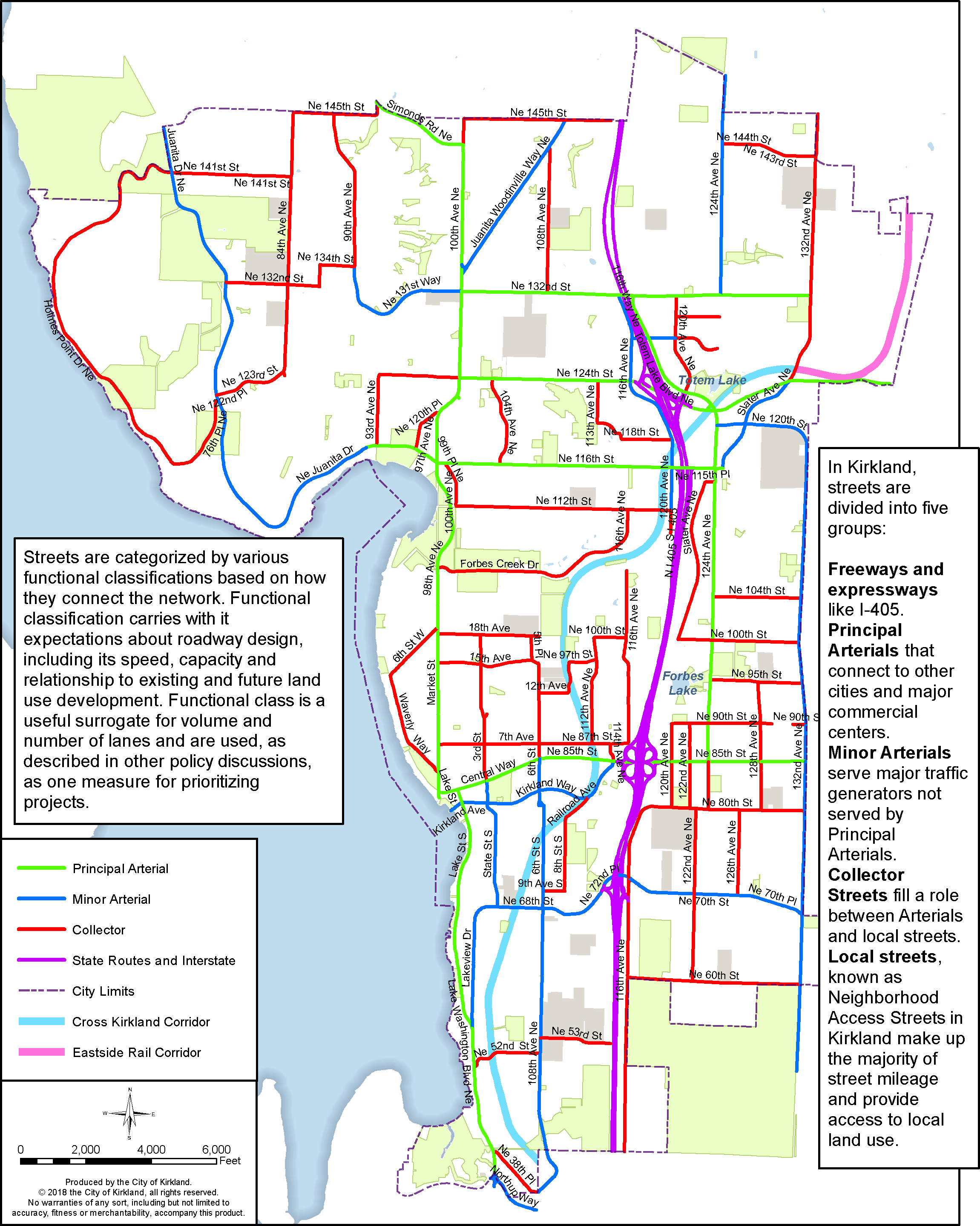
Figure T-15: Functional Classification of Streets
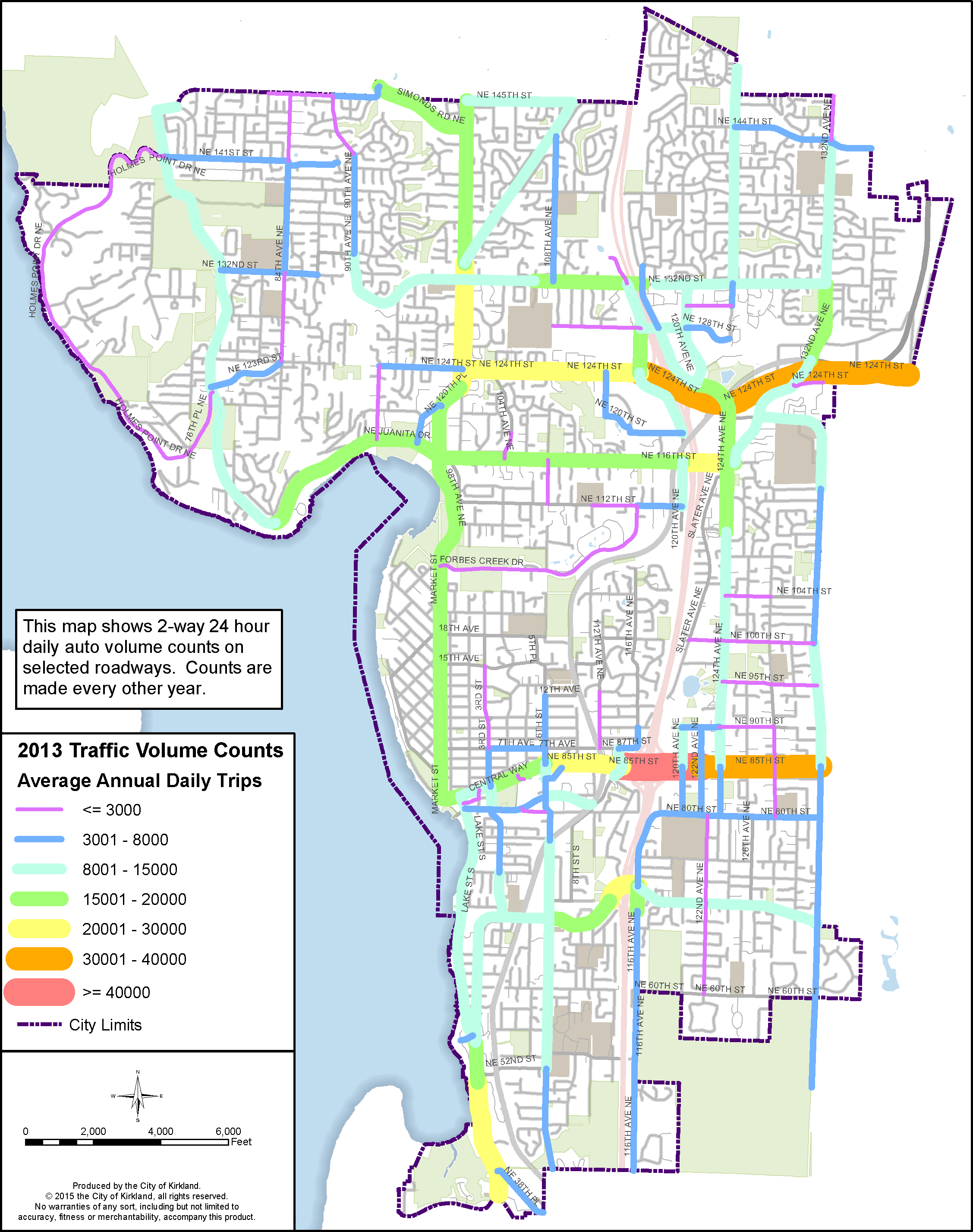
Figure T-16: Volume of Auto Traffic on Selected Streets