


7. TRANSPORTATION
The major east-west streets in Bridle Trails include NE 70th ST, which connects the west to east part of Kirkland and NE 60th ST (Figure BT-5). Other important elements of the transportation system include the pedestrian/bicycle overpass over I-405, links to the County trail system that connect to Seattle and Marymoor Park in Redmond, the Cross Kirkland Corridor, and the Houghton shopping district. 116th Avenue NE and 132nd Avenue connect to Bellevue. The policies below are intended to promote mobility, provide people with options to access goods and services without a car, and promote equestrian movement throughout the community.
Policy BT 18:
Improve vehicle, pedestrian, bicycle and equestrian mobility throughout the neighborhood, to other City and regional destinations.
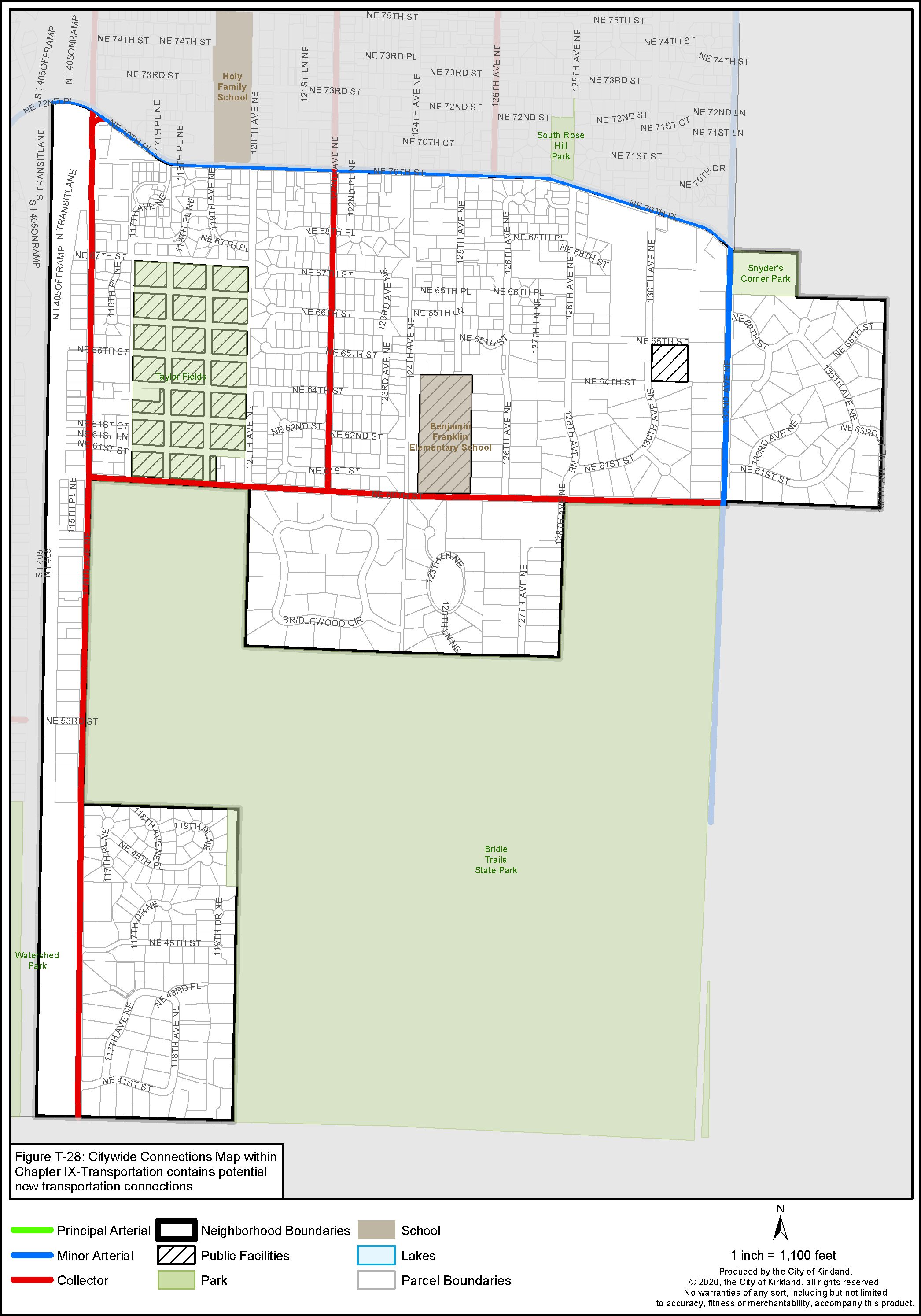
Figure BT-5: Bridle Trails Street Classifications
Pedestrian and Bicycle System
Desired major pedestrian and bicycle pathways in the Bridle Trails Neighborhood are designated in Figures BT-6 and BT-7. The new Greenways in progress and planned shown on Figure BT-7 will help add to the Citywide and regional pedestrian and bicycle system.
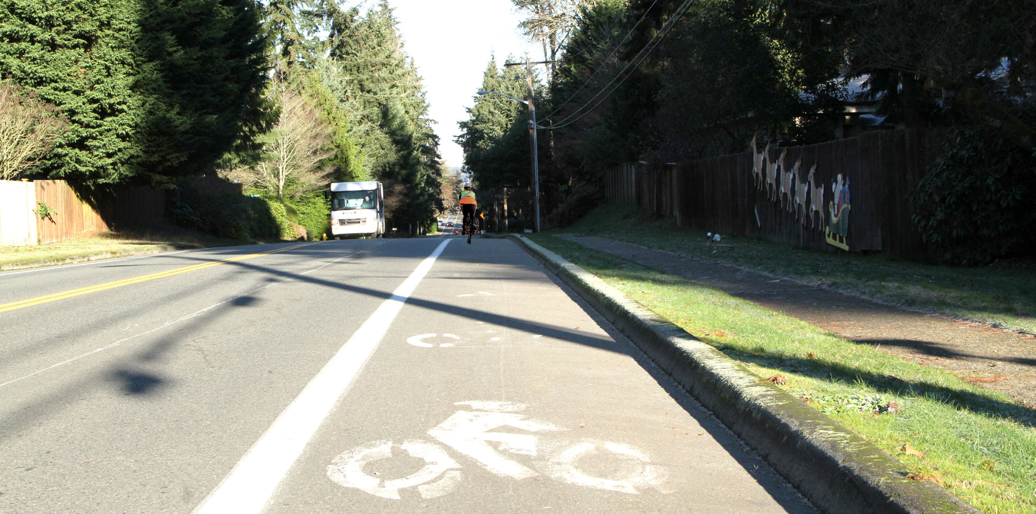
Bicycle lane in Bridle Trails
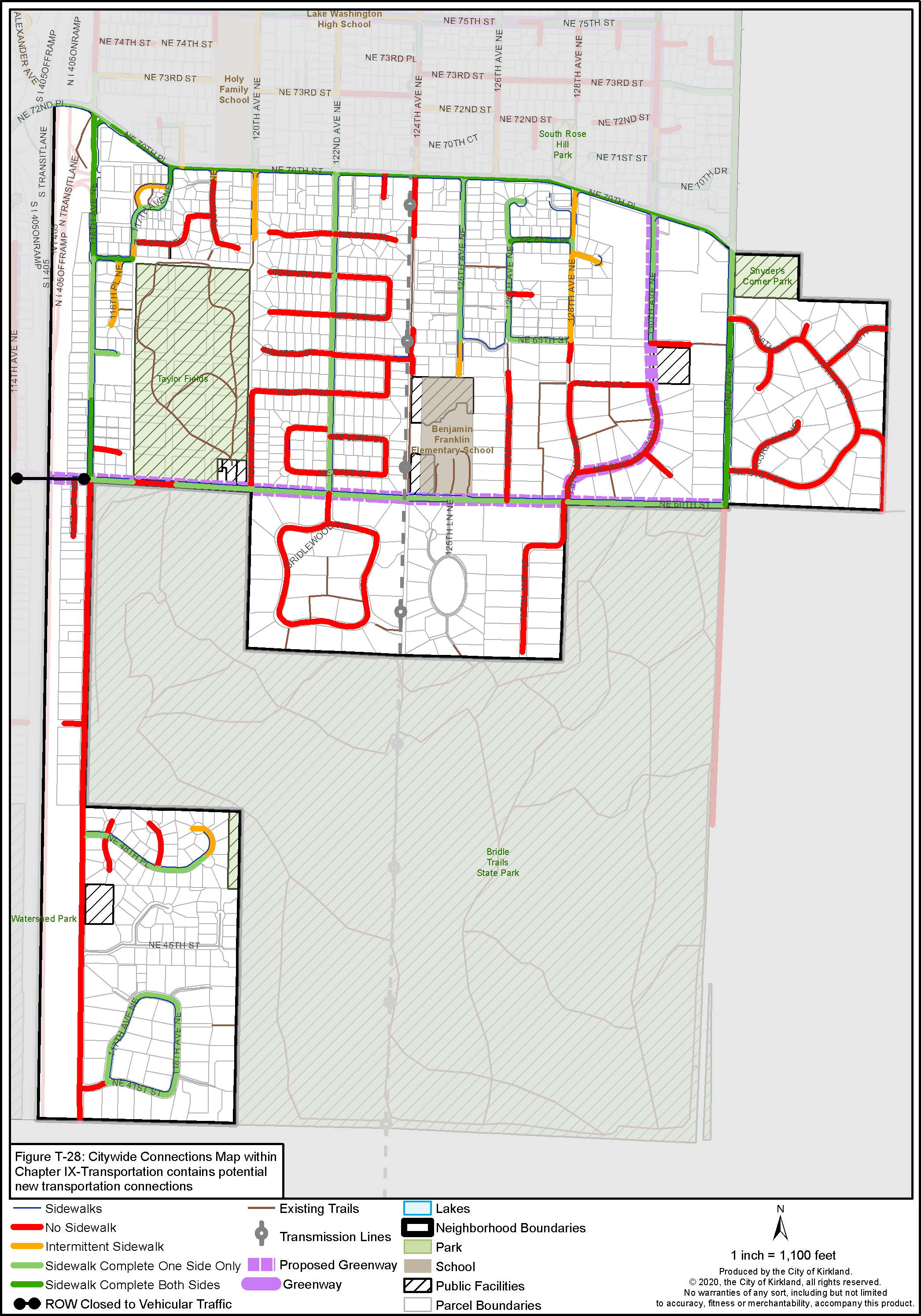
Figure BT-6: Bridle Trails Pedestrian System

Figure BT-7: Bridle Trails Bicycle System
Policy BT 19:
Plan for a future bicycle and pedestrian Greenway along NE 60th ST and 130th Avenue NE to connect to the Greenway north of NE 70th Place and to the South and North Rose Hill Neighborhoods.
Policy BT 20:
Develop bike lanes, a sidewalk, and/or multiuse path along 116th Ave NE, between NE 60th ST and the Bellevue city boundary in order to provide access to future light rail.
Policy BT 21:
Design trails and streets to minimize conflicts between horses and vehicles while promoting equestrian, pedestrian and bike access.
Policy BT 22:
In equestrian areas, design public improvements to reflect shared equestrian and pedestrian use of paths, sidewalks, roadway improvements, transit connections and signage to reflect the equestrian uses in the neighborhood.
• Where possible, some separation of equestrians from bicyclists and motorists is desirable.
• Equestrian paths should not be paved. Paths should be constructed with a specially designed, stabilized hoof grid mix to provide appropriate footing and to retain integrity in Puget Sound’s wet climate.
• Paths should be designed to accommodate horses and riders. Paths should be wide enough to support two-way equestrian travel and have enough vertical clearance for a horse and rider.
Policy BT 23:
Preserve and enhance equestrian, pedestrian and bike access to Bridle Trails State Park from the surrounding neighborhood, although bikes are not allowed in the park.
Policy BT 24:
Require private development projects to complete unimproved portions of the regional Eastside Powerline Corridor trail located in Bridle Trails within the Seattle City Light Power Line Easement or explore ways to use public funds to make improvements to trail. Where private development has already occurred, consider completing sections through the City’s Capital Improvement Program.
Public pedestrian and bicycle improvements should be provided under the Seattle City Light power line easement when development, redevelopment or platting occurs to complete the trail system. Public funding should also be considered. See PROS Plan for further details. This off-street north/south trail through the neighborhood serves the recreational needs of the community by providing a safe pedestrian, equestrian and bicycle link separated from the street system. Eventually this trail could link up to the South Rose Hill neighborhood and trail systems in adjoining jurisdictions. The trail should be enhanced with signage and wayfinding features, providing landscaping improvements that are consistent with the rural nature of the area.