


9. Urban Design
The Urban Design Elements shown in Figure J-8 taken together create a visual identity for Juanita. Discussion of these elements follows. See the Juanita Business District section of this chapter and the Community Character Element chapter for more discussion of urban design.
Gateways to the neighborhood are identified on Figure J-8.
Gateways to the neighborhood provide an important first impression of the area’s character and quality. Gateway locations are noted on Figure J-8, some of which have been previously described in this chapter. The locations were selected because they are prominent vantage points when entering the neighborhood. Each is located on a major pathway in the neighborhood. Improvement of these gateways is recommended by the most available means. This may involve dedication of land or construction and maintenance of the gateways by private developers as part of project approval. Typical improvements include landscaping and signs which recognize Juanita not only as a unique neighborhood, but also as part of the City of Kirkland.
View corridors to the lake and to Finn Hill should be opened and enhanced.
Given Juanita’s unique location on Juanita Bay, whenever there is development, major view corridors to the lake should be opened. Measures should be taken to improve significant public views. Public territorial views of the southeast slope of Finn Hill should be preserved and enhanced by removing elements which clutter the view, such as certain non-conforming signs and utility lines.
“Edges” created by landscaping or topographic change should be preserved.
Juanita is fortunate to have significant stands of trees which create a “soft edge” and provide containment for the commercial areas. Similarly the hillside in Totem Lake, once known as “Welcome Hill,” helps to define the boundary between Totem Lake and Juanita. Interstate 405 in the northeast corner of the neighborhood provides a hard edge or distinct boundary between Juanita and Kingsgate. Future development should preserve these edge conditions and encourage additional landscaping or topographic change to demarcate different areas or provide organization.
Pathways, with directional signs, should be developed to connect to activity areas. Landmarks should be preserved and enhanced.
There are several important nodes in Juanita where activity is concentrated. Juanita Bay Park and the walking bridge east of 100th Avenue NE, and Juanita Beach Park are nodes with regional significance. Other key focal points include schools, the North Kirkland Community Center and Park, and the two commercial business neighborhood centers. Pathways and signs should be developed to lead to these nodes.
Finally, the landmarks and urban design features shown on Figure J-8 are significant, for they help to distinguish the neighborhood from other places and provide a point of reference and a sense of place for the residents. Efforts should be taken to preserve and enhance these identity-giving features.
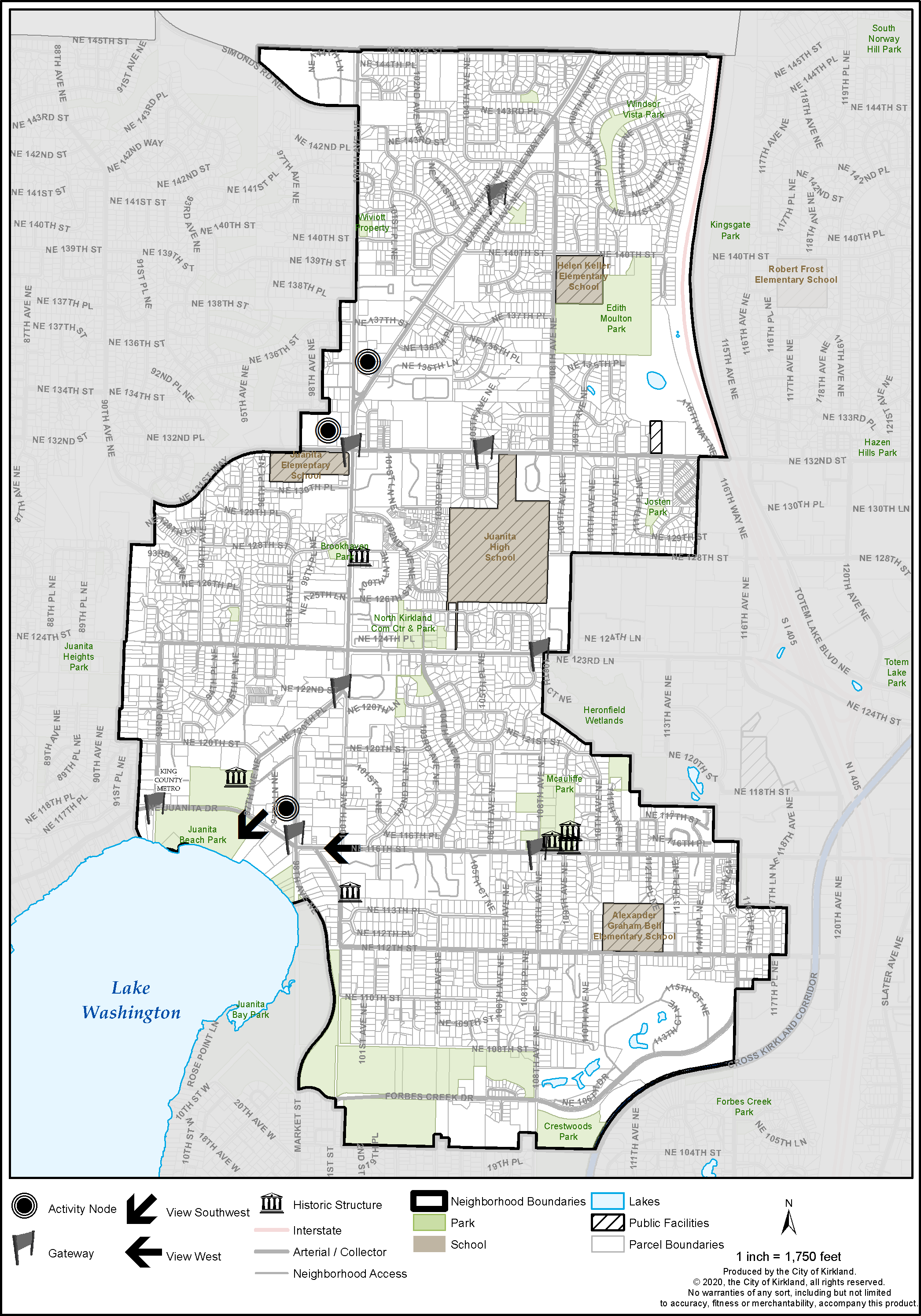
Figure J-8: Juanita Urban Design Features