


7. TRANSPORTATION
STREETS
Policy N-30:
Maintain the street and alley grid in the Norkirk Neighborhood.
Portions of Norkirk platted in the early part of the 20th century have a distinct alley grid that contributes to the unique character of the neighborhood. Maintenance of Norkirk’s grid pattern promotes neighborhood mobility, a more equitable distribution of traffic on neighborhood streets, and the development of ADUs with independent access points. The streets that compose this grid network consist of collector and local streets and alleys, with one principal arterial: Market Street, located at the western boundary of the neighborhood. Street classifications are described in the Transportation Element and shown on Figure N-5.
Alleys provide access and a service route for the lots they abut, while the streets provide circulation through the neighborhood. Utilizing alleys minimizes the number of curb cuts needed to serve abutting uses, thus minimizing conflicts with pedestrian and vehicular traffic on the street.
Policy N-31:
Minimize and reduce cut-through traffic and speeding.
Monitor and evaluate traffic patterns and volumes in the Norkirk Neighborhood to minimize cut-through traffic and speeding, especially between Market Street and Central Way. The evaluation should determine if additional strategies such as traffic calming, in cooperation with the Fire Department to accommodate emergency response needs and times, are needed. The neighborhood should be involved in this process.
Policy N-32:
Identify preferred routes through the neighborhood to and from City facilities.
The various City administration and maintenance facilities located in the Norkirk Neighborhood generate both service and visitor trips. When practical, vehicles should be routed onto collector streets where improvements are in place to protect the pedestrian, rather than onto local access streets that serve the internal needs of the residential areas.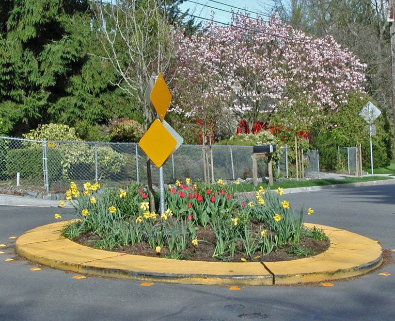
Example of traffic circle installed for slowing down vehicle speed
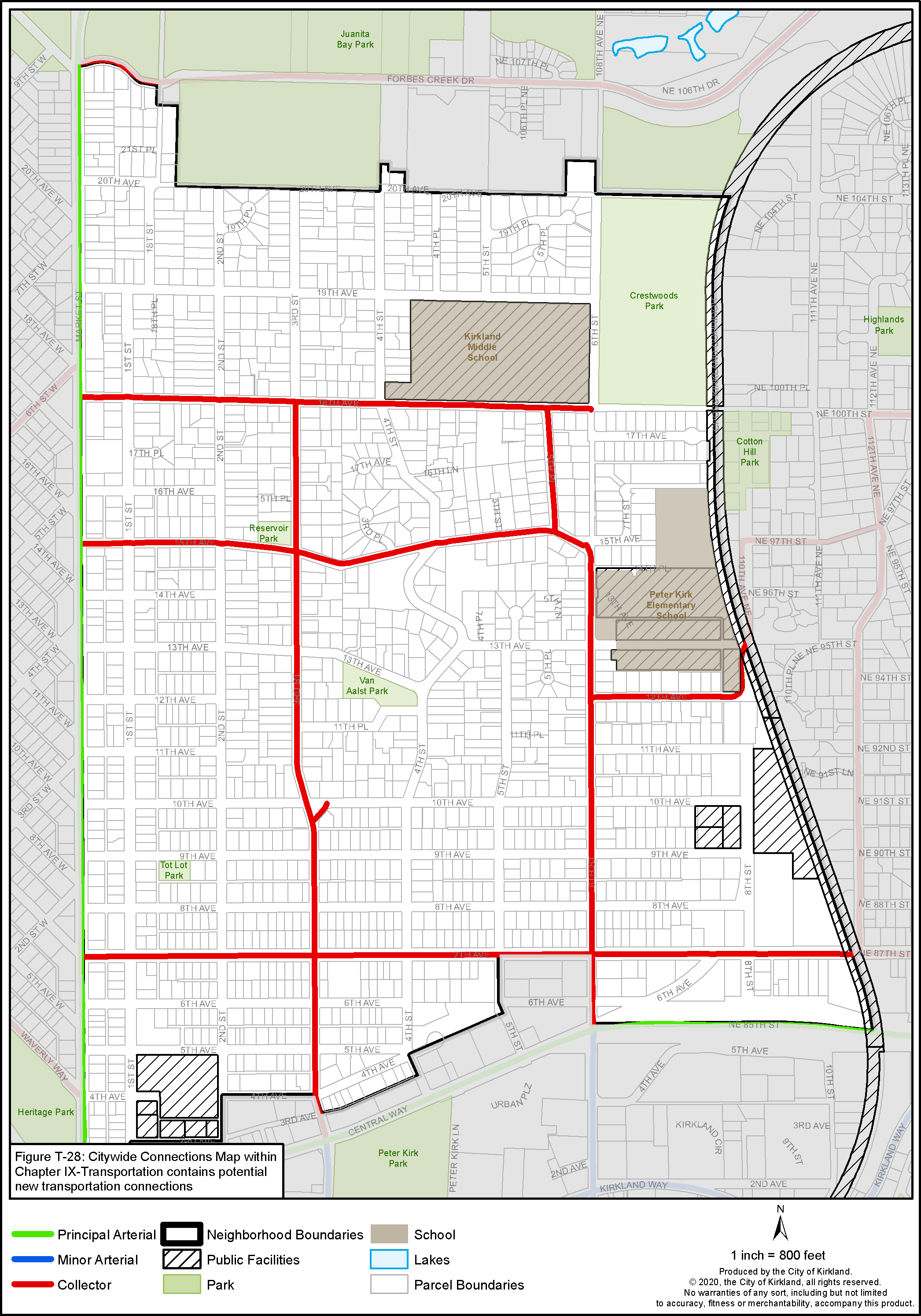
Figure N-5: Norkirk Street Classifications
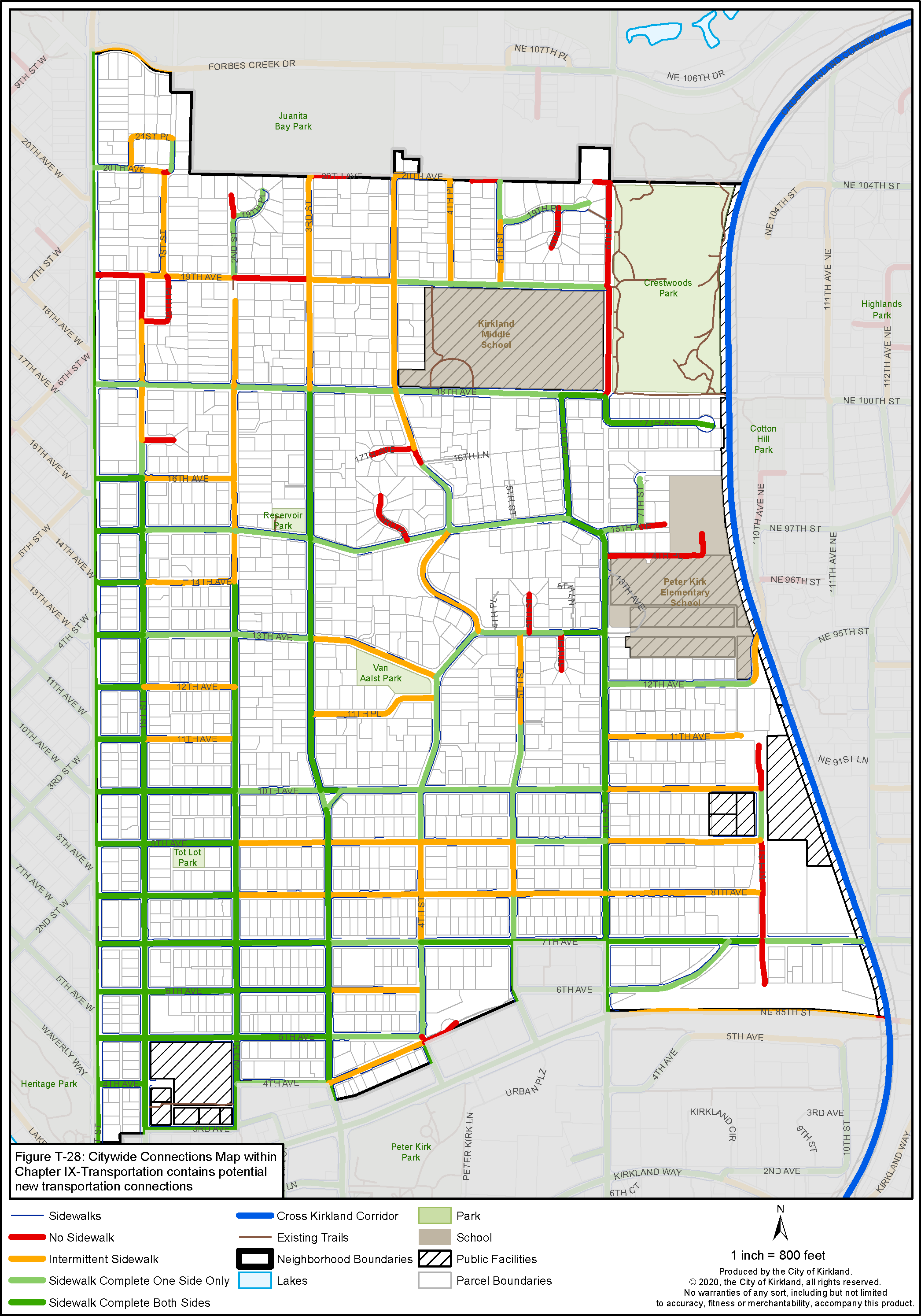
Figure N-6: Norkirk Pedestrian System
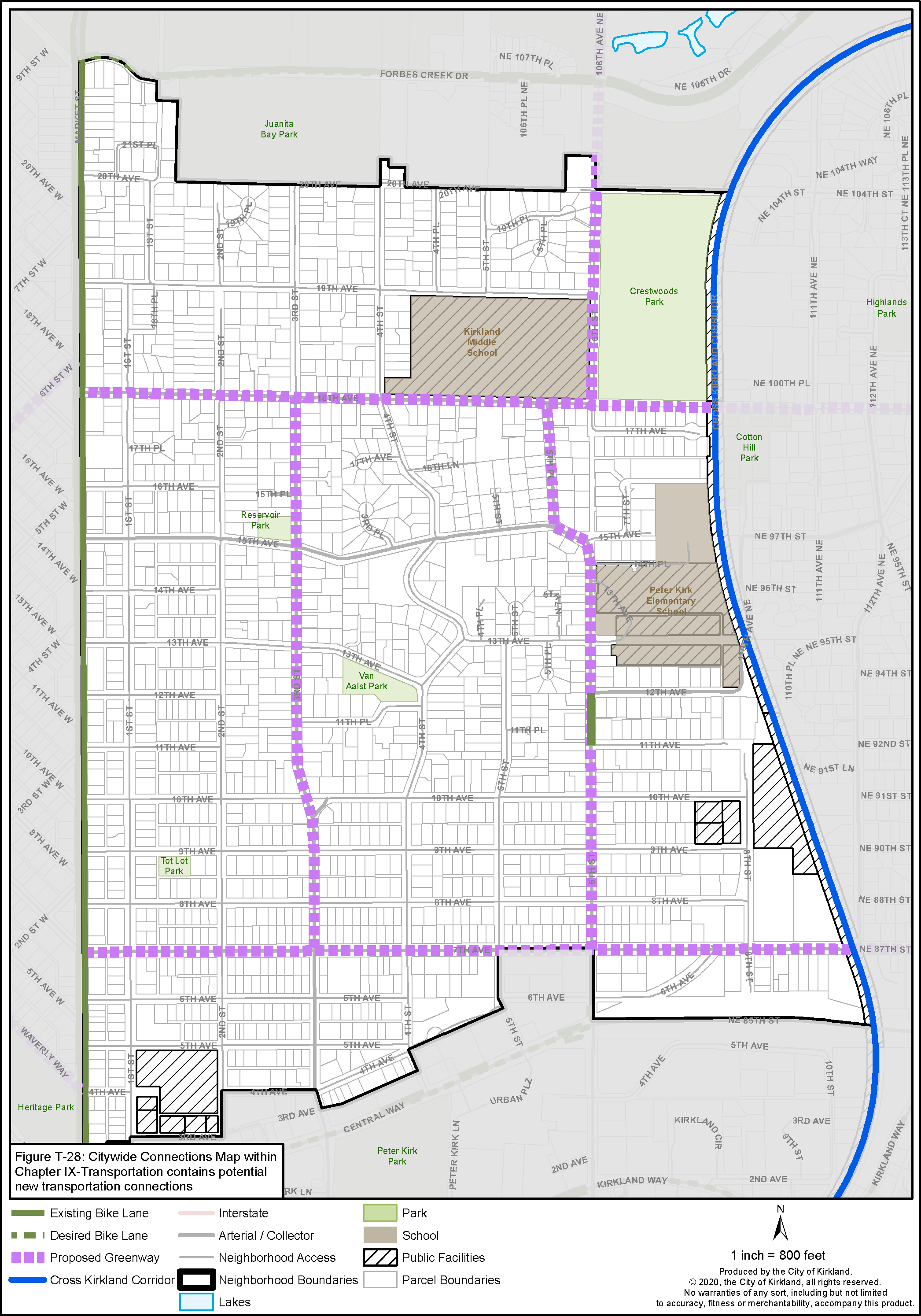
Figure N-7: Norkirk Bicycle System
The preferred routes for visitors to City Hall and for other City vehicles leaving City Hall are along 7th Avenue via 1st Street and 5th Avenue, along 3rd Street via 4th and 5th Avenues, and along 1st Street via 3rd Avenue. The preferred routes for service vehicles and visitors to the Maintenance Center are along 7th Avenue and 8th Street, internal to the industrial area in which it is located.
TRANSIT
King County Metro transit serves the Norkirk Neighborhood along Market Street and to a lesser extent through the neighborhood, connecting to Kirkland’s Transit Center, other neighborhoods, jurisdictions, and will allow transit connections to the Bus Rapid Transit Station at I-405/NE 85th Street interchange.
The Cross Kirkland Corridor, located at the eastern boundary of the neighborhood, will be used in the near term as a multi-use trail and utilities corridor connecting to other neighborhoods and cities. The Cross Kirkland Corridor Master Plan indicates that the corridor may one day include high capacity transit.
PEDESTRIAN/BICYCLE CIRCULATION
The City of Kirkland Active Transportation Plan (ATP) maps the bicycle and pedestrian facilities planned for a 10-year horizon. Figure N-6 shows the desired pedestrian system in the Norkirk Neighborhood. The capital improvement budget process prioritizes when routes will receive funding for improvements.
City street standards require that all through streets have pedestrian improvements including curbs, gutters, landscape strips, street trees and sidewalks. As new development occurs, pedestrian improvements are usually installed by the developer. In developed areas without sidewalks, the City should identify areas of need and install sidewalks through the capital improvement budget process.
Bicycles are permitted on all City streets. Bike facilities may include a designated bike lane with a painted line; or a shared use path for bicycle and pedestrian use. Existing and desired routes are shown in Figure N-7.
Policy N-33:
Enhance and maintain pedestrian and bicycle infrastructure within the Norkirk Neighborhood, especially on designated school walk routes, at activity nodes and connecting to adjacent neighborhoods.
The following routes should be evaluated in the capital improvement budget process which prioritizes when routes will receive funding for improvements. If funded, these routes should be improved with sidewalks, curbs, gutters, and landscape strips and lighting as needed:
• 19th Avenue between Market and 6th Streets leads to Kirkland Middle School and Crestwoods Park.
• 7th Avenue between Market and the Highlands Neighborhood provides a centrally located east/west pedestrian and bike route.
• 4th Street between Central Way and 19th Avenue provides a centrally located north/ south pedestrian route.
• 6th Street between 20th Avenue and Forbes Creek Drive connects the Norkirk and South Juanita Neighborhoods and include a bike route.
• 20th Avenue between 3rd Street and 5th Street provides an east/west pedestrian route at the northern boundary of the Norkirk Neighborhood.
Recommended improvements for a connected bike network in the Transportation Master Plan include a neighborhood greenway on 18th Avenue, 7th Avenue, 3rd Street, and 6th Street to connect with the routes in adjacent neighborhoods, Cross Kirkland Corridor and the Juanita Bay to Sammamish Valley Trail system. These improvements could include shared-lane pavement markings with wayfinding, speed reduction treatments, improved crossings, etc.
Policy N-34:
Support development of the Cross Kirkland Corridor as a multiuse corridor.
Develop the Cross Kirkland Corridor for transportation and recreation as described in the Cross Kirkland Corridor Master Plan (CKC) and pursue opportunities for new or improved connections into the neighborhood consistent with the CKC Master Plan and the Parks, Recreation and Open Space (PROS) Plan.
With development, redevelopment or platting, public pedestrian and bicycle access easements should be provided for properties adjacent to the CKC consistent with the CKC Master Plan and the Parks, Recreation and Open Space (PROS) Plan near the following locations:
• Cotton Hill Park
• End of NE 14th Place
• 110th Place NE
• NE 91st Street
• North of NE 85th Street