


3. HISTORICAL CONTEXT
In order to envision the early history of the Highlands Neighborhood you must consider life without Interstate 405, which was built in the late 1950s and 1960s and created a new eastern boundary for the neighborhood. Prior to I-405, Highlands was connected to and functioned as part of what was then known as Rose Hill.
Prior to 1800s
The Highlands Neighborhood is located on the traditional land of the First Peoples of Seattle, the Duwamish People. The Duwamish Tahb-tah-byook tribe once inhabited the Lake Washington shoreline from Juanita Bay to Yarrow Bay, as described in more detail in the Community Character Chapter of the Comprehensive Plan. Lake Washington and the surrounding area offered an abundance of riches, including wapatoes (a wetland tuber), tules, cedar roots, salmon, waterfowl, berries, deer, muskrat, beaver and otter. The 1855 Treaty of Point Elliott guaranteed hunting and fishing rights and reservations to all Tribes represented by the Native signers, including the Duwamish People. In return for the reservation and other benefits promised in the treaty by the United States government, the Duwamish People exchanged over 54,000 acres of its homeland. Today those 54,000 acres encompass much of present-day King County, including Kirkland (and the Highlands Neighborhood). Unfortunately, the opening of the Lake Washington Ship Canal in the early 1900s also had a detrimental effect on the Duwamish People, lowering the level of the lake, affecting wetlands, and diminishing traditional food sources.
Homesteads
In the 1870s the area that has become the Highlands Neighborhood was homesteaded by Reuben Spinney (the namesake of Spinney Park). Other residents were gentlemen farmers who worked in Seattle in lumber camps and returned home on the weekends to attend to their land and families.
Boom Development Period – 1910 to 1930
A portion of the Highlands Neighborhood was included in the original 5,000-acre site of Peter Kirk’s development company: Kirkland Land and Improvement Company. The original plat extended north to about NE 95th Street. The current Highlands street layout reflects the original platting from 1890. The original street names were: 112th – Fir Street; 114th – Cedar Street; 116th – Sheffield Street; and NE 100th Street – Victoria Street. The present NE 87th Street was originally called Piccadilly (7th Avenue to the west) and was the road to the mill near Forbes Lake. These original street names are now included on the bottom of the current street signs. Installing these signs was a joint project of the City and the Kirkland Heritage Society.
When Burke and Farrar, two Seattle developers, bought the remaining parcels of Kirk’s holdings in 1910, they replatted this area and extended the street system to the north. They also aggressively marketed lots in Kirkland. This was a “boom” time for Kirkland and the surrounding areas with the City’s population increasing from 532 in 1910 to 1,714 in 1930.
Recollections of Life in the 1920s, 1930s and Beyond
An interview with Annabel Jensen in the July 2003 Kirkland Courier article provides a view of life in the neighborhood during the 1920s and 1930s. The article notes: “116th and 112th (Sheffield and Fir) were gravel roads then.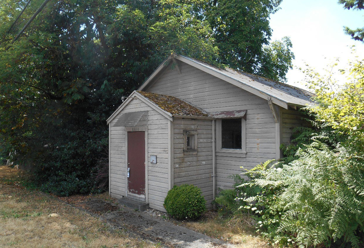
Grange Hall, formerly Acker’s store, was a neighborhood gathering place.
There was no 405 – Slater Avenue and NE 90th went through to upper Rose Hill. NE 85th was called the Kirkland-Redmond Highway. All the houses were on big lots, with gardens and orchards, dirt driveways, wells and outhouses.” She noted that all the kids worked during the summer picking raspberries and that it was a rare treat to go swimming in the lake. Marina Beach did not exist and “you had to push through the bushes to the water if you wanted to swim. Instead, everyone went to one of the resorts on Juanita Bay where there was a nice sandy beach, a two-story clubhouse with a dance floor upstairs and an amusement park in the summer with Dodge 'Ems (bumper cars).”
She noted that there were three grocery stores within a stone’s throw of the south part of Highlands. Leatha’s Store, also called the Rose Hill Grocery, was on the southeast corner of NE 90th Street and 116th Avenue NE. “It had a gas pump and one of the only telephones around – so everyone came to use it.” You picked up the receiver and asked the operator to place your call. Across the street was Acker’s store that later became the Grange Hall, and was used for meetings, dances and voting. The building still stands in 2020.
Schools
Prior to the construction of I-405, students went to Rose Hill Grade School, which was located on 122nd Avenue NE near Costco. After grade school, students attended Kirkland Junior High and Kirkland High School, which were located at Heritage Park. Highland’s students later went to Peter Kirk Elementary, Kirkland Middle School, and Lake Washington High School.
Annexation to Kirkland
The Highlands was annexed to Kirkland in stages, beginning with the period after World War II. A section of the neighborhood from NE 100th Street to NE 104th Street and from the railroad right-of-way (now known as the Cross Kirkland Corridor) to 116th Avenue NE was annexed on December 15, 1947. Additional small areas were annexed in 1963; however, the majority of the neighborhood was annexed in 1967 (on May 15, 1967, and August 21, 1967) when I-405 was nearing completion. This consolidated all of the property west of I-405 into the City of Kirkland.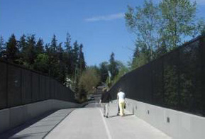
100th Street Pedestrian Bridge over I-405
Construction of I-405
The idea for a bypass road to serve the growing population on the Eastside of Lake Washington started with the construction of Interstate 90 in 1940 when the engineers put in a two-lane overpass at I-90, where this future I-405 would be built. The overpass sat unused for 14 years until construction began in the 1950s. In the initial plans, the only access points to Kirkland from I-405 were those at Houghton (NE 68th Street) and to Juanita at Totem Lake (NE 124th Street). Due to complaints from the community regarding the limited connections, the Central Way (NE 85th Street) interchange was added to the project. An overpass across I-405 at NE 100th Street to provide emergency access as well as pedestrian and bicycle access between the North Rose Hill and Highlands Neighborhoods was completed in 2002. It has been reported that several homes that had been in the I-405 right-of-way were moved onto vacant lots in the Highlands Neighborhood. As far as is known, no comprehensive survey of those properties has been made.
Founded in 1933, what would later come to be known as the Lee Johnson Chevrolet car dealership was originally located at the corner of Kirkland Avenue and Lake Street South. For a brief time, from 1964 to 1968, the dealership was located in the Highlands Neighborhood north of NE 85th Street to position itself near the existing two-lane highway that was replaced by I-405 (also the site of the original Steel Mill Hotel). That building was later moved, and the current dealership was constructed in 1968 at the southeast corner of the Central Way/NE 85th Street I-405 interchange after the completion of the freeway.
The following policies encourage preservation of structures and locations that reflect the neighborhood’s heritage.
Policy H-1:
Preserve features and locations that reflect the neighborhood’s history and heritage.
According to the Community Character Element Chapter of the Comprehensive Plan, at this time, there are no buildings, structures, sites or objects in the Highlands Neighborhood listed on the National and State Registers of Historic Places or designated by the City of Kirkland. The City should periodically survey buildings in the neighborhood to identify those of historic significance.
Policy H-2:
Provide markers and interpretive information at historic sites.
If there are historic places and features identified in the future, including those associated with the Duwamish People, they should be commemorated with signs or markers to help celebrate the history of the neighborhood. Attention should be given to celebrating the neighborhood’s history in an inclusive way, including by helping residents and visitors understand the history of the area prior to white settlement.