


1. Shoreline Land Use and Activities
Goal SA-1: Provide a high quality shoreline environment where:
(1) Natural systems are preserved.
(2) Ecological functions of the shoreline are maintained and improved over time.
(3) The public enjoys access to and views of the lake.
(4) Recreational opportunities are abundant.
The Kirkland shoreline forms the western boundary of the City and encompasses approximately 50,000 lineal feet (9.5 miles) of Lake Washington waterfront. A significant portion of the City’s shoreline is area zoned or designated as park/open space. Approximately 43 percent of the area within the shoreline jurisdiction, or a total of 139.7 acres of the shoreline, is within areas designated as park or open space. Except for a few anomalies, the high-functioning portions of the shoreline have been appropriately designated and preserved within these areas. The City’s extensive network of parks also provides the public with significant access opportunities throughout the City.
Much of the remaining shoreline is fully developed with single-family residential uses or areas of concentrated, compact development containing commercial, multifamily, or mixed uses. In general, this pattern of land use is stable and only minimal changes are anticipated in the planning horizon. Redevelopment on some properties may result in single-family residences converting over time to multifamily or with new commercial or mixed uses replacing existing commercial uses. Given the lack of existing vacant land (and much of that is encumbered by critical areas), additional housing or commercial square footage within the shoreline area will come over time as redevelopment and additions occur to existing developed properties.
Management of the shoreline area will need to carefully balance and achieve both shoreline utilization and protection of ecological functions. To protect valuable shoreline resources, the Shoreline Master Program limits the extent and character of a number of land uses and activities. Shoreline policies allow for a broad range of uses within the shoreline, while establishing limits to protect these shoreline resources and adjacent uses.
Shoreline policies aimed at protecting the natural environment address issues at both a broader scale, focusing on natural systems, as well as at the scale of ecological functions, which are the physical, chemical, and biological processes that contribute to the maintenance of the aquatic and terrestrial environments that constitute the shoreline’s natural ecosystem.
Issues that must be addressed by the Shoreline Use section include:
• How to manage new growth and redevelopment to be sensitive to and not degrade habitat, ecological systems and other shoreline resources.
• How to foster those uses that are unique to or depend on the proximity to the shoreline or provide an opportunity for substantial numbers of the people to enjoy the shoreline.
• How to ensure that land uses and shoreline activities are designed and conducted to minimize damage to the ecology of the shorelines and/or interference with the public’s use of the water and, where consistent with public access planning, provide opportunities for the general public to have access to the shorelines.
• How to protect the public right of navigation and ensure that uses minimize any interference with the public’s use of the water.
Policy SA-1.1: Allow for a diversity of appropriate uses within the shoreline area consistent with the varied character of the shorelines within the City.
The City’s shoreline area is a collection of varied neighborhoods and business districts, each containing their own distinctive character as well as biological and physical condition along the shoreline. Kirkland’s shorelines contain valuable natural amenities, providing critical habitat for fish and wildlife within the Juanita Bay and Yarrow Bay wetlands, two high-functioning natural areas. The shoreline also contains portions of several business districts, each with its own distinctive identity, including the Central Business District, Juanita Business District, and Carillon Point. Medium to high density residential and commercial uses are located to the south of the Central Business District and west of Juanita Beach Park. The shoreline in these more urban areas is heavily altered with shoreline armoring, overwater coverage, and impervious areas. Single-family residential uses are prevalent in the area north of the Central Business District. The City also contains a system of waterfront parks, which provide a broad range of passive and active recreational activities and environmental protection.
Policy SA-1.2: Preserve and enhance the natural and aesthetic quality of important shoreline areas while allowing for reasonable development to meet the needs of the City and its residents.
These different and unique shoreline areas each contain qualities that contribute to Kirkland’s shoreline identity, including waterfront orientation, shoreline public views and access, numerous and diverse recreational opportunities, abundant open space, natural habitat, and waterfront access trails. The Shoreline Master Program should seek to support these and other features which significantly contribute to the City’s desired character along the shoreline.
Policy SA-1.3: Maintain existing and foster new uses that are dependent upon or have a more direct relationship with the shoreline and Lake Washington.

Carillon Point Marina
Certain shoreline uses are more dependent on or have a more direct relationship with the shoreline than others. The Shoreline Management Act requires that shoreline master programs give priority to:
• Water-dependent uses. A water-dependent use is dependent on the water by reason of the intrinsic nature of its operations, and cannot exist in any other location. Examples include swimming beaches, boat launches, boat piers, and marinas. Industrial water-dependent uses, such as ship building facilities, are not currently found nor are planned along the City’s waterfront. The Kirkland waterfront contains several facilities that would be considered water-dependent uses. The City contains one public marina and several private marinas. Large private commercial marinas include Carillon Point Marina, Yarrow Bay Marina and Kirkland Homeport Marina. The Yarrow Bay Marina contains a retail fuel service facility for boats, while the tour boat operators working out of the City’s public marina provide shoreline tours. The City should encourage these water-dependent uses to remain.
• Water-related uses. A water-related use is dependent on a shoreline location because it has a functional requirement associated with a waterfront location, such as the transport of goods by water, or uses that support water-dependent uses. Examples include boat sales and outfitters and manufacturers that transport goods by water. These uses are typically not located along Kirkland’s shoreline, though the Yarrow Bay Marina contains a boat repair and service facility.
• Water-enjoyment uses. A water enjoyment use is a recreational use or other use that facilitates public access to the shoreline as a primary characteristic of the use, or a use that draws substantial numbers of people to the shoreline and that provides opportunities, through its design, location or operation, for the public to enjoy the physical and aesthetic benefits of the shoreline. Examples include parks and trails, museums, restaurants, and aquariums. Water enjoyment uses such as restaurants, retail stores, and offices are the primary commercial use along Kirkland’s shoreline.
• Single-family residential uses. There are single-family residential neighborhoods in the shoreline areas within the Market Neighborhood and the Finn Hill Neighborhood.
• Shoreline recreation. The shoreline contains an extensive network of open spaces and public parks along the shoreline, providing places for fishing, swimming, boating, wildlife viewing and other recreational and educational activities.
Shoreline Environment Designations
Goal SA-2: Provide a comprehensive shoreline environment designation system to categorize Kirkland’s shorelines into similar shoreline areas to guide the use and management of these areas.
Environment designations are analogous to zoning designations for areas under SMP jurisdiction. See Figure SA-1, Shoreline Environment Designations Map. Their intent is to encourage uses that will protect or enhance the current or desired character of a shoreline based on their physical, biological and development characteristics.
Policy SA-2.1: Designate properties as Natural in order to protect and restore those shoreline areas that are relatively free of human influence or that include intact or minimally degraded shoreline functions that are sensitive to potential impacts from human use.
This type of designation would be appropriate for associated wetlands in and adjacent to Juanita Bay Park, the Yarrow Bay wetlands complex, and the portion of Juanita Bay Park located within shoreline jurisdiction. The following management policies should guide development within these areas:
a. Any use or development activity that would potentially degrade the ecological functions or significantly alter the natural character of the shoreline area should be severely limited or prohibited, as follows:
1) Residential uses should be prohibited, except limited single-family residential development may be allowed as a conditional use if the density and intensity of such use is limited as necessary to protect ecological functions and be consistent with the purpose of the environment.
2) Subdivision of the subject property as regulated under the provisions of KMC Title 22 should be prohibited.
3) Commercial and industrial uses should be prohibited.
4) Nonwater-oriented recreation should be prohibited.
5) Roads, utility corridors, and parking areas that can be located outside of Natural designated shorelines should be prohibited unless no other feasible alternative exists. Roads, bridges and utilities that must cross a Natural designated shoreline should be processed through a Shoreline Conditional Use.
b. Development activity in the natural environment should only be permitted when no suitable alternative site is available on the subject property outside of shoreline jurisdiction.
c. Development, when feasible, should be designed and located to preclude the need for shoreline stabilization, flood control measures, native vegetation removal, or other shoreline modifications.
d. Development activity or land surface modification that would reduce the capability of vegetation to perform normal ecological functions should be prohibited.
e. Limited access may be permitted for scientific, historical, cultural, educational and low-intensity water-oriented recreational purposes, provided there are no significant adverse ecological impacts.
Policy SA-2.2: Designate properties as Urban Conservancy to protect and restore ecological functions of open space and critical areas while allowing a variety of compatible uses.
This type of designation would be appropriate for many of the City’s waterfront parks. The following management policies should guide development within these areas:
a. Allowed uses should be those that preserve the natural character of the area and/or promote preservation and restoration within critical areas and public open spaces either directly or over the long term.
b. Restoration of shoreline ecological functions should be a priority.
c. Development, when feasible, should be designed and located to preclude the need for shoreline stabilization, flood control measures, native vegetation removal, or other shoreline modifications.
d. Public access and public recreation objectives should be implemented whenever feasible and significant ecological impacts can be mitigated.
e. Water-oriented uses should be given priority over nonwater-oriented uses. For shoreline areas adjacent to commercially navigable waters, water-dependent uses should be given highest priority.
f. Commercial and industrial uses, other than limited commercial activities conducted accessory to a public park, should be prohibited.
Policy SA-2.3: Designate properties as Residential – Low (L) to accommodate low-density residential development.
This type of designation would be appropriate for single-family residential uses from one to nine dwelling units per acre for detached residential structures and one to seven dwelling units per acre for attached residential structures. The following management policies should guide development within these areas:
a. Standards for density, setbacks, lot coverage limitations, shoreline setbacks, shoreline stabilization, vegetation conservation, critical area protection, and water quality should mitigate adverse impacts to maintain shoreline ecological functions, taking into account the following:
1) The environmental limitations and sensitivity of the shoreline area;
2) The level of infrastructure and services available; and
3) Other Comprehensive Plan considerations.
b. Access, utilities, and public services should be available and adequate to serve existing needs and/or planned future development.
c. Industrial, commercial, multifamily and institutional uses, except for government facilities, should be prohibited.
Policy SA-2.4: Designate properties as Residential – Medium/High (M/H) to accommodate medium and high-density residential development.
This type of designation would be appropriate for detached, attached, or stacked residential uses of up to 15 or more dwelling units per acre south of the Downtown and 19 to 24 dwelling units per acre west of Juanita Beach Park. Additional density is permitted under certain provisions of the Zoning Code, such as planned unit development, affordable housing, low impact development and cottage housing.
The following management policies should guide development within these areas:
a. Standards for density, setbacks, lot coverage limitations, shoreline setbacks, shoreline stabilization, vegetation conservation, critical area protection, and water quality should mitigate adverse impacts to maintain shoreline ecological functions, taking into account the following:
1) The environmental limitations and sensitivity of the shoreline area;
2) The level of infrastructure and services available; and
3) Other Comprehensive Plan considerations.
b. Access, utilities, and public services should be available and adequate to serve existing needs and/or planned future development.
c. Visual and physical access should be implemented whenever feasible and adverse ecological impacts can be avoided. Continuous public access along the shoreline should be provided, preserved or enhanced.
d. Industrial uses should be prohibited.
e. Water-dependent recreational uses should be permitted.
f. Limited water-oriented commercial uses which depend on or benefit from a shoreline location should also be permitted.
g. Nonwater-oriented commercial uses should be prohibited, except for small-scale retail and service uses that provide primarily convenience retail sales and service to the surrounding residential neighborhood should be permitted along portions of the east side of Lake Washington Boulevard NE/Lake Street South.
h. Institutional uses may be permitted in limited locations.
Policy SA-2.5: Designate properties as Urban Mixed to provide for high-intensity land uses, including residential, commercial, recreational, transportation and mixed-use developments.
This type of designation would be appropriate for areas which include or are planned for retail, office, and/or multifamily uses. The following management policies should guide development within these areas:
a. Manage development so that it enhances and maintains the shorelines for a variety of urban uses, with priority given to water-dependent, water-related and water-enjoyment uses. Nonwater-oriented uses should not be allowed except as part of mixed-use developments, or in limited situations where they do not conflict with or limit opportunities for water-oriented uses or on sites where there is no direct access to the shoreline.
b. Visual and physical access should be implemented whenever feasible and adverse ecological impacts can be avoided. Continuous public access along the shoreline should be provided, preserved or enhanced.
c. Aesthetic objectives should be implemented by means such as sign control regulations, appropriate development siting, screening and architectural standards, and maintenance of natural vegetative buffers.
Policy SA-2.6: Designate properties as Aquatic to protect, restore, and manage the unique characteristics and resources of the areas waterward of the ordinary high water mark.
This type of designation would be appropriate for lands waterward of the ordinary high water mark. The following management policies should guide development within these areas:
a. Provisions for the management of the Aquatic environment should be directed towards maintaining and restoring shoreline ecological functions.
b. Shoreline uses and modifications should be designed and managed to prevent degradation of water quality and alteration of natural hydrographic conditions.
c. All developments and uses on navigable waters or their beds should be located and designed to minimize interference with surface navigation, to minimize adverse visual impacts, and to allow for the safe, unobstructed passage of fish and wildlife, particularly those species dependent on migration.
d. New overwater structures for water-dependent uses and public access are permitted, provided they will not preclude attainment of ecological restoration.
e. Public recreational uses of the water should be protected against competing uses that would interfere with these activities.
f. Underwater pipelines and cables should not be permitted unless demonstrated that there is no feasible alternative location based on an analysis of technology and system efficiency, and that the adverse environmental impacts are not significant or can be shown to be less than the impact of upland alternatives.
g. Existing residential uses located over the water and in the Aquatic environment may continue, but should not be enlarged or expanded.

Figure SA-1
Managing Shoreline Land Uses
Goal SA-3: Locate, design and manage shoreline uses to prevent and, where possible, restore significant adverse impacts on water quality, fish and wildlife habitats, the environment and other uses.
It is important that shoreline development be regulated to control pollution and prevention of damage to the natural environment. Without proper management, shoreline uses can cause significant damage to the shoreline area through cumulative impacts from shoreline armoring, stormwater runoff, introduction of pollutants, and vegetation modification and removal.
Given existing conditions, there is very little capacity for future development within the shoreline. However, it is anticipated that expansion, redevelopment or alteration to existing development will occur over time. With remodeling or replacement, opportunities exist to improve the shoreline environment. In particular, improvements to nearshore vegetation cover and reductions in impervious surface coverage are two key opportunity areas on private property to restore ecological function along the shoreline. Reduction or modification of shoreline armoring and reduction of overwater cover and in-water structures provide other opportunities.
Policy SA-3.1: Establish development regulations that avoid, minimize and mitigate impacts to the ecological functions associated with the shoreline zone.
In deciding whether to allow uses and activities in shoreline areas, the potential adverse impacts associated with uses or activities should be considered and avoided, where possible. This can be done by carefully selecting allowed uses, providing policies and standards to prevent or minimize adverse impacts, and carefully reviewing development proposals to prevent or minimize adverse impacts.
Policy SA-3.2: Provide adequate setbacks and vegetative buffers from the water and ample open space and pervious areas to protect natural features and minimize use conflicts.
The purpose of a setback is to minimize potential impacts of adjacent land uses on a natural feature, such as Lake Washington, and maximize the long-term viability of the natural feature. Setbacks perform a number of significant functions including reducing water temperature; filtering sediments and other contaminants from stormwater; reducing nutrient loads to lakes; stabilizing stream banks with vegetation; providing riparian wildlife habitat; maintaining and protecting fish habitats; forming aquatic food webs; and providing a visually appealing greenbelt and recreational opportunities.
Establishing the width of a setback so it is effective depends on the type and sensitivity of the natural feature and the expected impacts of surrounding land uses. In determining appropriate setbacks in the shoreline jurisdiction, the City should consider shoreline ecological functions as well as aesthetic issues.
Policy SA-3.3: Require new development or redevelopment to include establishment or preservation of appropriate shoreline vegetation to contribute to the ecological functions of the shoreline area.
Shoreline vegetation plays an important role in maintaining temperature, removing excessive nutrients, attenuating wave energy, removing sediment and stabilizing banks, and providing woody debris and other organic matter along Lake Washington.
The Final WRIA 8 Chinook Salmon Conservation Plan notes the importance of providing a vegetated riparian/lakeshore buffer and overhanging riparian vegetation to improve the habitat for juvenile Chinook salmon1. As a result, when substantial new upland development occurs, the on-site landscaping should be designed to incorporate native plant buffers along the shoreline. Proper plant selection and design should be done to ensure that views are not diminished.
Policy SA-3.4: Incorporate low-impact development practices, where feasible, to reduce the amount of impervious surface area.
Low-impact development strives to mimic nature by minimizing impervious surface, infiltrating surface water through biofiltration and bio-retention facilities, retaining contiguous forested areas and maintaining the character of the natural hydrologic cycle. Utilizing these practices can have many benefits, including improvement of water quality and reduction of stream and fish habitat impacts.
Policy SA-3.5: Limit parking within the shoreline area.
Facilities providing public parking are permitted within the shoreline area as needed to support adjoining water-oriented uses. Private parking facilities should be allowed only as necessary to support an authorized use. All parking facilities, wherever possible, should be located out of the shoreline area.
Policy SA-3.6: Minimize the aesthetic impacts of parking facilities.
Parking areas should be placed, screened, and buffered to mitigate impacts through use of design techniques, such as location, lidding, landscaping or other similar design features to minimize the aesthetic impacts of parking facilities. Exterior parking areas should be located away from the shoreline or attractively landscaped with vegetation that will not obstruct views of the lake from the public right-of-way.
Policy SA-3.7: Limit outdoor lighting levels in the shoreline to the minimum necessary for safe and effective use.
Artificial lighting can be used for many different purposes along the waterfront, including to aid in nighttime activities that would be impossible or unsafe under normal nighttime conditions, for security, or simply to make a property more attractive at night. At the same time, the shoreline area can be vulnerable to impacts of light and glare, potentially interrupting the opportunity to enjoy the night sky, impacting views and privacy and affecting the fish and wildlife habitat value of the shoreline area. To protect the scenic value, views, and fish and wildlife habitat value of shoreline areas, excessive lighting is discouraged. Shoreline development should use sensitive waterfront lighting to balance the ability to see at night with the desire to preserve the scenic and natural qualities of the shoreline. Parking lot lighting, lighting on structures or signs, and pier and walkway lighting should be designed to minimize excessive glare and light trespass onto neighboring properties and shorelines.
Policy SA-3.8: Encourage the development of joint-use overwater structures, such as joint-use piers, to reduce impacts to the shoreline environment.
The presence of an extensive number of piers has altered the shoreline. The construction of piers can modify the aquatic ecosystem by blocking sunlight and creating large areas of overhead cover. Minimizing the number of new piers by using joint facilities is one technique that can be used to minimize the effect of piers on the shoreline environment.
Policy SA-3.9: Allow variations to development standards that are compatible with surrounding development to facilitate restoration opportunities along the shoreline.
The City should consider appropriate variations to development standards to maximize the opportunities to restore shoreline functions. For example, reductions in setbacks could be used to facilitate restoration in highly altered areas that currently provide limited function and value for such attributes as large woody debris recruitment, shading, or habitat.
Goal SA-4: Incorporate a variety of management tools, including improvement of City practices and programs, public acquisition, public involvement and education, incentives, and regulation and enforcement to achieve its goals for the shoreline area.
Because Kirkland’s natural resources are located on both public and on private land, a variety of approaches is needed for effective management of the shoreline. Kirkland should ensure that it uses a mix of public education and involvement, acquisition, program funding, and improvement of City practices on City land, together with regulation and enforcement.
Goal SA-5: Ensure that private property rights are respected.
A significant portion of Kirkland’s shoreline is located in private ownership. Aspects of the Shoreline Master Program, including development regulations, setback requirements, environmental regulations and other similar regulatory provisions, may take the form of limitations on the use of private property. In establishing and implementing these types of land use controls, the City should be careful to consider the public and private interests as well as the long-term costs and benefits.
Residential
Goal SA-6: Protect and enhance the character, quality and function of existing residential neighborhoods within the City’s shoreline area.
Policy SA-6.1: Permit structures or other development accessory to residential uses.
Accessory uses such as garages, sheds, accessory dwelling units, and fences are common features normally applicable to residential uses. They should be permitted if located landward of the ordinary high water mark and outside of any critical area or critical area buffer.
Policy SA-6.2: New overwater residences are not a preferred use and shall not be permitted. Existing nonconforming overwater residential structures should not be enlarged or expanded.
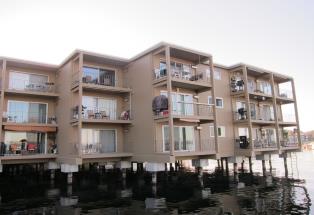
Overwater residences on the lake
The City contains a number of existing overwater residential structures that were constructed prior to the City’s limitation on overwater structures to water-dependent uses. These existing structures have created large areas of overhead cover, impacting the aquatic environment. Many of these structures are likely to be remodeled and modernized in the future and these activities should be carefully reviewed to prevent additional adverse impacts and to improve existing conditions, where possible.
Policy SA-6.3: Manage new subdivisions of land within the shoreline to:
• Avoid the creation of new parcels with building sites that would impact wetlands, streams, slopes, frequently flooded areas and their associated buffers;
• Ensure no net loss of ecological functions resulting from the division of land or build-out of the lots;
• Prevent the need for new shoreline stabilization or flood risk measures that would cause significant impacts to other properties or public improvements or a net loss of shoreline ecological functions;
• Implement the provisions and policies for shoreline designations and the general policy goals of this program; and
• Provide public access along the shoreline for subdivisions of five lots or more.
Though there is not a great capacity to add new units to the shoreline area through subdivision, if properties are divided they should be designed to ensure no net loss, minimize impacts, and prevent the need for new shoreline stabilization structures.
Policy SA-6.4: Evaluate new single-family development within areas impacted by critical areas to protect ecological functions and ensure some reasonable economic use for all property within Kirkland’s shoreline.
West of and contiguous with the Yarrow Bay wetlands adjacent to the City limits there are a number of properties that were previously platted for residential use but remain vacant, forested, and impacted by critical areas. In addition, a few properties along the Forbes Creek corridor and Juanita Bay may be similarly encumbered. When considering development proposals on these properties, the City should use a process designed to assure that proposed regulatory or administrative actions do not unconstitutionally infringe upon private property rights.
Commercial
Goal SA-7: Plan for commercial development along the shoreline that will enhance and provide access to the waterfront.
Policy SA-7.1: Permit water-enjoyment uses within the shoreline area of the Central Business District.
Downtown Kirkland is an active urban waterfront which strongly benefits from its adjacency to Moss Bay. The Downtown area has a strong land use pattern that is defined by its restaurants, art galleries and specialty shops, which are connected within a pedestrian-oriented district. These uses draw substantial numbers of people to the Downtown and can provide opportunities, if appropriately designed and located, for the public to enjoy the physical and aesthetic benefits of the shoreline. For these reasons, water-enjoyment uses, such as restaurants, hotels, civic uses, and retail or other commercial, uses should be encouraged within the Downtown provided they are designed to enhance the waterfront setting and pedestrian activity.
Policy SA-7.2: Manage development in the shoreline area of the Central Business District to enhance the waterfront orientation.
The Central Business District contains extensive public use and views of the waterfront provided by public parks, street ends, public and private marinas, public access piers and shoreline public access trails. Yet, development along the shoreline has historically “turned its back” to Lake Washington, with active areas located opposite the lake and separated from it by large surface parking lots, limiting the ability to fully capitalize on the Downtown waterfront setting. Future growth and redevelopment along the shoreline in the Downtown should continue to reflect the waterfront setting and ensure that development is oriented to the lake. One key opportunity is to develop a large public plaza over the Marina Park parking lot in order to better connect the Downtown to the lake and the park.
Policy SA-7.3: Maximize public access, use, and visual access to the lake within Carillon Point and the surrounding commercial area.

Public access at Carillon Point
Carillon Point is a vibrant mixed-use development that contains office space, restaurants, and retail space in addition to a hotel, day spa and marina facilities. The site has been designed to provide both visual and physical access to the shoreline, including expansive view corridors which provide a visual linkage from Lake Washington Boulevard NE to the lake, as well as an internal pedestrian walkway system and outdoor plazas. The Central Plaza of Carillon Point is frequently used for public gatherings and events. The Plaza is encompassed by a promenade and Carillon Point’s commercial uses. If new development or redevelopment occurs on this site, existing amenities related to public access, use and visual access to the lake should be preserved.
Immediately south of Carillon Point, the Yarrow Bay Marina and an office development provide opportunities for public use and enjoyment of the waterfront, including boat rental facilities, a public waterfront trail and waterfront access area with seating and interpretative signs. In addition, public views across the site have been preserved in an expansive view corridor.
If new development or redevelopment occurs in the commercial area, the strong public access to and along the water’s edge, waterfront public use areas, water-dependent uses such as the marinas, and views from Lake Washington Boulevard should be preserved to the greatest extent feasible.
Policy SA-7.4: Enhance the physical and visual linkages to Lake Washington in the Juanita Business District.
The shoreline area of the Juanita Business District presently contains a mix of retail, office and residential uses. Visual linkages to the lake in the Juanita Business District are limited, with existing development blocking most of the shoreline. Waterfront access trails are missing in several key locations, limiting access between Juanita Bay Park and Juanita Beach Park, which border the Business District on the north and south.
The ability to enhance physical and visual access to the lake is challenging in this area. Several of the shoreline properties are developed with residential condominiums, which are unlikely to redevelop. Some of the commercial properties are significantly encumbered by wetlands that are associated with Lake Washington. Should properties redevelop in this area, public access should be required as a part of redevelopment proposals, where feasible.
Despite these challenges, future redevelopment along the shoreline in the Juanita Business District should emphasize Juanita Bay as a key aspect of the district’s identity, highlighting recreational opportunities available at Juanita Beach Park and providing better visual and pedestrian connections to both Juanita Bay and Juanita Beach Park and Lake Washington.
Policy SA-7.5: Allow limited commercial uses in the area located between the Central Business District and Planned Area 15 if public access to and use of the shoreline is enhanced.
Commercial uses which are open to and will attract the general public to the shoreline, such as restaurants, are appropriate within the urban area located between Downtown Kirkland and Carillon Point west of Lake Washington Blvd/Lake Street South. These uses will enhance the opportunity for public access to this segment of the shoreline, and will complement neighboring shoreline parks and, as a result, should be encouraged. To assure that these uses enhance the opportunity for the public to take advantage of the shoreline, these uses should include amenities where the public can view and enjoy the shoreline. These uses should also be limited and designed to assure that they do not adversely impact the natural environment and interfere with nearby water dependent and water-related uses.
Policy SA-7.6: Allow limited commercial uses, such as a hotel/motel and limited marina use, within Planned Area 3B.
Planned Area 3B is fully developed with multifamily residential uses and contains a private marina facility. The site is also used for overnight lodging. The site has also been improved with a public trail along its entire perimeter, providing public access to Lake Washington and visual access to the Yarrow Bay wetlands.
Policy SA-7.7: Nonwater-oriented commercial development may be allowed if the site is physically separated from the shoreline by another property or right-of-way.
There are several commercial properties which do not have direct frontage on Lake Washington, either because they are separated by right-of-way (Lake Washington Boulevard NE, Lake Street, and 98th Avenue NE) or by another property. These properties should be allowed a greater flexibility of uses, given the physical separation from the waterfront area.
Policy SA-7.8: Prohibit overwater commercial development other than piers and similar features that support water-dependent uses.
Overwater structures can adversely impact the shoreline environment and should be avoided, except where necessary to support water-dependent uses, and then only when appropriately mitigated.
Boating Facilities
Goal SA-8: Manage boating facilities to avoid or minimize adverse impacts.
Policy SA-8.1: Locate new boating facilities and allow expansion of existing facilities at sites with suitable environmental conditions, shoreline configuration, and access.
One public marina and several private marinas are located on the lake within Kirkland. The City’s public pier is located Downtown at Marina Park. Large private marinas include Carillon Point Marina, Yarrow Bay Marina and Kirkland Homeport Marina. Other private marinas providing moorage for multifamily developments are also located along the shoreline.
As new boating facilities are established or existing ones expanded, the facility should be designed to:
• Meet health, safety, and welfare requirements, including provisions for pump-out facilities;
• Mitigate aesthetic impacts;
• Minimize impacts to neighboring uses;
• Provide public access;
• Assure no net loss of shoreline ecological functions and prevent other significant adverse impacts; and
• Protect the rights of navigation and access to recreational areas.
Policy SA-8.2: Require restoration activities when substantial improvements or repair to existing boating facilities is planned.
The Kirkland waterfront has been extensively modified with piers and other overwater structures. These overwater structures impact the nearshore aquatic habitat, blocking sunlight and creating large areas of overhead cover. These impacts, where they exist, should be mitigated when substantial improvements or repair to existing boating facilities are planned.
Restoration activities could include reducing or eliminating the number of boathouses and solid moorage covers, minimizing widths of piers and floats, increasing light transmission through overwater structures, enhancing the shoreline with native vegetation, improving shallow-water habitat, reducing the overall number and size of pier piles, and improving the quality of stormwater runoff.
Goal SA-9: Promote use of best management practices to control pollutants from boat use, maintenance and repair, as well as proper sewage disposal for boats and potential invasive vegetation transfer.
Marinas and the operation, maintenance and cleaning of boats can be significant sources of pollutants in water and sediments, as well as in animal and plant tissues. Significant steps have been taken at all levels of government and in the private sector to reduce the impacts of marinas and boating on the aquatic environment. The Federal Clean Water Act provides the federal government with the authority to regulate the discharge of boat sewage. In addition, the Department of Ecology has developed environmentally protective guidelines for the design and siting of marinas and sewage disposal facilities. The State Parks and Recreation Commission’s boater education program provides technical assistance and signage and other materials to marinas. At the local level, governments and private businesses participate in boater programs as well, educating their moorage clients and providing them with the means to dispose of their wastes properly. The City should work cooperatively with State agencies, marina operators and boat owners to continue to minimize the impacts of boating on the aquatic environment.
Managing Shoreline Modifications
Goal SA-10: Manage shoreline modifications to avoid, minimize, or mitigate significant adverse impacts.
Significant adverse impacts caused from shoreline modifications should be avoided, minimized, or mitigated in the following sequential order of preference:
• Avoiding the impact altogether by not taking a certain action or part of an action.
• Minimizing the impact(s) by limiting the degree or magnitude of the action and its implementation, by using appropriate technology, or by taking affirmative steps, such as project redesign, relocation, or timing, to avoid or reduce impacts;
• Minimizing or eliminating the impact by restoring or stabilizing the area through engineered or other methods;
• Rectifying the impact by repairing, rehabilitating, or restoring the affected environment to the historical conditions or the conditions existing at the time of the initiation of the project;
• Reducing or eliminating the impact or hazard over time by preservation and maintenance operations during the life of the action;
• Compensating for the impact by replacing, enhancing, or providing substitute resources or environments; and
• Monitoring the hazard or other required mitigation and taking remedial action when necessary.
Policy SA-10.1: Assure that shoreline modifications individually and cumulatively do not result in a net loss of ecological functions.
Shoreline modifications are manmade alterations to the natural lake edge and nearshore environment and primarily include a variety of armoring types (some associated with fill), piers, and other in-water structures. These modifications alter the function of the lake edge, change erosion and sediment movement patterns, affect the distribution of aquatic vegetation and are often accompanied by upland vegetation loss. Impacts from these shoreline modifications can be minimized by giving preference to those types of shoreline modifications that have a lesser impact on ecological functions and requiring mitigation of identified impacts resulting from shoreline modifications.
Fill
Policy SA-10.2: Limit fill waterward of the ordinary high water mark to support ecological restoration or to facilitate water-dependent or public access uses.
Fill allows for the creation of dry upland areas by the deposition of sand, silt, gravel or other materials onto areas waterward of the ordinary high water mark. Fill has traditionally been used in the shoreline area to level or expand residential yards and, in many cases, has been associated with armoring of the shoreline. This use of fill has resulted in an alteration of the natural functions of the lake edge and has often been accompanied by a loss of upland vegetation. As a result, this use of fill should be discouraged.
Alternatively, fill can also be used for ecological restoration, such as beach nourishment, when materials are placed on the lake bottom waterward of the ordinary high water mark. This type of fill activity should be encouraged; provided, that it is designed, located and constructed to improve shoreline ecological functions.
Land Surface Modification
Policy SA-10.3: Limit Land Surface Modification activities in the shoreline area.
Land Surface Modification activities are typically associated with upland development. These activities have the potential to cause erosion and siltation, increase runoff and flood volumes, reduce flood storage capacity and damage habitat and therefore should be carefully considered to ensure that any potential adverse impacts are avoided or minimized. Impacts from Land Surface Modification activities can be avoided through proper site planning, construction timing practices, and use of erosion and drainage control methods. Generally, these activities should be limited to the maximum extent necessary to accommodate the proposed use, and should be designed and located to protect shoreline ecological functions and ecosystem-wide processes.
Dredging
Policy SA-10.4: Design and locate new shoreline development to avoid the need for dredging.
Policy SA-10.5: Discourage dredging operations, including disposal of dredge materials.
Dredging is typically associated with a reconfiguration of the lake bed or stream channel to remove sediments, expand a channel, or relocate or reconfigure a channel. For instance, dredging can be used to excavate moorage slips that have been filled in with sediments or are located in shallow water. In other cases, dredging can be used to remove accumulated sediment that has disrupted water flow and, as a result, water quality, as is the case at Juanita Beach Park.
Dredging activities can have a number of adverse impacts, such as an increase in turbidity and disturbance to or loss of animal and plant species. Dredging activities can also release nutrients in sediments, and may temporarily result in increased growth of nuisance macrophytes such as milfoil after construction is completed. Dredging can also release toxic materials into the water column. As a result, dredging activities should be limited except when necessary for habitat or water quality restoration, or to restore access, and where impacts to habitat are minimized and mitigated.
Shoreline Stabilization
Policy SA-10.6: Limit use of hard structural stabilization measures to reduce shoreline damage.

Bulkheads along the lake
Lake Washington is an important migration and rearing area for juvenile Chinook salmon. The juvenile Chinook salmon using the lake depend on the following habitat characteristics:
• Shoreline areas with shallow depths (>1 m).
• Gentle slope.
• Fine substrates such as sand and gravel.
• Overhanging vegetation/small woody debris.
• Small creeks with a shallow, low-gradient at the creek mouth2.
Remaining areas with these characteristics should be protected and maintained, while developed areas along Kirkland’s shoreline should be enhanced with these habitat features, where feasible.
Bulkheads and other forms of hard stabilization measures impact the suitability of the shoreline for juvenile Chinook salmon habitat, in particular the slope, depth and substrate materials of the shoreline. Shoreline protective structures such as bulkheads create deeper water with steeper gradient and a coarser bottom substrate. Waves no longer are able to dissipate energy over distance as they hit shallower bottom, rocks, or shoreline vegetation. Rather, the wave reflects off a vertical wall, causing scouring of sediment at the base of the wall. The finer sands are removed as the gravel is eroded away and the bottom substrate becomes coarser. The result is a much deeper and steeper nearshore environment, and often elimination of a beach.
Despite these potential ecological impacts, there are some areas along the City’s shoreline, especially on shallow lots with steep banks, which may need some form of shoreline armoring in order to protect existing structures and land uses. It is the intent of this policy to require that shoreline stabilization be accomplished through the use of nonstructural measures, such as building setbacks or on-site drainage improvements, or soft structural measures, such as bioengineering or beach enhancement unless these methods are determined to be infeasible, based on a scientific or geotechnical analysis. In those circumstances where alternatives are demonstrated to not be feasible, the shoreline stabilization measures used should be located, designed, and maintained in a manner that minimizes adverse effects on shoreline ecology.
Policy SA-10.7: Design, locate, size and construct new or replacement structural shoreline protection structures to minimize and mitigate the impact of these activities on the Lake Washington shoreline.
Shoreline protective structures should be allowed to protect a legally established structure or use that is in danger of loss or substantial damage. The potential for damage must be conclusively shown, as documented by a geotechnical analysis, to be caused by shoreline erosion associated with wave action.
Where allowed, shoreline protection structures should minimize impacts on shoreline hydrology, navigation, habitat, and public access. Shoreline protective structures should be designed for the minimum height, bulk and extent necessary to address an identified hazard to an existing structure. As noted above, vegetation and nonstructural solutions should be used rather than structural bank reinforcement, unless these methods are determined to be infeasible, as documented by a geotechnical analysis.
Policy SA-10.8: Locate and design new development to eliminate the need for new shoreline modification or stabilization.

Soft shoreline restoration with native vegetation along the lake
New development should be located and designed so that new structural shoreline protection features are not needed.
Policy SA-10.9: Encourage salmon-friendly shoreline design during new construction and redevelopment by offering incentives and regulatory flexibility to improve the design of shoreline protective structures and revegetate shorelines.

Illustration of soft shoreline restoration with native vegetation
In recent years, many bioengineered techniques have been developed to provide alternative shoreline protection methods. These features may employ the use of gravel substrate material, terraces, large flat rocks, shallow pools, logs, and vegetation to prevent erosion and provide an attractive, usable shoreline. The aim of these designs is to reduce bank hardening, restore overhanging riparian vegetation, and replace bulkheads with sand beaches and gentle slopes. These techniques can provide many ecological benefits, including:
• Less turbulence.
• Shallower grade.
• Protection from predators.
• Finer sandy bottom.
• Increased food source.
The WRIA 8 Conservation Strategy notes the importance of reducing bank hardening, restoring overhanging riparian vegetation, replacing bulkheads and riprap with sandy beaches with gentle slopes to improve the habitat for juvenile Chinook salmon3. In order to facilitate the use of alternatives to shoreline stabilization composed of concrete, riprap, or other hard structural or engineered materials, the City should identify appropriate regulatory flexibility or offer incentives to shoreline property owners to voluntarily remove bulkheads and to revegetate the shoreline.
Policy SA-10.10: Expand outreach to lakeside property owners about shoreline landscape design, maintenance, and armoring alternatives.
The City should evaluate different outreach and education actions to foster stewardship of shoreline property owners and the general public, including but not limited to the following:
• Distribute educational materials on a range of topics, including salmon habitat needs, household and landscape best management practices, the value of large woody debris, the value of tree cover, and stormwater issues.
• Establish a contact list of shoreline property owners to facilitate educational outreach.
• Offer shoreline property owners workshops on “salmon-friendly” design.
• Use restoration projects sites for demonstration purposes and provide interpretation at restoration sites, including signage, tours, and other methods.
• Provide information about opportunities for involvement in community stewardship projects.
• Offer education to landscape designers/contractors on riparian design.
• Create local informational TV spots that could run on the City’s television channel.
• Focus environmental/science curricula on local watershed issues.
Public outreach efforts should focus on the opportunity to improve existing habitat, but also on the potential benefits that alternative shoreline stabilization can offer, including:
• Easier access to beach and water, especially with a kayak or other human-powered craft.
• Shallow gradient shore and water can be safer, especially for small children.
• More usable shoreline with beach and cove.
• Reduced maintenance.
• Potential for increased property values.
In-stream Structures
Policy SA-10.11: Limit the use of in-stream structures.
“In-stream structure” means a structure placed by humans within a stream waterward of the ordinary high water mark that either causes or has the potential to cause water impoundment or the diversion, obstruction, or modification of water flow. Within Kirkland, these features typically include those for flood control, transportation, utility service transmission, and fish habitat enhancement.
In-stream structures should only be used in those circumstances where it is demonstrated to provide for the protection and preservation of ecosystem-wide processes, ecological functions, and cultural resources, including, but not limited to, fish and fish passage, wildlife and water resources, shoreline critical areas, hydrogeological processes, and natural scenic vistas. The location and planning of in-stream structures should be determined with due consideration to the full range of public interests, watershed functions and processes, and environmental concerns, with special emphasis on protecting and restoring priority habitats and species.
Breakwaters and Similar Features
Policy SA-10.12: Limit the use of breakwaters and other similar structures.
A breakwater typically refers to an off-shore structure designed to absorb and/or reflect wave energy back into the water body. Breakwaters can be floating or fixed in location and may or may not be connected to the shore. These modifications are limited within the City, but can be found at Kirkland Homeport Marina as well as at Juanita Beach Park, where a breakwater has been installed around the overwater boardwalk to shelter the swimming area. Breakwaters have the potential to adversely impact the shoreline environment, including impacts to sediment transport, deflection of wave energy, a decrease in water flushing and water exchange, to name a few. As a result, the installation of new breakwaters should be limited to those circumstances when it is shown to be necessary to support water-dependent uses, public access, shoreline stabilization, or other specific public purpose. In these circumstances, the feature should be carefully designed to avoid, minimize, and then mitigate any adverse ecological impacts.
Piers
Goal SA-11: Minimize impacts to the natural environment and neighboring uses from new or renovated piers.

Piers near Juanita Bay
Policy SA-11.1: Design and locate private piers so that they do not interfere with shoreline recreational uses, navigation, or the public’s safe use of the lake and shoreline.
Private piers should be located and designed to provide adequate separation from public parks, other adjoining moorage facilities and adjacent properties in order to limit any adverse impacts to safe navigation or recreational uses.
Policy SA-11.2: Design and construct new or expanded piers so that they are in character with adjacent neighboring piers for length.
Private piers should not exceed the length of neighboring piers. A pier that exceeds the length of neighboring piers can be a boating hazard for the neighbors and the general public, result in unnecessary additional overwater coverage and create a structure out of character with the neighborhood.
Policy SA-11.3: Design and construct new or expanded piers and their accessory components, such as boat lifts and canopies, to minimize impacts on native fish and wildlife and their habitat.
The Kirkland waterfront has been extensively modified with piers and other overwater structures. These overwater structures impact the nearshore aquatic habitat, blocking sunlight and creating large areas of overhead cover. Piers and other overwater structures also shade the lake bottom and inhibit the growth of aquatic vegetation4. These types of structural modifications to shorelines are now known to benefit non-native predators (like largemouth and smallmouth bass), while reducing the amount of complex aquatic habitat formerly available to salmonids rearing and migrating through Lake Washington5. This can impact juvenile salmonids, in particular, due to their affinity to nearshore, shallow-water habitats. Chemical treatments of pier components, such as creosote pilings, installed prior to today’s standards, have also impacted water and sediment quality in the lake.
The combined effect of an overwater structure and a dramatic change in aquatic vegetation results in a behavior modification in juvenile salmonids, which will often change course to circumvent large piers or other overwater structures rather than swimming beneath them6. These behavior modifications disrupt natural patterns of migration and can expose juvenile salmonids to increased levels of predation.
Minimizing overwater coverage and associated support structures can benefit salmon. Studies related to shading effects from varying types of pier decking indicate that grated decking provides significantly more light to the water surface than traditional decking methods and may lead to improved migratory conditions for juvenile Chinook salmon7.
Impact minimization measures, which have been identified by State and federal agencies, include, but are not limited to:
• Shared use of piers;
• Reducing or eliminating the number of boathouses and solid moorage covers (e.g., use of clear, translucent materials proven to allow light transmission for new canopies);
• Minimizing the size and widths of piers and floats;
• Increasing light transmission through any overwater structures (e.g., use of grated decking);
• Maximizing the height of piers above the water surface;
• Enhancing the shoreline with native vegetation;
• Improving shallow-water habitat;
• Reducing the overall number and size of pier piles; and
• Improving the quality of stormwater runoff.
Policy SA-11.4: Minimize aesthetic impacts of piers and their accessory components.
To minimize aesthetic impacts, ensure that lighting does not spill over onto the lake water surface, and minimize glare, piers should make use of nonreflective materials, minimize lighting facilities to that necessary to find the pier at night and focus illumination downward and away from the lake.
Shoreline Habitat and Natural Systems Enhancement Projects
Goal SA-12: Restore shoreline areas that have been degraded or diminished in ecological value and function as a result of past activities.
Policy SA-12.1: Include provisions for shoreline vegetation restoration, fish and wildlife habitat enhancement, and low-impact development techniques in projects located within the shoreline, where feasible.
Shoreline habitat and natural systems enhancement projects include those activities proposed and conducted specifically for the purpose of establishing, restoring, or enhancing habitat for priority species in shorelines. Such projects may include shoreline modification actions such as modification of vegetation, removal of non-native or invasive plants, shoreline stabilization, dredging, and filling; provided, that the primary purpose of such actions is clearly restoration of the natural character and ecological functions of the shoreline.
The City’s shoreline has been impacted by past actions and, as a result, there are many opportunities available for restoration activities that would improve ecological functions. For example, enhancement of riparian vegetation, reductions or modifications to shoreline hardening, and improvements to fish passage would improve the ecological function of the City’s shoreline. Many of these restoration opportunities exist throughout the City on private property, as well as on City property, including parks, open spaces, and street ends. Both public and private efforts are needed to restore habitat areas. Opportunities include public-private partnerships, partnerships with other agencies and affected tribes, capital improvement projects, and incentives for private development to restore and enhance fish and wildlife habitat.
WRIA 8 Steering Committee. 2005. Final Lake Washington/Cedar/Sammamish Watershed (WRIA 8) Chinook Salmon Conservation Plan. July 2005.
Tabor, R.A. and R.M. Piaskowski. 2002. Nearshore habitat use by juvenile Chinook salmon in lentic systems of the Lake Washington Basin, Annual Report, 2001. U.S. Fish and Wildlife Service, Lacey, WA.
Tabor, R.A., J.A. Schuerer, H.A. Gearns, and E.P. Bixler. 2004b. Nearshore habitat use by juvenile Chinook salmon in lentic systems of the Lake Washington Basin, Annual Report, 2002. U.S. Fish and Wildlife Service, Western Washington Fish and Wildlife Office, Lacey, Washington.
Tabor, R.A., H.A. Gearns, C.M. McCoy III, and S. Camacho. 2006. Nearshore habitat use by juvenile Chinook salmon in lentic systems of the Lake Washington Basin, Annual Report, 2003 and 2004. U.S. Fish and Wildlife Service, Lacey, WA.
WRIA 8 Steering Committee. 2005. Final Lake Washington/Cedar/Sammamish Watershed (WRIA 8) Chinook Salmon Conservation Plan. July 2005.
Fresh, K.L. and G. Lucchetti. 2000. Protecting and restoring the habitats of anadromous salmonids in the Lake Washington Watershed, an urbanizing ecosystem. Pages 525-544 in E.E. Knudsen, C.R. Steward, D.D. MacDonald, J.E.Williams, and D.W. Reiser (editors). Sustainable Fisheries Management: Pacific salmon. CRC Press LLC, Boca Raton, FL.
Kahler, T., M. Grassley, and D. Beauchamp. 2000. A summary of the effects of bulkheads, piers, and other artificial structures and shorezone development on ESA-listed salmonids in lakes. Final Report. Prepared for City of Bellevue by The Watershed Company. 74 pp. Kerwin, J. 2001. Salmon and steelhead habitat limiting factors report for the Cedar-Sammamish Basin (Water Resource Inventory Area 8). Washington Conservation Commission. Olympia, WA.
Tabor, R.A., H.A. Gearns, C.M. McCoy III, and S. Camacho. 2006. Nearshore habitat use by juvenile Chinook salmon in lentic systems of the Lake Washington Basin, Annual Report, 2003 and 2004. U.S. Fish and Wildlife Service, Lacey, WA.
Tabor, R.A. and R.M. Piaskowski. 2002. Nearshore habitat use by juvenile Chinook salmon in lentic systems of the Lake Washington Basin, Annual Report, 2001. U.S. Fish and Wildlife Service, Lacey, WA.
Tabor, R.A., J.A. Schuerer, H.A. Gearns, and E.P. Bixler. 2004b. Nearshore habitat use by juvenile Chinook salmon in lentic systems of the Lake Washington Basin, Annual Report, 2002. U.S. Fish and Wildlife Service, Western Washington Fish and Wildlife Office, Lacey, WA.
Tabor, R.A., H.A. Gearns, C.M. McCoy III, and S. Camacho. 2006. Nearshore habitat use by juvenile Chinook salmon in lentic systems of the Lake Washington Basin, Annual Report, 2003 and 2004. U.S. Fish and Wildlife Service, Lacey, WA.
Gayaldo, P.F. and K. Nelson. 2006. Preliminary results of light transmission under residential piers in Lake Washington, King County, WA: A comparison between prisms and grating. Lake and Reserv. Manage. 22(3):245-249.