


Chapter 18.18
LANDSCAPING REGULATIONS1
Sections:
18.18.035 Review process and fees.
18.18.050 General requirements.
18.18.060 Landscape plan – Submittal requirements.
18.18.070 Landscape plan – General requirements.
18.18.075 Plant and soil requirements.
18.18.080 Landscape types – Abutting uses.
18.18.090 Landscaping – Open areas, utility tracts and other remaining land.
18.18.110 Landscaping standards – Multifamily, governmental, commercial and industrial development.
18.18.120 Landscaping standards – Parks, recreation, and public open space in the POSPF zone.
18.18.125 Landscaping standards – Streets and public rights-of-way.
18.18.130 Transitional landscape area.
18.18.140 Landscaping standards – Parking lots.
18.18.150 Landscape maintenance.
18.18.160 Performance assurance.
18.18.170 Modifications to standards.
18.18.010 Title.
The ordinance codified in this chapter shall be known as the landscape ordinance and may be cited as such. (Ord. 1671 § 1 (Exh. A (part)), 2018: Ord. 1390 § 1, Exh. A (part), 2010: Ord. 1305 § 1, Exh. A (part), 2008: Ord. 1256 § 1 (part), 2006: Ord. 1020 (part), 1997: Ord. 801 § 1, 1989).
18.18.020 Applicability.
This chapter applies to the provision of landscaping for new development and redevelopment. This chapter does not apply to landscaping by individual homeowners at an existing residential dwelling. A landscape plan is required and shall be submitted to the city with all land use applications and/or for a building permit for the following:
A. Residential short plats and subdivisions with respect to public right-of-way, public or private open space, buffers and utility tracts;
B. Industrial uses, commercial uses, binding site plans, multifamily, and condominiums, commercial site plans, clearing and grading permits and building permits under the provisions of NBMC Title 15, for development, other than single-family, on lands designated as LDR, CLDR, CR, HDR, NB, DC, IC, IMU, EP-1, EP-2, and POSPF, in accordance with this title;
C. Additions, expansions, or alterations that result in the exterior modification of existing building, structure, parking lot or site layout. Minor additions, expansions or alterations that do not trigger the need for additional parking, and additions, expansions or alterations to individual single-family homes are exempt;
D. Change of Use. When a residential structure is changed into a commercial or industrial structure, excluding a home occupation use, landscaping shall be provided for the commercial or industrial use as required by this chapter; and
E. Clearing and grading permits as applicable per Chapter 19.10 NBMC. (Ord. 1671 § 1 (Exh. A (part)), 2018: Ord. 1576 § 8, 2016: Ord. 1390 § 1, Exh. A (part), 2010: Ord. 1305 § 1, Exh. A (part), 2008: Ord. 1256 § 1 (part), 2006: Ord. 1020 (part), 1997: Ord. 801 § 3, 1989. Formerly 18.18.030).
18.18.030 Purpose.
The purpose of this chapter is to provide regulations that will:
A. Maintain and protect property values;
B. Create sustainable and well-designed landscaping which will improve the overall quality of the city and enhance a project’s visual appearance;
C. Promote landscaping that is resilient to drought and other environmental stresses, including the potential for changing climatic conditions;
D. Promote and preserve the city’s natural character;
E. Provide a buffer between incompatible land uses, along arterials and collector roads and in visually sensitive areas;
F. Screen uses such as parking lots, storage areas, utility boxes, garbage/service areas, etc. (Ord. 1671 § 1 (Exh. A (part)), 2018: Ord. 1390 § 1, Exh. A (part), 2010: Ord. 1305 § 1, Exh. A (part), 2008: Ord. 1256 § 1 (part), 2006: Ord. 1020 (part), 1997: Ord. 801 § 2, 1989. Formerly 18.18.020).
18.18.035 Review process and fees.
Landscaping plans shall be reviewed and approved before land use permit, construction permit, or business license approval. Procedures shall be as follows:
A. Landscaping associated with clearing or grading permit, construction permit, or business license review shall be reviewed according to the procedures for clearing and grading permits, building permits, and business licenses as Type I administrative applications per Chapter 20.01 NBMC.
B. A conceptual landscaping plan shall be required with a segregation of property under NBMC Title 17 or conceptual site plan under this title. The conceptual landscaping plan shall be reviewed as a Type II application according to the provisions for review of the land use permit approval per Chapter 20.01 NBMC.
C. The fee for landscaping plan reviews shall be as established by city schedule and collected at the time of the underlying Type I or Type II application review fee. (Ord. 1671 § 1 (Exh. A (part)), 2018: Ord. 1390 § 1, Exh. A (part), 2010: Ord. 1305 § 1, Exh. A (part), 2008: Ord. 1256 § 1 (part), 2006).
18.18.040 Definitions.
For the purposes of this chapter, the words set out in this chapter shall have the following meanings:
A. “Assurance device” is a mechanism approved by the city whereby the city has recourse to identifiable assets of the applicant in order to assure compliance with the provisions of this chapter.
B. “City center” means the area in downtown North Bend bounded by the South Fork Snoqualmie River on the west and south, East Second Street on the north, and East Park Street on the east.
C. “Compatible use” means a use or zoning district identical or similar to the use or zoning district on the site which is subject to the provisions of this chapter.
D. “Fence” is a barrier, including supporting posts, enclosing or separating a field, yard or other real property. This definition includes solid and open fences. A fence may be constructed of wood, masonry or any other material. For purposes of this chapter, plant material is not considered a fence.
E. “Final plat” is a map or chart of a subdivision of land which has been accurately surveyed, and such survey marked on the ground so that the streets, alleys, blocks, lots, and other divisions thereof can be identified, and which has been approved in accordance with Chapter 17.16 NBMC and other applicable ordinances of the city as to zoning and landscaping.
F. “Living ground cover” is low growing plant materials intended to provide ground cover around and between trees and shrubs or to cover open areas of ground.
G. “Major street” means a secondary arterial or arterial street.
H. “Minor street” means any street that is not a collector or arterial street.
I. “Parking lot” is an area designed for the parking of motor vehicles including entrance ways, parking aisles, driveways and loading areas.
J. “Planting area” is a physically accessible area of the project site that has been, or is required to be, improved through the installation and maintenance of plant materials.
K. “Species – invasive plant” means plant species that are not native to Washington State, spread quickly to invade additional areas, and can cause economic or environmental harm. For the purpose of this chapter, invasive plant species include, but are not limited to, English and Atlantic ivy, English holly, Japanese knotweed, Himalayan and Evergreen blackberry, Scotch broom, and those species identified under NBMC 18.18.075(C).
L. “Species – native plant” means plant species that are native to Washington State. For the purpose of this chapter, native plant species are also defined to include cultivars derived from the original native plants (also referred to as “nativars”).
M. “Significant tree” means any evergreen tree of at least 15 inches DBH and any deciduous tree, other than red alder, holly, poplar and cottonwood trees, at least 12 inches DBH. Red alder, holly, poplar, cottonwood and other invasive trees of any size are not considered significant trees.
N. “Transition area” is the point, usually along a property line, where a low intensity use abuts a higher intensity use. For the purposes of this chapter, a “transition area” does not include zoning districts separated by public or private streets.
O. “Transitional landscape area” includes specific locations along I-90, North Bend Way, and other streets identified within this chapter within North Bend and the UGA which require appropriate landscape transitions to help foster the existing small town character of North Bend, buffer incompatible uses, sustain the city’s natural assets for continued economic prosperity and quality of life and support the regional efforts along the Interstate 90 (I-90) corridor, a designated National Scenic Byway which gets international tourism promotion from the Federal Scenic Byways Program. North Bend is considered the “Gateway to the Puget Sound” from westbound I-90; therefore careful consideration should be taken with regard to landscaping and buffering intensive uses near and adjacent to the I-90 corridor in order to support the goals of the National Scenic Byway designation along the scenic I-90 corridor.
P. “Unacceptable plant materials” means plant materials which do not meet the standards of the American Association of Nurserymen as set forth in “American Association of Nurserymen.” A list of unacceptable plant materials is available from the city. The planning director may authorize the inclusion of any species which for reasons of site development, buffering, screening, landscaping or aesthetic value is desirable to include.
Q. “Unimproved lot” means a site that has not been built upon, paved, licensed or otherwise modified in a way that would preclude implementation of any aspect of this chapter.
R. “Vehicular use area” includes the parking lot, driveways and service areas. (Ord. 1671 § 1 (Exh. A (part)), 2018: Ord. 1663 § 11, 2018; Ord. 1390 § 1, Exh. A (part), 2010: Ord. 1305 § 1, Exh. A (part), 2008: Ord. 1256 § 1 (part), 2006: Ord. 1165 § 4, 2002; Ord. 1020 (part), 1997: Ord. 801 § 4, 1989).
18.18.050 General requirements.
A. Landscaping of properties owned by the city shall set an example for quality and attractiveness.
B. In the city center, where existing structures and smaller lots limit available land area, development of plazas, streetscape elements or other amenities shall be allowed in lieu of the minimum standards set forth in this chapter.
C. Trees and other vegetation whose roots tend to cause problems with water and sewer lines, foundations, streets, sidewalks, or other facilities shall not be permitted within required landscaped areas adjacent to streets, sidewalks, and utility easements. A list of unacceptable plant materials is available from the city.
D. The provisions of this chapter shall not result in obstructions to the minimum building setbacks permitted in a zoning district where a building is placed. Where building placement does not preclude the installation of landscaping, the provisions of this chapter shall be implemented. (Ord. 1671 § 1 (Exh. A (part)), 2018: Ord. 1390 § 1, Exh. A (part), 2010: Ord. 1305 § 1, Exh. A (part), 2008: Ord. 1256 § 1 (part), 2006: Ord. 1165 § 5, 2002: Ord. 1020 (part), 1997: Ord. 801 § 5, 1989).
18.18.060 Landscape plan – Submittal requirements.
The landscape plan shall contain at least the following information:
A. Three sets of the landscape plan drawings to scale of one inch equals 50 feet or larger (e.g., one inch equals 30 feet, one inch equals 20 feet). The plan shall include a bar scale for reference;
B. Name and address or location of the project;
C. A vicinity map;
D. North arrow and date of the plan;
E. Property boundaries, easements, rights-of-way, streets, walks, paths, vehicular drives, parking lots, existing and proposed structures, building entrances, freestanding lights and signs, service or loading areas, open spaces, plaza and recreational amenities;
F. Existing and proposed contours (minimum five-foot intervals), elevations and critical spot elevations;
G. Location, size, and species of existing significant trees as defined in this chapter within required landscape areas;
H. Any proposed or existing physical elements (such as fencing, walls, benches) that may affect the overall landscape;
I. Parking layout, including circulations, driveway location, parking stalls and curbing;
J. Dimensioned landscaped areas;
K. The location and type of irrigation systems; the source of the water should be noted;
L. Plant legend listing botanical and common names recognized by the ANSI-Z60.1 American Standards for Nursery Stock, and with required sizes per NBMC 18.18.075;
M. Significant vegetation to remain and to be removed, including existing trees proposed to be retained and removed per the clearing and grading regulations in Chapter 19.10 NBMC, and notation on removal of existing invasive species;
N. The location of all existing and proposed underground utilities, electrical and communication facilities; and
O. All open space areas, steep slopes, streams, wetlands, floodways, wellhead protection areas along with any associated buffer areas as designated by the critical area ordinance. (Ord. 1671 § 1 (Exh. A (part)), 2018: Ord. 1390 § 1, Exh. A (part), 2010: Ord. 1305 § 1, Exh. A (part), 2008: Ord. 1256 § 1 (part), 2006: Ord. 1237 § 16 (part), 2005: Ord. 1020 (part), 1997: Ord. 801 § 6 (A), 1989).
18.18.070 Landscape plan – General requirements.
A. Landscape plans shall enhance building designs, attractively screen parked vehicles and unsightly areas, and provide for adequate visibility at street intersections and driveway entrances.
B. Landscape plans shall incorporate pedestrian and bicycle trails in conformance with the comprehensive plan for pedestrian and/or bicycle circulation adopted by the city.
C. Where streams, wetlands, steep slopes or their buffers, or other critical areas exist on a proposed development site, the landscape plan shall be coordinated with measures for their protection and enhancement required by the critical area ordinance.
D. At least 60 percent of the required landscape plants, other than street trees, shall be comprised of native vegetation and at least 70 percent of required landscape plantings shall be comprised of drought-tolerant species. Cultivars derived from native species may be accepted as native species for the purpose of this requirement. Good resources for native plant species based on different parameters, including drought tolerance, sun vs. shade, growing heights, etc. are provided in the King County Native Plant Guide, and City of Kirkland Native Plant List, both available on the internet.
E. Landscape plans shall provide for the removal of existing invasive species from the site, including but not limited to English and Atlantic ivy, English holly, Japanese knotweed, Himalayan and Evergreen blackberry, Scotch broom, and those species identified under NBMC 18.18.075(C).
F. Landscape plans for new dwelling units in the LDR and CLDR zones shall be limited to the measures necessary to ensure compliance with subsection C of this section and NBMC 18.18.100.
G. All landscaped areas shall be graded to prevent erosion and to facilitate the installation, growth and maintenance of the landscaping. Berms or mounds should be no steeper than 3(H):1(V), unless otherwise approved by the city for screen purposes. All turf areas located in public rights-of-way shall have a grade no greater than 3:1.
H. Retaining walls shall not exceed six feet in height if they are adjacent to sensitive areas, public and/or private rights-of-way, parks, open space areas, buffers, or utility tracts.
I. Trees and very large shrubs should be located with consideration to underground and overhead utility lines or public improvements. (Ord. 1671 § 1 (Exh. A (part)), 2018: Ord. 1576 § 9, 2016: Ord. 1390 § 1, Exh. A (part), 2010: Ord. 1305 § 1, Exh. A (part), 2008: Ord. 1256 § 1 (part), 2006: Ord. 1020 (part), 1997: Ord. 801 § 6 (B), 1989).
18.18.075 Plant and soil requirements.
The following standards apply to all landscaping required by this chapter:
A. Minimum sizes at installation shall be as follows:
1. Street trees: two-inch caliper, with lower crown limbs no less than five feet above grade;
2. Deciduous trees: eight-foot minimum height (vine maple may be six-foot minimum height);
3. Evergreen trees: six-foot minimum height that are full and bushy;
4. Shrubs: two-gallon minimum size and two-foot minimum height with multiple canes and good density;
5. Ground cover: one-gallon pots.
B. Maximum Size. Species approved within a landscape plan shall have a growth pattern in scale with the development and be consistent with the preservation of significant trees.
C. Prohibited Plant Species. The following species have been determined harmful to the environment or noxious to other properties due to their ability to spread rapidly and/or invade other areas, and may not be used in any landscape plan subject to approval by the city of North Bend:
1. Any species listed on the Washington State Noxious Weed List and/or King County Noxious Weed List (including Class A, B, and C and monitor weeds).
2. The following additional aggressive nonnative tree species:
a. Common European Hawthorne (Crataegus monogyna).
b. European mountain ash (Sorbus aucuparia).
c. Bradford pear (Pyrus calleryana “Bradford”).
d. Tree of heaven/Chinese sumac (Ailanthus altissima).
e. Black locust (Robinia pseudoacacia).
f. English holly (Ilex aquifolium).
3. The following additional aggressive nonnative shrub and ground cover species:
a. English/Atlantic ivy (Hedera hibernica, Hedera helix).
b. English laurel (Prunus laurocerasus).
c. Spurge laurel (Daphne laureola).
d. Portuguese laurel (Prunus lusitanica).
e. Pampass grass (Cortaderia spp.).
f. Yellow archangel (Lamiastrum galeobdolon).
g. Perrywinkle (Vinca minor).
h. Winter creeper (Euonymus fortune).
i. Bamboo (Phyllostachys aurea, and all “running” bamboo species).
D. Landscape Soil Preparation and Drainage. The following section applies to all landscape planting areas, excluding a single-family home and the individual lots within a single-family short plat or subdivision. Landscape plans shall include the following standards on soil preparation and drainage, and soils shall be prepared accordingly in all landscape planting areas prior to installation of plant materials.
1. Landscape Soil Source. All soils required for landscape beds, lawns and planting strips for the site shall be retained and stockpiled from existing site organic soils where suitable for reuse, harvested from the A and B horizons and shall meet the criteria below. Screening/sifting is not required because this process destroys soil structure and texture, specifically peds or clods, important for soil health. If on-site soils are not acceptable or available in the volume needed, similar suitable soils from off site shall be provided.
a. Soil shall not contain more than 25 percent gravel or drain rock;
b. Soil volume shall not be comprised of more than 25 percent of roots, chips or woody material. No chemicals, construction materials or foreign materials shall be allowed in the final soil;
c. Rock and woody materials larger than two inches diameter exposed at the surface after placement shall be raked out of the landscape and planting beds;
d. Soils shall be tested in a soil lab and analyzed for acceptable ranges of soil particles, nutrients, organic matter, salts and pH. Soil analysis shall include recommendations for amendments for soil to be acceptable. Soils shall be altered pursuant to the recommendations of the soil analysis; and
e. Soils shall be protected from compaction and heavy moisture while being stored, and should not be moved or placed in the landscape areas while saturated.
2. Soil Preparation in Landscape Areas.
a. Lawns.
i. Acceptable soils shall be incorporated to a minimum depth of 12 inches using a backhoe bucket with teeth. Soils should be tamped lightly to minimize excessive settling. Only the top two to four inches should be tilled, if needed, to provide a smooth surface. Soils should be tamped by hand or light equipment only. Slightly mounding the final grade is recommended to compensate for likely settling. Sod or seed as specified per the landscape plans.
ii. If existing soils are unacceptable, 12 inches shall be removed. The existing subgrade shall be scarified to a minimum six-inch depth with a backhoe. Six inches of acceptable soils shall be placed over the scarified subgrade, then mixed into the subgrade and tamped lightly with backhoe or other appropriate equipment. The final six inches of acceptable topsoil should be tamped lightly to minimize settling. Slightly mounding the final grade is recommended to compensate for likely settling.
iii. Soils shall be incorporated to the appropriate depth such that a soil probe will plunge to 12 inches without excessive resistance.
b. Shrub and Ground Cover Beds.
i. Acceptable soils shall be incorporated to a minimum depth of 24 inches using a backhoe bucket with teeth or other appropriate equipment. Soils should be tamped lightly to minimize excessive settling. Slightly mounding the final grade is recommended to compensate for likely settling.
ii. If existing soils are unacceptable, 18 inches shall be removed. The existing subgrade shall be scarified to a minimum six-inch depth with backhoe. Six inches of acceptable soils shall be placed over the scarified subgrade, then mixed into the final subgrade and tamped lightly with backhoe or other appropriate equipment. The final 12 inches of acceptable topsoil should be placed in two six-inch lifts and tamped lightly to minimize settling. Slightly mounding the final grade is recommended to compensate for likely settling.
iii. Soils shall be incorporated to the appropriate depth such that a soil probe will plunge to 24 inches without excessive resistance.
c. Tree Planter Strips, and within 10 Feet of Tree Planting Locations in Planter Beds and Lawns.
i. Acceptable soils shall be incorporated to a minimum depth of 36 inches using a backhoe bucket with teeth or other appropriate equipment. Soils should be tamped lightly to minimize excessive settling. Slightly mounding the final grade is recommended to compensate for likely settling.
ii. If existing soils are unacceptable, 24 inches of soil shall be removed. The existing subgrade shall be scarified to a minimum 12-inch depth with a backhoe. The applicant shall ensure that soil excavation for amended or supplemental soils within the planter strip does not destabilize soils under the adjacent sidewalk or curb, retaining a two to one side slope of underlying structural soils adjacent to the curb and sidewalk, or as otherwise necessary to ensure structural stability. Six inches of acceptable soils shall be placed over the scarified subgrade, mixed into the subgrade and tamped lightly with a backhoe. The final 18 inches of acceptable topsoil shall be placed in two nine-inch lifts and tamped lightly to minimize settling. Slightly mounding the final grade is recommended to compensate for likely settling.
iii. Soils shall be incorporated to the appropriate depth such that a soil probe will plunge to 36 inches without excessive resistance.
3. Drainage. All landscape soils must drain. If drainage from landscape areas does not meet or exceed one-inch depth drainage in one hour, then additional drainage shall be provided.
a. Exemptions.
i. Areas exceeding a four to one slope are exempt from additional drainage requirements.
ii. Soils with proven natural drainage greater than one inch per hour are exempt.
b. Drainage, where necessary, shall consist of installing four-inch perforated pipe in linear layout or no less than 10 feet apart at the 18-, 24- or 30-inch depth, depending on the type of planting bed or strip. The trench for the pipe shall be 12 inches by 12 inches to accommodate the four-inch perforated pipe. The pipe shall be connected to a storm drain or outfall for positive flow. No filter fabric is recommended around or over the pipe. The pipe shall be covered and surrounded by four inches of drain rock on all sides. Soil preparation shall follow as described above. (Ord. 1671 § 1 (Exh. A (part)), 2018: Ord. 1390 § 1, Exh. A (part), 2010: Ord. 1305 § 1, Exh. A (part), 2008).
18.18.080 Landscape types – Abutting uses.
The following landscape types shall be required on lot lines for all abutting compatible uses and abutting uses in transition areas as specified in Table 1 at the end of this chapter. Adjustments may be provided to the planting spacing and densities within areas of required landscape buffers to accommodate visibility to specific site features such as building facades, signs, and site entries, so long as the density of required plantings throughout the buffer, as a whole, meets the applicable standard.
A. Type 1: Sight Barrier.
1. Purpose. To provide a very dense sight barrier between land uses and zoning districts.
2. Description.
a. Trees. At least 75 percent native evergreen trees spaced no more than 15 feet on center. Deciduous trees shall be spaced no more than 20 feet on center. For every 10 feet of landscape buffer depth (15 feet rounded down to 10, 25 feet rounded down to 20, etc.), the number of required trees shall equal the length of the planting area divided by 15 and shall be staggered to mimic natural growth patterns, not planted in a row.
b. Shrubs. Evergreen shrubs that achieve a height of six feet within three years, spaced no more than four feet apart and staggered to mimic natural growth patterns.
c. Ground Cover. Living ground cover planted at 24 inches on center in a triangular spacing pattern.
d. Irrigation. Automatic underground irrigation systems shall be installed to promote plant growth and maintenance of planting areas, except when 100 percent native, drought-tolerant landscaping is proposed, in which case a temporary irrigation system to facilitate plant establishment shall be installed for a period of not less than three years in a form approved by the city.
B. Type 2: Visual Separation.
1. Purpose. To create a visual separation between abutting land uses and zoning districts.
2. Description.
a. Trees. Up to 30 percent deciduous trees, spaced no more than 20 feet on center. Evergreen trees shall be spaced no more than 15 feet on center. For every 10 feet of buffer depth (15 feet rounded down to 10, etc.), the number of required trees shall equal the length of the landscaped area divided by 20 and shall be staggered to mimic natural growth patterns, not planted in a row.
b. Shrubs. A mix of evergreen and deciduous shrubs that achieve a height of six feet within three years, spaced no more than five feet apart and staggered to mimic natural growth patterns.
c. Ground Cover. Living ground cover planted at 24 inches on center in a triangular spacing pattern. Sod shall be the required ground cover along street frontages.
d. Irrigation. Automatic underground irrigation systems shall be installed to promote plant growth and maintenance of planting areas. When 100 percent native drought-tolerant landscaping is proposed, temporary irrigation for plant establishment, of not less than three years, may be installed as approved by the city.
C. Type 3: Visual Buffer.
1. Purpose. Provide a visual separation of uses from streets and a visual separation of compatible uses to soften the appearance of street, parking areas and building facades.
2. Description.
a. Trees. A combination of evergreen trees and deciduous trees. At least 70 percent deciduous trees, spaced no more than 20 feet on center. Evergreen trees shall be spaced no more than 15 feet on center. For every 10 feet of landscape buffer depth (15 feet rounded down to 10, etc.), the number of required trees shall equal the length of the landscaped area divided by 50 and shall be staggered to mimic natural growth patterns (not planted in a row).
b. Shrubs. A mix of evergreen and deciduous shrubs that do not exceed a height of three to four feet at maturity, spaced no more than four feet apart and staggered to mimic natural growth patterns.
c. Ground Cover. Living ground cover planted at 24 inches on center in a triangular spacing pattern.
d. Irrigation. Automatic underground irrigation systems shall be installed to promote plant growth and maintenance of planting areas. When 100 percent native drought-tolerant landscaping is proposed, temporary irrigation for plant establishment, of not less than three years, may be installed as approved by the city.
D. Type 4: Landscape Buffer to Agricultural.
1. Purpose. To provide a landscape buffer between designated agricultural lands as identified on the North Bend Comprehensive Plan Map 7-1, “North Bend UGA Designated Agricultural Land,” and abutting incompatible uses and zoning districts.
2. Description.
a. Minimum width of 150 feet to include a minimum width of 20 feet of Type 1 sight barrier landscaping.
b. Includes rights-of-way.
c. Create a visual screen by using Type 2 (visual separation) landscaping as a buffer with a minimum width of 20 feet aligned to the adjacent property.
d. Permits several uses within the landscaped buffer area to include: screens, berms, parking, and access routes, fences, utilities, storm ponds, and nonoccupied accessory structures.
3. Occupied structures (residential, commercial, and industrial) or sites are a nonconforming use. NBMC 18.30.040 applies for repairs or restoration of nonconforming use if damaged. (Ord. 1671 § 1 (Exh. A (part)), 2018: Ord. 1390 § 1, Exh. A (part), 2010: Ord. 1305 § 1, Exh. A (part), 2008: Ord. 1256 § 1 (part), 2006: Ord. 1167 § 2, 2002; Ord. 1020 (part), 1997: Ord. 801 § 6 (C), 1989).
18.18.090 Landscaping – Open areas, utility tracts and other remaining land.
Open areas, utility tracts and other land left void of structures and/or improvements, within a development, shall be planted per NBMC 18.18.080(C), Type 3, or as otherwise approved by the city. Sod, seeded grass or other living ground cover may be incorporated into these landscape areas, as approved by the city. These areas shall be bladed to remove rocks and debris prior to planting. (Ord. 1671 § 1 (Exh. A (part)), 2018: Ord. 1390 § 1, Exh. A (part), 2010: Ord. 1305 § 1, Exh. A (part), 2008: Ord. 1256 § 1 (part), 2006: Ord. 1020 (part), 1997: Ord. 801 § 6 (D), 1989).
18.18.100 Landscaping standards – Single-family, cottage, duplex, and townhouse (zero lot line single-family) development.
A. The following standards apply to residential short subdivisions and subdivisions under the provisions of NBMC Title 17 in accordance with this title:
1. Landscaped Entry Area Buffer. Single-family and cottage subdivisions with entrances on collector and/or arterial streets which contain 20 or more lots shall provide a landscaped entry area buffer at the entrances on collector or arterial streets to provide buffering from the street and a more attractive entry to the development. The entry area shall be subject to the following requirements:
a. The size of the required entry area buffer(s) shall be the greater of either 3,000 square feet or one and one-half percent of the gross acreage of the subdivision in total, up to a maximum requirement of 20,000 square feet.
b. The required square footage of the entry area buffer(s) shall be accommodated on both sides of the entrance to the subdivision but does not need to be equivalent in size on both sides of the entrance.
c. The entry area buffer shall be in addition to any dual frontage landscaping buffer required under NBMC 17.08.105, but may be accommodated within transitional landscape area buffers identified under NBMC 18.18.130.
d. The majority of the entry area buffer shall be along the collector or arterial street (more breadth along the collector/arterial than depth into the subdivision entrance).
e. If there are multiple entrances off collectors and arterials, required buffer area may be split among the entrances, but priority shall be given to buffering the higher-classification street.
f. The entry area buffer shall be a minimum of 15 feet deep in areas where a dual frontage buffer is not otherwise required under NBMC 17.08.105.
g. The entry area buffer shall be landscaped with Type II landscaping and shall retain any viable existing trees.
h. The entry area buffer may contain furnishings such as decorative low walls, seating areas, and subdivision signage pursuant to the sign regulations in Chapter 18.20 NBMC, but shall not contain stormwater facilities.
i. Photo A: Example Entry Area Buffer (Tannerwood Subdivision).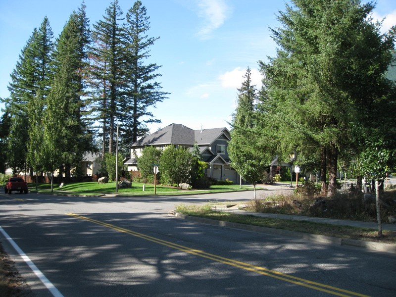
2. Street Trees. See NBMC 18.18.125, Landscaping standards – Streets and public rights-of-way.
3. Front Yards. The building lot shall be bladed prior to planting to remove rocks and debris. At a minimum, the front yard of all new lots and any side yard abutting a street shall be sodded or seeded with grass or otherwise landscaped and shall include a minimum of one tree. Townhomes may provide for one tree for every 30 feet of building within front yard areas rather than one tree for each lot. Front yard landscaping shall be installed prior to final inspection unless otherwise provided in NBMC 18.18.170.
4. Landscape plans for the development as a whole shall incorporate common open space or park areas as required per Chapter 17.25 NBMC and shall be integrated with trails and recreation facilities suitable for the benefit of the project’s anticipated residents.
B. The following standards apply to building permits for individual lots or other residential building sites for single-family, cottage and duplex uses in accordance with this title. The building lot shall be bladed prior to planting to remove rocks and debris. The front yard and any side yard abutting a street shall be sodded or seeded with grass, include a minimum of one tree and established by the builder prior to final occupancy unless otherwise provided in NBMC 18.18.170. (Ord. 1671 § 1 (Exh. A (part)), 2018: Ord. 1576 § 10, 2016: Ord. 1390 § 1, Exh. A (part), 2010: Ord. 1305 § 1, Exh. A (part), 2008: Ord. 1256 § 1 (part), 2006: Ord. 1020 (part), 1997: Ord. 801 § 6 (E), 1989).
18.18.110 Landscaping standards – Multifamily, governmental, commercial and industrial development.
The following standards shall apply to development on lands designated as HDR, NB, DC, IC, EP-1, and EP-2 and to development of uses other than parks and recreation on lands designated POSPF:
A. Underground automatic sprinkler systems shall be required for all multifamily, commercial and industrial projects. When 100 percent native drought-tolerant landscaping is proposed, temporary irrigation for plant establishment, of not less than three years, may be installed in place of a permanent sprinkler system as approved by the city.
B. Landscape plans for multifamily, commercial and industrial development shall incorporate common open space or park areas as required with trails, interior courtyards and recreation facilities suitable for the benefit of the project’s anticipated residents.
C. Foundation Planting.
1. For all multifamily buildings, foundation plantings shall be provided to soften the overall impact and scale of the buildings. Foundation plantings shall be provided around each individual building, at the base of the building.
2. For all commercial and industrial buildings, foundation plantings shall be provided around all areas of the base of the building not directly abutting a sidewalk, plaza, service or loading area. Foundation plantings shall be scaled according to the nature of the wall area, limited at primary building facades and around features such as windows, entries, and architectural elements, and increased for areas of blank walls and utilities.
3. For all office and industrial buildings, in the EP-1 and EP-2 zones, an average depth of 15 feet from the face of the building shall be provided around the building; provided, that pedestrian facilities, such as sidewalks, may be located within this 15 feet and shall count as landscaping; and provided further, that building loading areas shall not be subject to this requirement. (Ord. 1671 § 1 (Exh. A (part)), 2018: Ord. 1390 § 1, Exh. A (part), 2010: Ord. 1305 § 1, Exh. A (part), 2008: Ord. 1256 § 1 (part), 2006: Ord. 1020 (part), 1997: Ord. 801 § 6 (F), 1989).
18.18.120 Landscaping standards – Parks, recreation, and public open space in the POSPF zone.
The following standards shall apply to parks, recreation and public open space development on lands designated as POSPF:
A. Where buildings or parking is proposed within 20 feet of perimeter lot lines, the landscape standards in NBMC 18.18.080 and Table 1 at the end of this chapter shall apply.
B. For all other areas, the landscaping shall be as established by the master plan approved by the park commission pursuant to Table 18.10.050(4.00). (Ord. 1671 § 1 (Exh. A (part)), 2018: Ord. 1390 § 1, Exh. A (part), 2010: Ord. 1305 § 1, Exh. A (part), 2008: Ord. 1256 § 1 (part), 2006: Ord. 1020 (part), 1997: Ord. 801 § 6 (G), 1989).
18.18.125 Landscaping standards – Streets and public rights-of-way.
Street trees and planter strips in or along the public right-of-way shall be placed in accordance with the following:
A. Ground Cover. The planter strip shall be planted with either turf or low-growing shrubs and ground cover. Ground cover shall be from one-gallon pots spaced 24 inches on center. Low-growth shrubs may also be used in planter strips as design accents, provided adequate sight distance is provided at intersections and driveways, maintenance is provided to prune shrubs low to maintain visibility, and a pathway is provided from the curb to the sidewalk on each residential lot where on-street parking is allowed. Sustainable low impact ground cover and/or other vegetation are encouraged over sod to support water conservation. Alternative options for ground vegetation, to be approved by the city, may be utilized to support best available practices for stormwater treatment. Planter strips for streets constructed under the low impact development street standard incorporating stormwater management pursuant to Chapter 19.01 NBMC and the city of North Bend public works standards shall be planted according to the bioswale planting requirements in that chapter.
B. Street Trees.
1. Street tree species shall be chosen from the city’s list of approved street tree varieties, on file at the community and economic development department and on the city’s website, and/or alternative proposed species may be reviewed and approved administratively by the director if not on the list, and shall be evenly spaced within planter strips in accordance with the spacing requirements contained in said table.
2. Street trees shall be included in all landscape strips and sidewalk design.
3. The minimum street tree size shall be two-inch minimum caliper measured six inches above the root flare and conform to the most recent ANSI Z60.1 American Standard for Nursery Stock.
4. The first branch of the tree shall be a minimum of five feet above the ground except where the tree location does not present an obstruction to pedestrians, passing vehicles, or sightlines.
5. Root barriers shall be placed at the edge of the curb and edge of the sidewalk extending a minimum of five feet on either side of the trunk, and 18 inches in depth, for all species identifying the requirement for a root barrier in the city’s list of approved street trees, and as may be required by the city for trees approved for installation that are not on said list.
6. Once planted, street trees shall be watered immediately and thoroughly, twice per week during the first month, then once per week through the remainder of the dry season. Street trees shall be watered a minimum of once per month during the second summer season.
7. Within subdivisions, short plats, and along the frontage of multifamily, government, commercial and industrial development, street trees and planter strips shall be irrigated. Where street trees are isolated from other landscaping that would include irrigation, water bags may be approved for providing temporary irrigation for the first three years of plant establishment. Filling and maintaining water bags is the responsibility of the applicant as a part of the landscape maintenance period required pursuant to NBMC 18.18.150.
C. Cul-de-Sac. Street trees shall be planted within cul-de-sacs according to the spacing requirements specified in the city’s list of approved street tree varieties. To provide adequate planting area where space is limited due to driveway cuts through the planter strip, the following strategies shall be used separately or in combination:
1. Shared driveways between lots;
2. Narrow driveway cut to single garage width of 10 feet;
3. Reduce driveway wing wall width, as approved by the public works director. (Ord. 1671 § 1 (Exh. A (part)), 2018: Ord. 1635 § 1, 2017: Ord. 1390 § 1, Exh. A (part), 2010: Ord. 1305 § 1, Exh. A (part), 2008).
18.18.130 Transitional landscape area.
Properties within the transitional landscape area (TLA), as defined in this chapter, shall provide for landscape buffering in accordance with the standards below, in addition to other applicable provisions of this chapter.
A. General TLA Standards.
1. Within TLA buffers, existing native trees and vegetation shall be retained and supplemented with additional planted landscaping where existing native vegetation is insufficient to meet the prescribed landscape standard. Invasive nonnative species shall be uprooted and removed from the TLA buffer upon development. Supplemental trees shall be a minimum of 75 percent native evergreens to provide additional screening function, and for consistency with the natural forested character of the TLA.
2. Where a TLA affects more than 20 percent of the total gross area of any parcel, the TLA may be reduced such that not more than 20 percent of the total gross area of the parcel is affected by the TLA, subject to performance standards found in NBMC 18.10.050.
3. Regional trail linkages and sidewalks are allowed within the TLA, located to meander around retained trees.
4. The TLA shall be measured from the edge of the applicable right-of-way and should either be placed in a tract to be dedicated to the applicable owners’ association, placed within an easement for transitional landscape area purposes or subject to city approval, dedicated to the city for TLA and trail purposes.
B. Specific TLA Buffers.
1. A 20-foot buffer of Type 2 landscaping, as described in NBMC 18.18.080, shall be provided along Ribary Way for properties zoned IMU.
2. A 35-foot buffer shall be provided along the northern edge of Cedar Falls Way for properties zoned cottage residential, pursuant to the buffering requirements established in the cottage residential regulations in NBMC 18.11.070(B)(3)(b).
3. A 40-foot buffer of Type 2 landscaping, as described in NBMC 18.18.080, shall be provided in the following areas:
a. Along SE 140th Street for properties zoned EP-1 and EP-2.
b. Along West North Bend Way and Alm Way for properties zoned EP-1.
c. Along Southeast North Bend Way for properties zoned EP-2.
4. A 50-foot buffer of Type 2 landscaping, as described in NBMC 18.18.080, shall be provided along East North Bend Way for properties zoned cottage residential, and parks, open spaces and public facilities. An applicant may alternatively provide for acquisition and dedication of a portion of the Burlington Northern Railroad right-of-way for public trail purposes pursuant to the provisions of NBMC 18.11.070(C) in place of this buffering requirement. (Ord. 1671 § 1 (Exh. A (part)), 2018: Ord. 1390 § 1, Exh. A (part), 2010: Ord. 1305 § 1, Exh. A (part), 2008: Ord. 1256 § 1 (part), 2006: Ord. 1020 (part), 1997: Ord. 801 § 6 (H), 1989).
18.18.140 Landscaping standards – Parking lots.
Landscaping requirements for parking lots shall be those shown in Table 2 at the end of this chapter. (Ord. 1671 § 1 (Exh. A (part)), 2018: Ord. 1390 § 1, Exh. A (part), 2010: Ord. 1305 § 1, Exh. A (part), 2008: Ord. 1256 § 1 (part), 2006: Ord. 1020 (part), 1997: Ord. 801 § 6 (I), 1989).
18.18.150 Landscape maintenance.
A. Replacement. The property owner shall replace any unhealthy or dead plant materials in conformance with the approved landscape plan, shall maintain all plant material and irrigation facilities, and shall keep all landscape areas free of invasive species.
B. Maintenance Assurance. The community and economic development director shall require a maintenance assurance device and landscape maintenance agreement for a period of three years from the completion and approval of the planting in order to ensure compliance with this section. The amount of the maintenance assurance device shall be 20 percent of the cost of plant materials plus installation. A maintenance assurance device and landscape maintenance agreement are not required for an individual single-family home constructed outside of a new short plat or subdivision.
C. Minimal Landscape Project Fee-In-Lieu of Maintenance Assurance. For projects that have a landscape project cost for plant materials and installation valued at $5,000 or less, an applicant may provide a fee-in-lieu of maintenance assurance device to the city in the amount of 10 percent of the value of the landscaping, subject to entering a fee-in-lieu landscape agreement with the city. (Ord. 1671 § 1 (Exh. A (part)), 2018: Ord. 1390 § 1, Exh. A (part), 2010: Ord. 1305 § 1, Exh. A (part), 2008: Ord. 1256 § 1 (part), 2006: Ord. 1237 § 16 (part), 2005: Ord. 1020 (part), 1997: Ord. 801 § 7, 1989).
18.18.160 Performance assurance.
The required landscaping must be installed prior to issuance of the final plat approval, issuance of a certificate of occupancy, or issuance of any other final permit necessary to approve land development or construction; provided, however, that the director in his or her sole discretion may accept a bond, letter of credit, or other performance assurance device to ensure installation of all required landscaping by such later date as determined by the director. Any such performance assurance device shall be in a form acceptable to the director and in an amount determined by the director of not less than 150 percent of the cost of all required plant materials and installation. In no case shall such performance security device be in an amount less than $1,500. (Ord. 1671 § 1 (Exh. A (part)), 2018: Ord. 1390 § 1, Exh. A (part), 2010: Ord. 1305 § 1, Exh. A (part), 2008: Ord. 1256 § 1 (part), 2006: Ord. 1237 § 16 (part), 2005: Ord. 1020 (part), 1997: Ord. 801 § 8, 1989).
18.18.170 Modifications to standards.
A. Request. An applicant may request a modification of the landscaping requirements set forth in NBMC 18.18.060 through 18.18.140; provided, that modifications shall not allow disturbance of protected or environmentally sensitive critical areas and that street frontage landscaping shall be maintained.
B. Review. The planning director may approve modifications to the standards set forth in NBMC 18.18.060 through 18.18.140 if the proposed landscaping is superior to that which could be achieved by strict compliance with those standards.
C. Findings. In approving modifications to the standards set forth in NBMC 18.18.060 through 18.18.140, the planning director shall prepare written findings that the proposed modification is justified based on one of the following:
1. The modifications retain trees equal in number to what would otherwise be required under the tree retention requirements of the clearing and grading regulations in Chapter 19.10 NBMC; or
2. The modifications retain existing vegetation in consolidated locations promoting the natural vegetated character of the site; or
3. The modifications better accommodate or improve the existing physical conditions of the subject property; or
4. The modifications incorporate elements to provide for wind protection, or maintain solar access or incorporate best available low impact or sustainable landscaping techniques; or
5. A reduction may be allowed to the perimeter landscape buffers for lots one acre in size or less that are adjacent to properties within the same zoning district or a more intensive zoning district (i.e., residential to commercial, commercial to industrial), when such buffers occupy more than 20 percent of the gross area of the lot. (Ord. 1671 § 1 (Exh. A (part)), 2018: Ord. 1390 § 1, Exh. A (part), 2010: Ord. 1305 § 1, Exh. A (part), 2008: Ord. 1256 § 1 (part), 2006: Ord. 1020 (part), 1997: Ord. 801 § 9, 1989).
18.18.175 Fences.
Fences shall be constructed and maintained in conformance with the following standards:
A. Building Permit. A building permit is required for any fence greater than six feet in height.
B. Review. Fence proposals for all new multifamily (triplex or larger), commercial, utility, public/quasi-public, and resource uses with buildings and/or structures shall be reviewed under the primary approval(s) required (e.g., site plan approval, design review approval, etc.).
C. Setbacks.
1. Collector and Arterial Street Setback. Fences taller than four feet in height along the property line of a collector or arterial street shall be set back a minimum of five feet off the edge of the right-of-way.
2. Corner Line-of-Sight Setback. For corner lots (either street or alley), or where other relevant safety considerations are present, including major driveways, any solid fences or continuous hedges that are taller than three and one-half feet in height shall be placed behind a “sight triangle” area. The sides of a sight triangle shall be two perpendicular lines each varied in length based on classification of street and measured from the edge of the vehicle travel lane of the right-of-way (either the curb or fog line) of the two intersecting streets or street and alley. The hypotenuse of the sight triangle shall be the line that crosses the corner lot and connects the two sides of the triangle. The length of perpendicular measurement shall be 30 feet for local streets, and 50 feet for collector or arterial streets. In addition, solid fences and hedges higher than three and one-half feet on corner lots shall maintain a minimum five feet side yard setback from the edge of pavement or back side of any sidewalk or open drainage ditch along the street frontage. As necessary, the community and economic development department reserves the right to utilize other methodologies in ensuring an adequate line-of-sight area for corner lots, or where other public safety considerations are present.
3. No setbacks are required for fences along property lines other than those described above.
D. Height Limits. Fences in front yard areas or along the front property line, and within the corner line-of-sight setback, may not be greater than six feet in height, except as may be approved through an administrative adjustment to standards pursuant to Chapter 18.25 NBMC or a variance, in addition to the required building permit.
E. Wildlife. To allow for the movement of wildlife, fences are not permitted on the outside of perimeter landscape buffers within the TLA, or on the outside of the perimeter landscape buffer of EP-1 zoned properties adjacent to residential zones.
F. Additional Standards. Additional standards for fences exist within the land use performance standards in NBMC 18.10.050 and commercial design standards in Chapter 18.34 NBMC for certain land uses. (Ord. 1671 § 1 (Exh. A (part)), 2018: Ord. 1390 § 1, Exh. A (part), 2010: Ord. 1305 § 1, Exh. A (part), 2008: Ord. 1256 § 1 (part), 2006: Ord. 1214 § 2 (part), 2004; Ord. 1020 (part), 1997; Ord. 711 § 1, 1986: Ord. 450 § 3, 1977: Ord. 336 § 4.04, 1970).
18.18.180 Enforcement.
All provisions, conditions or requirements of the landscape plan shall be legally enforceable against the owner, and any person acquiring a lease or other ownership interest in the property subject to the landscape plan. (Ord. 1671 § 1 (Exh. A (part)), 2018: Ord. 1390 § 1, Exh. A (part), 2010: Ord. 1305 § 1, Exh. A (part), 2008: Ord. 1256 § 1 (part), 2006: Ord. 1020 (part), 1997: Ord. 801 § 10, 1989).
|
Subject Property by Zone |
Abutting a Right-of-Way or Adjacent Private/Public Parking Lot |
Abutting Single-Family |
Abutting Multifamily |
Abutting Business Commercial |
Abutting Industrial |
Abutting Parks and Open Space |
|---|---|---|---|---|---|---|
|
POSPF – Park Uses |
10' Type 3* |
10' Type 2* |
10' Type 2* |
10' Type 2* |
NA |
NA |
|
POSPF – Nonpark Uses outside the DC Zone |
10' Type 3 |
20' Type 1 |
15' Type 1 |
10' Type 2 |
10' Type 2 |
NA |
|
Nonresidential Uses in Single-Family Zones |
10' Type 3 |
10' Type 3 |
10' Type 1 |
10' Type 2 |
10' Type 2 |
10' Type 2 |
|
Multifamily |
10' Type 3 |
20' Type 2 |
10' Type 3 |
10' Type 1 |
10' Type 1 |
10' Type 2 |
|
Commercial |
10' Type 3; 5' when abutting an alley or adjacent private/public parking lot |
15' Type 1 |
15' Type 1 |
5' Type 2 (does not apply in DC zone) |
10' Type 2 |
10' Type 2 |
|
Industrial/Employment Park – 1 |
15' Type 1 |
30' Type 1 (no fencing on outside of buffer) |
20' Type 1 |
15' Type 1 |
10' Type 2 |
10' Type 1 |
|
Industrial/Employment Park – 2 |
20' Type 1 |
30' Type 1 |
20' Type 1 |
15' Type 1 |
15' Type 2 (30' Type 1 where abutting existing single-family residential use) |
10' Type 1 |
Notes and Comments:
1. On properties greater than one acre in size, the perimeter landscape buffer may be reduced or waived through the modification to standards process in NBMC 18.18.170 at the discretion of the planning director for areas that are left in an undeveloped condition (such as grass field or forest) and are further than 30 feet from site improvements (parking, buildings, storage, etc.).
2. Required planting width is measured from the property line.
3. The transitional landscape area (TLA) shall govern as designated by Figure 1-5, North Bend Comprehensive Plan Area.
4. Landscaping width can be reduced to minimum building setback where building precluded installation per NBMC 18.18.050(D).
5. Fencing is not permitted in EP-1 buffers adjacent to residential to allow for the movement of wildlife.
6. Perimeter buffers shall not preclude connectivity between adjacent parcels for shared parking or drive lanes.
* Applies only where buildings, paved or gravelled areas, and service areas on the subject property are adjacent to a property line or right-of-way.
|
Item |
Specifications |
|---|---|
|
For Parking Lots with 10 to 30 Stalls in All Zones |
7 percent of total vehicular use area shall be landscaped with Type 3 landscaping. TLA reduction may be allowed when on-site vehicular use area landscaping is increased to 10 percent. |
|
For Parking Lots with 31 or More Stalls in All Zones |
10 percent of total vehicular use area shall be landscaped with Type 3 landscaping. TLA reduction may be allowed when on-site vehicular use area landscaping is increased to 12 percent. |
|
For Parking Lots with 75 or More Stalls in the EP-1 or EP-2 Zone |
12 percent of total vehicular use area shall be landscaped with Type 2 landscaping. TLA reduction may be allowed when on-site vehicular use area landscaping is increased to 15 percent. |
|
Minimum Area of Each Planting Segment and Design Requirements in All Zones |
A. 100 square feet minimum. B. Shall project out into the pavement as peninsulas or islands, or as otherwise approved by the city. C. Planting areas shall be distributed as evenly as possible throughout the parking area and shall be located between parking stalls and/or at the end of parking rows. D. Automatic underground irrigation systems shall be installed to promote plant growth and maintain vegetation, unless 100 percent native drought-tolerant species are used and a watering plan is implemented consistent with NBMC 18.18.120(B). |
|
Curb and Structural Barriers in All Zones |
Curb and/or structural barriers shall be provided to protect the landscape plantings from vehicle overhang. |
|
Required Number of Shade Trees per Landscape Segment in All Zones |
At least one per planter area and/or one per 100 square feet of planter area whichever is greater. |
Notes and Comments:
1. “Vehicular use area” includes the parking lot, driveways and service areas.
(Ord. 1671 § 1 (Exh. A (part)), 2018: Ord. 1390 § 1, Exh. A (part), 2010: Ord. 1305 § 1, Exh. A (part), 2008: Ord. 1256 § 1 (part), 2006: Ord. 1214 § 3, 2004; Ord. 1165 § 6, 2002; Ord. 1020 (part), 1997: Ord. 711 § 1, 1986: Ord. 450 § 3, 1977: Ord. 336 § 4.04, 1970).
Prior legislation: Ord. 786.