


Natural Environment Revised 11/21
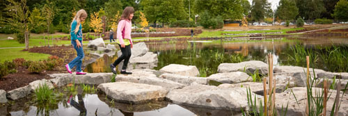
Two children skipping on the rocks at Yauger Park
What Olympia Values:
Olympians value our role as stewards of the water, air, land, vegetation, and animals around us, and believe it is our responsibility to our children and grandchildren to restore, protect, and enhance the exceptional natural environment that surrounds us.
Our Vision for the Future:
A beautiful, natural setting that is preserved and enhanced.
Read more in the Community Values and Vision chapter
Introduction
In Olympia, opportunities abound to experience and take part in the stewardship of the natural environment. Olympians plant trees, remove invasive plants, raise chickens, count salmon, recycle, drive hybrid-electric cars, and walk to their neighborhood store. Our parks and natural areas are home to rare birds, native salmon, and the tallest of native evergreen trees. Connecting with the environment and protecting it for future generations is a strongly held value for Olympians. We recognize our role as land stewards and our responsibility to protect water quality and clean air.
For more than 20 years, Olympia has embraced its role as a leader in the effort to create a sustainable community dedicated to the conservation, protection, and restoration of the natural environment. The City will continue this work -- through leadership, education, and planning -- as we address emerging environmental challenges.
Our community recognizes that natural resources are precious and limited, and that our growing population will test those limits. Our ability to meet several key challenges will define how well we manage our natural environment in the coming decades.
Key challenges:
• A growing population will put more pressure on these resources; to remove trees, to replace natural land surfaces with roads, buildings, and parking lots, and to encroach on environmentally sensitive area
• Climate change is likely to bring sea-level rise, unpredictable rainfall, increased stormwater runoff, changes in food supply, and increased stress on habitats and wildlife
• Increased waste and toxins through the products we purchase, which may contain artificial ingredients or toxins, or create unnecessary waste
All of these challenges have the potential to impact the quality of our natural water resources. We hope this community vision will define a path for change for us to follow as we continue to face these challenges in the next 20 years.
As Olympia continues to grow, it will be essential to reach a careful balance between planning for growth and maintaining our natural environment.
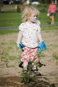
A young tree planter in Kettle View Park.
As a key land steward, the City’s role is to encourage and regulate new development and land management practices in a way that minimizes negative environmental impacts by:
• Carrying out the state’s Growth Management Act’s requirement that cities plan for anticipated population growth by accepting the need for denser development so that larger expanses of rural land can be preserved
• Encouraging low impact development and green building methods that include using renewable or recycled materials
• Constructing developments that have a low impact on soil and site conditions
• Treating stormwater runoff on-site
• Using building materials that require less energy, which public and private groups are now working closely with the City to explore new and reliable methods
• Ensuring that public land is preserved and cared for
• Identifying land at greatest risk for preservation, enhancement, and stewardship to support a diversity of wildlife habitat and species
• Continuing the City’s role as caretaker of Olympia’s urban forest, a diverse mix of native and ornamental trees that line our streets, shade our homes, and beautify our natural areas.
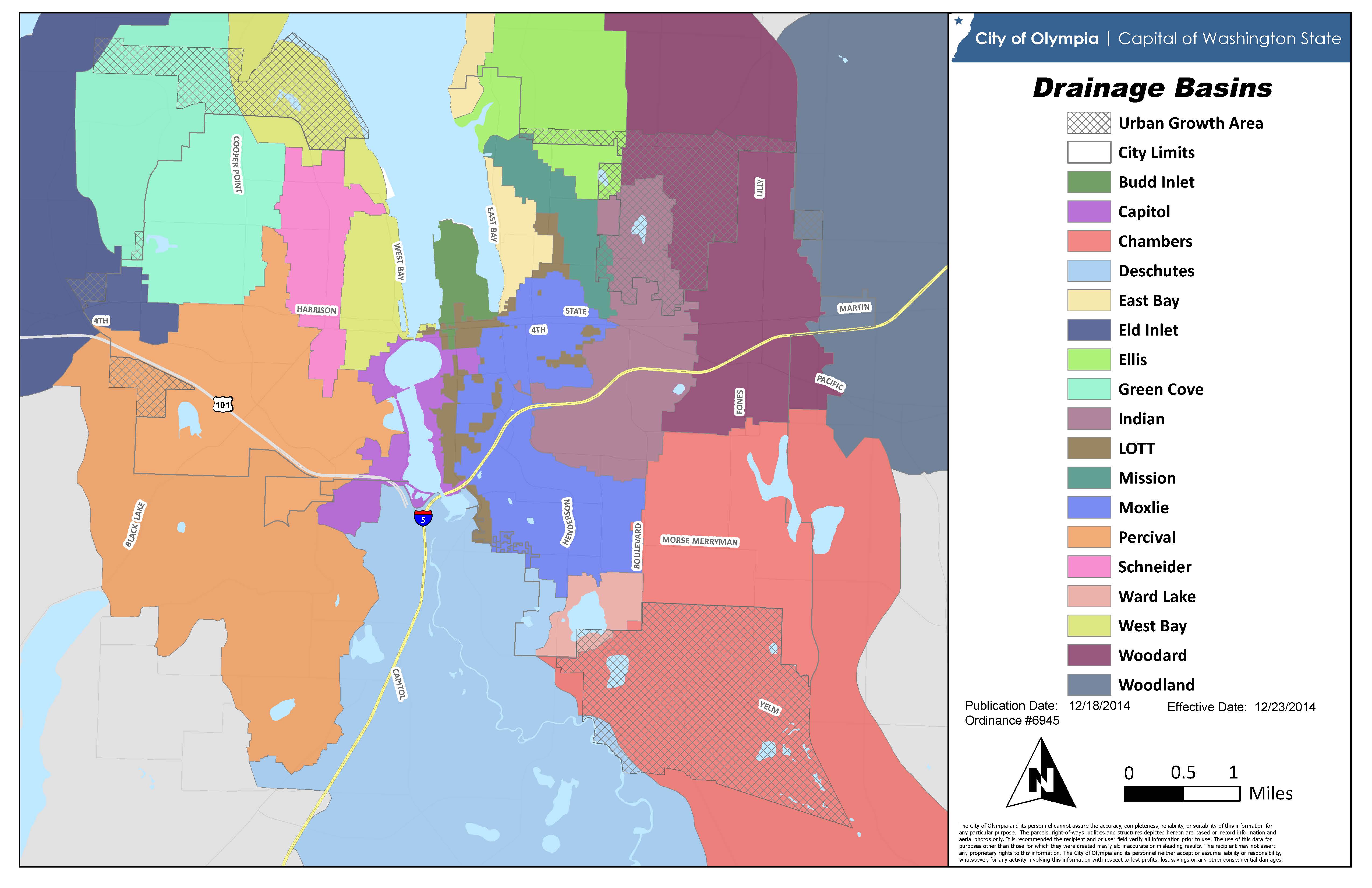
The Open Space and Environmentally Sensitive Areas Map reflects those areas in the City and UGA that are already preserved as open space, or that may be good opportunities for future preservation as open space.
Shown on the map are environmentally sensitive areas, such as steep slopes, flood plains, wetlands, and significant wildlife habitat. Many of these areas are protected by Critical Areas regulations so the map serves to highlight those areas for further evaluation prior to any new development project.
The map also reflects locations where there may be a greater potential for creating or enhancing existing open space corridors for recreation or wildlife habitat. These areas may still be undeveloped, owned or managed by the City, connected to other nearby open space areas, or have environmentally sensitive areas present.
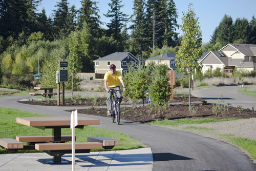
Kettle View Park bike rider.

Open Space Environmentally Sensitive Areas
Goals and Policies
Natural resources and processes are conserved and protected by Olympia’s planning, regulatory, and management activities.
PN1.1Administer development regulations which protect environmentally sensitive areas, drainage basins, and wellhead areas.
PN1.2Coordinate critical areas ordinances and storm water management requirements regionally based on the best scientific information available
PN1.3Limit development in areas that are environmentally sensitive, such as steep slopes and wetlands. Direct development and redevelopment to less-sensitive areas.
PN1.4Conserve and restore natural systems, such as wetlands and stands of mature trees, to contribute to solving environmental issues.
PN1.5Preserve the existing topography on a portion of a new development site; integrate existing site contours into the project design and minimize the use of grading and other large-scale land disturbances.
PN1.6Establish regulations and design standards for new developments that will minimize impacts to stormwater runoff, environmentally sensitive areas, wildlife habitat, and trees.
PN1.7Limit hillside development to site designs that incorporate and conform to the existing topography, and minimize their effect on existing hydrology.
PN1.8Limit the negative impacts of development on public lands and environmental resources, and require full mitigation of impacts when they are unavoidable.
PN1.9Foster City partnerships with public, private, and non-profit agencies and groups and encourage them to help identify and evaluate new low impact development and green building approaches.
PN1.10Increase the use of low impact and green building development methods through education, technical assistance, incentives, regulations, and grants.
PN1.11Design, build, and retrofit public projects using sustainable design and green building methods that require minimal maintenance and fit naturally into the surrounding environment.
PN1.12Require development to mitigate impacts and avoid future costs, by incorporating timely measures, such as the clean-up of prior contamination as new development and redevelopment occurs.
PN2.1Acquire and preserve land by a set of priorities that considers environmental benefits, such as stormwater management, wildlife habitat, or access to recreation opportunities.
PN2.2Preserve land when there are opportunities to make connections between healthy systems; for example, land parcels in a stream corridor.
PN2.3Identify, remove, and prevent the use and spread of invasive plants and wildlife.
PN2.4Preserve and restore native plants by including restoration efforts and volunteer partnerships in all city land management.
PN2.5Design improvements to public land using existing and new vegetation that is attractive, adapted to our climate, supports a variety of wildlife, and requires minimal, long-term maintenance.
PN2.6Conserve and restore wildlife habitat in both existing corridors and high-priority separate sites.
PN2.7Practice sustainable maintenance and operations activities that reduce the City’s environmental impact.
PN2.8Evaluate, monitor, and measure environmental conditions, and use this data to develop short- and long-term management strategies.
A healthy and diverse urban forest is protected, expanded, and valued for its contribution to the environment and community.
PN3.1Manage the urban forest to professional standards, and establish program goals and practices based on the best scientific information available.
PN3.2Measure the tree canopy and set a city-wide target for increasing it through tree preservation and planting.
PN3.3Preserve existing mature, healthy, and safe trees first to meet site design requirements on new development, redevelopment and city improvement projects.
PN3.4Evaluate the environmental, ecologic, health, social and economic benefits of the urban forest.
PN3.5Provide new trees with the necessary soil, water, space, and nutrients to grow to maturity, and plant the right size tree where there are conflicts, such as overhead utility wires or sidewalks.
PN3.6Protect the natural structure and growing condition of trees to minimize necessary maintenance and preserve the long-term health and safety of the urban forest.
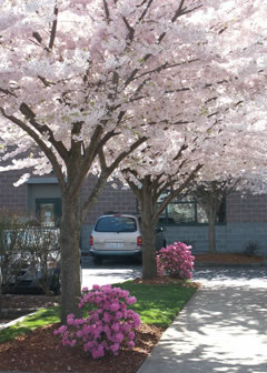
Cherry trees in bloom in the parking lot of the Briggs YMCA.
Protecting Our Water Resources
Olympia is fortunate to be surrounded by water and have abundant fresh water resources. Our deep, underground aquifers provide our drinking water. Our many protected streams and wetlands are valuable habitat for native wildlife. We kayak the waters of Budd Inlet, hop over rain puddles on the way to school, and enjoy Ellis Creek as we hike through nearby Priest Point Park.
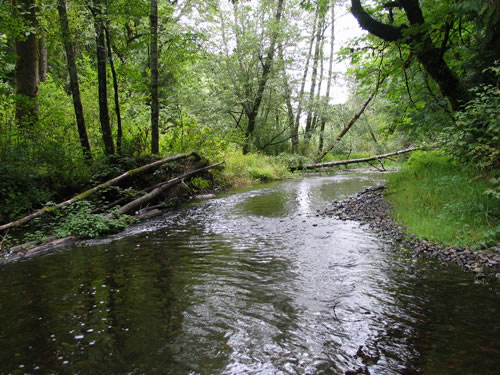
Moxlie Creek flowing through Watershed Park.
Within Olympia’s 24-square-mile area, there are nine major streams, four lakes, four large wetlands, and six miles of marine shoreline. As water moves down from Olympia’s higher elevations to the Sound, it filters through the ground into a number of separate drainage basins or watersheds.
Protecting water resources is one of Olympia’s core values. We recognize that many of our water resources have been damaged by pollution. The natural processes that would normally protect these resources, such as undeveloped land and wetlands, which filter stormwater pollutants and reduce runoff, must be protected and restored. If we take steps to restore these natural processes, we’ll be ensuring clean water and abundant aquatic life in Budd Inlet for us, and for future generations.
A new wetland constructed in Yauger Park.
Goals and Policies
The waters and natural processes of Budd Inlet and other marine waters are protected from degrading impacts and significantly improved through upland and shoreline preservation and restoration.
PN4.1Plan for the health and recovery of Budd Inlet on a regional scale and in collaboration with local tribes and all potentially affected agencies and stakeholders.
PN4.2Prioritize and implement restoration efforts based on the best scientific information available to restore natural processes and improve the health and condition of Budd Inlet and its tributaries.
PN4.3Restore and protect the health of Puget Sound as a local food source.
PN4.4As a party of significant interest, support the process for determining a balanced, scientifically grounded and sustainable approach to the management of the Deschutes River, state-owned Capitol Lake and Budd Inlet.
Ground and surface waters are protected from land uses and activities that harm water quality and quantity.
PN5.1Reduce the rate of expansion of impervious surface in the community.
PN5.2Increase the use of permeable materials and environmentally-beneficial vegetation in construction projects.
PN5.3Retrofit existing infrastructure for stormwater treatment in areas with little or no treatment.
PN5.4Require prevention and treatment practices for businesses and land uses that have the potential to contaminate stormwater.
PN5.5Improve programs and management strategies designed to prevent and reduce contamination of street runoff and other sources of stormwater
PN5.6Limit or prohibit uses that pose a risk to water supplies in Drinking Water (Wellhead) protection areas based on the best scientific information available and the level of risk. Require restoration of any such areas that have been degraded.

Olympia Wellhead Protection Areas
PN5.7Encourage more active inspection and maintenance programs for septic systems.
PN5.8Encourage existing septic systems to connect to sewer, and limit the number of new septic systems.
PN6.1Restore and manage vegetation next to streams, with an emphasis on native vegetation, to greatly improve or provide new fish and wildlife habitat.
PN6.2Maintain or improve healthy stream flows that support a diverse population of aquatic life.
PN6.3Establish and monitor water quality and aquatic habitat health indicators based on the best scientific information available.
PN6.4Use regulations and other means to prevent a net loss in the function and value of existing wetlands, while striving to increase and restore wetlands over the long-term.
PN6.5Retain and restore floodways in a natural condition.
PN6.6Preserve and restore the aquatic habitat of Budd Inlet and other local marine waters.
PN6.7Partner with other regional agencies and community groups to restore aquatic habitat through coordinated planning, funding, and implementation.
PN6.8Evaluate expanding low impact development approaches citywide, such as those used in the Green Cove Basin.
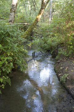
A healthy stream.
Clean Air and Cool Climate
Overall, Olympia’s air quality is often better than what federal standards require. We rarely experience days in which older residents and others with health issues are told to stay indoors due to polluted air. Stars are still visible in our night sky.
However, if we do not rein in local sources of carbon dioxide and other greenhouse gas emissions and limit nighttime light, we will jeopardize the quality of this invisible but critical resource.
As a community, we can commit to developing and adopting new and renewable solutions for commuting, heating our homes, powering our economy, fueling our vehicles, and lighting our streets, sidewalks, and businesses.
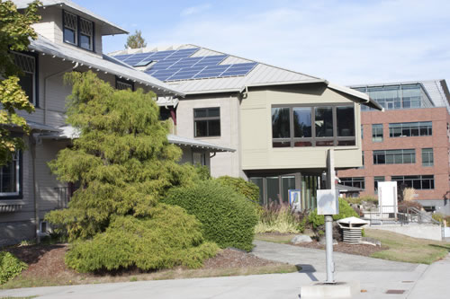
Solar panels on a commercial building in downtown Olympia.
Goals and Policies
PN7.1Partner with other state and local agencies to monitor, reduce and eliminate sources of air pollution that can be replaced with more efficient or clean methods and technologies.
PN7.2Partner with other state and local agencies to offset anticipated negative impacts on air quality by taking further steps to reduce air pollution, such as commute reduction programming and tree planting.
Community sources of emissions of carbon dioxide and other climate-changing greenhouse gases are identified, monitored and reduced.
PN8.1Participate with local and state partners in the development of a regional climate action plan aimed at reducing greenhouse gases by 45 percent below 2015 levels by 2030 and by 85 percent below 2015 levels by 2050.
PN8.2Monitor the greenhouse gas emissions from City operations, and implement new conservation measures, technologies and alternative energy sources to reach established reduction goals.
PN8.3Reduce the use of fossil fuels and creation of greenhouse gases through planning, education, conservation, and development and implementation of renewable sources of energy (see also GL2).
PN8.4Encourage the conservation and reuse of existing natural resources and building materials.
PN8.5Reduce the pollution and energy consumption of transportation by promoting the use of electric vehicles and expanding accessible and inviting alternatives that reduce vehicle miles traveled, including transit, walking and cycling (see also GT25).
PN8.6Plan to adapt, mitigate, and maintain resiliency for changing environmental conditions due to climate change, such as longer periods of drought and increased flooding related to changing weather patterns and sea level rise (see also GU11).
PN8.7Reduce energy use and the environmental impact of our food system by encouraging local food production (see also GL25).
For sea level rise, see the Utilities chapter GU11.
Artificial sources of nighttime light are minimized to protect wildlife, vegetation and the health of the public, and preserve views of the night sky.
PN9.1Design nighttime lighting that is safe and efficient by directing it only to the areas where it is needed. Allow and encourage reduction or elimination of nighttime light sources where safety is not impacted.
PN9.2Eliminate or reduce lighting near streams, lakes, wetlands, and shorelines to avoid disrupting the natural development and life processes of wildlife.

Residential light post.
Connect with the Natural World
Planting trees, observing birds in a nest, or lying on a sunny patch of grass are some of the ways we bring quiet into our lives and reconnect with the natural world. Researchers are now learning that having a connection to the natural world it isn’t just a luxury, but a necessity for a healthy, safe, and engaged community.
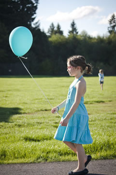
A child with a balloon explores Kettle Park.
We interact with the natural world in a variety of ways -- from eating healthy food, to commuting by bike, to learning a new outdoor activity, to stopping to chat with a neighbor under the shade of a tree. These activities all foster a strong connection to our community and an interest in stewarding our natural environment.
Goals and Policies
Risk to human health and damage to wildlife and wildlife habitat due to harmful toxins, pollution, or other emerging threats is tracked by appropriate agencies and significantly reduced or eliminated.
PN10.1Minimize the City’s purchase and use of products that contribute to toxic chemical pollution when they are manufactured, used, or disposed.
PN10.2Identify products that should be phased out by the community, and provide education on their negative impacts and the best available alternatives.
PN10.3Maintain City land and properties using non-chemical methods whenever possible; use standard Integrated Pest Management practices and other accepted, natural approaches to managing vegetation and pests.
All members of the community can experience the natural environment through meaningful volunteer experiences, active recreation, and interactive learning opportunities.
PN11.1Ensure that all members of the community have access to a nearby natural space that gives them opportunities to see, touch, and connect with the natural environment.
PN11.2Give all members of our community opportunities to experience, appreciate, and participate in volunteer stewardship of the natural environment.
PN11.3Provide environmental education programs, classes, and tours that teach outdoor recreation skills and foster an understanding and appreciation for the natural environment.
PN11.4Provide education and support to local community groups and neighborhoods who want to monitor and care for their local park or natural area.
PN11.5Foster a sense of place and community pride by carefully stewarding the trees, plants, and wildlife unique to Puget Sound.
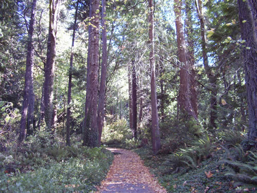
A trail leads into Priest Point Park
Shoreline Master Program
Goals and Policies
PN12.1The goals, policies and regulations of Olympia’s Shoreline Master Program are based on the governing principles in the Shoreline Master Program Guidelines, WAC 173-26-186 and the policy statement of RCW 90.58.020. It is the policy of the City to provide for the management of the shorelines of Olympia by planning for and fostering all reasonable and appropriate uses. This policy is designed to insure the development of these shorelines in a manner which, while allowing for limited reduction of rights of the public in the navigable waters, will promote and enhance the public interest. This policy contemplates protecting against adverse effects to the public health, the land and its vegetation and wildlife, and the waters of the State and their aquatic life, while protecting generally public rights of navigation and corollary rights incidental thereto.
A. The interest of all of the people shall be paramount in the management of those areas of Puget Sound lying seaward from the line of extreme low tide. Within this area the City will give preference to uses in the following order of preference which:
1. Recognize and protect the state-wide interest over local interest;
2. Preserve the natural character of the shoreline;
3. Result in long-term over short-term benefit;
4. Protect the resources and ecology of the shoreline;
5. Increase public access to publicly-owned areas of the shorelines;
6. Increase recreational opportunities for the public in the shoreline;
7. Provide for any other element as defined in RCW 90.58.100 as deemed appropriate or necessary.
B. The policies of Olympia’s Shoreline Program may be achieved by diverse means, one of which is regulation. Other means may include but are not limited to acquisition of lands and/or easements by purchase or gift, incentive programs, and implementation of capital facility and/or non-structural programs.
C. Regulation of private property to implement Shoreline Program goals such as public access and protection of ecological functions and processes must be consistent with all relevant constitutional and other legal limitations.
D. Regulatory or administrative actions must be implemented consistent with the Public Trust Doctrine and other applicable legal principles as appropriate and must not unconstitutionally infringe on private property rights or result in an unconstitutional taking of private property.
E. The regulatory provisions of this Shoreline Program are to be limited to shorelines of the State, whereas the planning functions of the Program may extend beyond the designated shoreline boundaries.
The policies and regulations established by this Shoreline Program are to be integrated and coordinated with the other goals, policies and rules of the Olympia Comprehensive Plan and development regulations adopted under the Growth Management Act (GMA).
F. The policies and regulations of Olympia’s Shoreline Program are intended to protect shoreline ecological functions by:
1. Requiring that current and potential ecological functions be identified and understood when evaluating new or expanded uses and developments;
2. Requiring adverse impacts to be mitigated in a manner that ensures no net loss of shoreline ecological functions. Mitigation shall include avoidance as a first priority, followed by minimizing, and then replacing/compensating for lost functions and/or resources;
3. Ensuring that all uses and developments, including preferred uses and uses that are exempt from a shoreline substantial development permit, will not cause a net loss of shoreline ecological functions;
4. Preventing, to the greatest extent practicable, cumulative impacts from individual developments;
5. Fairly allocating the burden of preventing cumulative impacts among development opportunities; and
6. Including incentives to restore shoreline ecological functions where such functions have been degraded by past actions.
PN12.2Shoreline Ecological Protection and Mitigation Goals
A. The Shoreline Management Act and the Shoreline Master Program Guidelines place a primary emphasis on the protection of shoreline ecological functions and system-wide processes. In accordance with the Guidelines (WAC 173-26), Olympia’s Shoreline Program must insure that shoreline uses, activities, and modifications will result in no net loss to these processes and functions.
B. The protection, restoration and enhancement of shoreline ecological functions and system-wide processes, especially as they pertain to the long-term health of Budd Inlet, are high priorities of Olympia’s Shoreline Program. The policies and regulations established therein are to be applied to all uses, developments and activities that may occur within the shoreline jurisdiction.
C. The City recognizes that there are many existing sources of untreated stormwater within the shoreline jurisdiction and that these sources of nonpoint pollution have negative impacts on shoreline ecological functions. The City’s Drainage Design and Erosion Control Manual of Olympia is the primary regulatory tool that addresses stormwater treatment and is periodically updated in response to changing guidelines from the Department of Ecology and changes in best management practices.
PN12.3Shoreline Ecological Protection and Mitigation Policies
A. All shoreline use and development should be carried out in a manner that avoids and minimizes adverse impacts so that the resulting ecological condition does not become worse than the current condition. This means assuring no net loss of ecological functions and processes and protecting critical areas that are located within the shoreline jurisdiction.
B. Natural features of the shoreline and nearshore environments that provide ecological functions and should be protected include but are not limited to marine and freshwater riparian habitat, banks and bluffs, beaches and backshore, critical saltwater and freshwater habitat, and wetlands and streams. Shoreline processes that should be protected include but are not limited to erosion and accretion, sediment delivery, transport and storage, organic matter input, and large woody debris recruitment. See WAC 173-26-201(2)(c).
C. Preserve and protect important habitat including but not limited to the Port Lagoon, Priest Point Park, Ellis Cove, Grass Lake, Chambers Lake, and Percival Canyon.
D. Development standards for density, setbacks, impervious surface, shoreline stabilization, vegetation conservation, critical areas, and water quality should protect existing shoreline functions and processes. During permit review, the Administrator should consider the expected impacts associated with proposed shoreline development when assessing compliance with this policy.
E. Where a proposed use or development creates significant adverse impacts not otherwise avoided or mitigated by compliance with Olympia’s Shoreline Program, mitigation measures should be required to ensure no net loss of shoreline ecological functions and system-wide processes.
F. The City should work with other local, state, and federal regulatory agencies, tribes, and non-government organizations to ensure that mitigation actions carried out in support of the Olympia Shoreline Program are likely to be successful and achieve beneficial ecological outcomes. This includes such measures as mitigation banks, fee in lieu programs, and assisting applicants/proponents in planning, designing, and implementing mitigation.
G. The City should develop a program to periodically review conditions on the shoreline and conduct appropriate analysis to determine whether or not other actions are necessary to protect and restore shoreline ecology to ensure no net loss of ecological functions.
H. Allow offsite mitigation when doing so would serve to better accomplish the goals and objectives of the Shoreline Management Act to protect and preserve ecological functions, or provide public access, or promote preferred shoreline uses, provide for appropriate development incentives and/or alternative mitigation options.
I. The City should encourage innovative mitigation strategies to provide for comprehensive and coordinated approaches to mitigating cumulative impacts and restoration rather than piecemeal mitigation.
J. When available and when appropriate to the situation, the City should allow for offsite mitigation approaches, including Advance Mitigation, Fee-In Lieu, and Mitigation Banking.
K. As part of the next update of the Drainage Design and Erosion Control Manual of Olympia, the City will consider methods and measures to encourage existing development, redevelopment and new development within the shoreline jurisdiction to comply with the City’s Drainage Design and Erosion Control Manual of Olympia and best management practices.
PN12.4Shoreline Use and Development Policies
A. The City should give preference to those uses that are consistent with the control of pollution and prevention of damage to the natural environment, or are unique to or dependent upon uses of the State's shoreline areas.
B. The City should ensure that all proposed shoreline development will not diminish the public's health, safety, and welfare, as well as the land or its vegetation and wildlife, and should endeavor to protect property rights while implementing the policies of the Shoreline Management Act.
C. The City should reduce use conflicts by prohibiting or applying special conditions to those uses which are not consistent with the control of pollution and prevention of damage to the natural environment or are not unique to or dependent upon use of the State's shoreline. In implementing this provision, preference should be given first to water-dependent uses, then to water-related uses and water-enjoyment uses.
D. The City should continue to develop information about the impacts of sea level rise on the shoreline and other affected properties; the City should develop plans to address the impacts of sea level rise in collaboration with impacted property owners, the community and the Department of Ecology. These plans should include at minimum flood prevention approaches, shoreline environment impact considerations and financing approaches. The City should amend the Shoreline Master Program and other policy and regulatory tools in the future as necessary to implement these plans.
E. The City should consider the impacts of sea level rise as it plans for the rebuild of Percival Landing and other shoreline improvements and it should be designed to provide for a reasonable amount of sea level rise consistent with the best available science and the life cycle of the improvements.
F. The City should collaborate with private property owners, business owners and community members in the implementation of the Shoreline Master Program to explore creative ways to reduce ecological impacts when new development or redevelopment is proposed. This objective may best be accomplished by developing flexible approaches to shoreline development where the total environmental benefit is enhanced through such measures. Opportunities for collaboration may include:
1. Provision of advanced stormwater management and treatment within the shoreline.
2. The restoration, repair and replacement of Percival Landing where appropriate.
3. Provision of direct physical access to the water where appropriate.
4. Provision of a shoreline trail where feasible and consistent with applicable laws.
5. Provision of native vegetation preservation and restoration where appropriate.
6. Bulkhead removal and replacement of hardened shoreline with soft structural stabilization measures water-ward of Ordinary High Water Mark (OHWM) where appropriate.
7. Provision of water related recreation, active playgrounds, and significant art installations, performance space, or interpretive features where appropriate.
PN12.5Aquatic Environment Management Policies
A. The Aquatic environment designation should apply to lands water-ward of the Ordinary High Water Mark.
B. Allow new overwater structures only for water-dependent uses, public access, or ecological restoration.
C. The size of new overwater structures should be the minimum necessary to support the structure’s intended use.
D. In order to reduce the impacts of shoreline development and increase effective use of water resources, multiple uses of overwater facilities should be encouraged.
E. All development and uses on navigable waters or their beds should be located and designed to minimize interference with surface navigation, to consider impacts to public views, and to allow for the safe, unobstructed passage of fish and wildlife, particularly those species dependent on migration.
F. Uses that adversely impact the ecological functions of critical saltwater and freshwater habitats should not be allowed except where necessary to achieve the objectives of RCW 90.58.020, and then only when their impacts are mitigated according to the sequence described in WAC 173-26-201(2)(e) as necessary to assure no net loss of ecological functions.
G. Shoreline uses and modifications should be designed and managed to prevent degradation of water quality and alteration of natural hydrographic conditions.
H. Space for preferred shoreline uses should be reserved. Such planning should consider upland and in-water uses, water quality, navigation, presence of aquatic vegetation, existing shellfish protection districts and critical wildlife habitats, aesthetics, public access and views.
PN12.6Natural Environment Management Policies
A. The Natural environment designation should be assigned to shoreline areas if any of the following characteristics apply:
1. The shoreline is ecologically intact and therefore currently performing an important, irreplaceable function or ecosystem-wide process that would be damaged by human activity;
2. The shoreline is considered to represent ecosystems and geologic types that are of particular scientific and educational interest; or
3. The shoreline is unable to support new development or uses without significant adverse impacts to ecological functions or risk to human safety.
B. Priest Point Park is one of a few shorelines along Budd Inlet that is ecologically intact. Therefore, any use or modification that would substantially degrade the ecological functions or natural character of this shoreline area should not be allowed.
C. Scientific, historical, cultural, educational research uses, and water-oriented recreation access may be allowed provided that no significant ecological impacts on the area will result. Recreation uses should be limited to trails and viewing areas.
D. Uses should be highly restricted and allowed only with a conditional use permit for water-oriented recreational uses.
E. New roads, utility corridors, and parking areas should be located outside of the shoreline jurisdiction.
PN12.7Urban Conservancy Environment Management Policies
A. The Urban Conservancy environment designation should be applied to shoreline areas appropriate and planned for development that is compatible with maintaining or restoring ecological functions of the area, that are not generally suitable for water-dependent uses and that lie in incorporated municipalities and urban growth areas if any of the following characteristics apply:
1. They are suitable for water-related or water-enjoyment uses;
2. They are open space, flood plain or other sensitive areas that should not be more intensively developed;
3. They have potential for ecological restoration;
4. They retain important ecological functions, even though partially developed; or
5. They have potential for development that is compatible with ecological restoration.
B. Uses that preserve the natural character of the area or promote preservation of open space or critical areas should be the primary allowed use. Uses that result in the restoration of ecological functions should be allowed if the use is otherwise compatible with the purpose of the Urban Conservancy environment and the setting.
C. Standards should be established for shoreline stabilization measures, vegetation conservation, water quality, and shoreline modifications. These standards should ensure that new development does not result in a net loss of shoreline ecological functions or further degrade shoreline values.
D. Public access trails and public passive recreation should be provided whenever feasible and significant ecological impacts can be mitigated.
E. Water-oriented uses should be given priority over non-water oriented uses. For shoreline areas adjacent to commercially navigable waters, water-dependent uses should be given highest priority.
F. Restoration and protection of shorelands, stream openings and associated wetlands within the Urban Conservancy environment should be given high priority.
PN12.8Waterfront Recreation Environment Management Policies
A. The Waterfront Recreation environment designation should be assigned to shoreline areas that are or are planned to be used for recreation, or where the most appropriate use is for recreation open space or habitat conservation.
B. Development standards should take into account existing improvements and character of park areas, allow for development of low-intensity recreational uses, and restoration of shorelines. Low intensity recreation should be non-motorized and not significantly alter the landscape, such as running and walking, bicycling, wildlife viewing, picnicking, nature study, and quiet contemplation and relaxation. Associated facilities might include trails, open fields and lawn areas, picnic shelters, public art, interpretive exhibits and supporting parking and restrooms.
C. Trails, water access, interpretive sites, viewing platforms and passive recreation areas should be allowed within setbacks and vegetation buffers when significant ecological impacts can be mitigated.
D. Preferred uses include trails, water-related recreation, active playgrounds, and significant art installations, performance space, interpretive features, open lawn areas, play equipment, shelters, picnic areas, launch ramps, viewing platforms and accessory uses. Special events may take place.
E. Shoreline restoration should be a priority. All development should ensure no net loss of shoreline ecological functions.
PN12.9Marine Recreation Environment Management Policies
A. The Marine Recreation environment designation should be assigned to areas on the Port Peninsula that are used or planned to be used for boating facilities, water-oriented recreation and commercial uses. Preferred uses include:
1. Boating facilities including marinas, launch ramps, boat moorage, maintenance and repair, and upland boat storage; together with offices and other associated facilities;
2. Water-oriented recreation such as trails and viewing areas; water access, water-related recreation, active playgrounds, and significant art installations, performance space, or interpretive features; and
3. Water-oriented commercial uses.
B. Operation and management of the Marine Recreation environment should be directed towards maintaining and enhancing water-oriented services, while ensuring that existing and future activity does not degrade ecological functions.
C. All development should ensure no net loss of shoreline ecological functions.
D. Innovative approaches to restoration and mitigation should be encouraged, including incentive and alternative mitigation programs such as Advance Mitigation and Fee In-lieu.
E. Encourage bulkhead removal and replacement of hardened shoreline with soft structural stabilization measures water-ward of OHWM.
F. The City recognizes the Port’s responsibility to operate its marine facilities and to plan for this area’s future use through the development and implementation of its Comprehensive Scheme of Harbor Improvements.
G. The City recognizes that the Marine Recreation shoreline (Reach 5C) and the adjoining Urban Conservancy/Urban Intensity shoreline in Reach 6A provide a variety of benefits to the community including boat moorage, utility transmission, transportation, public access, water enjoyment, recreation, wildlife habitat and opportunities for economic development. These benefits are put at risk by continued shoreline erosion. The City recognizes that there exists a need to develop a detailed plan for shoreline restoration and stabilization for Reaches 5C and 6A and encourages the Port to partner in this effort.
1. This plan may include:
a. Measures to enhance shoreline stabilization through the introduction of bioengineered solutions.
b. Measures to incorporate habitat restoration water-ward of the OHWM.
c. Measures to incorporate public access and use through trails, public art, parks and other pedestrian amenities.
d. Measures to incorporate sea level rise protection.
e. Setbacks, building heights and building design considerations.
2. Upon completion of a jointly developed shoreline restoration and stabilization plan for Reaches 5C and 6A, the City will initiate a limited amendment to the SMP to implement this Plan.
PN12.10Shoreline Residential Environment Management Policies
A. The Shoreline Residential environment designation should be applied to shoreline areas if they are predominantly single-family or multi-family residential development or are planned and platted for residential development.
B. Establish standards for density or minimum frontage width, setbacks, lot coverage limitations, buffers, shoreline stabilization, vegetation conservation, critical area protection, and water quality, taking into account the environmental limitations and sensitivity of the shoreline area, the level of infrastructure and services available, and other comprehensive planning considerations.
C. Multi-family development and subdivisions of land into more than nine (9) parcels should provide public access.
D. Commercial development should be limited to water-oriented uses and not conflict with the character in the Shoreline Residential environment.
E. Water-oriented recreational uses should be allowed.
F. Encourage restoration of degraded shorelines in residential areas and preservation of existing vegetation.
G. Encourage bulkhead removal and replacement of hardened shoreline with soft structural stabilization measures water-ward of OHWM.
PN12.11Urban Intensity Environment Management Policies
A. The Urban Intensity environment should be assigned to shoreline areas if they currently support high intensity uses related to commerce, industry, transportation or navigation, and high-density housing; or are suitable and planned for high-intensity water-oriented uses.
B. Olympia’s shoreline is characterized by a wide variety of “urban” uses and activities, including commercial, industrial, marine, residential, and recreational uses. Together, these uses and activities create a vibrant shoreline that is a key component of Olympia’s character and quality of life. These types of uses should be allowed within the Urban Intensity environment, with preference given to Water-Dependent and Water-Enjoyment uses. Shorelines in this Shoreline Environment Designation (SED) are highly altered and restoration opportunities are limited. The City’s own Percival Landing is a good example of how the immediate shoreline in the Urban Intensity SED should be redeveloped with a focus on public access and enjoyment, sea level rise protection and restoration of shoreline environmental function where feasible.
C. Nonwater-oriented uses may be allowed where they do not conflict with or limit opportunities for water-oriented uses or on sites where there is no direct access to the shoreline.
D. Preferred uses include water-oriented recreation such as trails and viewing areas, water access, water-related recreation, active playgrounds, and significant art installations, performance space, or interpretive features.
E. Provide for the restoration, repair and replacement of Percival Landing including consideration of sea level rise protection.
F. Policies and regulations should assure no net loss of shoreline ecological functions as a result of new development. Where applicable, new development should include environmental cleanup and restoration of the shoreline to comply with any relevant state and federal law.
G. Where feasible visual and physical public access should be required as provided for in WAC 173-26-221(4)(d) and this shoreline program.
H. Aesthetic objectives should be implemented by means such as sign control regulations, appropriate development siting, screening and architectural standards, and vegetation conservation measures.
I. Innovative approaches to restoration and mitigation should be encouraged, including incentive and alternative mitigation programs such as Advance Mitigation and Fee In-lieu.
J. Encourage bulkhead removal and replacement of hardened shoreline with soft structural stabilization measures water-ward of OHWM.
PN12.12Port Marine Industrial Environment Management Policies
A. The Port Marine Industrial environment should be assigned to the shoreline area located within the portion of the Port of Olympia that supports uses related to water-oriented commerce, transportation or navigation, or are planned for such uses.
B. Highest priority should be given to water-dependent and water-related industrial uses.
C. The preferred location for non-water-dependent industrial uses is in industrial areas as far from the shoreline as feasible.
D. Coordinate planning efforts to ensure that there is adequate land reserved for water-dependent industrial uses to promote economic development, and to minimize impacts upon adjacent land uses.
E. Encourage growth and re-development in areas that are already developed.
F. Industrial use and development should be located, designed, and operated to avoid or minimize adverse impacts upon the shoreline and achieve no net loss of shoreline ecological functions and processes.
G. Industrial uses and related development projects are encouraged to locate where environmental cleanup can be accomplished.
H. Encourage the cooperative use of docking, parking, cargo handling and storage facilities on industrial properties.
I. Innovative approaches to restoration and mitigation should be encouraged, including incentive and alternative mitigation programs such as Advance Mitigation and Fee In-lieu.
PN12.13Archaeological, Historic, and Cultural Resources Policies
A. The destruction or damage to any site having any archaeological, historic, cultural, scientific, or educational value as identified by the appropriate authorities, including affected Indian tribes, and the Office of Archaeology and Historic Preservation, should be prevented.
PN12.14Parking Policies
A. Motor vehicle parking is not a preferred use within the shoreline jurisdiction and should be allowed only as necessary to support authorized uses.
B. Where feasible, parking for shoreline uses should be located in areas outside the shoreline jurisdiction; otherwise locate parking as far landward of the Ordinary High Water Mark as feasible.
C. Parking facilities or lots within the shoreline jurisdiction should utilize low impact best management practices where feasible to reduce stormwater impacts.
D. Design and construct parking facilities or lots to be compatible with adjacent uses and to avoid impacts to the shoreline environment.
E. Provide walkways between parking areas and the buildings or uses they serve. Such walkways should be located as far landward of the Ordinary High Water Mark as feasible.
PN12.15Public Access Policies
A. Protect and maintain existing visual and physical public access so that the public may continue to enjoy the physical, visual, and aesthetic qualities of the shoreline.
B. Incorporate public access into all new development or redevelopment if it creates or increases a demand for public access. Public access should also be required if the proposed use or development impairs existing legal access or rights.
C. Protect the rights of navigation and space necessary for water-dependent uses when identifying locations for public access.
D. Public access should be commensurate with the scale and character of a proposed use or development. Requirements should be reasonable, effective and fair to all affected parties including but not limited to the landowner and the public.
E. Developments, uses, and activities on or near the shoreline should not impair or detract from the public's use of the water or rights of navigation.
F. Impacts resulting from public access improvements should be mitigated in order to avoid a net loss of shoreline ecological processes and functions.
G. Public access should be designed to provide for public safety and comfort, and to limit potential impacts to private property.
H. Public access should be designed with provisions for persons with disabilities.
I. Public access should connect to public areas, undeveloped rights-of-way, and other pedestrian or public thoroughfares.
J. Public access and interpretive displays should be provided as part of publicly-funded projects.
PN12.16Scientific and Educational Activity Policies
A. Encourage scientific and educational activities related to shoreline ecological functions and processes.
PN12.17Signage Policies
A. Signs should not block or otherwise interfere with visual access to the water or shorelands.
B. Signs should be designed and placed so that they are compatible with the aesthetic quality of the existing shoreline and adjacent land and water uses.
PN12.18Vegetation Conservation Area Policies
A. Developments and activities within the shoreline jurisdiction should be planned and designed to protect, conserve and establish native vegetation in order to protect and restore shoreline ecological functions and system-wide processes occurring within riparian and nearshore areas such as:
1. Providing shade necessary to maintain water temperatures required by salmonids, forage fish, and other aquatic biota;
2. Regulating microclimate in riparian and nearshore areas;
3. Providing organic inputs necessary for aquatic life, including providing food in the form of various insects and other benthic macro invertebrates;
4. Stabilizing banks, minimizing erosion and sedimentation, and reducing the occurrence or severity of landslides;
5. Reducing fine sediment input into the aquatic environment by minimizing erosion, aiding infiltration, and retaining runoff;
6. Improving water quality through filtration and vegetative uptake of nutrients and pollutants;
7. Providing a source of large woody debris to moderate flows, create hydraulic roughness, form pools, and increase aquatic diversity for salmonids and other species; and
8. Providing habitat for wildlife, including connectivity for travel and migration corridors.
B. Restrict clearing and grading within vegetation conservation areas in order to maintain the functions and values of the shoreline environment, including protection of habitat, steep slopes and shoreline bluffs. Any alterations should be the minimum necessary to accommodate an authorized use or development.
C. The composition, structure and density of the vegetation should replicate the functions of a natural, unaltered shoreline to the greatest extent feasible.
D. Maintaining a well-vegetated shoreline with native species is preferred over clearing vegetation to create views or provide lawns. Limited and selective clearing for views and lawns, or for safety, may be allowed when slope stability and ecological functions are not compromised, but landowners should not assume that an unobstructed view of the water is guaranteed. Trimming and pruning are preferred over removal of native vegetation. Property owners should be encouraged to avoid or minimize the use of fertilizers, herbicides and pesticides.
E. Property owners should be encouraged to preserve and enhance woody vegetation and native groundcovers to stabilize soils and provide habitat. Maintaining native plant communities is preferred over non-native ornamental plantings because of their ecological value.
F. Develop educational materials and establish a public outreach program to educate shoreline landowners and community members about the importance of protecting and enhancing vegetative buffers along the shoreline.
PN12.19View Protection Policies
A. Preserve views and vistas to and from the water, by public and private entities, to ensure that the public may continue to enjoy the physical and aesthetic qualities of the shoreline, including views of the water and views of shoreline areas from the water and the iconic views of the State Capitol and Olympic Mountains.
B. Development should be designed to preserve and enhance the visual quality of the shoreline, including views over and through the development from the upland side of the subject property, and views over and through the development from the water.
PN12.20Water Quality Policies
A. All shoreline uses and activities should be located, designed, constructed, and maintained to avoid impacts to water quality.
B. Stormwater management facilities for new uses and development should be designed, constructed, and maintained in accordance with the current Olympia Drainage Design and Erosion Control Manual of Olympia. To the extent feasible, low impact development best management practices should be incorporated into every project along the shoreline.
C. To reduce impacts to water quality, the use of chemical fertilizers, pesticides or other similar chemical treatments should be avoided. Landscaping should be designed to avoid or minimize the use of such products. Maintenance activities should use integrated pest management best practices. Pesticide free areas should be encouraged.
D. Uses and activities that pose a risk of contamination to ground or surface waters should be prohibited.
PN12.21Agriculture Policies
A. Recognize existing agricultural uses within the City and allow them to continue operating.
B. New agricultural uses should be prohibited.
PN12.22Aquaculture Policies
A. Aquaculture should not be permitted in areas where it would result in a net loss of ecological functions, adversely impact eelgrass and microalgae, or significantly conflict with navigation and other water-dependent uses.
B. Aquaculture facilities should be designed and located so as not to spread disease to native aquatic life, establish new non-native species which cause significant ecological impacts, or significantly impact the aesthetic qualities of the shoreline.
PN12.23Boating Facilities Policies
A. Boating facilities, such as marinas and launch ramps, are water-dependent uses and should be given priority for shoreline location.
B. Boating facilities and their accessory uses should be located, designed, constructed and maintained to achieve the following:
1. Protect shoreline ecological functions and system-wide processes. When impacts cannot be avoided, mitigate to assure no net loss to shoreline ecological functions;
2. Maintain use of navigable waters, public access areas, and recreational opportunities, including overwater facilities;
3. Minimize adverse impacts to adjacent land uses such as noise, light and glare, aesthetics, and public visual access; and
4. Minimize adverse impacts to other water-dependent uses.
C. Development of new boating facilities should be coordinated with public access and recreation plans and should be collocated with Port or other compatible water-dependent uses where feasible. Affected parties and potential partners should be included in the planning process.
D. Boating facilities should provide physical and visual public shoreline access and provide for multiple uses including water-related uses, to the extent compatible with shoreline ecological functions and processes.
E. Upland boat storage is preferred over new in-water moorage.
F. New covered moorage should be prohibited.
G. Pilings treated with creosote or other similarly toxic materials should be replaced with steel or concrete pilings to minimize adverse impacts to water quality. Unused or derelict pilings should be removed.
PN12.24Commercial Policies
A. Give preference to water-dependent commercial uses, then to water-related, and then water-enjoyment commercial uses in shoreline jurisdiction. Non-water-oriented commercial uses should require a conditional use permit if located within 100 feet of the water.
B. The preferred location for non-water-oriented commercial uses is in commercial areas no closer than 30 feet from the shoreline.
C. Coordinate planning efforts between the City and the Port to promote economic development in downtown Olympia.
D. Commercial development should be located, designed, and operated to avoid and minimize adverse impacts on shoreline ecological functions and processes.
E. Commercial development should provide public access to shoreline beaches, docks, walkways, or viewing areas unless such improvements are demonstrated to be incompatible due to reasons of safety, security, or impact to the shoreline environment.
F. Commercial development should be designed to be visually compatible with adjacent and upland properties and so that the height, bulk, and scale do not impair views.
G. Commercial development should implement low impact development techniques to the maximum extent feasible.
PN12.25Industrial Policies
A. Give preference to water-dependent industrial uses first, then to water-related industrial uses over non-water-oriented industrial uses.
B. Non-water oriented industrial uses should be prohibited within the shoreline jurisdiction.
C. Coordinate planning efforts between the City and the Port to ensure that there is adequate land reserved for water-dependent industrial uses, to promote economic development, and to minimize impacts upon adjacent land uses.
D. Locate water-dependent or water-related industrial marine uses in areas already established or zoned for industrial use.
E. Industrial use and development should be located, designed, and operated to avoid and minimize adverse impacts on shoreline ecological functions and processes.
F. Transportation and utility corridors serving industrial uses should be located away from the water’s edge to minimize ecological impacts and reduce the need for waterfront signs and other infrastructure.
G. Industrial uses and related development projects are encouraged to locate where environmental cleanup can be accomplished.
H. Encourage the cooperative use of docking, parking, cargo handling and storage facilities on industrial properties.
I. Design port facilities to permit viewing of harbor areas from viewpoints, waterfront restaurants, and similar public facilities which would not interfere with Port operations or endanger public health or safety.
PN12.26Recreation Policies
A. Public recreation is a preferred use of the shoreline. Recreational uses and developments that facilitate the public’s ability to reach, touch, and enjoy the water’s edge, to travel on the waters of the State, and to view the water and shoreline are preferred. Where appropriate, such facilities should be dispersed along the shoreline in a manner that supports more frequent recreational access and aesthetic enjoyment for a substantial number of people.
B. Water-oriented recreational uses, such as boating, swimming beaches, and wildlife viewing, should have priority over non-water oriented recreation uses, such as sports fields. A variety of compatible recreation experiences and activities should be encouraged to satisfy diverse recreational needs.
C. Recreational developments and plans should promote the conservation and restoration of the shoreline’s natural character, ecological functions, and processes.
D. Plan, design, and implement shoreline recreational development consistent with the growth projections, level-of-service standards, and goals established in Olympia’s Comprehensive Plan and Parks, Arts and Recreation Plan.
E. Hiking paths, sidewalks, and bicycle paths in proximity to or providing access to the shoreline are encouraged.
F. Recreation facilities should be integrated and linked with linear systems, such as hiking paths, sidewalks, bicycle paths, easements, and/or scenic drives.
G. Recreation facilities should incorporate public education and interpretive signs regarding shoreline ecological functions and processes, historic and cultural heritage.
H. Recreation facilities should be designed to preserve, enhance, or create scenic views and vistas.
I. Commercial recreation facilities should be consistent with the provisions for commercial development (see commercial policies above).
PN12.27Residential Policies
A. All residential developments should be located, designed, and properly managed to avoid damage to the shoreline environment and avoid cumulative impacts associated with shoreline armoring, overwater structures, stormwater runoff, septic systems, vegetation clearing, and introduction of pollutants.
B. The overall density of development, lot coverage, setbacks, and height of structures should be appropriate to the physical capabilities of the site.
C. Residential development, including the division of land and the construction of residential units, should be designed and located so that shoreline armoring and flood hazard measures will not be necessary to protect land or structures.
D. Dwelling units and accessory structures should be clustered to preserve natural features and minimize overall disturbance of the site.
E. New residential development should provide opportunities for public access.
F. New residential development should minimize impacts upon views from adjacent residential areas, in keeping with the Shoreline Management Act.
G. ‘Live-aboard’ vessels associated with marinas may be allowed, but all other overwater residential development including floating homes should be prohibited. A floating home permitted or legally established prior to January 1, 2011 and floating on-water residences legally established prior to July 1, 2014 will be considered conforming uses.
H. Whenever possible, non-regulatory methods to protect, enhance and restore shoreline ecological functions should be encouraged for residential development.
PN12.28Transportation Policies
A. New roads and railroads, and expansions thereof should not be built within the shoreline jurisdiction. Where this is not feasible, such improvements should be located and designed to have the least possible adverse effect on the shoreline, not result in a net loss of shoreline ecological functions, or adversely impact existing or planned water-oriented uses, public access, and habitat restoration and enhancement projects.
B. Maintenance and repair of existing roads and railroads should avoid adverse impacts on adjacent shorelines and waters.
C. Transportation facilities should be designed and located to minimize the need for the following:
1. Structural shoreline protection measures;
2. Modifications to natural drainage systems; and
3. Waterway crossings.
D. Planning for transportation and circulation corridors should consider location of public access facilities, and be designed to promote safe and convenient access to those facilities.
E. Pedestrian trails and bicycle paths are encouraged where they are compatible with the natural character, resources, and ecology of the shoreline.
F. Piers and bridges for roads, pedestrian trails, bicycle paths, and railroads are preferred over the use of fill in upland and aquatic areas.
G. When transportation corridors are necessary, joint use corridors are preferred and encouraged for roads, utilities, and all forms of transportation/circulation.
PN12.29Utility Policies
A. Utility facilities should be designed, located and maintained to minimize harm to shoreline ecological functions, preserve the natural landscape, and minimize conflicts with present and planned land and shoreline uses while meeting the needs of future populations in areas planned to accommodate growth.
B. Expansion of existing sewage treatment, water reclamation, substations, and power plants should be compatible with recreational, residential, or other public uses of the water and shorelands.
C. Where water crossings are unavoidable, they should be located where they will have the least adverse ecological impact.
D. New utilities should use existing transportation and utility sites, rights-of-way and corridors, rather than creating new corridors.
E. Utilities should be located and designed to avoid impacts to public recreation and public access areas, as well as significant historic, archaeological, cultural, scientific or educational resources.
F. Encourage the use of utility rights-of-way for public access to and along shorelines.
G. Design and install utilities in such a way as to avoid impacts to scenic views and aesthetic qualities of the shoreline area.
PN12.30Shoreline Modification Policies
A. Locate and design all new development in a manner that prevents or minimizes the need for shoreline modifications.
B. Regulate shoreline modifications to assure that individually and cumulatively, the modifications do not result in a net loss of shoreline ecological functions.
C. Give preference to those types of shoreline modifications that have a lesser impact on ecological functions.
D. Require mitigation of impacts resulting from shoreline modifications.
E. Plan for the enhancement of impaired ecological functions while accommodating permitted uses. Incorporate all feasible measures to protect ecological functions and ecosystem-wide processes in the placement and design of shoreline modifications. To avoid and reduce ecological impacts, use mitigation sequencing set forth in WAC 173-26-201(2)(e) and Section 3.21 of the SMP.
F. Give preference to nonstructural flood hazard reduction measures over structural measures, where feasible.
PN12.31Dredging Policies
A. Design and locate new development to minimize the need for dredging.
B. Allow dredging for water-dependent uses or essential public facilities or both, only when necessary and when significant ecological impacts are minimized and appropriate mitigation is provided.
C. Allow dredging in locations where a comprehensive management plan has been evaluated and authorized by local and state governmental entities.
D. Plan and conduct dredging to minimize interference with navigation and adverse impacts to other shoreline uses and properties.
E. Allow maintenance dredging of established navigation channels and basins.
F. Conduct dredging and disposal in a manner to minimize damage to natural systems, including the area to be dredged and the area where dredged materials will be deposited. Disposal of dredge spoils on land away from the shoreline is preferred over open water disposal.
G. Re-use of dredge spoils is encouraged for beneficial uses such as restoration and enhancement.
H. Dredging and dredge disposal should not occur where they would interfere with existing or potential ecological restoration activities.
I. Allow dredging for ecological restoration or enhancement projects, beach nourishment, public access or public recreation provided it is consistent with the policies and regulations of the Master Program.
PN12.32Fill Policies
A. Fill should be located, designed, and constructed to protect shoreline ecological functions and system-wide processes. The quantity and extent of fill should be the minimum necessary to accommodate a permitted shoreline use or development.
B. Fill landward of the Ordinary High Water Mark should be permitted when necessary to support permitted uses, and when significant impacts can be avoided or mitigated.
C. Fill should be allowed to accommodate berms or other structures to prevent flooding caused by sea level rise, when consistent with the flood hazard reduction provisions in this Shoreline Program. Any such fill should include mitigation assuring no net loss of ecological functions and system-wide processes.
D. Fill for the maintenance, restoration, or enhancement of beaches or mitigation projects should be permitted.
E. Fill water-ward of the Ordinary High Water Mark should be permitted only to accommodate water-dependent uses, public access, cleanup of contaminated sites, the disposal of dredge materials associated with a permitted dredging activity, or other water-dependent uses that are consistent with the goals and policies of Olympia’s Shoreline Program.
F. Fill for the purpose of creating new uplands should be prohibited unless it is part of an authorized restoration activity.
G. Fill should not adversely impact navigation.
H. Fill should not be allowed where structural shoreline stabilization would be required to maintain the materials placed.
PN12.33Moorage Policies
A. New moorage should be permitted only when it can be demonstrated that there is a specific need to support a water-dependent or public access use.
B. Moorage associated with a single-family residence is considered a water-dependent use provided it is designed and used as a facility to access watercraft, and other moorage facilities are not available or feasible.
C. Allow shared moorage for multi-family uses or as part of a mixed use development when public access is provided.
D. Give preference to buoys over piers, docks, and floats; however, discourage the placement of moorage buoys where sufficient dock facilities exist.
E. Give preference to shared moorage facilities over single-user moorage where feasible. New subdivisions of more than two lots and new multi-family development of more than two dwelling units should provide shared moorage.
F. Moorage facilities should be sited and designed to avoid adversely impacting shoreline ecological functions and processes, and should mitigate for unavoidable impacts to ecological functions.
G. Moorage facilities should be spaced and oriented in a manner that minimizes hazards and obstructions to public navigation rights and corollary rights including but not limited to boating, swimming, and fishing.
H. Encourage the cooperative use of docking facilities in industrial areas instead of new facilities.
I. Moorage facilities should be restricted to the minimum size necessary to meet the needs of the proposed use. The length, width and height of piers, docks and floats should be no greater than required for safety and practicality for the primary use.
J. Encourage design elements that increase light penetration to the water below existing or new moorage facilities, such as increasing the structure’s height, modifying orientation and size, and use of grating as a surface material. No new over-water covered moorage or boathouses should be allowed.
K. Moorage facilities should be constructed of materials that will not adversely affect water quality or aquatic plants and animals in the long-term.
PN12.34Restoration and Enhancement Policies
A. Olympia recognizes the importance of restoration of shoreline ecological functions and processes and encourages cooperative restoration efforts and programs between local, state, and federal public agencies, tribes, non-profit organizations, and landowners to address shorelines with impaired ecological functions and processes.
B. Restoration actions should restore shoreline ecological functions and processes as well as shoreline features and should be targeted towards meeting the needs of both sensitive and locally important plant, fish and wildlife species as well as the biologic recovery goals for State and federally listed species and populations.
C. Coordinate restoration and enhancement with other natural resource management efforts and plans.
D. Consider restoration actions outside of the shoreline jurisdiction that have a system-wide benefit.
E. When prioritizing restoration actions, the City will give highest priority to measures that have the greatest chance of re-establishing shoreline ecological functions and processes.
F. Incorporate restoration and enhancement measures into the design and construction of new uses and development, public infrastructure (e.g., roads, utilities), and public recreation facilities.
G. Shoreline restoration and enhancement should be considered as an alternative to structural stabilization and protection measures where feasible.
H. All shoreline restoration and enhancement projects should protect the integrity of adjacent natural resources including aquatic habitats and water quality.
I. Design, construct, and maintain restoration and enhancement projects in keeping with restoration priorities and other policies and regulations set forth in Olympia’s Shoreline Program.
J. Design restoration and enhancement projects to minimize maintenance over time.
K. Shoreline restoration and enhancement should not extend water-ward more than necessary to achieve the intended results.
L. Permanent in-stream structures should be prohibited except for restoration and enhancement structures, and transportation and utility crossings as described elsewhere in this Program. In-stream structures should provide for the protection and preservation of ecosystem-wide processes, ecological functions, and cultural resources. The location and planning of in-stream structures should give due consideration to the full range of public interests, watershed functions and processes, and environmental concerns, with special emphasis on protecting and restoring priority habitat and species.
M. Restoration and enhancement projects may include shoreline modification actions provided the primary purpose of such actions is clearly restoration of the natural character and ecological functions of the shoreline.
PN12.35Shoreline Stabilization Policies
A. Preserve remaining unarmored shorelines and limit the creation, expansion and reconstruction of bulkheads and other forms of shoreline armoring.
B. New development requiring structural shoreline armoring should not be allowed. Shoreline use and development should be located and designed in a manner so that structural stabilization measures are not likely to become necessary in the future.
C. Structural shoreline armoring should only be permitted when there are no feasible alternatives, and when it can be demonstrated that it can be located, designed, and maintained in a manner that minimizes adverse impacts on shoreline ecology and system-wide processes, including effects on the project site, adjacent properties, and sediment transport.
D. The reconstruction or expansion of existing hard armoring should only be permitted where necessary to protect an existing primary structure or legally existing shoreline use that is in danger of loss or substantial damage, and where mitigation of impacts is sufficient to assure no net loss of shoreline ecological functions and processes.
E. Encourage the removal of bulkheads and other hard armoring and restore the shoreline to a more natural condition. Where stabilization is necessary for the protection of private or public property, alternative measures that are less harmful to shoreline ecological functions should be employed.
F. Nonstructural stabilization measures, including relocating structures, increasing buffers, enhancing vegetation, managing drainage and runoff, and other measures, are preferred over structural shoreline armoring.
G. Failing, harmful, unnecessary, or ineffective structures should be removed. Shoreline ecological functions and processes should be restored using non-structural methods.
H. Shoreline stabilization and shoreline armoring for the purpose of leveling or extending property, or creating or preserving residential lawns, yards, or landscaping should not be allowed.
I. Shoreline stabilization measures, individually or cumulatively, should not result in a net loss of shoreline ecological functions or system-wide processes. Preference should be given to structural shoreline stabilization measures that have a lesser impact on ecological functions, and mitigation of identified impacts resulting from said modifications should be required.
J. The City should promote non-regulatory methods to protect, enhance, and restore shoreline ecological functions and other shoreline resources. Examples of such methods include public facility and resource planning, technical assistance, education, voluntary enhancement and restoration projects, land acquisition and restoration, and other incentive programs.
K. Jetties, breakwaters, or groin systems should not be permitted unless no other practical alternative exists. If allowed, they should be located, designed, and maintained to avoid impacts to shoreline ecological functions and system-wide processes.
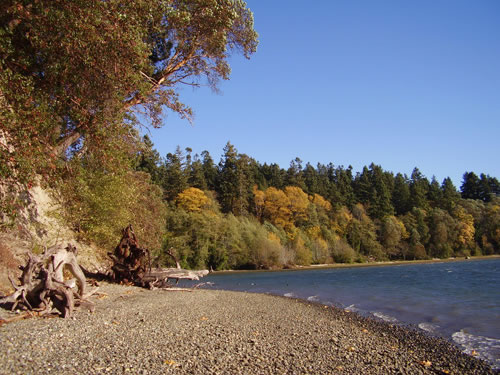
Priest Point Park shoreline.
For More Information
• City of Olympia Habitat and Stewardship Strategy (2013)
• Parks, Arts, and Recreation Plan (2010)
• Greenhouse Gas Emissions Report (2005)
• Greenhouse Gas Emissions Report (2008)
• 2011 City of Olympia Engineered Sea-level Rise