


Chapter 16.20
PRELIMINARY PLATS
Sections:
16.20.010 What this chapter does.
16.20.030 Preliminary plat approval required.
16.20.060 Expirations and extensions of approvals.
16.20.010 What this chapter does.
This chapter establishes the preliminary plat review and approval process, submittal requirements, and duties of the planning director, planning commission and city council regarding the review and processing of preliminary plats. [Ord. O-07-2014 (Exh. A); Ord. O-16-2010 § 2 (Exh. A); Ord. O-23-2005 § 3 (Exh. 1(2) § 4.1)].
16.20.020 Purpose.
The purpose of the preliminary plat application is to: review the specific layout of the lots created by the subdivision; ensure proper coordination of public and private street systems and circulation; review demand and availability of public utilities; review park and recreation sites; and review project densities. [Ord. O-07-2014 (Exh. A); Ord. O-16-2010 § 2 (Exh. A); Ord. O-23-2005 § 3 (Exh. 1(2) § 4.2)].
16.20.030 Preliminary plat approval required.
All proposed subdivision plats must receive preliminary plat approval by the planning commission and city council as shown on Table 16.05.220(b) prior to action on the final plat application. The approved preliminary plat vests the applicant with density for the subdivision, street configuration, and lot layouts.
Approved master development plans that meet the details and requirements of this chapter shall serve as preliminary plats. [Ord. O-38-2023 § 2 (Exh. A); Ord. O-25-2016 § 2 (Exh. A); Ord. O-07-2014 (Exh. A); Ord. O-16-2010 § 2 (Exh. A); Ord. O-23-2005 § 3 (Exh. 1(2) § 4.3)].
16.20.040 Application.
Only property owners or their duly authorized agents shall make application for a preliminary plat. All applications shall be filed on forms prepared by the planning director. No preliminary plat application shall be processed without the submission of the completed application and all supporting materials as required by this chapter, including the processing fee. Incomplete applications shall not be processed under any circumstance.
A. Supporting Materials. The preliminary plat application shall be submitted with the materials listed below. However, the planning commission or city council may require additional supporting materials, if necessary, to demonstrate that the proposed development complies with this title and EMMC Title 17. The number of hard copies and electronic copies, as well as the appropriate format of each, will be determined by the planning director.
1. Preliminary Plat. A preliminary plat drawing will be required which shows accurate alignments, boundaries and monuments as certified by a land surveyor registered in Utah. Preliminary plats shall be prepared at a scale no smaller than one inch equals 100 feet. Plats of large areas may be prepared on multiple, serially numbered sheets with match lines and an index map. The vicinity and index maps shall appear on the first of the serially numbered sheets. The following data shall be included on the preliminary plat:
a. A title block showing the name of the proposed development and its location by lot, block, and subdivision, or quarter-quarter section, section, township, range, principal meridian, county, and state;
b. The name and address of a registered engineer licensed in the state of Utah who prepared the plat, together with a professional registration number;
c. A north point and scale, including both graphic and written scales;
d. The exterior boundaries of the proposed development;
e. The location, nature, and boundaries of existing public streets and public or private easements in or adjacent to the proposed development, and county book and page number references to the instruments establishing the easements;
f. A vicinity map that locates the proposed development within the city and its subdivision or section showing major streets, landmarks, and boundaries and recorded names of adjacent or nearby subdivisions;
g. Existing contours at two-foot intervals. Elevations will be based on National Geodetic Survey area level data;
h. The layout of streets, their proposed names and grades. Plats should not contain lots fronting onto arterial or collector streets. Proposed streets must provide connectivity to adjacent properties under other ownership if within 200 feet;
i. The location, exterior dimensions to the nearest foot, and number of proposed lots and blocks, or other parcels to be created by the proposed development;
j. The acreage of each proposed lot or parcel, and a table showing the total number of lots, total acreage of the area proposed for development, the total buildable acreage (excluding slopes greater than 25 percent, major utility corridors, and natural washes), the total acreage in lots, the average lot size, the total acreage in streets, and the total acreage of neighborhood parks, neighborhood squares, and other parcels proposed for dedication to public use or to be held in common by the owners; 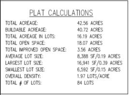
k. The location of irrigation structures and watercourses within or adjacent to the proposed development;
l. The location and exterior dimensions of existing and proposed buildings;
m. The location on each lot of the buildable area when the natural grade is in excess of 25 percent;
n. Sites, if any, to be reserved, dedicated for parks, playgrounds, schools, churches, public or natural open space or other public purposes, together with proposed ownership of such sites;
o. Sites intended for conditional uses within the underlying zone, such as commercial sites or other business establishments.
B. Landscaping and Parks Plan. A landscaping plan, prepared and stamped by a licensed landscape architect, indicating the size and location of proposed parks and open spaces. The landscaping plan shall include, at a minimum, the following information:
1. The location and dimension of all existing and proposed structures, property lines, easements, parking lots, rights-of-way, amenities, and lighting.
2. The plant names (both botanical and common name), location, quantity, and size of all existing and proposed plants and trees.
3. Existing and proposed grading of the site indicating contours at two-foot intervals.
4. Proposed and existing fences and identification of the fencing materials, color, and design.
5. A summary of the total percentage of landscaped areas, domestic turf grasses, and drought-tolerant plant species.
6. A completed parks and open space worksheet, detailing the proposed park equipment/amenities and their associated point values.
C. Ownership Affidavit. An affidavit (certificate of clear title) that the applicant is the owner, the equitable owner, or authorized by the owner in writing to make application for the proposed development.
D. Water Rights. Water rights documentation showing availability of water rights sufficient to serve the development, or acknowledgement in the form of a signed letter that the developer intends and commits to purchase water from the city.
E. Utility Plan. A map showing all the proposed locations of utilities including water, sewer, and storm drainage. The gas, electrical and telecommunication lines are not a required element of the preliminary utility plans; however, off-site capacity of these systems shall be provided. The location and size of existing and proposed utility lines and facilities in or adjacent to the proposed development shall also be shown.
F. Grading, Drainage, and Erosion Plan. A grading, drainage, and erosion plan shall be submitted. The report shall contain the drainage basin map and a plan view of the overall storm water system. The grading, drainage, and erosion plan shall address the following issues: description of features and hydrological conditions; drainage basin and subbasin; drainage facility design criteria; infrastructure design criteria; grading plan; and erosion control. Specifically, the report shall contain at a minimum the following information:
1. The existing roadways, drainage ways, vegetation and hydrological conditions of a 10-year, 24-hour event and a 100-year, 24-hour event.
2. The major basin descriptions referencing all major drainage reports such as FEMA, major drainage planning reports, or flood insurance maps and the basin characteristics and planned land uses.
3. The subbasin description showing the historical drainage pattern and off-site drainage patterns both upstream and downstream of the property.
4. A general discussion of how the proposed system conforms to existing drainage patterns and off-site upstream drainage will be collected to protect development.
5. Grading plan showing: soil map depicting unique soil features such as collapsible soil, rock features, etc.; a grading plan showing all cut and fill areas within development including the identification of slopes, fill and cut depths, and rock features within 10 feet of post grade soil surface.
G. Easements. The proposed grants of easements to be imposed on any land within the development.
H. Traffic Plan. A traffic report prepared by a licensed traffic engineer showing anticipated trip generation and the level of service provided to SR 73 or other arterial and collector roads.
I. Sign Plan. A signage plan (if signage is being proposed for the project) shall be submitted. The signage plan shall include a site plan drawn to scale showing the proposed location of on-premises and off-premises directional signage and color graphics showing the proposed sign copy, type of sign, and dimensions of signs. Permission from property owners to locate any off-site signs on their property shall be submitted.
J. Public Notice. Addressed and stamped envelopes (the city’s address will be the return addresses on the envelopes) of property owners located within 600 feet of the proposed preliminary plat area (including a minimum of at least 25 adjacent property owners).
K. Fee. The processing fee required by the current consolidated fee schedule approved by the city council. [Ord. O-20-2018 § 2 (Exh. A); Ord. O-07-2014 (Exh. A); Ord. O-13-2012 § 2 (Exh. A); Ord. O-16-2010 § 2 (Exh. A); Ord. O-23-2005 § 3 (Exh. 1(2) § 4.4)].
16.20.050 Approval process.
Upon completion of the master development plan or rezoning of property, the developer shall file a completed preliminary plat application, which includes a proposed preliminary plat, all required supporting materials and the required application fee at least 28 calendar days before the planning commission meeting at which a hearing on the application is requested.
A. Complete Application. The planning director shall determine whether the application is complete within seven calendar days after its filing. The planning director shall notify the developer of additional materials that are required within one week of the submittal date.
B. Development Review Committee (DRC) Review. The application shall be scheduled for the next available development review committee (DRC) meeting, and the submitted materials provided to city staff, consultants, or agencies for their review. Review time shall comply with the requirements of Title 10, Chapter 9a, Utah Code Annotated 1953, as amended. Once the DRC recommends that the project is ready for the planning commission’s review, the planning director shall schedule the project for the next available meeting. The DRC includes the department head or assigned representative from each of the following departments or groups: attorney, building, energy, engineering, fire, parks, planning, public works.
C. Staff Report. The planning director shall prepare, or contract with appropriate professionals for the preparation of, a written report that explains how, in the professional opinion of the planning director or the contractors, the proposed development complies, or fails to comply, with state statutes, this title or other city ordinances. Upon completion, but not less than four working days before the scheduled hearing, a draft report shall be transmitted to the developer and to the planning commission. These reports will also be placed on file for public review with the application materials. In the event that the city contracts with professionals for assistance, the costs of report preparation shall be added to the application fee required for preliminary plats.
D. Public Hearing. The planning director shall cause all property owners within 600 feet of the boundaries of the proposed application area (including a minimum of at least 25 adjacent property owners and affected entities, if there be any) to be notified by first class mail of the time and place of the public hearing at least 10 days prior to the planning commission meeting. A copy of the public notice of the hearing shall also be posted in three public places (including the city offices) within the city at least 10 days prior to the hearing.
E. Planning Commission Approval. If the proposed development complies with all applicable development requirements and utility standards for the site, is in the public interest and is fully consistent with any applicable master development plan and development agreement previously approved by the city, and the submission is complete in all respects, the planning commission shall take action on the proposed development application as allowed by this title. The planning commission may recommend approval, approval with conditions, disapproval based upon findings of facts, or table the application and request further information to resolve any issues or questions prior to approval.
F. City Council Approval. The city council shall review the application, consider the planning commission’s recommendations, and take action on the proposed development application. The council may approve, approve with conditions, disapprove based upon findings of facts, or table the application and request further information to resolve any issues or questions prior to approval.
G. Additional Development Processes. Granting of preliminary plat approval by the planning commission (or city council, as applicable) shall not constitute final acceptance of the subdivision by the planning commission or city council, nor shall approval of the preliminary plat relieve the subdivider of the responsibility to comply with all required conditions, ordinances, requirements or policies in order to meet all city standards. [Ord. O-04-2024 § 2 (Exh. A); Ord. O-07-2014 (Exh. A); Ord. O-16-2010 § 2 (Exh. A); Ord. O-23-2005 § 3 (Exh. 1(2) § 4.5)].
16.20.060 Expirations and extensions of approvals.
Preliminary plat approvals shall expire two years from the date of approval by the planning commission or city council if a final plat application has not been approved by the city council within that time. If the preliminary plat contains more than one phase, this plat will expire if each phased final plat application is not approved within two years of the most recent final plat approval.
A. Extensions of Time. An extension of time may be requested by an applicant for any of the applications listed above with the following requirements:
1. A written, signed request for an extension of time shall be received by the planning director prior to the expiration date of the project.
2. The request for an extension of time shall specify any progress made on the project’s conditions of approval and the reasons for the extension request, along with supporting documentation.
B. Criteria for Approving Extensions of Time. It is the responsibility of the applicant to request an extension of time prior to a project’s expiration. The city is not responsible to remind applicants of expiration dates. The planning director shall approve or deny a request for an extension of time within a reasonable period of time after receiving the request. The planning director may grant up to a single one-year extension of time to any project that meets one of the following criteria:
1. The applicant must have shown a good faith effort to initiate the project by systematically completing predevelopment conditions.
2. The applicant’s initiation of development activities is based on an action by the city or other public agency which has not taken place or was delayed, resulting in a time delay beyond the permit holder’s control.
C. Appeals. An applicant may appeal the planning director’s decision to the planning commission within 15 days of the date of the decision. The applicant may then appeal a decision of the planning commission to the city council within 15 days of the planning commission’s decision. In no case shall the planning commission or city council approve more than a single one-year extension of time.
D. Resubmitting an Expired Project. A project that has expired may be resubmitted within two years of the expiration date for a fee to cover time and materials, not to exceed 50 percent of the original fee, if the project is substantially similar to the expired plan. The resubmitted project must be in compliance with the current development code at the time of resubmittal. [Ord. O-38-2023 § 2 (Exh. A); Ord. O-07-2014 (Exh. A); Ord. O-16-2010 § 2 (Exh. A)].