|
|
|
|
TRANSPORTATION
Future Vision for Redmond: Transportation
Redmond has embraced energy-efficient and environmentally sound transportation systems. The City has invested strategically and leveraged regional funds to improve transportation choices and mobility. Every year more people walk, bicycle, carpool, or use transit or alternative fuel vehicles to travel. Transit service links all of Redmond’s neighborhoods to the hubs of Downtown and Overlake, creating an attractive and practical transportation alternative. Overlake and Downtown are extensively served by high-capacity transit that provides easy access to many destinations in the region. Transit stations along the route include shops, restaurants, offices and residences.
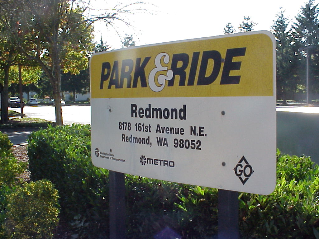
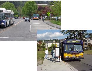
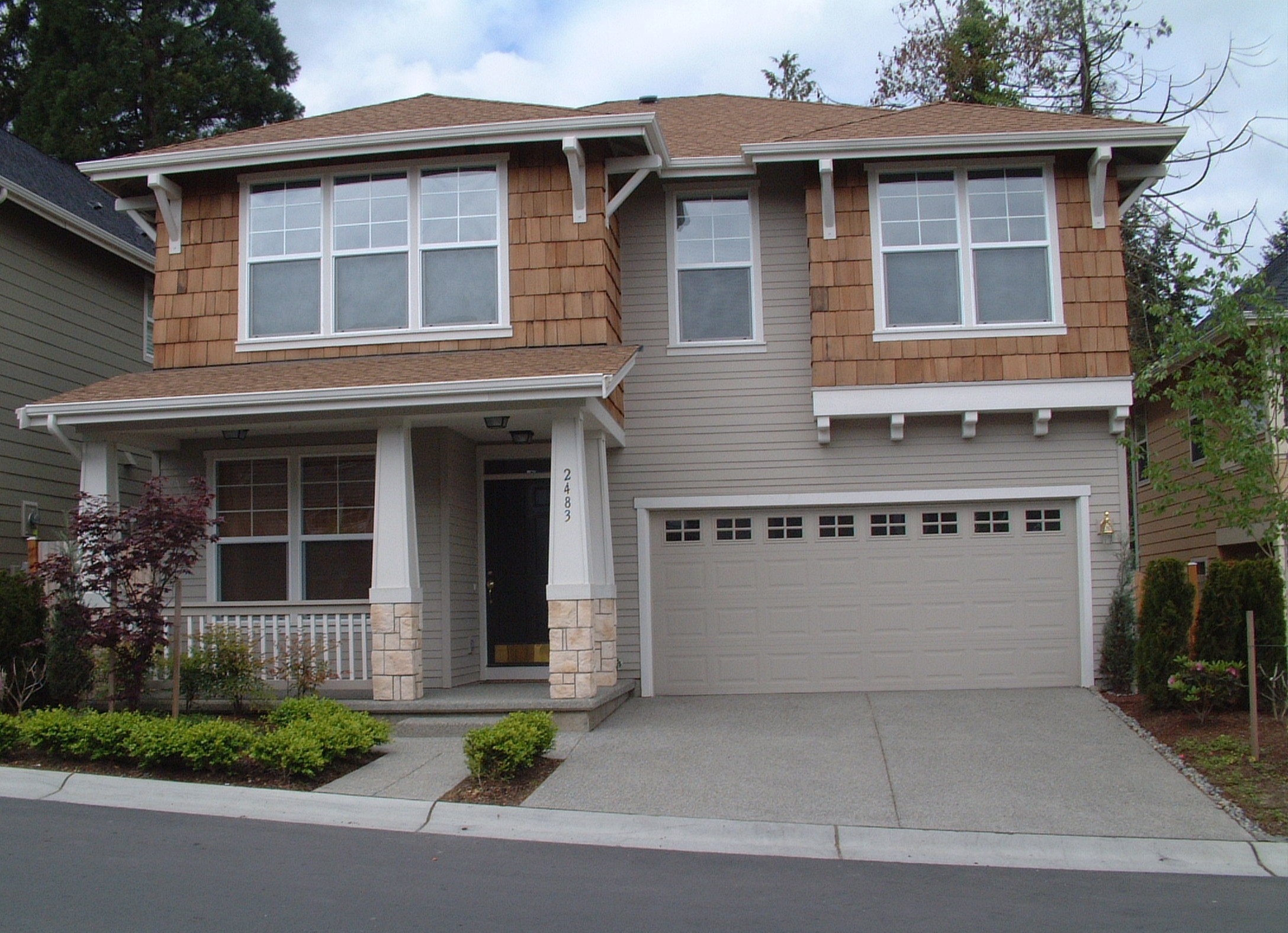
Downtown Redmond Park and Ride
People spend less time traveling and more time where they want to be. All Redmond homes, schools and businesses have high-speed access to the Internet. More neighborhoods and workplaces are served by nearby stores and services that are small in scale and well-designed. Significant investments in SR 520, I-405, and regional and local transit routes have improved mobility for people and goods. In Redmond, roadway projects have been built where needed to improve safety and operating efficiency, and the City has maintained a good system of access and circulation for delivery and freight. Most streetscapes are attractive and functional for various travel modes, with street trees and landscaped areas that separate pedestrians from traffic.
Organization of This Element
Introduction
A. The Transportation System
Concurrency and Level-of-Service
Transportation Master Plan
Streets
Public Transportation
Bicycle and Pedestrian Transportation
Neighborhood Traffic Calming
B. Transportation Demand Management
C. Parking Management
D. The Eastside and Regional Transportation
Introduction
The intent of the Transportation Element is to guide the development of the City’s transportation system in support of the City’s vision for the future. The transportation policies are designed to guide the actions of both public agencies, such as the City, as well as private decisions related to individual developments. The Transportation Element also provides the foundation for development regulations contained in the Redmond Community Development Guide that implement the City’s vision.
To fulfill the City’s vision, the Transportation Element must:
◊ Promote a strong multi-modal transportation system that offers travel choices, with improved connections both within and through Redmond, and between Redmond and the region.
◊ Support the City’s land use and community character objectives, including retaining Redmond’s character as a green city with a small-town feel.
◊ Enable the City to effectively influence regional transportation decisions and investments.
To achieve Redmond’s transportation vision, the policies have been developed with a common understanding of the concepts of mobility, circulation, and access. “Mobility” is the ability to travel over distances; “circulation” is the ability to move about within an area, connecting different localized land uses; and “access” is the ability to get to individual destinations.
TR-1
Provide for the mobility, circulation, and access needs of those who live, shop, visit, and work in Redmond. Consider pass-through trips when planning and developing the transportation system. Arterial and local streets, sidewalks, trails, bicycle lanes, paths, and public transit are to serve these needs.
TR-2
Ensure that all transportation programs, facility plans, investments, and performance measures, whether funded or built privately or by a public sector agency, serve to achieve the preferred land use pattern contained in the Land Use Element of the Redmond Comprehensive Plan.
A. The Transportation System
The Transportation Element is designed to guide development of the City’s transportation system to serve the “full build out” permitted by the Land Use Plan contained in the Land Use Element and permitted by adopted zoning. The Land Use Plan provides for significant amounts of new residential and commercial development, and associated population and employment in the City. Redmond’s growth targets through 2022 are contained in Table LU-1 in the Land Use Element.
The Transportation Element policies and plans are also based on an assumption that land uses surrounding the City will develop in a pattern consistent with the regional strategies, including VISION 2020 and Destination 2030. Land use and transportation forecasts for these surrounding areas, which were developed by the Puget Sound Regional Council, were integrated into the assumptions underlying the Transportation Element.
For the future, Redmond’s transportation system will have a significant impact on the lives of those who live and work in Redmond, as well as those who visit or shop here. A transportation system that provides alternatives and good travel circulation patterns supports the City’s land uses by enabling people to more easily get from one place to another. The proper mix of motorized and non-motorized facilities in a commercial core leads to a better shopping and business environment. The design and construction of arterial and local streets and associated pedestrian and bicycle facilities provides for a safer, quieter, and more attractive neighborhood. Circulation patterns, both present and future, must reflect, support, and be compatible with the land use patterns that they serve.
Along with promoting desired land uses, a good transportation system will enhance the health, safety, and welfare of people who live or work in the City. From the perspective of the City, an effective transportation system reduces air and noise pollution. Properly designed and classified roads and intersections prevent injuries and accidents. Public transit, pedestrian, and bicycle routes help expand opportunities for mobility and reduce congestion, pollution, and parking space needs.
The Transportation System section of this element contains policies that address the management and supply of transportation resources. System management policies are contained in the Concurrency and Level-of-Service section. The Transportation System Plan section specifies the type of transportation programs, projects, and services that are designed to promote the mobility necessary for implementation of the Land Use Plan.
Concurrency and Level-of-Service
Transportation concurrency and level-of-service standards are key requirements of the Washington State Growth Management Act. By policy and regulation, the City of Redmond is required to ensure that transportation facilities needed to serve growth are in place when development occurs, or within six years of the completion of the development. Regulations implementing concurrency and level-of-service are contained in the Redmond Community Development Guide. The concurrency policies contained in this section will not go into effect until the City adopts new concurrency regulations. Once the regulations are adopted, the following concurrency policies shall become effective and shall:
◊ Promote desired land uses through a plan-based concurrency approach and level-of-service standard.
◊ Expand travel choices.
◊ Maintain community character.
◊ Ensure accountability.
Plan-Based Approach and the Level-of-Service Standard
TR-3
Utilize a “plan-based” approach as the basis for Redmond’s transportation concurrency management system. Ensure through the plan-based approach that the funding of programs, construction of facilities, and provision of services occur in proportion to the needs of the City, and the pace of growth. Ensure that the transportation system, under the plan-based approach, explicitly supports achievement of the community vision and policies set forth in the Comprehensive Plan, including this Transportation Element.
TR-4
Support land uses envisioned by the Comprehensive Plan through an appropriate transportation level-of-service standard. Redmond’s transportation level-of-service standard is established to mean that so long as the growth of the City and the development of the City’s transportation system are proportionate, work in parallel, and are consistent with the Comprehensive Plan, all concurrency management requirements are considered met.
Concurrency Management – Expanding Travel Choices
TR-5
Ensure that Redmond’s transportation concurrency management responses to growth have the effect of expanding the choices available for travel to, from, through, and within Redmond.
TR-6
Use the concurrency management system to achieve a multi-modal travel environment. Projects, programs, and services representing appropriate responses to existing and growth-related travel demands include those that improve motor vehicle operations, public transit service levels, the walking environment, bicycling, and ridesharing, as well as transportation demand management and transportation system management measures.
TR-7
Establish transportation measures and objectives for each of the primary travel modes – personal motor vehicle, public transit, walking, and bicycling – as a way to gather supplemental information to assist in the management of the concurrency management system and evaluate the performance of each of the modes.
Maintaining Community Character
TR-8
Consider community character factors, such as land use patterns, the green character of the City, the environment, neighborhood vitality, and quality of life in the determination of whether planned transportation systems support the Land Use Plan. Value community character equally with transportation system capacity in the evaluation of concurrency and ensure that no transportation project conflicts with or detracts from the desired character of the community, as described in the
Comprehensive Plan, including Redmond’s vision for the future.
Ensuring Accountability
TR-9
Develop a system of annual monitoring and reporting of transportation level-of-service and concurrency that will become part of the City’s routine monitoring and reporting of transportation system trends and performance. Report on progress made in implementing the transportation system, including the achievement of needed funding. Take action to correct an imbalance if the pace of growth exceeds the pace of implementing and building the Transportation Plan, or if there is inadequate funding for the plan.
TR-10
Include transportation concurrency monitoring data in the annual and the five-year transportation performance reports.
TR-11
Conduct the measurement and evaluation of concurrency, including levels of transportation service, at a Citywide level.
Interim Transportation Level-of-Service Standards
TR-12
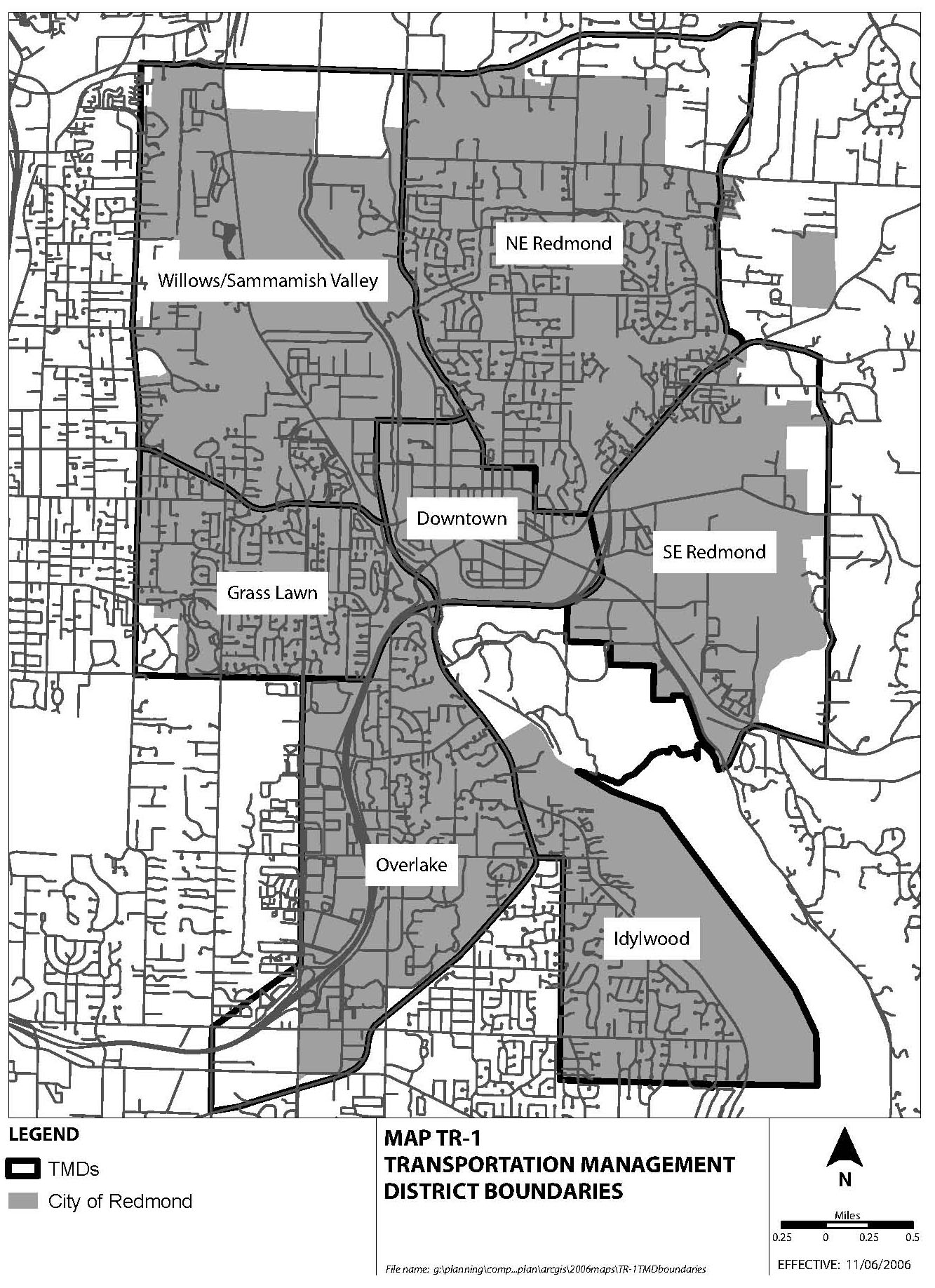
Maintain level-of-service standards using the transportation management districts contained in Map TR-1, level-of-service descriptions contained in Table TR-1, and arterial intersection level-of-service standards contained in Table TR-2, until a plan-based concurrency approach is adopted.
Table TR-1: Description of Average Intersection Level-of-Service
LOS Categories
Definition
(Average volume/
capacity ratio)Description
(Subjective impression of user)LOS A
Less than or equal to 0.600
Highest driver comfort, little delay, free flow.
LOS B
0.601 – 0.700
High degree of driver comfort, little delay.
LOS C
0.701 – 0.800
Some delays. Acceptable level of driver comfort. Efficient traffic operation.
LOS D+ (High D)
0.801 – 0.850
Some driver frustration. Efficient traffic operation.
LOS D- (Low D)
0.851 – 0.900
Increased driver frustration. Long signal cycle length.
LOS E+ (High E)
0.901 – 0.950
Near capacity. Notable delays. Low driver comfort. Difficulty of signal progression.
LOS E- (Low E)
0.951 – 1.000
At capacity. High level of congestion. High level of driver frustration.
LOS F
Above 1.000
Break-down flow. Excessive delays.
Table TR-2: Arterial and Transit Service Standards with Mode Split Targets
Transportation Management District
Arterial Intersection
Level-of-Service Standard
(Area average of intersections)Transit
Level-of-Service Standard
(% of land uses within 1/4 mi of 30-minute, peak hour transit service)Mode Split Targets Level-of-Service Standard
(% daily trips by modes other than Single-Occupant Vehicle)
Letter Value
Maximum
V/C RatioResidential Land Uses
Employment Land Uses
1993
2012
1. Downtown
E+
0.95
100%
100%
18
30
2. NE Redmond
D+
0.85
30%
90%
18
23
3. Willows/
Sammamish ValleyD-
0.90
30%
90%
10
20
4. Grass Lawn
D+
0.85
50%
90%
15
18
5. Overlake
E+
0.95
50%
100%
18
30
6. Idylwood
D+
0.85
30%
50%
15
18
7. SE Redmond
D-
0.90
70%
30%
10
20
Ord. 2537
Transportation Master Plan
The primary purpose of the transportation system is to support development of the land uses envisioned by the Comprehensive Plan, and to shape the form of urban development within Redmond’s mixed-use, commercial, industrial, and residential neighborhoods. To further that purpose, the Transportation Master Plan (TMP) contains the specific features comprising Redmond’s transportation system, including the programs, projects, and services that are necessary to support planned land uses.
The Transportation Master Plan
TR-13
Develop and maintain a Transportation Master Plan (TMP), including a section on financing, that achieves a multi-modal travel environment. Include in the TMP projects, programs, and services that improve: motor vehicle operations; the movement of people, goods, and services; public transit service; the walking and bicycling environment; a program for transportation demand management; and other necessary transportation measures.
Transportation Programs and Facilities
TR-14
Identify and implement the long-range Transportation Facilities Plan, contained in TMP Figure 6.2: 2022 TFP Project List, and Figure 6.3: 2022 TFP Project Map, to assure compliance with the City’s adopted transportation level-of-service standards while supporting the City’s land use and community character objectives.
TR-15
Use the Six-Year Transportation Improvement Program (TIP) as a guide for short-term transportation investment decisions, consistent with the Transportation Master Plan.
TR-16
Allocate resources in the City’s transportation Capital Investment Program (CIP) according to the following in order of priority:
♦ Address public health and safety concerns, including neighborhood traffic protection;
♦ Ensure adequate maintenance of existing facilities throughout the City;
♦ Ensure that as development occurs, the City’s transportation concurrency and level-of-service (LOS) standard are met by completing planned facilities, including capacity projects; providing travel choices; supporting funding partnerships; and efficiently operating the transportation system.
Financial Program
The Transportation Facility Plan’s Financial Program contains details of transportation revenue sources that the City can reasonably expect to receive during the life of the Transportation Facility Plan. Revenue sources contained in the Financial Program vary widely in terms of the amounts available and the types of projects for which they may be used. In most cases, individual transportation projects are funded by a combination of funding sources, reflecting the fact that transportation projects have multiple purposes and serve multiple beneficiaries.
TR-17
Develop a financial strategy to assure that on an average cost basis, new development contributes its fair share of the cost of transportation programs, facilities, and services needed to mitigate growth related transportation impacts. Credit only those projects, programs, and measures contained in, or consistent with the Transportation Master Plan Figure 6.1: 2005-2022 Transportation Revenue Forecasts, as meeting needs resulting from growth. Impact fees, local improvement districts, transportation benefit districts, grants, contributions, business taxes, bonds, and debt financing are some of the funding mechanisms to be considered by the City.
TR-18
Take the following actions in the event that the City is unable to fund the growth-related transportation programs, facilities, and services identified in the Transportation Facilities Plan (not in priority order):
♦ Delay development until such time that programs, facilities, or services can be funded;
♦ Amend the City’s Comprehensive Plan to reduce the travel demand placed on the transportation system;
♦ Obtain needed revenue or revise the Transportation Facilities Plan to reflect known financial resources; or
♦ Change the transportation level-of-service standard.
TR-19
Establish an ongoing allocation of funds for the construction and maintenance of non-motorized improvements in the transportation Capital Investment Program in order to assure adequate, predictable, and dedicated funding of the Bicycle and Pedestrian Plans.
Streets
To serve Redmond, local and arterial streets will require maintenance, safety, and efficiency improvements. The quality of life for many people is significantly affected by how well streets function – this is true for pedestrians, bicyclists, and transit riders in addition to motorists. Streets do more than move people. They also represent major public facilities whose quality of design, sensitivity to human needs, and integration with their surroundings can complement land use policies and enhance an urban environment or erode it.
To implement the land use policies of the Comprehensive Plan, local and arterial streets need to do more than just move people and goods. They must also be compatible with and support the land use goals of Redmond’s residential, commercial, and mixed-use areas.
TR-20
Establish a street classification system that is designed to balance street capacity needs and compatibility with adjacent land uses, the Land Use
Element, and compliance with the other elements in the Comprehensive Plan. Use the street classification system contained in TMP Figures 5D.7, that classifies streets according to function so that needed traffic capacity may be preserved and planned street improvements will be consistent with those functions. For street classifications and locations, see TMP Figures 5D.7 through 5D.13.
TR-21
Establish standards for the design and construction of arterial and local streets in Redmond. Achieve the following as part of the development process:
♦ Require that all arterial and local streets be built to comply with the City’s design standards and plans for streets, bicycles, and pedestrian facilities;
♦ Require that all property be conveniently accessible from streets, walkways, and trails, subject to environmental limitations;
♦ Maintain continuity of the street pattern by avoiding dead-end and half-streets not having turnaround provisions;
♦ Avoid the creation of excessively large blocks and long local access residential streets;
♦ Complete missing links and improve street connections;
♦ Wherever possible, separate pedestrians from traffic lanes by the use of street trees and landscaped strips, and avoid the construction of sidewalks next to street curbs;
♦ Manage access to arterials; and
♦ Identify specific street improvements that benefit transit operations, and work with transit providers to prioritize street improvements.
TR-22
Use the “multi-modal corridor” designation described and depicted in TMP Figures 5E.6 and 5E.7, to designate arterials and local streets of critical significance to transit operations, bicycle circulation, and pedestrian circulation.
TR-23
Maintain the Redmond Intelligent Transportation System Plan to guide the implementation of transportation system management (TSM) for all modes, using techniques, such as traffic signal coordination, transit signal priority, and the provision of real time transit arrival data, in order to maximize the efficiency of the City’s transportation system.
Public Transportation
The VISION 2020 Growth Management Plan and the Destination 2030 Transportation Plan contain the regional growth and transportation strategies for the Puget Sound region. These plans call for the channeling of future growth into centers and the linking of these centers with high-capacity transit. The Countywide Planning Policies for King County expand on this strategy by outlining guidelines for the designation and development of centers and measures to be taken by local jurisdictions in support of a high-capacity transit system.
In Redmond’s Comprehensive Plan, Downtown Redmond and part of Redmond Overlake are designated as Urban Centers that warrant high-capacity transit service between these neighborhoods and the region. SE Redmond may be another destination for high-capacity transit service and an appropriate location for a high-capacity transit maintenance facility.
The Transit Plan
TR-24
Implement Redmond’s Transit System Plan contained in TMP Chapter 5C to identify needed transit routes, passenger amenities such as shelters, service levels, and capital projects needed to provide local Redmond, Eastside and regional transit service.
TR-25
Use transit as a way to provide for access, circulation, and mobility needs in areas planned for higher-density mixed-use development and for favorable pedestrian environments.
Local Redmond, Eastside and Regional Transit Service
TR-26
Support and improve transit service and amenities in neighborhoods, especially when and where appropriately sized vehicles in the transit fleet are used as a way to:
♦ Increase ridership;
♦ Improve access, circulation, and mobility, with connections to local Redmond destinations, the Eastside, and to the regional transit system; and
♦ Balance protection of neighborhoods with transit access and service goals.
TR-27
Work to redevelop the Downtown Redmond Park and Ride facility as a multi-story, mixed-use transit-oriented development (TOD) that is complementary to the Downtown neighborhood. Maintain the park and ride function of this site with the current vehicle parking capacity.
TR-28
Develop the Redmond Downtown Transit Center with full transit center components, including timed transfers between most routes, passenger waiting areas and other amenities, and on-site route information.
High-Capacity Transit
TR-29
Participate actively and continuously in the planning and development of an efficient, timely, and effective regional high-capacity transit system that is competitive with the single-occupant vehicle. Plan for the extension of high-capacity transit to the Eastside and to Overlake, Downtown Redmond, and SE Redmond as part of Sound Transit Phase 2, or any successor plan.
TR-30
Support high-capacity transit service and support facilities for Redmond that:
♦ Provide service to Overlake, Downtown Redmond, and SE Redmond that is located to ensure efficient, timely, and effective service, within a high-capacity transit alignment located mainly in the SR 520 freeway corridor;
♦ Locate high-capacity transit stations in Overlake, Downtown Redmond, and SE Redmond;
♦ Locate the SE Redmond station site near the intersection of SR 202 and SR 520; and
♦ Achieve higher bus transit service levels to and within Redmond’s two Urban Centers, providing connections to the high-capacity transit stations.
TR-30.1
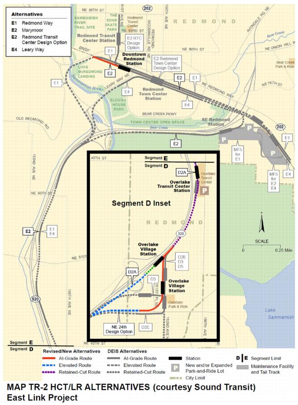
Maintain the ability to construct high-capacity transit/light rail on alignment alternatives identified through Sound Transit’s planning process and illustrated on Map TR-2. Once a preferred high-capacity transit/light rail alignment has been established, ensure the right-of-way is secured.
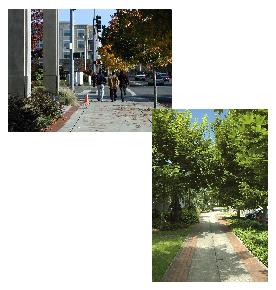
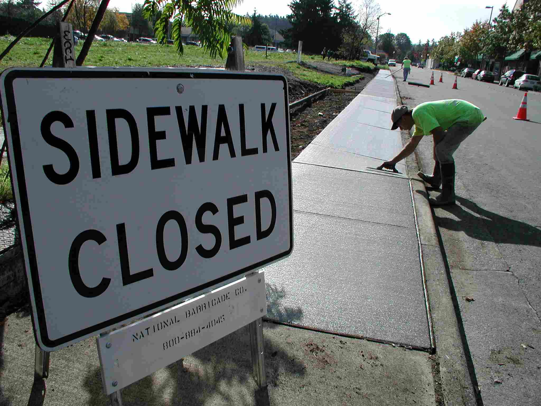
Pedestrian and Bicycle Transportation
The Pedestrian Plan
An attractive pedestrian environment is a key element in developing a physically and socially healthy community. Most intense retail uses are heavily dependent on foot traffic to generate sales. Once individuals get in their cars, it is very difficult to get them out. Encouraging nonmotorized pedestrian access to transit is a preferred strategy in supporting the use of public transit as an alternative to the automobile.
Many of the City’s transportation-related facilities are located within corridors that are shared or intersect with other pedestrian sidewalks, trails and pathways. In these cases, construction of sidewalks, trails and pathways should be coordinated to ensure safe and efficient use of all types of trails and other nonmotorized facilities.
Pedestrian improvements
TR-31
Implement the Pedestrian Plan contained in TMP Chapter 5A to:
♦ Provide for a safe, convenient and coordinated system of sidewalks, trails, and pathways, including through routes, to meet needs for pedestrian transportation;
♦ Interconnect neighborhoods and be coordinated with the surrounding jurisdictions to allow people to conveniently travel between and within neighborhoods and local activity centers by using non-motorized means;
♦ Include a typology of pedestrian environments, using the following designations: “Pedestrian Places, Pedestrian Supportive Environments, Pedestrian Tolerant Environments and Pedestrian Intolerant Environments”;
♦ Set a pedestrian plan objective such that all areas of Redmond provide no less than a pedestrian tolerant environment;
♦ Identify areas to be designated as pedestrian promenades, with pedestrian-friendly environments;
♦ Prepare a planned pedestrian program at a Citywide and neighborhood level, with a detailed description of the pedestrian facilities and environments to be achieved. Identify a list of priority pedestrian projects in the Transportation Master Plan;
♦ Be implemented as part of the City’s review of private and public development projects; and comprise an element of the plan-based approach to concurrency.
The Bicycle Plan
Bicycle travel in Redmond is an important mode of travel both for recreational and non-recreational purposes, and forms a critical element of many individuals’ daily travel plans. While the majority of people in Redmond rely on the auto on a daily basis, the quality of the bicycle system directly affects the perceived quality of life for Redmond residents.
Integrated bicycle facilities
TR-32
Implement the Bicycle Plan contained in TMP Chapter 5B to:
♦ Ensure that bicycle pathways, lanes, and routes are established, constructed, and maintained to specifications that encourage safe and convenient circulation and connectivity;
♦ Consider the need for bicycle facilities that are integrated into the street and pedestrian system;
♦ Interconnect neighborhoods and be coordinated with the surrounding jurisdictions to allow people to conveniently travel between and within neighborhoods and local activity centers by using bicycle paths, lanes and routes;
♦ Maintain a typology of bicycle environments, designating bicycle paths, lanes, and routes;
♦ Set bicycle plan objectives;
♦ Update the planned bicycle program at a Citywide and neighborhood level, with a detailed description of the bicycle facilities and environments to be achieved. Identify a list of priority bicycle projects in the Transportation Master Plan;
♦ Be implemented as part of the City’s review of private and public development projects; and
♦ Comprise an element of the plan-based approach to concurrency.
A System of Bicycle and Pedestrian Facilities
TR-33
Use the Bicycle and Pedestrian Plans to guide the design, construction, and maintenance of bicycle and pedestrian facilities by both public and private parties, including the preparation of design standards and elements that promote a pleasant and safe traveling environment.
TR-34
Require that during the review process for new development or redevelopment that:
♦ Projects are consistent with the Pedestrian and Bicycle Plans;
♦ Planned facilities are secured with required frontage and crossing improvements consistent with the Bicycle and Pedestrian Plans;
♦ On-site bicycle and pedestrian facilities are provided which provide safe connections to the general circulation system;
♦ New subdivisions and short plats include, consistent with RCW 58.17.060, the required pedestrian facilities (frontage and off-site improvements) that assure safe walking conditions for students who walk to and from school;
♦ Construction and implementation of other off-road and multi-use trails and trail crossings as described in the Parks, Recreation and Open Space Plan, or which are located within a development area or within a shared corridor, are coordinated with project review; and
♦ Safety and security considerations for pedestrians and bicyclists are factored into the review of development proposals.
Neighborhood Traffic Calming
The environmental quality of a residential neighborhood is directly and significantly affected by conditions present on area streets. Factors such as excessive speed or traffic volume, safety, air and noise pollution, and conflicts with driveway access greatly influence people’s perceptions of the quality of their neighborhood. There are increasing pressures on residential neighborhood streets from speeding drivers and “cut-through” traffic (individuals using local streets as alternatives to the arterial street system). It is difficult to forecast with precision the location and amount of overflow traffic that should be expected as a result of growth. Therefore, it is necessary to have in place mitigation programs that can provide a proportional response to local residential traffic control problems as they arise.
Neighborhood traffic circle for traffic calming
TR-35
Minimize the environmental impacts on residential neighborhoods by discouraging the use of existing and new local streets by nonlocal cut-through traffic. Place a high priority on prevention and alleviation of traffic impacts on residential neighborhoods as part of the City’s transportation system management program.
TR-36
Maintain an ongoing allocation of funds necessary to maintain a traffic control program based on the fundamentals of education, enforcement, and engineering for evaluating and responding to residential neighborhood traffic control concerns. Maintain standards for maximum desirable traffic speeds and volumes of nonlocal traffic. Apply a hierarchy of traffic control responses based on the severity of the local traffic problem.
Ord. 2575; Ord. 2392; Ord. 2381; Ord. 2343
B. Transportation Demand Management
Transportation Demand Management (TDM) refers to the range of actions and strategies that offer alternatives to single-occupant vehicle (SOV) travel. TDM is a highly valuable tool because it focuses on more effectively managing the use of existing and planned transportation capacity, rather than increasing roadway capacity, to better meet mobility needs.
TR-37
Use TDM techniques as effective and efficient mechanisms to address transportation problems.
♦ Use TDM techniques to help increase the person-carrying capacity of the transportation system;
♦ Require large employers to implement a Commute Trip Reduction Program for employees, as mandated by the State Commute Trip Reduction Act;
♦ Require new commercial development to provide for implementation of a transportation management program to mitigate commute trips consistent with the City’s mode split goals;
♦ Implement TDM strategies that emphasize incentives rather than disincentives. Avoid imposing disincentives to single-occupant vehicle travel when the City determines that there is an absence of reasonable transportation alternatives;
♦ Provide physical features supportive of the use of alternative modes of travel and maintain a list of acceptable TDM techniques and physical features;
♦ Encourage participation in Transportation Management Associations (TMAs) to support trip reduction activities;
♦ Establish and implement a mitigation funding system that applies to all new development that warrants TDM conditioning for development approval. Use the funds generated by this system to specifically support the administration of the TDM element of development review;
♦ Encourage the development and support of TDM programs for noncommute/nonemployer based sites;
♦ Use TMP Chapter 5F to provide direction to the City in promoting TDM, including using the measures contained in the implementation section of the chapter.
C. Parking Management
Research has demonstrated that strategies involving parking supply and price are among the most effective tools in influencing travel behavior and enhancing the market for transit and other transportation options.
TR-38
Develop and implement comprehensive parking management programs that address shared parking, transit access parking, and localized parking imbalances. Evaluate parking pricing strategies as a mechanism to support transportation demand management objectives when there are viable transportation alternatives available.
TR-39
Establish minimum and maximum parking ratio requirements consistent with the transportation and land use objectives of the Comprehensive Plan, considering constraints imposed by financial institutions. Consider reducing the minimum and maximum parking ratio requirements further as transportation options increase with development of enhanced transit service or as demand drops with achievement of mode split goals. Create for inclusion in the Redmond Community Development Guide a process and decision criteria to allow under special circumstances the granting of parking ratios above or below the established ratios.
TR-40
Encourage reduction in required parking ratios less than the required minimum for office, industrial, institutional and mixed land uses by:
♦ Streamlining the process for new development to provide less than the minimum parking where demand for employee parking is below normal;
♦ Allowing and encouraging property owners of major work sites to reduce their parking supply, especially where an excess exists, to support City mode split goals;
♦ Allowing reductions in minimum parking ratios in exchange for contributions to improved transit services or facilities; and
♦ Allowing parking to be provided below the minimum ratio where there are incentives to redevelop existing sites in employment centers supported by transit and where such actions are not likely to cause “spill over” parking impacts on adjacent land uses.
D. The Eastside and Regional Transportation
Transportation and Interlocal Agreements with Other Jurisdictions
A significant amount of travel that occurs in Redmond is regional in nature. In other words, trips that are made through Redmond have their origin or destination, or both, outside of the City limits. Nevertheless, the City of Redmond has the ability to significantly control regional travel as well as the impacts of local travel within Redmond, and from Redmond to other neighboring jurisdictions. Effectively managing and maintaining service standards through concurrency controls requires coordination with neighboring jurisdictions. To do this the City shall:
TR-41
Develop and maintain interlocal agreements with neighboring jurisdictions that require development within Redmond and within the neighboring jurisdictions to anticipate and mitigate significant cross-jurisdiction transportation impacts, including pass-through traffic, impacts to concurrency, and the level-of-service standard.
TR-42
Address pressure to move traffic from residential developments in eastern King County through SE Redmond in a manner that maintains Redmond’s land use and community character objectives.
Eastside Transportation Partnership
Transportation problems and their solutions generally transcend individual city boundaries. Therefore the Eastside Transportation Partnership (ETP) was created to develop a policy and facility plan for the Eastside to assure mobility, and to provide an ongoing forum for the discussion of transportation policy. ETP membership includes Eastside cities as well as key transportation agencies, such as Washington State Department of Transportation, Metropolitan King County and the Puget Sound Regional Council. ETP has evolved into the primary body for the development of transportation policy and strategy for the Eastside, with its positions carrying significant weight in county, regional and state decisionmaking forums.
TR-43
Participate in the Eastside Transportation Partnership on an ongoing and cooperative basis to implement transportation plans and policies that affect the City, the Eastside, and the region.
State Highways
TR-44
Maintain an inventory of State-owned highways, and monitor the State-established level-of-service on these highways. Examine the impact of development generating traffic on these highways. Table TR-7 contains this inventory and level-of-service information.
Air Quality
TR-45
Observe federal and State clean air acts by maintaining conformity with the Metropolitan Transportation Plan of the Puget Sound Regional Council, and by following the requirements of the Chapter 173-420 WAC.
Ord. 2287