


Division 10-60.10:
Thoroughfare Types
Sections:
10-60.10.010 Purpose
10-60.10.020 Applicability
10-60.10.030 Allowed Thoroughfares
10-60.10.040 Functions of Thoroughfares
10-60.10.050 Speed/Movement Types
10-60.10.060 Boulevards as Arterials and Major Collectors in Transect Zones
10-60.10.070 Other Considerations
10-60.10.080 Thoroughfare Components
10-60.10.090 Thoroughfare Assemblies
10-60.10.010 Purpose
This division provides illustrations, descriptions, and standards for thoroughfares (streets) in areas of the City where transect zones may be applied. Thoroughfare components include lane configurations, parking, edge treatments, and frontages, among others. The standards of this division are supplemental to those contained in the Engineering Standards. These standards are intended to promote walkable, safe street environments. Standards for appropriate street trees and public lighting are also provided.
10-60.10.020 Applicability
A. This division describes the standards for development of thoroughfares in walkable environments throughout the City. It supplements the Engineering Standards. Where these standards conflict with the Engineering Standards, the standards of the Engineering Standards shall apply.
B. These thoroughfare standards are applicable for the transformation of existing streets or the creation of new streets in any areas within the transect zones.
C. The standards set forth in this division may also be used in the non-transect zones with Director or City Engineer approval.
D. Additional thoroughfare assemblies can be integrated into this division as they are approved by the City.
10-60.10.030 Allowed Thoroughfares
The following thoroughfares are allowed:
A. Predefined thoroughfare assemblies found in Section 10-60.10.090, Thoroughfare Assemblies.
B. Thoroughfares that match the standards found in Table 10-60.10.080.A, Summary Thoroughfare Components, and use the predefined components in Tables 10-60.10.080.B through 10-60.10.080.F.
C. Thoroughfares that match the standards found in Table 10-60.10.080.A, Summary Thoroughfare Components, but do not use the predefined components in Tables 10-60.10.080.B through 10-60.10.080.F, shall require a review and approval by the City Engineering Section, Public Works Division, and Flagstaff Fire Department representatives.
10-60.10.040 Functions of Thoroughfares
The design of thoroughfares significantly shapes the form and character of cities, towns, and neighborhoods. An understanding of a thoroughfare’s function helps to determine the correct application of a thoroughfare type in transect zones. The five basic functions of movement are the street as a:
A. Carrier. The thoroughfare serves as a carrier or conveyor of pedestrians, vehicles, bicycles, trucks, or other type of foot, motorized, and non-motorized traffic.
B. Connector. The thoroughfare serves to connect one or more activities or uses that are separated from each other.
C. Space/Shelter. The thoroughfare or the public realm serves an important role as a location for public activity, such as cafes, restaurants, and outdoor shopping. Creating a safe walkable streetscape is important for the successful achievement of this function.
D. Symbol. As a symbol, the design of a thoroughfare can provide messages and information about a place, enable drivers and pedestrians to find specific locations or activities, and to use the street as a means of orientation and place-finding. It can also have a monumental or symbolic function. Route 66 is a good example of a thoroughfare with symbolic meaning.
E. City Builder or Destroyer. The thoroughfare as described here may enhance land values, land uses, and architectural scale, or destroy these if improperly regarded. In other words, thoroughfares can create a strong sense of community, or if not carefully designed, break down and even divide a community.
10-60.10.050 Speed/Movement Types
A. The design speed for pedestrian safety and mobility is the primary determinant of movement types. Movement types associated with assigned lane widths and curb radii are applied in each transect zone.
1. Yield. Drivers must proceed slowly, with extreme care and must yield to approaching traffic when vehicles are parked on both sides of the thoroughfare. A yield street is the functional equivalent of traffic calming. Design speed of 20 miles per hour or less.
2. Slow. Drivers can proceed carefully with an occasional stop to allow a pedestrian to cross or another car to park. The character of the street should make drivers uncomfortable exceeding the design speed due to the presence of parked cars, sense of enclosure from buildings and street trees, tight turning radii, and other design elements. Design speed of 20 miles per hour.
3. Free. Drivers can generally expect to travel without delay at the appropriate design speed. Street design supports safe pedestrian movement at the higher design speed. This movement type is appropriate for thoroughfares designed to traverse longer distances or connect to higher intensity locations. Design speed of 25 miles per hour.
4. Speed. Drivers can expect travel similar to conventional suburban street design but with continued emphasis on pedestrian safety and comfort. Design speed of 30 miles per hour.
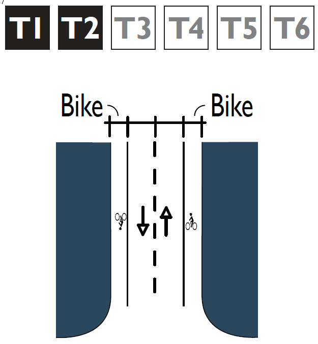
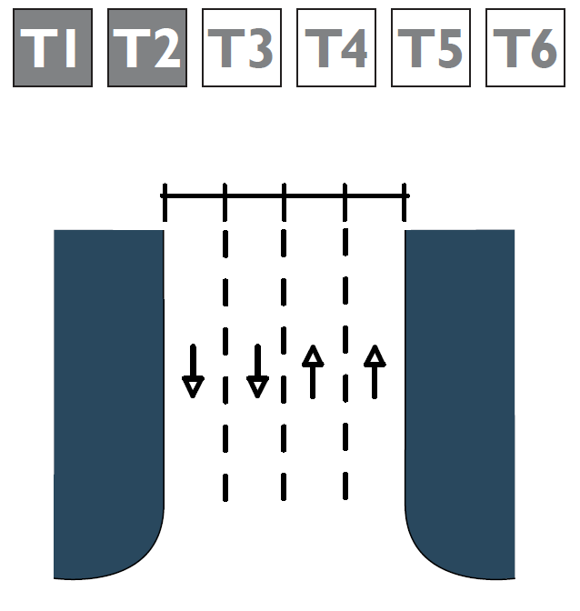
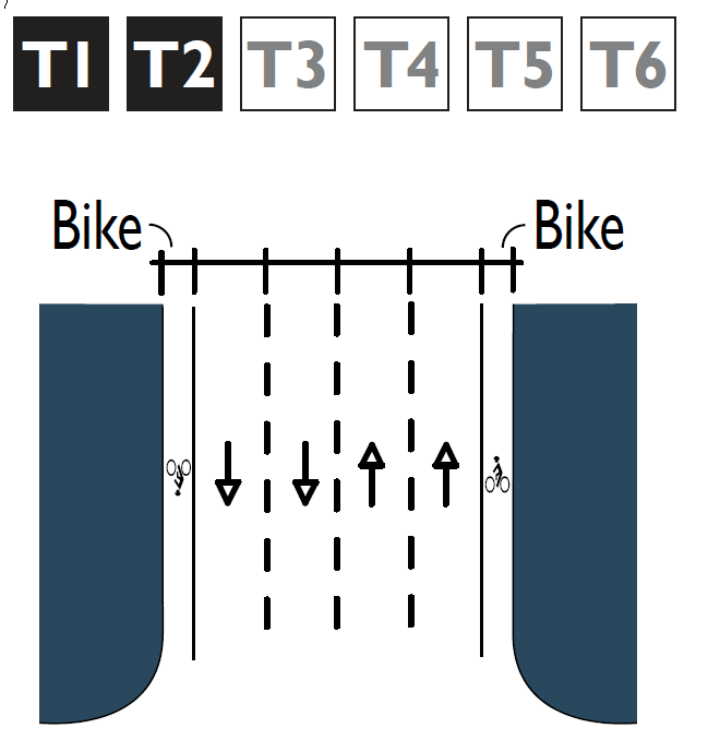
5. Rural. This is a conventional street design in which drivers can expect a separation of modes (i.e. bike lanes, walking paths and roads) allowing automobile travel to be unimpeded by pedestrians or walkability concerns. This movement type is rarely used in traditional town planning, but may be needed when a thoroughfare crosses through T1 or T2 transect zones. Design speed may be above 35 miles per hour.
B. The design criteria for yield, slow, and free streets shall be commensurate with local streets and the speed and rural with minor collector streets.
10-60.10.060 Boulevards as Arterials and Major Collectors in Transect Zones
A. Major and minor arterial roads and major collector roads as described and mapped in the General Plan should ideally be placed on the periphery of proposed traditional neighborhood districts. This ensures that the arterial and major collector roads maintain their integrity to convey vehicles effectively, and that the neighborhood maintains its integrity as a walkable neighborhood. Where these arterial and major collector roads are located on the edge of a proposed neighborhood or cross through it when no other alternative location is practical or feasible, then the arterial and major collector road should be designed as a boulevard.
B. Boulevards are a thoroughfare designed for high vehicular capacity and moderate to high speeds that contain the following features:
1. Central vehicle travel lanes that allow for the free movement of traffic;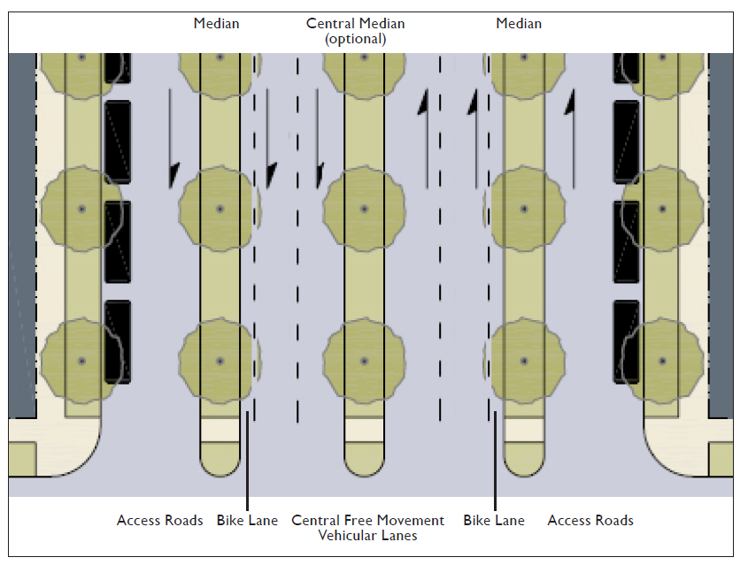
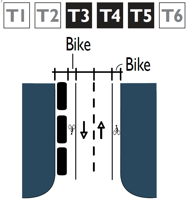
2. A bike lane will typically be provided adjacent to the outer most central vehicle travel lanes;
3. Medians that buffer between the central free movement vehicular lanes and access roads. An optional median may be placed between the opposing directions of travel in the central vehicular lanes. In order to ensure the safety of pedestrians crossing the boulevard, all medians shall be a minimum width of eight feet to provide a pedestrian refuge; and
4. An access road, also known as a frontage road, that is designed for slow speeds on the outer edge of the right-of-way and separated from the faster vehicle lanes by a median as illustrated above. Bicycles can also be safely accommodated along the access road.
C. With this design, a boulevard satisfies the carrier and connector functions required of a regional arterial network, while also accommodating the space/shelter functions of a thoroughfare in a traditional neighborhood. See Table 10-60.10.080.D for examples of different boulevards.
10-60.10.070 Other Considerations
Other factors that may need to be considered in the selection of an appropriate thoroughfare type in transect zones could include the following:
A. Topography. Thoroughfares that traverse steep slopes may need to incorporate additional design consideration for such elements as drainage facilities, and bicycle lanes on the uphill side of the street.
B. Parking. Parking availability on-site or on the thoroughfare will determine the appropriate thoroughfare type. Parking will also be determined by lot size and use.
C. Truck Access. Thoroughfares that provide access to high volumes of large trucks may need additional design considerations to mitigate potential negative effects on walkability.
D. Bus Service. Thoroughfares that will serve as a public transit or school bus route may need additional design considerations, including, but not limited to, the location of bus stops.
10-60.10.080 Thoroughfare Components
A. Requirements for pedestrian safety and mobility establish thoroughfare design speed. Design speed then determines the dimensions of each thoroughfare element, such as vehicular lanes and turn radii.
B. Thoroughfares shall be designed according to the types of vehicles expected to use each thoroughfare on a daily basis. Occasionally, large vehicles are expected on all thoroughfares. All thoroughfares shall allow these vehicles to safely pass without major difficulty. It is expected that large vehicles may cross the centerline when making turning movements.
C. A thoroughfare selection report shall be prepared for all new developments subject to the provisions of this division and submitted to the City Traffic Engineer for review and approval. The thoroughfare selection report may be included as part of a required traffic impact analysis or traffic impact study. The thoroughfare selection report shall demonstrate what criteria or rationale were used for selecting thoroughfare types.
|
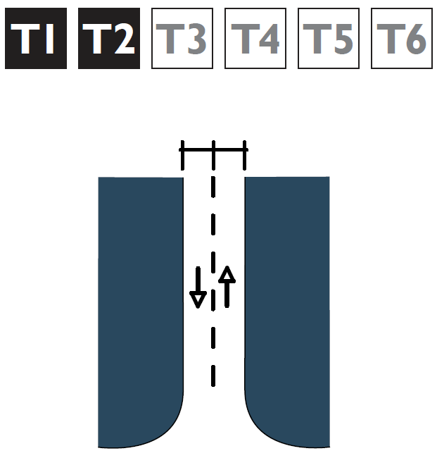
T1 and T2 Movement Type |
Speed |
Travel Lane1 |
Bicycle Facility3, 4 |
Parking Lane (if provided) |
Edge |
Parkway Min. |
Path Min. |
|
Slow |
20 mph |
8' |
-- |
-- |
R |
5' – 10' |
8' – 10' |
|
Free |
25 mph |
9' |
-- |
-- |
R or C |
5' – 10' |
8' – 10' |
|
Speed 30 |
30 mph |
10' |
P |
-- |
R or C |
5' – 10' |
8' – 10' |
|
Rural |
35 mph |
11' |
P |
-- |
R or C |
5' – 10' |
8' – 10' |
|
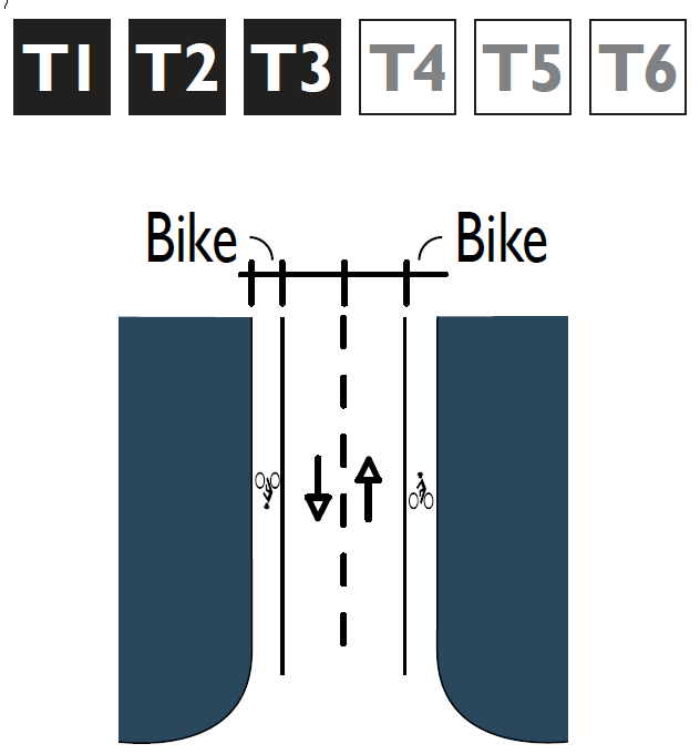
T3 Movement Type |
Speed |
Travel Lane1 |
Bicycle Facility3, 4 |
Parking Lane (if provided) |
Edge |
Parkway Min. |
Path Min. |
|
Yield2 |
20 mph |
12' |
-- |
7' |
C |
5' – 10' |
5' |
|
Lots > 1 acre |
20 mph |
9' |
-- |
-- |
R or C |
5' – 10' |
5' |
|
Slow |
20 mph |
9' |
-- |
7' |
C |
5' – 10' |
5' |
|
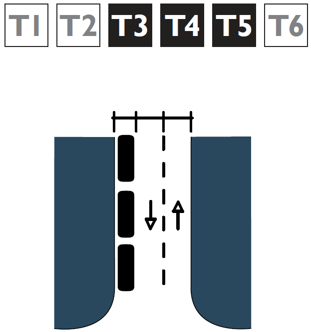
Free |
25 mph |
10' |
-- |
8' |
C |
5' – 10' |
5' |
|
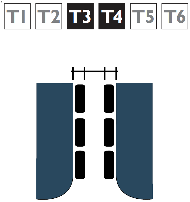
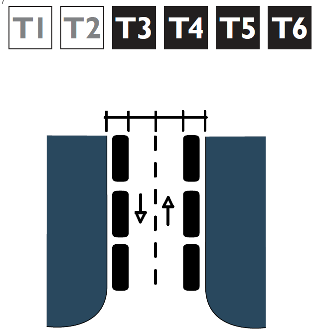
Speed 30 |
30 mph |
10' |
P |
8' |
C |
5' – 10' |
5' |
|
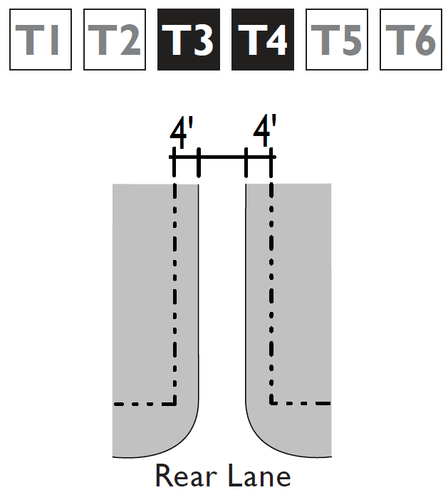
Rear Lane2 |
n/a |
12' |
-- |
-- |
R or RB |
4' |
-- |
|
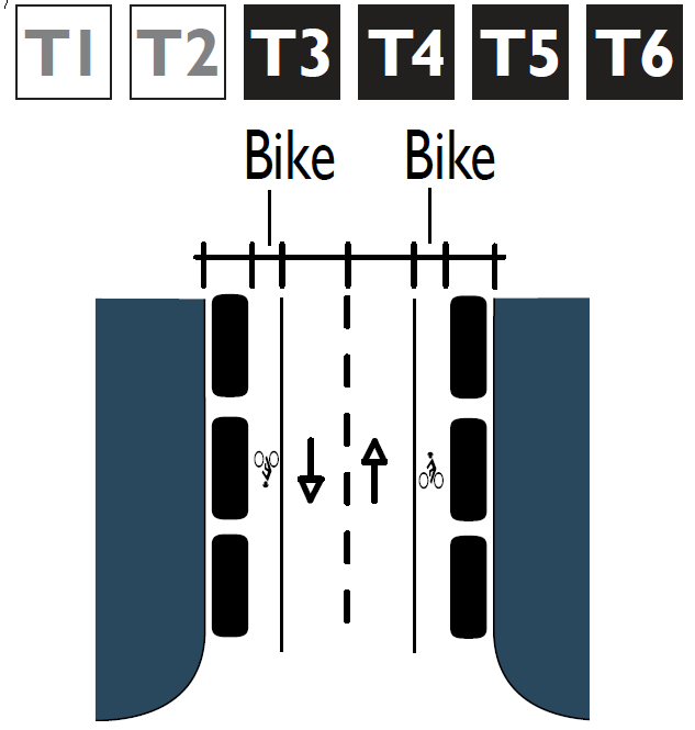
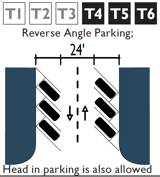
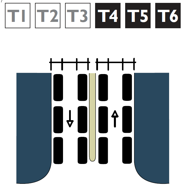
T4 Movement Type |
Speed |
Travel Lane1 |
Bicycle Facility3, 4 |
Parking Lane (if provided) |
Edge |
Parkway Min. |
Path Min. |
|
Yield2 |
20 mph |
12' |
-- |
7' |
C |
5' |
6' |
|
Slow |
20 mph |
9' |
-- |
7' |
C |
5' |
6' |
|
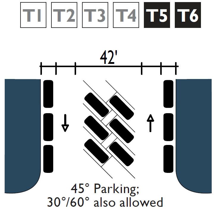
Slow (w/ 45° angle parking) |
20 mph |
12' |
-- |
18' |
C |
7' |
6' |
|
Free |
25 mph |
10' |
S |
8' |
C |
5' |
6' |
|
Free (w/ 45° angle parking) |
25 mph |
12' |
-- |
18' |
C |
7' |
6' |
|
Speed 30 |
30 mph |
10' |
S |
8' |
C |
5' |
6' |
|
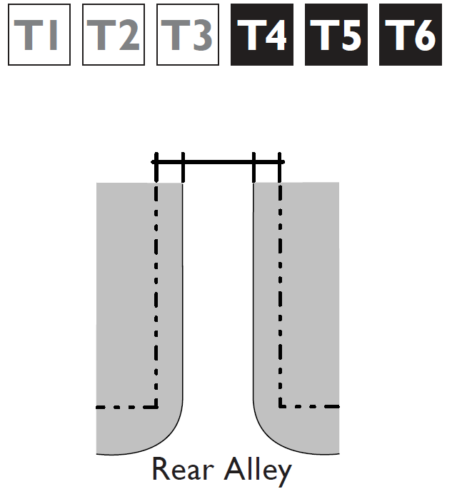
Alley2 |
n/a |
21' |
-- |
-- |
RB |
-- |
-- |
|
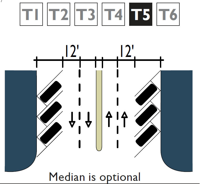
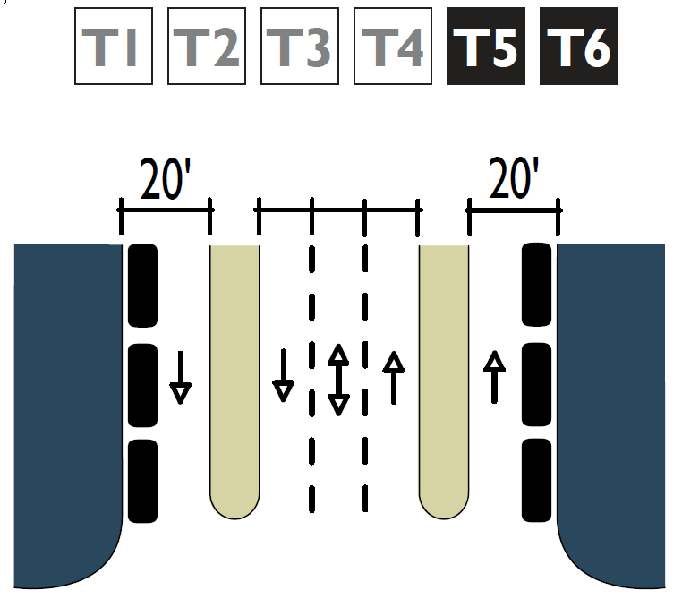
T5 Movement Type |
Speed |
Travel Lane1 |
Bicycle Facility3, 4 |
Parking Lane (if provided) |
Edge |
Furnishing |
Path Min. |
|
Slow |
20 mph |
9' |
-- |
7' |
C |
5' min. |
8' |
|
Slow (w/ 45° angle parking) |
20 mph |
12' |
-- |
18' |
C |
5' – 7' |
8' |
|
Free |
25 mph |
10' |
S |
8' |
C |
5' min. |
8' |
|
Free (w/ 45° angle parking) |
25 mph |
12' |
-- |
18' |
C |
5' – 7' |
8' |
|
Speed 30 |
30 mph |
11' |
S |
8' |
C |
5' min. |
8' |
|
Alley2 |
n/a |
21' |
-- |
-- |
RB |
-- |
-- |
|
T6 Movement Type |
Speed |
Travel Lane1 |
Bicycle Facility3, 4 |
Parking Lane (if provided) |
Edge |
Furnishing Min. |
Path Min. |
|
Slow |
20 mph |
9' |
-- |
7' |
C |
5' min. |
8' |
|
Slow (w/ 45° angle parking) |
20 mph |
12' |
-- |
18' |
C |
5' – 7' |
8' |
|
Free |
25 mph |
9' |
P |
8' |
C |
5' min. |
8' |
|
Speed 30 |
30 mph |
11' |
P |
8' |
C |
5' min. |
8' |
|
Alley2 |
n/a |
21' |
-- |
-- |
RB |
-- |
-- |
|
End Notes |
|||||||
|
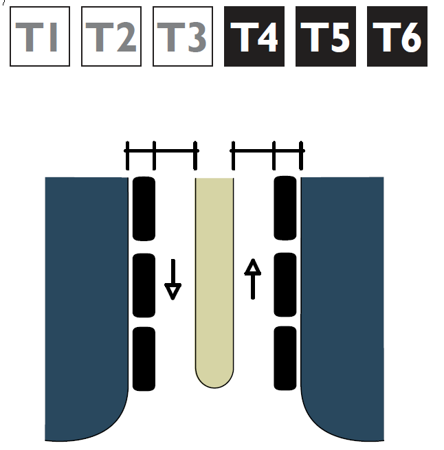
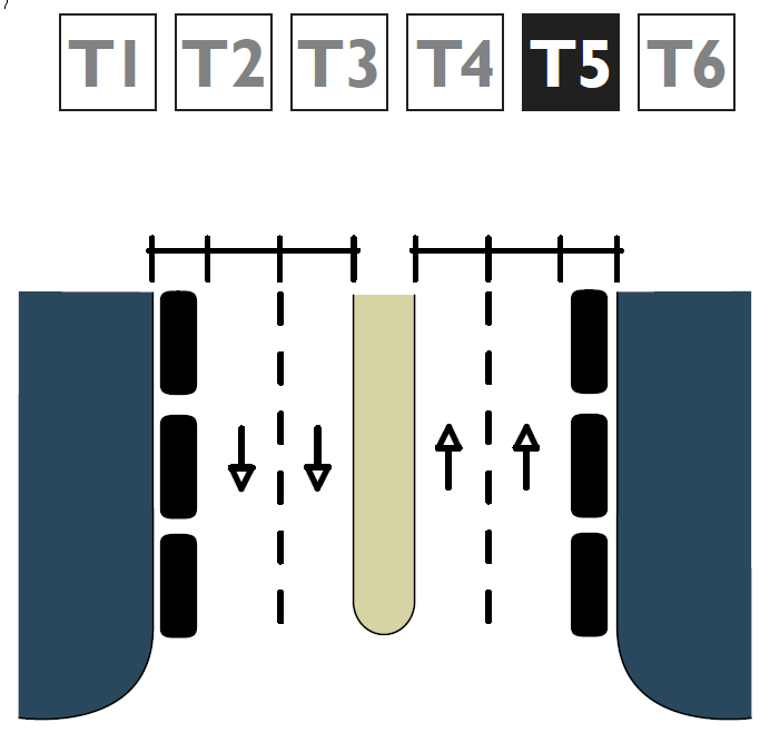
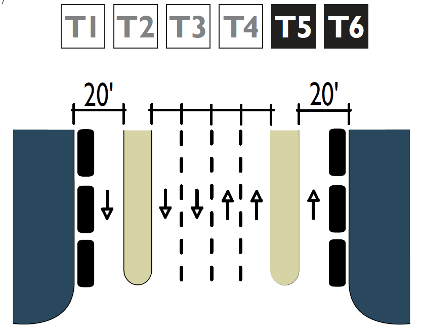
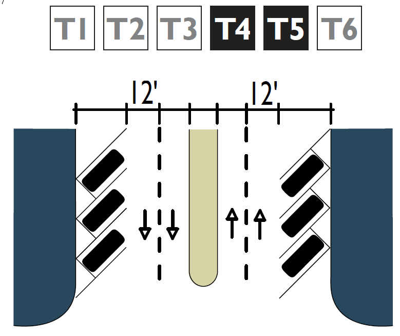
1 All lane dimensions shall be measured to the face of the curb. Where no curb and gutter is provided, the lane dimension shall be to the edge of the asphalt. In transects T1 and T2, add 1.5 feet to the travel lane width if curb and gutter are used and there is no on-street parking. Where parallel on-street parking is allowed and provided, travel lane width shall increase by one foot. |
|||||||
|
2 Assumes two-way traffic. The 12' dimension for a yield street is a single lane for 2-way traffic when vehicles are parked on both sides. |
|||||||
|
3 Bike lanes may also be required where uphill grades exceed 7% or to provide continuity between neighborhoods. |
|||||||
|
4 A sharrow or bicycle boulevard is allowed on streets with a design speed of less than 25 mph. |
|||||||
|
Key R = Rural Edge Treatment C = Curb Edge Treatment RB = Ribbon Curb (18") P = Permitted S = When Authorized by Staff -- = Not Permitted |
|
|
|||||
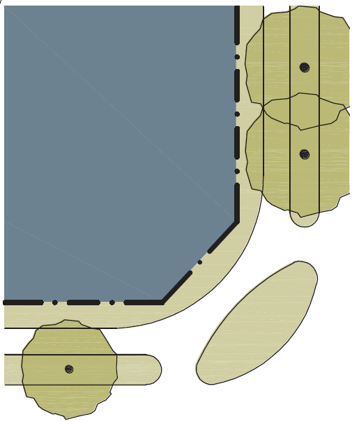
|
Table 10-60.10.080.B Bicycle Facilities Standards |
|
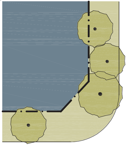
Table 10-60.10.080.C Curb Radius |
|||
|
Class I: Multi-Use Trail |
|
This table provides the radius for curbs at the intersection of thoroughfares. |
|||
|
Width |
10' min. |
|
Movement Type |
Speed |
Curb Radius with Parking |
|
Class II: Bicycle Lane1 |
|
Width |
20 mph |
10' |
|
|
Width Adjacent to |
|
|
Slow |
20 mph |
5' – 10' |
|
Rural Edge |
4' |
|
Free |
25 mph |
10' – 15' |
|
Parking |
5' |
|
Speed |
30 mph |
15' – 20' |
|
Curb and Gutter |
6' to edge of curb |
|
Rural |
35 mph |
25' |
|
Class III: Sharrow/Bicycle Boulevard |
|
|
|
|
|
|
Width |
no minimum |
|
|
|
|
|
Design Speed of Thoroughfare |
<25 mph |
|
|
|
|
|
Cycle Track |
|
|
|
|
|
|
Width |
6' min. |
|
|
|
|
|
End Notes |
|
|
|
|
|
|
1In transect zones T5 and T6 a cycle track may be provided in lieu of a bike lane. |
|
|
|
|
|
Unless otherwise noted, travel and parking lane widths are determined in Table 10-60.10.080.A.
|
Movement Type |
Yield |
Slow |
Free |
Speed |
Rural |
|---|---|---|---|---|---|
|
Design Speed |
<20 MPH |
20 MPH |
25 MPH |
30 MPH |
35 MPH |
|
No Parking |
|
|
|
|
|
|
No Parking |
|
|
|
|
|
|
Limited Parking |
|
|
|
|
|
|
One-Side Parking |
|
|
|
|
|
|
Two-Side Parking |
|
|
|
|
|
|
Angle Parking |
|
|
|
|
|
|
Medians with Parking |
|
|
|
|
|
|
Medians with Parking |
|
|
|
|
|
|
Medians with Angled Parking |
|
|
|
|
|
|
Medians with Angled Parking |
|
|
|
|
|
|
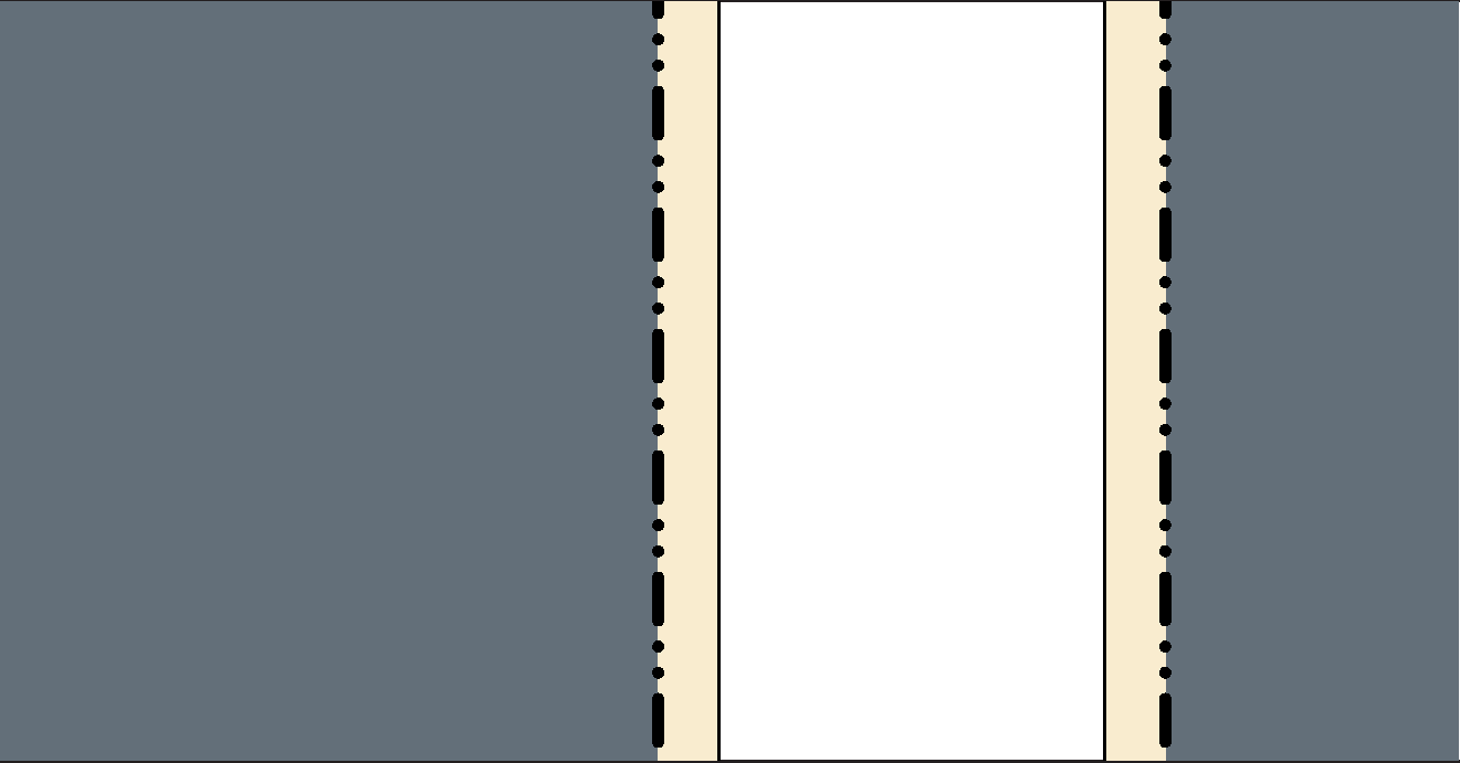
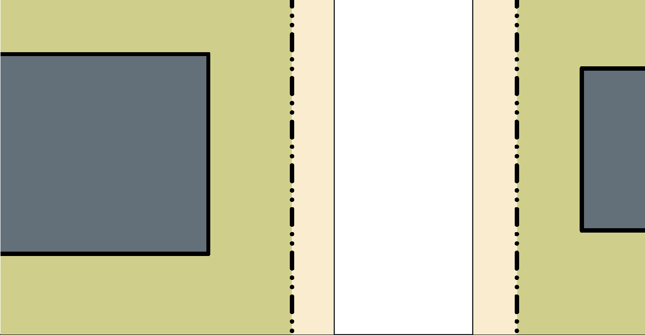
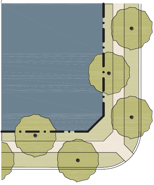
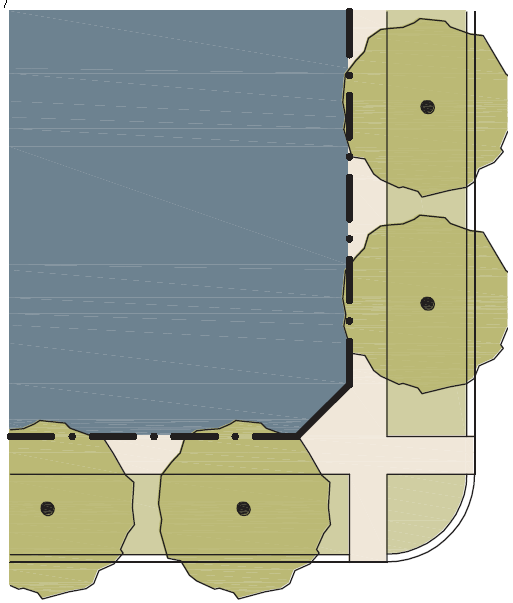
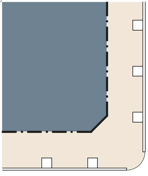
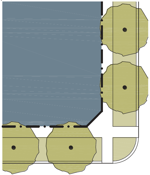
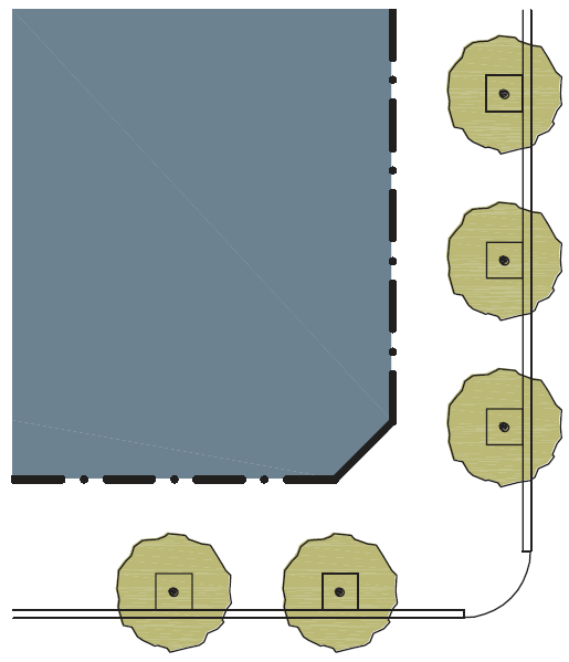
The public frontage is the area between the curb of the vehicular lanes and the frontage line. Dimensions are provided in Table 10-60.10.080.F (Public Frontage Standards). |
|||||
|---|---|---|---|---|---|
|
Public Frontage Type |
|
› |
‹ |
|
|
|
LOT PRIVATE FRONTAGE |
› |
‹ |
R.O.W PUBLIC FRONTAGE |
Transect Zone |
|
|
|
|
|
|
|
|
|
Highway (HW): The highway frontage has bicycle trails, no parking and open swales drained by percolation. The landscaping consists of the natural condition or multiple species arrayed in naturalistic clusters. Buildings are buffered by distance or berms. |
|
|
|||
|
Road (RD): The road frontage has open swales drained by percolation, a walking path or bicycle trail along one or both sides, and yield parking. The landscaping consists of multiple species arrayed in naturalistic clusters. |
|
|
|||
|
Street (ST): The street frontage has raised curbs drained by inlets and sidewalks separated from the vehicular lanes by individual or continuous planters. The landscaping consists of street trees of a single or alternating species aligned in a regularly spaced allee.1 |
|
|
|||
|
Drive (DR): The drive frontage has raised curbs drained by inlets and a wide sidewalk or paved path along one side, related to a civic space. It is separated from the vehicular lanes by individual or continuous planters. The landscaping consists of street trees of a single or alternating species aligned in a regularly spaced allee. |
|
|
|||
|
Avenue (AV): The avenue frontage has raised curbs drained by inlets and wide sidewalks separated from the vehicular lanes by a narrow continuous planter with parking on both sides. The landscaping consists of a single tree species aligned in a regularly spaced allee. |
|
|
|||
|
Commercial Street (CS) or Avenue: The commercial street or avenue frontage has raised curbs drained by inlets and very wide sidewalks along both sides separated from the vehicular lanes by separate tree wells with grates. The landscaping consists of a single tree species aligned with regular spacing where possible. |
|
|
|||
|
Boulevard (BV): The boulevard frontage has slip roads on both sides. It consists of raised curbs drained by inlets and sidewalks along both sides, separated from the vehicular lanes by planters. The landscaping consists of double rows of a single tree species aligned in a regularly spaced allee. |
|
|
|||
|
Rear Alley (RA): The rear alley frontage is located to the rear of lots. It consists of a paved surface and ribbon curb at the edges adjacent to property lines or buildings. Alleys are typically not landscaped. |
|
|
|||
|
Rear Lane (RL): The rear lane frontage is located to the rear of lots. It consists of a paved surface and compacted gravel or similar material placed on the outer edges. Lanes are typically not landscaped. |
|
|
|||
|
1 Streets with a right-of-way width of 40 feet or less are exempt from tree standards. |
|||||

|
Key |
|
Allowed |
|
Not Allowed |
||
|
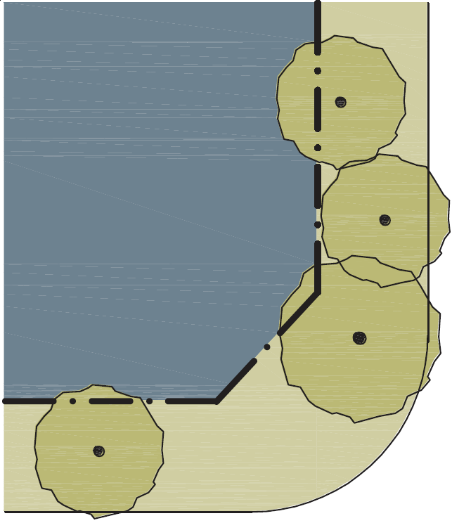
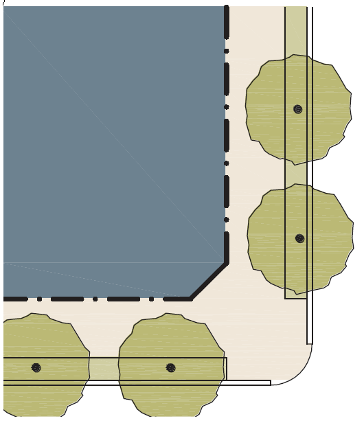
This table assembles prescriptions and dimensions for the public frontage elements – curbs, walkways, and planters – relative to specific thoroughfare types within transect zones. Assembly combines the curb, walkway, and planter for the various street types. |
|||
|---|---|---|---|
|
Transect Zone |
|
|
|
|
Public Frontage Type |
HW-RD-ST |
RD and ST |
ST-DR-AV |
|
Assembly: The principal variables are the type and dimension of curbs, walkways, planters and landscape. |
|
|
|
|
Total Width |
13' – 22' |
13' – 22' |
10' – 17' |
|
Curb: The detailing of the edge of the vehicular pavement, incorporating drainage. |
|
|
|
|
Type |
Rural |
Raised Curb |
Raised Curb |
|
Radius |
25' |
10' – 30' |
5' – 20' |
|
Walkway: The pavement dedicated exclusively to pedestrian activity. |
|
|
|
|
Type |
Path |
Sidewalk |
Sidewalk |
|
Width |
5' – 10' |
5' min. |
5' min. |
|
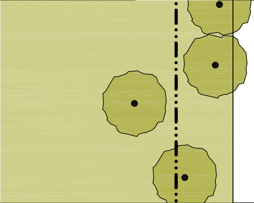
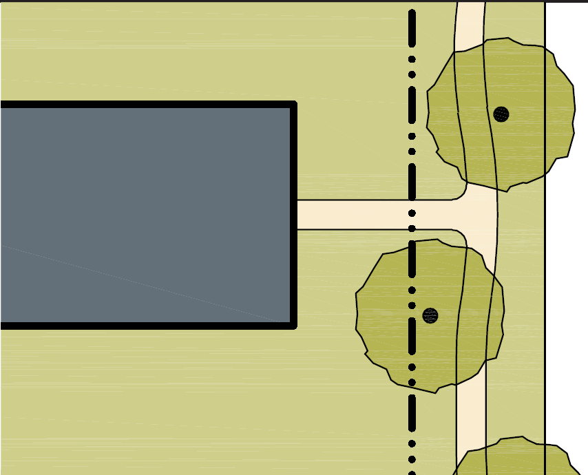
Planter: The layer which accommodates street trees and other landscape. |
|
|
|
|
Arrangement |
Clustered |
Clustered |
Regular |
|
Species |
Multiple |
Multiple |
Multiple |
|
Type |
Continuous Planter |
Continuous Planter |
Continuous Planter |
|
Width |
5' min. |
5' min. |
3' – 6' |


|
Key |
|
Allowed |
|
Not Allowed |
||
|
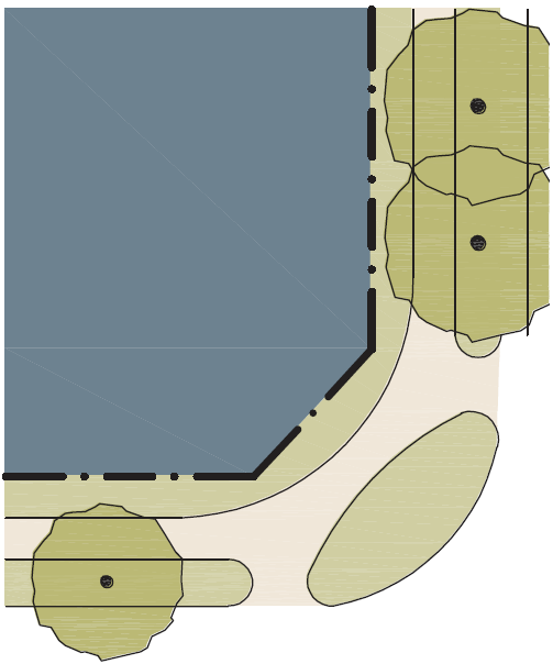
This table assembles prescriptions and dimensions for the public frontage elements – curbs, walkways, and planters – relative to specific thoroughfare types within transect zones. Assembly combines the curb, walkway, and planter for the various street types. |
|||
|---|---|---|---|
|
Transect Zone |
|
|
|
|
Public Frontage Type |
ST-DR-AV-BV |
CS-DR-AV-BV |
CS-DR-AV-BV |
|
Assembly: The principal variables are the type and dimension of curbs, walkways, planters and landscape. |
|
|
|
|
Total Width |
12' – 26' |
12' – 19' |
18' – 30' |
|
Curb: The detailing of the edge of the vehicular pavement, incorporating drainage. |
|
|
|
|
Type |
Raised Curb |
Raised Curb |
Raised Curb |
|
Radius |
5' – 20' |
5' – 20' |
5' – 20' |
|
Walkway: The pavement dedicated exclusively to pedestrian activity. |
|
|
|
|
Type |
Sidewalk |
Sidewalk |
Sidewalk |
|
Width |
5' – 7' |
7' – 10' |
10' – 30' |
|
Planter: The layer which accommodates street trees and other landscape. |
|
|
|
|
Arrangement |
Regular |
Regular |
Opportunistic |
|
Species |
Alternating |
Single |
Single |
|
Type |
Continuous Planter |
Continuous Planter |
Tree Well |
|
Width |
5' min. |
5' min. |
3' – 6' |


|
Key |
|
Allowed |
|
Not Allowed |
||
|
This table shows common street tree types and their appropriateness within the transect zones. Title 18 of the Engineering Standards provides detailed specifications for landscaping within thoroughfares. |
||
|---|---|---|
|
Standards |
Illustration |
Recommended Species |
|
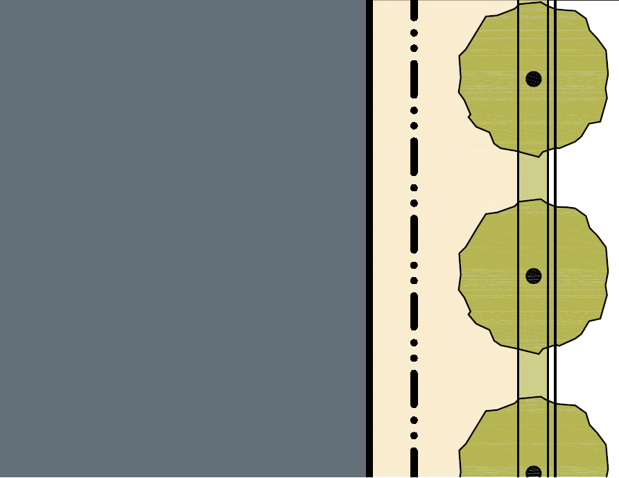
Tree Shape: Oval
Placement: Spacing 25' – 35' o.c. |
|
American Linden, Amur Maple, Black Locust, European White Birch, Green Ash, Quaking Aspen, Silver Maple, London Planetree, Freeman Maple, Flowering Pear |
|
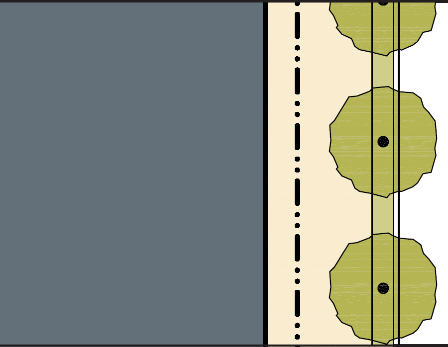
Tree Shape: Ball
Placement: Spacing 20' – 30' o.c. |
|
Alligator Juniper, Bird Cherry, Chokeberry, Crabapple, English Hawthorn, European Mountain Ash, Littleleaf Linden, One-seed Juniper, Western Redbud, Utah Juniper |
|
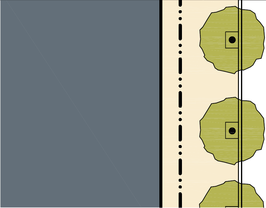
Tree Shape: Pyramid
Placement: Spacing 25' – 35' o.c. |
|
Austrian Pine, Colorado Blue Spruce, Engelmann Spruce, Limber Pine, Ponderosa Pine, Eastern Red Cedar Juniper, Rocky Mountain Juniper, Scotch Pine, White Fir |
|
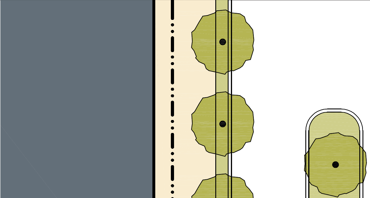
Tree Shape: Umbrella
Placement: Spacing 20' – 30' o.c. |
|
American Elm, Northern Red Oak, Honey Locust, Gambel Oak, Flowering Cherry, Crabapple |
|
Tree Shape: Vase
Placement: Spacing 25' – 35' o.c.
|
|
Flowering Plum |


|
Key |
|
Allowed |
|
Not Allowed |
||
|
Lighting varies in brightness and also in the character of the fixture according to the transect zones. This table shows the types of light poles and fixtures that may be approved by the City Public Works Division assigned to the transect zones. However, the Public Works Division must be included in the selection of light poles and light fixtures. |
|||||
|---|---|---|---|---|---|
|
Transect Zone |
|
|
|
|
|
|
Fixture Type |
Cobra Head |
Pipe |
Post |
Column |
Double Column |
|
Illustration |
|
|
|
|
|
|
Placement |
|||||
|
Spacing |
50' o.c. |
50' o.c. |
50' o.c. |
50' o.c. |
50' o.c. |
|
Form |
|||||
|
Height |
18' – 24' |
14' – 24' |
14' – 18' |
14' – 18' |
14' – 18' |
|
Miscellaneous |
|||||
|
Luminance |
See Division 10-50.60 (Outdoor Lighting Standards) |
||||
|
Shielding |
See Division 10-50.60 (Outdoor Lighting Standards) |
||||
|
Key |
|
Allowed |
|
(Ord. 2016-07, Amended, 2/16/2016 (Res. 2016-02))
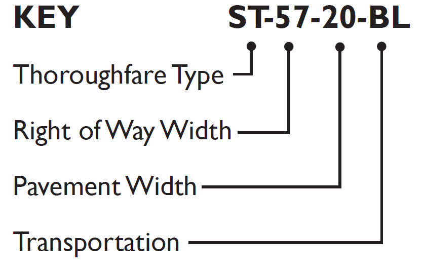
10-60.10.090 Thoroughfare Assemblies
A. This section provides an example of thoroughfare assemblies that have been approved by the City for use in transect zones that are derived from the standards and specifications in Table 10-60.10-090.A., Thoroughfare Assemblies. The Engineering Standards also provide additional detailed specifications for the design and construction of thoroughfares.
|
|
|
|
|
|
|
|
KEY |
|
||||
|
Highway: |
HW |
||||
|
Boulevard: |
BV |
||||
|
Avenue: |
AV |
||||
|
Commercial Street: |
CS |
||||
|
Drive: |
DR |
||||
|
Street: |
ST |
||||
|
Road: |
RD |
||||
|
Rear Alley: |
RA |
||||
|
Rear Lane: |
RL |
||||
|
Bicycle Trail: |
BT |
||||
|
Bicycle Lane: |
BL |
||||
|
Bicycle Route: |
BR |
||||
|
Path: |
PT |
||||
|
Passage: |
PS |
||||
|
Transit Route: |
TR |
||||
|
|
|
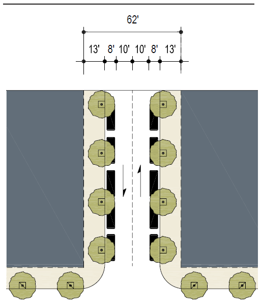
CS-62-36 |
|
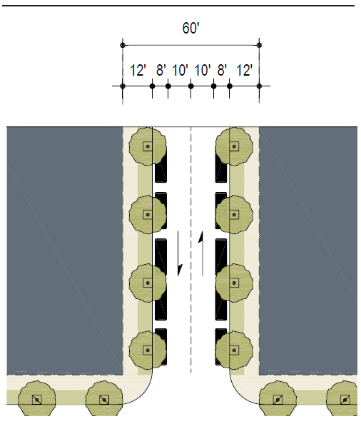
ST-60-36 |
|
|
Thoroughfare Type |
|
Commercial Street |
|
Street |
|
|
Transect Zone Assignment |
|
T5, T6 |
|
T3, T4 |
|
|
Right-of-Way Width |
|
62' |
|
60' |
|
|
Pavement Width |
|
36' |
|
36' |
|
|
Movement |
|
Free Movement |
|
Free Movement |
|
|
Design Speed |
|
25 MPH |
|
25 MPH |
|
|
Pedestrian Crossing Time |
|
10.2 seconds |
|
10.2 seconds |
|
|
Traffic Lanes |
|
2 |
|
2 |
|
|
Parking Lanes |
|
Both sides @ 8', marked |
|
Both Sides @ 8', marked |
|
|
Curb Radius |
|
10' |
|
15' |
|
|
Walkway Type |
|
13' Sidewalk |
|
5' – 7' Sidewalk |
|
|
Planter Type |
|
4'x4' Tree Well |
|
5' – 7' Continuous Planter |
|
|
Curb Type |
|
Curb |
|
Curb |
|
|
Landscape Type |
|
Trees at 30' o.c. Avg. |
|
Trees at 30' o.c. Avg. |
|
|
Transportation Provision |
|
-- |
|
BR |
|
(Ord. 2019-22, Amended, 7/2/2019 (Res. 2019-31))