


Division 13-10-014
Roadway Functional Classifications and Truck Routes
Sections:
13-10-014-0001 Roadway Functional Classifications
13-10-014-0001.1 Definitions
13-10-014-0002 Truck Routes
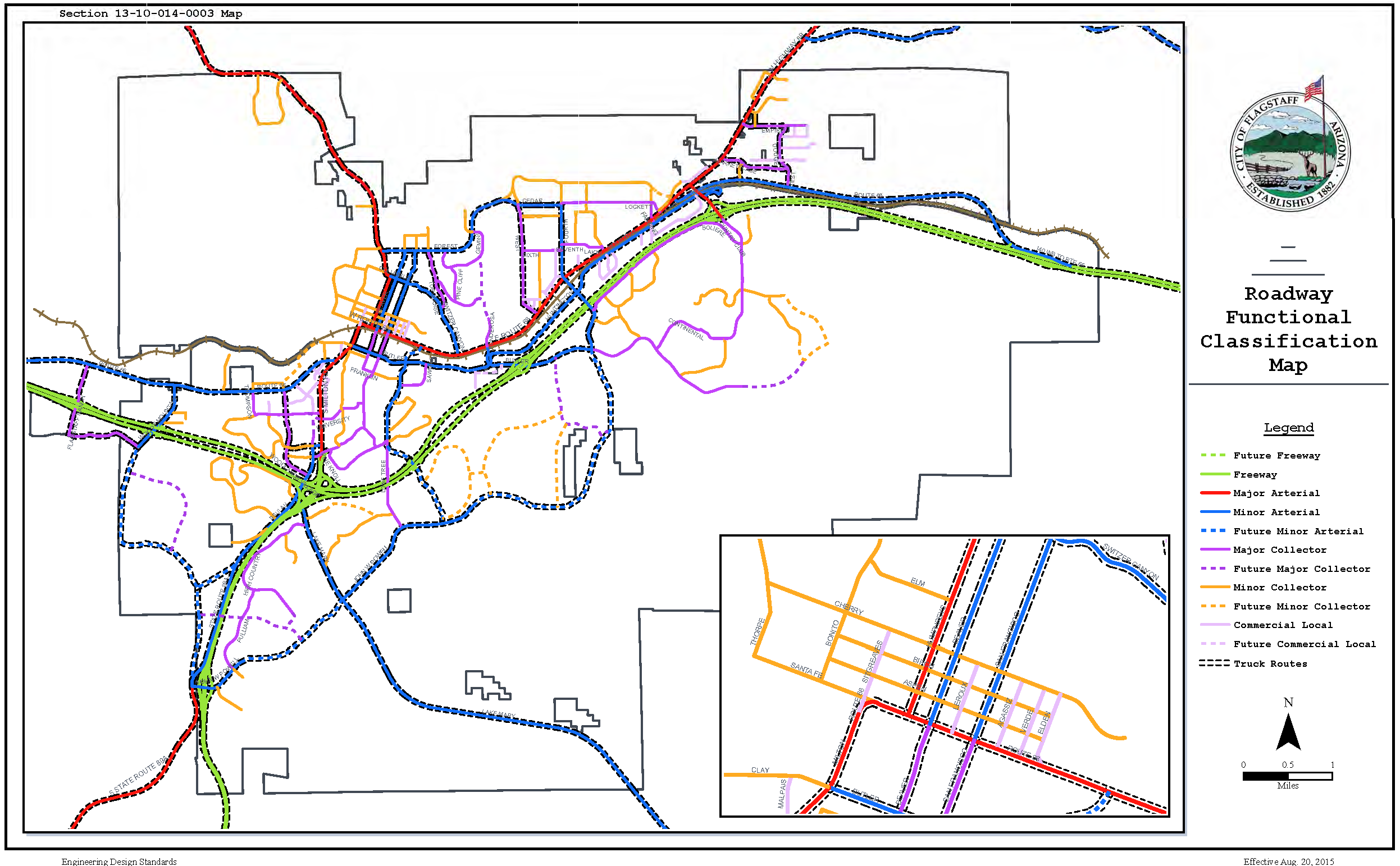
13-10-014-0003 Map
13-10-014-0001 Roadway Functional Classifications
This division defines the roadway functional classes, and also provides a map of the City of Flagstaff with the various roadway classifications and truck routes. (Ord. 2017-22, Rep&ReEn, 07/05/2017)
13-10-014-0001.1 Definitions
"Commercial local" refer to streets that provide for direct vehicle, bicycle, and pedestrian access to commercial land uses. The streets do not serve trans-regional trips and provide no route continuity beyond the areas they connect. Adjacent land uses include commercial areas, industrial sites, and institutional sites.
"Freeways" refer to high-speed facilities with access permitted only at traffic interchanges.
"Major arterials" provide relatively high-capacity roadways for longer trips. They provide direct service to major regional centers or activity and often serve as boundaries between districts. Major arterials provide roadway continuity and length for trans-regional, inter-regional and inter-state trips and connect the Flagstaff region to surrounding regions. Throughput capacity will be emphasized over local access. Adjacent land uses include commercial areas, open space, public lands, industrial sites and institutional sites. Residential property will not abut major arterials unless separated by adequate buffering.
"Major collectors" collect traffic from minor collectors and local streets within a district and deliver that traffic to major or minor arterials. They are generally not intended to serve trans-regional trips and generally will not provide route continuity for more than a mile or two (2) (except in rural areas where they may be longer). These roadways are generally contained entirely within a district and connect the neighborhoods of that district with each other. Adjacent land uses include residential and commercial areas, open space, public lands, industrial sites, and institutional sites.
"Minor arterials" provide capacity and continuity for travel between different districts of the region. Adjacent land uses include residential and commercial areas, open space, public lands, industrial sites, and institutional sites. The activity center for a district will often be located along a minor arterial or at the intersection of a minor arterial with another minor arterial or a major collector.
"Minor collectors" collect traffic from local streets and deliver it to major collectors or minor arterials. They will not serve trans-regional trips and will not provide route continuity for more than a mile (except in rural areas where they may be longer). Adjacent land uses include residential and commercial areas, open space, public lands, industrial sites, and institutional sites. The contribution of minor collectors to the structural framework of the region is minimal, but affects neighborhood form. (Ord. 2017-22, Rep&ReEn, 07/05/2017)
13-10-014-0002 Truck Routes
The Truck Routes Map positively identifies where trucks are to operate for cross and through-town trips. The Regional Plan policies direct the City and County to develop regulations for specifying how trucks may make deliveries (i.e., make use of the shortest route in and out of a residential area, during certain hours in certain zones). The map will guide investment and design decisions so that trucks may operate in the Flagstaff region safely and efficiently. (Ord. 2017-22, Rep&ReEn, 07/05/2017)
13-10-014-0003 Map
Please see the map found in the "Roadway Functional Classification Map" which is attached to the ordinance codified in this division and hereby incorporated herein by this reference as "13-10-014-0003 Map."
(Ord. 2017-22, Rep&ReEn, 07/05/2017)