


6. TRANSPORTATION
The circulation pattern in the Everest Neighborhood is well established, but new pedestrian and bike connections to the BRT/Stride station and CKC are needed to more sustainably connect the neighborhood to regional destinations (see Figures EV-4, EV-5, and EV-6). Kirkland Way and NE 68th Street serve as major east/west corridors for through traffic. Sixth Street South is, and should remain, the major north/south corridor for through traffic. Interstate 405 is located along the eastern boundary of the Everest Neighborhood.
Streets
Policy EV-16:
Improve vehicular circulation patterns and proportionately distribute traffic on surrounding streets.
Vehicle traffic from larger employers and pass through traffic during commute times can result in congested streets for residents wanting to travel within or to other parts of the city. Future modifications to circulation patterns in the Everest Neighborhood should conform to the following provisions. See also Figure T-28, Citywide Connections in the Transportation Chapter for potential vehicle and pedestrian connections:
(1) Industrial traffic in residential areas should be discouraged.
Industrial access should be directed towards the nearest arterial street capable of handling the traffic regardless of which neighborhood it is in. (see Figure EV-4).
(2) Kirkland Way and Cross Kirkland Corridor bridge.
Although Kirkland Way presently accommodates a significant amount of traffic, this route poses several problems. The street is too narrow for pedestrians and bicyclists to pass safely under the bridge due to the abutments. Signs and other safety measures continue to be installed to warn trucks of the low clearance. Numerous truck accidents have occurred in the vicinity of the Cross Kirkland Corridor bridge (old railroad crossing) because of the low clearance height for trucks. The City should continue to find ways to solve these mobility problems.
(3) Portions of 10th Street South are to remain unopened to vehicular traffic.
Critical areas are present southeast of Everest Park and therefore, 10th Street South, south of Slater Avenue South should be maintained and improved as a route for nonmotorized use.
(4) Implement the recommendations of the 6th Street Corridor Study.
(5) Add an east/west through block vehicle and pedestrian connection in HENC 1 when redevelopment of parcels occurs (see Land Use section above and Zoning Code) to better distribute increased traffic.
(6) Support transportation measures that will reduce vehicle commuter or pass-through traffic through the neighborhood.
Pedestrian and Bicycle Circulation
The I-405 pedestrian overpass at the east end of Kirkland Avenue, and connecting pathways through the north part of the neighborhood, serve as important pedestrian links between the Moss Bay and Rose Hill Neighborhoods (see Figure E-5). Connections to the Cross Kirkland Corridor provide a major pedestrian and bicycle route connecting the neighborhood to other City and regional destinations.
The major pedestrian routes by which the majority of residents enter and traverse this neighborhood are Kirkland Avenue, Kirkland Way, 116th Avenue NE, pedestrian freeway overpass, 6th Street South, and the Cross Kirkland Corridor. The majority of the neighborhood’s commercial developments are located along these routes, and it is along these routes that impressions of neighborhood character are formed. These routes should continue to be maintained.
Policy EV-17:
Maintain and enhance the pedestrian/bicycle circulation system in the neighborhood by providing improvements for pedestrians and bicycles according to Figure EV-5, the Transportation Element, and consistent with the Transportation Master Plan and future NE 85th Street/I-405 Station Area Plan.
Major pedestrian and bicycle pathways should be built through the area according to the designations shown in Figures EV-5, EV-6, T-28 Citywide Connections Map, T-19 Bicycle Network Map, and Policy T-2.3, Greenways, in the Transportation Element. Priority pedestrian and bicycle connections include:
• From the north end of Slater Street to the BRT/Stride Station and pedestrian freeway bridge.
• Unopened segments of 10th Street South, Alexander Avenue, and Slater Avenue South contain unimproved pathways that provide important pedestrian connections through the neighborhood. These pathways should be improved in a manner sensitive to the surrounding critical areas while promoting access for additional users.
• Kirkland Way lacks sidewalks and bicycle lanes. The City should pursue funding for sidewalk and bicycle improvements along the street to improve nonmotorized access to Downtown, the BRT/Stride Station, and Rose Hill.
• Portions of Kirkland Avenue have missing sections of sidewalks that impairs access to the CKC, to Downtown, and Lake Washington. Kirkland Avenue is designated as a Greenway in Transportation Element Policy T-2.3 (see Figure T-19). The City should pursue funding sections of missing sidewalks and bicycle infrastructure along the street to complete the pedestrian and bicycle network to these key activity areas of the city.
• Pedestrian and bicycle access should be developed from the east end of 9th Avenue South to NE 70th Street to provide convenient access to public transit facilities near Interstate 405.
Policy EV-18:
Support development of the Cross Kirkland Corridor as a multi-use corridor for pedestrians and bicycles and increase access points along the corridor.
The Cross Kirkland Corridor provides an opportunity for a bicycle, pedestrian and high-capacity transit corridor. With development, public access easements should be provided for properties adjacent to the Cross Kirkland Corridor consistent with City regulations, and the CKC Master Plan.
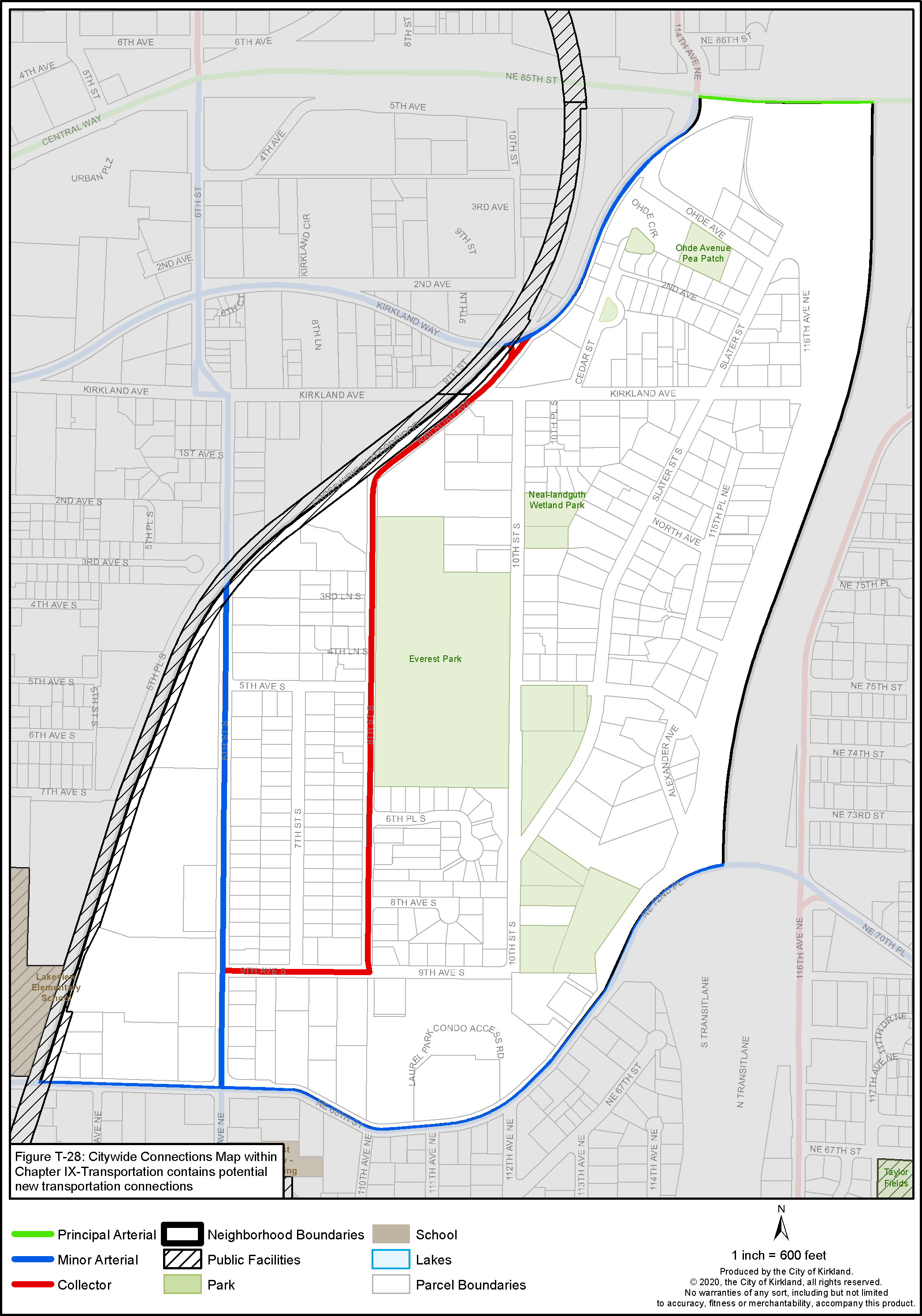
Figure EV-4: Everest Street Classifications
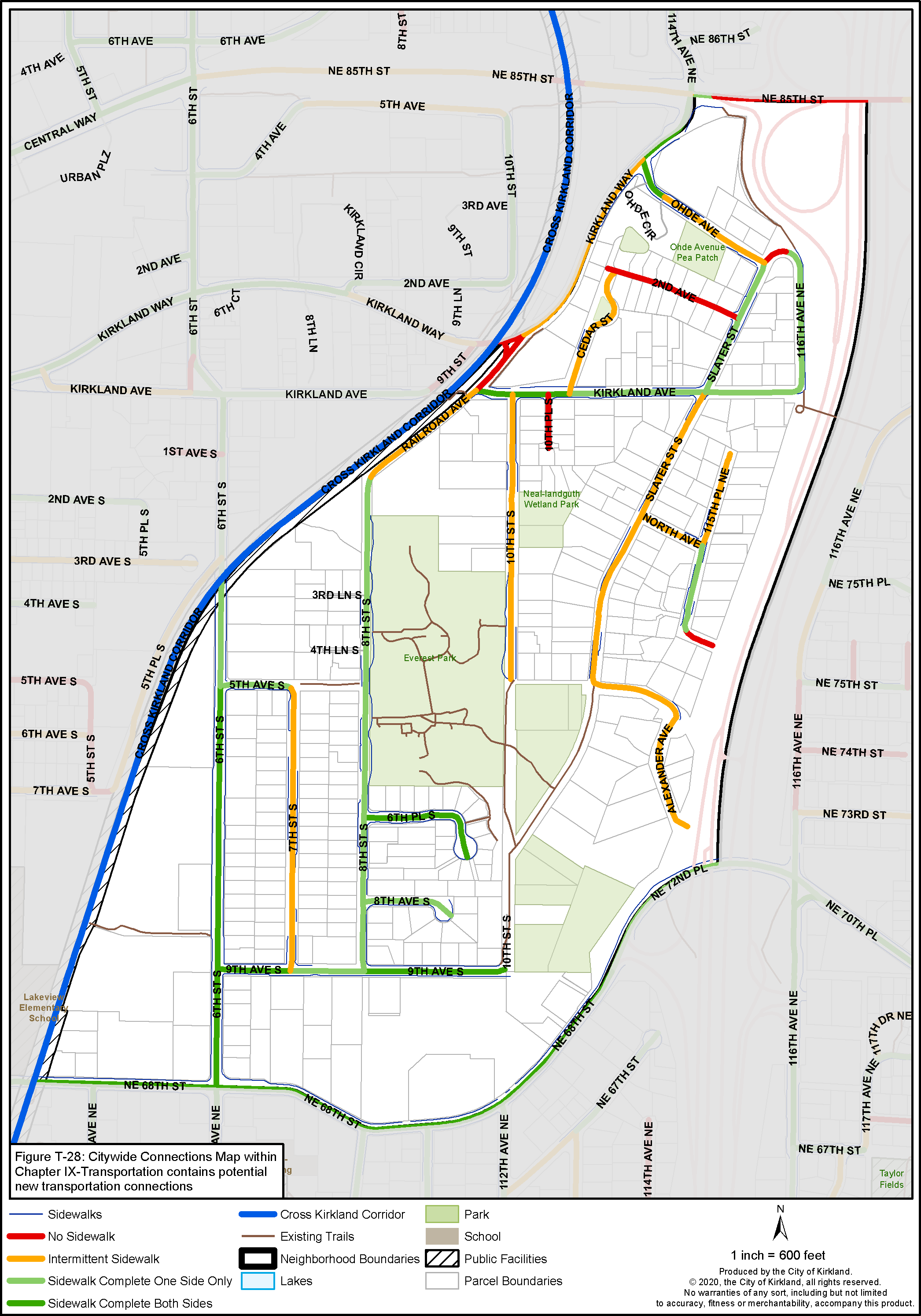
Figure EV-5: Everest Street Pedestrian System
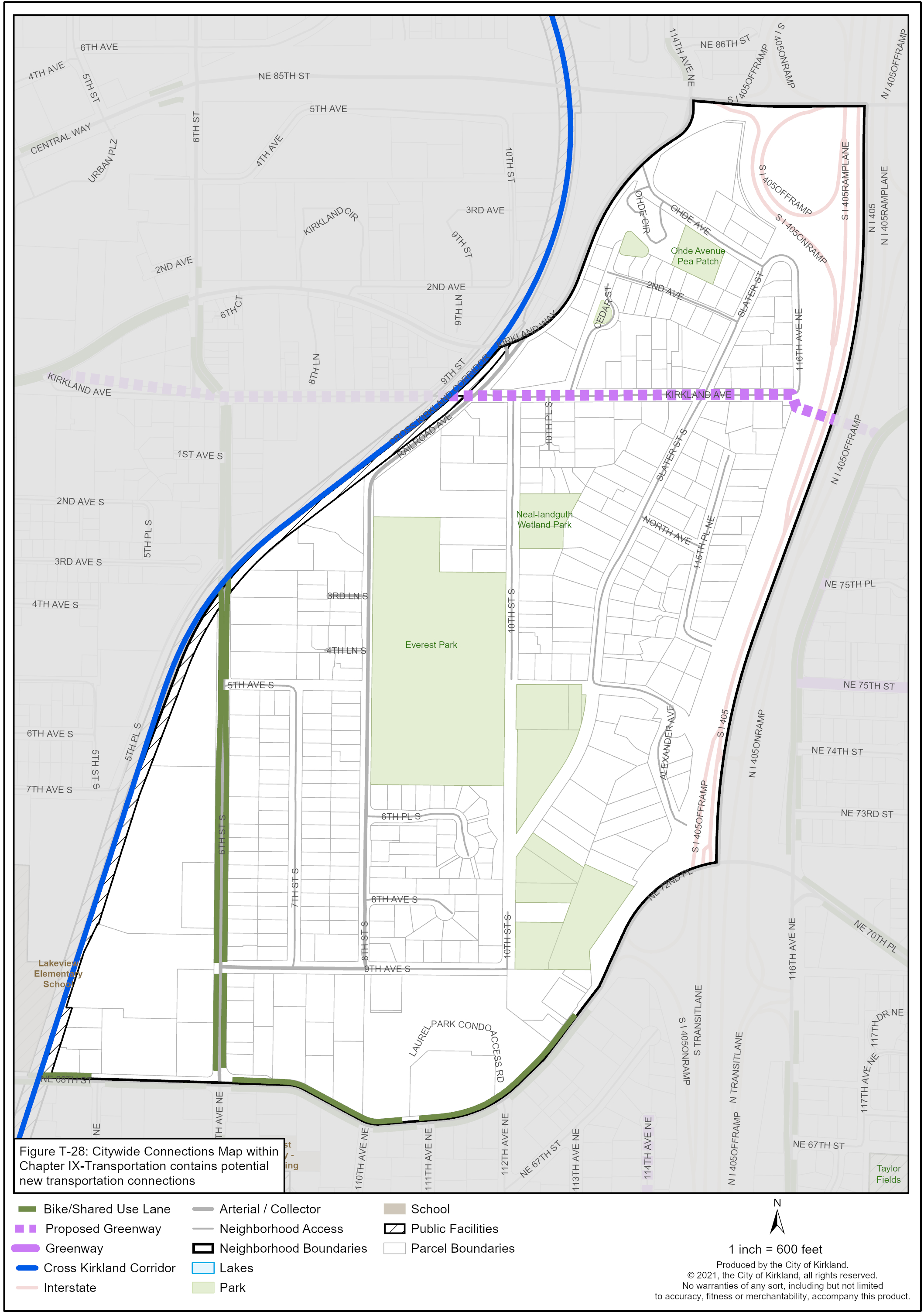
Figure EV-6: Everest Bicycle System