


Chapter 16.45
WETLANDS
Sections:
16.45.010 Introduction.
A. It is the purpose of this chapter to provide balanced wetland protection measures pursuant to the Washington State Growth Management Act (GMA, RCW 36.70A.172) that:
1. Include best available science to protect the functions and values of wetlands with special consideration to conservation or protection measures necessary to preserve or enhance anadromous fisheries;
2. Further the goal of no net loss of wetland functions;
3. Encourage restoration and enhancement of degraded and low quality wetlands;
4. Provide a high level of protection for higher quality wetlands;
5. Complement state and federal wetland protective measures; and
6. Allow reasonable use of property.
B. Applicability.
1. The provisions of this chapter apply to all land uses and development activity, and all structures and facilities in the town, whether or not a permit or permit authorization is required, and shall apply to every person, firm, partnership, corporation, group, governmental agency, or other entity that owns, leases, or administers land within the town. No person, company, agency, or applicant shall alter a wetland or wetland buffer except as consistent with this chapter.
2. The town will not approve any permit or otherwise issue any authorization to alter the condition of any land, water, or vegetation, or to construct or alter any structure or improvement in, over, or on a wetland or wetland buffer, without first ensuring compliance with the requirements of this chapter, including, but not limited to, the following development permits:
a. Building permit;
b. Grading permit;
c. Forest practices conversion permit regulated by WAC Title 222;
d. Conditional use permit;
e. Short subdivision;
f. Subdivision;
g. Planned unit development;
h. Site plan; or
i. Zoning variance.
3. Reasonable Use Exceptions. The responsible official will use the following exceptions that shall apply in implementing the standards of this chapter, although the standards shall be applied to the maximum extent practicable to avoid and minimize impacts on wetland functions and values. Mitigation for unavoidable adverse impacts shall be required. The standards of this chapter shall not be used to preclude the following activities in wetland areas:
a. The placement of a single-family residence and normal accessory structures on an otherwise legally buildable lot of record. The following standards may be applied on established properties to limit the proposed location and size of structures and proposed removal of vegetation:
i. The expansion of a home on a lot that does not show building or development envelopes, wetlands or wetland buffers on the recorded plat shall not exceed 25 percent of the existing building footprint. Expansion should only be allowed on the upland side; i.e., not encroaching farther towards the wetland;
ii. The replacement of single-wide mobile home with another dwelling and normal accessory structures. Expansion should only be allowed on the upland side; i.e., not encroaching farther towards the wetland; and
iii. Fire hazard clearing recommended by the fire marshal, or consistent with written fire marshal or fire chief guidelines.
b. The standards of this chapter shall not be used to deny all reasonable economic use of private property. The following criteria must be met in order to verify that all reasonable economic use of the property has been denied:
i. The application of this chapter would deny all reasonable economic use of the property;
ii. No other reasonable economic use of the property has less impact on the wetland and buffer area;
iii. Any wetland or buffer alteration is the minimum necessary to allow for reasonable economic use of the property; and
iv. The inability of the applicant to derive reasonable economic use of the property is not the result of actions by the applicant after the date of adoption of this code provision.
c. The application of this chapter shall not be used to deny a development proposal for a linear facility from a public agency or public utility provided the agency or utility meets the following criteria:
i. There is no practical alternative to the proposed project with less impact on the wetland and buffer area; and
ii. The application of this chapter would unreasonably restrict the ability to provide public utility services to the public.
d. Approval of a development permit application pursuant to the provisions of this chapter does not discharge the obligation of the applicant to comply with the provisions of this chapter.
4. Exempted Activities. All exempted activities shall use reasonable methods to avoid potential impacts to wetlands and buffers. Exemptions from permits are not exemptions from wetland stewardship responsibilities. The following developments, activities, and associated uses shall be exempt from the provisions of this chapter; provided, that they are otherwise consistent with the provisions of other local, state, and federal laws and requirements:
a. Reconstruction of damaged or destroyed structures within the same building footprint. Expansion or reconstruction within a new or expanded footprint that affects a nonexempt wetland or wetland buffer is subject to the provisions of this title. Such expansion or reconstruction shall occur in a one-year time limit.
b. The harvesting or normal maintenance of vegetation in a manner that is not injurious to the natural reproduction of such vegetation.
c. Existing agricultural activities and structures:
i. Agricultural activities and structures in operation at the time of adoption of this code provision that are affecting wetlands not associated with a riparian corridor are exempt from regulation under this chapter;
ii. Changes in agricultural practices within the same footprint as the existing agricultural activities in subsection (B)(4)(c)(i) of this section, including reconstruction of existing agricultural structures, or construction of new agricultural structures, are exempt from regulation under this chapter; and
iii. Agricultural activities and structures in operation at the time of adoption of this code provision that are affecting wetlands associated with riparian corridors shall be regulated through Chapter 16.40 YMC, Priority Habitat Areas.
d. The removal or eradication of nuisance vegetation or other exotic nuisance plants including nonnative blackberries; provided, that ground disturbing heavy machinery (scraping, ripping, etc.,) is not used. Cutting, mowing, and ground disturbance with hand tools is allowed.
e. Site investigative work necessary for land use application submittals such as surveys, soil logs, and percolation tests.
f. Emergency clearing to abate immediate danger to persons or property. For emergency clearing of hazard trees, remove only that portion of the hazard tree as necessary to remediate the hazard.
g. Clearing necessary for the emergency repair of utility or public facilities. Emergency work that causes substantial degradation to functions and values must be reported to the town in a timely manner.
h. Clearing for operation, maintenance, or repair of existing utilities or public facilities that does not further increase the impact to, or encroach further within, the wetland or wetland buffer.
i. Clearing, as minimally necessary, for placement of fencing, private wells, septic systems or individual lot sewer, water, electrical, or utility connections in wetland buffers, where practical alternatives do not exist.
j. Clearing, as minimally necessary, for stream bank restoration, for native replanting or enhancements in wetlands and wetland buffers.
k. Clearing in wetlands and wetland buffers, as minimally necessary, for soil, water, vegetation and resource conservation projects having received an environmental permit from a public agency.
l. Clearing in wetlands and wetland buffers, as minimally necessary, for creating a four-foot or narrower path using natural, wood-based or vegetated pervious surfacing.
m. Land disturbance in wetlands and wetland buffers cumulatively less than five cubic yards in volume and 300 square feet in area; provided, that the wetland hydroperiod is not significantly affected.
5. Exempted Wetlands. This chapter shall not apply to the following wetlands:
a. All isolated Category IV wetlands less than 4,000 square feet that:
i. Are not associated with riparian areas or their buffers;
ii. Are not associated with shorelines of the state or their associated buffers;
iii. Are not part of a wetland mosaic;
iv. Do not score five or more points for habitat function based on the 2014 update to the Washington State Wetland Rating System for Western Washington: (Ecology Publication No. 14-06-029, or as revised and approved by Ecology); and
v. Do not contain a priority habitat area or a priority area for a priority species identified by the Washington Department of Fish and Wildlife, do not contain federally listed species or their critical habitat, or species of local importance identified in Chapter 16.40 YMC.
b. Buffer provisions for wetlands less than 1,000 square feet that meet the criteria described in subsection (B)(5)(a) of this section, and do not contain federally listed species or their critical habitat.
c. Artificial. Wetlands intentionally created from nonwetland upland sites including, but not limited to, irrigation and drainage ditches, grass-lined swales, canals, detention facilities, stormwater management facilities, farm ponds, landscape amenities, and unintentionally created wetlands created as a result of the construction of a public or private road, street, or highway after July 1, 1990; provided, that wetlands created as mitigation shall not be exempted.
d. Riparian. Wetlands less than five feet measured horizontally of bank-full width for streams.
6. Interpretation.
a. This chapter shall apply in addition to zoning and other regulations adopted by the town.
b. When there is a conflict between any provisions of this chapter or any other regulations adopted by Yacolt, the regulations providing the most protection to affected critical areas shall apply.
c. Compliance with this chapter does not constitute compliance with other federal, state and local regulations and permit requirements (for example, shoreline substantial development permits, hydraulic project approval (HPA) permits, Section 106 of the National Historic Preservation Act, U.S. Army Corps of Engineers Section 404 permits, National Pollutant Discharge Elimination System (NPDES) permits, or DOE Section 401 Water Quality Certification). The applicant is responsible for complying with all requirements, apart from the provisions of this chapter. [Ord. 569 § 2 (Exh. A), 2018.]
16.45.020 Wetland rating.
A. Rating System Document. Wetlands shall be rated according to the Washington State Department of Ecology’s wetland rating system found in the Washington State Wetland Rating System for Western Washington: 2014 Update (Ecology Publication No. 14-06-029, October 2014).
B. Wetland Rating System. The rating system contains a general description of each wetland category followed by specific criteria. If the specific criteria conflict with the general description, the town shall determine the most appropriate classification as applied to a particular site. The rating system document contains the definitions and methods for determining if the criteria below are met:
1. Category I. Category I wetlands represent unique or rare wetland types; are more sensitive to disturbances than most wetlands; are relatively undisturbed and contain ecological attributes that are impossible to replace within a human lifetime; or provide a high level of functions. Category I wetlands are:
a. Relatively undisturbed estuarine wetlands larger than one acre;
b. Wetlands that are identified by scientists of the Washington Natural Heritage Program as high-quality wetlands;
c. Bogs;
d. Mature and old-growth forested wetlands larger than one acre; or
e. Wetlands that function at high levels (scoring 23 points or more) on the rating form.
2. Category II. Category II wetlands are difficult, though not impossible, to replace, and provide high levels of some functions. These wetlands occur more commonly than Category I wetlands, but they still need a relatively high level of protection.*
Category II wetlands are wetlands that perform functions well, as characterized by a score of 20 through 22 on the rating form.
3. Category III. Category III wetlands are wetlands with a moderate level of functions (scoring between 16 and 19 points on the rating form); generally, wetlands in this category have been disturbed in some ways and are often less diverse or more isolated from other natural resources in the landscape than Category II wetlands.
4. Category IV wetlands have the lowest levels of functions (scoring less than 16 points on the rating form) and are often heavily disturbed. These are wetlands that should be replaceable, or in some cases may be improved. However, experience has shown that replacement cannot be guaranteed in any specific case. These wetlands may provide some important functions, and also need to be protected.
C. Date of Wetland Rating. Wetland rating categories shall be applied as the wetland exists on the date of adoption of the rating system by Clark County, as the wetland naturally changes thereafter, or as the wetland changes in accordance with permitted activities. Wetland rating categories shall not change due to illegal modifications.
* Code reviser’s note: This language has been added at the town’s request to clarify the description of Category II wetlands for language inadvertently omitted from Ordinance 569.
[Ord. 569 § 2 (Exh. A), 2018.]
16.45.030 Standards.
A. General. The standards apply whenever a nonexempt project (see YMC 16.45.010(B)(4)) is proposed on a parcel of real property containing a nonexempt wetland or wetland buffer (see YMC 16.45.010(B)(5)).
1. For the purpose of computing the processing limitation period applicable to a development permit application, the application shall not be deemed fully complete until completion (if required) of the wetland determination pursuant to subsection C of this section, the wetland delineation pursuant to subsection D of this section, and the buffer designation pursuant to subsection E of this section. This subsection shall not be construed in any way to delay vesting under Washington law.
2. Administrative appeals of determinations made under this section must be filed in conjunction with, and within the limitation period applicable to, an available administrative appeal of the development permit application; provided, that an aggrieved party may appeal preliminary decisions deciding an exemption, determining or delineating a wetland, determining a buffer, or otherwise finally applying the provisions of this chapter, in the same manner, and within the limitation period applicable to, appeals from responsible official decisions under YMC 16.05.220.
B. Binding Predetermination. Prior to submittal of a triggering application, a person may request from the responsible official a written binding pre-determination of whether a probable regulated wetland area exists on or within 100 feet of any parcel less than 40 acres. The predetermination shall be binding on the responsible official for a period of three years; provided, that such predetermination shall be subject to administrative appeal upon its application in conjunction with a triggering application.
C. Wetland Determination. In conjunction with the submittal of a development permit application, the responsible official shall determine the probable existence of a wetland on the parcel involved in the development permit application. If wetlands or wetland buffers are found to exist on a parcel, wetland delineation is required.
D. Wetland Delineation.
1. Methodology. The location of a wetland and its boundary shall be determined through the performance of a field investigation in accordance with the approved federal wetlands delineation manual and applicable regional supplements. If a wetland is located off site and is inaccessible, the best available information shall be used to determine the wetland boundary and category.
2. Information Requirements. Wetland boundaries shall be staked and flagged in the field and a delineation report shall be submitted to the public works department. The report shall include the following information:
a. USGS quadrangle map with site clearly defined;
b. Topographic map of area;
c. National wetland inventory map showing site;
d. Soil Conservation Service soils map showing site;
e. Site map, at a scale no smaller than one inch equals 100 feet (a scaling ratio of 1:1,200), if practical, showing the following information:
i. Wetland boundaries;
ii. Sample sites and sample transects;
iii. Boundaries of forested areas; and
iv. Boundaries of wetland classes if multiple classes exist;
f. Discussion of methods and results with special emphasis on technique used from the wetlands delineation manual;
g. Acreage of each wetland on the site based on the survey if the acreage will impact the buffer size determination or the project design; and
h. All completed field data sheets per the wetlands delineation manual, numbered to correspond to each sample site.
3. Responsibility. The wetland delineation is the responsibility of the applicant. The responsible official shall verify the accuracy of the boundary delineation within 28 working days of receiving the delineation report. This review period may be extended when excessively dry conditions prohibit the confirmation of the wetland delineation. If the delineation is found to not accurately reflect the boundary of the wetland, the responsible official shall issue a report, within 28 working days of receiving the applicant’s delineation report, citing evidence (for example, soil samples) that demonstrates where the delineation is in error. The applicant may then revise the delineation and submit another report or administratively appeal.
E. Buffers. Wetland buffer widths shall be determined by the responsible official in accordance with the standards below:
1. All buffers shall be measured horizontally outward from the delineated wetland boundary or, in the case of a stream with no adjacent wetlands, the ordinary high water mark as surveyed in the field.
2. Buffer widths, which are based on wetland category and modified by the intensity of the impacts from the proposed land uses, are as follows:
|
Wetland Rating |
Low Intensity Use |
Moderate Intensity Use |
High Intensity Use |
|---|---|---|---|
|
Category I |
50 ft. |
75 ft. |
100 ft. |
|
Category II |
50 ft. |
75 ft. |
100 ft. |
|
Category III |
40 ft. |
60 ft. |
80 ft. |
|
Category IV |
25 ft. |
40 ft. |
50 ft. |
3. Buffer widths to protect habitat functions in Category I, II, and III wetlands, which are based on wetland category and modified by the intensity of the impacts from the proposed land uses, are as follows:
|
Habitat Score in the Rating Form |
Low Intensity Use |
Moderate Intensity Use |
High Intensity Use |
|---|---|---|---|
|
4 points or less |
See Table 16.45.030-1 |
See Table 16.45.030-1 |
See Table 16.45.030-1 |
|
5 points |
70 ft. |
105 ft. |
140 ft. |
|
6 points |
90 ft. |
135 ft. |
180 ft. |
|
7 points |
110 ft. |
165 ft. |
220 ft. |
|
8 points |
130 ft. |
195 ft. |
260 ft. |
|
9 points |
150 ft. |
225 ft. |
300 ft. |
4. See Table 16.45.030-3 for types of land uses that can result in low, moderate, and high impacts to wetlands.
|
Level of Impact from Proposed Change in Land Use |
Types of Land Use Based on Common Zoning Designations |
|---|---|
|
High |
• Commercial |
|
• Urban |
|
|
• Industrial |
|
|
• Institutional |
|
|
• Retail sales |
|
|
• Residential (more than 1 unit/acre) |
|
|
• Conversion to high intensity agriculture (dairies, nurseries, greenhouses, growing and harvesting crops requiring annual tilling and raising and maintaining animals, etc.) |
|
|
• High intensity recreation (golf courses, ball fields, etc.) |
|
|
• Hobby farms |
|
|
Moderate |
• Residential (1 unit/acre or less) |
|
• Moderate intensity open space (parks with biking, jogging, etc.) |
|
|
• Conversion to moderate intensity agriculture (orchards, hay fields, etc.) |
|
|
• Paved trails |
|
|
• Building of logging roads |
|
|
• Utility corridor or right-of-way shared by several utilities and including access/maintenance road |
|
|
Low |
• Forestry (cutting of trees only) |
|
• Low intensity open space (hiking, bird-watching, preservation of natural resources, etc.) |
|
|
• Unpaved trails |
|
|
• Utility corridor without a maintenance road and little or no vegetation management |
F. Buffer Standards and Authorized Activities. The following additional standards apply for regulated activities in a wetland buffer:
1. Reduced Width Based on Modification of Land Use Intensity. The required buffer width shall be decreased if design techniques are used that reduce the land use intensity category delineated in Table 16.45.030-3. Eligible design measures include the following in subsections (F)(1)(a) and (b) of this section:
a. General Site Design Measures. High intensity buffers may be reduced to moderate intensity buffers if all of the following mitigation measures are applied to the greatest extent practicable:
i. Buffer Enhancement. Improve the function of the buffer such that buffer areas with reduced function can function properly. This could include the removal and management of noxious weeds and/or invasive vegetation or specific measures to improve hydrologic or habitat function.
ii. Shielding of High Intensity Uses.
(A) Lights. Direct all lights away from wetlands;
(B) Noise. Locate activity that generates noise away from wetlands. If warranted, enhance existing buffer with native vegetation plantings adjacent to noise source. For activities that generate relatively continuous, potentially disruptive noise, such as certain heavy industry or mining, establish an additional 10-foot heavily vegetated buffer strip immediately adjacent to the outer wetland buffer;
(C) Pets and Human Disturbance. Use privacy fencing; plant dense vegetation to delineate buffer edge and to discourage disturbance using vegetation appropriate for the eco-region. Place wetland and its buffer in a separate tract;
(D) Toxic Runoff. Route all new, untreated runoff away from wetland while ensuring wetland is not dewatered. Establish covenants limiting use of pesticides within 150 feet of wetland. Apply integrated pest management;
(E) Stormwater Runoff. Retrofit stormwater detention and treatment for roads and existing adjacent development. Prevent channelized flow from lawns that directly enters the buffer. Use low intensity development techniques (for more information refer to the drainage ordinance and manual). Use low intensity development techniques (for more information refer to the Department of Ecology’s 2012 Stormwater Management Manual for Western Washington, as amended in 2014);
(F) Change in Water Regime. Infiltrate or treat, detain, and disperse into buffer new runoff from impervious surfaces and new lawns; and
(G) Dust. Use best management practices to control dust.
b. Habitat Corridors. Establishment of a minimum 100-foot-wide functioning or enhanced vegetated corridor between the wetland and any other priority habitat areas as defined by the Washington State Department of Fish and Wildlife reduces a high land use intensity buffer to a moderate land use intensity buffer provided both of the following conditions are met:
i. Applies only to wetlands with habitat function scores higher than four on the rating system form;
ii. The habitat corridor must be protected for the entire distance between the wetland and the priority habitat area by some type of permanent legal protection such as a covenant or easement.
c. The responsible official may determine that proposed measures, other than those specifically listed in subsections (F)(1)(a) and (b) of this section, will effectively reduce land use intensity and protect or enhance and values of wetlands and, therefore, allow buffer modifications where appropriate.
2. Buffer Averaging. The boundary of the buffer zone may be modified by averaging buffer widths. Averaging may not be used in conjunction with any of the other provisions for reduction. If buffer averaging is used, the following conditions must be met:
a. A maximum of 25 percent of the total required buffer area on the site (after all reductions are applied) may be averaged; and
b. The total area contained in the buffer, after averaging, shall be at least functionally equivalent and equal in size to the area contained within the buffer prior to averaging.
3. Road and Utility Crossings. Crossing buffers with new roads and utilities is allowed provided all of the following conditions are met:
a. Buffer functions, as they pertain to protection of the adjacent wetland and its functions, are replaced according to the ratios determined in this section based on the quality of the impacted buffer type;
b. Impacts to the buffer and wetland are minimized; and
c. The use of best management practices in maintaining existing utility corridors where such maintenance activities do not expand further into the critical area.
4. Stormwater Management Facilities. Stormwater management activities should be allowed only if they do not alter the hydroperiod of the wetland or adversely affect water quality. Category I and II wetlands should never be used for regional detention, and Category III and IV should be used only under certain conditions. At a minimum, stormwater facilities should be limited to dispersion outfalls and bioswales and should be allowed in the outer 25 percent of the buffer of Category III or IV wetlands only, except as allowed in wetlands approved for hydrologic modification and/or treatment in accordance with Guide Sheet 2 in Appendix I-D: Guidelines for Wetlands when Managing Stormwater (https://fortress.wa.gov/ecy/madcap/wq/2014SWMMWWinteractive/Content/Topics/VolumeI2014/VolI%20AppD%202014.htm) of the Department of Ecology’s 2012 (as amended in 2014) Stormwater Management Manual for Western Washington.
5. Other Activities in a Wetland Buffer. Regulated activities not involving stormwater management facilities or road and utility crossings are allowed provided all of the following conditions are met:
a. The activity is temporary and will cease or be completed within three months of the date the activity begins;
b. The activity will not result in a permanent structure in or under the buffer;
c. The activity will not result in the reduction of buffer acreage, type, or functions; and
d. The activity will not result in a reduction of wetland acreage, classification, or functions.
G. Standards – Wetland Activities. The following additional standards apply to the approval of all activities permitted within wetlands under this chapter:
1. Sequencing. Applicants shall demonstrate that a range of project alternatives have been given substantive consideration with the intent to avoid or minimize impacts to wetlands. Documentation must demonstrate that the following hierarchy of avoidance and minimization has been pursued:
a. Avoid impacts to wetlands providing the responsible official finds that, for Category III and IV wetlands, avoiding all impact will result in a project that is either:
i. Inconsistent with the town of Yacolt comprehensive growth management plan;
ii. Inconsistent with county-wide critical area conservation goals; or
iii. Not feasible to construct.
b. Minimize impacts to wetlands if complete avoidance is infeasible. The responsible official must find that the applicant has limited the degree or magnitude of impact to wetlands by using appropriate technology and by taking affirmative steps to reduce impact through efforts such as:
i. Seeking easements or agreements with adjacent land owners or project proponents where appropriate;
ii. Seeking reasonable relief that may be provided through application of other town zoning and design standards;
iii. Site design; and
iv. Construction techniques and timing.
c. Compensate for wetland impacts that will occur after efforts to minimize have been exhausted. The responsible official must find that:
i. The affected wetlands are restored to the conditions existing at the time of the initiation of the project;
ii. Unavoidable impacts are mitigated in accordance with this subsection; and
iii. The required mitigation is monitored and remedial action is taken when necessary to ensure the success of mitigation activities.
2. Location of Wetland Mitigation. Wetland mitigation for unavoidable impacts shall be located using the following prioritization:
a. On Site. Locate mitigation according to the following priority:
i. Within or adjacent to the same wetland as the impact;
ii. Within or adjacent to a different wetland on the same site;
b. Off Site. Locate mitigation within the same watershed, as shown on Figure 16.45.030-1, or use an established wetland mitigation bank; the service area determined by the mitigation bank review team and identified in the executed mitigation bank instrument;
c. In Kind. Locate or create wetlands with similar landscape position and the same hydro-geomorphic (HGM) classification based on a reference to a naturally occurring wetland system; and
d. Out of Kind. Mitigate in a different landscape position and/or HGM classification based on a reference to a naturally occurring wetland system.
3. Types of Wetland Mitigation. The various types of wetland mitigation allowed are listed below in the general order of preference. The ratios presented are based on the type of compensatory mitigation proposed (e.g., restoration, creation, and enhancement). In the 2008 Federal Mitigation Rule, the U.S. Army Corps of Engineers provided definitions for these types of compensatory mitigation. For consistency, this document uses the same definitions which are provided below:
a. Restoration. The manipulation of the physical, chemical, or biological characteristics of a site with the goal of returning natural or historic functions to a former or degraded wetland is restoration. For the purpose of tracking net gains in wetland acres, restoration is divided into:
i. Reestablishment. The manipulation of the physical, chemical, or biological characteristics of a site with the goal of returning natural or historic functions to a former wetland is reestablishment. Reestablishment results in a gain in wetland acres (and functions). Activities could include removing fill material, plugging ditches, or breaking drain tiles.
ii. Rehabilitation. The manipulation of the physical, chemical, or biological characteristics of a site with the goal of repairing natural or historic functions of a degraded wetland is rehabilitation. Rehabilitation results in a gain in wetland function but does not result in a gain in wetland acres. Activities could involve breaching a dike to reconnect wetlands to a floodplain or return tidal influence to a wetland.
b. Creation (Establishment). The manipulation of the physical, chemical, or biological characteristics present to develop a wetland on an upland or deep water site where a wetland did not previously exist is creation. Establishment results in a gain in wetland acres. Activities typically involve excavation of upland soils to elevations that will produce a wetland hydroperiod, create hydric soils, and support the growth of hydrophytic plant species.
c. Enhancement. The manipulation of the physical, chemical, or biological characteristics of a wetland site to heighten, intensify, or improve specific function(s) or to change the growth stage or composition of the vegetation present is enhancement. Enhancement is undertaken for specified purposes such as water quality improvement, floodwater retention, or wildlife habitat. Enhancement results in a change in some wetland functions and can lead to a decline in other wetland functions, but does not result in a gain in wetland acres. Activities typically consist of planting vegetation, controlling nonnative or invasive species, modifying site elevations or the proportion of open water to influence hydroperiods, or some combination of these activities.
Figure 16.45.030-1
Town of Yacolt Watershed Map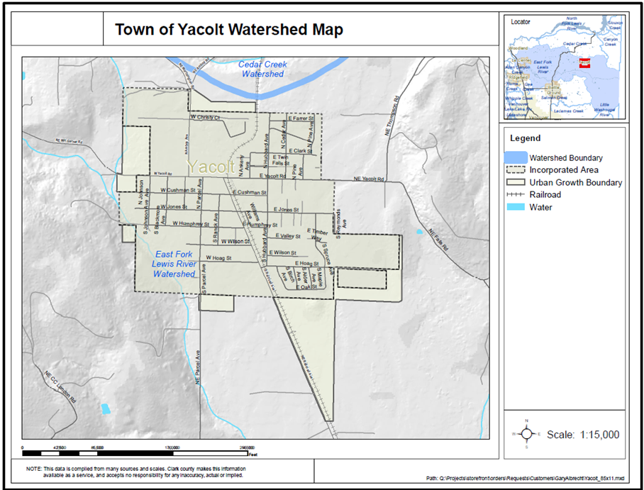
d. Protection/Maintenance (Preservation). Removing a threat to, or preventing the decline of, wetland conditions by an action in or near a wetland. This includes the purchase of land or easements, repairing water control structures or fences, or structural protection such as repairing a barrier island. This term also includes activities commonly associated with the term “preservation.” Preservation does not result in a gain of wetland acres, may result in a gain in functions, and will be used only in exceptional circumstances.
e. Wetland Mitigation Ratios.
i. Standard Wetland Mitigation Ratios. The following mitigation ratios for each of the mitigation types described in Table 16.45.030-4 apply:
|
Category and Type of Wetland Impacts |
Reestablishment or Creation |
Rehabilitation Only |
Reestablishment or Creation (R/C) plus Rehabilitation (RH) |
Reestablishment or Creation (R/C) plus Enhancement (E) |
Enhancement Only |
|---|---|---|---|---|---|
|
All Category IV |
1.5:1 |
3:1 |
1:1 R/C and 1:1 RH |
1:1 R/C and 2:1 E |
6:1 |
|
All Category III |
2:1 |
4:1 |
1:1 R/C and 2:1 RH |
1:1 R/C and 4:1 E |
8:1 |
|
Category II Estuarine |
Case-by-case |
4:1 Rehabilitation of an estuarine wetland |
Case-by-case |
Case-by-case |
Case-by-case |
|
All Other Category II |
3:1 |
6:1 |
1:1 R/C and 4:1 RH |
1:1 R/C and 8:1 E |
12:1 |
|
Category I Forested |
6:1 |
12:1 |
1:1 R/C and 10:1 RH |
1:1 R/C and 20:1 E |
24:1 |
|
Category I Based on score for functions |
4:1 |
8:1 |
1:1 R/C and 6:1 RH |
1:1 R/C and 12:1 E |
16:1 |
|
Category I Natural heritage site |
Not considered possible |
6:1 Rehabilitation of a natural heritage site |
R/C Not considered possible |
R/C Not considered possible |
Case-by-case |
|
Category I Bog |
Not considered possible |
6:1 Rehabilitation of a bog |
R/C Not considered possible |
R/C Not considered possible |
Case-by-case |
|
Category I Estuarine |
Case-by-case |
6:1 Rehabilitation of an estuarine wetland |
Case-by-case |
Case-by-case |
Case-by-case |
ii. The responsible official has the authority to reduce wetland mitigation ratios under the following circumstances:
(A) Documentation by a qualified wetland specialist demonstrates that the proposed mitigation actions have a very high likelihood of success based on prior experience;
(B) Documentation by a qualified wetland specialist demonstrates that the proposed actions for compensation will provide functions and values that are significantly greater than the wetland being affected;
(C) The proposed actions for compensation are conducted in advance of the impact and are shown to be successful;
(D) In wetlands where several HGM classifications are found within one delineated wetland boundary, the areas of the wetlands within each HGM classification can be scored and rated separately and the mitigation ratios adjusted accordingly, if all the following apply:
(1) The wetland does not meet any of the criteria for wetlands with “special characteristics,” as defined in the rating system;
(2) The rating and score for the entire wetland is provided as well as the scores and ratings for each area with a different HGM classification;
(3) Impacts to the wetland are all within an area that has a different HGM classification from the one used to establish the initial category; and
(4) The proponents provide adequate hydrologic and geomorphic data to establish that the boundary between HGM classifications lies at least 50 feet outside of the footprint of the impacts.
4. Wetland Buffers Required for Mitigation. Wetland mitigation shall be protected by a buffer that is wide enough to protect the most sensitive function, according to Tables 16.45.030-1 and 2:
a. Reductions to the required buffers may be applied in accordance with subsection F of this section;
b. All wetland buffers shall be included within the mitigation site and subject to the conservation covenant required under subsection (H)(3) of this section.
H. Standard Requirements. Any action granting or approving a development permit application shall be conditioned on the following:
1. Marking Buffer during Construction. The location of the outer extent of the wetland buffer shall be marked in the field and such markings shall be maintained throughout the duration of the permit;
2. Permanent Marking of Buffer Area. A permanent physical demarcation along the upland boundary of the wetland buffer area shall be installed and thereafter maintained. Such demarcation may consist of logs, a tree or hedge row, fencing, or other prominent physical marking approved by the responsible official. In addition, small signs shall be posted at an interval of one per lot or every 100 feet, whichever is less, and perpetually maintained at locations along the outer perimeter of the wetland buffer approved by the responsible official worded substantially as follows:
Wetland and Buffer –
Please retain in a natural state
3. A conservation covenant shall be recorded in a form approved by the town attorney as adequate to incorporate the other restrictions of this section and to give notice of the requirement to obtain a wetland permit prior to engaging in regulated activities within a wetland or its buffer; and
4. In the cases of plats, short plats, and recorded site plans, include on the face of such instrument the boundary of the wetland and its buffer and a reference to the separately recorded conservation covenant provided for in subsection (H)(3) of this section.
I. Standard Requirements – Waivers. The responsible official shall waive the requirements of subsections D, E and H of this section in certain cases described below if the applicant designates development envelopes which are clearly outside of any wetland or buffer. The responsible official may require partial wetland delineation to the extent necessary to ensure eligibility for this waiver:
1. Residential building permits and home businesses;
2. Land divisions:
a. Development envelopes shall be required for a fully complete preliminary application;
b. Development envelopes shall be shown on the final plat; and
c. A note referencing the development envelopes shall be placed on the final plat.
3. Site plan reviews where the responsible official determines that all development is clearly separated from the wetlands and wetland buffers:
a. Development envelopes shall be required for a fully complete preliminary application;
b. Development envelopes shall be shown on the final site plan; and
c. A note referencing the development envelopes shall be placed on the final site plan.
J. Mitigation Plans.
1. General. Mitigation plans are required for activities in a buffer or wetland. Content requirements which are inappropriate and inapplicable to a project may be waived by the responsible official upon request of the applicant.
2. Preliminary Mitigation Plan. The purpose of the preliminary plan is to determine the feasibility of the project before extensive resources are devoted to the project. The responsible official may waive the requirement for a preliminary mitigation plan when a wetland permit is not associated with a development permit application listed in YMC 16.45.010(B). The preliminary mitigation plan consists of two parts: baseline information for the site and a conceptual plan. If off-site wetland mitigation is proposed, baseline information for both the project site and mitigation site is required.
a. Baseline information shall include:
i. Wetland delineation report as described in subsection (D)(2) of this section;
ii. Copies of relevant wetland jurisdiction determination letters, if available, such as determinations of prior converted crop lands, correspondence from state and federal agencies regarding prior wetland delineations, etc.;
iii. Description and maps of vegetative conditions at the site;
iv. Description and maps of hydrological conditions at the site;
v. Description of soil conditions at the site based on a preliminary on-site analysis;
vi. A topographic map of the site; and
vii. A functional assessment of the existing wetland and buffer.
(A) Application of the rating system in YMC 16.45.020(B) will generally be considered sufficient for functional assessment.
(B) The responsible official may accept or request an alternate functional assessment methodology when the applicant’s proposal requires detailed consideration of specific wetland functions.
(C) Alternate functional assessment methodologies used shall be scientifically valid and reliable.
b. The contents of the conceptual mitigation plan shall include:
i. Goals and objectives of the proposed project;
ii. A wetland buffer width reduction plan, if width reductions are proposed, that includes:
(A) The land use intensity, per Table 16.45.030-3, of the various elements of the development adjacent to the wetlands;
(B) The wetland buffer width(s) required by Tables 16.45.030-1 and 16.45.030-2;
(C) The proposed buffer width reductions, including documentation that proposed buffer width reductions fully protect the functions of the wetland in compliance with subsection F of this section;
iii. A wetland mitigation plan that includes:
(A) A sequencing analysis for all wetland impacts;
(B) A description of all wetland impacts that require mitigation under this chapter; and
(C) Proposed mitigation measures and mitigation ratios;
iv. Map showing proposed wetland and buffer. This map should include the existing and proposed buffers and all proposed wetland impacts regulated under this chapter;
v. Site plan;
vi. Discussion and map of plant material to be planted and planting densities;
vii. Preliminary drainage plan identifying location of proposed drainage facilities including detention structures and water quality features (e.g., swales);
viii. Discussion of water sources for all wetlands on the site;
ix. Project schedule;
x. Discussion of how the completed project will be managed and monitored; and
xi. A discussion of contingency plans in case the project does not meet the goals initially set for the project.
3. Final Mitigation Plan. The contents of the final mitigation plan shall include:
a. The approved preliminary mitigation plan and all conditions imposed on that plan. If the preliminary mitigation plan requirement is waived, the final plan shall include the content normally required for the preliminary plan listed in subsections (J)(2)(a), (J)(2)(b)(i) and (J)(2)(b)(ii) of this section.
b. Performance Standards. Specific criteria shall be provided for evaluating whether or not the goals and objectives of the mitigation project are being met. Such criteria may include water quality standards, survival rates of planted vegetation, species abundance and diversity targets, habitat diversity indices, or other ecological, geological or hydrological criteria.
c. Detailed Construction Plans. Written specifications for the mitigation project shall be provided. The specifications shall include: the proposed construction sequence, grading and excavation details, water and nutrient requirements for planting, specification of substrate stockpiling techniques, and planting instructions, as appropriate. These written specifications shall be accompanied by detailed site diagrams, scaled cross-sectional drawings, topographic maps showing slope percentage and final grade elevations, and any other drawings appropriate to show construction techniques or anticipated final outcome.
d. Monitoring Program. The mitigation plan shall include a description of a detailed program for monitoring the success of the mitigation project.
i. The mitigation project shall be monitored for a period necessary to establish that the mitigation is successful, but not for a period of less than five years. Creation and forested wetland mitigation projects shall be monitored for a period of at least 10 years;
ii. Monitoring shall be designed to measure the performance standards outlined in the mitigation plan and may include but not be limited to:
(A) Establishing vegetation plots to track changes in plant species composition and density over time;
(B) Using photo stations to evaluate vegetation community response;
(C) Sampling surface and subsurface waters to determine pollutant loading, and changes from the natural variability of background conditions, (pH, nutrients, heavy metals);
(D) Measuring base flow rates and stormwater runoff to model and evaluate water quality predictions, if appropriate;
(E) Measuring sedimentation rates, if applicable; and
(F) Sampling fish and wildlife populations to determine habitat utilization, species abundance and diversity;
iii. A monitoring protocol shall be included outlining how the monitoring data will be evaluated by agencies that are tracking the progress of the project;
iv. Monitoring reports shall be submitted annually, or on a prearranged alternate schedule, for the duration of monitoring period; and
v. Monitoring reports shall analyze the results of monitoring, documenting milestones, successes, problems, and recommendations for corrective and/or contingency actions to ensure success of the mitigation project.
e. Associated Plans and Other Permits. To ensure consistency with the final mitigation plan, associated plans and permits shall be submitted, including, but not limited to:
i. Engineering construction plans;
ii. Final site plan or proposed plat;
iii. Final landscaping plan;
iv. An as-built plan for projects that require wetland creation or wetland construction;
v. Final drainage plan;
vi. Final erosion and sediment control plan;
vii. Habitat permit;
viii. WDFW HPA;
ix. USACE Section 404 permit; and
x. WDOE administrative order or Section 401 certification.
f. Evidence of Financial and Scientific Proficiency. A description of how the mitigation project will be managed during construction and the scientific capability of the designer to successfully implement the proposed project. In addition, a demonstration of the financial capability of the applicant to successfully complete the project and ensure it functions properly at the end of the specific monitoring period.
g. Contingency Plan. Identification of potential courses of action and any corrective measures to be taken when monitoring or evaluation indicates project performance standards are not being met. [Ord. 569 § 2 (Exh. A), 2018.]
16.45.040 Wetland permits.
A. General.
1. A wetland permit is required for any development activity that is not exempt pursuant to YMC 16.45.010(B)(4) and (B)(5) within wetlands and wetland buffers.
2. Standards for wetland permits are provided in YMC 16.45.030.
3. All wetland permits require approval of a preliminary and final mitigation plan in accordance with the provisions of YMC 16.45.030(J) unless the preliminary mitigation plan requirement is waived under the provisions of YMC 16.45.030(J)(1) or (J)(2).
4. Wetland permit application, processing, preliminary approval, and final approval procedures are set out in subsections C and D of this section.
5. Provisions for programmatic permits are provided by subsection E of this section.
6. Provisions for emergency wetland permits are provided by subsection F of this section.
B. Standards – General. Wetland permit applications shall be based upon a mitigation plan and shall satisfy the following general requirements:
1. The proposed activity shall not cause significant degradation of wetland functions; and
2. The proposed activity shall comply with the town of Yacolt’s stormwater management plan, Chapter 13.10 YMC.
C. Wetland Permit – Applications.
1. Applications for wetland permits shall be made to the town on forms furnished by the town. The town shall process a wetland permit application as a request for land use approval pursuant to existing land use review procedures.
2. Wetlands permit applications shall include:
a. Wetland delineations and required buffer width;
b. A site plan for the proposed activity overlaid on an aerial photograph at a scale no smaller than one inch equals 400 feet showing the location, width, depth, and length of all existing and proposed structures, roads, stormwater management facilities, sewage treatment, and installations within the wetland and its buffer;
c. The exact sites and specifications for all regulated activities including the amounts and methods; and
d. A proposed preliminary mitigation plan meeting the requirements of this chapter.
D. Wetland Permit – Approval.
1. The town shall issue final approval of the wetland permit authorizing commencement of the activity permitted thereby upon:
a. Submittal and approval of a final mitigation plan;
b. Installation and approval of the required field markings; and
c. The recording of a conservation covenant.
2. Conditions. An approval of a wetland permit shall incorporate the following conditions:
a. Posting of a cash performance bond or other security acceptable to the town in an amount and with surety and conditions sufficient to fulfill the initial (first year) requirements of the required final plan and mitigation plan, and to secure compliance with other conditions and limitations set forth in the permit.
i. The town shall release the performance bond upon determining that all initial (first year) activities, including any required compensatory mitigation, have been completed in accordance with the terms and conditions of the permit and the requirements of this chapter.
ii. Upon forfeiture of a performance bond, the proceeds thereof shall be utilized either to correct deficiencies which resulted in forfeiture or, if such correction is deemed by the town to be impractical or ineffective, to enhance other wetlands in the same watershed.
b. Posting of a cash maintenance bond or other security acceptable to the town in an amount and with surety and conditions sufficient to fulfill the requirements of the required final plan and mitigation plan and to secure compliance with other conditions and limitations set forth in the permit for the duration (beyond one year) of the required monitoring and maintenance time period.
i. The town shall release the maintenance bond at the end of the approved monitoring and maintenance time period upon determining that all activities, including any required compensatory mitigation, have been completed in accordance with the terms and conditions of the permit and the requirements of this chapter.
ii. Upon forfeiture of a performance or maintenance bond, the proceeds thereof shall be utilized either to correct deficiencies which resulted in forfeiture or, if such correction is deemed by the town to be impractical or ineffective, to enhance other wetlands in the same watershed.
3. Duration. Wetland permit final approval shall be valid for a period of two years from the date of issuance unless:
a. A longer period, not to exceed five years, is specified in the permit; or
b. The town grants an extension upon the written request of the original permit holder or successor in title demonstrating to the satisfaction of the town:
i. That the original intent of the permit would not be altered or enlarged by the extension;
ii. That relevant circumstances and standards have not changed substantially since the permit application; and
iii. That the applicant has complied with the terms of the permit.
4. Revocation. In addition to other remedies provided for elsewhere, the town may suspend or revoke a permit if the applicant or permittee has not complied with any of the conditions or limitations set forth in the permit, has exceeded the scope of work set forth in the permit, or has failed to undertake the project in the manner set forth in the permit.
E. Programmatic Permits for Routine Maintenance and Operations of Utilities and Public Facilities. The responsible official may issue programmatic wetland permits for routine maintenance and operations of utilities and public facilities within wetlands and wetland buffers, and for wetland enhancement programs. It is not the intent of the programmatic permit process to deny or unreasonably restrict a public agency or utility’s ability to provide services to the public. Programmatic permits only authorize activities specifically identified in and limited to the permit approval and conditions.
1. Application Submittal Requirements. Unless waived by the responsible official with specific findings in the approval document in accordance with YMC 16.45.030(J)(1) and (J)(2), applications for programmatic wetland permits shall include a programmatic permit plan that includes the following:
a. A discussion of the purpose and need for the permit;
b. A description of the scope of activities in wetlands and wetland buffers;
c. Identification of the geographical area to be covered by the permit;
d. The range of functions and values of wetlands potentially affected by the permit;
e. Specific measures and performance standards to be taken to avoid, minimize and mitigate impacts on wetland functions and values including:
i. Procedures for identification of wetlands and wetland buffers;
ii. Maintenance practices proposed to be used;
iii. Restoration measures;
iv. Mitigation measures and assurances;
v. Annual reporting to the responsible official that documents compliance with permit conditions and proposes any additional measures or adjustments to the approved programmatic permit plan;
vi. Reporting to the responsible official any specific wetland or wetland buffer degradations resulting from maintenance activities when the degradation occurs or within a timely manner;
vii. Responding to any public works department requests for information about specific work or projects;
viii. Procedures for reporting and/or addressing activities outside the scope of the approved permit; and
ix. Training all employees, contractors and individuals under the supervision of the applicant who are involved in permitted work.
2. Findings. A decision preliminarily approving or denying a programmatic wetland permit shall be supported by findings of fact relating to the standards and requirements of this chapter.
3. Approval Conditions. Approval of a programmatic wetland permit shall incorporate at least the following as conditions:
a. The approved programmatic permit plan;
b. Annual reporting requirements; and
c. A provision stating the duration of the permit.
4. Duration and Reauthorization.
a. The duration of a programmatic permit is for five years, unless:
i. An annual performance-based re-authorization program is approved within the permit; or
ii. A shorter duration is supported by findings.
b. Requests for reauthorization of a programmatic permit must be received prior to the expiration of the original permit.
i. Reauthorization is reviewed and approved through the process described in subsection (E)(1) of this section.
ii. Permit conditions and performance standards may be modified through the reauthorization process.
iii. The responsible official may temporarily extend the original permit if the review of the reauthorization request extends beyond the expiration date.
F. Emergency Wetland Permit.
1. Authorization. Notwithstanding the provisions of this chapter, the mayor or his or her designee may issue a temporary emergency wetland permit prospectively or, in the case of imminent threats to public health, safety, or welfare, retroactively, where the anticipated threat or loss may occur before a permit can be issued or modified under the procedures otherwise required by this division and other applicable laws.
2. Prior to issuing an emergency wetland permit, the mayor or his or her designee shall issue a finding that extraordinary circumstances exist and that the potential threat to public health, safety, or welfare from the emergency situation is clearly significant and substantial.
3. Conditions. Any emergency permit granted shall incorporate, to the greatest extent practicable and feasible but not inconsistent with the emergency situation, the standards and criteria required for nonemergency activities under this chapter and shall:
a. Be limited in duration to the time required to complete the authorized emergency activity, not to exceed 90 days; and
b. Require, within this 90-day period, the restoration of any wetland altered as a result of the emergency activity, except that if more than 90 days from the issuance of the emergency permit is required to complete restoration, the emergency permit may be extended to complete the restoration. If the restoration takes more than one year to complete, or if it is a forested system, then mitigation for temporal loss may be required.
4. Notice. Notice of issuance of an emergency permit shall be published in a newspaper having general circulation in the town of Yacolt not later than 21 days after issuance of such permit.
5. Termination. The emergency permit may be terminated at any time without process upon a determination by the town that the action is no longer necessary to protect human health or the environment. [Ord. 569 § 2 (Exh. A), 2018.]