


Division 10-30.60:
Site Planning Design Standards
Sections:
10-30.60.010 Purpose
10-30.60.020 Applicability
10-30.60.030 General Site Planning Standards
10-30.60.040 Natural Features and Site Drainage
10-30.60.050 Compatibility
10-30.60.060 Building Placement
10-30.60.070 Parking Lots, Driveways and Service Areas
10-30.60.080 Pedestrian and Bicycle Circulation Systems
10-30.60.090 Common Spaces and Civic Spaces
10-30.60.100 Private Streets
10-30.60.010 Purpose
The purpose of this division is to provide standards for development that reinforce the character of the neighborhoods, districts and corridors of the City. It is important that development within the City take into account several factors that are unique to the region, in addition to other required site design standards that promote more livable, sustainable communities.
10-30.60.020 Applicability
A. The standards found within this division are applicable to:
1. All development within the City, except as listed in subsection (D) of this section; and
2. Projects involving Zoning Map amendments, annexations, conditional use permits, and site plan reviews.
B. Unless stated otherwise, these standards shall apply to all zones.
C. The standards found in this division work in conjunction with the standards found in Chapter 10-40, Specific to Zones, and Chapter 10-50, Supplemental to Zones.
D. Exemptions. The standards found within this division shall not apply to:
1. Industrial uses not located in the Research and Development zone;
2. Any change of use of a building or property that does not affect site design or layout;
3. Residential Developments with less than five Dwelling Units. However, the standards shall apply to residential subdivisions.
(Ord. 2025-26, Amended, 12/2/2025 (Res. 2025-61); Ord. 2016-07, Amended, 2/16/2016 (Res. 2016-02))
10-30.60.030 General Site Planning Standards
Project siting has the greatest impact on how effectively sustainable development principles can be addressed. Careful planning, design, and construction enables new development to take advantage of Flagstaff’s climate to reduce energy usage and costs, thereby providing long term economic sustainability as energy prices fluctuate. On the other hand, poor project siting and design can detrimentally impact the potential to harvest solar energy, create a less automobile dependent environment, and address economic and agricultural sustainability. The optimal layout of any project site requires an in-depth understanding of local context and completion of a detailed site analysis plan.
A site analysis plan is particularly important in Flagstaff, where widely varying terrain, scenic views, natural watercourses, preservation of existing vegetation, and relationships to existing development, especially residential development, must be considered in site planning. All development proposals shall to the maximum extent feasible demonstrate a diligent effort to retain significant existing natural features characteristic of the site and surrounding area. Therefore, a completed site analysis plan must be included with an application for new development submitted to the Director. All new development proposals will be reviewed with respect to their response to the physical characteristics of the site and the contextual influences of the surrounding area. These should be considered early and throughout design development. Special attention should be given to maintaining the Urban Growth Boundary and proximity to sensitive areas as defined in the General Plan, such as Walnut Canyon or Picture Canyon.
The following items as illustrated below are essential components of a site analysis plan for a potential development site:
Figure 10-30.60.030A. Components of a Site Analysis Plan.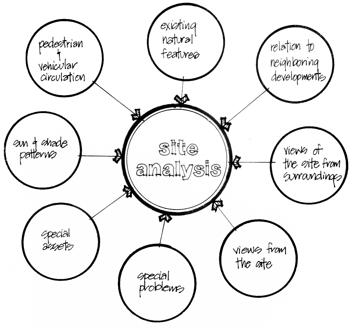
A. Topography of the Site. The slope of a parcel affects the cost and complexity of construction and should be understood in order to minimize site disturbance associated with site grading.
1. A plan indicating areas of slope shall be provided in accordance with the standards established in Section 10-50.90.050, Steep Slopes:
a. 0 to 16.99 percent;
b. 17 to 24.99 percent;
c. 25 to 34.99 percent; and
d. 35 percent and steeper.
2. On lots with slopes 17 percent or greater, building foundation shall step to follow the slope of the site to the maximum extent feasible.
B. Solar Orientation or Aspect.
Figure 10-30.60.030B. Diagram Showing Areas with High Potential for Using Solar Power and Solar Water Heating Based on Orientation of Slopes.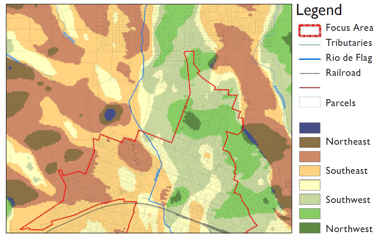
1. Flagstaff has an annual average of 288 days in which there is good solar energy potential. The abundant number of days with good solar energy potential provides the opportunity to power, heat, and light buildings from a renewable energy source. Development in Flagstaff shall consider the following:
a. The ability of development to take advantage of the sun’s energy to:
(1) Passively heat buildings;
(2) Provide natural light;
(3) Harvest solar power; and
(4) Heat water.
b. Development on lots and slopes that have good solar energy potential should consider both solar power and solar water heating as alternative energy solutions.
2. The use of solar collectors for the purpose of providing energy for heating or cooling is permitted in all zones, whether as part of a principal structure or as an accessory structure.
3. The forest resources required to be protected within a new development site (see Division 10-50.90, Resource Protection Standards) that are located on the south or west side of any proposed building may be removed to ensure that the buildings, as well as any associated solar collectors, maximize their solar access potential, provided:
a. It can be demonstrated to the satisfaction of the Director that such tree removal is essential to the solar efficiency of the building(s) and any associated solar collectors; and
b. There are additional forest resources on the site to compensate for the forest resources removed. If there are insufficient forest resources on the site to allow for such tree removal, an additional deciduous tree (minimum 2.5-inch caliper) may be planted on the south or west side of the building for each existing ponderosa pine tree removed.
4. Within a multi-building development approved after the effective date, new buildings or additions to buildings shall be situated and designed to ensure that, where feasible, the solar energy potential of other buildings within the development is not impeded or compromised.
C. Existing or Native Vegetation Types and Relative Quality.
1. Maintaining existing natural vegetation that is in good health can assist a development in fitting into the environment and context, and enhance property values.
2. Planting native vegetation supports the local ecology and reduces the demand for water. Benefits of using native vegetation include:
a. Native vegetation takes full advantage of rainfall with no additional water needed after plants have acclimatized to the site;
b. Generally require less maintenance and no fertilizers; and
c. Increase the habitat for native flora and fauna.
3. See Division 10-50.60, Landscaping Standards, for more standards.
D. View Corridors. An analysis of the site to determine view corridors to and from the proposed development will allow for good views to be preserved, framed, and/or incorporated into the design. Development can be oriented away from or screened from less desirable views. To the maximum extent feasible views across or through other parcels shall be maintained.
E. Climatic Considerations.
1. The prevailing wind patterns should be understood in order for a proposed development to take advantage of or screen buildings from the prevailing wind.
a. Applicants can take advantage of prevailing wind to naturally ventilate buildings.
b. Building orientation and the placement of trees and landscaping can be designed to screen portions of the site from strong prevailing winds.
2. Precipitation patterns and frequency should be understood in order to properly design development to accommodate snow loads and periods of low precipitation. Roofs with pitches of a six-inch rise over 12-inch run or higher are appropriate for Flagstaff’s snow loads. See incentives for using higher pitched roofs found in Division 10-50.30, Building Height Standards.
F. Subsurface Conditions. Soil and foundation conditions are one of the most important considerations in evaluating a site. An understanding of the soil and geology can help inform decisions on appropriate foundation types, stormwater management solutions and landscaping options.
G. Drainage Swales and Stream Corridors.
1. Drainage swales and stream corridors should be identified and located to ensure that disturbance to these areas is minimized.
2. Water runoff from proposed development should be accounted for and should be detained on-site to improve water quality and reduce the risk of flooding down stream. See the City of Flagstaff Stormwater Management Design Manual and City of Flagstaff LID Manual for standards.
H. Built Environment and Land Use Context.
1. The context of the site should be taken into account in the design of the new development. Key contextual influences that should be identified, analyzed, and considered in the planning process include:
a. Land use and site organization in relation to building form, character and scale of existing and proposed development;
b. Sensitivity and nature of adjoining land uses in order to avoid unreasonable noise, odors, or traffic impacts;
c. Location of property boundaries and setbacks;
d. Location of adjacent roads, driveways, off-street vehicular connections, pedestrian ways, access points, bicycle facilities, and easements;
e. Locations of existing or proposed transit facilities;
f. Existing structures and other built improvements;
g. Prehistoric and historic sites, structures, and routes; and
h. Other features of the site and/or surrounding area that may be impacted by or may impact the proposed development.
2. Developments shall adhere to the standards in Section 10-30.60.090, Common Spaces and Civic Spaces, and Section 10-30.60.080, Pedestrian and Bicycle Circulation Systems.
(Ord. 2023-29, Amended, 12/5/2023 (Res. 2023-58); Ord. 2016-07, Amended, 2/16/2016 (Res. 2016-02))
10-30.60.040 Natural Features and Site Drainage
The standards that follow are intended to ensure that site work is planned to protect the natural features of a development site and to ensure that natural features are incorporated as an amenity into the overall site plan.
A. Applicable to All Zones.
1. Topography.
a. The extent and visual impacts of cut and fill on a site shall be minimized, and large grade changes must be divided into a series of benches and terraces, where feasible.
b. Roads and driveways shall follow existing contours, where feasible.
c. Building foundations shall be stepped so that finish floor elevations mimic natural grade. If stepping the finish floor is not feasible, cut slopes must be disguised with appropriate placement of the building and/or the placement of screen walls and landscape buffers.
d. Retaining walls shall blend with the natural features of the site and shall be constructed with native rock or masonry that conveys a scale, color, and texture similar to that of traditional rock walls, such as split-face block or scored and textured concrete.
e. The height of exposed retaining walls and retaining walls visible from the public right-of-way shall be limited to no more than five feet where feasible. Where greater heights are needed to retain cut or fill conditions, a series of terraced or stepped walls shall be used or a building shall be placed to screen the cut slope so it is not visible from public rights-of-way.
f. The width of a retaining wall terrace must be no less than three feet.
Figure 10-30.60.040A
Minimize the Extent of the Cut and Fill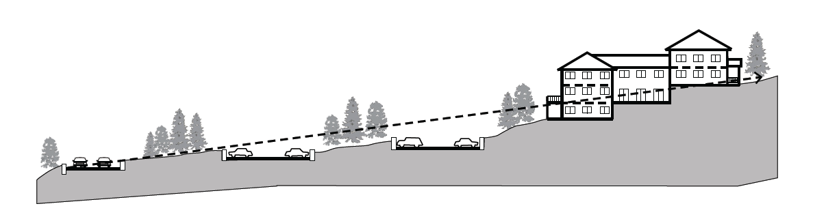
Figure 10-30.60.040B
Building Designed with Stepped Foundations to Match Natural Grade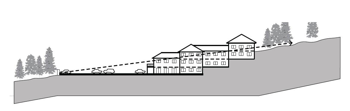
Figure 10-30.60.040C
Step Buildings to Mimic Natural Grade.
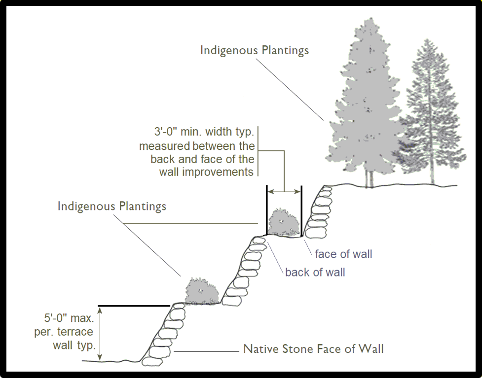
Figure 10-30.60.040.D.
Retaining Walls.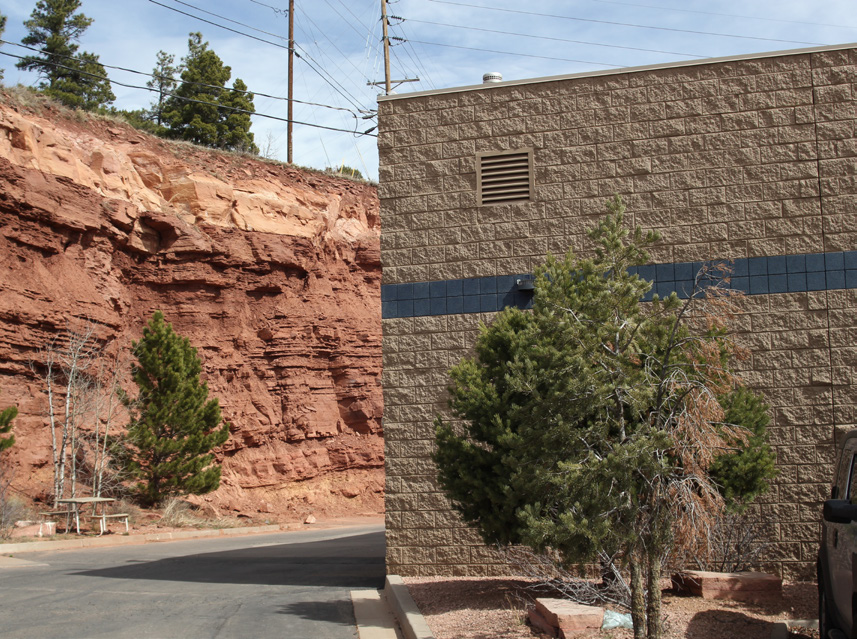
Figure 10-30.60.040.E.
A Building Can Screen a Tall Cut Slope
2. Site Drainage. The City of Flagstaff Stormwater Management Design Manual and City of Flagstaff LID Manual provide standards for the protection of natural drainage systems as well as standards for stormwater runoff and the design of detention and retention facilities.
(Ord. 2019-32, Amended, 11/5/2019 (Res. 2019-49); Ord. 2016-07, Added, 2/16/2016 (Res. 2016-02))
10-30.60.050 Compatibility
Compatibility is important to ensure that the characteristics of different uses, activities or designs allow them to be located near or adjacent to each other in a harmonious manner. Compatibility does not mean “the same as.” Rather, it refers to how well a new development is sensitive to the character of existing development. The following basic design elements shall be considered when assessing the compatibility of a new development project which is subject to approval of a conditional use permit or for which a Zoning Map amendment is requested relative to adjacent existing development:
A. Patterns of Development. Patterns of development include characteristics such as the streetscape, site relationships, signage, and landscape features.
1. Streetscape. The streetscape of a property includes the nature and character of the street, alleys, crossings, sidewalks, walls, fences, bicycle racks, street furniture, light fixtures, landscaping, signage, and other features. Neighborhoods often have similar and consistent streetscapes.
2. Site Relationships. This refers to the similarity of arrangement of structures relative to the street, each other, and adjacent properties, including similar setbacks, distances between buildings, lot coverage, common space or yards, parking and vehicle access patterns, and pedestrian access patterns.
3. Signage. The quantity and appearance of all signs, including size, position, attachment, and the materials, textures, and colors used, shall be in keeping with the collective characteristics of the context area.
4. Landscaping Features. Plantings and ornamental features shall continue that of the context and should not obscure or cover significant architectural details or features. The extent of landscaping shall be consistent with that of the context area.
B. Scale. Scale refers to similar or harmonious proportions, especially overall height and width, but also includes the visual intensity of the development, the building massing, and the shapes and sizes of the various design elements, such as the windows and doors.
1. Height. Respecting the overall existing height of a resource is critical to prevent new work from dominating existing work.
2. Proportions. Traditional structures commonly have established proportions for various parts of the structure and for the arrangement of the parts. The specific proportions can vary depending on specific architectural solutions, but the existing proportions shall be observed.
3. Building Massing. Massing refers to the volumes and sub-volumes that make up the entire structure. Larger structures can typically be made more compatible with smaller structures by carefully breaking up the building massing into smaller sub-volumes, creating the appearance of a grouping of small structures.
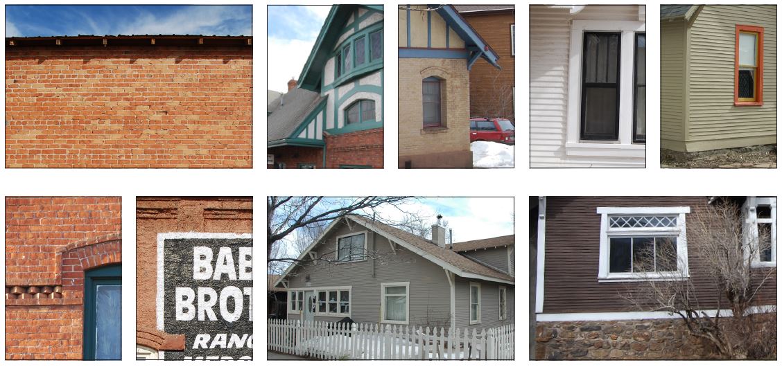
C. Continuity. Continuity encompasses patterns of development and scale, but also characteristics such as site development, building forms, textures, materials, details, and colors.
1. Site Development. The development of sites includes paving, pedestrian access, walls, fences, light fixtures, common space or yards, landscaping, signage, and other elements. Similarity or cohesiveness in basic design elements for buildings and structures is required for compatible site design.
2. Building Forms. Building forms, including roof forms, commonly have some variation. New development shall be in harmony with or use the predominant forms of the context area.
3. Texture. Texture refers to the surface quality of structures, especially the shadow patterns. Shadows are traditionally created by the surface materials themselves having some dimension, but also by adding architectural details such as trims and ornaments and recessing of windows and doors. Traditional structures commonly have changes in the surface materials to create shadow patterns, commonly with rougher textures placed lower on the structure.
4. Materials. Materials make up and cover the surface of a structure and include the various structural and architectural details, trims, and ornaments, as well as foundations, walls, decking, and roofing. New development shall use or be in harmony with the predominant materials of the context area.
5. Details. Structural and architectural details shall be designed so as to make new work appear similar to existing work. Modern details, often needed by modern building codes, should be obscured or designed to minimize visual obtrusiveness.
6. Colors. Color choice provides one of the best opportunities to enhance cohesiveness. Color schemes shall be developed in accordance with the specific architecture and the context area. In general, restraint should be used in the number of colors. Body colors should be subtle, and trim colors should provide contrast or definition to the body color. Natural materials, such as masonry and wood shingles, should not be painted.
(Ord. 2023-29, Amended, 12/5/2023 (Res. 2023-58); Ord. 2016-07, Amended, 2/16/2016 (Res. 2016-02). Formerly 10-30.60.080)
Architectural Character

Texture and Materials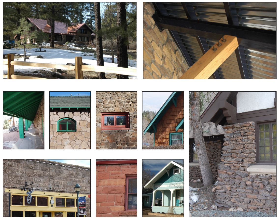
10-30.60.060 Building Placement
Building placement on a development site is important because it establishes the form and pattern for the development along a street, which in turn affects the human scale of a site layout, its economic vitality, and how well the site functions with the connections between buildings, parking areas, and adjacent development.
A. Building-forward design solutions that ensure the building front is located at or near the sidewalk edge are required. Display windows and other architectural features that provide interest to pedestrians shall also be incorporated into the design. See also Section 10-50.20.030, Architectural Standards, with specific reference to the location and orientation of building entrances and windows subsections.
Figure 10-30.60.060A
A Good Example of a Building Placed Close to a Public Street with Strong Pedestrian Connections Between the Sidewalk and Building Entrances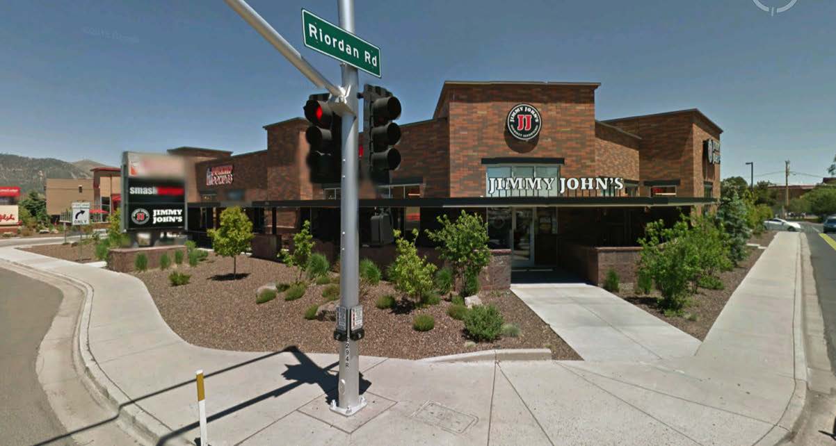
Figure 10-30.60.060B
A Building “Near” the Sidewalk with Strong Pedestrian Connectivity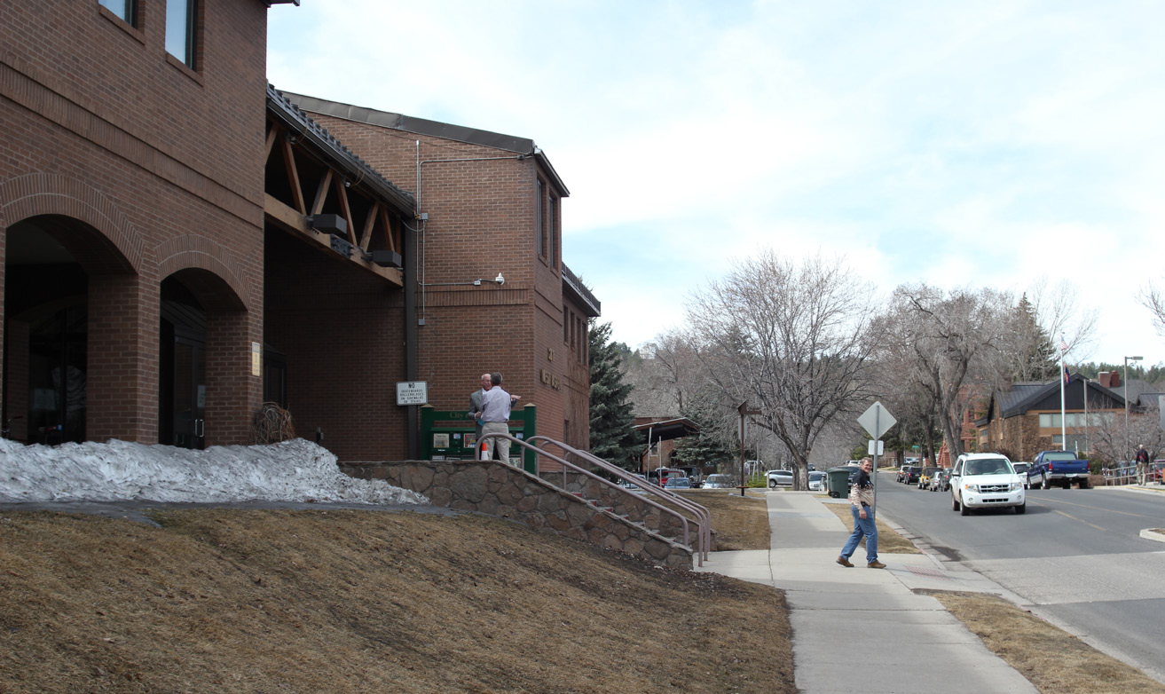
B. When buildings are located at or near a sidewalk edge, the following standards apply to allow flexibility with site layout:
1. Required building foundation landscaping (see Section 10-50.60.050, Landscaping Standards) is not required along a street frontage and only peripheral buffer landscaping is required; and
2. Forest resource protection standards (see Section 10-50.90.060, Forest) may be reduced by five percent.
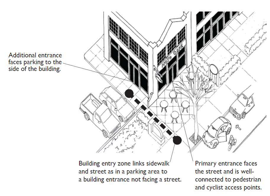
C. The primary entrance to a building shall be located to face a street or be connected to a street through the design of a building entry zone. The primary entrance to a building may also face a plaza or pedestrian way. When it is not possible to locate the primary entrance to face the street, plaza, or pedestrian way, a secondary entrance should be designed to connect to these public spaces.
|
Figure 10-30.60.060C Locate the Primary Building Entrance to Face the Street or the Building Entry Zone |
Figure 10-30.60.060D A Building Entry Zone Connecting a Parking Area to the Building Entry |
D. If it is not feasible to locate a building at the sidewalk edge (e.g., to accommodate a drive-through lane), a screen wall designed to match the building materials of the primary building on the site or similar landscape feature is required. If the prevailing building placement of a block is characterized by building forward design, then the provisions of this subsection shall not apply.
(Ord. 2023-29, Amended, 12/5/2023 (Res. 2023-58); Ord. 2016-07, Added, 2/16/2016 (Res. 2016-02))
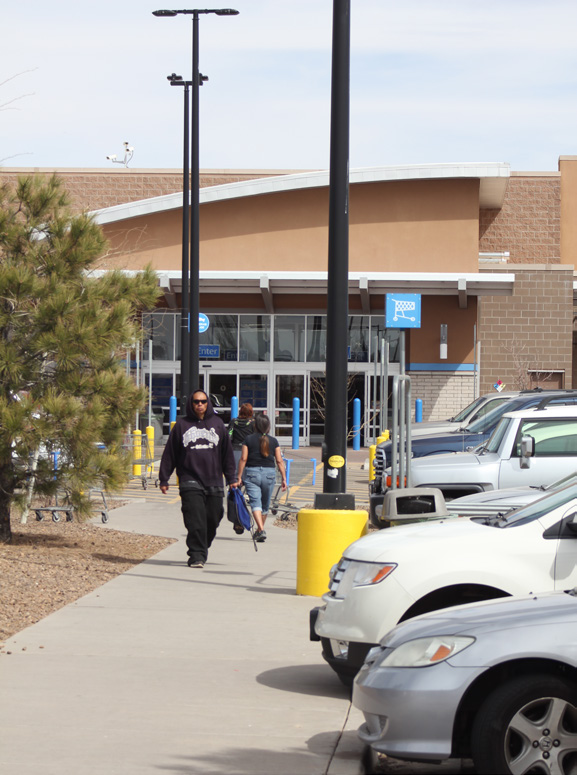
10-30.60.070 Parking Lots, Driveways and Service Areas
A. Applicable to All Zones.
1. Parking lots shall meet the standards established in Section 10-50.70.080, Parking Spaces, Lot Design and Layout.
2. Parking lots shall be designed to the maximum extent feasible to connect parking lots on adjacent lots.
a. Avoid parallel road conditions, in which two abutting properties have separate service roads.
b. Provide cross-property easements to share driveways and reduce the need for additional curb cuts to the maximum extent feasible.
3. To the maximum extent feasible, parking lots on a primary frontage shall be completely located to the side or behind a building rather than in front to reduce the visual impact of the parking lot.
4. Parking areas shall be screened from view of public ways with landscaping (i.e., berm, low decorative wall, evergreen hedge).
5. Parking areas over one acre shall be divided into smaller lots with planted buffers between them to minimize the perceived scale of the parking lot.
6. Drive-through aisles and stacking areas shall meet the design standards established in Section 10-40.60.160, Drive-through Retail or Service Facility.
7. Developments shall minimize the number of curb cuts onto a public street along a property edge by sharing driveways with an adjacent property to the maximum extent feasible.
8. Direct vehicular access via roads or driveways shall connect overall site circulation patterns with adjacent parcels.
9. Driveways that connect to parking areas or service areas shall not be located between the front of a building and the property line adjacent to the public right-of-way.
10. Service entrances, waste disposal areas, and other similar uses shall be oriented toward service lanes and away from major streets.
11. Service entrances and utility service boxes (e.g., electric, gas, cable, telephone) shall be screened with walls or plantings.
12. Service areas shall be positioned to minimize conflicts with other adjacent uses.
13. Visual impacts of a service area canopy shall be minimized.
B. Applicable to Non-Transect Zones. The following standards are additional standards that apply in non-transect zones.
1. In developments larger than 20,000 square feet or more than 50 units, driveways and entry roads shall use distinctive landscape elements to clearly define gateways.
2. Developments shall minimize the width of internal roadways to the maximum extent feasible. Where a range of street widths are available and appropriate, the narrowest street section shall be selected.
3. Developments shall provide a continuous internal circulation system within a property that enhances connections to external circulation systems.
(Ord. 2016-07, Amended, 2/16/2016 (Res. 2016-02). Formerly 10-30.60.050)
10-30.60.080 Pedestrian and Bicycle Circulation Systems
The standards that follow are intended to encourage walking, biking and other non-motorized forms of transportation in a safe and convenient environment to, from, and within a site or subdivision.
A. Applicable to All Zones.
1. On-Site Connections. A convenient well-connected network of on-site pedestrian and bicycle circulation systems creates a more inviting pedestrian environment and encourages using alternatives to the automobile within a development.
a. On developments larger than 20,000 square feet or more than 50 units, pedestrian and bicycle ways shall be designed to be visible from and link to the various functions and spaces in a coordinated system.
b. On developments smaller than or equal to 20,000 square feet or 50 units, pedestrian and bicycle ways shall be designed to be visible from and link to the various functions and spaces in a coordinated system to the maximum extent feasible.
c. Functions to be linked include, but are not limited to:
(1) Building entrances;
(2) Transit stops; and/or
(3) Outdoor plazas, courtyards, and common space.
2. Off-Site Connections. A network of off-site circulation connections encourages using alternatives to the automobile to and from a development.
a. Pedestrian and bicycle ways shall be designed to:
(1) Provide a direct connection to adjoining public sidewalks;
(2) Provide an internal walkway that will link to those of adjacent properties;
(3) Provide connections to the Flagstaff Regional and Urban Trails Systems and other regional trails when they abut a property or are within 100 feet; and
(4) Provide connections to transit stops, where applicable.
b. Where appropriate, equestrian connections shall be designed and provided to National Forest lands and other open space areas.
3. Design. The design of pedestrian and bicycle circulation systems shall follow the standards established below.
a. A Flagstaff Urban Trail System (FUTS) trail may be substituted for a sidewalk or pedestrian way in cases where the Director determines the function is interchangeable and equally accessible.
b. Within a parking lot greater than 8,000 square feet, pedestrian ways shall provide a clear, continuous, pedestrian route with landscaping, fences, and pedestrian-scaled lighting to building entrances.
c. Bicycle racks shall be provided in accordance to Section 10-50.80.050, Bicycle Parking.
d. Pedestrian and bicycle ways shall use materials that provide traction and facilitate general maintenance and snow removal.
B. Applicable to Non-Transect Zones. The following standards are additional standards that apply in non-transect zones.
1. In developments larger than 20,000 square feet or more than 50 units, pedestrian and bicycle ways shall use distinctive landscape elements to clearly define gateways.
2. Pedestrian and bicycle ways shall be designed using decorative paving, such as colored concrete, stamped concrete, signs and landscaping to identify the crossing point.
3. On sidewalks narrower than eight feet, street-side sidewalks shall be separated from the street with a minimum five-foot-wide parkway strip.
4. On sidewalks wider than eight feet where no parkway strip is provided, tree wells with a minimum four-foot by four-foot dimension shall be provided.
C. Applicable to Transect Zones. The following standards are additional standards that apply in transect zones.
1. Pedestrian and bicycle ways shall be designed using decorative paving, such as colored concrete, stamped concrete, striping and/or signs to identify the crossing point.
2. Public sidewalks shall conform to the standards set forth in Chapter 10-60, Specific to Thoroughfares.
(Ord. 2023-29, Amended, 12/5/2023 (Res. 2023-58); Ord. 2016-07, Amended, 2/16/2016 (Res. 2016-02). Formerly 10-30.60.040)
10-30.60.090 Common Spaces and Civic Spaces
A. Applicable to All Zones.
1. Location. Common spaces and civic spaces shall be located to:
a. Be shared by adjoining buildings, to the maximum extent feasible;
b. Visually or physically connect with common space on adjacent properties;
c. Connect the entrances of multiple buildings on a site;
d. Integrate and preserve natural features to the maximum extent feasible;
e. Orient to views of activities, architectural landmarks, or natural features to provide visual interest;
f. Enhance existing vegetation and landscaping, particularly mature ponderosas;
g. Preserve and/or enhance major drainage ways; and
h. Include site and regional stormwater detention facilities, when such facilities are designed as an integral component and amenity.
2. Design. In order to create user-friendly spaces and to encourage use by the public, common spaces and civic spaces shall incorporate all of the following features to the maximum extent feasible:
a. Plan site drainage to lead runoff away from active use areas;
b. Orient common space to face south and west for solar access to extend its use throughout the year;
c. Create a sense of enclosure for outdoor seating areas with landscaping, topography, and/or buildings and structures;
d. Create a consistent palette of streetscape furnishings, such as benches, landscaping, shelter, and trash receptacles;
e. Locate streetscape furnishings in clusters or nodes;
f. Incorporate low impact development (LID) standards in areas that are conducive to LID; and
g. Minimize grading and land disturbances.
B. Applicable to Non-Transect Zones. The following standards are additional standards that apply in non-transect zones:
1. Civic or Public Space Requirement. Nonresidential developments larger than 20,000 square feet in gross floor area shall provide a minimum of five percent of the development site area as an outdoor pedestrian amenity space that serves as an enhancement to the entrance(s) to a building. This outdoor pedestrian amenity space may include a landscape oasis area as defined in Section 10-50.60.050.C., Oasis Allowance, structures providing protection from the weather, benches, tables, or other pedestrian-friendly features.
C. Applicable to Transect Zones. The following standards are additional standards that apply in transect zones:
1. Location and Size. Common spaces and civic spaces shall be located and sized according to the standards established in Section 10-30.80.050, Allocation of Transect Zones, and Section 10-30.80.060, Civic Spaces and Buildings.
2. Design. Common spaces and civic spaces shall be designed according to the standards established in Chapter 10-70, Specific to Civic Spaces.
(Ord. 2023-29, Amended, 12/5/2023 (Res. 2023-58); Ord. 2023-28, Amended, 12/5/2023 (Res. 2023-57); Ord. 2020-11, Amended, 5/5/2020 (Res. 2020-17); Ord. 2016-07, Amended, 2/16/2016 (Res. 2016-02). Formerly 10-30.60.060)
10-30.60.100 Private Streets
A. Applicability.
1. The following standards shall apply in non-transect zones and T1 Natural and T2 Rural Transect zones.
2. Private streets are not considered driveways or parking aisles, and driveways or parking aisles shall not be considered private streets. See Section 10-50.80.080, Parking Spaces, Lot Design and Layout, for regulations pertaining to driveways and parking aisles, as well as applicable sections of the Engineering Standards.
3. Private streets are permitted within all residential subdivisions but are not allowed on those streets that provide access to other parcels of land. Private streets shall be designed and constructed to the standards for public streets as established in the Engineering Standards. Manufactured home parks are exempt from this requirement.
B. Private Road Maintenance. All developments containing private streets must adopt deed restrictions or covenants that require the establishment and membership of all property owners in a homeowners’ association whose purpose shall include the maintenance of the private streets within the development.
(Ord. 2016-07, Amended, 2/16/2016 (Res. 2016-02). Formerly 10-30.60.070)