


Chapter 2.1
Zoning District Administration
Sections:
2.1.100 Classification of Zoning Districts
2.1.120 Determination of Zoning District Boundaries
2.1.100 Classification of Zoning Districts.
Chapter 2.1 establishes zoning districts consistent with the City of Halsey Comprehensive Plan. Every unit of land (parcel, lot, tract and right-of-way) is designated with a zoning district or “zone”.
2.1.110 Zoning Map.
Zoning districts are depicted on the City of Halsey Zoning Map.
A. Adoption of the Halsey Zoning Map. The boundaries of each zoning district are shown on the City of Halsey Zoning Map, dated July 1, 2019, is hereby adopted by reference as a part of this Code. A certified print of the adopted zoning map, and any amendments, shall be maintained by the City.
B. Applicability of Zoning Requirements. Each parcel of land or portion thereof within the zoning district boundaries, as designated on the zoning map, is classified, zoned and limited to the uses as specified in this Code.
C. Zoning Map Amendments. All amendments to the City zoning map shall be made in accordance with the provisions of Chapter 4.7.
1. Copies of all map amendments shall be dated with the effective date of the ordinance adopting the map amendment, and shall be maintained without change, together with the adopting documents, on file at the City; and
2. The City shall make available for public inspection an up-to-date copy of the revised zoning map, so that it accurately portrays changes of zone boundaries or classification, as applicable.1
3. Upon adoption of a zoning map amendment, the City Administrator shall provide a copy of the adopted ordinance to the Linn County Assessor and the Linn County Geographic Information Services office.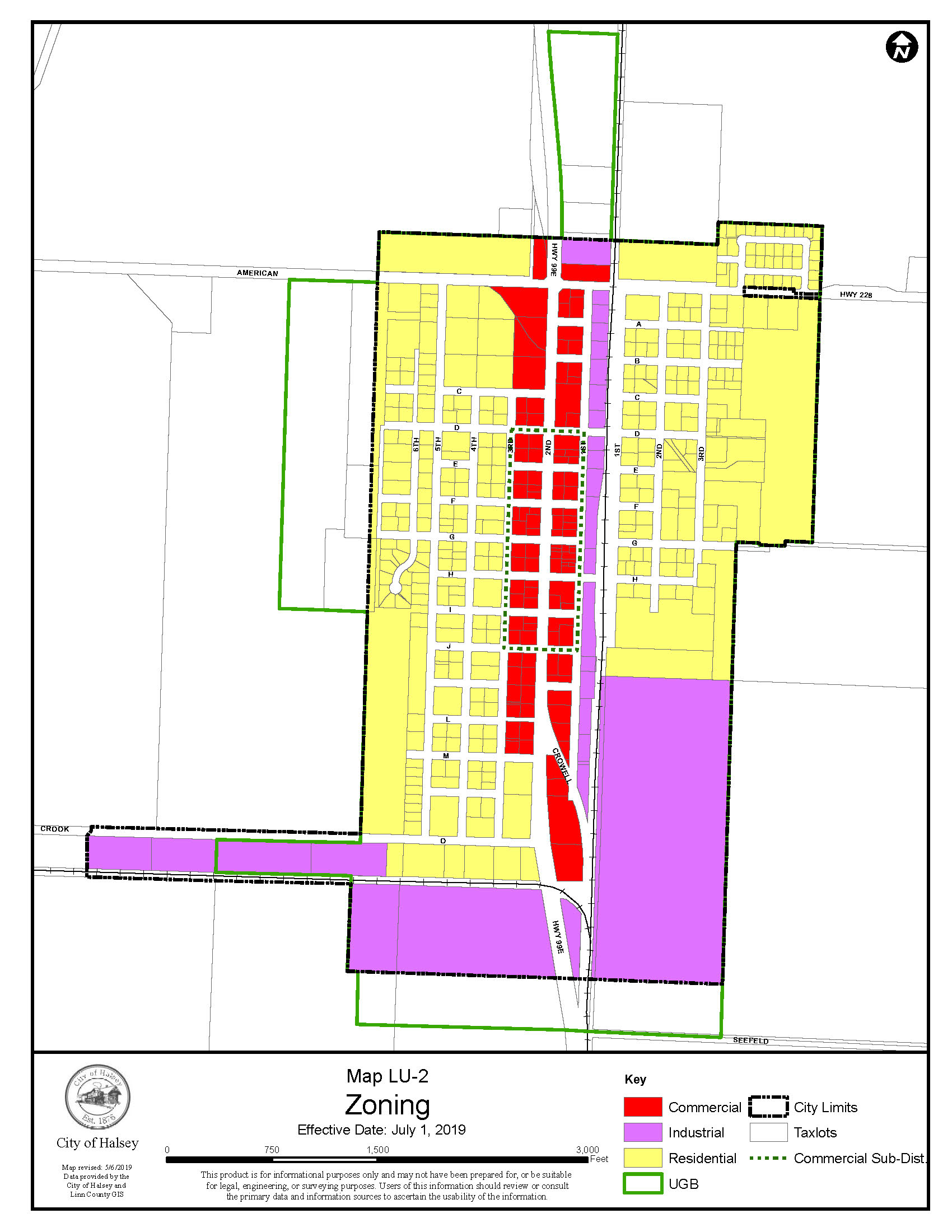
2.1.120 Determination of Zoning District Boundaries
Where due to the scale, lack of detail or illegibility of the Zoning Map, or due to any other reason there is uncertainty as to the intended location of a zoning district boundary line, the City Planner, or upon referral, the Planning Commission, shall determine the boundary in accordance with the following guidelines:
A. Boundaries indicated as approximately following the center lines of streets, highways, railroad tracks or alleys shall be construed to follow such center lines;
B. Boundaries indicated as approximately following the boundaries of a parcel or lot shall be construed as following such boundaries;
C. Boundaries indicated as approximately following a City boundary, or the Urban Growth Boundary, shall be construed as following said boundary;
D. Boundaries indicated as approximately following drainage channels or basins shall be construed as following drainage channels or basins; and
E. Whenever any public right-of-way is lawfully vacated, the lands formerly within the vacated right-of- way shall automatically be subject to the same zoning district designation that is applicable to lands abutting the vacated area. In cases where the right-of-way formerly served as a zoning district boundary, the lands formerly within the vacated right-of-way shall be allocated proportionately between the subject zoning districts.
The Linn County, Oregon Geographic Information System (Linn GIS) website has up-to-date information on zoning, tax lots, aerial photography, flood plain boundaries, and other spatial information on all properties in the City of Halsey. Click link to go to Linn County GIS website: Linn County, Oregon GIS