


Article 4 / Nonresidential Districts
Sec. 4.1 / General Purposes
The nonresidential zoning districts contained in this Code were created for the following general purposes:
A. Provide appropriately located areas for well-designed business, commercial, and industrial development that is consistent with the Prescott General Plan and with standards of public health and safety established by this Development Code and the State of Arizona;
B. Ensure that all nonresidential uses meet appropriate standards for development intensity, effective vehicular and pedestrian access, safe and efficient on-site circulation, adequate parking, signage, and related site design issues;
C. Protect adjacent residential and nonresidential uses from potential negative impacts resulting from excessive noise, light, odor, vibration, development intensity, traffic congestion, or other adverse environmental effects;
D. Provide sufficient business, commercial and industrial development opportunities to effectively support the needs of Prescott’s local and regional populations; and
E. To ensure the provision of public services and facilities needed to accommodate planned land uses and population densities, as well as vehicular-, pedestrian- and bike- access.
Sec. 4.2 / Natural Open Space (NOS)
The Natural Open Space (NOS) District is a passive use recreational district. This District is intended to conserve private and public natural and scenic resources of community value. Such open lands may include mountaintops, ridgelines, steep slope areas, scenic view sheds, wildlife habitats, wooded areas, archeological sites, passive open space that typically contain no (modern) buildings or structures.
4.2.2. / District Applicability
NOS district standards apply to areas so zoned, typically to open space lands that are owned by the public or a homeowners’ association.
Uses are allowed in the NOS district in accordance with the Use Table of Sec. 2.3.
4.2.4. / Density and Dimensional Standards
All development in the NOS district is subject to the standards of this section, the Measurements, Computations and Exceptions specified in Sec. 2.7.3, and other applicable provisions of this Code. 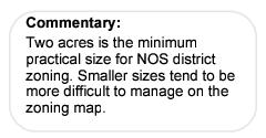
A. Minimum Lot Area: None
B. Minimum Lot Width: None
C. Maximum Lot Coverage: None
D. Maximum Building/Structure Height: None
E. Minimum Setbacks: None
Sec. 4.3 / Recreational Space (RS)
The Recreational Space (RS) District is an active recreational district designed to accommodate a wide variety of outdoor recreational improvements and related facilities. The RS district is intended to apply to public or private property used for active, outdoor recreation as defined by Sec. 11.2.
Uses are allowed in the RS district in accordance with the Use Table of Sec. 2.3.
4.3.3. / Density and Dimensional Standards
All development in the RS district is subject to the standards of this section, the Measurements, Computations and Exceptions specified in Sec. 2.7.3, and other applicable provisions of this Code. 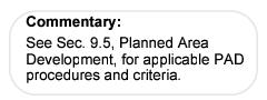
A. Minimum Lot Area: None
B. Minimum Lot Width: None
C. Maximum Lot Coverage: None
D. Maximum Building/Structure Height: 35 ft
E. Minimum Setbacks: 50 ft
Sec. 4.4 / Mixed Use District (MU)
The Mixed Use District (MU) District is a low-intensity mixed-use district with a strong residential character. The MU District provides specific standards for the development of limited business, office, or service uses in existing residential structures, or in new structures within residential areas, on individual lots with a minimum area of 7,500 square feet. All uses in the MU District are intended to support and serve residential households. To protect the residential character of established neighborhoods, MU District uses are encouraged to occupy existing residential structures without changing the character of such structures, and to emphasize pedestrian rather than vehicular access. The MU District standards are intended to facilitate adaptive re-use and preservation of older residential structures, and compatible new development.
Uses are allowed in the MU district in accordance with the Use Table of Sec. 2.3. Such uses shall be housed in permanent buildings in permanent locations unless otherwise noted.
4.4.3. / Density and Dimensional Standards
All development in the MU district is subject to the standards of this section, the Measurements, Computations and Exceptions specified in Sec. 2.7.3, and other applicable provisions of this Code.
A. Maximum Densities via PAD: 10.0 dwelling units/acre
B. Minimum Lot Areas: 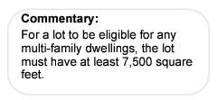
1. Single-Family Dwellings: 7,500 square feet/ unit
2. Duplex Dwellings: 3,750 square feet/ unit
3. Patio Home Dwellings: via PAD
4. Townhouse Dwellings: via PAD
5. Multi-Family Dwellings:
a. 3 Units: 7,500 square feet/ lot
b. Each Additional Unit: 5,000 square feet/ unit
6. Nonresidential Uses: 7,500 square feet
C. Minimum Lot Width: 50 feet
D. Maximum Lot Coverage: 40%
E. Maximum Building/Structure Height: 35 feet
F. Minimum Setbacks:
1. Front: 15 feet
2. Side: 7 feet
3. Rear: 10 feet
4. Corner: 10 feet
Standards applicable in the MU District include the following:
A. Where an existing single-family residence is converted to a duplex or nonresidential use, All required parking shall be accessed from an alley where such alley access is available, or from a single common driveway where such alley access is not available.
B. New construction with alley access shall provide at least 50% of required parking in the rear yard accessed via the alley.
Sec. 4.5 / Residential Office (RO)
The Residential Office (RO) District is a low-intensity business district that provides a transitional zone between residential or mixed-use areas and more intense business uses. The RO district provides specific standards for the development of small-scale business, office, or service uses. RO district uses attract customers from adjacent neighborhoods and are typically located along collector or arterial streets. RO district standards are intended to compliment adjacent residential areas with compatible site and building design elements including; low-scale building mass, landscape buffers, subdued exterior lighting and signage, and effective pedestrian and vehicular access. District uses shall not create excessive traffic, noise, light, or other activity that would have negative impacts on adjacent residential areas.
Uses are allowed in the RO district in accordance with the Use Table of Sec. 2.3. Such uses shall be housed in permanent buildings in permanent locations unless otherwise noted.
4.5.3. / Density and Dimensional Standards
All development in the RO district is subject to the standards of this section, the Measurements, computations and Exceptions specified in Sec. 2.7.3, and other applicable provisions of this Code.
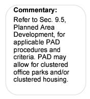
A. Maximum Densities via PAD: 10.0 dwelling units/ acre
B. Minimum Lot Areas:
1. Single-Family Dwellings: 9,000 square feet/ unit
2. Duplex Dwellings: 4,500 square feet/ unit
3. Patio Home Dwelling Units: via PAD
4. Townhouse Dwelling Units: via PAD
5. Multi-Family Dwelling Units:
a. 3 Units: 13,500 square feet/ lot
b. Each Additional Unit: 4,500 square feet/ unit
6. Nonresidential Uses: 9,000 square feet
C. Minimum Lot Width: 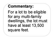
1. Residential Uses: 50 feet/ lot
2. Nonresidential Uses: 50 feet/ lot
D. Maximum Lot Coverage: 40%
E. Maximum Building/Structure Height: 25 feet
F. Minimum Setbacks:
1. Front: 15 feet
2. Side: 7 feet
3. Rear: 10 feet
4. Corner: 10 feet
District standards applicable in the RO district include the following:
A. Where an existing single-family residence is converted to a duplex or nonresidential use, all required parking shall be accessed from an alley where such alley access is available, or from a single common driveway where such alley access is not available.
B. New construction with alley access shall provide at least 50% of required parking in the rear yard accessed via the alley.
C. The maximum allowable floor area shall be 6,000 gross square feet per structure.
Sec. 4.6 / Neighborhood Oriented Business (NOB)
The Neighborhood Oriented Business (NOB) District is a low-to-moderate-intensity business district. The NOB district provides specific standards for the development of a variety of business, office, or service uses. Building size is limited in order to mitigate the impacts on nearby residents. NOB district uses attract customers from a limited area and are typically located along collector or arterial streets. NOB district uses are intended to compliment residential areas with compatible site and building design elements including; low-scale building mass, landscape buffers, subdued exterior lighting and signage, and effective pedestrian and vehicular access. District uses shall not create excessive traffic, noise, light, or other activity that would have negative impacts on adjacent residential areas. Typical NOB district uses include: small retail shops, limited service uses, drug stores, business and offices, restaurants, and financial services uses.
Uses are allowed in the NOB district in accordance with the Use Table of Sec. 2.3. Such uses shall be housed in permanent buildings in permanent locations unless otherwise noted.
4.6.3. / Density and Dimensional Standards
All development in the NOB district is subject to the standards of this section, the Measurements, Computations and Exceptions specified in Sec. 2.7.3, and other applicable provisions of this Code.
A. Maximum Densities via PAD: 14.0 dwelling units/ acre
B. Minimum Lot Areas:
1. Single-Family Dwellings: 10,000 square feet/ unit
2. Duplex Dwellings: 5,000 square feet/ unit
3. Patio Home Dwellings: via PAD
4. Townhouse Dwellings: via PAD
5. Multi-family Dwellings:
a. 3 Units: 10,000 square feet/ lot
b. Each Additional Unit: 3,050 square feet/ unit
6. Nonresidential Uses: 10,000 square feet
C. Minimum Lot Widths: 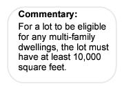
1. Single-Family Dwellings: 50 feet/ lot
2. Duplex Dwellings: 50 feet/ lot
3. Patio Home Dwellings: via PAD
4. Townhouse Dwellings: via PAD
5. Multi-Family Dwellings: 50 feet/ lot
6. Nonresidential uses: 50 feet
D. Maximum Lot Coverage: 50%
E. Maximum Building/Structure Height: 35 feet
F. Minimum Setbacks:
1. Front: 15 feet
2. Side: 7 feet
3. Rear: 10 feet
4. Corner: 10 feet
District standards applicable in the NOB district include the following:
A. Maximum building size shall be 12,000 square feet per structure; provided, however, larger structures may be allowed subject to the approval of a Conditional Use Permit pursuant to Sec. 9.3.
B. Where an existing single-family residence is converted to a duplex or nonresidential use, all parking shall be accessed from an alley where such alley access is available, or from a single common driveway where such alley access is not available.
C. New construction with alley access shall provide at least 50 percent of required parking in the rear yard accessed via the alley.
Sec. 4.7 / Business General (BG)
The Business General (BG) District is a moderate-intensity business district. The BG district provides specific standards for the development of small to mid-sized business, office, or service uses. BG district uses attract customers from the citywide area and are utilized by pedestrian, automobile, and mass transit populations. To ensure appropriate access and visibility these uses are most often located on a collector or arterial street. Typical BG district uses include: retail stores selling durable goods, business and offices, restaurants, and financial services uses.
Uses are allowed in the BG district in accordance with the Use Table of Sec. 2.3. Such uses shall be housed in permanent buildings in permanent locations unless otherwise noted.
4.7.3. / Density and Dimensional Standards
All development in the BG district is subject to the standards of this section, the Measurements, Computations and Exceptions specified in Sec. 2.7.3, and other applicable provisions of this Code.
A. Maximum Densities via PAD: 32.0 dwelling units/acre
B. Minimum Lot Areas:
1. Single-Family Dwellings: 6,000 square feet/unit
2. Duplex Dwellings: 3,000 square feet/unit
3. Patio Home Dwellings: via PAD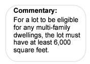
4. Townhouse Dwellings: via PAD
5. Multi-Family Dwellings:
a. 3 Units: 6,000 square feet/ lot
b. 4th Unit: 1,500 square feet/ unit
c. Each Additional Unit: 1,400 square feet/ unit
6. Nonresidential Uses: None
C. Minimum Lot Width:
1. Residential Uses: 50 feet/ lot
2. Nonresidential Uses: None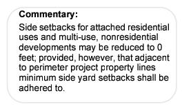
D. Maximum Lot Coverage:
1. Residential Uses: 60%
2. Nonresidential Uses: None
E. Maximum Building/Structure Height: 50 feet
F. Minimum Setbacks:
1. Front:
a. Residential Uses: 15 feet
b. Nonresidential Uses: 10 feet
2. Side:
a. Residential Uses: 10% of lot width, not less than 5 or more than 12 feet
b. Nonresidential Uses: 
1) Attached Uses and Structures: 0 feet
2) Detached Uses and Structures: 7 feet
c. Multi-use Projects
1) Interior of Multi-use Projects: 0 feet
2) Perimeter of Multi-use Projects: 7 feet
3. Rear: 10 feet
4. Corner: 8 feet
District standards applicable in the BG district include the following:
A. Where an existing single-family residence is converted to a duplex or nonresidential use, a minimum of 50 percent of the off-street parking shall be accessed from an alley where such alley access is available, or from a single common driveway where such alley access is not available.
B. New construction with alley access shall provide at least 50 percent of required parking in the rear yard accessed via the alley.
Sec. 4.8 / Business Regional (BR)
The Business Regional (BR) District is a high-intensity business district. The BR district provides specific standards for the development of a wide variety of large business, office, or service uses. BR district uses attract customers from the regional area and have a strong automobile/mass transit orientation. To ensure appropriate access, visibility, and sufficient parking, these uses are typically situated on large parcels located along high volume arterial roadways. Typical BR district uses include; large-scale office buildings, retail stores selling durable goods and specialty items, restaurants, entertainment and commercial recreation uses, automobile service facilities, and business, personal and financial services.
Uses are allowed in the BR district in accordance with the Use Table of Sec. 2.3. Such uses shall be housed in permanent buildings in permanent locations unless otherwise noted.
4.8.3. / Density and Dimensional Standards
All development in the BR district is subject to the standards of this section, the Measurements, Computations and Exceptions specified in Sec. 2.7.3, and other applicable provisions of this Code.
A. Maximum Densities via PAD: 32.0 dwelling units/acre 
B. Minimum Lot Areas:
1. Single-Family Dwellings: 6,000 square feet/unit
2. Duplex Dwellings: 3,000 square feet/unit
3. Patio Home Dwellings: via PAD
4. Townhouse Dwellings: via PAD
5. Multi-Family Dwellings:
a. 3 Dwelling Units: 6,000 square feet/ lot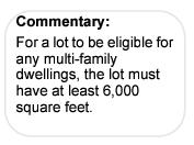
b. 4th Dwelling Unit: 1,500 square feet/ unit
c. Each Additional Unit: 1,400 square feet/ unit
6. Nonresidential Uses: None
C. Minimum Lot Width:
1. Residential Uses: 50 feet/ lot
2. Nonresidential Uses: None
D. Maximum Lot Coverage:
1. Residential Uses: 60%
2. Nonresidential Uses: None
E. Maximum Building/Structure Height: 50 feet, up to 100’ by SUP (See Sec. 4.8.4A)
F. Minimum Setbacks: 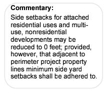
1. Front:
a. Residential Uses: 15 feet
b. Nonresidential Uses: 10 feet
2. Side:
a. Residential Uses: 10% of lot width, not less than 5 or more than 12 feet
1) Attached Uses and Structures: 0 feet
2) Detached Uses and Structures: 7 feet
b. Multi-use Projects
1) Interior of Multi-use Projects: 0 feet
2) Perimeter of Multi-use Projects: 7 feet
3. Rear: 10 feet
4. Corner: 8 feet
District standards applicable in the BR district include the following:
A. Maximum building/structure height greater than the otherwise applicable maximum height up to a 100-foot maximum may be approved subject to the approval of a Special Use Permit pursuant to Sec. 9.9.
B. New construction with alley access shall provide at least 50 percent of required parking in the rear yard accessed via the alley.
Sec. 4.9 / Downtown Business (DTB)
The Downtown Business (DTB) District is a moderate to high intensity retail, service and business district. The DTB district provides specific standards for the development of business, service, entertainment, and residential uses in the Downtown Business area. DTB district standards are intended to preserve and enhance the unique historic and pedestrian character of downtown Prescott. The DTB district provides opportunities for the development of a full range of uses including; restaurants, business and governmental offices, retail stores, lodging, theaters, museums, individual residences and high density housing.
Uses are allowed in the DTB district in accordance with the Use Table of Sec. 2.3. Such uses shall be housed in permanent buildings in permanent locations unless otherwise noted.
4.9.3. / Density and Dimensional Standards
All development in the DTB district is subject to the standards of this Section, the Measurements, Computations and Exceptions specified in Sec. 2.7.3 and other applicable provisions of this Code.
A. Maximum Densities: 58.0 dwelling units/acre
B. Minimum Lot Areas: 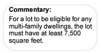
1. Single-Family Dwellings: 6,000 square feet
2. Duplex Dwellings: 3,000 square feet
3. Patio Home Dwellings: N/A
4. Townhouse Dwellings: N/A
5. Multi-Family Dwellings: None
6. Nonresidential Uses: None
C. Minimum Lot Width:
1. Single-Family Dwellings: 50 feet/ lot
2. Duplex Dwellings: 50 feet/ lot
3. Patio Home Dwellings: N/A
4. Townhouses: N/A
5. Multi-Family Dwellings: 50 feet
6. Nonresidential Uses: None
D. Maximum Lot Coverage:
1. Single-Family Dwellings: 40 percent
2. Duplex Dwellings: 40 percent
3. All Other Uses: None
E. Maximum Building/Structure Height:
1. Single-Family Dwellings: 35 feet
2. Duplex Dwellings: 35 feet
3. All Other Uses: 50 feet, up to 100 feet by SUP (See Section 4.9.4.D)
F. Minimum Setbacks: None
4.9.4. / District Standards, Guidelines, and Procedures
District standards, guidelines and procedures applicable in the DTB district include the following:
A. Compatibility Review Guidelines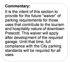
The purpose of these standards is to maintain downtown Prescott’s established development pattern through measurable design criteria. Review shall ensure that new development conforms to adopted standards for building scale, height, massing, materials, and streetscape design applicable to the Downtown Business District. Development in downtown Prescott shall meet the following criteria:
1. Construction and exterior building materials shall comply with the applicable building codes adopted by City Council.
2. Structures shall comply with the dimensional standards, building height limits, and setback requirements established for the Downtown Business District.
3. All mechanical equipment shall be screened from view in accordance with the requirements of Section 6.5.8.E.
B. Parking and Loading
1. Off-street parking and loading shall be provided for all uses in accordance with the provisions of Section 6.2, Off-street Parking and Loading, and particularly Section 6.2.2.C, Change of Use. Where surface parking lots are developed, such parking areas shall be screened in all cases from street view in accordance with the applicable requirements of Section 6.5.6, Parking Area Landscaping.
2. Notwithstanding the off-street parking requirements of Section 6.2, Off-street Parking, off-street parking within the DTB shall not be required for permitted uses within buildings constructed prior to 1968. For uses in buildings constructed from 1968 to the present, retail stores, restaurants and other hospitality-related uses in the Retail, Service and Business Categories as defined by Sections 11.1.5.E.3.a. and 11.1.5.E.3.c shall not be required to provide off-street parking. Notwithstanding the foregoing, all uses which require overnight parking, including hotel, resort, and similar uses, shall comply with the City’s parking requirements as described in Section 6.2, Off-street Parking. It shall be the applicant’s responsibility to provide sufficient documentation as to the construction date of the building.
3. Fees In Lieu of Parking. Within the DTB, off-street parking requirements for uses not exempted by subsection B.2 of this Section may be satisfied by payment of an in-lieu parking fee, in an amount and manner established by the City Council by resolution. Such payment shall be made prior to the issuance of a Certificate of Occupancy. In-lieu fees in the DTB shall be governed by the following:
a. The in-lieu fee may not be used for more than 20 required parking spaces for any use.
b. The in-lieu fee may be used at the time of a change of use on a site resulting in additional required parking which cannot physically be accommodated on site, subject to other provisions of this section (specifically subsection B.2 of this Section).
c. The in-lieu fee may be used at the time of a change to structures on a site which results in a reduction of the number of existing physical parking spaces on the site and/or an addition to the floor area of the building, subject to other provisions of this section (specifically subsection B.2 of this Section).
d. The in-lieu fee option may be requested by a tenant with the property owner’s written consent. The in-lieu fee agreement shall be in a form approved by the City Attorney and will establish the number of parking spaces and the total amount of the in-lieu fees under the agreement. Such agreement shall run with the use; provided, however, that it may be terminated, modified or replaced to comply with the provisions of subsections B.4.a. through B.4.c of this Section, subject to other provisions of this Section (specifically subsection B.2 of this Section).
C. Landscaping
The landscaping requirements in Sec. 6.5, Landscaping and Screening, shall apply with the following exceptions:
1. Street frontage landscape strips may be reduced to 0 feet in direct relationship to the building setback.
2. Where low screening walls are provided to screen parking lots, the street frontage landscape strips may be reduced by up to 5 feet in width with plantings placed on the street side of the screening wall.
D. Height
Notwithstanding other provisions to the contrary, building height up to 100 feet may be allowed subject to the approval of a Special Use Permit pursuant to Sec. 9.9. Issues to be considered as part of such reviews shall include:
1. Compatibility of the size and scale of the proposed structure with other like structures in the vicinity where such structures are substantially in compliance with this LDC;
2. Topography of the site and vicinity -- the Community Development Director shall determine the site area to be displayed;
3. Effect on the view shed from surrounding areas;
4. Fire and public safety considerations;
5. Adequacy of parking to serve the proposed structure; and
6. Effect on the streetscape, including but not limited to, proposed setbacks and landscaping.
E. Signs
All signs and sign permits approved within the Downtown Business (DTB) District pursuant to the requirements of Sec. 9.7, Sign Permits and Comprehensive Sign Plans, shall be in accordance with the following standards:
1. Maximum Aggregated Signage
All signs not specifically exempt pursuant Sec. 6.12.3, Exempt Signs, except for murals and entrance signs, shall count toward the maximum aggregated allowable total signage as specified in Sec. 6.12.5, Permitted Signs.
2. Entrance Signs
Buildings with public access easements may install signage at the entrance façade sized up to 2x the width of the access easement. This shall be in addition to the maximum aggregated allowable total signage allowed for “Business (1 or 2 Businesses)” in Table 6.12.5B.
3. Sign Placement
All wall signs other than perpendicular signs shall be installed flat against the building façade where architecture permits.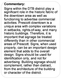
a. One suspended perpendicular sign per building shall be permitted not to exceed 4 linear feet in overhang. A right-of-way permit shall be required when the sign encroaches over the right-of-way.
b. One perpendicular entrance sign per customer entrance is permitted when placed under the awning. The sign shall be centered under the awning as measured across the sidewalk.
4. Painted Signs and Murals
Wall signs and murals painted directly on façades are permitted when complementary to the building. The Community Development Director may require that such signs and murals be subject to the review of the Preservation Commission.
5. Flashing, revolving or roof-mounted signs
Flashing, revolving or roof-mounted signs shall be prohibited. No sign shall extend above the top of any part of the roofline.
6. Changeable Copy Signs
Theater marquees may use scrolling, electronic changeable copy signs.
7. Façade Insets or Bands
Many historic buildings include insets or bands within the façade design specifically for signage. Where this condition exists, allowed signage shall be constrained within this area and shall not extend beyond the provided insets or bands. This shall not limit overall signage allowances to the inset or façade design.
8. Neon Signs
Neon signs are allowed and shall count toward the total allowable sign area calculation. Use of neon is also acceptable as a building accent, provided the area contained within the neon tube used for such accent lighting shall count toward the total allowable sign area calculation.
9. Sign Lighting
a. Preferred sign lighting shall be by incandescent or neon tube fixtures. Lettering may be painted or individually cut figures. Neon may be used for lettering if set into individually cut channel-type figures. Internally illuminated fluorescent signs are discouraged. Translucent panels where used must be limited in bright lighting in accordance with the requirements of Sec. 6.11.4B, Outdoor Advertising Displays and Signs Lighting.
b. Fluorescent lighting shall not be allowed, either exposed or as a backlight, with the exception of under-awning security lighting.
10. Seasonal Bunting
Seasonal bunting shall be considered temporary signage and may be allowed in accordance with the provisions of Table 6.12.5C, Temporary Sign Standards.
11. Sandwich Signs
Sandwich signs are not allowed on site, but may be allowed in the right-of-way, per City Code, Title VIII, Sec. 8-4-2.
F. Grandfathered Signs in Downtown Area
The following signs are considered contributions to the historic character of the Downtown Business District. Although some may be nonconforming, their historic value merits their preservation.
1. A.J. Head Hotel
2. A1 Beer at The Palace
3. Arizona National Bank Time & Temperature Sign
4. Dinner Bell
5. First National Bank of Arizona
6. Hassayampa Hotel
7. Hotel St. Michael
8. Hotel Vendome
9. Lily Ice Cream at 145 N. Cortez
10. Sam Hill signs in Montezuma sidewalk (2)
11. Sam Hill Warehouse
12. The Bird Cage
13. US Post Office
14. Valley National Bank on E. Gurley
15. Yavapai County Courthouse
Sec. 4.10 / Industrial Transition (IT)
The Industrial Transitional (IT) District is a moderate-intensity business and light-industrial district that provides a transitional zone between adjacent residential and business uses and more intense industrial uses. The IT district provides specific standards for the development of business and low-intensity industrial uses. IT district standards facilitate the development of Industrial Light uses in well-designed landscaped settings while providing performance standards and buffering requirements designed to minimize potential negative impacts on adjacent uses. Typical IT district uses include: small-scale manufacturing, indoor storage, research and development, and large commercial services. In addition, multi-family dwellings may be permitted as a transitional use.
Uses are allowed in the IT district in accordance with the Use Table of Sec. 2.3. Such uses shall be housed in permanent buildings in permanent locations unless otherwise noted.
4.10.3. / Density and Dimensional Standards
All development in the IT district is subject to the standards of this section, the Measurements, Computations and Exceptions specified in Sec. 2.7.3, and other applicable provisions of this Code.
A. Maximum Densities via PAD: 14.0 dwelling units/acre
B. Minimum Lot Area:
1. Multi-Family Dwellings:
a. 3 Units: 7,500 square feet/ lot
b. Each Additional Unit: 3,600 square feet/ unit
2. Nonresidential uses: None
C. Minimum Lot Width:
1. Multi-Family Dwellings: 50 feet/ lot
2. Nonresidential Uses: None
D. Maximum Lot Coverage: None
E. Maximum Building/Structure Height: 40 feet
F. Minimum Setbacks:
1. Front: 20 feet
2. Side: 7 feet
3. Rear: 20 feet
4. Corner: 10 feet
District standards applicable in the IT district include the following:
A. [RESERVED]
Sec. 4.11 / Industrial Light (IL)
The Industrial Light (IL) District is a moderate-intensity industrial district. The IL district provides specific standards for the development of a variety of light industrial and service uses. Typical IL district uses include: manufacturing, wholesaling, warehousing, distribution, research and development, and large-scale commercial services.
Uses are allowed in the IL district in accordance with the Use Table of Sec. 2.3. Such uses shall be housed in permanent buildings in permanent locations unless otherwise noted.
4.11.3. / Density and Dimensional Standards
All development in the IL district is subject to the standards of this section, the Measurements, Computations and Exceptions specified in Sec. 2.7.3, and other applicable provisions of this Code.
A. Maximum Density: None
B. Minimum Lot Area: None
C. Minimum Lot Width: None
D. Maximum Lot Coverage: None
E. Maximum Building/Structure Height: 50 feet
F. Minimum Setbacks:
1. Front: 10 feet
2. Side: 7 feet
3. Rear: 10 feet
4. Corner: 10 feet
District standards applicable in the IL district include the following:
A. [RESERVED]
Sec. 4.12 / Industrial General (IG)
The Industrial General (IG) District is a high-intensity industrial district. The IG district provides specific standards for the development of a wide variety of Industrial General uses. Typical IG district uses include: large-scale manufacturing, wholesaling, warehousing, regional and national distribution facilities, materials extraction, materials salvage, storage, and related activities.
Uses are allowed in the IG district in accordance with the Use Table of Sec. 2.3. Such uses shall be housed in permanent buildings in permanent locations unless otherwise noted.
4.12.3. / Density and Dimensional Standards
All development in the IG district is subject to the standards of this section, the Measurements, Computations and Exceptions specified in Sec. 2.7.3, and other applicable provisions of this Code.
A. Maximum Density: None
B. Minimum Lot Area: None
C. Minimum Lot Width: None
D. Maximum Lot Coverage: None
E. Maximum Building/Structure Height: 50 feet, up to 100 feet by SUP per Sec. 4.12.4A.
F. Minimum Setbacks:
1. Front: 25 feet
2. Side: 15 feet
3. Rear: 25 feet
4. Corner: 15 feet
District standards applicable in the IG district include the following:
A. Maximum building/structure height greater than the otherwise applicable maximum height up to a 100-foot maximum may be approved subject to the approval of a Special Use Permit pursuant to Sec. 9.9.
Sec. 4.13 / Specially Planned Community (SPC)
The Specially Planned Community (SPC) District permits greater flexibility and more creative and imaginative design for the development of residential areas than is generally possible in residential districts while allowing a range of nonresidential, commercial and industrial uses, all as specified in the required site specific Master Plan. The district promotes development of self-contained villages and more economical and efficient use of the land with a harmonious variety of housing choices, a higher level of recreational amenities and facilities, and appropriate civic and business uses, while preserving natural qualities of open spaces. A variety of housing types and uses may be permitted with an orderly relationship to one another. In addition to the use and area regulations of this Section, development in the SPC district shall be in compliance with all other applicable provisions of this Code, or as may be specified by the required SPC Master Plan. (Ord. 5041-1581, 7-25-2017)
Although properties designated as SPC on the Zoning District Map owned by governmental entities and used for governmental purposes are exempt from the otherwise required provisions of this district, they are encouraged to comply. (Ord. 5041-1581, 7-25-2017)
4.13.3. / Approval and Conditions
Every SPC district approved under the provisions of this Section shall follow the procedure for and be considered an amendment to the zoning map (Section 9.15, Zoning Map Amendment) and shall comply with the requirements of this Section, unless exempted per Section 4.13.2. In approving the SPC district, the Council may impose conditions relative to the standards of development and such conditions shall be satisfied prior to approval of a Certificate of Occupancy for any structure in the SPC district. All SPC districts approved in accordance with the provisions of this Section shall be referenced on the Zoning District Map and a list of such SPC districts, together with the land uses permitted therein and on the respective lots, shall be maintained in the office of the Community Development Director. The establishment of a SPC district shall require the following:
A. Master Plan Requirement
1. In establishing a SPC district in accordance with this Section, the City Council shall require a master plan of the development. Such master plan shall be approved and a Memorandum of Master Plan filed as part of the rezoning ordinance prior to the issuance of any Building Permit or Site Disturbance and Grading Permit in a SPC district. Such required Plan and rezoning ordinance shall set forth the following for each subarea:
a. Proposed land use plan including the number and type of dwelling units, total floor area for specified nonresidential land uses, significant open space, natural areas or recreation features to be incorporated into the development plan;
b. Requirements for ingress and egress to the property, public or private streets or drives, with adequate right-of-way, sidewalks, utilities, drainage, parking space, setbacks, height of building, maximum lot coverage, yards and open spaces, screening walls or fences, landscaping and other development and protective requirements including maintenance considered necessary to create a reasonable transition to and protection of the adjacent property;
c. Locations of significant natural features including but not limited to steep slope areas, natural drainageways and floodplains, wetlands, ridges, and unique stands of vegetation and rock outcrops;
d. The approximate locations of elements such as a golf course and related facilities, or other recreational facilities and open space, major roads, trails and other dominate features of the Plan; and
e. Conceptual plans and/or reports identifying design compatibility and preservation techniques intended for landscaping, natural features, screening, lighting, and other site/building design elements in the SPC Master Plan.
B. Disturbable Area Map
1. Each Final Plat shall incorporate a plat note reference to a nonrecorded Disturbable Area Map illustrating the disturbable area as defined in Section 11.2.5, and kept on file in the Community Development Department. The Disturbable Area Map shall be the same size and scale as the Final Plat but need not include a legal description(s) of the disturbable area. Such maps shall include the following:
a. Topographic information at 5-foot intervals, or other appropriate intervals approved by the Community Development Director;
b. Significant features such as major rock outcrops and stands of mature trees on each lot;
c. Envelopes delineating disturbable areas of natural terrain on some or all lots as determined at preliminary plat; and
d. Maximum disturbable area in square feet on each lot.
2. The Community Development Director may approve changes to approved Disturbable Area Map, subject to the following requirements:
a. A civil engineer or land surveyor shall certify that the proposed changes will result in the preservation of an area that is equal to or greater than that required to be preserved on the approved Map;
b. Changes to an approved Disturbable Area Map shall not be approved in the NOS district; and
c. Changes to an approved Disturbable Area Map shall not be approved that reduce or otherwise affect open space tract designations or no-build easements. (Ord. 5041-1581, 7-25-2017)
4.13.4. / Status of Prior Approvals
With respect to the Hassayampa Villages and Prescott Lakes Recreation Community District projects, where the City Council approved specific minimum development requirements that are more or less stringent than the minimum development requirements contained in this Code, the development requirements set forth in the ordinances approving Hassayampa Villages and Prescott Lakes Recreation Community Districts are hereby ratified, confirmed and validated. (Ord. 5041-1581, 7-25-2017)
Uses or Use Categories permitted in the SPC district shall be specifically listed as a part of the rezoning ordinance approving the SPC district. Such uses shall be housed in permanent buildings in permanent locations unless otherwise noted. Uses or Use Categories not specifically allowed by the rezoning ordinance are prohibited. (Ord. 5041-1581, 7-25-2017)
To achieve the intent of the Prescott General Plan and this Section (Section 4.13.1), proposed projects in the SPC district may contain the following mix of uses:
A. Residential Uses
Two or more residential housing types, the types, numbers and densities of dwellings shall be as determined and approved by City Council on the SPC Master Plan.
B. Recreational Facilities
One or more significant recreational facilities, clubs, or amenities in addition to greenbelts, and active and passive open space.
C. Nonresidential Uses
1. A mix of uses from the Retail, Service, Business and Industrial Use Categories as described in Sections 11.1.5 and 11.1.6, which is reasonably calculated to meet the daily and frequent shopping needs of the SPC district residents at a minimum.
2. A mix of uses from the Public, Civic, and Institutional Use Categories as described in Section 11.1.4, which is reasonably calculated to meet the needs of the SPC district residents at a minimum. (Ord. 5041-1581, 7-25-2017)
4.13.7. / Density and Dimensional Standards
All development in the SPC district is subject to the approval of Density and Dimensional Standards by the City Council, in accordance with the Measurements, Computations and Exceptions specified in Section 2.7.3, and other applicable provisions of this Code. Minimum lot area, building height, setbacks and lot width standards shall be specified within general parameters as part of the SPC Master Plan and finalized at the time of Final Plat. (Ord. 5041-1581, 7-25-2017)
Subject to the requirements of Section 7.4.3, Streets, and Section 6.3, Access Management, lesser street widths and gated private streets may be considered, based upon significant natural constraints, and demonstrated adequate or enhanced general circulation for project users and the general public. (Ord. 5041-1581, 7-25-2017)
District standards applicable in the SPC district include the following, or as may be specified in the required SPC Master Plan:
A. Sensitive Terrain
Sensitive terrain, including steep slope areas, significant rock outcroppings, mature stands of trees, and riparian areas, shall be designated as “Open Space,” and restricted by “No Build” easements and other plat dedications, and/or rezoning to the Natural Open Space (NOS) zoning district to ensure preservation in perpetuity. Such areas shall be identified and evaluated for preservation as a part of the platting process. Thereafter, changes to the land use of such areas shall require rezoning pursuant to the provisions of Section 9.15, Zoning Map Amendment (Rezoning).
B. Disturbable Area
Where required by an approved Final Plat, each building permit application shall indicate the disturbable area based on the Disturbable Area Map as described in Section 4.13.3.B, along with any “No Build” restriction areas, the calculated lot area, and the foot print(s) proposed for impervious cover (roof and pavement area). Such disturbable areas shall be formalized as part of the platting process. The Disturbable Area Map shall be used to review development plans of individual lots or tracts.
C. Site Design and Building Orientation
All land uses and structures shall:
1. Contribute to the uniqueness of a zoning district and the City of Prescott with predominant materials, elements, features, color range, and activity areas tailored specifically to the site and its context;
2. Utilize an architectural style that is complementary to that of other structures in the area or vicinity;
3. Exhibit a unity of design for buildings within multi-building complexes through the use of similar elements such as rooflines, materials, window arrangement, sign location, and details;
4. Incorporate, within all walls over 100 feet in length, at least 3 recesses, off-sets, balconies, angular forms and other features within each 100-foot length to provide a visually interesting shape;
5. Preserve the natural environment and protect the privacy of adjacent users to the extent practicable;
6. Locate parking and maneuvering areas in the rear yard or interior side yards, unless such location would cause the undue destruction of significant mature trees, vegetation, or sensitive terrain; parking areas not located in the rear yard or interior side yards shall be screened from view as specified in Section 6.5.8, Screening Standards; and
7. Locate loading area and service bays away from the street on the side or rear of any structure, unless such location would cause the undue destruction of significant mature trees, vegetation, or sensitive terrain; loading area and service bays not located in the rear yard or interior side yards shall be screened from view as specified in Section 6.5.8, Screening Standards.
D. Building Separation
1. Depending on the type of SPC district proposed, building separation can range from campus-like to attached buildings. The Master Plan shall specify intent and generalized standards, and the Final Plat shall provide specific standards. The Residential Protection Standards of Section 6.13 shall apply unless more restrictive standards are specified in the approved Master Plan and Final Plats.
2. Where existing mature trees, significantly tall rock outcrops or other terrain features provide adequate privacy screening between buildings, the Community Development Director may reduce the required building separations and setbacks pursuant to the provisions of Section 9.16, Administrative Adjustments.
3. Where special architectural design elements create privacy through the location of windows, doors, walls and private yards or courts or other design features, the building separations and setbacks required above may be reduced by the Community Development Director pursuant to the provisions of Section 9.16, Administrative Adjustments.
4. Where reduction of building setbacks and separations, and locations are desired by the applicant, the applicant must submit a site plan of existing conditions, visual analysis, construction documents or other proof in support of such reductions or deviations when filing for a building permit.
E. Land Use Compatibility
1. Internal
All buildings, structures and landscaping shall be compatible with the natural environment and existing nearby neighborhoods within the SPC district. To further this intent, property owners’ associations shall be formed to review and approve the compatibility of proposed buildings, structures, walls and other screening and landscaping, site plans and grading plans. Evidence of such approval must be provided by the applicant at the time of submittal for Building Permits or Site Disturbance and Grading Permits. The City’s role in enforcement of compatibility pursuant to this Section and Section 6.5, Landscaping and Screening, shall include the issuance or withholding of required permits based upon a determination of compatibility by the property owners’ association.
2. External
In addition to the Residential Protection Standards of Section 6.13, additional buffer yard depths and/or treatments may be required along SPC district perimeters, as necessary to promote land use compatibility. (Ord. 5041-1581, 7-25-2017)
4.13.10. / Administrative Adjustments
After City Council approval of a SPC Master Plan, administrative adjustments pursuant to the provisions of Section 9.16 may be approved by the Community Development Director, if deemed consistent by the Community Development Director with the overall intent and character of the Master Plan; such minor adjustments may not include increases in the total number of dwellings or total square footage of nonresidential uses for the overall SPC district property. (Ord. 5041-1581, 7-25-2017)